National Monument · California

Trails in Cabrillo National Monument

2 named trails · 2 miles · 2 with the Park Service's own write-up. The lines, trailheads and points are the Park Service's; the write-ups are the Service's own words; the climbing is read from USGS elevation along each line.

Open on the parks mapEvery park with trailsPark on nps.gov

2 trails, A to Z.

Bayside Trail

1.2 mi one way · about 40 ft of climbing · 300 ft of descent · 95 ft–408 ft · asphalt, gravel surface · hiking

311 ft 95 ft · 0.8 mi high 311 ft

Bayside Trail the Park Service's write-up

1-2 Hours · no dogs
A dirt path snakes along a hillside in front of blue water.
The Bayside Trail as seen from the Cabrillo statue plaza. Photo: NPS Photo / T. Jordan

Length: 2.5 mi (4 km) round-trip

Time: 1 - 2 hours

Difficulty: Easy (Western side is a Class 5 trail, Eastern side is a Class 3 trail)

Elevation Change: 340 feet

Location: Northeast of the Old Point Loma Lighthouse grounds.

Parking: Main Parking Lot by Visitor Center.

Closest Restroom : Old Point Loma Lighthouse Grounds.

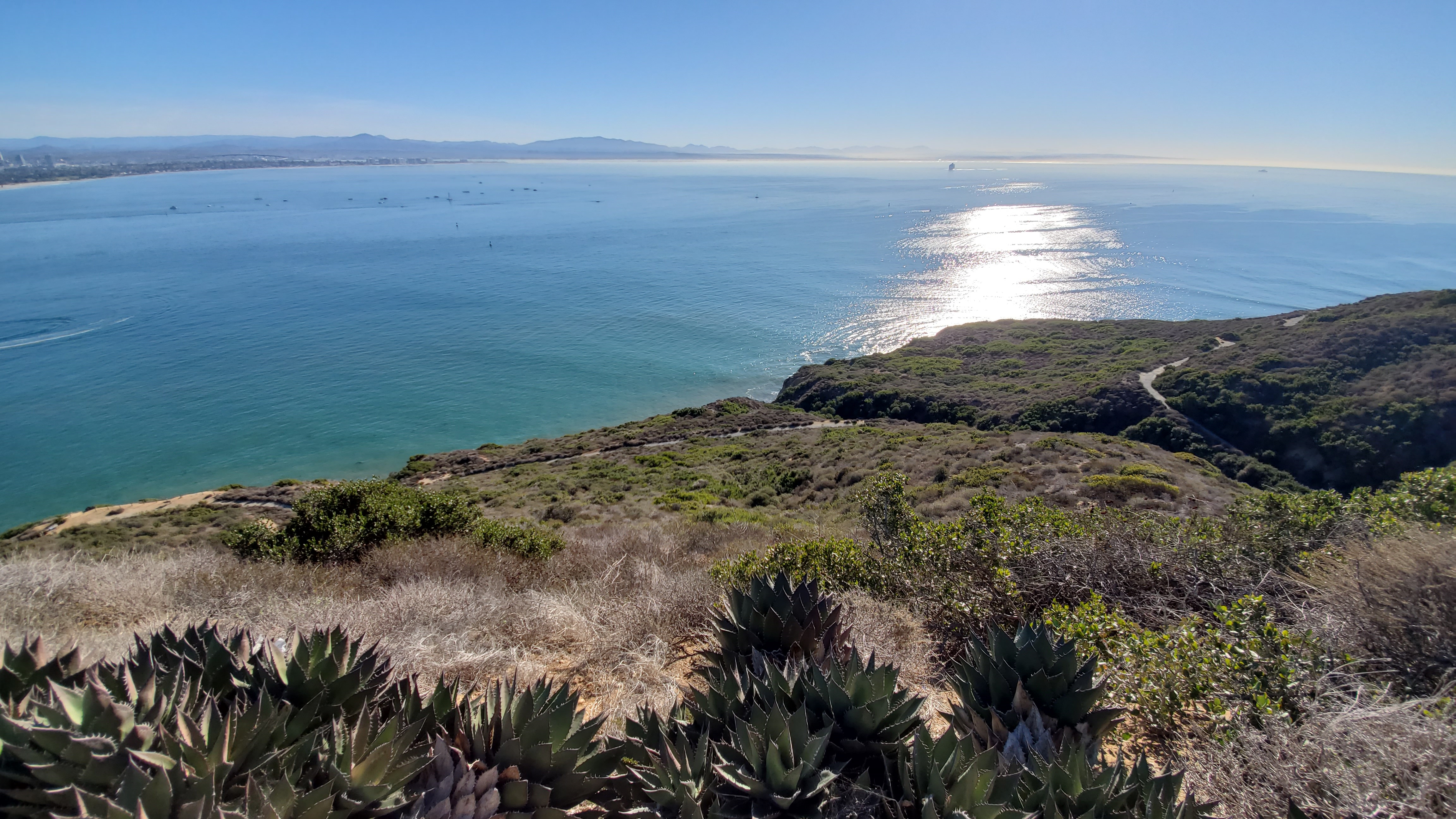
Route: This trail follows an old military road that winds down from the top of the park toward San Diego Bay. After reaching the bottom, you return to the trailhead by retracing your steps back up the trail. The trail begins on as an asphalt road and turns off the road onto a dirt and gravel path part way down. There is no access to the beach at any point on the trail

Safety: There are no restrooms or water sources along this trail. Hikers should plan to bring water and sun protection, especially during the warm summer months. As in any natural area, there are environmental hazards to watch out for, including toxic plants, animals (such as rattlesnakes), and fragile cliff faces.

Bayside Beauty

The Bayside Trail has great views of the ocean, native wildlife, and the city of San Diego. On a clear day you can see the mountains of Mexico to the south, the Laguna mountains to the east behind the San Diego skyline, Naval Air Station North Island, and the Coronado Bridge. Benches and stopping points provide a chance to catch your breath and take in some of the most beautiful views in San Diego county.

Exhibits along the trail explore topics such as native vegetation, animal life, the local climate, World War II history, etc. Along the trail you will also encounter a historic searchlight shelter and power plant used during World War I and World War II. Benches along the trail allow you to rest, reflect, and enjoy the view.

The downhill portion of the trail ends at an overlook of Ballast Point, where Cabrillo’s ships anchored after three months at sea in 1542. Today, nuclear-powered submarines are docked there, in the same place! Cabrillo’s statue looms on the bluff about 300 feet above this point.

Climate, Plants, and Animals

The natural environment along the trail is much the same as when Juan Rodriguez Cabrillo came ashore here in 1542. The trail is one of very few places in the world where Coastal Sage Scrub can live. Coastal sage habitat includes plants such as the fragrant black age and sagebrush and is one of the most threatened habitat types in the world. The trail is also home to the Southern Maritime Chaparral, another vulnerable and precious habitat, including cliff spurge, dudleya and barrel cactus. Point Loma gets approximately 10 inches of rain a year, so wildlife has adaptated to survive the relatively dry climate.

Hundreds of different native plants and animals call the Coastal Sage Scrub their home. Many local birds, such as the California Quail, American Kestrel, and Morning Dove might be seen along the trail. The Point Loma peninsula is an important stopover for many birds that use the Pacific Flyway. In the spring, migratory birds such as hummingbirds, warblers, wrentits, and bushtits make their appearance. Cottontail rabbits, ground squirrels, lizards, snakes, and foxes might be seen along the trail. During the summer, please keep an eye out for rattlesnakes.

Plants

Lichens

Mosses

Snake Cholla

Prickly Pear

Buckwheat

Four O’Clock

Tree Tobacco

Indian Paintbrush

Black Sage

Toyon

Deerweed

Bushy Yate (Eucalyptus)

Sugar Gum (Eucalyptus)

Laurel Sumac

Lemonade Berry

Wild Cucumber

California Sage

Chaparral Broom

Black-eyed Susan

Golden Yarrow

Mohave Yucca

Coast Ceanothus

Birds and Animals

California Striped Racer

Southern Pacific Rattlesnake

San Diego Gopher Snake

Great Basin Fence Lizard

Calif. Side-blotched Lizard

San Diego Alligtor Lizard

Great Blue Heron

Brown Pelican

Brush Rabbit

Scrub Jay

Rufus-sided Towhee

Snowy Egret

Forster’s Tern

Wrentit

Calif. Ground Squirrel

Western Gull

Anna’s hummingbird

Gray Fox

Military History

Wayside signs along the Bayside trail highlight the importance of Point Loma and its strategic location in our military history. In 1852, the U.S. Government designated the area as a military reserve. The Army housed a portion of its intricate coastal defense system on Point Loma.

During World Wars I and II cannons, mortars, and observation bunkers were constructed in a protective ring around the harbor. You’ll see a 1919 searchlight power station that was part of the system and housed huge searchlights that were used to light up the harbor entrance. The searchlight itself was housed a short way down the trail. When it was needed the soldiers wheeled it out on steel tracks, most of which have been removed. From there it could sweep the harbor entrance and illuminate approaching ships and aircraft.

From the tip of Zuniga Jetty, which you can see stretching from North Island southward toward the ocean, a submarine net anchored to Point Loma could be raised to prevent the entry of enemy underwater craft.

Today you can also see modern day military defense installations. At the end of the trail is a view of Ballast Point, home to nuclear-powered submarines. Across the bay you can see Naval Air Station North Island.

Accessibility There is a slight grade over the course of the hike, resulting in a 340 feet elevation change between the trailhead and bottom of the trail. This may be challenging for hikers with respiratory or heart problems. Benches and stopping points are located periodically along the hiking route. The trail begins as an asphalt road and becomes gravel and dirt part-way down. The Western section of this trail is classified as a Class 5 trail while the Eastern section is a Class 3 trail. There are no water sources or restrooms available along the trail. Service animals are allowed.
This hike on nps.gov

Tidepool Trail

0.5 mi one way · about 30 ft of climbing · 70 ft of descent · 26 ft–96 ft · earth surface · hiking

96 ft 52 ft · 0.5 mi high 96 ft

Coastal Trail the Park Service's write-up

30-60 Minutes · dogs allowed

Start Tidepool Parking Lot #1 (Southern Lot)

A long downward set of steps along a dirt path going towards the ocean.
Steps leading down to the ocean and the tidepools from Lot #2 Photo: NPS Photo/D. Wieder

Length: 1 mi (1.6 km) round-trip

Time: 30 minutes - 1 hour

Difficulty: Easy (Trail is listed as a Class 5 trail at both ends with a Class 3 trail in the middle sections.)

Elevation Change: 50 ft. (100 ft. if traveling to tidepools from Lot #2)

Location: Cabrillo Road, bluffs overlooking the Tidepools

Parking: Tidepool Lot #1 or Tidepool Lot #2

Closest Restroom : Pit Toilet at Tidepool Lot #1

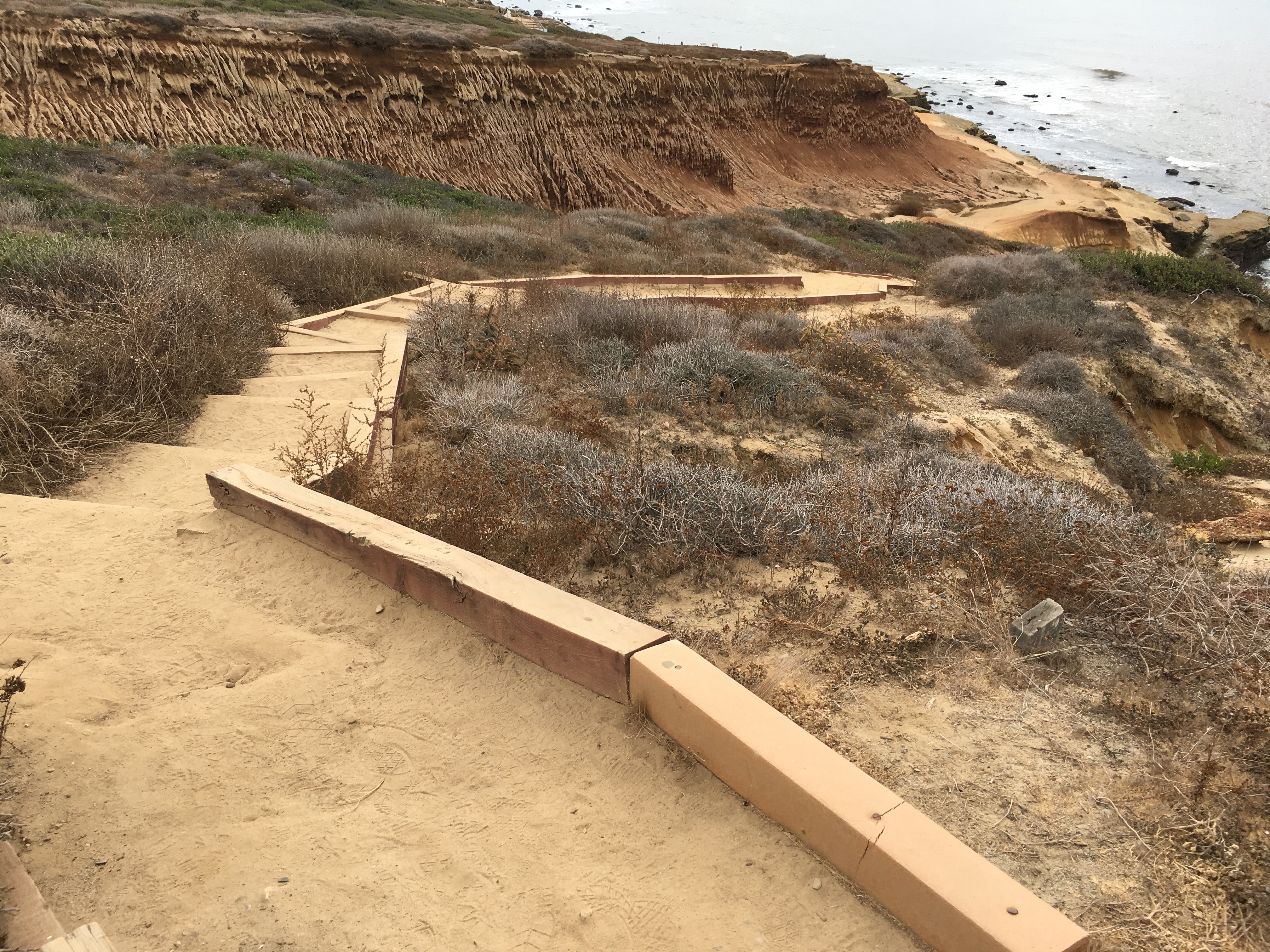
Route: This dirt trail passes along the bluffs overlooking the Cabrillo Tidepools. This trail can be started from the entrances at Tidepool Lot #1 or #2. It is a 1/2 mile (0.8 km) trip from one lot to the other. Portions of the trail contain steps and there are a few steep slopes. A spur from this trail provides access to the tidepools during low tide events. To return to the trailhead, retrace your steps back the trail entrance you started from.

Directions: Once you are in the park, take the turnoff for Cabrillo Rd. and travel down the hill 1 mile (1.6 km) to reach Tidepool Lot #1. Additional parking is available 1/2 mile (0.8 km) further down the road at Tidepool Lot #2.

Safety: There are no water sources along this trail. Hikers should plan to bring water and sun protection, especially during the warm summer months. Beware of slippery terrain and waves when on the tidepool spur trail. As in any natural area, there are environmental hazards to watch out for, including toxic plants, animals (such as rattlesnakes), and fragile cliff faces.

Coasting Along Cabrillo

The Coastal Trail travels along the bluffs on the western side of Cabrillo, just above the tidepools. The path provides an amazing opportunity to take in views of the ocean, delicate bluffs, and the tidepools below (when exposed). The trail near Lot #1 branches in two directions. One portion heads down towards the tidepools while the main trail passes over a small hill and continues along the bluffs towards Lot #2. A spur trail just south of Lot #2 leads to a bluff with additional coastal views.

While much of the trail crosses barren badlands, there are ample opportunities to explore the area’s native plant life as well. At any point, you can look upslope to the east and see native Mediterranean Coastal Sage Scrub and Maritime Chaparral plants. This native vegetation was once abundant in southern California but development has left very little acreage remaining. You can also see a strand of rare Shaw’s Agave just south of Lot #2. You may see rangers and volunteers pulling invasive weeds in this area and working in other parts of the park. This work is invaluable in helping preserve the rare ecosystems found withing the park. For example, one recent project led to the resurgence of native sea dahlia!

There is an also opportunity to examine some World War II history during this hike. Near the top of the stairs towards Lot #2, you will come across Searchlight Shelter, No. 15, an underground structure from World War II. What you see from the trail is the sliding roof. Make sure you stay off the roof as it is very unstable!

Regardless of which parking lot you use to start the hike, you return the way you came to finish it.

Accessibility Service animals are allowed. There are steep steps at various locations along the route and portions of the trail have a moderate grade. Terrain on this trail is uneven, subject to erosion, and is not accessible for wheelchair or strollers.

This hike on nps.gov

Oceanside Trail the Park Service's write-up

45-60 Minutes · no dogs

Start Oceanside Trail

A windy dirt path on a hillside overlooking the ocean.
View along the Oceanside Trail Photo: NPS Photo/A. Gossard

Length: 1 mi (.6 km) round-trip

Time: 1 hour

Difficulty: Easy

Elevation Change: 340 feet

Location: Southwest of the Old Point Loma Lighthouse grounds.

Parking: Main Parking Lot by Visitor Center.

Closest Restroom : Old Point Loma Lighthouse Grounds, Tidepools by Lot 1.

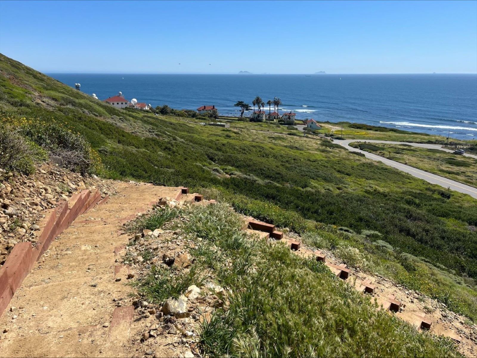
The Oceanside Trail significantly increases recreational opportunities by providing an entirely new trail that increases the park’s trail network by over 20% while also offering a car-free mode of access to the tidepool area. Visitors can now hike with an ocean view and walk to the tidepool area without needing to walk the narrow road shoulder. The trailhead starts at the top of the Whale Watch & Kelp Forest Overlook trail, south of the Old Point Loma Lighthouse. The trail leads down the bluffs and connects to the Coastal Trail and parking lot adjacent to the tide pools area. In addition to overlooking the ocean, this trail will pass by historic coastal defense structures, and give visitors the opportunity to hike in extremely rare undeveloped coastal scrub environments that are home to diverse plant and animal life.

Accessibility Unfortunately, due to the steep gradient of the hill, the trail will not be wheelchair accessible. For wheelchair accessible options, check out the Mobility Services page. The new trail is considered strenuous and will have stair steps, steep areas, uneven surfaces, and switchbacks. It will be narrow with a steep angled slope greater than 15% running slope in some spots. Cell service is not available on the trail or when down in the coastal area. Cell phone service is normally available at the upper trailhead. The trail is very close to the border with Mexico, so many visitors receive international roaming messages on their phones. There is generally no cell phone service at the bottom of the trail or at the tidepool area.

This hike on nps.gov

About these trails

The lines are the National Park Service's public trails layer, the trailheads and the waterfalls, views, peaks and historic places along them the Service's public points of interest, read 2026-10-14 and simplified for the map. The write-ups are the Service's own "things to do", unedited. Heights come from USGS 3DEP through Terrain Tiles on AWS (Mapzen/Tilezen), read along each line and rounded; a short trail on steep ground can be off by a few tens of feet. Closures change: check the park's own site before you go.