
Bayside Trail
Bayside Trail 2.5 mi round trip · the Park Service's write-up
1-2 Hours · no dogs
Length: 2.5 mi (4 km) round-trip
Time: 1 - 2 hours
Difficulty: Easy (Western side is a Class 5 trail, Eastern side is a Class 3 trail)
Elevation Change: 340 feet
Location: Northeast of the Old Point Loma Lighthouse grounds.
Parking: Main Parking Lot by Visitor Center.
Closest Restroom : Old Point Loma Lighthouse Grounds.
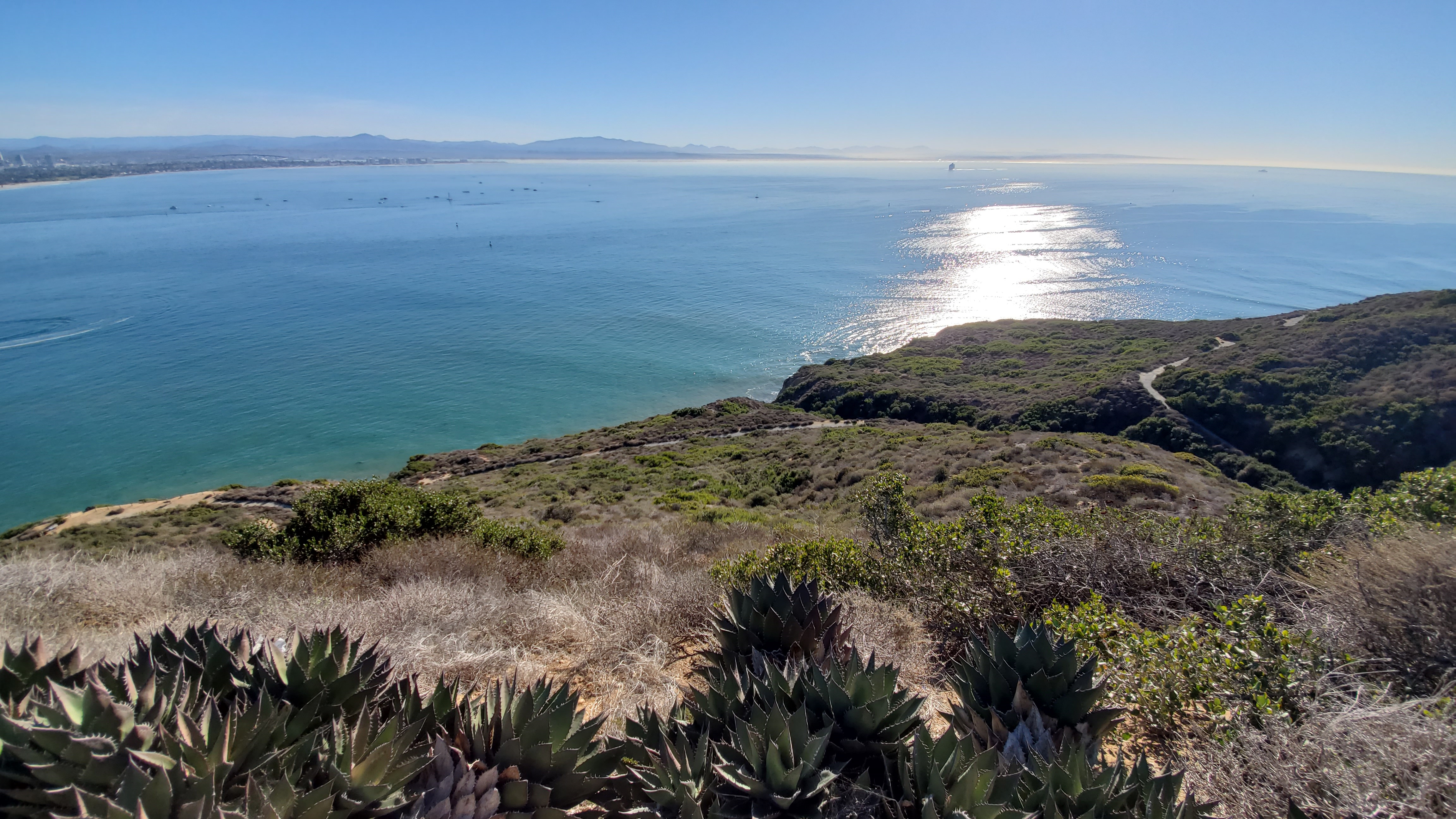
Route: This trail follows an old military road that winds down from the top of the park toward San Diego Bay. After reaching the bottom, you return to the trailhead by retracing your steps back up the trail. The trail begins on as an asphalt road and turns off the road onto a dirt and gravel path part way down. There is no access to the beach at any point on the trail
Safety: There are no restrooms or water sources along this trail. Hikers should plan to bring water and sun protection, especially during the warm summer months. As in any natural area, there are environmental hazards to watch out for, including toxic plants, animals (such as rattlesnakes), and fragile cliff faces.
Bayside Beauty
The Bayside Trail has great views of the ocean, native wildlife, and the city of San Diego. On a clear day you can see the mountains of Mexico to the south, the Laguna mountains to the east behind the San Diego skyline, Naval Air Station North Island, and the Coronado Bridge. Benches and stopping points provide a chance to catch your breath and take in some of the most beautiful views in San Diego county.
Exhibits along the trail explore topics such as native vegetation, animal life, the local climate, World War II history, etc. Along the trail you will also encounter a historic searchlight shelter and power plant used during World War I and World War II. Benches along the trail allow you to rest, reflect, and enjoy the view.
The downhill portion of the trail ends at an overlook of Ballast Point, where Cabrillo’s ships anchored after three months at sea in 1542. Today, nuclear-powered submarines are docked there, in the same place! Cabrillo’s statue looms on the bluff about 300 feet above this point.
Climate, Plants, and Animals
The natural environment along the trail is much the same as when Juan Rodriguez Cabrillo came ashore here in 1542. The trail is one of very few places in the world where Coastal Sage Scrub can live. Coastal sage habitat includes plants such as the fragrant black age and sagebrush and is one of the most threatened habitat types in the world. The trail is also home to the Southern Maritime Chaparral, another vulnerable and precious habitat, including cliff spurge, dudleya and barrel cactus. Point Loma gets approximately 10 inches of rain a year, so wildlife has adaptated to survive the relatively dry climate.
Hundreds of different native plants and animals call the Coastal Sage Scrub their home. Many local birds, such as the California Quail, American Kestrel, and Morning Dove might be seen along the trail. The Point Loma peninsula is an important stopover for many birds that use the Pacific Flyway. In the spring, migratory birds such as hummingbirds, warblers, wrentits, and bushtits make their appearance. Cottontail rabbits, ground squirrels, lizards, snakes, and foxes might be seen along the trail. During the summer, please keep an eye out for rattlesnakes.
Plants
Lichens
Mosses
Snake Cholla
Prickly Pear
Buckwheat
Four O’Clock
Tree Tobacco
Indian Paintbrush
Black Sage
Toyon
Deerweed
Bushy Yate (Eucalyptus)
Sugar Gum (Eucalyptus)
Laurel Sumac
Lemonade Berry
Wild Cucumber
California Sage
Chaparral Broom
Black-eyed Susan
Golden Yarrow
Mohave Yucca
Coast Ceanothus
Birds and Animals
California Striped Racer
Southern Pacific Rattlesnake
San Diego Gopher Snake
Great Basin Fence Lizard
Calif. Side-blotched Lizard
San Diego Alligtor Lizard
Great Blue Heron
Brown Pelican
Brush Rabbit
Scrub Jay
Rufus-sided Towhee
Snowy Egret
Forster’s Tern
Wrentit
Calif. Ground Squirrel
Western Gull
Anna’s hummingbird
Gray Fox
Military History
Wayside signs along the Bayside trail highlight the importance of Point Loma and its strategic location in our military history. In 1852, the U.S. Government designated the area as a military reserve. The Army housed a portion of its intricate coastal defense system on Point Loma.
During World Wars I and II cannons, mortars, and observation bunkers were constructed in a protective ring around the harbor. You’ll see a 1919 searchlight power station that was part of the system and housed huge searchlights that were used to light up the harbor entrance. The searchlight itself was housed a short way down the trail. When it was needed the soldiers wheeled it out on steel tracks, most of which have been removed. From there it could sweep the harbor entrance and illuminate approaching ships and aircraft.
From the tip of Zuniga Jetty, which you can see stretching from North Island southward toward the ocean, a submarine net anchored to Point Loma could be raised to prevent the entry of enemy underwater craft.
Today you can also see modern day military defense installations. At the end of the trail is a view of Ballast Point, home to nuclear-powered submarines. Across the bay you can see Naval Air Station North Island.
Accessibility There is a slight grade over the course of the hike, resulting in a 340 feet elevation change between the trailhead and bottom of the trail. This may be challenging for hikers with respiratory or heart problems. Benches and stopping points are located periodically along the hiking route. The trail begins as an asphalt road and becomes gravel and dirt part-way down. The Western section of this trail is classified as a Class 5 trail while the Eastern section is a Class 3 trail. There are no water sources or restrooms available along the trail. Service animals are allowed.