Buffalo National River · Arkansas

Beaver Jim Villines Homestead Trail

0.2 mi of trail, end to end · about 80 ft of climbing · 1,002 ft–1,086 ft

HistoryBoat launches

1,007 ft 1,086 ft · 0.1 mi high 1,086 ft

Along the way Ponca James A. Villines (Beaver Jim) Chicken House James A. Villines (Beaver Jim) Fruit Cellar James A. Villines (Beaver Jim) House James A. Villines (Beaver Jim) Smokehouse James A. Villines (Beaver Jim) WPA Outhouse

Hike the Beaver Jim Villines Homestead Trail the Park Service's write-up

15-60 Minutes · dogs allowed

Start Ponca Access
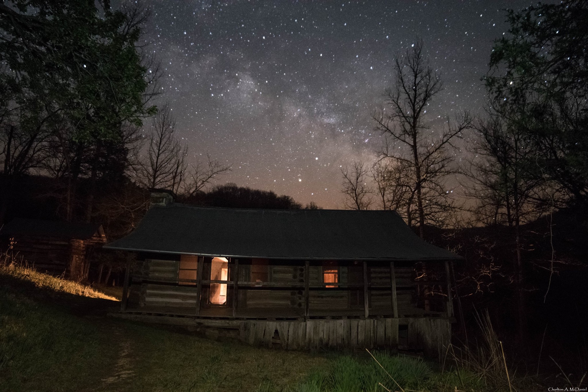
Beaver Jim's Cabin in Starlight
Beaver Jim's cabin under a starry sky Photo: Charlton McDaniel

This short, interpretive loop begins at the Ponca Access of the Buffalo River near the intersection of Hwy. 43 and 74. Walk across the low-water bridge (when passable) and follow signs up the hill. This easy trail passes the old homestead and farm buildings of "Beaver" Jim Villines, an early fur trapper and trader in Boxley Valley.

Accessibility This trail has a somewhat steep grade from the Ponca Access to the homestead. Service animals are permitted.

This hike on nps.gov

All 48 trails in Buffalo National RiverFind a trailOn the parks mapPark on nps.gov

About this trail's facts

The lines are the National Park Service's public trails layer, the trailheads and the waterfalls, views, peaks and historic places along them the Service's public points of interest, read 2026-10-16 and simplified for the map; the length is the line's, end to end. The write-ups are the Service's own "things to do" text, unedited. Heights come from USGS 3DEP through Terrain Tiles on AWS (Mapzen/Tilezen), read along each line and rounded; a short trail on steep ground can be off by a few tens of feet. Closures change: check the park's own site before you go.