
Peekaboo Loop Trail
Bryce Amphitheater Traverse the Park Service's write-up
3-4 Hours · no dogs
Start Bryce Point
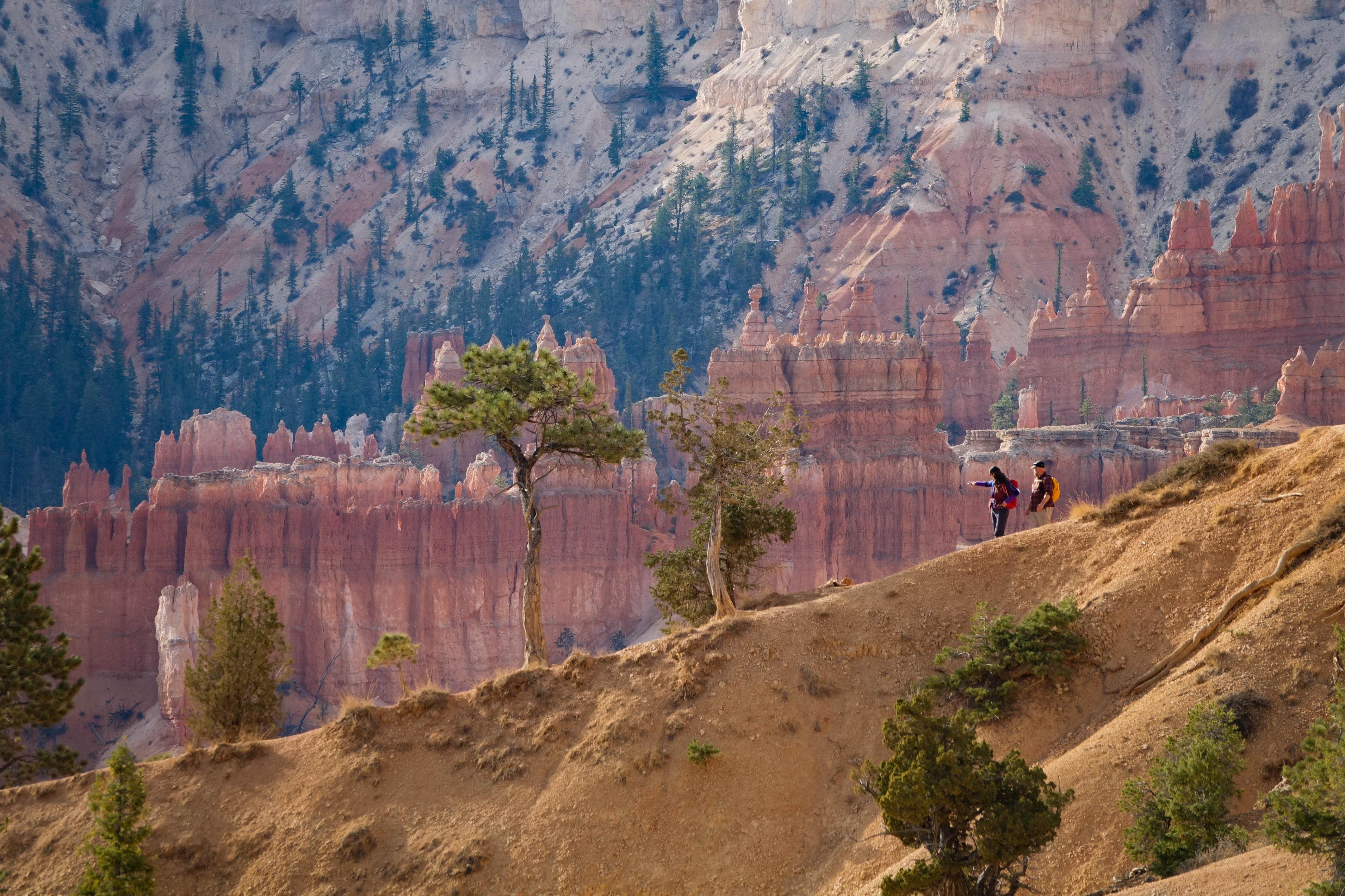
The Bryce Amphitheater Traverse is a one-way hike combining the Peekaboo Loop with the Queen's Garden trail. Hikers descend from Bryce Point, turning left (clockwise) on Peekaboo Loop and then connecting to the Queen's Garden trail to ascend to Sunrise Point.
Trailhead: Bryce Point
Parking: At trailhead (check when parking lots are busiest ). Oversized vehicles are not permitted in this parking area when the shuttle is in operation.
Distance: 4.7 miles (7.6 km)
Approximate Time: 3-4 hours
Elevation Gain: 1145 feet (349 meters)
Difficulty: Strenuous (rapid elevation gain, longer length)
Services: Pit toilets on the west side of Peekaboo Loop (summer only)
Shuttle Service: Yes.
This trail may be inaccessible during mid-winter due to snow depths ranging from 2-15 ft. (.7-5 m)
Pets are not allowed on this trail. Service animals are allowed in national parks. What is a service animal?
Hikers will encounter horses and mules on the Peekaboo Loop and should give the right-of-way to these riders.
Accessibility Due to the park's natural terrain, this is not considered an accessible trail. Surface Type: Firm Native Sediment Total Ascent: 1145 feet (349 meters) Length: 4.7 mi (7.6 km) Typical Grade: 11.0% (Queen's); 6.0% (Peekaboo) Maximum Grade: 25.0% (Queen's) ; 27.0% (Peekaboo) Typical Cross Slope: 5.0% (Queen's) ; 4.0% (Peekaboo) Maximum Cross Slope: 17.0% (Queen's); 21.0% (Peekaboo) Typical Width : 81 inches (206 cm) (Queen's); 76 inches (193 cm) (Peekaboo) Minimum Width: 33 inches (84 cm) (Queen's) ; 48 inches (122 cm) (Peekaboo) Service animals are allowed in national parks. What is a service animal?
Figure-8 Combination the Park Service's write-up
4-5 Hours · no dogs
Start Queen's Garden Trailhead
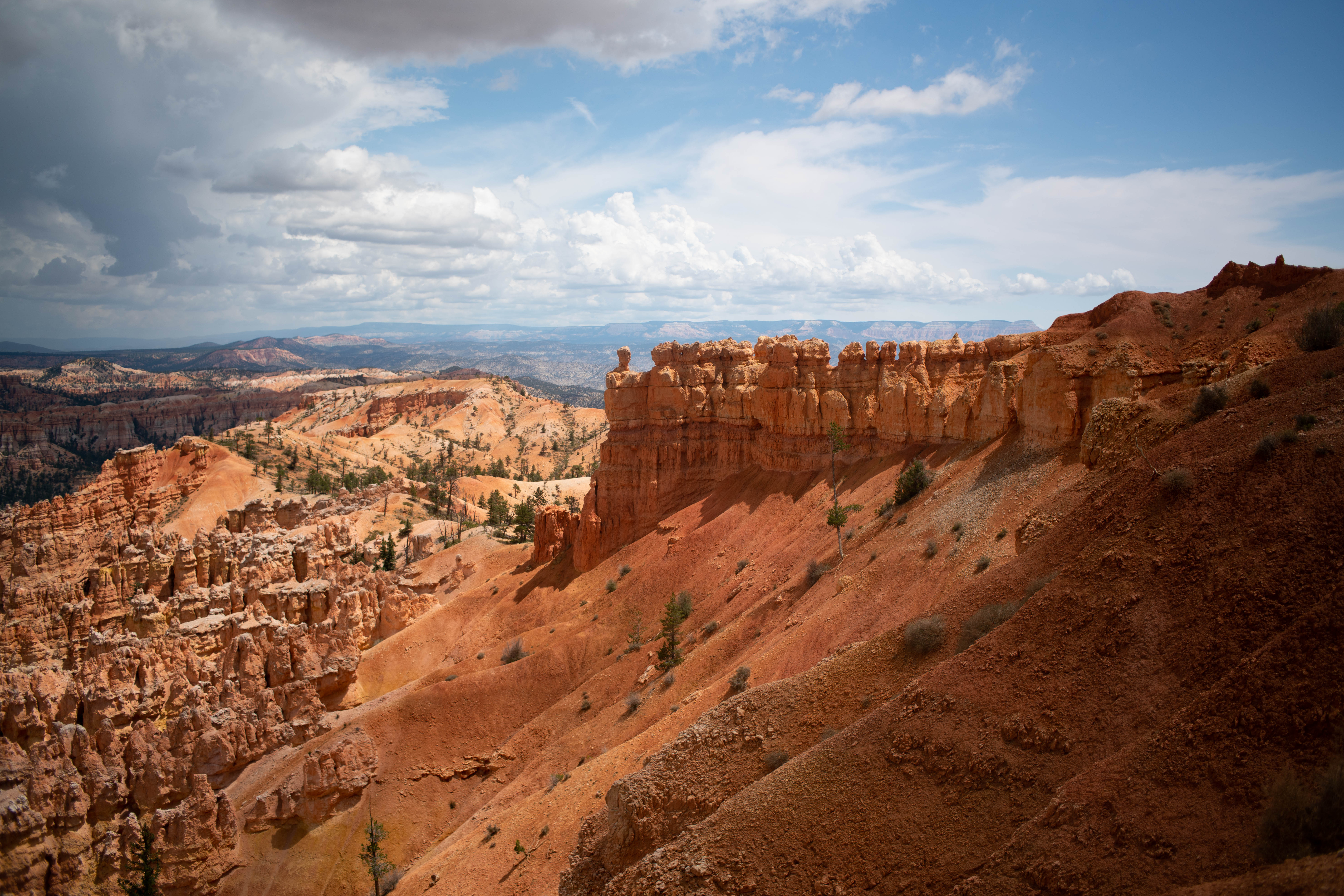
The Figure-8 Combination combines three amphitheater hikes, Queen's Garden, Navajo Loop, and the Peekaboo Loop, into one ultimate hike! We recommend a clockwise direction descending Queen's Garden, connecting to the Peekaboo Loop (we recommend hiking it in a clockwise direction), and ascending either side of the Navajo Loop (Two Bridges in winter). From there you can complete the trail by hiking back to Sunrise Point along the Rim Trail.
Trailhead: Sunrise Point or Sunset Point
Parking: Available at both Sunrise and Sunset Points (check when parking lots are busiest ). Oversized vehicles are not permitted in these parking areas when the shuttle is in operation .
Distance: 6.4 miles (10.3 km)
Approximate Time: 4-5 hours
Elevation Gain: 1575 feet (480 meters)
Difficulty: Strenuous (rapid elevation gain, longer length)
Services: Accessible restrooms available at Sunset Point (year-round) and available at the General Store near Sunrise Point (seasonally). Water-fill stations available at Sunset Point (seasonally), the Sunset Point restroom (year-round), and the General Store (seasonally). Pit toilets on the west side of Peekaboo Loop (summer only)
Shuttle Service: Yes.
This trail may be inaccessible during mid-winter due to snow depths ranging from 2-15 ft. (.7-5 m)
Pets are not allowed on this trail. Service animals are allowed in national parks. What is a service animal?
Hikers will encounter horses and mules on the Peekaboo Loop and should give the right-of-way to these riders.
You can hike these trails individually as the Peekaboo Loop , Queen's Garden , and the Navajo Loop .
Accessibility Due to the park's natural terrain, this is not considered an accessible trail. Surface Type: Firm Native Sediment Total Ascent: 1575 feet (480 meters) Length: 6.4 mi (10.3 km) roundtrip Typical Grade: 11.0% (Queen's);14.0% (Navajo); 6.0% (Peekaboo) Maximum Grade: 25.0% (Queen's) ; 30.0% (Navajo); 27.0% (Peekaboo) Typical Cross Slope: 5.0% (Queen's) ; 7.0% (Navajo); 4.0% (Peekaboo) Maximum Cross Slope: 17.0% (Queen's); 24.0% (Navajo) ; 21.0% (Peekaboo) Typical Width : 81 inches (206 cm); 77 inches (196 cm) (Navajo); 76 inches (193 cm) (Peekaboo) Minimum Width: 33 inches (84 cm) ; 25 inches (64 cm) (Navajo); 48 inches (122 cm) (Peekaboo) Service animals are allowed in national parks. What is a service animal?
Navajo/Peekaboo Combination Loop the Park Service's write-up
3-4 Hours · no dogs
Start Navajo Loop Trailhead
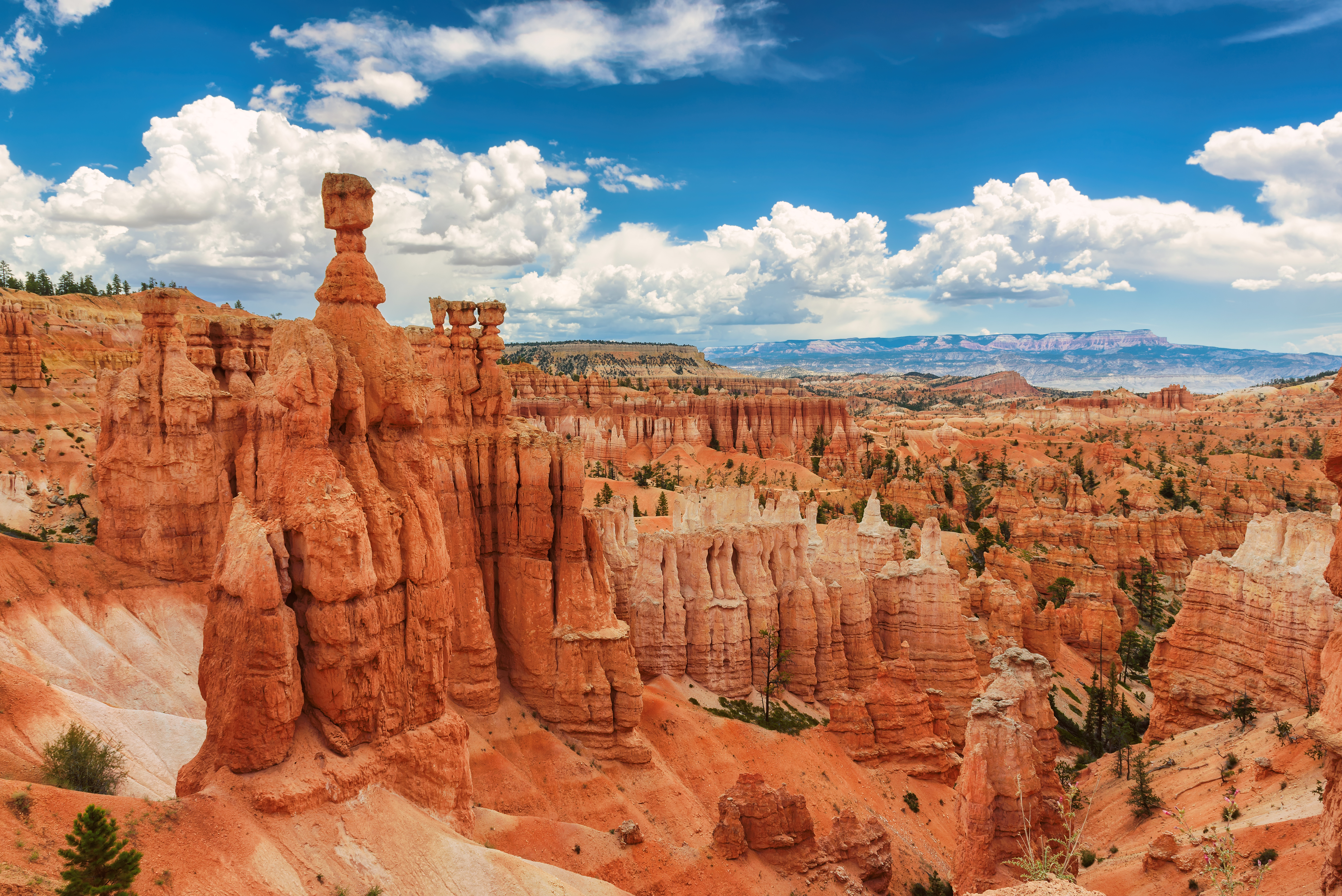
Combine two of our most iconic trails, the Navajo and Peekaboo Loop trails, into a a mini Figure-8 combination loop. Start the hike at Sunset Point, descend down either side of the Navajo Loop (Two Bridges in winter), connect to the Peekaboo Loop (we recommend hiking it in a clockwise direction), and ascend Navajo back to Sunset Point.
Trailhead: Sunset Point
Parking: At trailhead (check when parking lots are busiest ). Oversized vehicles are not permitted in this parking area when the shuttle is in operation.
Distance: 4.9 miles (7.9 km)
Approximate Time: 3-4 hours
Elevation Gain: 1475 feet (450 meters)
Difficulty: Strenuous (rapid elevation gain, longer length)
Services: Accessible restrooms available at Sunset Point (year-round). Pit toilets on the west side of Peekaboo Loop (summer only). Water-fill stations available at Sunset Point (seasonally) and the Sunset Point restroom (year-round).
Shuttle Service: Yes.
In winter, use the Two Bridges side of the Navajo Loop.
Pets are not allowed on this trail. Service animals are allowed in national parks. What is a service animal?
Hikers will encounter horses and mules on the Peekaboo Loop and should give the right-of-way to these riders.
You can hike these two trails individually as the Peekaboo Loop and the Navajo Loop .
Accessibility Due to the park's natural terrain, this is not considered an accessible trail. Surface Type: Firm Native Sediment Total Ascent: 1475 feet (450 meters) Length: 4.9 mi (7.9 km) roundtrip Typical Grade: 14.0% (Navajo); 6.0% (Peekaboo) Maximum Grade: 30.0% (Navajo); 27.0% (Peekaboo) Typical Cross Slope: 7.0% (Navajo); 4.0% (Peekaboo) Maximum Cross Slope: 24.0% (Navajo) ; 21.0% (Peekaboo) Typical Width : 77 inches (196 cm) (Navajo); 76 inches (193 cm) (Peekaboo) Minimum Width: 25 inches (64 cm) (Navajo); 48 inches (122 cm) (Peekaboo) Service animals are allowed in national parks. What is a service animal?
Peekaboo Loop the Park Service's write-up
3-4 Hours · no dogs
Start Bryce Point
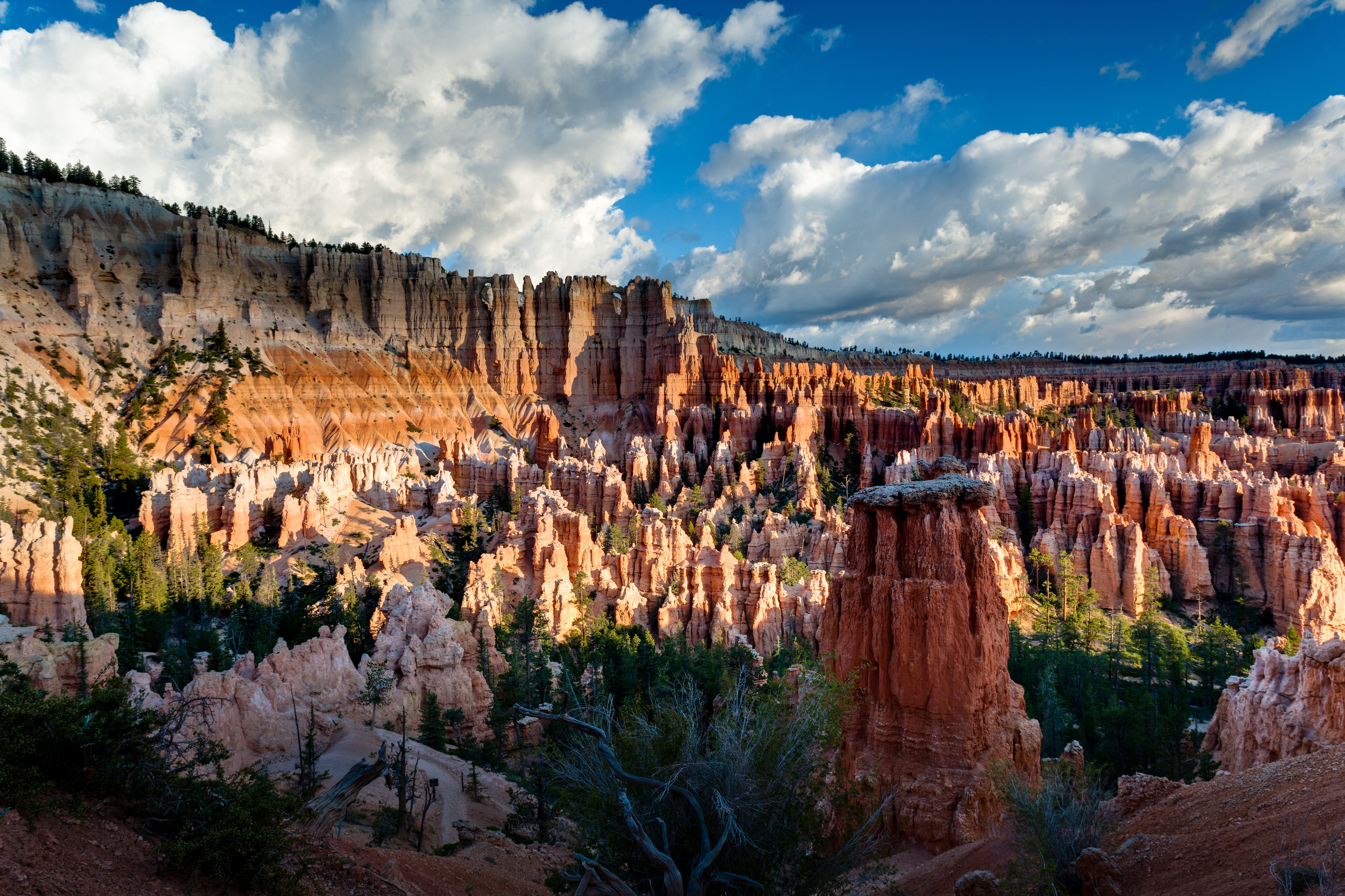
The Peekaboo Loop descends 670 feet (204 meters) from Bryce Point to this hoodoo-filled loop trail before ascending back up to Bryce Point. In summer months, hikers will encounter horses/mules on this trail. We recommend hiking this trail in a clockwise direction.
Trailhead: Bryce Point
Parking: At trailhead (check when parking lots are busiest ). Oversized vehicles are not permitted in this parking area when the shuttle is in operation.
Distance: 5.5 miles (8.9 km)
Approximate Time: 3-4 hours
Elevation Gain: 1560 feet (474 meters)
Difficulty: Strenuous (rapid elevation gain, longer length)
Services: Pit toilets on the west side of Peekaboo Loop (summer only)
Shuttle Service: Yes.
This trail may be inaccessible during mid-winter due to snow depths ranging from 2-15 ft. (.7-5 m)
Pets are not allowed on this trail. Service animals are allowed in national parks. What is a service animal?
Hikers may encounter horses and mules on this trail and should give the right-of-way to these riders.
Accessibility Due to the park's natural terrain, this is not considered an accessible trail. Surface Type: Firm Native Sediment Total Ascent: 1560 feet (474 meters) Length: 5.5 mi (8.9km) roundtrip Typical Grade: 6.0% Maximum Grade: 27.0% Typical Cross Slope: 4.0% Maximum Cross Slope: 21.0% Typical Width : 76 inches (193 cm) Minimum Width: 48 inches (122 cm) Service animals are allowed in national parks. What is a service animal?