
Schiff Path
Hike Emery Path 0.5 mi one way · the Park Service's write-up
20-45 Minutes · dogs allowed · Spring, Summer, Fall
Start Emery Path
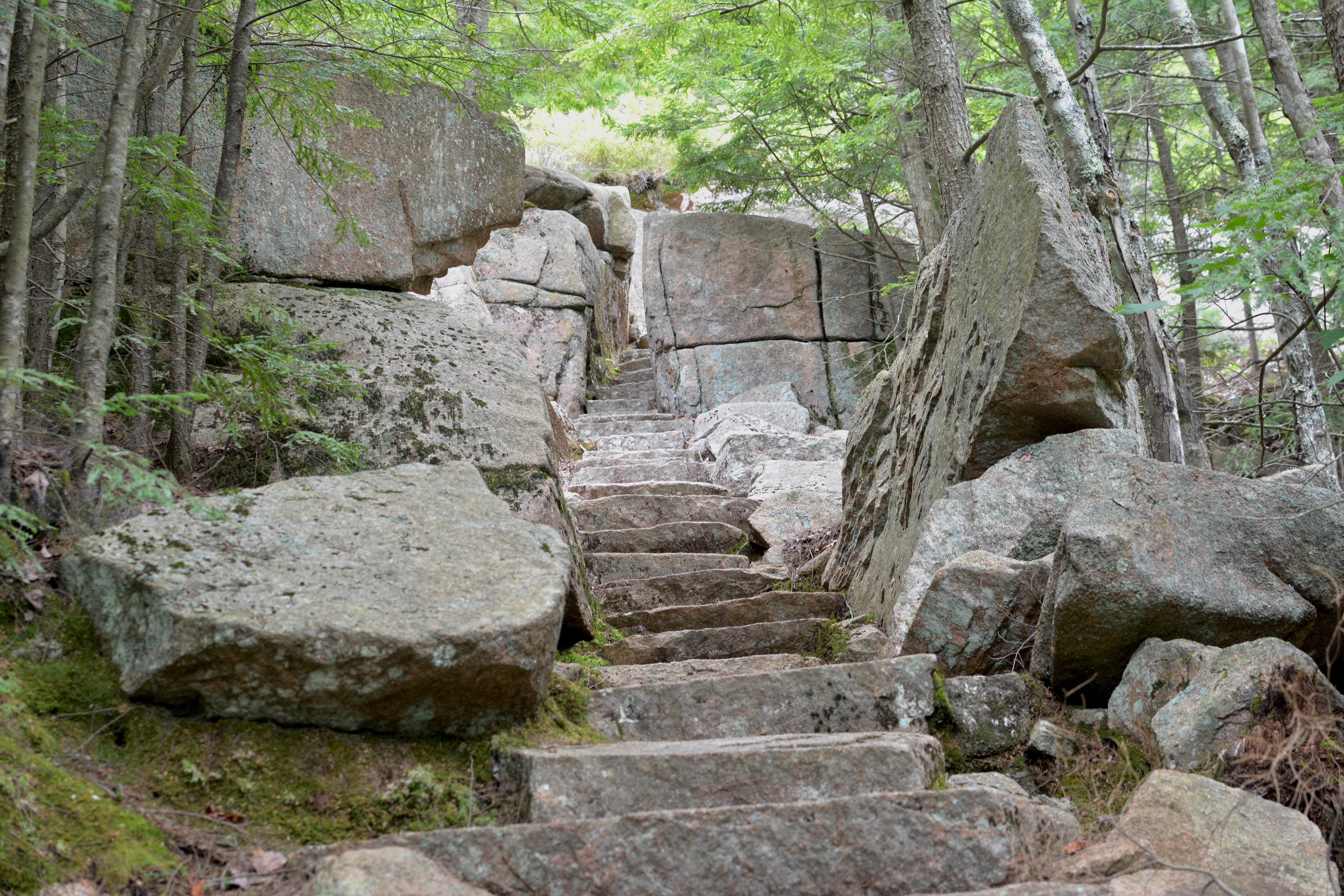
Emery Path is a memorial path at Sieur de Monts. It is a .5 mile steep ascent with examples of high quality trail work. It is one of the routes to reach Schiff Path, and eventually the summit of Dorr Mountain. It is said to have been one of George Dorr's favorite trails.
Emery Path was funded by Mrs. Alfred Anson in memory of her first husband, John Emery. John Emery was a successful developer of commercial and residential real estate in Cincinnati, Ohio. The trail was improved by the Civilian Conservation Corps (CCC) in 1934.
Distance: .5 miles one way
Terrain: Forested area with steep and rocky sections, granite steps, narrow passages
Hike Description
Start at the Sieur de Monts Nature Center. Cross the small wooden bridge and turn left.
Turn right to pass by two large stones inscribed with "Sieur de Monts Spring" and "Sweet Waters of Acadia" and proceed to the start of Emery Path.
The trail quickly ascends for .5 miles on granite stairs and steep sections through the forest.
To reach the summit of Dorr Mountain, continue onto Schiff Path for.9 miles.
To return to Sieur de Monts, retrace your steps back or take Homans Path or Kurt Diederich's Climb. All three trails are quick, steep descent with granite steps. Use caution, especially when the rock is wet and slippery.
Accessibility Emery Path is not accessible. The trail has uneven footing, steep sections, a narrow passage, and granite stairs throughout. There is an accessible restroom at Sieur de Monts.
Hike Schiff Path the Park Service's write-up
30-60 Minutes · dogs allowed · Spring, Summer, Fall
Start Schiff Path
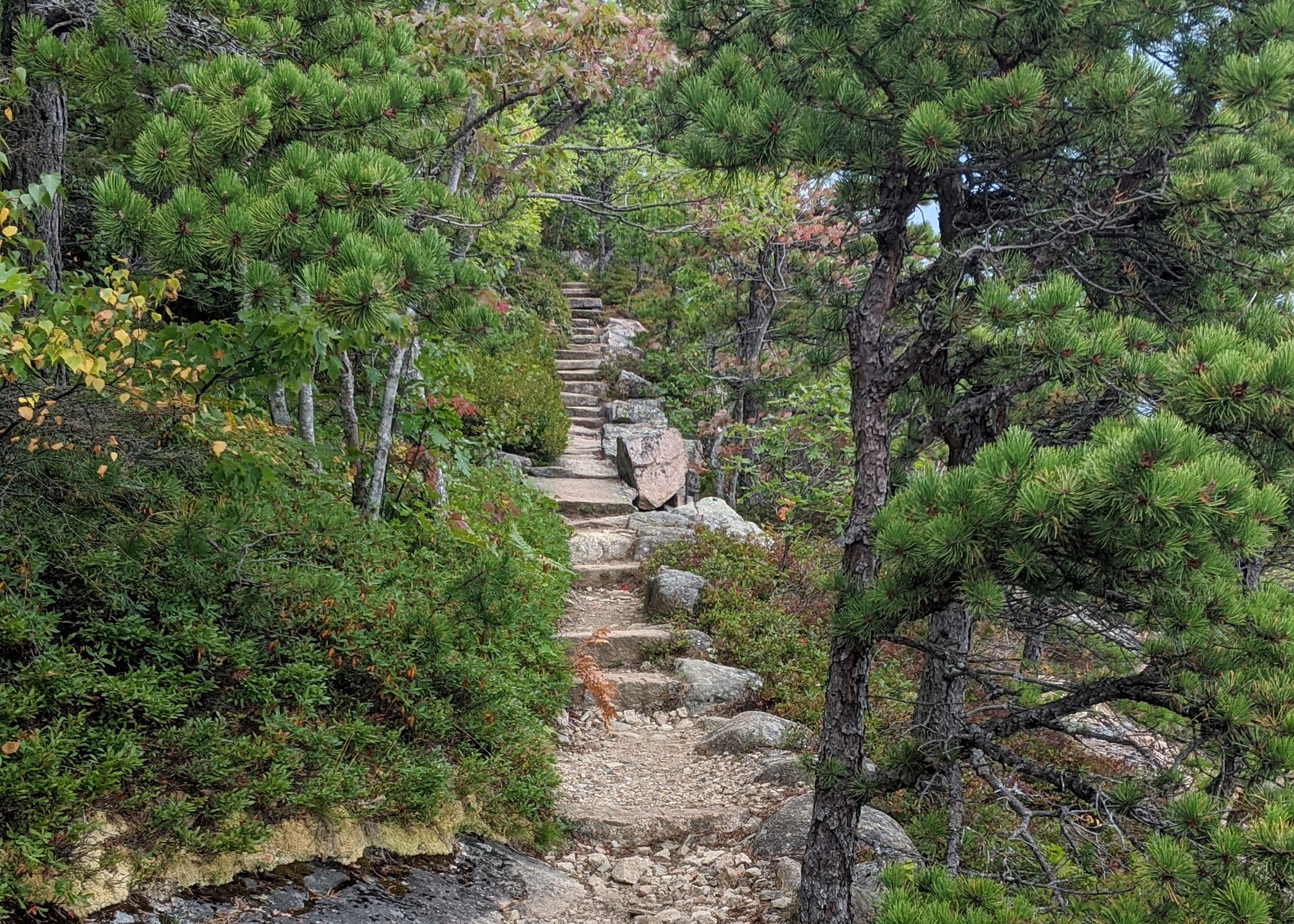
Schiff Path is a popular trail that runs along the east face of Dorr Mountain and provides views of Frenchman Bay and the Tarn. It acts as a link between several trails starting at Sieur de Monts and the summit of Dorr Mountain.
Schiff Path is named after Jacob Henry Schiff. He was the senior partner of the New York investment banking house Kuhn Loeb and gained prestige in business and philanthropy. It is one of the memorial trails built at Sieur de Monts by George Dorr, in conjunction with the Bar Harbor Village Improvement Association.
Distance: Varies
Terrain: Forested, rocky path, granite steps, steep inclines, exposed ridgeline
Hike Description
To reach the Schiff Path, start on either Emery Path, Homans Path, Kurt Diederichs Climb, or Ladder Trail from Sieur de Monts. These trails are comparable in length, steepness, and amount of stairs (with the exception of Ladder Trail, which also contains a few iron ladders).
Continue onto Schiff Path as it gently rises along a ridgeline and enjoy views of Frenchman Bay and the Tarn below.
At the intersection with the Ladder Trail, turn right.
The trail begins a steep ascent for .4 miles, gaining 400 ft over exposed granite sections.
At the junction, either turn left for .1 miles to reach the summit of Dorr Mountain or continue straight to intersect the Gorge Path (Dorr West Face Trail) towards Cadillac Mountain.
Accessibility Schiff Path is not accessible. The trail and connector trails have uneven footing, rocky, steep sections, and granite stairs throughout. There is an accessible restroom at Sieur de Monts.