
National Park · Maine
Trails in Acadia National Park
219 named trails · 222 miles · 52 with the Park Service's own write-up. The lines, trailheads and points are the Park Service's; the write-ups are the Service's own words; the climbing is read from USGS elevation along each line.
219 trails, A to Z.
Acadia Mountain Trail
Hike St. Sauveur and Acadia Mountain Loop the Park Service's write-up
2-4 Hours · dogs allowed
Start Acadia Mountain Trailhead
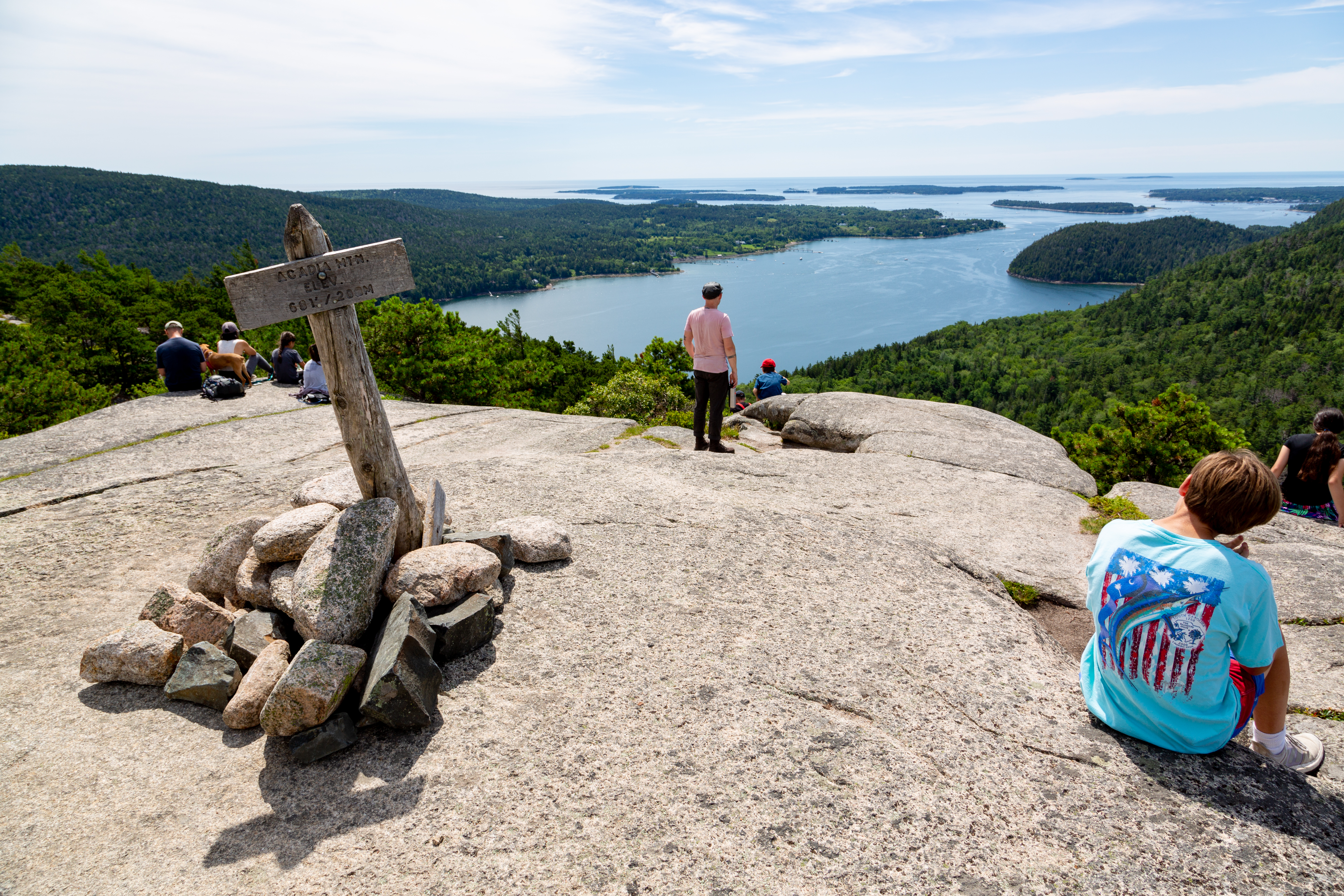
The St. Sauveur and Acadia Mountain Loop is a challenging hike that summits two mountain peaks. It offers stunning views of Somes Sound and the surrounding mountains, as well as outlying islands and the ocean. Choose dry weather to complete this hike, as many sections are rugged, exposed granite slopes near cliff edges.
Distance: 3.7 miles round trip
Terrain: Steep granite slopes and ridgelines, forested trails
Hike Description
This trail rises quickly on open granite and meets the junction of the St. Sauveur Trail and the Acadia Mountain Trail.
The hike can be taken for a loop in either direction. Both directions have steep ascents and descents on the East faces.
Turn right on the St. Sauveur Trail toward St. Sauveur Mountain.
The trail ascends gradually through the forest with an occasional view of Echo Lake to the north. There is no view from the summit.
Past the summit, a shorter connector trail to the left leads to the Valley Peak Trail and views of Somes Sound.
Turn left on the trail and continue to a steep and rugged descent through the forest.
Note: If you go straight past the summit on the St. Sauveur trail, you will reach summit of Valley Peak. A return to the loop via the Valley Peak Trail adds 0.7 miles.
After descending the mountain, continue straight at the next intersection towards the Acadia Mountain Trail.
To shorten the loop, take a left on the Man o' War Brook fire road. It will lead back to the Acadia Mountain Trail. Another left then leads back to the beginning of the hike.
The trail then rises as a steep climb over stretches of loose rock and ledges as it ascends the eastern side of Acadia Mountain. Acadia Mountain actually has two peaks.
After the second peak, the trail begins to descend through the forest with an occasional view of Echo Lake and the surrounding mountains. This trail brings you back to the intersection of St. Sauveur Tail and Acadia Mountain Trail completing the loop.
Accessibility St. Sauveur and Acadia Mountain Loop is not accessible. The trails have uneven footing and short, steep sections requiring some scrambling throughout. There are no accessible restrooms at the trailhead, only a vault toilet.
Hike the Acadia Mountain Loop with Island Explorer Bus the Park Service's write-up
2-3 Hours · dogs allowed · Spring, Summer, Fall
Start Acadia Mountain Loop
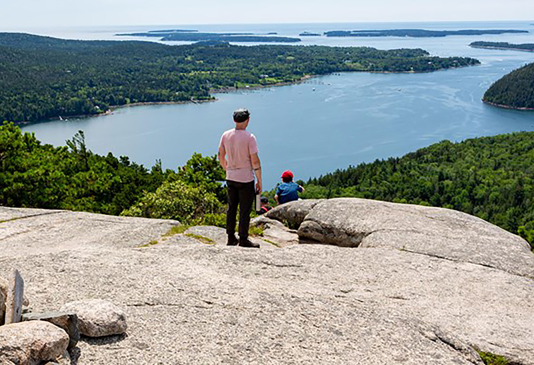
Nestled in between Echo Lake and Somes Sound lies Acadia Mountain. Standing just 681 ft tall it offers amazing views of the surrounding waters and mountains. Located on the West or “Quiet Side” of the park, it offers a quieter hike through the forest and over granite slabs. Listen for numerous birds chirping along the trail. To do the loop continue on the Man O War Fire Brook Road.
This trail is steep on both sides and steeper on the West Side next to Somes Sound, with more granite and rocky sections. Taking the Fire Road all the way over to the West side of the mountain, and then going up to the summit, is the easier way. A false summit provides a great view of the mountains and sound. Just 0.3 miles further on is the actual summit; it is marked with a trail marker. Taking the east side down is easier with some rocky spots and stone steps. Please be mindful of where you are stepping as all trails in this park have roots and rocks that you can slip or trip on.
Acadia Mountain rises in between two bodies of water overlooking Southwest Harbor. Hiking up the west side has great views of Somes Sound. The east side has great views of Beech Mountain with the Fire Tower in the distance. Enjoy a mostly forested trail with a few rock scrambles.
Acadia Mountain Trail follows up the east and west side of the mountain with views of the surrounding mountains and bodies of water. With the Island Explorer bus, visitors won't need to park along the road and can ride to the trailhead stress-free.
Bus: Island Explorer #7 (Southwest Harbor) from Bar Harbor at Village Green and get off at the parking lot for Acadia Mountain. safely cross the road. Ask the driver if you feel more comfortable. The trailhead is on the other side. Once you finish the hike the bus will pick up back at the trailhead.
Accessibility Due to the steep nature of the trail, it is not accessible. The trail has a moderate to steep grade throughout.
Access Trail
Hike Beech Mountain Trail the Park Service's write-up
1-2 Hours · dogs allowed
Start Beech Mountain
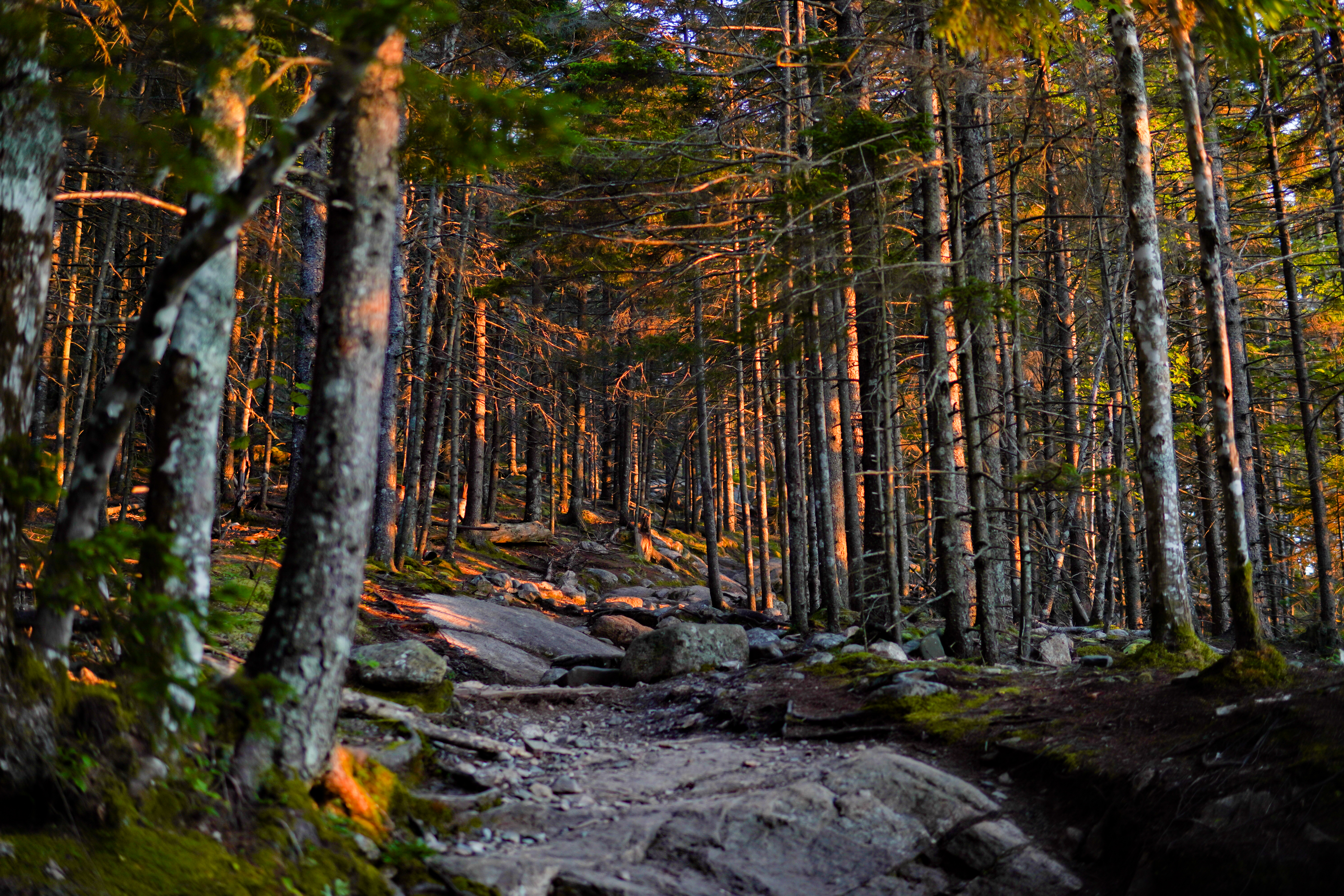
A short, moderate loop on the west side of Mount Desert Island, Beech Mountain Trail provides hikers with views of Long Pond and Mansell Mountain on the way up and access to one of the few remaining fire towers in the area. This hike is also a good sunset option, but carry appropriate gear and headlamps when hiking at dusk and dark.
Distance: 1.2 miles round trip
Terrain: Forested path, rocky trails, granite stairs and slopes, wooden steps
Hike Description
The loop begins from the Beech Mountain parking lot, on the northwest side of the lot.
At the first junction, stay right to follow the longer path to the summit.
The trail begins as a gradual forested path, however, as elevation increases, the trail becomes rockier.
The trail opens up at .5 miles to granite slabs which provide sweeping views of Long Pond and Mansell Mountain. This is a popular spot to watch the sunset.
After .1 miles, keep left at the intersection towards Beech Mountain summit. The trail will feature granite and wooden steps to the summit.
At the next intersection, just below the fire tower, keep right to access the summit and fire tower. The first platform of the fire tower is open and provides views of Somes Sound, Echo Lake, Acadia Mountain, and other mountains on the east side of the Mount Desert Island.
Retrace to the intersection just below the summit, stay straight and follow the sign showing .4 miles to the Beech Mountain Parking Area.
This trail contains multiple steep granite slopes before descending into the woods. This section of trail is not recommended in wet weather.
Follow the trail down a quick, steep rocky section. At next intersection, follow the trail back to the parking lot.
Accessibility Beech Mountain Trail is not accessible. The trail has uneven footing and short, steep sections throughout. There are no accessible restrooms at the trailhead.
Hike Wonderland Trail the Park Service's write-up
30-60 Minutes · dogs allowed
Start Wonderland Trail
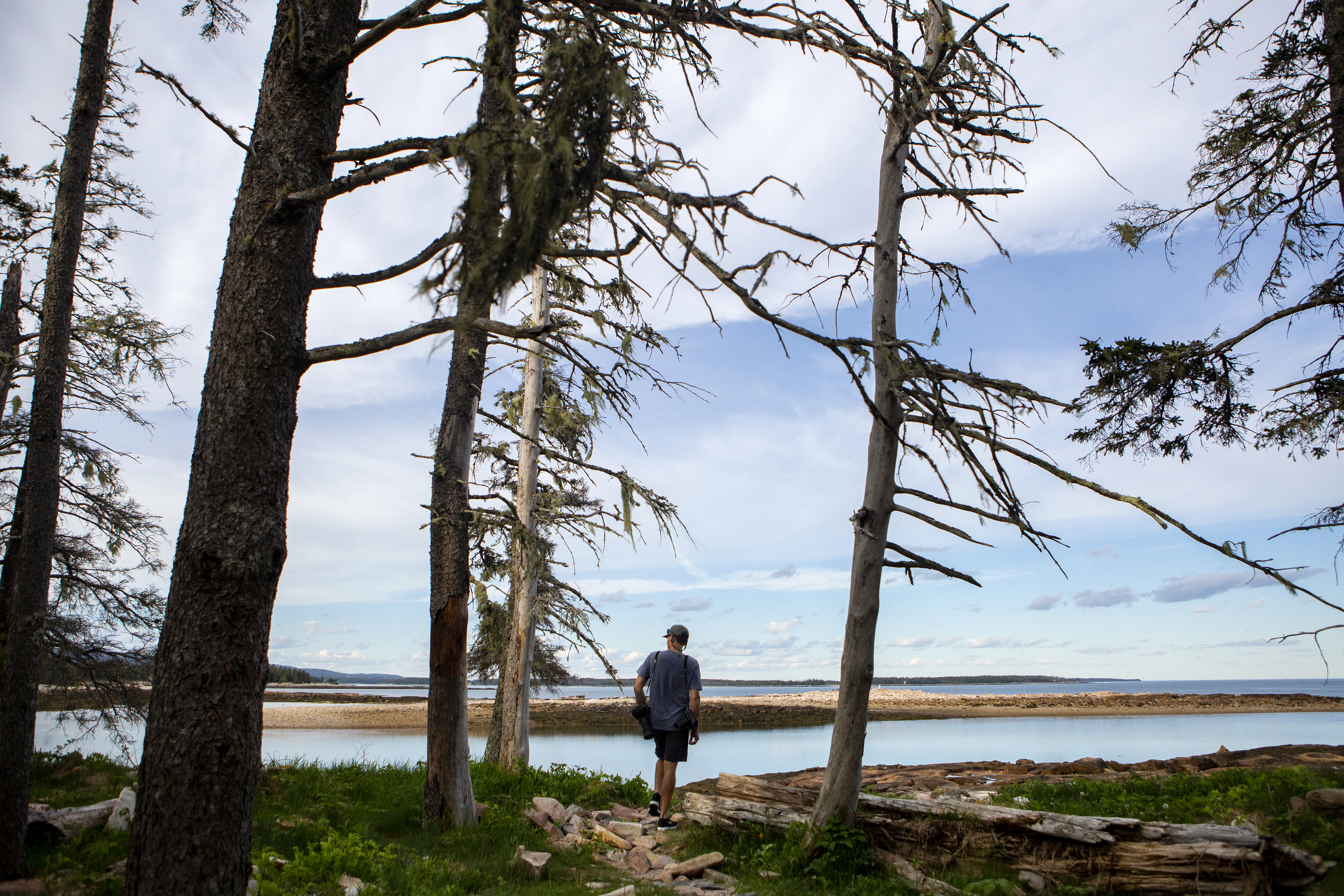
Located between Seawall Campground and the Ship Harbor Trail on Maine Route 102A, Wonderland Trail is an old gravel fire road which leads to the ocean. It is a family-friendly coastal trail, popular for birding and tidepooling at low tide. When exploring this area, never turn your back on the water. Explore as the tide is going out, and be gentle with any creatures in the tidepools.
Distance: 1.4 miles round trip
Terrain: gravel fire road, rocky sections, coastline
Hike Description
Start from the parking area and follow the trail along a old gravel fire road.
The road is mostly flat with minimal roots and rocks, leading through a spruce forest before opening up to Jack Pine.
The coastline access starts close to the end and opens up to a rocky shoreline. Use caution on the rocks, especially when wet. Views of the Duck Islands to the southeast and Great Cranberry Island to the northeast can be seen from the shore.
After seeing the coastline or tidepooling during low tide, return back the same way to reach the parking area.
Accessibility The Wonderland Trail is not accessible. The trail has uneven footing in areas. There is limited parking in a small lot. Street parking is also available. No accessible parking spaces are designated. There is no toilet at the trailhead. The closest accessible toilet is at the Ship Harbor Trailhead, a short drive south.
Alder Trail
Amphitheatre Carriage Road
Amphitheatre East
Amphitheatre East Carriage Road
Amphitheatre Trail
Amphitheatre West
Amphitheatre West Carriage Road
Anvil Trail
Asticou & Jordan Pond Path
Asticou Ridge Trail
Aunt Betty Pond
Aunt Betty Pond Carriage Road
Bald Peak Trail
Hike Bald Peak and Parkman Mountain Loop the Park Service's write-up
1-2 Hours · dogs allowed
Start Bald Peak and Parkman Mountain
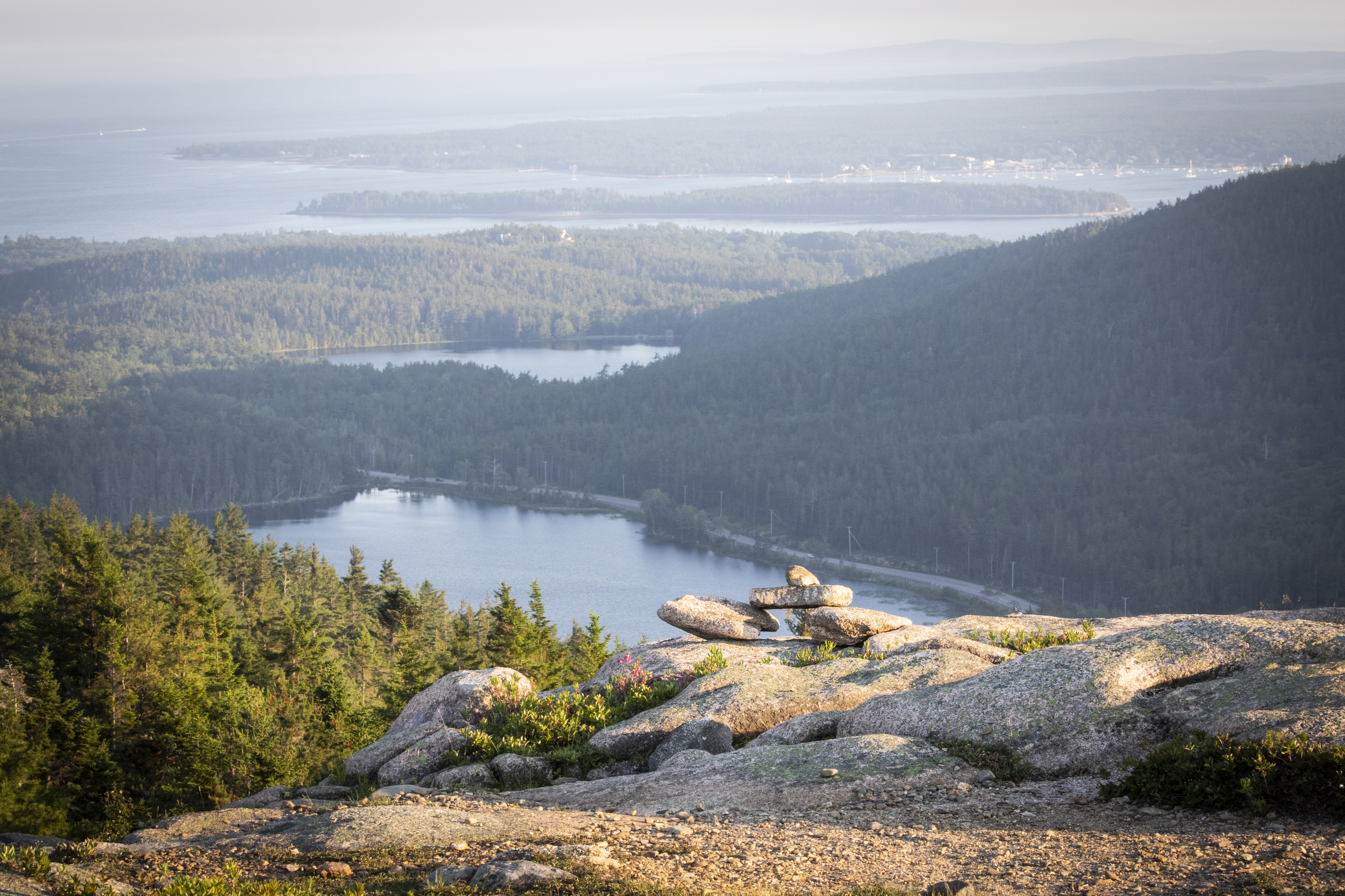
A short, challenging hike to the top of two mountains each over 900 feet. The hike crosses carriage roads before summiting for ocean views of the Somes Sound and Northeast Harbor. Start with Bald Peak Trail, as it offers steeper terrain than its western Parkman Mountain Trail counterpart. Choose dry weather to avoid hazards on slippery, exposed granite sections. This hike is also a good sunset option, but carry appropriate gear and headlamps when hiking at dusk and dark.
Distance: 2.7 miles round trip
Terrain: Forested path, steep granite and challenging rocky footing throughout with one iron rung.
Hike Description
The hike starts at Sargent Mountain Trailhead and descends slightly through the forest on the Hadlock Brook Trail.
Pass the Parkman Mountain Trail junction. After .2 miles, come to the junction for the Bald Peak Trail and turn left.
The Bald Peak Trail becomes more rugged as it follows a stream and begins to ascend Bald Peak. There are two carriage road crossings.
After crossing the second carriage road, the hike becomes significantly steeper and exposed. Blue blazes and stone Bates cairns on the open granite face mark the trail. This section is not recommended in wet weather.
At the top of Bald Peak, enjoy views of Upper Hadlock Pond and the outlying islands.
Continue down the north side of the mountain before ascending to the junction with Parkman Mountain Trail. Take a right for .1 mi to the summit.
Retrace the trail southward, pass the junction again, and continue the descent into the forest. There are two steep ledges and one iron rung. These sections are challenging when wet.
The trail crosses the carriage road three times before ending at the junction where the hike started. A right turn leads back the ME Route 198 and the parking lot.
Accessibility Bald Peak and Parkman Mountain Loop is not accessible. The trails have uneven footing and short, steep sections requiring some scrambling throughout. There are no accessible restrooms at the trailhead.
Bar Island Access
Bar Island Trail
Hike Bar Island Trail the Park Service's write-up
45-90 Minutes · dogs allowed
Start Bar Island
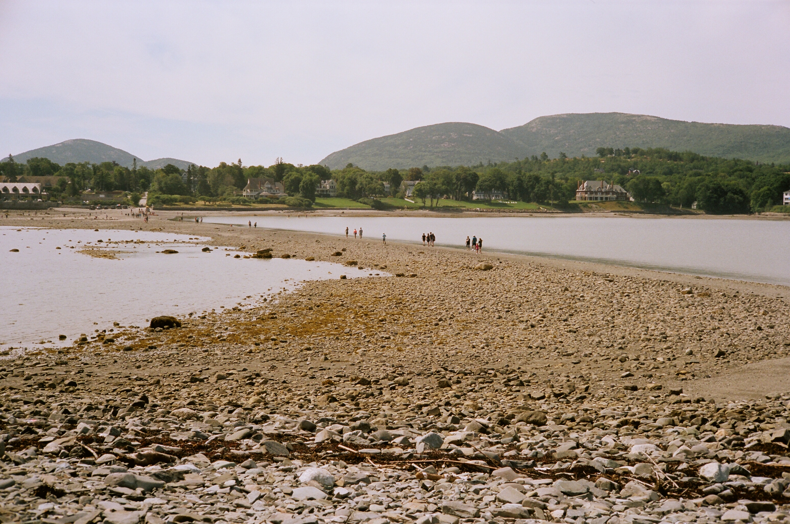
For 1.5 hours before and after low tide, a gravel bar is exposed connecting the town of Bar Harbor and Bar Island. The bar provide opportunities for investigating small tide pools. Once on the island, the Bar Island Trail gradually ascends through the forest on an old road to various open sections with views of Bar Harbor and Frenchman Bay.
Distance: 1.9 miles round trip (gravel bar and trail)
Terrain: Rocks, gravel sand bar, old dirt road, forested path
Be cautious and aware of the tides, as the bar is otherwise covered by the ocean. If you walk over to the island and lose track of time, it is nine hours until the bar emerges again to safely walk across.
.
Hike Description
Start the hike by walking down Bridge Street from West Street in downtown Bar Harbor. Before taking this hike, check the tide chart for Bar Island .
Walk across the "land bridge" for .5 miles towards Bar Island.
Once on the island, continue past the trailhead signs and onto the Bar Island Trail.
The trail gradually ascends through the forest on an old road.
At the next junction, turn right for a short spur to an old home site with a view of Bar Harbor.
Return to the trail and bear left towards the highest point on the island. Enjoy views of Bar Harbor and Frenchman Bay. Time your hike carefully to allow adequate return time based on the tides.
Return back down the trail and across the land bridge to Bridge Street and Bar Harbor.
Accessibility Bar Island Trail and the land bridge formed at low tide are not accessible. The trail is sand and gravel with uneven footing and roots that continue onto the island.
Bass Harbor Head Light Access
Beachcroft Path
Hike Beachcroft Path the Park Service's write-up
1-2 Hours · dogs allowed
Start Beachcroft Path
The Beachcroft Path is a memorial path constructed in 1915. It was funded by Anna Warren Ingersoll Smith in memory of her husband Charles Morton Smith. It is named after their summer cottage in Bar Harbor. In 1926, Mrs. Smith, upset with the condition of the trail under park service management, established an endowment fund for maintenance, which led to improvement of the trail.
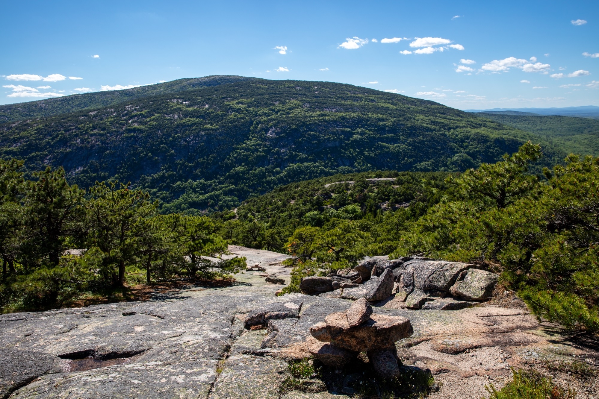
Take this trail to hike towards Champlain Mountain for panoramic coastal mountain views of Mount Desert Island, Frenchman Bay, and the outlying islands.
Distance: 2 miles round trip
Terrain: Forested path, steep, exposed rocky sections, cut stone steps
Hike Description
Start at the Beachcroft Path Trailhead, located off ME Route 3. Use care crossing the road.
This trail can also be started from Sieur de Monts via the Wild Gardens Path (add .6 miles round trip). Once reaching the Tarn, turn left and continue to ME Route 3. The Beachcroft Path Trailhead is across ME Route 3 slightly to the right.
Follow the cut granite stairs and flat stone pathways up the side of Huguenot Head, crossing a large boulder field. Enjoy views of Dorr Mountain and the Tarn below.
After circling around Huguenot Head, the trail dips slightly before ascending Champlain Mountain. This section of trail has granite stairs and rocky scrambles up granite ledges.
Before the summit, the trail goes over large expanses of granite. It is not recommended in wet weather.
Reach the 1,058 ft peak of Champlain Mountain and enjoy views of Mount Desert Island, Frenchman Bay, and the outlying islands.
Return back the same way to the Beachcroft Path Trailhead.
Accessibility The Beachcroft Path is not accessible. The trail has uneven footing and short, steep sections throughout. There are no accessible restrooms at the trailhead.
Beech Cliff Loop Trail
Beech Cliff Trail
Hike Beech Cliff Trail with Island Explorer Bus the Park Service's write-up
2-4 Hours · no dogs · Spring, Summer, Fall
Start Beech Cliff Trail, Beech Cliff Loop, and Canada Cliffs Trail
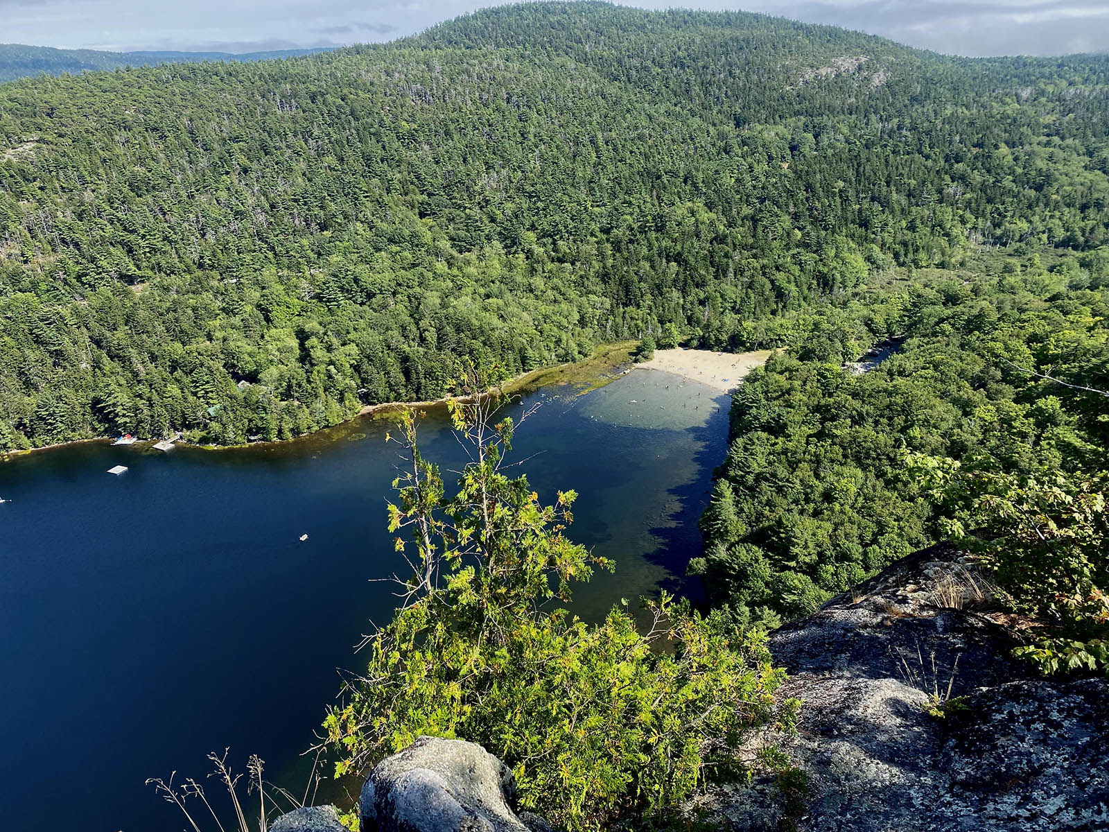
This short but strenuous hike climbs the cliffs above Echo Lake with expansive views of the lake directly below, multiple nearby peaks, and the ocean beyond. It includes four sets of iron ladders helping hiking hikers reach the rewarding vistas at the top.
This hike is located on the west side of Acadia National Park and while the parking lot and beach area of Echo Lake can be quite busy on summer days, the trail soon ascends the cliffs and the crowds are left behind. With four iron ladders and steep cliffs at the top of the climb fear of heights may pose a problem for some visitors. For those who wish to avoid the ladders, there is an overlook prior to the ladders that offer some great views. The Beech Cliff loop at the top of the cliffs is a must-do but take care not to get too close to the edge of the cliffs at 480 feet above the lake.
While this hike doesn’t include the summit of Beech Mountain, a trail at the top of the cliffs connects to the Beech Mountain parking area with a hike to its peak. Take the Canada Cliffs Trail down to the Echo Lake Parking area for a relaxing, gradual walk to complete the hike. On a hot day, a dip in Echo Lake is a sure way to finish off the hike.
Note: This hike is not safe young children or people who are not steady on their feet. Dogs are not allowed on this trail.
Pets Dogs are not permitted on Beech Cliffs Trail.
Accessibility The Beech Cliff Trail is not accessible. It includes stone stairs, exposed roots and rocks, and four iron ladders. It has an elevation gain of 480 feet in the first .4 mile.
Beech Mountain Trail
Hike Beech Mountain South Ridge Loop the Park Service's write-up
1-2 Hours · dogs allowed
Start Beech Mountain
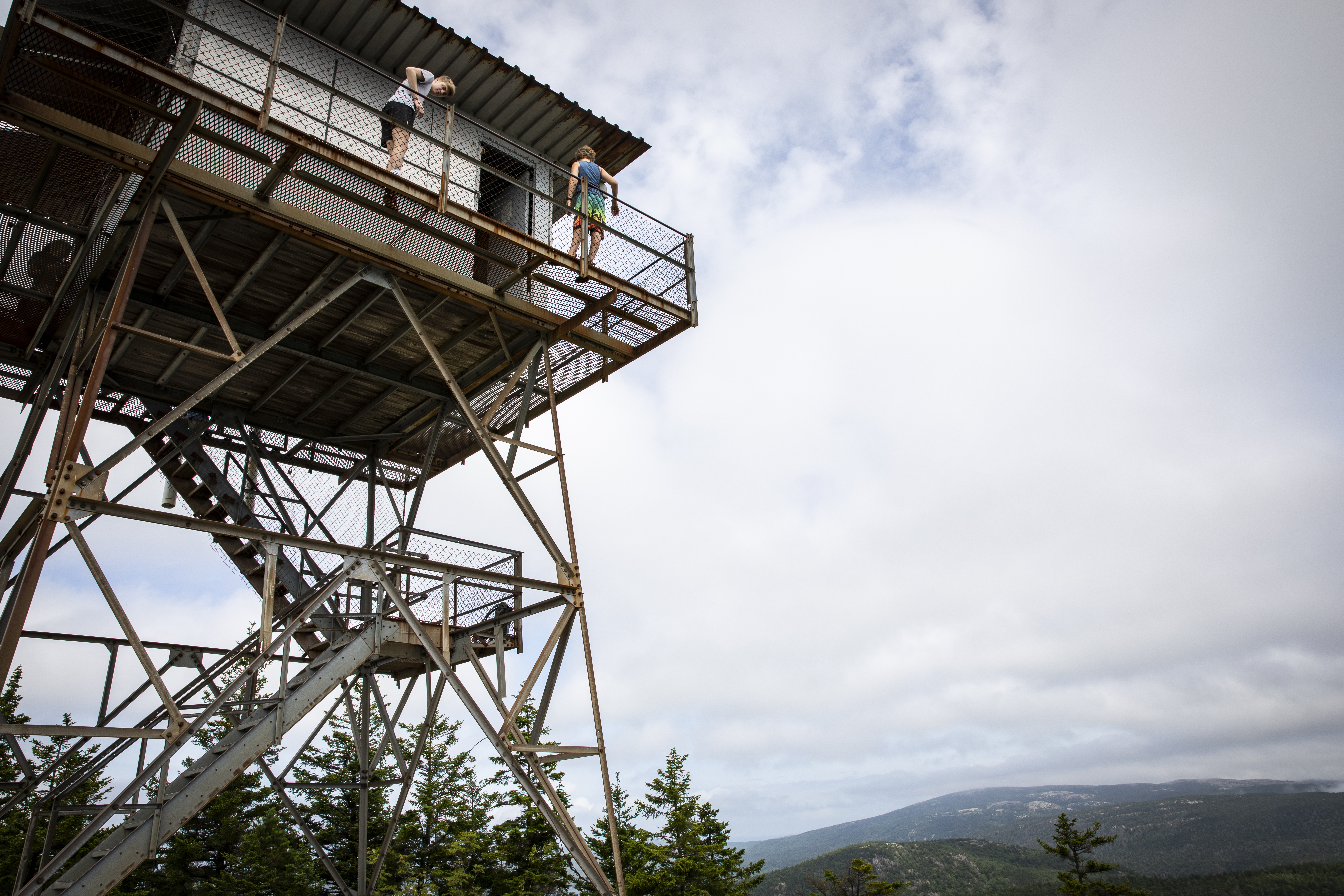
This moderate hike traverses a loop through the forest before ascending Beech Mountain, providing visitors with access to a fire tower and views of Long Pond, Mansell Mountain, and the west side of Mount Desert Island. This hike is also a good sunset option, but carry appropriate gear and headlamps when hiking at dusk and dark.
Distance: 2.1 miles round trip
Terrain: Forested path, rocky trails, granite stairs and slopes, wooden steps
Hike Description
The loop begins from the Beech Mountain parking lot, on the northwest side of the lot.
At the first junction, stay right to follow the longer path to the summit.
The trail begins as a gradual forested path, however, as elevation increases, the trail becomes rockier.
The trail opens up at .5 miles to granite slabs which provide sweeping views of Long Pond and Mansell Mountain. This is a popular spot to watch the sunset.
After .1 miles, keep left at the intersection towards Beech Mountain summit. The trail will feature granite and wooden steps to the summit.
At the next intersection, just below the fire tower, keep right to access the summit and fire tower. The first platform of the fire tower is open and provides views of Somes Sound, Echo Lake, Acadia Mountain, and other mountains on the east side of the Mount Desert Island.
Follow blue blazes to the right of the granite to begin the Beech Mountain South Ridge Trail.
The trail descends down a few sections of granite slope before becoming a forested path with stone stairs down the mountain. This section of trail is not recommended in wet weather.
After .8 miles, keep left at the Valley Trail intersection to return to the Beech Mountain Parking Area.
Follow the trail .8 miles back to the parking lot. This section of trail is flat and mainly smooth, forested path, with a few stone steps.
Accessibility The Beech Mountain South Ridge Loop is not accessible. The trail has uneven footing and short, steep sections throughout. There are no accessible restrooms at the trailhead.
Hike Beech Mountain Trail the Park Service's write-up
1-2 Hours · dogs allowed
Start Beech Mountain
A short, moderate loop on the west side of Mount Desert Island, Beech Mountain Trail provides hikers with views of Long Pond and Mansell Mountain on the way up and access to one of the few remaining fire towers in the area. This hike is also a good sunset option, but carry appropriate gear and headlamps when hiking at dusk and dark.
Distance: 1.2 miles round trip
Terrain: Forested path, rocky trails, granite stairs and slopes, wooden steps
Hike Description
The loop begins from the Beech Mountain parking lot, on the northwest side of the lot.
At the first junction, stay right to follow the longer path to the summit.
The trail begins as a gradual forested path, however, as elevation increases, the trail becomes rockier.
The trail opens up at .5 miles to granite slabs which provide sweeping views of Long Pond and Mansell Mountain. This is a popular spot to watch the sunset.
After .1 miles, keep left at the intersection towards Beech Mountain summit. The trail will feature granite and wooden steps to the summit.
At the next intersection, just below the fire tower, keep right to access the summit and fire tower. The first platform of the fire tower is open and provides views of Somes Sound, Echo Lake, Acadia Mountain, and other mountains on the east side of the Mount Desert Island.
Retrace to the intersection just below the summit, stay straight and follow the sign showing .4 miles to the Beech Mountain Parking Area.
This trail contains multiple steep granite slopes before descending into the woods. This section of trail is not recommended in wet weather.
Follow the trail down a quick, steep rocky section. At next intersection, follow the trail back to the parking lot.
Accessibility Beech Mountain Trail is not accessible. The trail has uneven footing and short, steep sections throughout. There are no accessible restrooms at the trailhead.
Beech South Ridge Trail
Beech West Ridge Trail
Boat launches
Along the way Long Pond - South End
Beehive Trail
Hike Beehive Loop the Park Service's write-up
1-3 Hours · no dogs · Spring, Summer, Fall
Start The Beehive
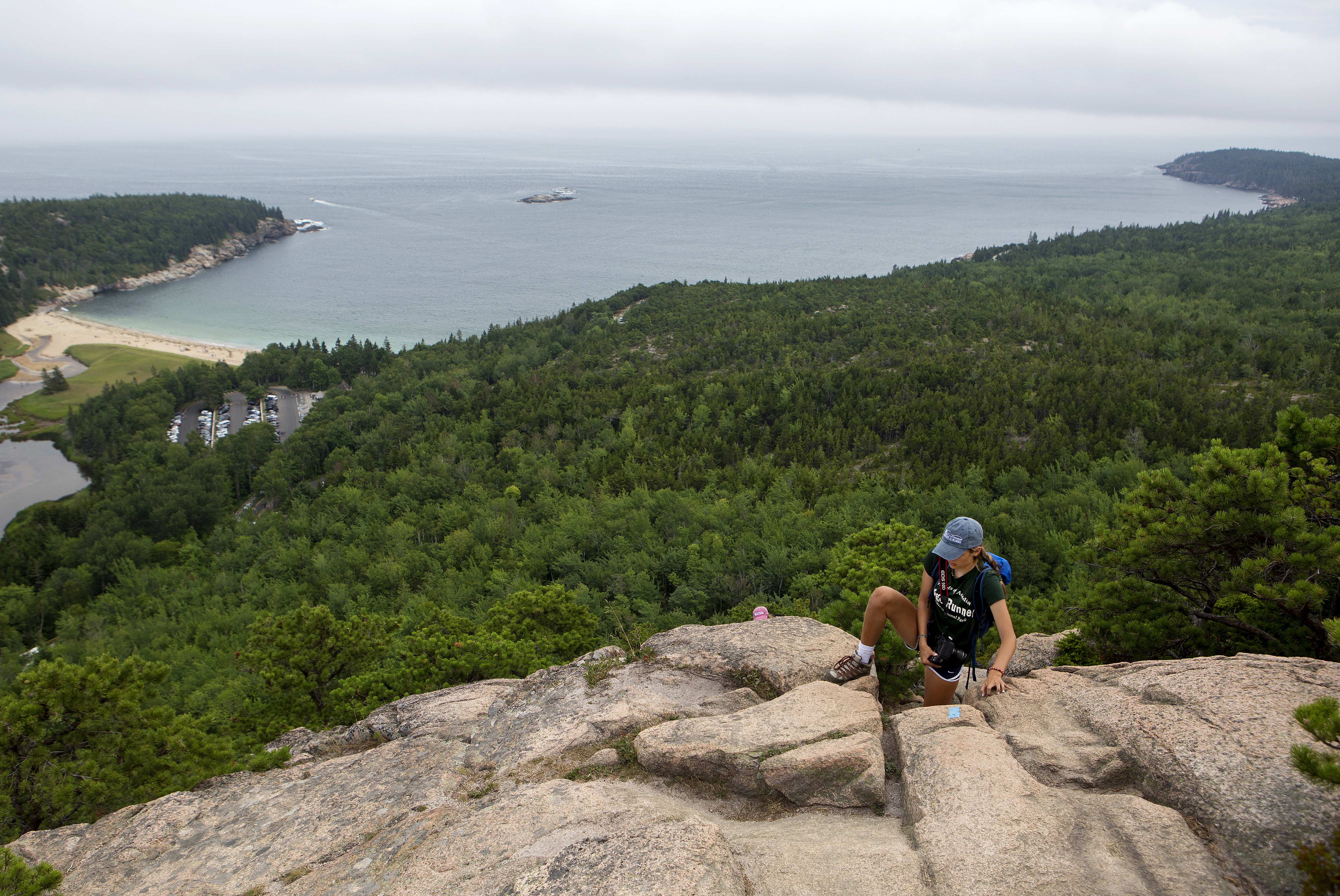
If you are searching for an adventurous hike with a spectacular view, look no further than the Beehive loop. One of Acadia's famous rung and ladder trails, Beehive Loop is a great way to get acquainted with these difficult trails. If choosing this hike, expect steep granite staircases, iron rungs, and exposed cliff faces. As one of the parks most trafficked trails, people challenge their bodies and minds as they ascend this 450ft cliff trail and are rewarded with stunning views over Sand Beach, Thunder Hole, and the Gulf of Maine stretching to the horizon.
Distance:1.4 miles round trip. Duration of hikes depend on your pace and if you stop and enjoy scenic areas. For an average pace, this hike takes 1 to 3 hours.
Safety:The trail is rocky and uneven. The first part of this trail ascends a 450-ft cliff with exposed edges. Steep drop offs with no railings require secure footings. Good foot wear is recommended.This trail is very dangerous in inclement weather. During rain events granite becomes extremely slippery. Allowing the rocks to dry provides a safer ascent.
Pets Pets are not permitted on rung and ladder trails in Acadia National Park.
Accessibility The Beehive Loop is not accessible. The trail involves granite stairs, iron rungs, and rock scrambling. There is accessible parking at the Sand Beach parking areas as well as accessible restrooms.
Bernard Mountain Trail
Hike Western Mountain Loop the Park Service's write-up
2-3 Hours · dogs allowed
Start Long Pond, Western Mountain

The Western Mountain Loop travels through forest and up summits over a series of trails on the west side of Mount Desert Island. Although there are not many views, it is a challenging hike with hundreds of cut stone steps on the historic Perpendicular Trail and other steep sections along the way. Western Mountain collectively refers to Mansell Mountain and Bernard Mountain.
Distance: 3.8 miles round trip
Terrain: Forested paths, granite staircase, rocky trails, and rooted paths
Hike Description
Begin from the parking area/boat launch located at the end of the Long Pond Road in Southwest Harbor.
The hike starts on the Long Pond Trail, located at the west end of the parking area, behind a building.
Walk 0.2 miles before reaching the second trail junction, where you will turn left onto of the Perpendicular Trail.
A few iron rungs, a small ladder, and over 300 cut granite steps allow hikers to ascend the steep slope of Mansell Mountain. There are a few views of Long Pond between the trees.
Just before the trail turns away from the face, there is a short spur trail to an overlook of Beech Mountain, Long Pond and the outlying islands.
The trail levels off in the woods before reaching the summit of Mansell Mountain. There are no views from the summit.
Continue past the summit on the Mansell Mountain Trail. At the next junction, turn right (north) on the Razorback Trail.
Bear right at the next intersection to remain on the Razorback Trail to Great Notch.
At the intersection with the Great Notch Trail, continue straight onto Bernard Mountain Trail. Follow this for 0.4 miles, steeply climbing up the side of the mountain over cliffs and tree roots.
Pass the summit of Knight Nubble.
At the junction with the Sluiceway Trail (Little Notch), continue straight and additional 0.2 miles to reach the summit of Bernard Mountain. Although rising to 1,071 ft, the summit is mostly wooded with minimal views. Return back down to the trail junction.
Turn right and descend on the Sluiceway Trail for 0.5 miles.
At the junction with the Gilley Trail, turn left.
Shortly afterward, at the intersection with the Great Notch Trail, turn right and continue the descent. Stay right at the intersections with the Razorback and Mansell Mountain Trails and you will eventually come to the trailhead at Gilley Field parking.
Cross the parking area to continue straight on Cold Brook Trail back to the parking lot at the south end of Long Pond.
Accessibility The Western Mountain Loop is not accessible. The trails have uneven footing, hundreds of granite stairs, iron rungs, a ladder, and many steep sections. There are no accessible restrooms at the trailhead.
Birch Harbor Mt Bike Path
Bowditch Trail
Bowl Trail
Brown Mt. Connector
Brown Mt. Connector Carriage Road
Brown Mt. Parking
Bubble & Jordan Ponds Path
Bubble/Wildwood
Bubble/Wildwood Carriage Road
Bridges
Along the way Clearance: 12 feet 9 inches
Hike Pemetic Summit with Island Explorer Bus the Park Service's write-up
2-4 Hours · dogs allowed · Spring, Summer, Fall
Start Bubble Pond to Jordan Pond via Pemetic Mountain
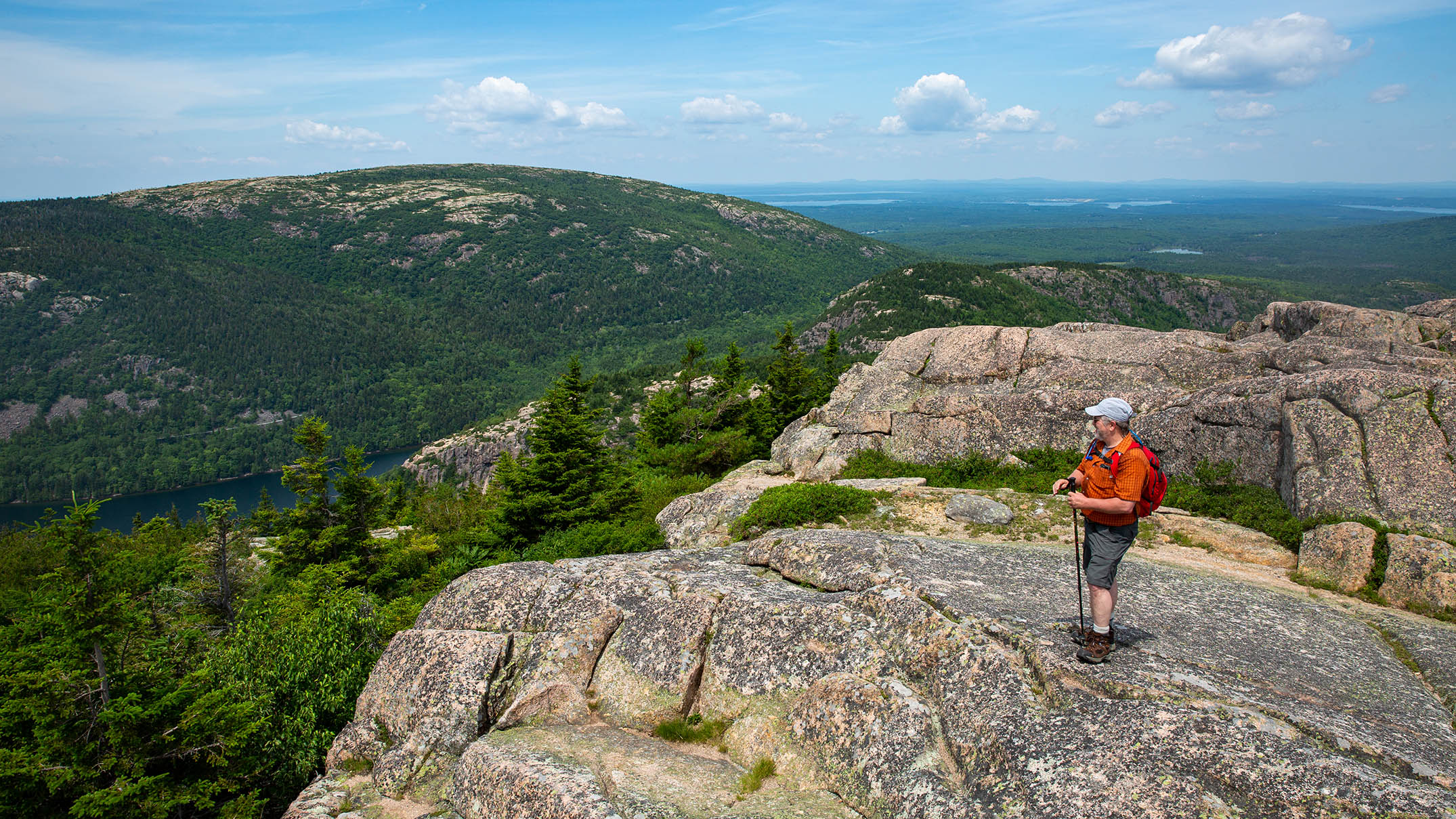
Summiting Pemetic Mountain offers breathtaking views of neighboring mountain peaks and the Cranberry Isles off the island’s southern coast. Along the way, hikers can enjoy the shores of Jordan Pond and the much quieter Bubble Pond. Pairing this hike with the Island Explorer bus gives hikers the flexibility to explore the mountain along its more gradual ridges without adding extreme mileage.
While hikers can choose either Bubble Pond or Jordan Pond as the starting point, Pemetic’s North Ridge Trail is the steeper of the two climbs and slightly easier to ascend than descend. Ascending the North Ridge trail is a strenuous climb with a few instances of rock scramble requiring three-point touch. This climb lasts approximately a mile through the trees with occasional viewpoints east with views of Cadillac Mountain.
Pemitic’s summit is just 0.1 miles past the intersection with Pemetic Northwest Trail where hikers are first treated to views towards Sargent and Penobscot Mountains to the west. At the summit, the Cranberry Isles are seen to the south as the view-scape stretches into the Atlantic Ocean. These southern views can be appreciated throughout the decent on Pemetic South Ridge Trail.
Conclude the hike through a coniferous forest along the Bubble and Jordan Ponds Path. This gradual decent takes hikers down to the shore of Jordan Pond and ultimately up to the Jordan Pond House with restrooms, food and a gift shop.
Start the hike up and over Pemetic Mountain from the shores of Bubble Pond nestled in the glacially carved valley between Cadillac and Pemetic Mountains. Quickly cut away from the glistening shores to the steep northern ridge, hiking over rocks and roots beneath tall conifers. As the trees thin and shorten, hikers are treated to views of Cadillac and glimpses of Bubble Pond now far below. As the view-scape breaks to the west, across the much wider valley housing Jordan Pond stands Penobscot and Sargent peaks. From the summit of Pemetic and along its south ridge, the Atlantic Ocean stretches into the horizon and the Cranberry Isles lay scattered amongst the waves. Descend back into the forest below, sunlight filtering through the pines, down to the shores of Jordan Pond.
Accessibility Pemetic North and South Ridge Trail are steep, rocky and rooty with rock scramble requiring scattered instances of three-point touch. This trail gains approximately 850 feet in elevation.
Bubbles Divide
Bubbles Trail
Hike Bubbles the Park Service's write-up
60-90 Minutes · dogs allowed · Spring, Summer, Fall
Start The Bubbles
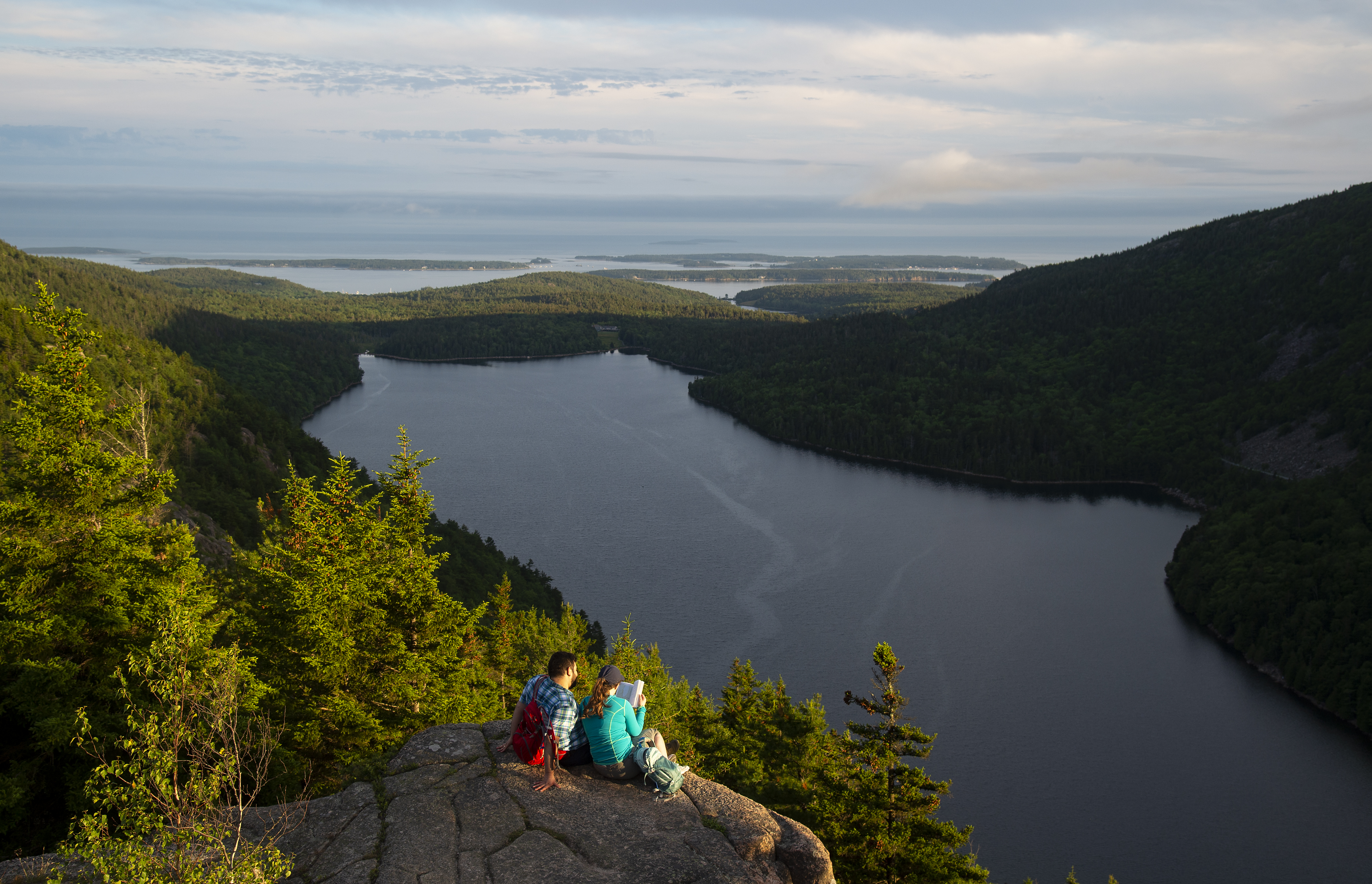
This 1.5 mile hike is a quick way to access the iconic North Bubble, South Bubble, and Bubble Rock. Visitors can take two short spur trails to reach each summit with expansive views of Jordan Pond and the surrounding mountains.
Distance: 1.5 miles round trip
Terrain: Forested path, steep rocky sections, exposed granite, wide stairs
Hike Description
The hike starts at the Bubbles Divide parking lot.
Follow the Bubbles Divide Trail for .25 miles as it becomes steeper with steps just before the junction of the Bubbles Trail to North Bubble.
Take a right at this junction on the Bubbles Trail.
Continuing onto North Bubble, the trail becomes steep with open granite ledges and will be slick in wet weather. There are excellent views of Jordan Pond, Pemetic and Sargent Mountains, and the Cranberry Isles.
Return back down from the summit of North Bubble to the first junction. Turn right and follow the Bubbles Divide Trail towards South Bubble and Bubble Rock for .7 miles.
After reaching the summit of South Bubble, turn back and follow blue blazes for Bubble Rock, a precarious glacial erratic.
Return on the Bubbles Divide Trail all the way back to the parking lot.
Accessibility The Bubbles hike is not accessible. The trails have uneven footing, stairs, and short, steep sections. There are no accessible restrooms at the trailhead.
Hike Bubbles Nubble Loop the Park Service's write-up
1-2 Hours · dogs allowed · Spring, Summer, Fall
Start The Bubbles
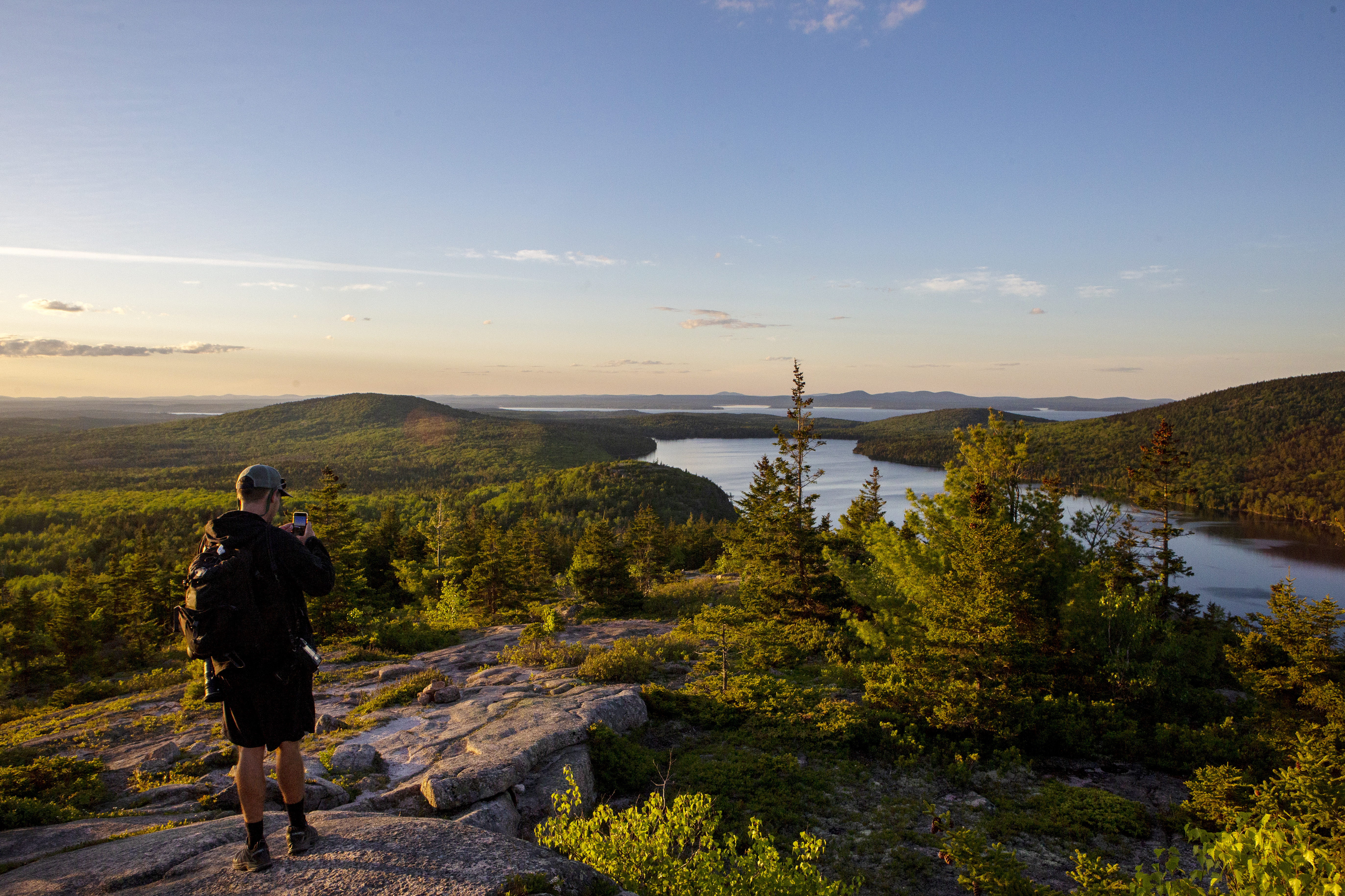
This hike traverses the summits of North Bubble, South Bubble, and Conners Nubble and crosses varying terrain of forest paths, steep granite sections, and a level carriage road. Visitors can enjoy views of Eagle Lake, Jordan Pond, Pemetic and Sargent Mountains, and the Cranberry Isles. This is a great option during the peak of fall foliage.
Distance: 2.6 miles round trip
Terrain: Forested paths, rocky granite ridgelines, stairs, packed gravel carriage roads
Hike Description
Start at the Bubbles Divide Trailhead.
The trail ascends quickly with steps leading up. At the junction, turn left towards South Bubble and Bubbles Divide Trail. This moderate out and back spur is .6 miles round trip to reach the summit of South Bubble and Bubble Rock.
Return the way you came and from the signpost continue to North Bubble. The trail becomes steep with open granite ledges and is slick in wet weather.
Reach the summit of North Bubble and enjoy views of Eagle Lake and the northern portion of the island before descending into the forest.
Stay on the Bubbles Trail as it crosses the carriage road.
Ascend for .1 miles to Conners Nubble for another view of Eagle Lake. Retrace your steps back on the carriage road.
Turn left onto the carriage road and continue for .6 miles.
Look for a path and small wooden footbridge. When Jordan Pond Carry trail intersects the carriage road, turn right onto it. Portions of the trail have wooden planks to avoid wet sections.
The trail gently rises until it reaches the junction with the Bubbles Divide Trail. Turn left and return to the parking lot.
Accessibility The Bubbles Nubble Loop is not accessible. The trails have uneven footing, stairs, and short, steep sections. There are no accessible restrooms at the trailhead.
Hike Double Bubble Nubble Loop with Island Explorer the Park Service's write-up
4-5 Hours · dogs allowed · Spring, Summer, Fall
Start Double Bubble Nubble Loop
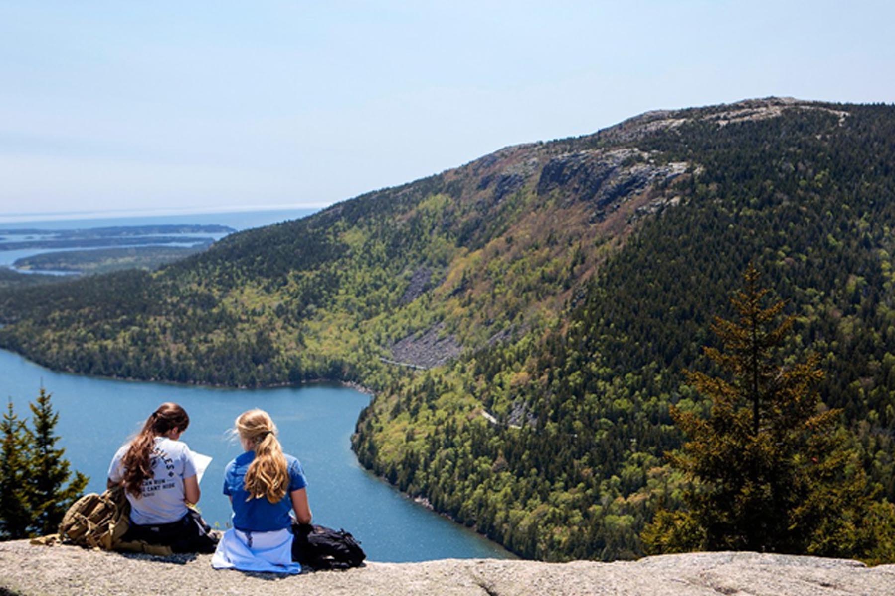
The Double Bubble Nubble is fun to say and fun to do for anyone looking for a longer (6.6 mile) hike filled with short but steep climbs up three peaks with stunning views of Jordan Pond and Eagle Lake in the valley below. This hike is mostly moderate with a few areas of intense rock scramble.
The Bubbles are an extremely worthwhile hike in Acadia National Park for their scenic and iconic value. Combining these two summits with Conners Nubble will give hikers an exciting 6.6-mile trek with numerous, breathtaking vistas. The bus has the advantage of dropping hikers a mile away from the formal start of the loop, an inaccessible location to vehicles.
For a short distance (0.4 miles) hikers will walk along the mixed-use Carriage Roads before connecting to flat and gradual hiking trails weaving south towards Jordan Pond along the Jordan Pond Carry. Hikers have a choice when it comes to summiting South Bubble and summiting is not necessary to complete the loop if hikers want to skip it all together. The steepest and most strenuous trail entails more than 450 feet of climb over 0.2 miles. Hikers will need use of their hands in places over intense but brief rock scramble. For this reason, the southern ridge along the Bubbles Trail up South Bubble is not recommended for dogs.
The summit of South Bubble overlooks Jordan Pond and Eagle Lake, and the glacier erratic, Bubble Rock, is a worthwhile, 0.1-mile side trip off the summit to see this large boulder teetering on the edge. The northern decent is a more gradual trail and an alternative out and back summit for anyone looking to avoid extreme rock scramble.
The continuation of the Bubbles Trail up the North Bubble is comparatively more moderate, and the summit gives views over Eagle Lake, typically with far fewer people. Continuing north to Conner’s Nubble will thin the crowds further and the summit offers yet another scenic overlook of Eagle Lake before the trail loops back around to its starting point.
Accessibility Periods of rock scramble make this trail briefly strenuous and its distance a challenge. Hikers should expect many rocks and roots throughout the trail and should be prepared to use their hands for balance when summiting. The trail gains elevation quickly in three distinct places as it summits both Bubbles and Conners Nubble so hikers will need climbing energy throughout the hike.
Buck Cove Bike Path
Buck Cove Mountain Trail
Bunkers Harbor Bike Path
Cadillac Cliffs Path
Cadillac North Ridge Trail
Hike Cadillac North Ridge Trail the Park Service's write-up
2-4 Hours · dogs allowed
Start Cadillac North Ridge Trail
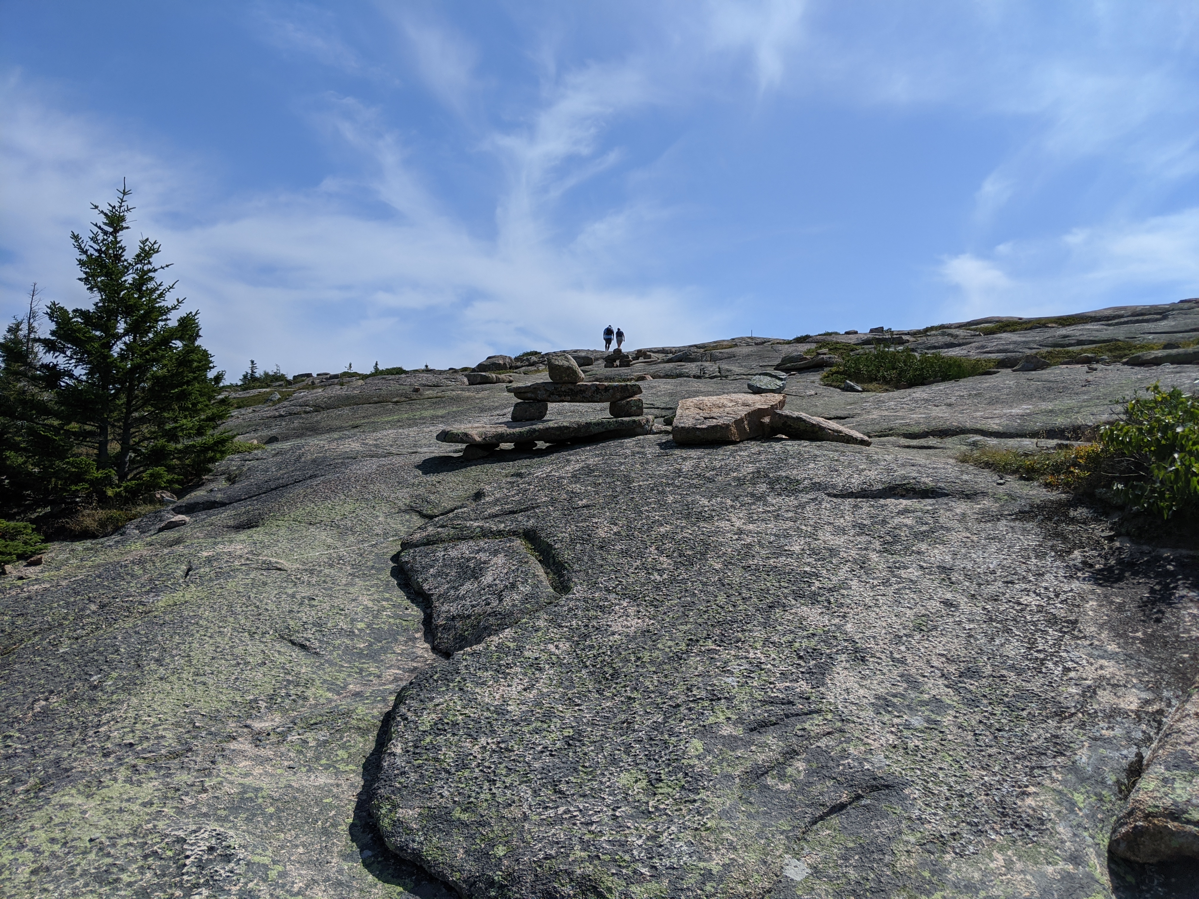
A moderate out-and-back hike to the highest point both at Acadia National Park and on the eastern seaboard. The trail is mostly exposed, providing hikers with sweeping vistas of Bar Harbor, Frenchman Bay, and the Schoodic Peninsula. This hike is a popular option for sunrise and sunset, but carry appropriate gear and headlamps when hiking at dawn, dusk and dark.
Distance: 4.4 miles round trip
Terrain: Granite slope and stairs, rocky trail
Hike Description
The hike can begin in two places, both from the Park Loop Road.
First option (recommended): Take Kebo Brook Trail from the Island Explorer bus stop for .1 miles. Turn right up the stone stairs, cross the road, and continue onto the Cadillac North Ridge Trail.
Second option: Just past the start of the one-way section towards Sand Beach, there is a small pull-off on the left side of the road. Parking is extremely limited. Cross the road onto the Cadillac North Ridge Trail and gently ascend up a granite slope into the woods.
After 1 mile, the trail enters the woods, it becomes more rocky, with a few sets of granite stairs. Watch your footing through this section, as it can be tricky.
After 0.3 miles, the hike becomes steeper and more exposed. This gives hikers more of a challenge, but also more of a reward with sweeping views.
The trail parallels the road for a short section. Follow blue blazes and Bates cairns to stay on the trail.
Continue along granite slopes until the trail flattens out near the summit.
At the fork shortly before the summit, keep right. Continue for 0.1 miles to complete the Cadillac North Ridge Trail.
The trail ends on the north side of the summit parking lot. From here, hikers can walk .5 miles around Cadillac Summit Loop for sweeping vistas of the east side of the mountain or hike a bit up the Cadillac South Ridge Trail to reach the summit marker. Services at the summit include a restroom and gift shop.
Return to the north side of the parking lot and follow the Cadillac North Ridge Trail back down to the trailhead. Please note there is no public transportation to and from the summit of Cadillac Mountain.
Accessibility Cadillac North Ridge Trail is not accessible. The trail has steep sections throughout with uneven footing. There are no accessible restrooms at the trailhead.
Hike Gorge/Cadillac Mountain North Ridge Loop with Island Explorer Bus the Park Service's write-up
2-4 Hours · dogs allowed · Spring, Summer, Fall
Start The Gorge Path and the Cadillac North Ridge Trail
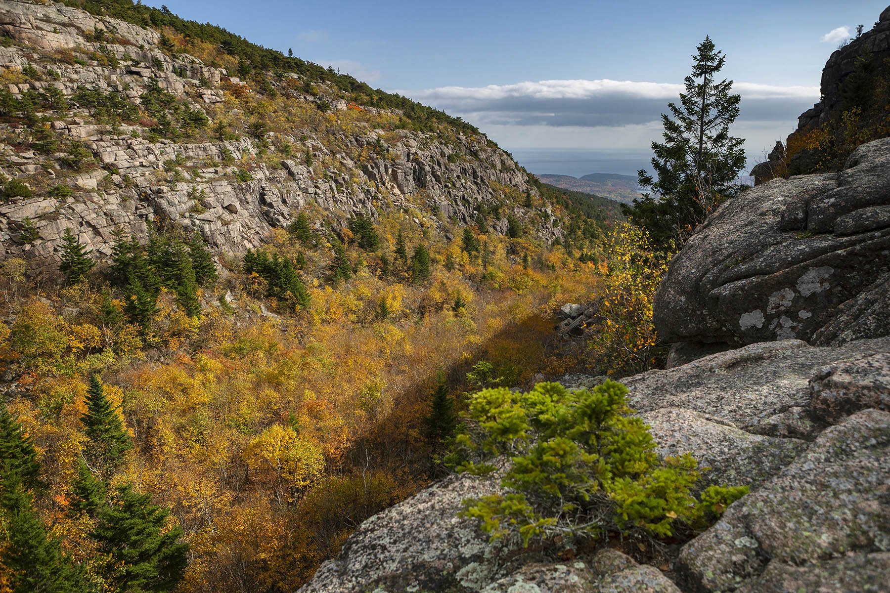
This is a great option for hiking to the summit of Cadillac Mountain. The Gorge Path is mostly shaded and is perfect for hot summer days. It follows Kebo Brook which cuts deeply through the granite bedrock with views of steep canyons walls from the gorge below. The final portion of the path ascends a steep rock face and gives hikers vistas of Dorr Mountain, Frenchman Bay, the Atlantic Ocean, as well the deeply cut gorge itself. The summit of Cadillac Mountain provides a 360-degree view out over Mount Desert Island, its multiple peaks, the surrounding islands, and the ocean beyond.
If interested in hiking a loop trail instead of an out-and-back, the Gorge Path/North Ridge Trail combination is a good choice. The ascent is mostly shaded so it is perfect for hot summer days. Starting with the Kebo Brook Trail, it wanders through a forest of maple, oak, beech, and birch. As the Gorge Path climbs, it follows a portion of Kebo Brook which cuts deeply in the granite bed rock between two peaks, Dorr Mountain and Cadillac Mountain. Great views of the walls of the gorge rise from the trail lined with birch and spruce trees. The final .4-mile ascent changes dramatically to a steep rock scramble of over large granite boulders while offering fine views of Dorr Mountain, Frenchman Bay, the Atlantic Ocean, and the gorge below.
The hike down the North Ridge Trail, is more gradual over exposed granite with views to the north, west, and Frenchman Bay with the porcupine islands. Hiking this peak with use of the Island Explorer Bus offers hikers a bus-stop-only starting point for a moderate to strenuous hike.
This is a great option for hiking to the summit of Cadillac Mountain. It follows Kebo Brook which cuts deeply through the granite bedrock with views of steep canyons walls from the gorge below. The final portion of the path ascends a steep rock face and gives hikers vistas of Dorr Mountain, Frenchman Bay, the Atlantic Ocean, as well the deeply cut gorge itself. The summit of Cadillac Mountain provides a 360-degree view out over Mount Desert Island, its multiple peaks, the surrounding islands, and the ocean beyond.
Accessibility This loop is not accessible. The Gorge Path/North Ridge Loop has exposed roots and rocks, steep stone stairs, and requires scrambling over large boulders.
Cadillac South Ridge Trail
Hike Cadillac South Ridge Trail the Park Service's write-up
2-4 Hours · dogs allowed
Start Cadillac South Ridge Trail

This out and back trail is the longer, more scenic option for reaching the summit of Cadillac Mountain. Ascend a forested path to a unique meadow-like area before continuing your climb on an exposed granite ridgeline with spectacular views of the Atlantic Ocean and outlying islands before reaching the summit. It is very popular in the summer months, with options to descend other trails and use the Island Explorer to return to the trailhead.
Distance: 7.1 miles roundtrip
Terrain and Safety: Forested path, granite ridgeline, one iron rung. The trail is rocky with uneven footing. Good foot wear is recommended.
Hike Description
The trail starts in a forested area and gradually steepens as it approaches the ridge.
At the junction with Eagle’s Crag, there is a .3 mi spur trail (Eagle’s Crag Loop Trail) to the right, which rejoins the South Ridge Trail. Take this for views from an overlook of the forest below and ocean further out.
Continue on the South Ridge Trail through the forest and reach The Featherbed, a small pond with a bench.
The trail climbs a steep section and becomes more exposed, eventually going above the treeline along the ridge.
It descends again, crossing an old road, and then ascends to the summit. Use the gravel access road to reach the summit parking area.
Return the same way, or choose Cadillac North Ridge Trail or Gorge Path for a shorter return and use Island Explorer to get back to the trailhead.
Accessibility Cadillac South Ridge Trail is not accessible. There is limited accessible parking at Blackwoods Campground, but no restrooms.
Cadillac Summit Developed Area
Cadillac Summit Loop
Hike Cadillac Summit Loop the Park Service's write-up
1-3 Hours · dogs allowed · reservation required · Spring, Summer, Fall
Start Cadillac Mountain, Acadia National Park
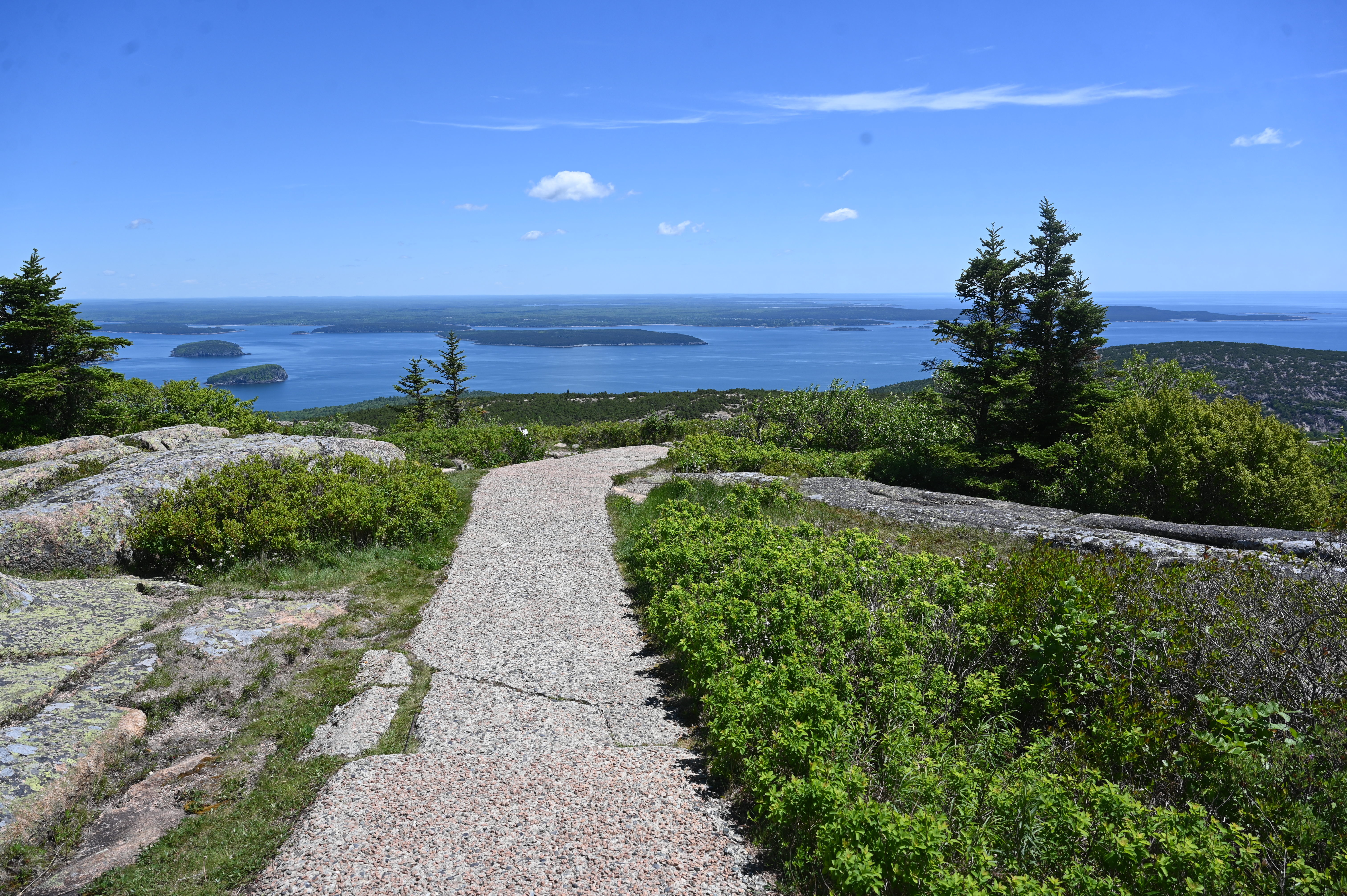
The Cadillac Summit Loop, located on the eastern side of Mount Desert Island, is well known as one of the most scenic paths at Acadia National Park. Starting at the top of Cadillac Mountain, which is accessible via car, this path provides a walk with breathtaking 360-degree views of Frenchman Bay, the Porcupine Islands, and Downeast Maine.
Note: If you want to drive up the Cadillac Summit Road between late-May and mid-October, you will need to buy a vehicle reservation . These are only sold online in advance and are not available for purchase in person in the park. Learn more at Recreation.gov
Cadillac Mountain is an often-crowded location and this trail is heavily trafficked during the summer season. The paved path has some steeper grades and flat sections with overlooks and wayside displays along the way.
Additional description:
Cadillac Summit Loop
.
NoteL
Accessibility While there are some steps with nearby ramp options required to access the full loop, the trail is a paved walkway that is intended to be accessible for people who use wheelchairs. In the parking area, there are five angled accessible spaces designated by blue paint and striping on the ground. One is located in front of a gift shop and restroom facility. Four more are located along the right side of the parking loop near the entrance to the trail. Accessible restrooms are available next to the gift shop.
Cadillac West Face Trail
Campground Access
Canada Cliffs Trail
Canon Brook Trail
Carriage Road
Hike Bubbles Nubble Loop the Park Service's write-up
1-2 Hours · dogs allowed · Spring, Summer, Fall
Start The Bubbles
This hike traverses the summits of North Bubble, South Bubble, and Conners Nubble and crosses varying terrain of forest paths, steep granite sections, and a level carriage road. Visitors can enjoy views of Eagle Lake, Jordan Pond, Pemetic and Sargent Mountains, and the Cranberry Isles. This is a great option during the peak of fall foliage.
Distance: 2.6 miles round trip
Terrain: Forested paths, rocky granite ridgelines, stairs, packed gravel carriage roads
Hike Description
Start at the Bubbles Divide Trailhead.
The trail ascends quickly with steps leading up. At the junction, turn left towards South Bubble and Bubbles Divide Trail. This moderate out and back spur is .6 miles round trip to reach the summit of South Bubble and Bubble Rock.
Return the way you came and from the signpost continue to North Bubble. The trail becomes steep with open granite ledges and is slick in wet weather.
Reach the summit of North Bubble and enjoy views of Eagle Lake and the northern portion of the island before descending into the forest.
Stay on the Bubbles Trail as it crosses the carriage road.
Ascend for .1 miles to Conners Nubble for another view of Eagle Lake. Retrace your steps back on the carriage road.
Turn left onto the carriage road and continue for .6 miles.
Look for a path and small wooden footbridge. When Jordan Pond Carry trail intersects the carriage road, turn right onto it. Portions of the trail have wooden planks to avoid wet sections.
The trail gently rises until it reaches the junction with the Bubbles Divide Trail. Turn left and return to the parking lot.
Accessibility The Bubbles Nubble Loop is not accessible. The trails have uneven footing, stairs, and short, steep sections. There are no accessible restrooms at the trailhead.
Carroll Homestead Access Path
Champlain North Ridge Trail
Champlain South Ridge Trail
Cliff Trail
Hike Beech Cliff Trail with Island Explorer Bus the Park Service's write-up
2-4 Hours · no dogs · Spring, Summer, Fall
Start Beech Cliff Trail, Beech Cliff Loop, and Canada Cliffs Trail
This short but strenuous hike climbs the cliffs above Echo Lake with expansive views of the lake directly below, multiple nearby peaks, and the ocean beyond. It includes four sets of iron ladders helping hiking hikers reach the rewarding vistas at the top.
This hike is located on the west side of Acadia National Park and while the parking lot and beach area of Echo Lake can be quite busy on summer days, the trail soon ascends the cliffs and the crowds are left behind. With four iron ladders and steep cliffs at the top of the climb fear of heights may pose a problem for some visitors. For those who wish to avoid the ladders, there is an overlook prior to the ladders that offer some great views. The Beech Cliff loop at the top of the cliffs is a must-do but take care not to get too close to the edge of the cliffs at 480 feet above the lake.
While this hike doesn’t include the summit of Beech Mountain, a trail at the top of the cliffs connects to the Beech Mountain parking area with a hike to its peak. Take the Canada Cliffs Trail down to the Echo Lake Parking area for a relaxing, gradual walk to complete the hike. On a hot day, a dip in Echo Lake is a sure way to finish off the hike.
Note: This hike is not safe young children or people who are not steady on their feet. Dogs are not allowed on this trail.
Pets Dogs are not permitted on Beech Cliffs Trail.
Accessibility The Beech Cliff Trail is not accessible. It includes stone stairs, exposed roots and rocks, and four iron ladders. It has an elevation gain of 480 feet in the first .4 mile.
Hike Beehive Loop the Park Service's write-up
1-3 Hours · no dogs · Spring, Summer, Fall
Start The Beehive
If you are searching for an adventurous hike with a spectacular view, look no further than the Beehive loop. One of Acadia's famous rung and ladder trails, Beehive Loop is a great way to get acquainted with these difficult trails. If choosing this hike, expect steep granite staircases, iron rungs, and exposed cliff faces. As one of the parks most trafficked trails, people challenge their bodies and minds as they ascend this 450ft cliff trail and are rewarded with stunning views over Sand Beach, Thunder Hole, and the Gulf of Maine stretching to the horizon.
Distance:1.4 miles round trip. Duration of hikes depend on your pace and if you stop and enjoy scenic areas. For an average pace, this hike takes 1 to 3 hours.
Safety:The trail is rocky and uneven. The first part of this trail ascends a 450-ft cliff with exposed edges. Steep drop offs with no railings require secure footings. Good foot wear is recommended.This trail is very dangerous in inclement weather. During rain events granite becomes extremely slippery. Allowing the rocks to dry provides a safer ascent.
Pets Pets are not permitted on rung and ladder trails in Acadia National Park.
Accessibility The Beehive Loop is not accessible. The trail involves granite stairs, iron rungs, and rock scrambling. There is accessible parking at the Sand Beach parking areas as well as accessible restrooms.
Cliff Trail Sec. 1
Cold Brook Trail
Compass Harbor Trail
Hike Compass Harbor Trail the Park Service's write-up
30-45 Minutes · dogs allowed
Start Compass Harbor
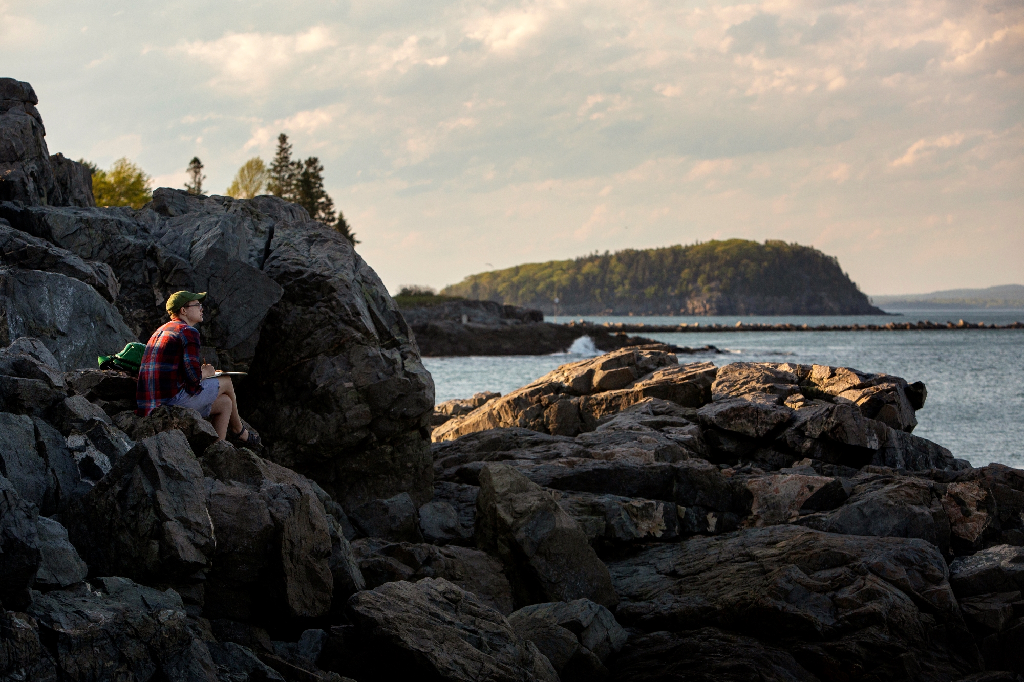
The Compass Harbor Trail provides an easy walk through the woods to the shore just outside the village of Bar Harbor. The land is the former estate of George B. Dorr, who was instrumental in the creation of Acadia National Park as well as its first superintendent. Explore the historic site and enjoy a dramatic shoreline with views of Frenchman Bay and Ironbound Island.
Distance: 0.8 miles round trip
Terrain: Forested path, rocky coastline
Hike Description
Start at the Compass Harbor Trailhead and travel 0.1 miles from the parking area before the first junction.
Turn left at the junction and follow as the trail circles around to a dramatic shoreline over looking Frenchman Bay and Ironbound Island.
From the shore, the trail continues back into the woods to the remains of the former home and grounds of the Dorr estate, including the cottage's foundation, stone steps leading down to the ocean, remnants of a saltwater pool, and the remains of gardens and apple trees.
Go 0.1 past the foundation to loop back to the first junction.
Continue 0.1 miles back the trailhead.
Accessibility Compass Harbor Trail is mostly accessible. The trail is fairly level to the historic site, but becomes rocky and uneven near the shoreline. There is no accessible restroom at the trailhead.
Day Mountain Trail
Bridges
Along the way Clearance: 12 feet 9 inches
Day Mt Connector
Bridges
Along the way Clearance: 12 feet 9 inches
Day Mt. Loop
Day Mt. Summit
Day Mtn Loop Carriage Road
Bridges
Along the way Clearance: 12 feet 9 inches
Day Mtn Summit Carriage Road
Deep Cove Trail
Deer Brook Trail
Dorr North Ridge Trail
Dorr South Ridge Trail
Dorr West Face Trail
Duck Brook Bridge
Duck Brook Path
Duck Brook Rd
Duck Harbor Mountain Trail
Duck Harbor Trail
Eagle Lake
Eagle Lake Carriage Road
Boat launches
Along the way Eagle Lake
Eagle Lake Connector
Eagle Lake Connector Carriage Road
Eagle Lake Parking
Eagle Lake Trail
Eagle Lake/Jordan Pond Carriage Road
Eagle/Bubble Connector
Eagle/Bubble Connector Carriage Road
Eagle/Jordan
Eagles Crag Trail
East Trail
Hike the Acadia Mountain Loop with Island Explorer Bus the Park Service's write-up
2-3 Hours · dogs allowed · Spring, Summer, Fall
Start Acadia Mountain Loop
Nestled in between Echo Lake and Somes Sound lies Acadia Mountain. Standing just 681 ft tall it offers amazing views of the surrounding waters and mountains. Located on the West or “Quiet Side” of the park, it offers a quieter hike through the forest and over granite slabs. Listen for numerous birds chirping along the trail. To do the loop continue on the Man O War Fire Brook Road.
This trail is steep on both sides and steeper on the West Side next to Somes Sound, with more granite and rocky sections. Taking the Fire Road all the way over to the West side of the mountain, and then going up to the summit, is the easier way. A false summit provides a great view of the mountains and sound. Just 0.3 miles further on is the actual summit; it is marked with a trail marker. Taking the east side down is easier with some rocky spots and stone steps. Please be mindful of where you are stepping as all trails in this park have roots and rocks that you can slip or trip on.
Acadia Mountain rises in between two bodies of water overlooking Southwest Harbor. Hiking up the west side has great views of Somes Sound. The east side has great views of Beech Mountain with the Fire Tower in the distance. Enjoy a mostly forested trail with a few rock scrambles.
Acadia Mountain Trail follows up the east and west side of the mountain with views of the surrounding mountains and bodies of water. With the Island Explorer bus, visitors won't need to park along the road and can ride to the trailhead stress-free.
Bus: Island Explorer #7 (Southwest Harbor) from Bar Harbor at Village Green and get off at the parking lot for Acadia Mountain. safely cross the road. Ask the driver if you feel more comfortable. The trailhead is on the other side. Once you finish the hike the bus will pick up back at the trailhead.
Accessibility Due to the steep nature of the trail, it is not accessible. The trail has a moderate to steep grade throughout.
Ebens Head Trail
Echo Lake Ledges Trail
Emery Path
Hike Emery Path the Park Service's write-up
20-45 Minutes · dogs allowed · Spring, Summer, Fall
Start Emery Path
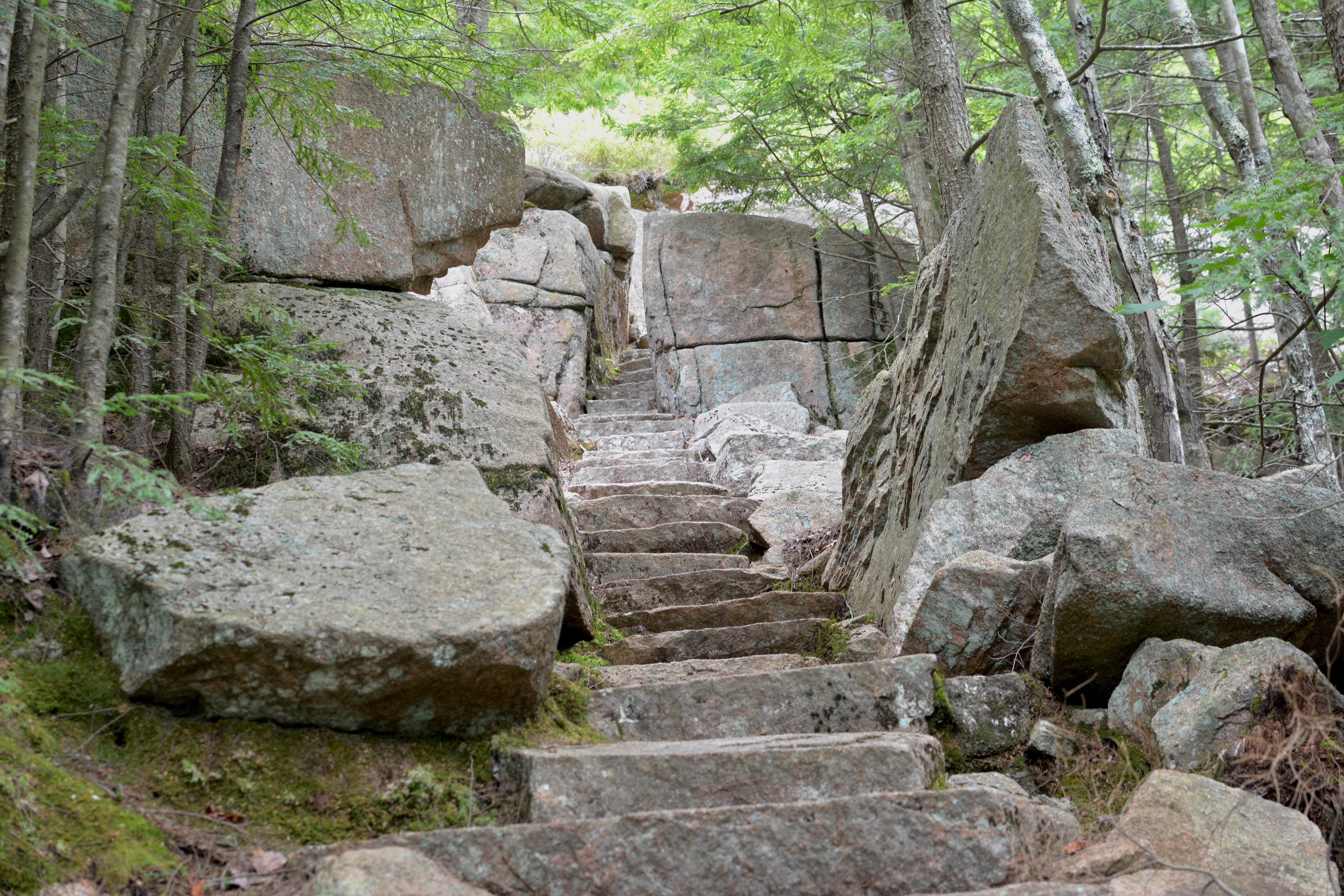
Emery Path is a memorial path at Sieur de Monts. It is a .5 mile steep ascent with examples of high quality trail work. It is one of the routes to reach Schiff Path, and eventually the summit of Dorr Mountain. It is said to have been one of George Dorr's favorite trails.
Emery Path was funded by Mrs. Alfred Anson in memory of her first husband, John Emery. John Emery was a successful developer of commercial and residential real estate in Cincinnati, Ohio. The trail was improved by the Civilian Conservation Corps (CCC) in 1934.
Distance: .5 miles one way
Terrain: Forested area with steep and rocky sections, granite steps, narrow passages
Hike Description
Start at the Sieur de Monts Nature Center. Cross the small wooden bridge and turn left.
Turn right to pass by two large stones inscribed with "Sieur de Monts Spring" and "Sweet Waters of Acadia" and proceed to the start of Emery Path.
The trail quickly ascends for .5 miles on granite stairs and steep sections through the forest.
To reach the summit of Dorr Mountain, continue onto Schiff Path for.9 miles.
To return to Sieur de Monts, retrace your steps back or take Homans Path or Kurt Diederich's Climb. All three trails are quick, steep descent with granite steps. Use caution, especially when the rock is wet and slippery.
Accessibility Emery Path is not accessible. The trail has uneven footing, steep sections, a narrow passage, and granite stairs throughout. There is an accessible restroom at Sieur de Monts.
Flying Mountain Trail
Hike Flying Mountain Loop the Park Service's write-up
1-2 Hours · dogs allowed · Spring, Summer, Fall
Start Flying Mountain Trailhead
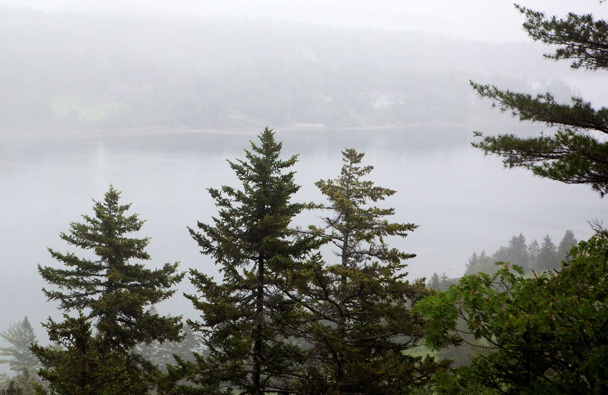
This moderate hike is a great option for families with skilled, young hikers. The loop offers a short, relatively steep hike to the top of a small mountain with spectacular views of Somes Sound and descends to a quiet ocean cove with a rocky beach.
Distance: 1.5 miles round trip
Terrain: Log and gravel steps. Becoming more rugged, traversing rocks and roots. exposed ledges, rocky granite and stone steps. Flat grassy terrain between Valley Cove and the parking lot.
Hike Description
Start the trail at Fernald Point Road and ascend through a forest on log and gravel steps.
The trail becomes becomes more rugged over rocks and roots, and then ascends exposed ledges before reaching the peak. Overlooks along the way provide views of Somes Sound to the east and the ocean to the south.
The trail continues north along the ridge, passes the summit markers, and descends to Valley Cove over rocky ground and stone steps.
The trail returns through forest along Valley Cove Road (foot traffic only) to the parking area.
Accessibility Flying Mountain Loop is not accessible. The trail has uneven footing throughout. There are no accessible restrooms at the trailhead.
Frazer Creek Bike Path
Visitor centers
Along the way Schoodic Woods Campground
Giant Slide Trail
Hike Giant Slide Loop the Park Service's write-up
2-4 Hours · dogs allowed
Start Giant Slide Trailhead
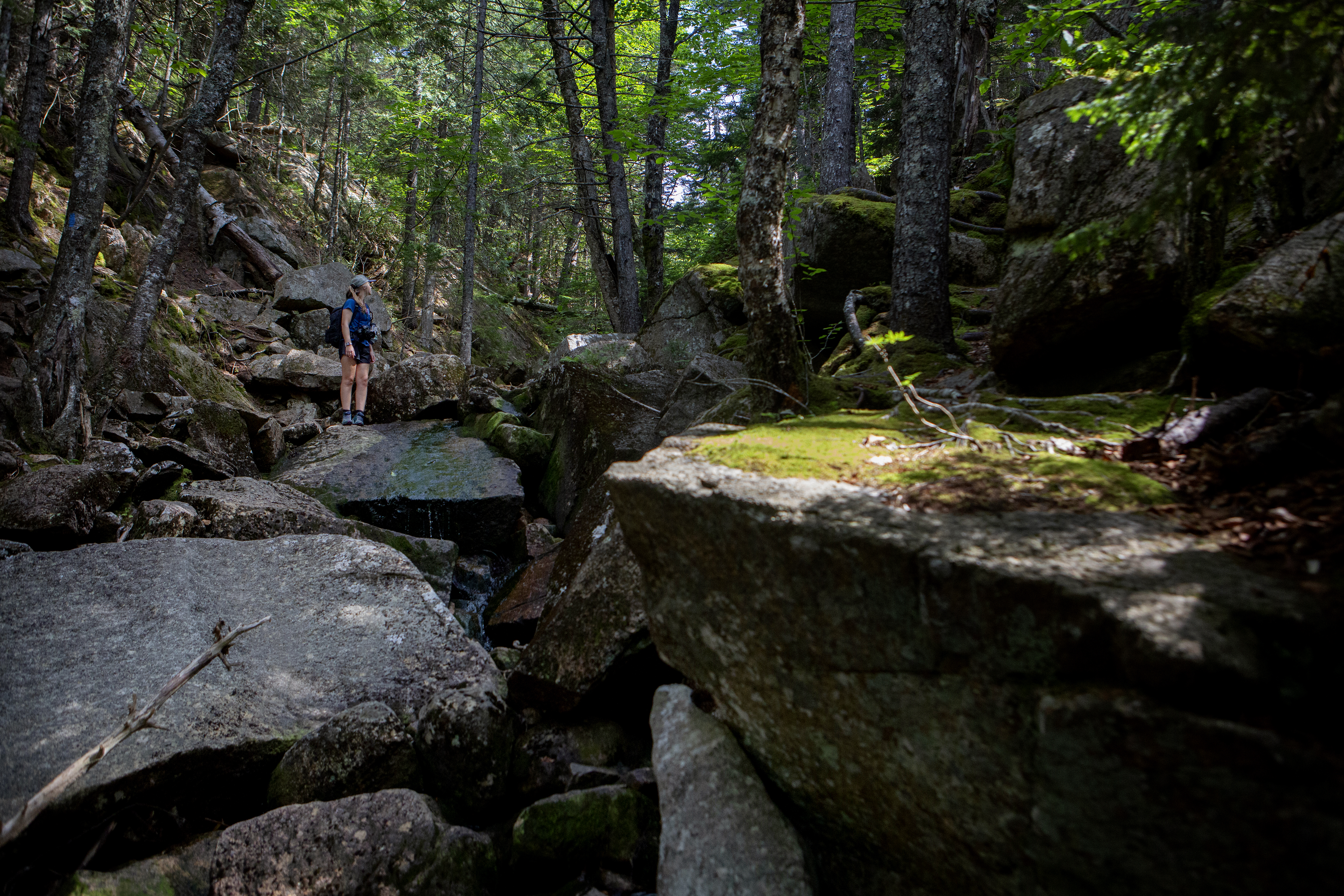
This is a challenging "lollipop" hike up a rugged ravine to excellent views atop Sargent Mountain, Gilmore Peak, and Parkman Mountain. As this trail begins on private land, please respect owner privacy and protect fragile moss and lichen by staying on the marked trail.
Distance: 5.7 miles round trip
Terrain: Forested trail, rocky granite slopes, rock slide and boulder fields, granite exposed summits
Hike Description
The Giant Slide Trail begins as a very gradual ascent through private land. Please respect private land ownership and protect the mossy forest.
After crossing the carriage road, the trail gradually steepens and becomes a climb along Sargent Brook. Any crossings and condensation due to the coolness of the ravine can make the trail slippery.
There are several places where the trail traverses under large boulders providing challenging tight squeezes with low clearance.
Turn left at the junction of Sargent Northwest Trail and the Parkman Mountain Trail, and continue away from the stream towards a steep ascent.
The trail opens and provides views to the west and north, before reaching the summit of Sargent Mountain at 1, 373 ft.
Follow Sargent South Ridge Trail down to the junction for the Maple Spring Trail, and continue the descent on the west side of Sargent Mountain.
Continue straight at the junction of the Grandgent Trail, and then ascend Gilmore Peak at 1,019 ft.
Descend again and cross Giant Slide Trail. The Grandgent Trail terminates at the junction of the Parkman Mountain Trail.
For a shorter hike, turn onto Giant Slide Trail for 1.9 miles and continue back to the parking area.
Take the short out and back to the summit of Parkman Mountain, and then gradually descend north, crossing a carriage road.
The trail returns to a forested area and terminates at the junction of the Giant Slide Trail. Follow back along the rugged ravine to the parking area.
Accessibility Giant Slide Loop is not accessible. The trails have uneven footing and short, steep sections requiring some scrambling throughout. There are no accessible restrooms at the trailhead.
Gilley Trail
Goat Trail
Goat Trail Sec. 1
Golf Course Trail
Gorge Path
Hike Gorge Path the Park Service's write-up
2-3 Hours · dogs allowed · Spring, Summer, Fall
Start Gorge Path Trailhead
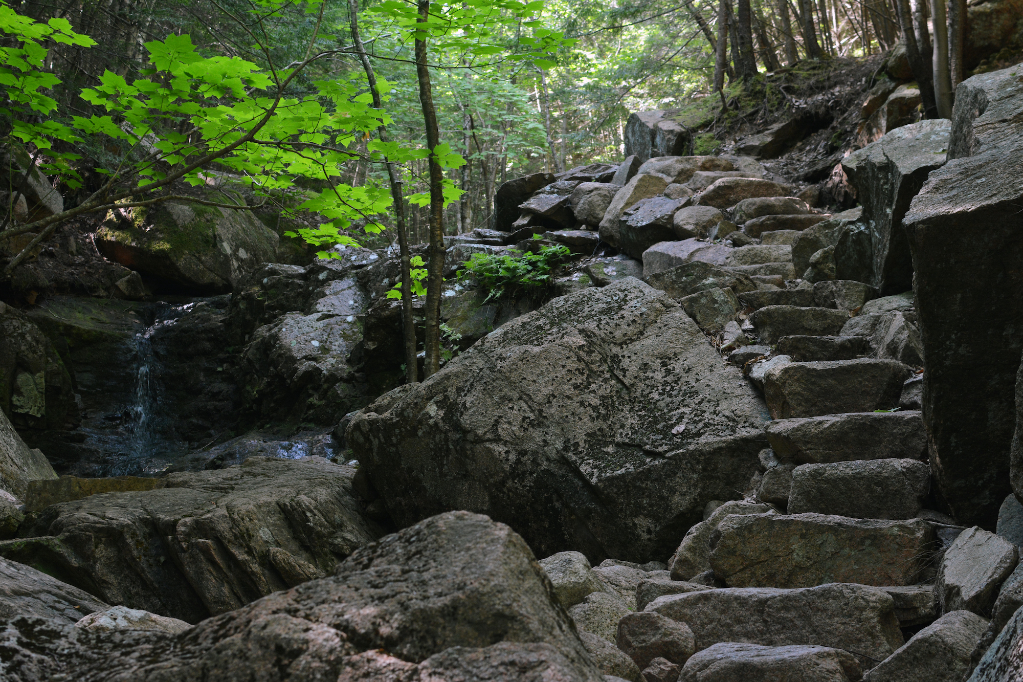
The Gorge Path follows a narrow, rocky gorge separating Dorr and Cadillac Mountains. The trail passes steep cliff walls and small cascades, climbs granite steps, and stays mostly in the shade. There are a few stream crossings, where flat rocks help aid footing. This trail is not advisable when wet, since rocky sections in forested areas take longer to dry out.
Distance: 2.5 miles round trip (see description below for longer hikes)
Terrain: Forested sections with steep, granite stairs and some scrambling
Hike Description
The hike starts at the Gorge Path parking area, located off the Park Loop Road.
Note: For a longer hike (1.6 miles round trip), start at Kebo Brook Trailhead. Follow Kebo Brook Trail for .4 miles, then turn right onto Gorge Path. Continue .4 miles, pass under the bridge, and turn right up the stairs.
Follow the stairs down along the side of the bridge. Continue straight at the sign.
The trail goes through forested areas, follows and crosses a stream, and goes over one small boardwalk.
At the junction with Hemlock Trail, continue straight.
The trail gradually ascends with a few stream crossings, before becoming steep and rocky. There are a few long sections of granite steps throughout. Enjoy views of gorge walls, a small waterfall, and a memorial plaque.
The trail levels out and reaches the intersection of the Cadillac-Dorr Connector Trail.
For Dorr Mountain, turn left at the signs. After .2 miles, turn right onto Dorr West Face Trail. Continue for .1 miles to reach the summit.
For Cadillac Mountain, turn right and continue on the Gorge Path. Continue for .4 miles and intersect the Cadillac Summit Loop.
Accessibility Gorge Path is not accessible. There is uneven footing over rocks and steep sections of flat, granite stairs throughout. There are no accessible restrooms at the trailhead.
Gorham Mountain Trail
Hike Gorham Mountain Loop the Park Service's write-up
1-3 Hours · dogs allowed · Spring, Summer, Fall
Start Gorham Mountain Summit
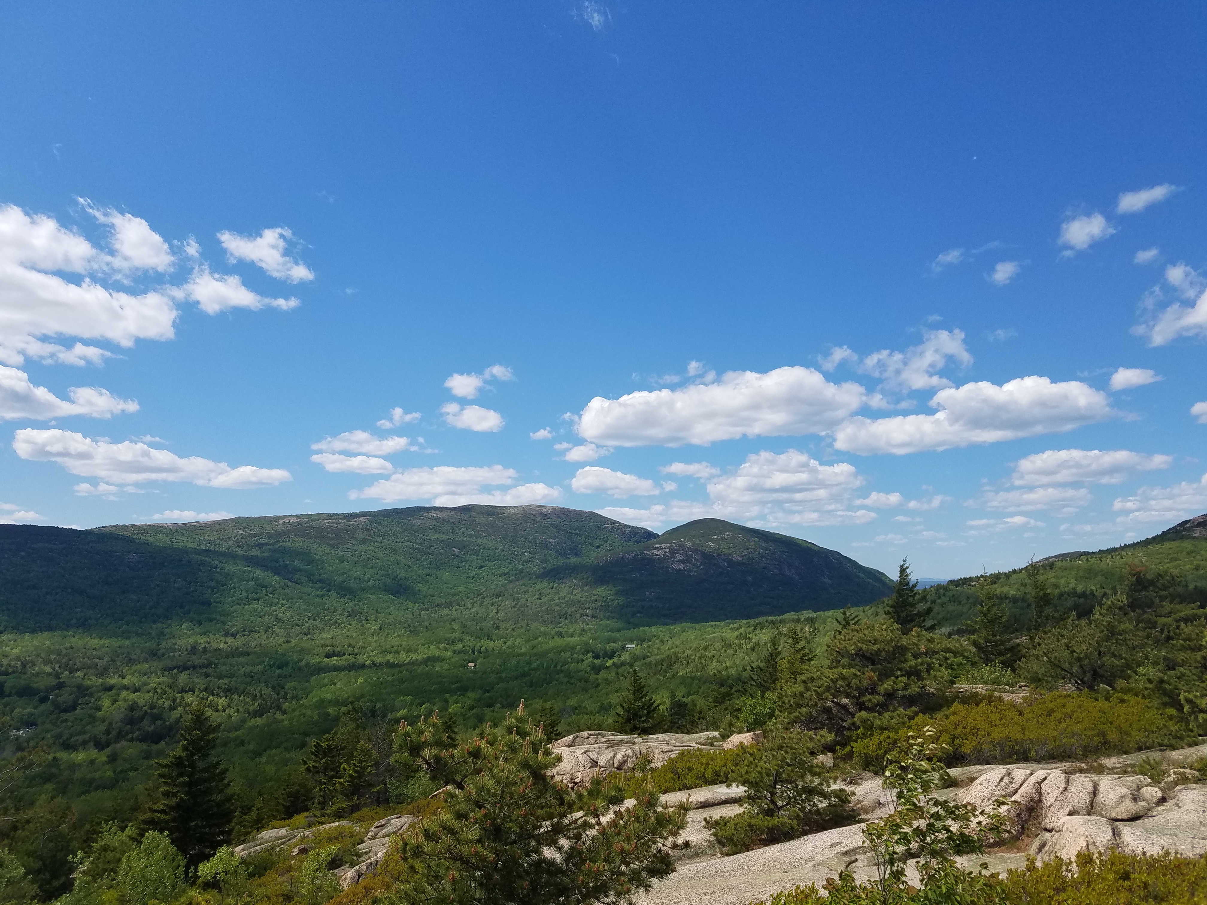
Gorham Mountain Loop provides an excellent overview of what Acadia has to offer on this beautiful hike. Rocky coastline, Cadillac looming in the distance, and a panoramic view of ocean drive await those who hikes this loop. Enjoy a taste of history on this hike with a plaque dedicated to Waldron Bates . Bates was a visionary when it came to outdoor recreation and many trails in the park exist because of his dedication.
Distance: 3.5 mile round trip. Choosing to do the Cadillac Cliff trail section does not change the distance only changes the difficulty.
Terrain and Safety: The trail is rocky with uneven footing. Good foot wear is recommended. The Cadillac Cliff trail section does involve rungs and ladders. Caution is advised during inclement weather.
Hike Description
The hike begins at the southwest corner of the Gorham Mountain parking lot. Look for a large stump with Gorham Mountain trail carved into it.
Follow the trail gradually up granite slab 0.2 miles until the trail intersects with Cadillac Cliff Trail. This is also where the Bates plaque resides. Continue left to remain on the Gorham Mountain loop hike.
To the right is the Cadillac Cliff trail. This 0.3 mile section goes along old sea cliffs. The trail does have rungs and ladders to assist hikers over rock scrambles. It finishes with a steep granite stair climb where it returns back to the Gorhman Mountain loop.
The trail begins to involve rocky uneven surfaces and it continues 0.3 miles until it meet up with the Cadillac Cliff trail again.
From this intersection the trail continues another 0.4 mile to the summit of Gorham Mountain. Be aware that a couple hundred feet from the summit is a false summit. Beautiful views but to continue the loop keep following the trail until you reach the summit marker.
Past the summit the trail descends down rocky terrain 0.5 miles until it reaches the Bowl trail. Head right on the bowl trail 0.5 miles where it will come out at the entrance to Sand Beach.
Cross the crosswalk safely and walk to the end of the upper Sand Beach parking lot. Here the Ocean Path trail will follow the coastline 0.7 miles to Thunder Hole.
Keep on the Ocean Path trail after Thunder Hole for another 0.3 miles. Be looking for a stump with Gorham Mountain carved into it. Cross the crosswalk safely to the Gorham Mountain parking lot to finish the hike.
Accessibility The Gorham Mountain Loop is not accessible. The trail has uneaven footing and a few places where scrambling over rocks is required. Be aware the Cadillac Cliff trail addition on this hike does involve rungs and ladders.
Grandgent Trail
Great Head Trail
Hike Great Head Trail the Park Service's write-up
2-4 Hours · dogs allowed
Start Great Head/Sand Beach
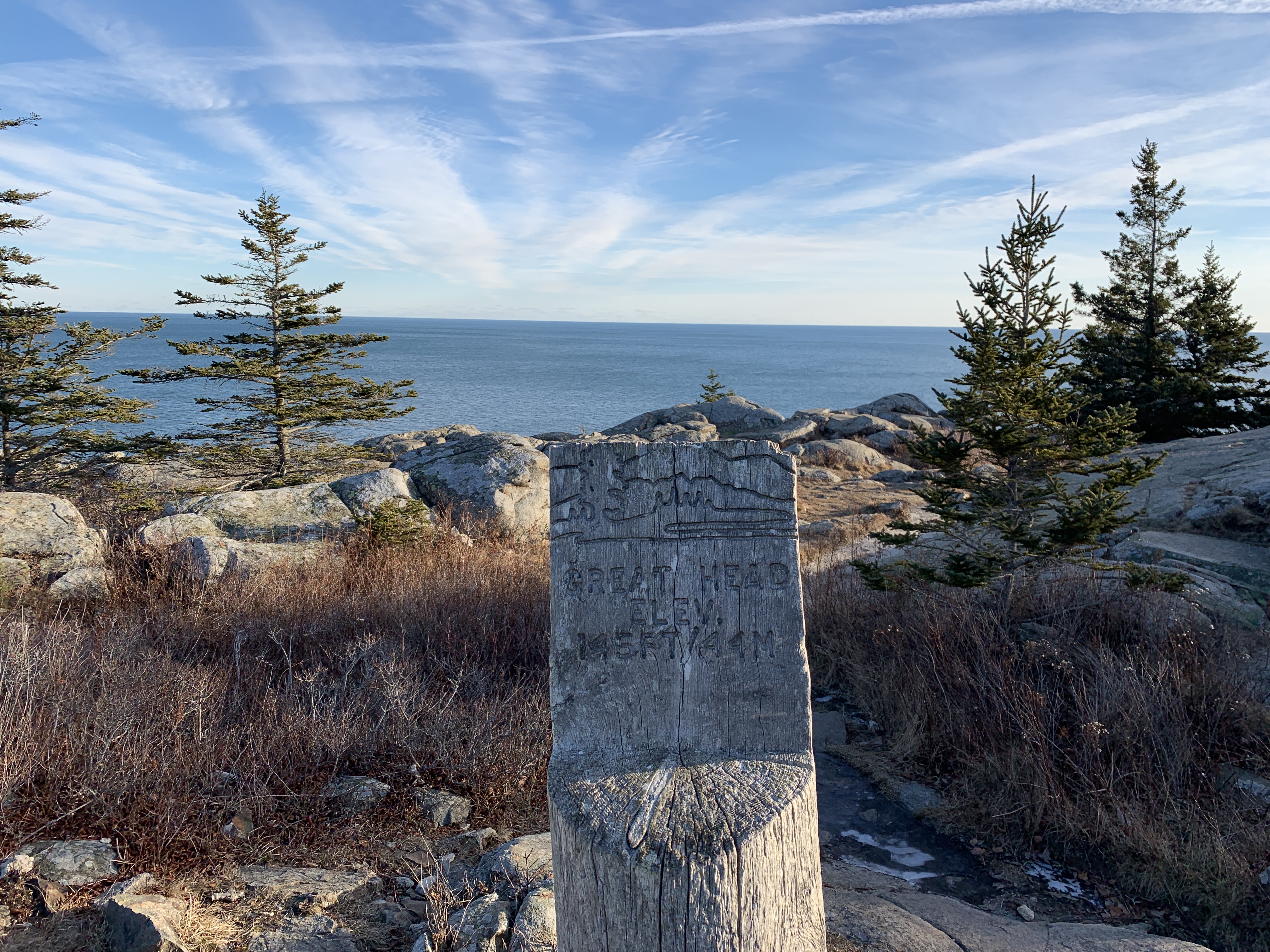
This hike on Great Head Trail is a wonderful mix of ocean views, rocky scrambles, and hidden history. Near the top of the granite steps at the beginning of the hike, a large millstone (6'10" in diameter) can be found to the left. In the early 1900's, the Satterlee family owned this area. They built a stone tower on the highest point that included a tea room and an observatory. The ruins of this tower still remain. Along the trail you can also find a bronze monument for David Phillips McKinney, who died in this location in 1969.
Distance: 1.9 miles round trip. There is a way to shorten the hike to 1.3 miles (see description below).
Terrain and Safety: The trail is rocky with uneven footing. Good foot wear is recommended. Rocky granite, short steep sections. Steep drops into the ocean. Keep children away from the edge.
Hike Description
The trail begins at the far end of Sand Beach with granite steps. A right at the top of the steps leads to an open ledge ascent that provide excellent views of Sand Beach and The Beehive.
The trail continues along the headland with dramatic views of the coastline and ocean. It is a gradual grade to reach the highest point at 145 feet above sea level. At this point the ruins of a 1915 tea house can be seen. You can also see a plaque dedicated to David Phillips McKinney who died in this location in 1969.
The trail turns away from the shore and descends through the forest. A cedar post marks a junction in the trail.
For a shorter loop (1.3 miles) , take the trail to the left. It climbs steeply before leveling out and leading back to Sand Beach.
For a longer loop (1.9 miles) continue straight.
The trail angles back toward the ocean with occasional views.
At the next junction, turn left for a easy walk back to the top of the steps where the hike began. Descend the steps to Sand Beach.
Check out our Great Head Photo Hike for step by step photographs and more detailed descriptions.
Accessibility The Great Head Trail is not wheelchair accessible. The trail has uneven footing and a few places where scrambling over rocks is required. There is accessible parking at the Sand Beach parking areas as well as accessible restrooms.
Hike Great Head with Island Explorer Bus the Park Service's write-up
1-2 Hours · dogs allowed · Spring, Summer, Fall
Start Great Head Trail
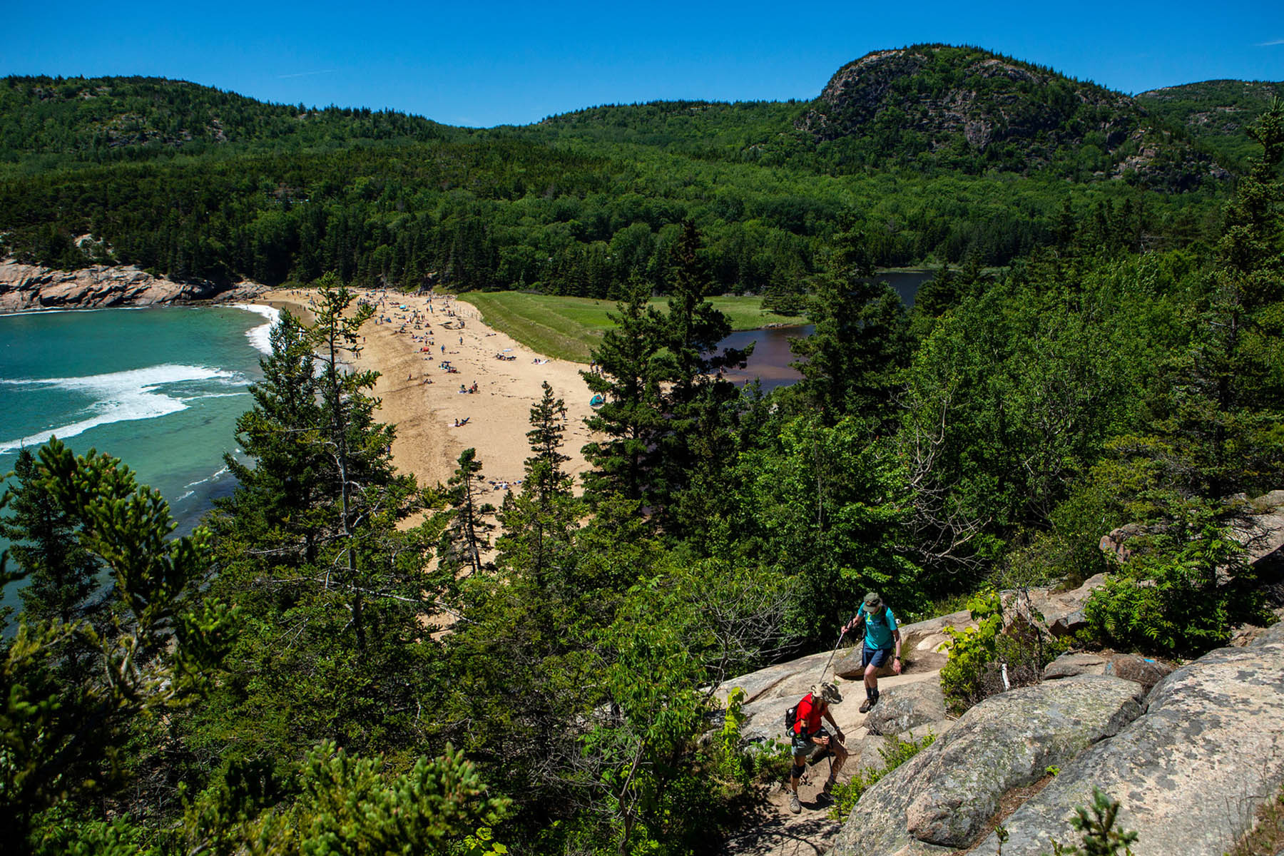
Great Head rises above Newport Cove and Sand Beach. Standing just 145 feet above the ocean, this huge rock offers amazing views of the ocean and mountains behind the beach. A longer loop of 1.9 miles is available, as well as a shorter loop of 1.3 miles.
Before starting the climb up the rock scramble clean off your hiking boots or shoes the best you can. This will make your footwear have better grip. Along the trail there will be numerous spots to stop and have great views of the ocean, sand beach and the cove. Take extra care to watch where you are stepping as this trail is very rocky. The 1.3-mile loop does not have as many views of the ocean but does include remnants of the old tea house.
Great Head rises above Newport Cove with dramatic view of the ocean and the surrounding mountains. Smell the salty air and feel the cool breeze blowing off the ocean. This trail also includes remnants of a cool tea house. Enjoy swimming at Sand Beach in the summer and watching for shore birds along the way.
Accessibility This trail is not accessible since it starts from Sand Beach, which is only accessible by stairs. Due to its uneven surface, this trail cannot be accessed from the small parking lot on Schooner Head Road.
Great Meadow Loop
Hike Village Green to Sieur de Monts with Island Explorer Bus the Park Service's write-up
1-1 Hours · dogs allowed · Spring, Summer, Fall
Start Hike Village Green to Sieur de Monts with Island Explorer Bus
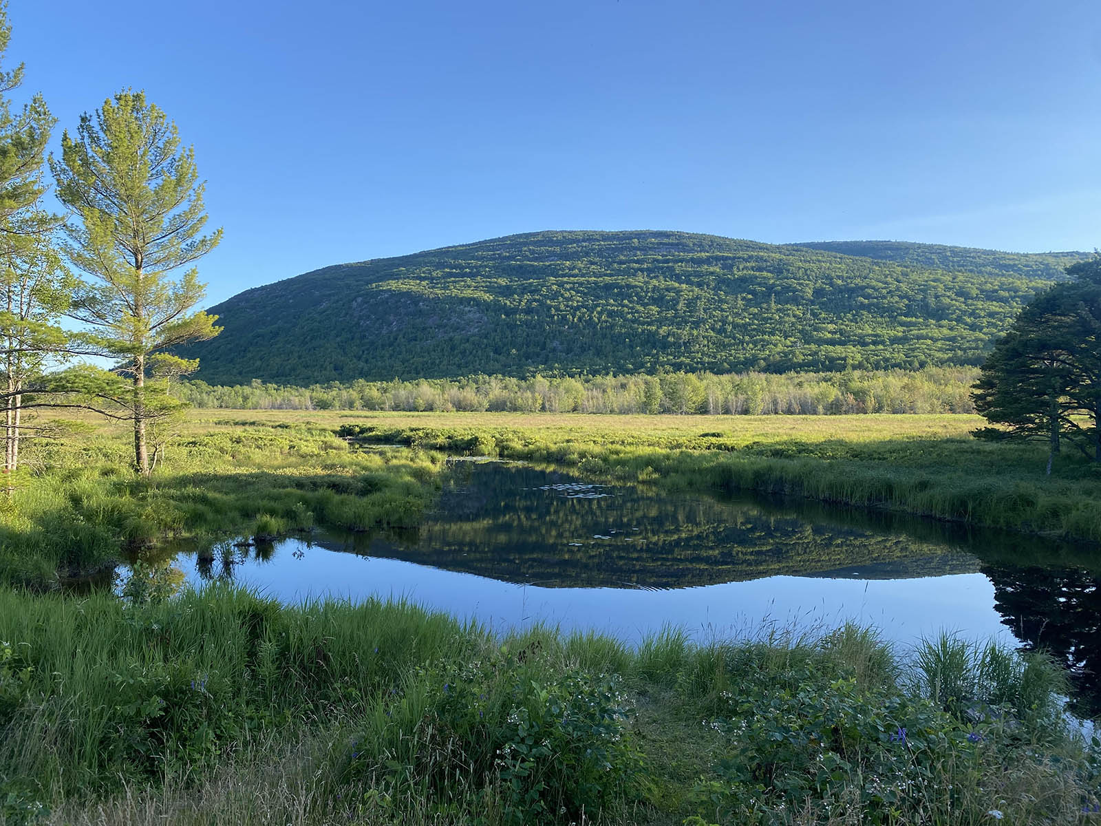
This hike starts in downtown Bar Harbor within walking distance to many hotels and other lodgings. It is a great alternative to driving into the park with gorgeous views of the Great Meadow and the mountains beyond.
If you are staying in Bar Harbor and want to stretch your legs by walking into Acadia, this hike is a wonderful alternative to driving. It begins in the middle of Bar Harbor at the Village Green, crosses through neighborhoods, and soon reaches the boundary of the park. The trail crosses the Great Meadow, the largest freshwater wetland in Acadia, and traverses a boardwalk which is a popular area for bird watching. It ends at Sieur de Monts, an area that includes the Nature Center, the Wild Garden and an Island Explorer bus stop that can take visitors to sought-after sites in the park or return them back to Bar Harbor.
Accessibility The Jesup Path boardwalk is a 3-foot-wide wooden boardwalk with benches and pullouts running through a wetland area. The Jesup Path boardwalk is 3 foot wide and accessible.
Great Notch Trail
Hadlock Brook Trail
Hadlock Loop
Hadlock Loop Carriage Road
Hadlock Ponds Trail
Hike Hadlock Ponds Loop the Park Service's write-up
2-4 Hours · dogs allowed
Start Hadlock Ponds
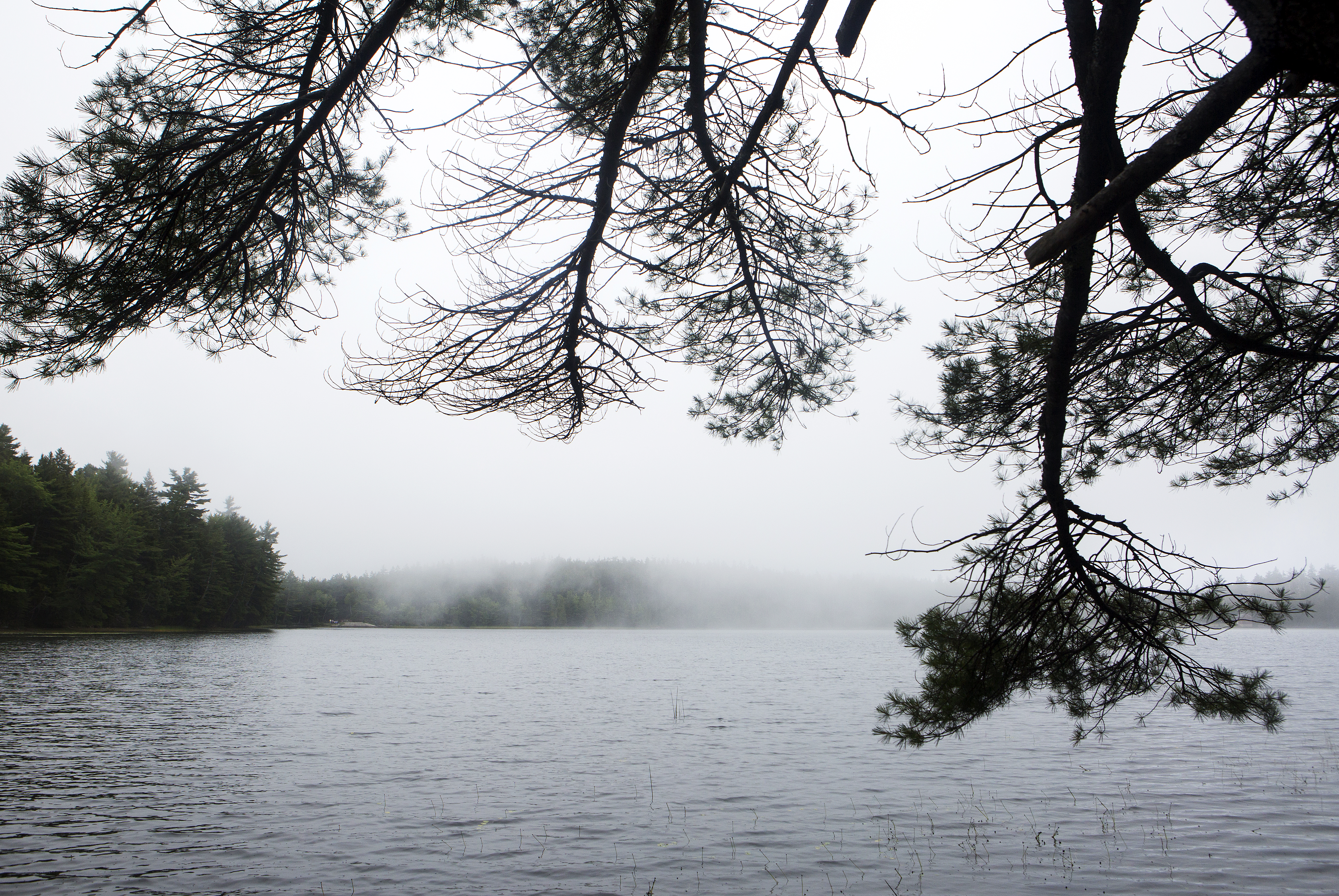
Serene woods, babbling brooks, and crystal clear ponds accompany hikers throughout this walk. Enjoy boardwalks, wooden bridges and some uneven terrain on this figure eight trail that includes both Lower and Upper Hadlock Ponds. Listen for the iconic wail of common loons who can be seen on this hike.
Distance: 4.1 miles round trip
Terrain and Safety: The trail has places with uneven footing. Bog walks can be narrow and slippery when wet. Good footwear is recommended.
Hike Description
Park at the Norumbega Mountain parking area. This is a parking area on Route 198 that is a pull through parking area on the western side of the highway. Cross Rt. 198 safely and begin walking on the Hadlock Ponds Trail.
The Hadlock Ponds Trail begins with a dirt path through the woods. Follow this trail 0.5 miles past multiple other trail intersections and two carriage road intersections. Always make sure to continue on the trail directed to by a sign with Hadlock Ponds Trail carved into it.
Continue another 0.7 miles after the last carriage road intersection to begin following the edge of Upper Hadlock Ponds. Watch out for uneven terrain and roots within the trail. As the trail parallels the pond it does become a narrow bogwalk. Appropriate footwear with good traction is recommended. Bogwalk is very slippery when wet. Caution is advised.
The trail will intersect with Route 198. Safely cross Route 198 and continue on the Hadlock Ponds Trails for 0.3 miles. The trail winds it way past brooks and many vernal pools in this section. Pay close attention to the blue blazes that mark the trail.
The Hadlock Ponds trail splits at Lower Hadlock Pond. Take a left to continue around the pond. Follow this trail 1.6 miles to circle Lower Hadlcok Pond in its entirety.
Once the loop has been completed around Lower Hadlock Pond, return back up the trail first taken after crossing Route 198. In 0.1 miles there will be an intersection with the Norumbega Connector Trail. Take this trail 0.9 miles through spruce woods back to the Norumbega Parking area. This trail has a lot of tree roots. Sturdy footwear is recommended.
The Hadlock Ponds loop is 4.1 miles round trip. However, there are many ways to shorten this hike if desired.
Accessibility The Hadlock Ponds Loop is not accessible. The trail has uneven footing and narrow bogwalks.
Hemlock Path
Hike Jesup Path and Hemlock Path Loop the Park Service's write-up
30-60 Minutes · dogs allowed
Start Sieur de Monts Nature Center
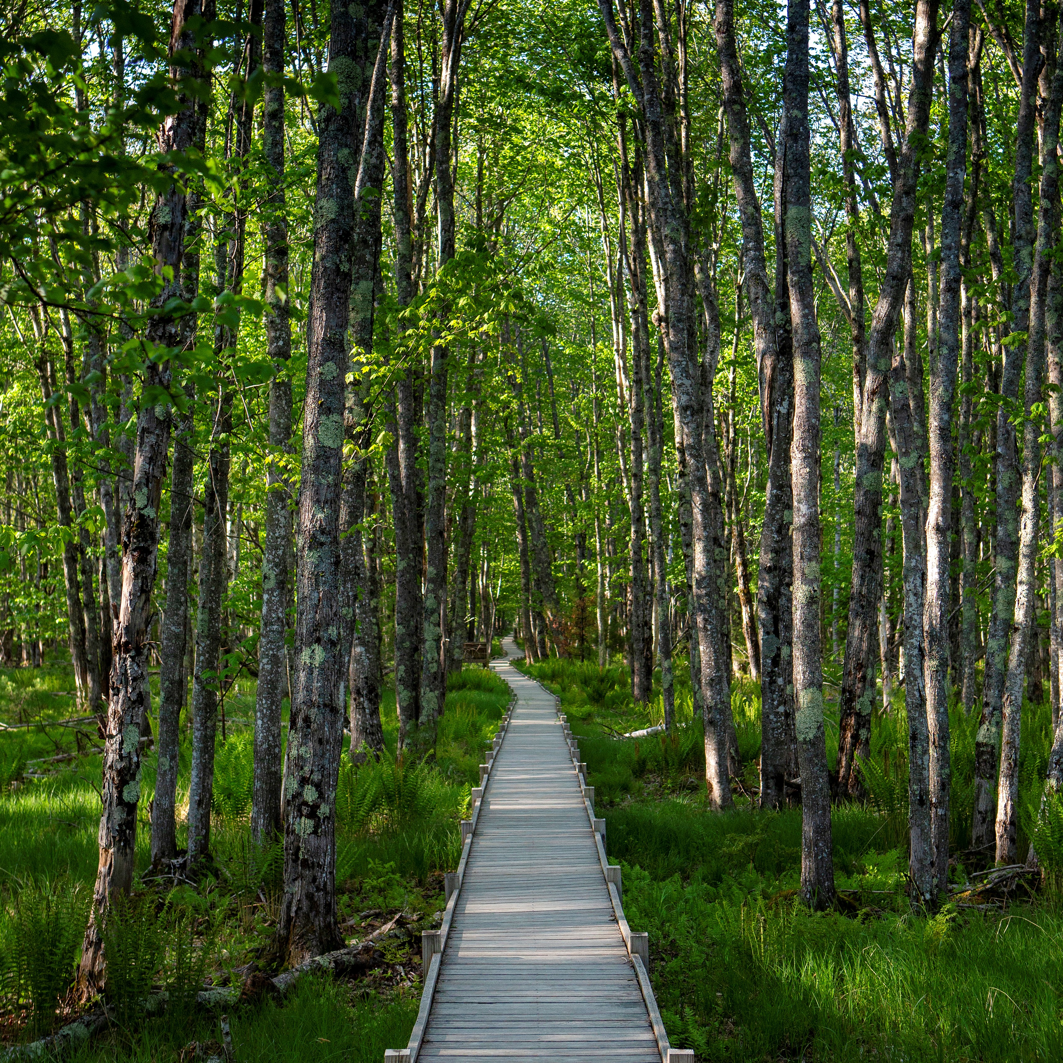
The Jesup Path and Hemlock Path Loop consists of two mostly level trails creating a figure-8. Starting at historic Sieur de Monts, this trail provides a walk through a hemlock and birch forest, a section of the Great Meadow wetland and provides breathtaking views of Dorr Mountain.
Birdwatching, photography, and dog walking are common activities along this trail. It is used routinely by people with mobility limitations and families with small children.
Distance: 1.5 miles round trip
Terrain: Compact, flat trail. Wooden boardwalk with benches and pullouts, wide, gravel fire road.
The fare-free Island Explorer serves this destination. Buses drop off and pick up at regular intervals throughout the day at a designated stop located at the edge of the parking lot. An electronic digital display notes scheduled bus arrival times.
Hike Description
Start the hike just before the entrance to the Wild Gardens of Acadia at Sieur de Monts. A wooden footbridge provides access to the Jesup Path.
Follow the path as it crosses Hemlock Path, and continue straight onto the boardwalk.
The boardwalk runs through a boggy, white birch forest. There are interpretive waysides and benches along the way.
As the boardwalk ends, the trail crosses Hemlock Path again. Continue through the Great Meadow, finally ending at the Park Loop Road.
Cross the Park Loop Road, and turn right onto the Great Meadow Loop. Use caution when crossing the Park Loop Road as there are no crosswalks.
At the next trail junction, turn right and cross back over the Park Loop Road onto Hemlock Path.
Follow Hemlock Path back into the Great Meadow, past the boardwalk, and through a forest of hemlocks.
The path leads back to Sieur de Monts parking lot.
.
Additional Descriptions:
Jesup Path
Hemlock Path
Accessibility The Jesup Path and Hemlock Path Loop is mostly accessible. Both trails are mostly level. The boardwalk is wide enough for a single wheelchair. There are accessible bathrooms across the parking lot from the trailhead.
Hemlock Trail
Hike Jesup Path and Hemlock Path Loop the Park Service's write-up
30-60 Minutes · dogs allowed
Start Sieur de Monts Nature Center
The Jesup Path and Hemlock Path Loop consists of two mostly level trails creating a figure-8. Starting at historic Sieur de Monts, this trail provides a walk through a hemlock and birch forest, a section of the Great Meadow wetland and provides breathtaking views of Dorr Mountain.
Birdwatching, photography, and dog walking are common activities along this trail. It is used routinely by people with mobility limitations and families with small children.
Distance: 1.5 miles round trip
Terrain: Compact, flat trail. Wooden boardwalk with benches and pullouts, wide, gravel fire road.
The fare-free Island Explorer serves this destination. Buses drop off and pick up at regular intervals throughout the day at a designated stop located at the edge of the parking lot. An electronic digital display notes scheduled bus arrival times.
Hike Description
Start the hike just before the entrance to the Wild Gardens of Acadia at Sieur de Monts. A wooden footbridge provides access to the Jesup Path.
Follow the path as it crosses Hemlock Path, and continue straight onto the boardwalk.
The boardwalk runs through a boggy, white birch forest. There are interpretive waysides and benches along the way.
As the boardwalk ends, the trail crosses Hemlock Path again. Continue through the Great Meadow, finally ending at the Park Loop Road.
Cross the Park Loop Road, and turn right onto the Great Meadow Loop. Use caution when crossing the Park Loop Road as there are no crosswalks.
At the next trail junction, turn right and cross back over the Park Loop Road onto Hemlock Path.
Follow Hemlock Path back into the Great Meadow, past the boardwalk, and through a forest of hemlocks.
The path leads back to Sieur de Monts parking lot.
.
Additional Descriptions:
Jesup Path
Hemlock Path
Accessibility The Jesup Path and Hemlock Path Loop is mostly accessible. Both trails are mostly level. The boardwalk is wide enough for a single wheelchair. There are accessible bathrooms across the parking lot from the trailhead.
Hike Village Green to Sieur de Monts with Island Explorer Bus the Park Service's write-up
1-1 Hours · dogs allowed · Spring, Summer, Fall
Start Hike Village Green to Sieur de Monts with Island Explorer Bus
This hike starts in downtown Bar Harbor within walking distance to many hotels and other lodgings. It is a great alternative to driving into the park with gorgeous views of the Great Meadow and the mountains beyond.
If you are staying in Bar Harbor and want to stretch your legs by walking into Acadia, this hike is a wonderful alternative to driving. It begins in the middle of Bar Harbor at the Village Green, crosses through neighborhoods, and soon reaches the boundary of the park. The trail crosses the Great Meadow, the largest freshwater wetland in Acadia, and traverses a boardwalk which is a popular area for bird watching. It ends at Sieur de Monts, an area that includes the Nature Center, the Wild Garden and an Island Explorer bus stop that can take visitors to sought-after sites in the park or return them back to Bar Harbor.
Accessibility The Jesup Path boardwalk is a 3-foot-wide wooden boardwalk with benches and pullouts running through a wetland area. The Jesup Path boardwalk is 3 foot wide and accessible.
Homans Path
Hike Homans Path the Park Service's write-up
15-30 Minutes · dogs allowed · Spring, Summer, Fall
Start Homans Path
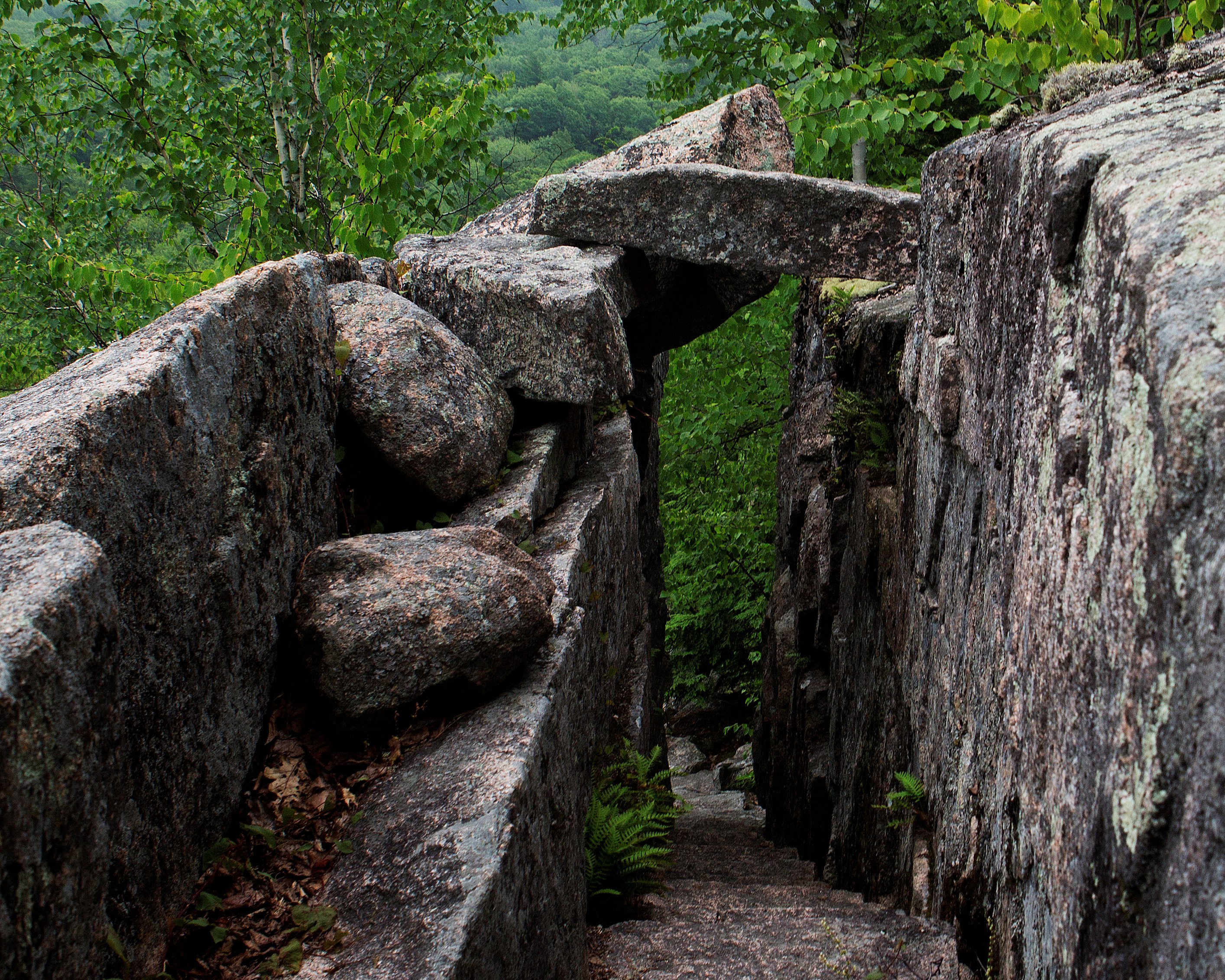
Homans Path is a memorial path at Sieur de Monts. It is a .3 mile steep ascent with impressive examples of intricate rock work. It is one of the routes to reach Schiff Path, and eventually the summit of Dorr Mountain.
It is named to honor Eliza Lothrop Homans for her major donations of land, including the Beehive and Bowl area, to the Hancock County Trustees of Public Reservations. It was unmaintained for a time and was removed from park maps in the 1940s. However, in 2003, Homans Path was officially reopened. In 2006, the trail was damaged by an earthquake, and had to be temporarily closed. Once repaired and safe to use again, the trail reopened in 2007.
Distance: .3 miles one way
Terrain: Forested area with steep and rocky sections, granite steps, narrow passages
Hike Description
Start at the Sieur de Monts Nature Center. Cross the small wooden bridge and walk around the left side of Wild Gardens of Acadia.
Follow the Jesup Path to the intersection with Hemlock Path and Homans Path.
Turn left onto Homans Path.
The trail quickly ascends for .3 miles on granite stairs and steep sections through the forest.
Join up with Emery Path.
To reach the summit of Dorr Mountain, follow Emery Path and continue onto Schiff Path for 1.2 miles.
To return to Sieur de Monts, retrace your steps back or take Emery Path or Kurt Diederichs Climb. All three trails are quick, steep descent with granite steps. Use caution, especially when the rock is wet and slippery.
Accessibility Homans Path is not accessible. The trail has uneven footing, steep sections, a narrow passage, and granite stairs throughout. There is an accessible restroom at Sieur de Monts.
Hulls Cove Visitor Center Accessible Entryway
Visitor centers
Along the way Hulls Cove Visitor Center
Hulls Cove Visitor Center Entry Stairway
Visitor centers
Along the way Hulls Cove Visitor Center
Hunters Beach Trail
Hunters Brook Trail
Jesup Path
Hike Jesup Path and Hemlock Path Loop the Park Service's write-up
30-60 Minutes · dogs allowed
Start Sieur de Monts Nature Center
The Jesup Path and Hemlock Path Loop consists of two mostly level trails creating a figure-8. Starting at historic Sieur de Monts, this trail provides a walk through a hemlock and birch forest, a section of the Great Meadow wetland and provides breathtaking views of Dorr Mountain.
Birdwatching, photography, and dog walking are common activities along this trail. It is used routinely by people with mobility limitations and families with small children.
Distance: 1.5 miles round trip
Terrain: Compact, flat trail. Wooden boardwalk with benches and pullouts, wide, gravel fire road.
The fare-free Island Explorer serves this destination. Buses drop off and pick up at regular intervals throughout the day at a designated stop located at the edge of the parking lot. An electronic digital display notes scheduled bus arrival times.
Hike Description
Start the hike just before the entrance to the Wild Gardens of Acadia at Sieur de Monts. A wooden footbridge provides access to the Jesup Path.
Follow the path as it crosses Hemlock Path, and continue straight onto the boardwalk.
The boardwalk runs through a boggy, white birch forest. There are interpretive waysides and benches along the way.
As the boardwalk ends, the trail crosses Hemlock Path again. Continue through the Great Meadow, finally ending at the Park Loop Road.
Cross the Park Loop Road, and turn right onto the Great Meadow Loop. Use caution when crossing the Park Loop Road as there are no crosswalks.
At the next trail junction, turn right and cross back over the Park Loop Road onto Hemlock Path.
Follow Hemlock Path back into the Great Meadow, past the boardwalk, and through a forest of hemlocks.
The path leads back to Sieur de Monts parking lot.
.
Additional Descriptions:
Jesup Path
Hemlock Path
Accessibility The Jesup Path and Hemlock Path Loop is mostly accessible. Both trails are mostly level. The boardwalk is wide enough for a single wheelchair. There are accessible bathrooms across the parking lot from the trailhead.
Hike Sieur de Monts to Jesup Path with Island Explorer Bus the Park Service's write-up
1-2 Hours · dogs allowed · Spring, Summer, Fall
Start Sieur de Monts to Jesup Path and Hemlock Road Loop
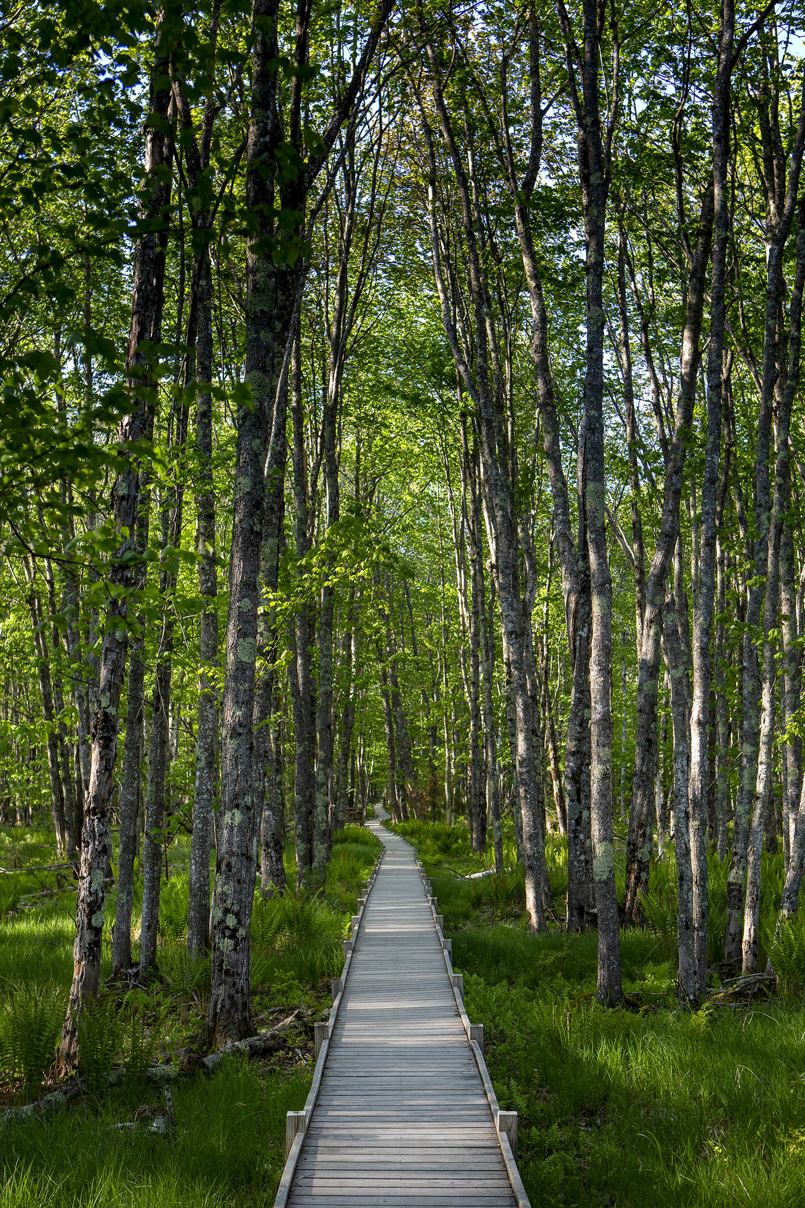
The Jesup Path and Hemlock Road Loop consists of two mostly level trail consisting of boardwalk and compressed crushed gravel creating a figure-8 for a 1.5-mile round trip hike made possible by the Island Explorer Bus. The loop runs through stands of white birch and hemlock and into the Great Meadow beyond Sieur de Monts. The hike offers benches and pullouts with views of Dorr Mountain interspersed in this walk. Great for families, kids, and wheel-chair accessible. Restrooms available.
This hike provides a tranquil stroll in a wooded area of the park accessible by almost anyone. Accessing the starting point of this trail by the Island Explorer is relatively easy since the Sieur de Monts drop off point is one of the first stops from the Hulls Cove Visitors Center. Additionally, the starting and ending point of this walk use the same bus location, making this hike easy to navigate. Before starting the walk, visitors can explore the heart of Acadia at Sieur de Monts, by checking out the exhibits and talking to a ranger at the Nature Center and viewing the Sieur de Monts Spring, the original Abbe Museum structure, the George B. Dorr Memorial, and the Wild Gardens of Acadia. This is also an excellent spot for birdwatching. Open, grassy fields beside the Nature Center are ideal for young children to run and play.
Sieur de Monts, often referred to as the "Heart of Acadia." Includes Sieur de Monts Spring and spring house, Nature Center, Wild Gardens of Acadia, Abbe Museum(closed), the tarn, Great Meadow Wetland, and access to multiple historic memorial paths. It is the first major stopping point along the Park Loop Road. At Sieur de Monts you can learn the natural and cultural history of Acadia through interpretive signs and hike trails of various lengths and difficulty and enjoy birdwatching. In the summer months you can speak with park staff at the Nature Center. This area serves as a memorial to George Dorr for his work toward the creation of the park and his direction from 1916–1944 as its first superintendent.
Accessibility The Jesup Path boardwalk is a 3-foot-wide wooden boardwalk with benches and pullouts running through a wetland area. The Jesup Path boardwalk is 3 foot wide and accessible. Great for familiesand kids.
Hike Sieur de Monts to Sand Beach Trek with Island Explorer the Park Service's write-up
2-4 Hours · dogs allowed · Spring, Summer, Fall
Start Sieur de Monts to Sand Beach

The trek from Sieur de Monts to Sand beach connects four trails and summits Champlain Mountain for a 4.1-mile hike made possible by the Island Explorer Bus. The trails take hikers up a strenuous climb to a mountain summit with breathtaking views, through woodlands and past lakes and ponds while starting and ending at popular destinations with even more to explore.
Hiking from Sieur de Monts to Sand Beach is a predominantly strenuous climb with great reward. Before starting the trek, visitors can explore the heart of Acadia at Sieur de Monts, meandering on historic paths, past historical buildings or checking out the exhibits and talking to a ranger at the Nature Center.
Summiting Champlain Mountain will be a tough 1.2 mile climb up 900 feet, but the views on the way and at the top stretch for miles in all directions, overlooking mountains, lakes and the Atlantic Ocean. The more gradual decent will continue to treat hikers to sweeping views. The daring can take a dip in Acadia’s second highest lake/pond, The Bowl, or simply enjoy the calm along the shores.
Hikers can choose to end their hike at Sand Beach where many enjoy swimming in the cold Atlantic waters. For anyone who still hasn’t gotten enough, this trek intersects with several other trails like Gorham Mountain and the Ocean Path that offer extension further south and to more bus stops.
The start and end of this trek is along the Park’s scenic loop road and the number 4 Loop Road bus (the primary bus for this section) will continue to other popular destinations like Jordan Pond. Visitors wanting to explore more should check out other popular and scenic trails at locations along the Park Loop Road.
Accessibility The first .3 miles from Sieur de Monts is a narrow trail through the woods with rocks and roots but no elevation gain. The 1.2 mile climb up the Beachcroft Trail is strenuous with 900 feet of elevation gain across stone steps and granite slabs. The last 2.5 miles is a more gradual downhill along Champlain South Ridge Trail and the Bowl Trail along granite slabs, rocks, roots and steps back down 900 feet in elevation.
Hike Village Green to Sieur de Monts with Island Explorer Bus the Park Service's write-up
1-1 Hours · dogs allowed · Spring, Summer, Fall
Start Hike Village Green to Sieur de Monts with Island Explorer Bus
This hike starts in downtown Bar Harbor within walking distance to many hotels and other lodgings. It is a great alternative to driving into the park with gorgeous views of the Great Meadow and the mountains beyond.
If you are staying in Bar Harbor and want to stretch your legs by walking into Acadia, this hike is a wonderful alternative to driving. It begins in the middle of Bar Harbor at the Village Green, crosses through neighborhoods, and soon reaches the boundary of the park. The trail crosses the Great Meadow, the largest freshwater wetland in Acadia, and traverses a boardwalk which is a popular area for bird watching. It ends at Sieur de Monts, an area that includes the Nature Center, the Wild Garden and an Island Explorer bus stop that can take visitors to sought-after sites in the park or return them back to Bar Harbor.
Accessibility The Jesup Path boardwalk is a 3-foot-wide wooden boardwalk with benches and pullouts running through a wetland area. The Jesup Path boardwalk is 3 foot wide and accessible.
Jordan Cliffs Trail
Hike Jordan Cliffs Loop the Park Service's write-up
3-4 Hours · no dogs · Spring, Fall
Start Jordan Pond
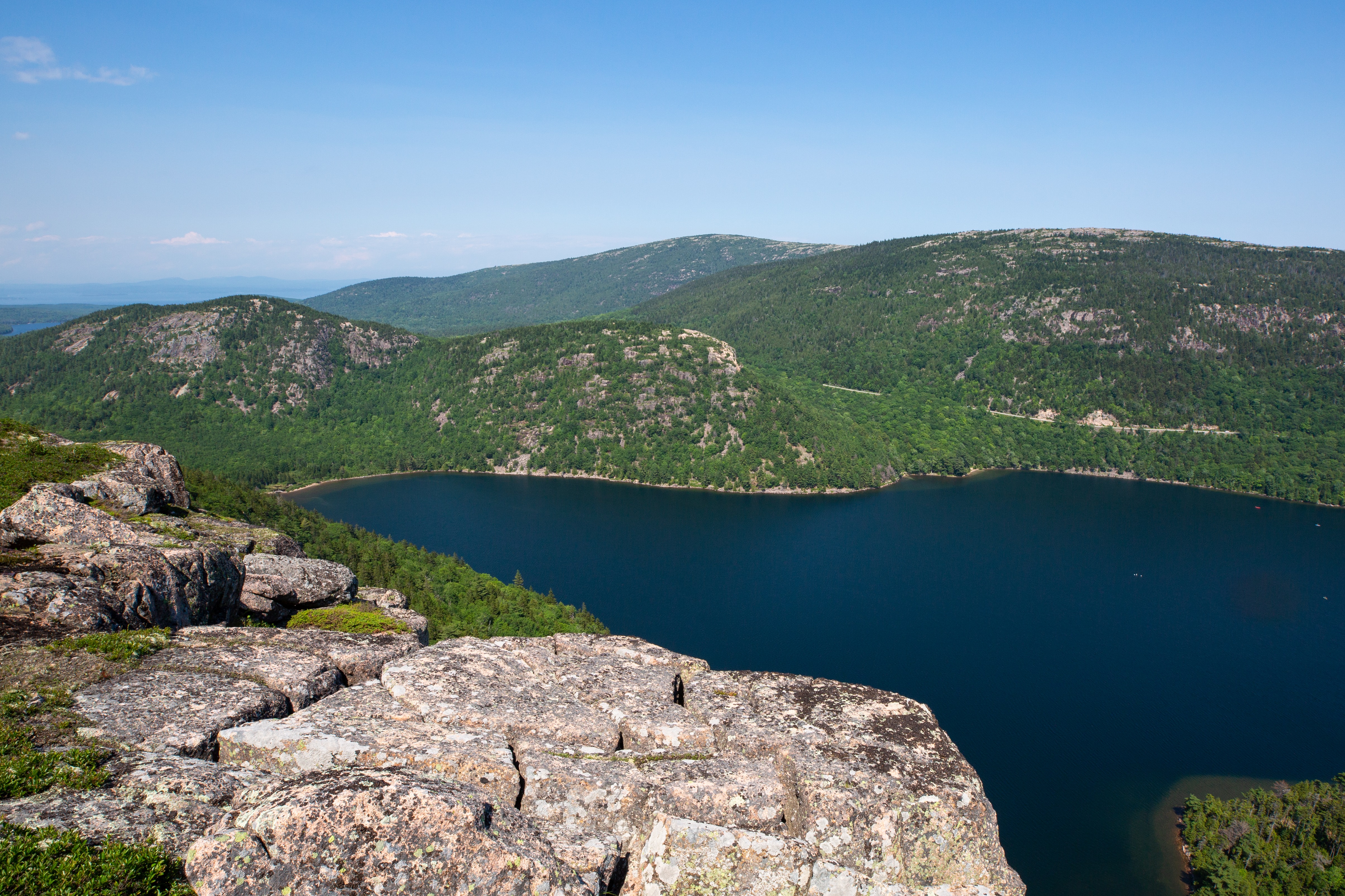
The Jordan Cliffs Loop offers a challenging hike across the steep slope, iron rungs included, and a strenuous climb up Sargent Mountain. Hikers are rewarded with panoramic views from two mountain summits and a picturesque pond nestled between the mountains. It is not recommended for small children, for people with a fear of heights, or for anyone in wet weather.
Distance: 5.0 miles round trip
Terrain: Forested path, granite stairs and slopes, iron rungs, sheer cliffs, rocky trails
Hike Description
Start at the Jordan Pond boat launch. At the pond, turn left on the Jordan Pond Trail.
When it connects with the carriage road, turn left on the carriage road. At sign post 15 turn right. The Spring Trail begins after crossing a small wooden foot bridge.
Continue for .3 miles over a gradual ascent using several sets of stone stairs.
At the junction for the Jordan Cliffs Trail, bear right and cross the carriage road.
The Jordan Cliffs Trail continues through the forest as it traverses the rugged east face of Penobscot Mountain. Stone steps, and a narrow, one log bridge provides some assistance. Enjoy views of Jordan Pond and the surrounding mountains where the trail opens up.
Be cautious as the trail narrows with a 200 foot drop and has an exposed climb with iron rungs.
After the junction with Penobscot East Trail, the Jordan Cliffs Trail begins a rugged descent for .25 miles and ends at the junction of the Deer Brook Trail and the East Cliffs Trail.
Continue for .6 miles on the Sargent East Cliffs Trail on a steep, rugged climb. Stone steps provide some assistance.
Just before the summit of Sargent Mountain, the trail levels off and then gradually ascends. The hiker is rewarded at the summit with excellent views of Jordan Pond, Eagle Lake and the surrounding mountains.
Continue down Sargent South Ridge Trail with a left turn at the junction with the Penobscot Mountain Trail. The trail descends steeply and passes Sargent Mountain Pond before ascending the north slope of Penobscot.
Continue south on the Penobscot Mountain Trail, descending on open granite sections.
At the junction of the Spring Trail, turn left and descend steeply. Use both hands and iron rungs and wooden rails to assist the rugged descent.
Cross the carriage road and returns to the start near Jordan Pond.
Pets Pets are not allowed, due to the iron rungs, ladders, and many steep sections.
Accessibility The Jordan Cliffs Loop is not accessible. The trails have sections with uneven footing, climbing, iron rungs and ladders, and steep, exposed granite throughout. There are accessible restrooms at Jordan Pond House.
Jordan Pond Carry
Jordan Pond House Carriage Road Access
Jordan Pond House Trail
Hike Jordan Pond Loop with Island Explorer Bus the Park Service's write-up
1-2 Hours · dogs allowed · Spring, Summer, Fall
Start Jordan Pond Loop
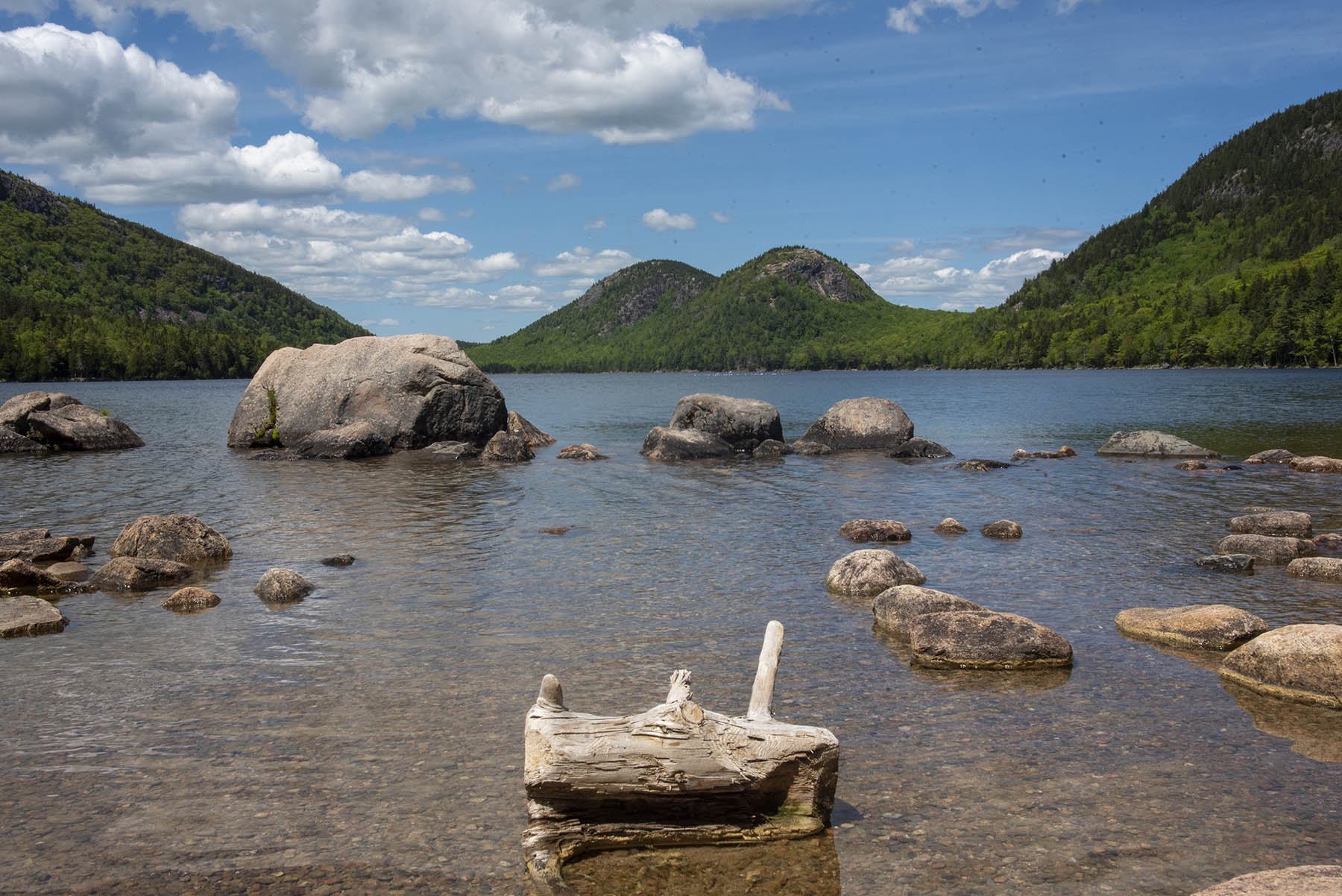
Offering visitors one of the of the iconic vistas of the Acadia, Jordan pond lies at the base three picturesque peaks: Pemetic, the Bubbles, and Penobscot. The pond is a remnant of glaciers and is the deepest of the lakes in the park at 150 feet and the second largest in the park. The calm, pristine water and the lush surroundings allow the visitor to relax on this 3.3-mile hike around the pond while soaking up some unforgettable scenery.
The Jordan Pond Loop circles one of the most picturesque ponds on the island and is considered a park crown jewel. It has been described as the “clearest lake in Maine”, and is a major tourist draw. It is at the base of several mountains that surround it, including the Bubbles on the north end, the steep rock face of Jordan Cliff to the west, and western flank of Pemetic Mountain to the east.
There are many opportunities to explore the shore of the pond and birdwatching is popular with peregrine falcons nesting in the towering rock face of Jordan Cliff during the summer, and common loons that nest on the pond below. The trail also allows for multiple opportunities to explore the shores of the pond.
Although it has no real elevation gain, the trail has three distinct walking surfaces to consider. The pond’s east side trail is mostly even with occasional exposed tree roots and rocks; the west portion requires rock hopping on and between large granite boulders, while the southwest section consists of a narrow boardwalk to protect the fragile wetland below. If looking for a hike with no obstacles, it is suggested to hike only the east side and return.
Accessibility The Jordan Pond path is an unpaved trail. The first 1.3 miles is the most even section, but there are exposed roots and rocks along the way. The west side of the pond consists of large boulders to be negotiated and narrow single-file boardwalks with widened areas to make passing possible.
Hike Sargent and Penobscot Mountains from JPH with Island Explorer Bus the Park Service's write-up
dogs allowed · Spring, Summer, Fall
Start Sargent and Penobscot Mountains from JPH
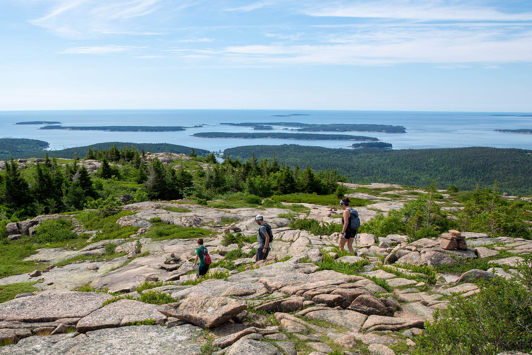
Depending on the route you choose the assent to Penobscot and Sargent Mountains are a challenging, and strenuous climb that is sometimes difficult, but rewarding. The hike from Jordan Pond House across Spring Trail up Penobscot Mountain Trail and then on to Sargent South Ridge Trail to Sargent Mountain is approx. 6- or 7-miles roundtrip and is made possible by the Island Explorer Bus. The trails consist of forested path, granite stairs and slopes, and iron rungs, in a mostly conifer forest. Hikers are rewarded with panoramic views from two mountain summits and a picturesque pond nestled between the mountains. It is not recommended for small children, for people with a fear of heights, or for anyone in wet weather. Restrooms available at Jordan Pond House.
This 3-to-4-hour hike provides challenging trails and rewarding views. Several trails lead to Sargent Mountain and Sargent Mountain Pond in Acadia National Park. All of them are steep and all of them offer stunning views of mountain, valley, and sea. Start your experience by walking to the edge of Jordan Pond in front of the Pond House to enjoy the spectacular view of the Bubble Mountains across the lake. Cross near signpost 15 on the Carriage Road to access the Spring trail to begin your climb. You can bag multiple peaks along your hike including Sargent Mountain, Penobscot Mountain, Gilmore Peak, Parkman Mountain, Bald Peak, and Cedar Swamp Mountain if you wish to increase the length and difficulty of your hike. Including all these peaks in a single day is possible but plan in advance and be ready to dedicate many hours to hiking. Bring lots of water, snacks, and layers.
Several trails lead to Penobscot and Sargent Mountains in Acadia National Park. All of them are steep and made of boot-battering granite, and all of them offer stunning views of mountain, valley, and sea. The trails consist of forested path, granite stairs and slopes, and iron rungs, in a mostly conifer forest. Sargent Mountain Pond lies between the two peaks. It is small, tranquil and beautiful. You may wish to swim or picnic by this mountain pond.
THINGS TO DO:
Photography - The views of the Bubble Mountains across Jordan Pond are known the world over for their spectacular beauty. Along the hike, enjoy views of Jordan Pond and the surrounding mountains where the trail opens up.
Birdwatching- Watch for soaring birds over Jordan Pond and loons in the lake. (Nearby Jordan Cliffs Trail is sometimes closed to protect nesting peregrine falcons. Check the park website or the Hulls Cove Visitors Center for trail closures).
Passport Stamp Collecting - Visitors can collect a passport stamp from Jordan Pond House at mile 0.0 at the start of the trek.
Historic Structures -Jordan Pond House is located on the southern end of Jordan Pond. It has been a scenic, recreational, and dining destination on Mount Desert Island since the nineteenth century.
Dining - Jordan Pond House serves tea and popovers, as it has since the 1890s, in addition to other dining options. The Carriage Road Carry takeout restaurant is located on the second-floor landing of the restaurant. It serves a light breakfast including coffee and sandwiches for lunch. The gift shop offers drinks, ice cream and other trail snacks, located on the send floor. All these dining options are open seasonally mid-May through mid-October. Enjoy superb views of the Bubble Mountains across the lake from the landing.
Restrooms - There are bathrooms at Jordan Pond House.
Accessibility This trail is recommended for experienced, fit hikers only. It is not recommended for small children, for people with a fear of heights, or for anyone in wet weather.
Jordan Pond House Walkways
Jordan Pond Nature Trail
Boat launches
Along the way Jordan Pond
Jordan Pond Path
Boat launches
Along the way Jordan Pond
Hike Jordan Pond Loop with Island Explorer Bus the Park Service's write-up
1-2 Hours · dogs allowed · Spring, Summer, Fall
Start Jordan Pond Loop
Offering visitors one of the of the iconic vistas of the Acadia, Jordan pond lies at the base three picturesque peaks: Pemetic, the Bubbles, and Penobscot. The pond is a remnant of glaciers and is the deepest of the lakes in the park at 150 feet and the second largest in the park. The calm, pristine water and the lush surroundings allow the visitor to relax on this 3.3-mile hike around the pond while soaking up some unforgettable scenery.
The Jordan Pond Loop circles one of the most picturesque ponds on the island and is considered a park crown jewel. It has been described as the “clearest lake in Maine”, and is a major tourist draw. It is at the base of several mountains that surround it, including the Bubbles on the north end, the steep rock face of Jordan Cliff to the west, and western flank of Pemetic Mountain to the east.
There are many opportunities to explore the shore of the pond and birdwatching is popular with peregrine falcons nesting in the towering rock face of Jordan Cliff during the summer, and common loons that nest on the pond below. The trail also allows for multiple opportunities to explore the shores of the pond.
Although it has no real elevation gain, the trail has three distinct walking surfaces to consider. The pond’s east side trail is mostly even with occasional exposed tree roots and rocks; the west portion requires rock hopping on and between large granite boulders, while the southwest section consists of a narrow boardwalk to protect the fragile wetland below. If looking for a hike with no obstacles, it is suggested to hike only the east side and return.
Accessibility The Jordan Pond path is an unpaved trail. The first 1.3 miles is the most even section, but there are exposed roots and rocks along the way. The west side of the pond consists of large boulders to be negotiated and narrow single-file boardwalks with widened areas to make passing possible.
Hike Jordan Pond Path the Park Service's write-up
1-3 Hours · dogs allowed
Start Jordan Pond

The Jordan Pond Path traverses the shore of Jordan Pond, one of Acadia’s most iconic landscapes. Located in a steep valley carved out by the retreat of glaciers, Jordan Pond is bordered by Penobscot, Pemetic, and two rounded peaks known as the Bubbles. Listen for the calls of common loons, search for signs of beaver activity, and watch the granite cliffs above for nesting peregrine falcons.
Distance: 3.3 mile loop
Terrain: Forested areas with uneven footing on wooden boardwalks, rocks, and footbridges
Jordan Pond is designated public water supply, so wading and swimming are prohibited at all times.
Hike Description
Note: The western half of the Jordan Pond Path is significantly more difficult than the eastern half, and may be challenging for families with small children, seniors, and people with mobility impairments.
The full loop consists of the eastern half, a short walk along the coast at the northern end of the pond, and a trek back to the trailhead along the western half (or said route in reverse). Visitors are encouraged to begin with the eastern half of the loop in case they choose to turn around, and the description below follows this order. See the photo gallery below the description for visual references.
At several points along the Jordan Pond Path, it intersects with other trails. Please check the difficulty and elevation profiles of these trails and make sure you are prepared before choosing to hike them.
Eastern Half
Start at the boat launch for Jordan Pond. Turn right and follow along the east shoreline.
The path is defined by even terrain and crushed stone underfoot. Use caution on stepping stones and bridges that allow water to flow from the slope above.
About two-thirds of the way along the eastern half of the loop, the Jordan Pond Path intersects with the Bubbles Trail and Jordan Pond Carry. This half of the Bubbles Trail leads to South Bubble and Bubble Rock.
Continue along the path to reach the northern end of the pond, which is marked by the Bubbles Divide Trailhead, as well as the Jordan Pond Buoy and two wooden log bridges slightly further along.
Western Half
Starting from the wooden bridges, continue along the path into the forest. Shortly after the bridge, the path intersects with the Deer Brook Trail, which crosses the Eagle Lake/Jordan Pond carriage road and eventually intersects with trails leading to Sargent Peak and Penobscot Peak.
The forest then gives way to an open, rocky area consisting of boulders that broke off from the sheer cliffs above. This area, while mostly level, involves stepping stones, uneven footing, and may require some scrambling. Use caution when climbing the rocks.
After the rocks is a raised wooden plank boardwalk through a forested area. Please stay on the path to protect vegetation.
At the end of the plank boardwalk, the path follows a short walk through the forest before coming to a small stone bridge. The gravel trail crossing the bridge is the Eagle Lake/Jordan Pond carriage road. Visitors may turn right after the bridge to continue along the carriage road, which intersects with the Jordan Stream Path further down.
To finish the Jordan Pond Path, turn left after the bridge into the small stone courtyard. Follow the shoreline to return to the Jordan Pond Path Trailhead.
Accessibility The Jordan Pond Path is not accessible. The trail has uneven footing, stepping stones, and a small bridge. The Jordan Pond restuarant area and boat launch are accessible.
Hike Pemetic Mountain Loop the Park Service's write-up
2-3 Hours · no dogs · Spring, Summer, Fall
Start Pemetic Mountain
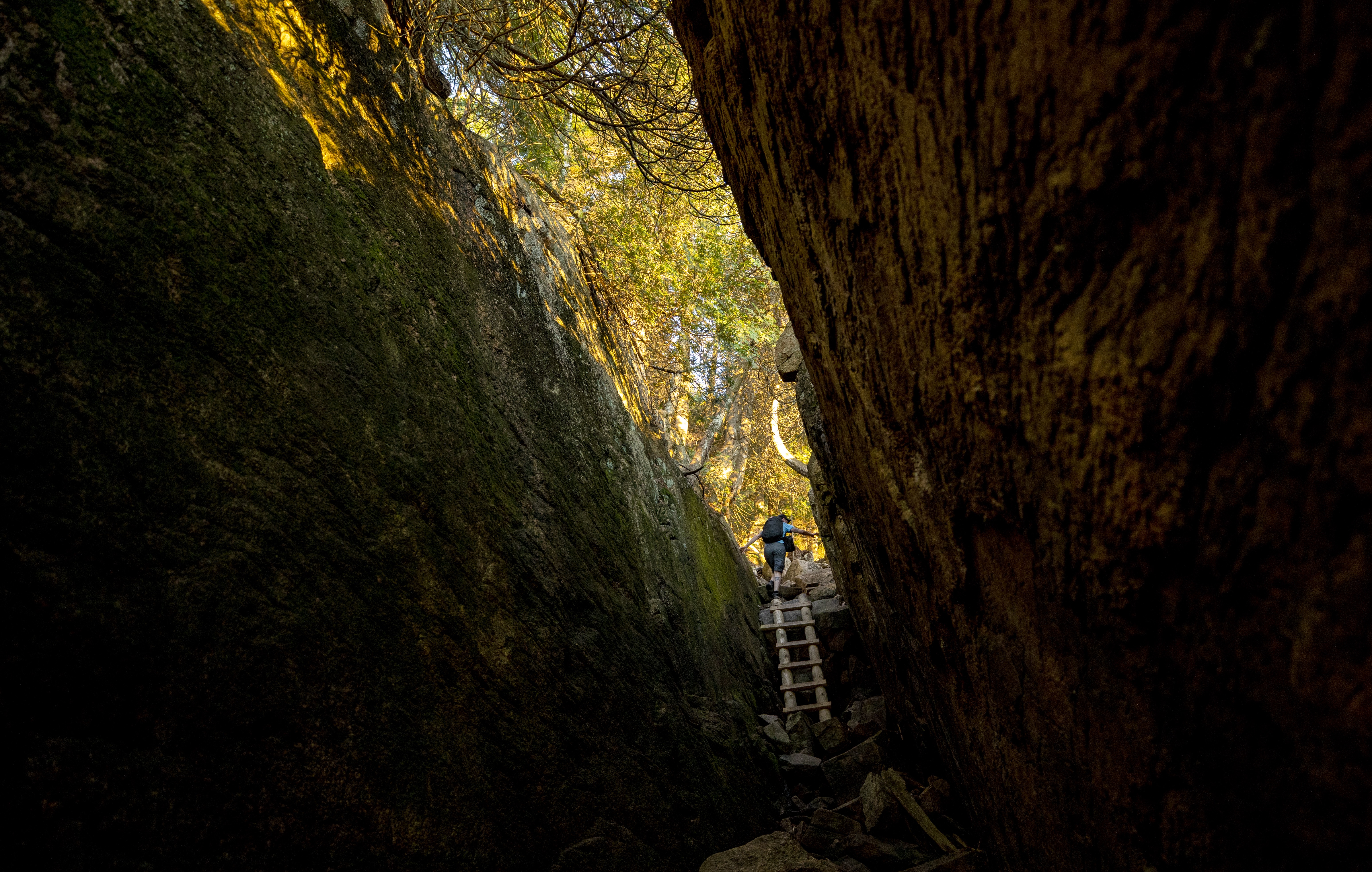
The Pemetic Mountain Loop combines a variety of hiking environments from an easy walk along a scenic pond to a rugged ascent. It culminates at an open granite summit with excellent views of the surrounding landscape, ocean and outlying islands.
Distance: 4 miles round trip
Terrain: Flat forested lake side trail, steep granite ledges and rocky trails, granite ridgelines, rooted forest trails
Hike Description
Start at Jordan Pond boat launch and turn right onto the Jordan Pond Path.
Continue along the east side of the pond for .8 miles. Enjoy views of South Bubble.
Turn right onto Jordan Pond Carry. Continue this trail to Bubble Rock parking lot.
Cross the road at the Pemetic Mountain Northwest Ridge Trailhead.
This trail follows a ravine with steep rocky granite sections, some requiring scrambling. Several iron rungs and a wooden ladder lead you to the summit of Pemetic Mountain.
Enjoy views of Jordan Pond, Penobscot Mountain, and Sargent Mountain from the summit.
Follow signs to descend on the Pemetic South Ridge Trail.
At the junction, turn right onto Bubble and Jordan Pond Path. Continue for .4 miles.
Cross the road to return to the Jordan Pond House and parking areas.
Pets Dogs are not allowed since there are iron rungs, ladders, and many steep sections.
Accessibility Pemetic Mountain Loop is not accessible. There is uneven footing, steep sections, and iron rungs and ladders along the route. There are accessible restrooms at Jordan Pond House.
Jordan Stream
Jordan Stream Carriage Road
Jordan Stream Path
Jordan/Wildwood
Bridges
Along the way Clearance: 12 feet 9 inches
Jordan/Wildwood Carriage Road
Bridges
Along the way Clearance: 12 feet 9 inches
Kane Path
Kebo Brook Trail
Hike Kebo Brook Trail to Kebo Mountain the Park Service's write-up
1-2 Hours · dogs allowed
Start Kebo Brook Trailhead
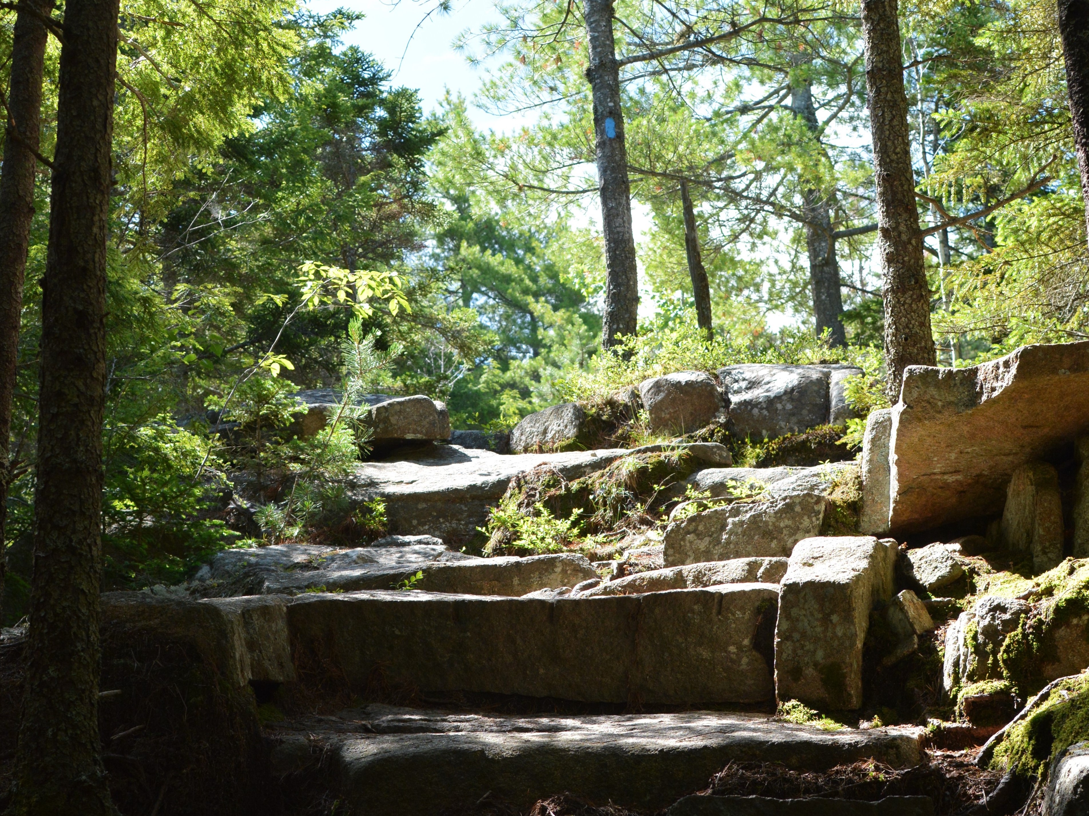
This trail mixes quiet, forested areas with rocky sections to quickly reach a mountain summit. It ranges from a fairly level and packed trail to climbing up steps and exposed granite areas. Enjoy the sound of water while crossing over Kebo Brook. Partial views of Frenchman Bay can be seen from the summit of Kebo Mountain.
Distance: 2 miles round trip from trailhead at Cadillac North Ridge Island Explorer Stop
Terrain and Safety: The Kebo Brook Trail is fairly level and packed with some large rocks to walk on. It changes to steep, short rocky sections once on Kebo Mountain Trail until the summit. Good foot wear is recommended. Be cautious crossing the Park Loop Road after turning onto Kebo Mountain Trail.
Hike Description
The trail begins at Kebo Brook Trailhead. Follow signs for Kebo Brook Trail and Cadillac North Ridge.
The trail continues along forested area. Follow signs and continue straight at the junction with Cadillac North Ridge Trail.
Follow blue blazes for another .5 miles. Follow signs straight at the junction with the Gorge Path. Walk on large, flat stones placed along the trail to cross Kebo Brook and other streams.
Turn right at the junction of Kebo Brook Trail and Kebo Mountain Trail. Follow steps up and use caution as trail continues across Park Loop Road.
Follow trail as it climbs a steep .3 miles to the summit of Kebo Mountain.
Return down the same trail. Watch footing on steep, short rocky sections.
Accessibility The Kebo Brook Trail and Kebo Mountain Trail are not accessible. The trails have uneven footing and a few places where high steps and scrambling over rocks is required.
Kebo Mountain Trail
Hike Kebo Brook Trail to Kebo Mountain the Park Service's write-up
1-2 Hours · dogs allowed
Start Kebo Brook Trailhead
This trail mixes quiet, forested areas with rocky sections to quickly reach a mountain summit. It ranges from a fairly level and packed trail to climbing up steps and exposed granite areas. Enjoy the sound of water while crossing over Kebo Brook. Partial views of Frenchman Bay can be seen from the summit of Kebo Mountain.
Distance: 2 miles round trip from trailhead at Cadillac North Ridge Island Explorer Stop
Terrain and Safety: The Kebo Brook Trail is fairly level and packed with some large rocks to walk on. It changes to steep, short rocky sections once on Kebo Mountain Trail until the summit. Good foot wear is recommended. Be cautious crossing the Park Loop Road after turning onto Kebo Mountain Trail.
Hike Description
The trail begins at Kebo Brook Trailhead. Follow signs for Kebo Brook Trail and Cadillac North Ridge.
The trail continues along forested area. Follow signs and continue straight at the junction with Cadillac North Ridge Trail.
Follow blue blazes for another .5 miles. Follow signs straight at the junction with the Gorge Path. Walk on large, flat stones placed along the trail to cross Kebo Brook and other streams.
Turn right at the junction of Kebo Brook Trail and Kebo Mountain Trail. Follow steps up and use caution as trail continues across Park Loop Road.
Follow trail as it climbs a steep .3 miles to the summit of Kebo Mountain.
Return down the same trail. Watch footing on steep, short rocky sections.
Accessibility The Kebo Brook Trail and Kebo Mountain Trail are not accessible. The trails have uneven footing and a few places where high steps and scrambling over rocks is required.
Kurt Diederichs Climb
Hike Kurt Diederichs Climb the Park Service's write-up
20-30 Minutes · dogs allowed · Spring, Summer, Fall
Start Kurt Diederichs Climb
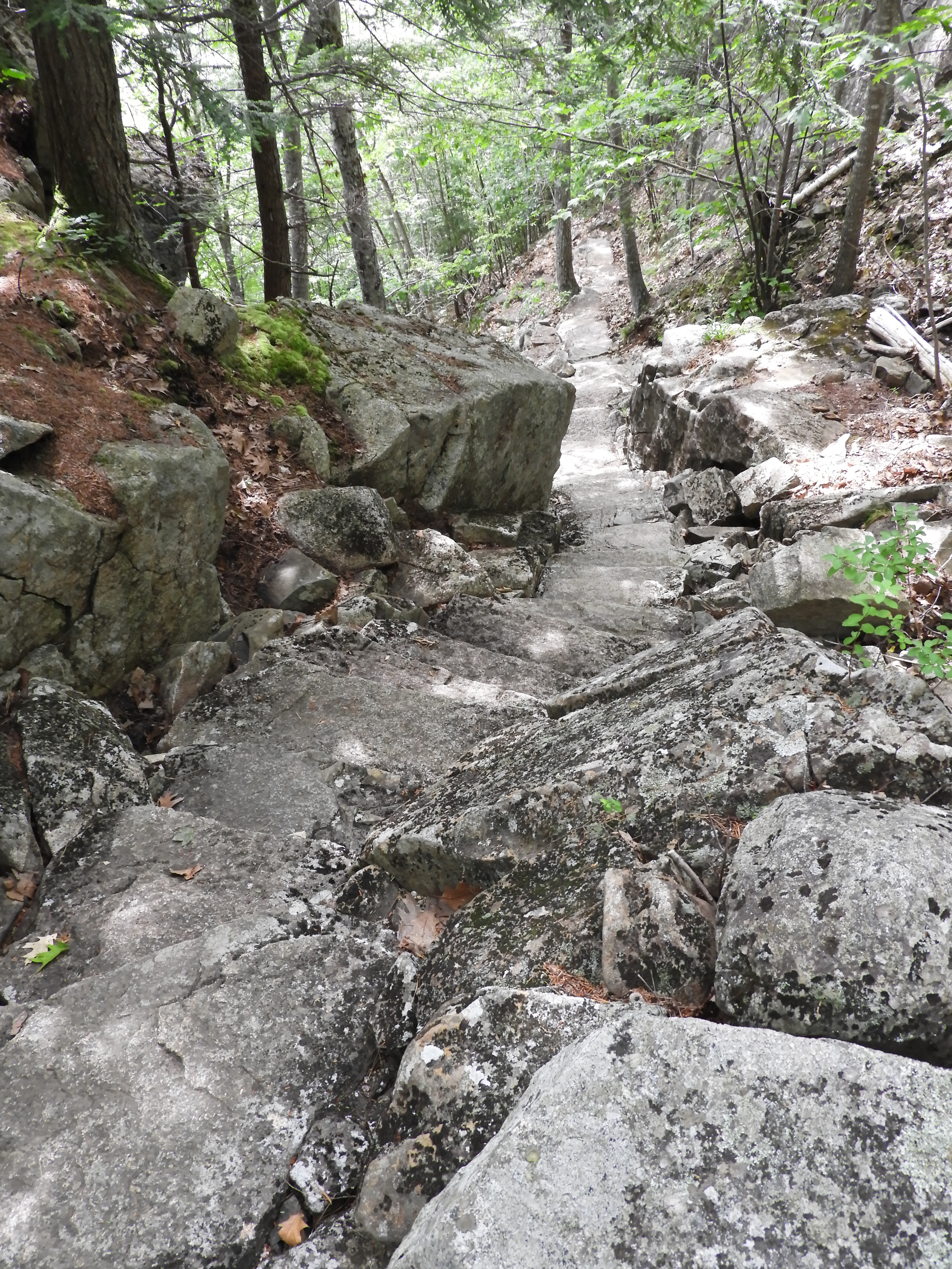
Kurt Diederichs Climb is a memorial trail at Sieur de Monts. It is a .4 mile steep ascent with many granite steps leading from the Tarn. It is one of the routes to reach Schiff Path, and eventually the summit of Dorr Mountain.
Kurt Diederich, and his daughter Elsa, lived in Washington D.C. after the death of his wife Sybil. They summered at his aunt’s cottage, Bowling Green, in Bar Harbor. Kurt died prematurely from anesthesia in 1913 at age 26. His aunt, Enid Hunt Slater, provided funds for a memorial path built in his honor. The sixth step up from the beginning of the trail at the Tarn is engraved with “Kurt Diederichs Climb.”
Distance: .4 miles one way
Terrain: Forested area with steep, rocky sections and many granite steps
Hike Description
Start at the Sieur de Monts Nature Center.
Walk towards the Abbe Museum and turn slightly left to follow the Jesup Path.
Continue for .2 miles before reaching the intersection of Kurt Diederichs Climb and Kane Path.
Turn right onto Kurt Diederichs Climb. Check the sixth step to see the engravement.
Begin the quick and steep ascent for less than .4 miles on mostly granite steps.
The trail ends at the intersection with Schiff Path.
To reach the summit of Dorr Mountain, follow Schiff Path for just over 1 mile.
To return to Sieur de Monts, retrace your steps back or take Emery Path or Homans Path. All three trails are quick, steep descent with granite steps. Use caution, especially when the rock is wet and slippery.
Accessibility Kurt Diederich's Climb is not accessible. The trail has uneven footing, granite stairs, and steep sections throughout. There is an accessible restroom at Sieur de Monts.
Ladder Trail
Ledge Trail
Little Harbor Brook Trail
Little Hunters Beach Trail
Little Long Pond Loop
Little Long Pond Loop Carriage Road
Long Pond Trail
Boat launches
Along the way Long Pond - South End
Hike Beech Mountain South Ridge Loop the Park Service's write-up
1-2 Hours · dogs allowed
Start Beech Mountain
This moderate hike traverses a loop through the forest before ascending Beech Mountain, providing visitors with access to a fire tower and views of Long Pond, Mansell Mountain, and the west side of Mount Desert Island. This hike is also a good sunset option, but carry appropriate gear and headlamps when hiking at dusk and dark.
Distance: 2.1 miles round trip
Terrain: Forested path, rocky trails, granite stairs and slopes, wooden steps
Hike Description
The loop begins from the Beech Mountain parking lot, on the northwest side of the lot.
At the first junction, stay right to follow the longer path to the summit.
The trail begins as a gradual forested path, however, as elevation increases, the trail becomes rockier.
The trail opens up at .5 miles to granite slabs which provide sweeping views of Long Pond and Mansell Mountain. This is a popular spot to watch the sunset.
After .1 miles, keep left at the intersection towards Beech Mountain summit. The trail will feature granite and wooden steps to the summit.
At the next intersection, just below the fire tower, keep right to access the summit and fire tower. The first platform of the fire tower is open and provides views of Somes Sound, Echo Lake, Acadia Mountain, and other mountains on the east side of the Mount Desert Island.
Follow blue blazes to the right of the granite to begin the Beech Mountain South Ridge Trail.
The trail descends down a few sections of granite slope before becoming a forested path with stone stairs down the mountain. This section of trail is not recommended in wet weather.
After .8 miles, keep left at the Valley Trail intersection to return to the Beech Mountain Parking Area.
Follow the trail .8 miles back to the parking lot. This section of trail is flat and mainly smooth, forested path, with a few stone steps.
Accessibility The Beech Mountain South Ridge Loop is not accessible. The trail has uneven footing and short, steep sections throughout. There are no accessible restrooms at the trailhead.
Hike Beech Mountain Trail the Park Service's write-up
1-2 Hours · dogs allowed
Start Beech Mountain
A short, moderate loop on the west side of Mount Desert Island, Beech Mountain Trail provides hikers with views of Long Pond and Mansell Mountain on the way up and access to one of the few remaining fire towers in the area. This hike is also a good sunset option, but carry appropriate gear and headlamps when hiking at dusk and dark.
Distance: 1.2 miles round trip
Terrain: Forested path, rocky trails, granite stairs and slopes, wooden steps
Hike Description
The loop begins from the Beech Mountain parking lot, on the northwest side of the lot.
At the first junction, stay right to follow the longer path to the summit.
The trail begins as a gradual forested path, however, as elevation increases, the trail becomes rockier.
The trail opens up at .5 miles to granite slabs which provide sweeping views of Long Pond and Mansell Mountain. This is a popular spot to watch the sunset.
After .1 miles, keep left at the intersection towards Beech Mountain summit. The trail will feature granite and wooden steps to the summit.
At the next intersection, just below the fire tower, keep right to access the summit and fire tower. The first platform of the fire tower is open and provides views of Somes Sound, Echo Lake, Acadia Mountain, and other mountains on the east side of the Mount Desert Island.
Retrace to the intersection just below the summit, stay straight and follow the sign showing .4 miles to the Beech Mountain Parking Area.
This trail contains multiple steep granite slopes before descending into the woods. This section of trail is not recommended in wet weather.
Follow the trail down a quick, steep rocky section. At next intersection, follow the trail back to the parking lot.
Accessibility Beech Mountain Trail is not accessible. The trail has uneven footing and short, steep sections throughout. There are no accessible restrooms at the trailhead.
Hike Perpendicular and Razorback Loop the Park Service's write-up
1-2 Hours · no dogs · Spring, Summer, Fall
Start Long Pond, Mansell Mountain
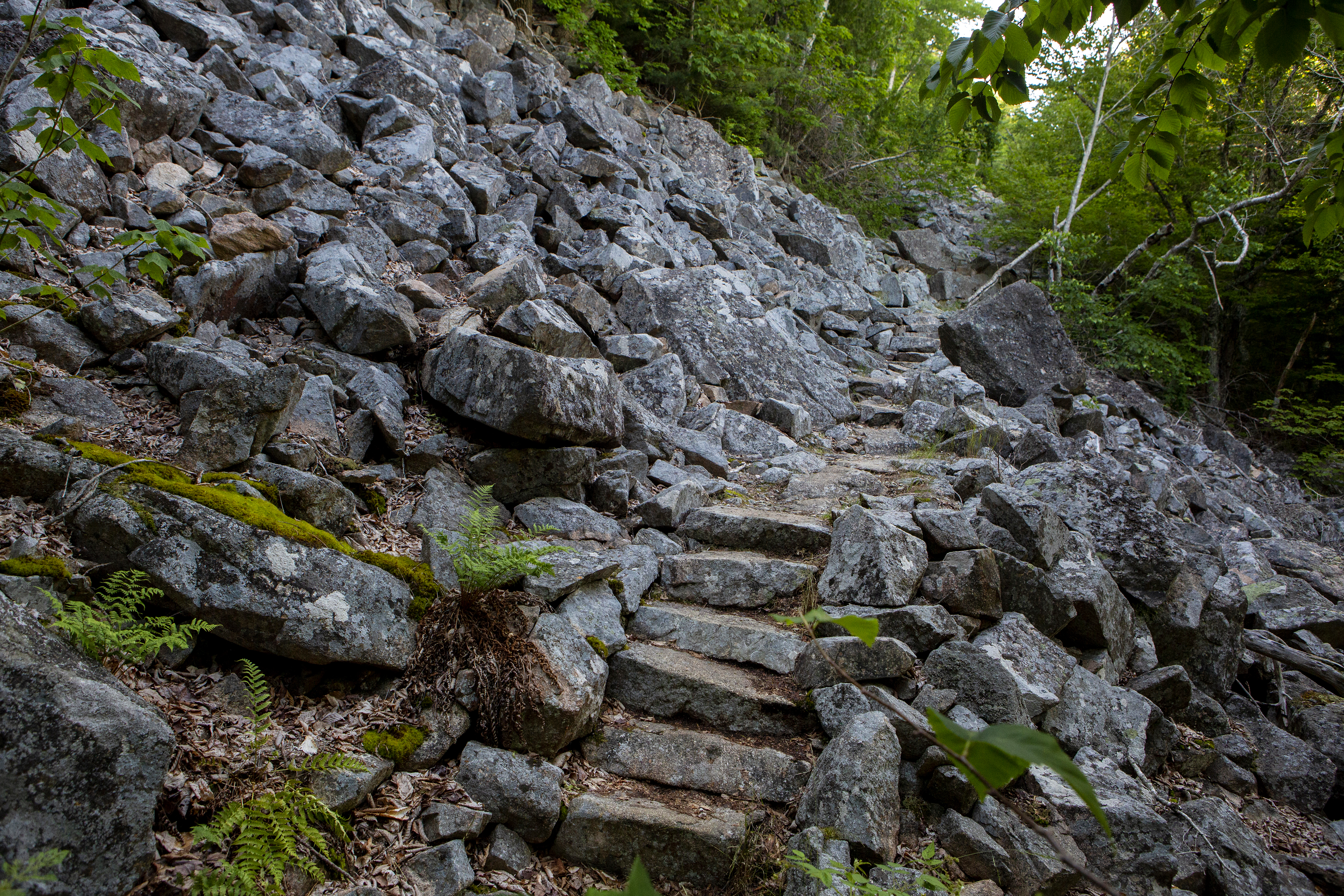
The Perpendicular and Razorback Loop features a steep hike up to the summit of Mansell Mountain on the west side of Mount Desert Island. Although the trail and summit are mostly wooded, it is a quieter, strenuous hiking opportunity. The Perpendicular Trail was built by the Civilian Conservation Corps (CCC) from 1933 to 1934. Flat boulders were laid end-to-end to form an easier walking path over the talus slope and rock steps were also added. The crew covered stones with moss and planted ferns to help them blend with their natural surroundings.
Distance: 2.7 miles round trip
Terrain: Forested paths, granite staircase, rocky trails, and rooted paths
NOTE: Pets are prohibited on the Perpendicular Trail (Mansell Mountain) since there are many steep sections, stairs, iron rungs, and a ladder.
Hike Description
The hike starts on the Long Pond Trail, located at the far end of the parking lot.
Walk .2 miles before reaching the junction of the Perpendicular Trail.
Over 300 cut granite steps, a few iron rungs and a small ladder allows hikers to ascend steep slope of Mansell Mountain. There are a few views of Long Pond between the trees.
Just before the trail turns away from the face, there is a short spur trail to an overlook of Beech Mountain, Long Pond and the outlying islands.
The trail levels off in the woods before reaching the summit of Mansell Mountain. There are no views from the summit.
Descend past the junction for the Mansell Mountain Trail before ending at the Razorback Trail.
Turn left (south) on the Razorback Trail. The trail provides great views as it steeply descends along the ridge before entering the forest and ending at the Gilley Trail.
Turn left on the Cold Brook Trail and continue onto the Long Pond Trail before ending at the parking lot.
Pets Pets are prohibited on Perpendicular Trail (Mansell Mountain) since there are many steep sections, stairs, iron rungs, and a ladder.
Accessibility The Perpendicular and Razorback Loop is not accessible. The trails have uneven footing and hundreds of granite stairs. There are no accessible restrooms at the trailhead.
Lower Amphitheatre
Lower Amphitheatre Carriage Road
Lower Hadlock Trail
Hike Norumbega Mountain Loop the Park Service's write-up
2-3 Hours · dogs allowed
Start Norumbega Mountain
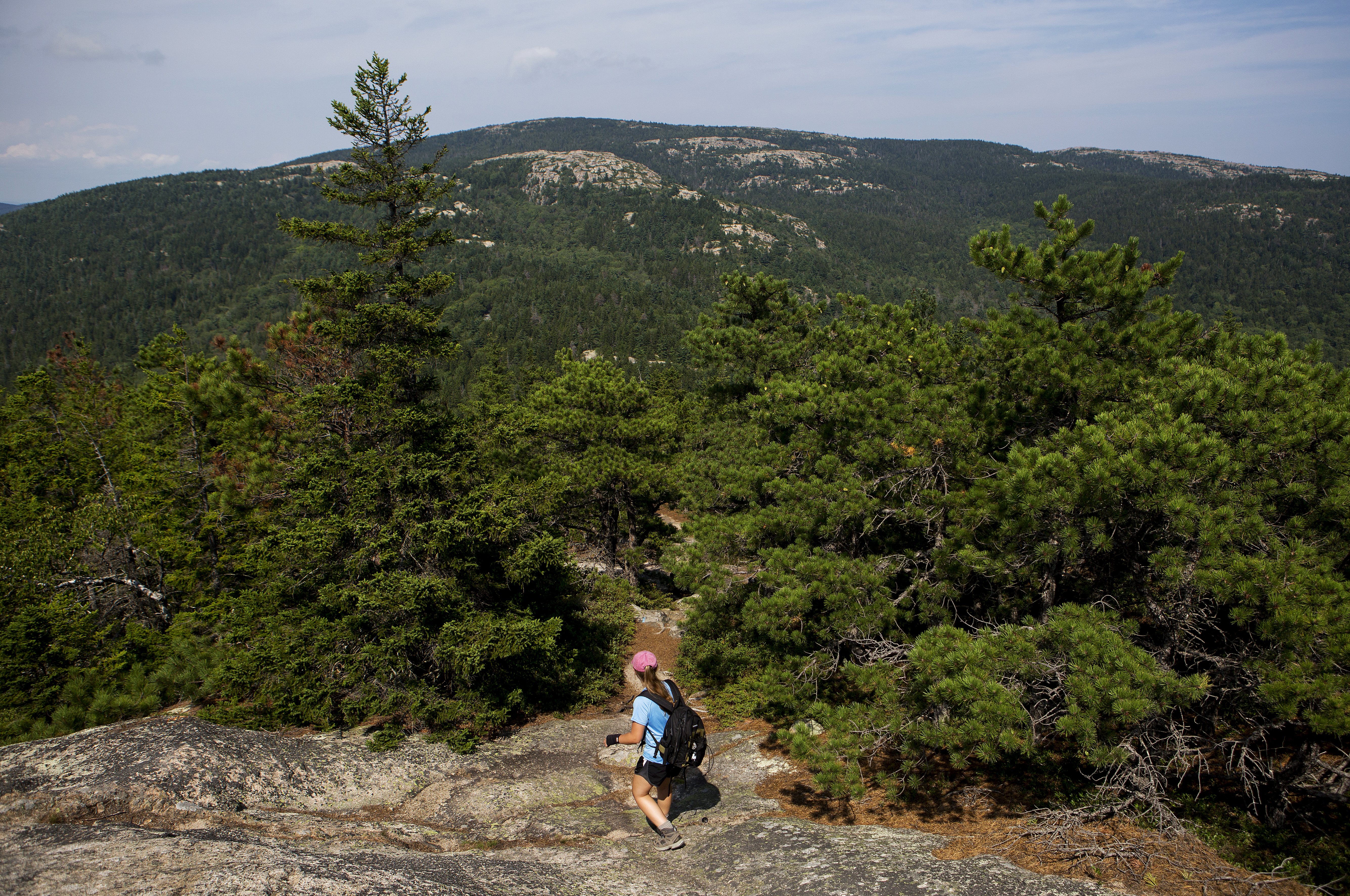
The Norumbega Mountain Loop features a steep hike up to the summit of Norumbega Mountain, then a gradual descent in the forest before hiking along the western shore of Lower Hadlock Pond. Portions of hike are on boardwalks since the trail goes over boggy areas.
Distance: 3.2 miles round trip
Terrain: The trail is rocky with uneven footing. Short, steep granite sections throughout. Some boardwalk sections along the pond's edge.
Hike Description
The Norumbega Loop starts on the northern end of the parking area. Follow signs for the Goat Trail.
The Goat Trail quickly ascends a steep section with granite boulders It joins with the Norumbega Mountain Trail along the ridge, and directly to the left of the signposts is the true summit of Norumbega Mountain at 852 ft.
The trail descends gradually through a forested area with some views of Somes Sound.
At the bottom, it reaches Lower Hadlock Pond and turns left on the Hadlock Pond Trail along the shoreline. The trail has some rooted sections and boardwalks over boggy areas before reaching a small waterfall where water flows from Upper Hadlock to Lower Hadlock Pond.
At the junction, take the Norumbega Connector to lead back to the parking area.
For a longer hike, add .4 miles by following the Hadlock Ponds Trail around Upper Hadlock Pond and Hadlock Brook Trail back to the highway.
Accessibility Norumbega Mountain Loop is not accessible. The trails have uneven footing, short, steep sections that require some scrambling, and some narrow boardwalks. There are no accessible restrooms at the trailhead.
Lower Harbor Trail
Lower Norumbega Trail
Man o'War Brook Trail
Mansell Mountain Trail
Hike Beech Mountain South Ridge Loop the Park Service's write-up
1-2 Hours · dogs allowed
Start Beech Mountain
This moderate hike traverses a loop through the forest before ascending Beech Mountain, providing visitors with access to a fire tower and views of Long Pond, Mansell Mountain, and the west side of Mount Desert Island. This hike is also a good sunset option, but carry appropriate gear and headlamps when hiking at dusk and dark.
Distance: 2.1 miles round trip
Terrain: Forested path, rocky trails, granite stairs and slopes, wooden steps
Hike Description
The loop begins from the Beech Mountain parking lot, on the northwest side of the lot.
At the first junction, stay right to follow the longer path to the summit.
The trail begins as a gradual forested path, however, as elevation increases, the trail becomes rockier.
The trail opens up at .5 miles to granite slabs which provide sweeping views of Long Pond and Mansell Mountain. This is a popular spot to watch the sunset.
After .1 miles, keep left at the intersection towards Beech Mountain summit. The trail will feature granite and wooden steps to the summit.
At the next intersection, just below the fire tower, keep right to access the summit and fire tower. The first platform of the fire tower is open and provides views of Somes Sound, Echo Lake, Acadia Mountain, and other mountains on the east side of the Mount Desert Island.
Follow blue blazes to the right of the granite to begin the Beech Mountain South Ridge Trail.
The trail descends down a few sections of granite slope before becoming a forested path with stone stairs down the mountain. This section of trail is not recommended in wet weather.
After .8 miles, keep left at the Valley Trail intersection to return to the Beech Mountain Parking Area.
Follow the trail .8 miles back to the parking lot. This section of trail is flat and mainly smooth, forested path, with a few stone steps.
Accessibility The Beech Mountain South Ridge Loop is not accessible. The trail has uneven footing and short, steep sections throughout. There are no accessible restrooms at the trailhead.
Hike Beech Mountain Trail the Park Service's write-up
1-2 Hours · dogs allowed
Start Beech Mountain
A short, moderate loop on the west side of Mount Desert Island, Beech Mountain Trail provides hikers with views of Long Pond and Mansell Mountain on the way up and access to one of the few remaining fire towers in the area. This hike is also a good sunset option, but carry appropriate gear and headlamps when hiking at dusk and dark.
Distance: 1.2 miles round trip
Terrain: Forested path, rocky trails, granite stairs and slopes, wooden steps
Hike Description
The loop begins from the Beech Mountain parking lot, on the northwest side of the lot.
At the first junction, stay right to follow the longer path to the summit.
The trail begins as a gradual forested path, however, as elevation increases, the trail becomes rockier.
The trail opens up at .5 miles to granite slabs which provide sweeping views of Long Pond and Mansell Mountain. This is a popular spot to watch the sunset.
After .1 miles, keep left at the intersection towards Beech Mountain summit. The trail will feature granite and wooden steps to the summit.
At the next intersection, just below the fire tower, keep right to access the summit and fire tower. The first platform of the fire tower is open and provides views of Somes Sound, Echo Lake, Acadia Mountain, and other mountains on the east side of the Mount Desert Island.
Retrace to the intersection just below the summit, stay straight and follow the sign showing .4 miles to the Beech Mountain Parking Area.
This trail contains multiple steep granite slopes before descending into the woods. This section of trail is not recommended in wet weather.
Follow the trail down a quick, steep rocky section. At next intersection, follow the trail back to the parking lot.
Accessibility Beech Mountain Trail is not accessible. The trail has uneven footing and short, steep sections throughout. There are no accessible restrooms at the trailhead.
Hike Perpendicular and Razorback Loop the Park Service's write-up
1-2 Hours · no dogs · Spring, Summer, Fall
Start Long Pond, Mansell Mountain
The Perpendicular and Razorback Loop features a steep hike up to the summit of Mansell Mountain on the west side of Mount Desert Island. Although the trail and summit are mostly wooded, it is a quieter, strenuous hiking opportunity. The Perpendicular Trail was built by the Civilian Conservation Corps (CCC) from 1933 to 1934. Flat boulders were laid end-to-end to form an easier walking path over the talus slope and rock steps were also added. The crew covered stones with moss and planted ferns to help them blend with their natural surroundings.
Distance: 2.7 miles round trip
Terrain: Forested paths, granite staircase, rocky trails, and rooted paths
NOTE: Pets are prohibited on the Perpendicular Trail (Mansell Mountain) since there are many steep sections, stairs, iron rungs, and a ladder.
Hike Description
The hike starts on the Long Pond Trail, located at the far end of the parking lot.
Walk .2 miles before reaching the junction of the Perpendicular Trail.
Over 300 cut granite steps, a few iron rungs and a small ladder allows hikers to ascend steep slope of Mansell Mountain. There are a few views of Long Pond between the trees.
Just before the trail turns away from the face, there is a short spur trail to an overlook of Beech Mountain, Long Pond and the outlying islands.
The trail levels off in the woods before reaching the summit of Mansell Mountain. There are no views from the summit.
Descend past the junction for the Mansell Mountain Trail before ending at the Razorback Trail.
Turn left (south) on the Razorback Trail. The trail provides great views as it steeply descends along the ridge before entering the forest and ending at the Gilley Trail.
Turn left on the Cold Brook Trail and continue onto the Long Pond Trail before ending at the parking lot.
Pets Pets are prohibited on Perpendicular Trail (Mansell Mountain) since there are many steep sections, stairs, iron rungs, and a ladder.
Accessibility The Perpendicular and Razorback Loop is not accessible. The trails have uneven footing and hundreds of granite stairs. There are no accessible restrooms at the trailhead.
Hike Western Mountain Loop the Park Service's write-up
2-3 Hours · dogs allowed
Start Long Pond, Western Mountain
The Western Mountain Loop travels through forest and up summits over a series of trails on the west side of Mount Desert Island. Although there are not many views, it is a challenging hike with hundreds of cut stone steps on the historic Perpendicular Trail and other steep sections along the way. Western Mountain collectively refers to Mansell Mountain and Bernard Mountain.
Distance: 3.8 miles round trip
Terrain: Forested paths, granite staircase, rocky trails, and rooted paths
Hike Description
Begin from the parking area/boat launch located at the end of the Long Pond Road in Southwest Harbor.
The hike starts on the Long Pond Trail, located at the west end of the parking area, behind a building.
Walk 0.2 miles before reaching the second trail junction, where you will turn left onto of the Perpendicular Trail.
A few iron rungs, a small ladder, and over 300 cut granite steps allow hikers to ascend the steep slope of Mansell Mountain. There are a few views of Long Pond between the trees.
Just before the trail turns away from the face, there is a short spur trail to an overlook of Beech Mountain, Long Pond and the outlying islands.
The trail levels off in the woods before reaching the summit of Mansell Mountain. There are no views from the summit.
Continue past the summit on the Mansell Mountain Trail. At the next junction, turn right (north) on the Razorback Trail.
Bear right at the next intersection to remain on the Razorback Trail to Great Notch.
At the intersection with the Great Notch Trail, continue straight onto Bernard Mountain Trail. Follow this for 0.4 miles, steeply climbing up the side of the mountain over cliffs and tree roots.
Pass the summit of Knight Nubble.
At the junction with the Sluiceway Trail (Little Notch), continue straight and additional 0.2 miles to reach the summit of Bernard Mountain. Although rising to 1,071 ft, the summit is mostly wooded with minimal views. Return back down to the trail junction.
Turn right and descend on the Sluiceway Trail for 0.5 miles.
At the junction with the Gilley Trail, turn left.
Shortly afterward, at the intersection with the Great Notch Trail, turn right and continue the descent. Stay right at the intersections with the Razorback and Mansell Mountain Trails and you will eventually come to the trailhead at Gilley Field parking.
Cross the parking area to continue straight on Cold Brook Trail back to the parking lot at the south end of Long Pond.
Accessibility The Western Mountain Loop is not accessible. The trails have uneven footing, hundreds of granite stairs, iron rungs, a ladder, and many steep sections. There are no accessible restrooms at the trailhead.
Maple Spring Trail
Median Ridge Trail
Middle Peak Road
Mountain Brook Bike Path
Murphy Lane
Nat Merchant Trail
Norumbega Mountain Trail
Hike Norumbega Mountain Loop the Park Service's write-up
2-3 Hours · dogs allowed
Start Norumbega Mountain
The Norumbega Mountain Loop features a steep hike up to the summit of Norumbega Mountain, then a gradual descent in the forest before hiking along the western shore of Lower Hadlock Pond. Portions of hike are on boardwalks since the trail goes over boggy areas.
Distance: 3.2 miles round trip
Terrain: The trail is rocky with uneven footing. Short, steep granite sections throughout. Some boardwalk sections along the pond's edge.
Hike Description
The Norumbega Loop starts on the northern end of the parking area. Follow signs for the Goat Trail.
The Goat Trail quickly ascends a steep section with granite boulders It joins with the Norumbega Mountain Trail along the ridge, and directly to the left of the signposts is the true summit of Norumbega Mountain at 852 ft.
The trail descends gradually through a forested area with some views of Somes Sound.
At the bottom, it reaches Lower Hadlock Pond and turns left on the Hadlock Pond Trail along the shoreline. The trail has some rooted sections and boardwalks over boggy areas before reaching a small waterfall where water flows from Upper Hadlock to Lower Hadlock Pond.
At the junction, take the Norumbega Connector to lead back to the parking area.
For a longer hike, add .4 miles by following the Hadlock Ponds Trail around Upper Hadlock Pond and Hadlock Brook Trail back to the highway.
Accessibility Norumbega Mountain Loop is not accessible. The trails have uneven footing, short, steep sections that require some scrambling, and some narrow boardwalks. There are no accessible restrooms at the trailhead.
Ocean Path
Hike Ocean Path Trail the Park Service's write-up
2-4 Hours · dogs allowed
Start Ocean Path Trail

Explore vast slabs of pink granite, picturesque cliffs, and breathtaking oceans views as the Ocean Path takes you along the bold coast of Maine. The Ocean Path is a great way to access Thunder Hole and Otter Point from Sand Beach on a gradual hike. Find a plaque dedicated to John D. Rockefeller for all of the work he did in providing the experience that people continue to have today in Acadia National Park.
Distance: 2.2 mile traill one way, 4.4 miles round trip. The trail is 0.7 miles from Sand Beach to Thunder Hole.
Terrain/Safety: From Sand Beach to Thunder Hole the trail is a mix of concrete and packed gravel surfaces. The rest of the trail is gravelly and rocky with uneven surfaces. There are two staircases present 1.4 miles into the trail as the path climbs around a rocky cliff section. Steep drops into the ocean. Keep children away from the edge. Good footwear is recommended.
Visitors can ride the fare-free Island Explorer to visit Ocean Path. The bus drops off and picks up at regular intervals throughout the day at the Island Explorer sign located in the right lane of Park Loop Road at Thunder Hole, and on the right side of Sand Beach lower parking lot.
Hike Description
The trail begins from the upper parking lot of Sand Beach. It can also be accessed from the Thunder Hole and Otter Point parking areas.
Leaving from Sand Beach the trail consists of concrete and packed gravel sections that gradually rise over a hill providing a overarching view across the entire ocean path coastline.
Gradually descend on accessible trail to Thunder Hole, an underwater sea cave that with the right conditions (2 hours before high-tide and high winds) can produce thundering crashes heard up and down the trail.
Continuing past Thunder Hole the trail becomes uneven but remains gradual as it begins climbing up through a spruce/fir forest.
Arrive at Otter Cliffs, 110-ft cliffs that mark the highest point along the Ocean Path. Climb up a granite staircase to a walkway that parallels the road to cross over the cliffs and descend down another staircase on the other side.
The trail continues down to Otter Point where granite slabs are surrounded by ocean on both sides. Many people return to Sand Beach from here but a couple hundred more feet the trail ends at Otter Cove with a small staircase and a stunning view across the Otter Cove causeway with Cadillac and Dorr Mountain in the background.
Accessibility Ocean Path is accessible from the upper parking lot of Sand Beach to Thunder Hole. From Thunder Hole to Otter Point the trail becomes uneven and granite staircases help bring the trail past Otter Cliffs. There is accessible parking at the Sand Beach parking areas as well as accessible restrooms.
Hike Ocean Path Trail with Island Explorer Bus the Park Service's write-up
1-2 Hours · dogs allowed · Spring, Summer, Fall
Start The Ocean Path Trail
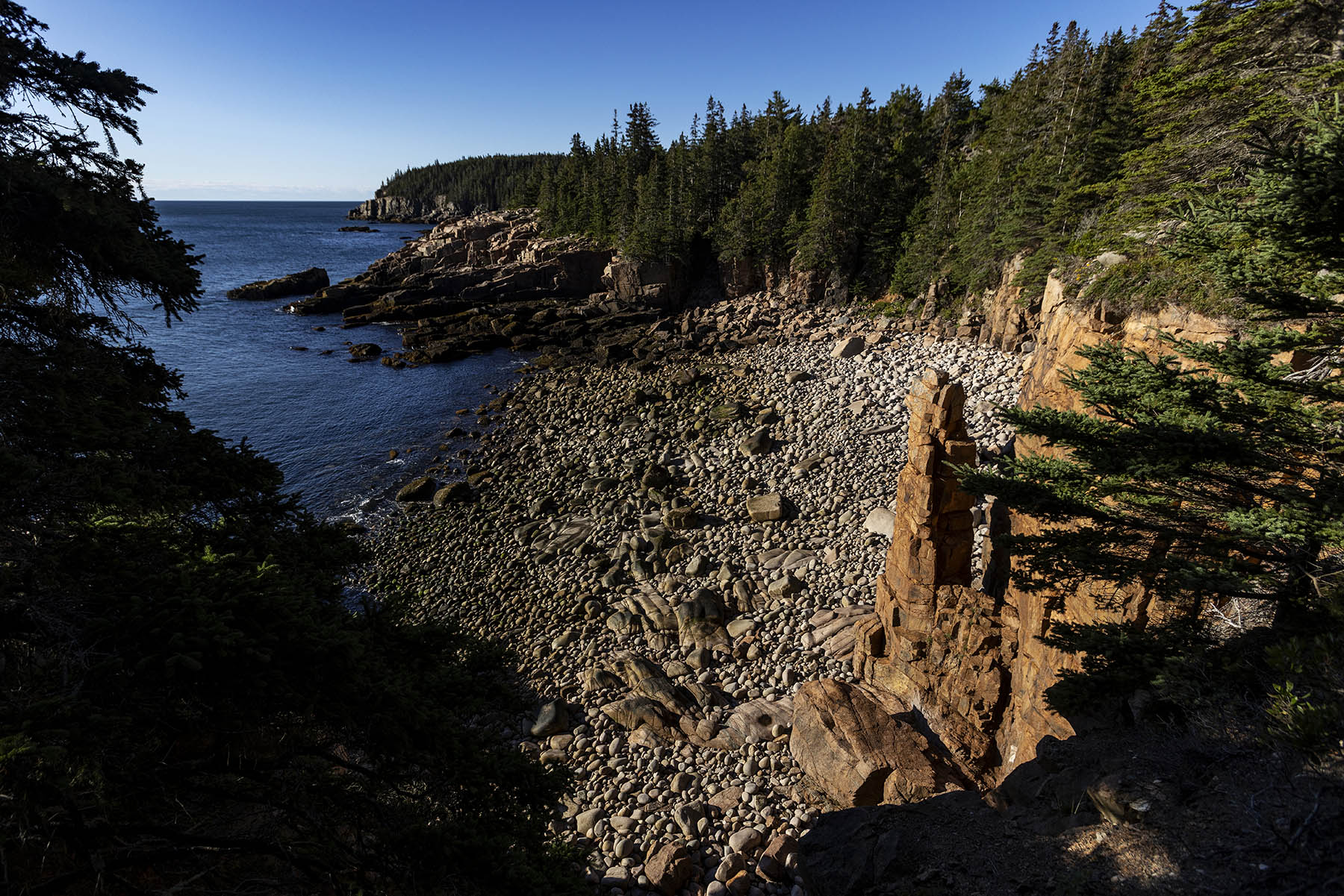
The Ocean Path stretches 2.2 miles along Acadia’s coastline. With a sand beach, rocky inlets and granite cliffs, this scenic trail is rightfully popular for those looking to get the most out of their trip to Acadia. This trail links together many of the Parks “must see” locations in one hike and has four official bus stops: one at its start and end and two along the way for maximum trail flexibility.
Hiking the Ocean Path is a relaxing and engaging way to explore many of Acadia’s iconic locations and vistas. By combining this hike with the bus, it cuts what would otherwise be an out-and-back hike in half while removing the stress of finding parking at any of the numerous popular destinations along this stretch. The trail is mostly flat and the section from Sand Beach to Thunder Hole is a 4-foot-wide path of mixed gravel and concrete with a few shallow steps. Beyond popular destinations and countless scenic vistas, other activities include swimming at Sand Beach, collecting a passport stamp from Thunder Hole and bird watching. Hikers can start at either end of the path, Sand Beach or Otter Point, and there are an additional two bus stops along the trail as well that can also act as the beginning/end of the hike. This flexibility is great for mixed groups or hikers unsure if they can make it 2.2 miles.
Swimming: Sand Beach is where the Ocean Path begins and is the easiest place to access the ocean for swimming in the whole park. The water is cold (around 55 degrees Fahrenheit in summer) so use caution and plan for a short swim.
Bird Watching: Ocean Path can be a great location to watch for sea birds like cormorants, guillemots and gulls
Passport Stamp Collecting: The Thunder Hole passport stamp can be found at the Thunder Hole gift shop at mile 0.7
Accessibility Ocean Path is an unpaved trail. The first .7 miles from Sand Beach to Thunder Hole is 3-4 feet wide, mixed gravel and concrete with a minimal grade and some small steps. Past Thunder Hole, the trail becomes uneven and narrows.
Orange & Black Path
Otter Cove Trail
Paradise Hill
Paradise Hill Carriage Road
Parkman Mountain Trail
Hike Bald Peak and Parkman Mountain Loop the Park Service's write-up
1-2 Hours · dogs allowed
Start Bald Peak and Parkman Mountain
A short, challenging hike to the top of two mountains each over 900 feet. The hike crosses carriage roads before summiting for ocean views of the Somes Sound and Northeast Harbor. Start with Bald Peak Trail, as it offers steeper terrain than its western Parkman Mountain Trail counterpart. Choose dry weather to avoid hazards on slippery, exposed granite sections. This hike is also a good sunset option, but carry appropriate gear and headlamps when hiking at dusk and dark.
Distance: 2.7 miles round trip
Terrain: Forested path, steep granite and challenging rocky footing throughout with one iron rung.
Hike Description
The hike starts at Sargent Mountain Trailhead and descends slightly through the forest on the Hadlock Brook Trail.
Pass the Parkman Mountain Trail junction. After .2 miles, come to the junction for the Bald Peak Trail and turn left.
The Bald Peak Trail becomes more rugged as it follows a stream and begins to ascend Bald Peak. There are two carriage road crossings.
After crossing the second carriage road, the hike becomes significantly steeper and exposed. Blue blazes and stone Bates cairns on the open granite face mark the trail. This section is not recommended in wet weather.
At the top of Bald Peak, enjoy views of Upper Hadlock Pond and the outlying islands.
Continue down the north side of the mountain before ascending to the junction with Parkman Mountain Trail. Take a right for .1 mi to the summit.
Retrace the trail southward, pass the junction again, and continue the descent into the forest. There are two steep ledges and one iron rung. These sections are challenging when wet.
The trail crosses the carriage road three times before ending at the junction where the hike started. A right turn leads back the ME Route 198 and the parking lot.
Accessibility Bald Peak and Parkman Mountain Loop is not accessible. The trails have uneven footing and short, steep sections requiring some scrambling throughout. There are no accessible restrooms at the trailhead.
Parkman Mt. Parking
Parkman/Aunt Betty
Parkman/Aunt Betty Carriage Road
Pemetic East Cliff Trail
Pemetic North Ridge Trail
Pemetic Northwest Trail
Pemetic South Ridge Trail
Hike Pemetic South Ridge the Park Service's write-up
2-3 Hours · dogs allowed
Start Pemetic Mountain

Sitting in between two iconic locations in Acadia National Park, Cadillac Mountain and Jordan Pond, is Pemetic Mountain. This spectacular mountain gives those who summit it panoramic views of Jordan Pond, Eagle Lake, Cadillac Mountain, and the bold coast of Maine stretching towards the horizon in every direction. Enjoy simple dirt trails and granite ridgeline throughout this hike.
Distance: 2.0 miles one-way. 4.0 miles round trip.
Terrain: The trail is rocky with uneven footing. Good foot wear is recommended. Rocky granite, short steep sections. Hiking in inclement weather is advised.
Hike Description
The hike begins at the end of the Jordan Pond North Parking. The trail head is north of the pit toilet. Follow this trail 0.1 miles where it comes upon the Jordan Pond Path.
Turn right on Jordan Pond Path and cross the stone walkway. At the end of this walkway there is a stump that has Jordan Pond Path with an arrow carved into it. There is a trail that goes right at this post with no name. Take this trail.
Follow this trail 0.1 miles where it will run into the Park Loop Road. Safely cross this road and continue walking what is called the Bubble and Jordan Pond Path. Continue another 0.4 miles on this dirt and granite step path until you reach the trail marker for Pemetic South Ridge.
Ascend the south ridge of Pemetic Mountain for 1.3 miles. This trail involves uneven ground, shorter rock scrambles, and granite ridgeline. It will slowly climb out of the forest exposing dramatic vistas in every direction as the trail approaches the summit at 1248 ft.
Return back to Jordan Pond the same way to complete this hike.
Accessibility The Pemetic South Ridge Trail is not accessible. The trail has uneven footing and many places where scrambling over rocks is required.
Penobscot East Trail
Penobscot Mountain Trail
Perpendicular Trail
Hike Perpendicular and Razorback Loop the Park Service's write-up
1-2 Hours · no dogs · Spring, Summer, Fall
Start Long Pond, Mansell Mountain
The Perpendicular and Razorback Loop features a steep hike up to the summit of Mansell Mountain on the west side of Mount Desert Island. Although the trail and summit are mostly wooded, it is a quieter, strenuous hiking opportunity. The Perpendicular Trail was built by the Civilian Conservation Corps (CCC) from 1933 to 1934. Flat boulders were laid end-to-end to form an easier walking path over the talus slope and rock steps were also added. The crew covered stones with moss and planted ferns to help them blend with their natural surroundings.
Distance: 2.7 miles round trip
Terrain: Forested paths, granite staircase, rocky trails, and rooted paths
NOTE: Pets are prohibited on the Perpendicular Trail (Mansell Mountain) since there are many steep sections, stairs, iron rungs, and a ladder.
Hike Description
The hike starts on the Long Pond Trail, located at the far end of the parking lot.
Walk .2 miles before reaching the junction of the Perpendicular Trail.
Over 300 cut granite steps, a few iron rungs and a small ladder allows hikers to ascend steep slope of Mansell Mountain. There are a few views of Long Pond between the trees.
Just before the trail turns away from the face, there is a short spur trail to an overlook of Beech Mountain, Long Pond and the outlying islands.
The trail levels off in the woods before reaching the summit of Mansell Mountain. There are no views from the summit.
Descend past the junction for the Mansell Mountain Trail before ending at the Razorback Trail.
Turn left (south) on the Razorback Trail. The trail provides great views as it steeply descends along the ridge before entering the forest and ending at the Gilley Trail.
Turn left on the Cold Brook Trail and continue onto the Long Pond Trail before ending at the parking lot.
Pets Pets are prohibited on Perpendicular Trail (Mansell Mountain) since there are many steep sections, stairs, iron rungs, and a ladder.
Accessibility The Perpendicular and Razorback Loop is not accessible. The trails have uneven footing and hundreds of granite stairs. There are no accessible restrooms at the trailhead.
Precipice Trail
Hike Precipice Loop the Park Service's write-up
2-3 Hours · no dogs · Spring, Fall
Start Precipice Trailhead
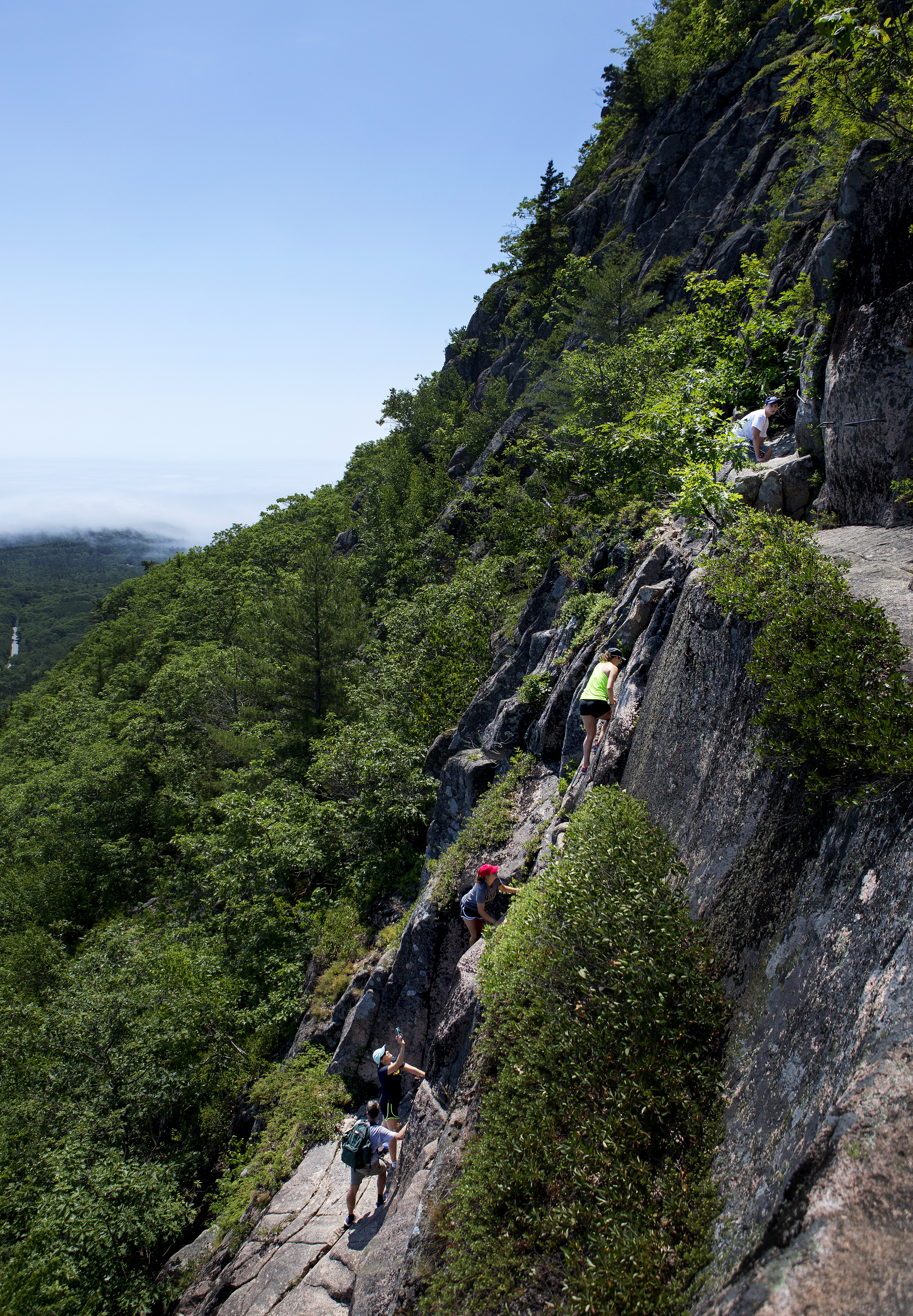
Rising over 1,000 feet in 0.9 miles, the Precipice Trail requires physical and mental strength. It is a rugged, non-technical climb with open cliff faces and iron rungs. Upon reaching the summit of Champlain Mountain, climbers are rewarded with impressive views. It is not recommended for small children, for people with a fear of heights, or for anyone in wet weather. Descending the Precipice is dangerous and not advised.
Distance: 3.2 miles round trip
Terrain: Boulders, Granite stairs and slopes, iron rungs, sheer cliffs, rocky trails
Hike Description
The Precipice Loop starts with a traverse of rugged slope. A wooden bridge and occasional iron handrail allow climbers to traverse narrow, exposed ledges.
At the junction with the Orange and Black Path, the Precipice Trail continues to the left.
Several series of long iron rungs and ladders lead up the open, vertical cliff face.
Continue along granite slopes until you reach the summit.
Enjoy views of Frenchman Bay and the surrounding area from the top of Champlain Mountain.
Descending the Precipice Trail is dangerous and not advised. Return on the North Ridge Trail of Champlain Mountain. This is a moderately steep descent on open granite.
At the next junction, in 0.6 miles, turn right onto the Orange and Black Path. There are several steep sections, so care is advised.
Turn left to continue on the Champlain North Ridge Trail and to a small alternate parking area on the Park Loop Road. You will need to walk the Park Loop Road back to the parking area.
At the base of a stone staircase, the Orange and Black Path splits. A right traverses the steep slope of Champlain's East Face and intersects with the Precipice Trail.
For an easier return to the parking lot, turn left and continue down to the Park Loop Road. Take a right and walk back to the parking area. Watch for traffic.
Pets Pets are not allowed, due to the iron rungs, ladders, and many steep sections.
Accessibility The Precipice Loop is not accessible. The trails have sections with uneven footing, climbing, iron rungs and ladders, and steep, exposed granite throughout. There are no accessible restrooms at the trailhead.
Pretty Marsh Fire Road
Pretty Marsh Picnic Area
Quarry Trail
Razorback Trail
Hike Perpendicular and Razorback Loop the Park Service's write-up
1-2 Hours · no dogs · Spring, Summer, Fall
Start Long Pond, Mansell Mountain
The Perpendicular and Razorback Loop features a steep hike up to the summit of Mansell Mountain on the west side of Mount Desert Island. Although the trail and summit are mostly wooded, it is a quieter, strenuous hiking opportunity. The Perpendicular Trail was built by the Civilian Conservation Corps (CCC) from 1933 to 1934. Flat boulders were laid end-to-end to form an easier walking path over the talus slope and rock steps were also added. The crew covered stones with moss and planted ferns to help them blend with their natural surroundings.
Distance: 2.7 miles round trip
Terrain: Forested paths, granite staircase, rocky trails, and rooted paths
NOTE: Pets are prohibited on the Perpendicular Trail (Mansell Mountain) since there are many steep sections, stairs, iron rungs, and a ladder.
Hike Description
The hike starts on the Long Pond Trail, located at the far end of the parking lot.
Walk .2 miles before reaching the junction of the Perpendicular Trail.
Over 300 cut granite steps, a few iron rungs and a small ladder allows hikers to ascend steep slope of Mansell Mountain. There are a few views of Long Pond between the trees.
Just before the trail turns away from the face, there is a short spur trail to an overlook of Beech Mountain, Long Pond and the outlying islands.
The trail levels off in the woods before reaching the summit of Mansell Mountain. There are no views from the summit.
Descend past the junction for the Mansell Mountain Trail before ending at the Razorback Trail.
Turn left (south) on the Razorback Trail. The trail provides great views as it steeply descends along the ridge before entering the forest and ending at the Gilley Trail.
Turn left on the Cold Brook Trail and continue onto the Long Pond Trail before ending at the parking lot.
Pets Pets are prohibited on Perpendicular Trail (Mansell Mountain) since there are many steep sections, stairs, iron rungs, and a ladder.
Accessibility The Perpendicular and Razorback Loop is not accessible. The trails have uneven footing and hundreds of granite stairs. There are no accessible restrooms at the trailhead.
Redfield Hill
Redfield Hill Carriage Road
Bridges
Along the way Clearance: 10 feet 4 inches
Saint Sauveur Mountain Trail
Sand Beach Connector
Sand Beach Developed Area
Sand Beach Stairway
Sargent East Cliffs Trail
Sargent Northwest Trail
Sargent South Ridge Trail
Satterlee Trail
Schiff Path
Hike Emery Path the Park Service's write-up
20-45 Minutes · dogs allowed · Spring, Summer, Fall
Start Emery Path
Emery Path is a memorial path at Sieur de Monts. It is a .5 mile steep ascent with examples of high quality trail work. It is one of the routes to reach Schiff Path, and eventually the summit of Dorr Mountain. It is said to have been one of George Dorr's favorite trails.
Emery Path was funded by Mrs. Alfred Anson in memory of her first husband, John Emery. John Emery was a successful developer of commercial and residential real estate in Cincinnati, Ohio. The trail was improved by the Civilian Conservation Corps (CCC) in 1934.
Distance: .5 miles one way
Terrain: Forested area with steep and rocky sections, granite steps, narrow passages
Hike Description
Start at the Sieur de Monts Nature Center. Cross the small wooden bridge and turn left.
Turn right to pass by two large stones inscribed with "Sieur de Monts Spring" and "Sweet Waters of Acadia" and proceed to the start of Emery Path.
The trail quickly ascends for .5 miles on granite stairs and steep sections through the forest.
To reach the summit of Dorr Mountain, continue onto Schiff Path for.9 miles.
To return to Sieur de Monts, retrace your steps back or take Homans Path or Kurt Diederich's Climb. All three trails are quick, steep descent with granite steps. Use caution, especially when the rock is wet and slippery.
Accessibility Emery Path is not accessible. The trail has uneven footing, steep sections, a narrow passage, and granite stairs throughout. There is an accessible restroom at Sieur de Monts.
Hike Schiff Path the Park Service's write-up
30-60 Minutes · dogs allowed · Spring, Summer, Fall
Start Schiff Path
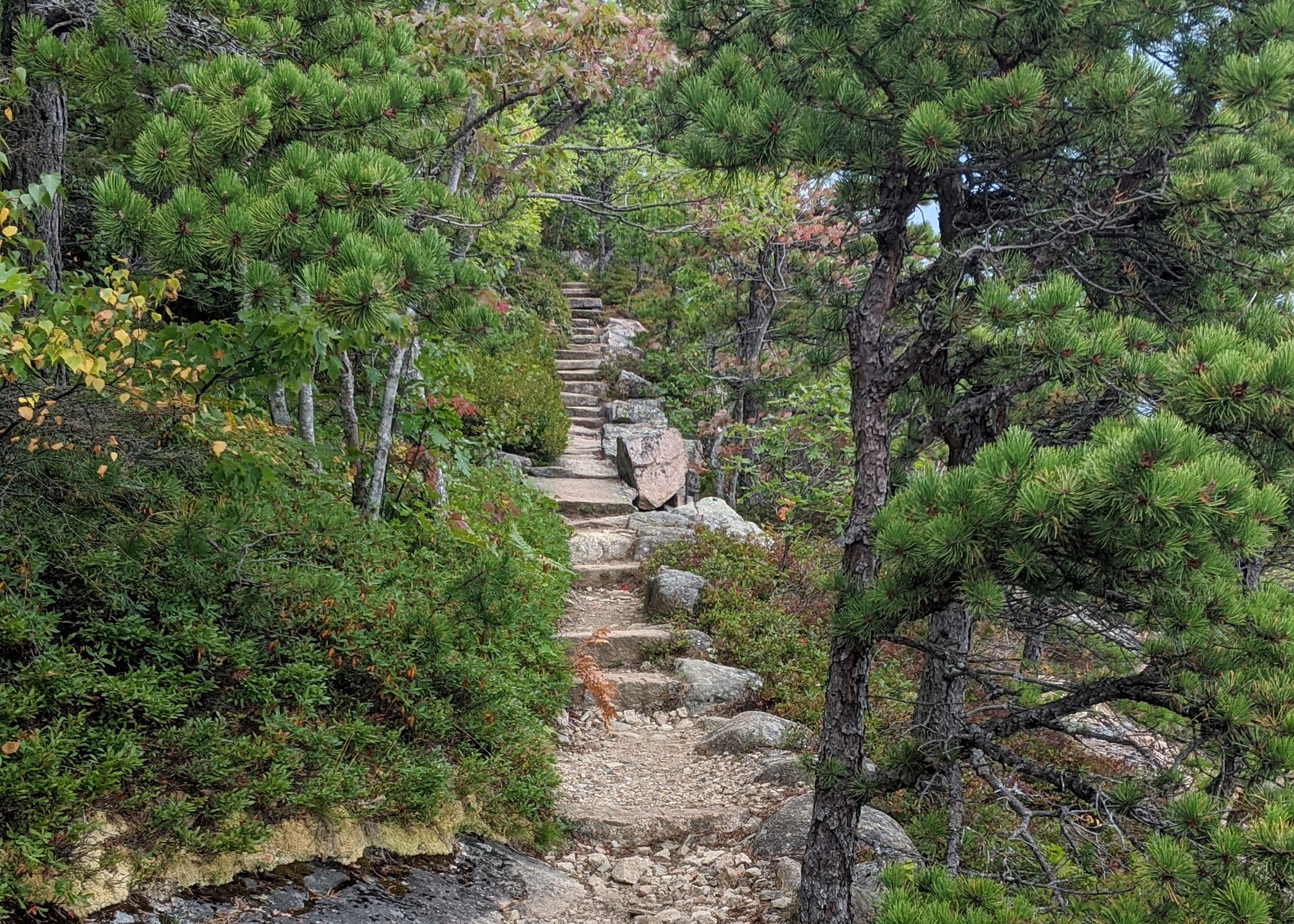
Schiff Path is a popular trail that runs along the east face of Dorr Mountain and provides views of Frenchman Bay and the Tarn. It acts as a link between several trails starting at Sieur de Monts and the summit of Dorr Mountain.
Schiff Path is named after Jacob Henry Schiff. He was the senior partner of the New York investment banking house Kuhn Loeb and gained prestige in business and philanthropy. It is one of the memorial trails built at Sieur de Monts by George Dorr, in conjunction with the Bar Harbor Village Improvement Association.
Distance: Varies
Terrain: Forested, rocky path, granite steps, steep inclines, exposed ridgeline
Hike Description
To reach the Schiff Path, start on either Emery Path, Homans Path, Kurt Diederichs Climb, or Ladder Trail from Sieur de Monts. These trails are comparable in length, steepness, and amount of stairs (with the exception of Ladder Trail, which also contains a few iron ladders).
Continue onto Schiff Path as it gently rises along a ridgeline and enjoy views of Frenchman Bay and the Tarn below.
At the intersection with the Ladder Trail, turn right.
The trail begins a steep ascent for .4 miles, gaining 400 ft over exposed granite sections.
At the junction, either turn left for .1 miles to reach the summit of Dorr Mountain or continue straight to intersect the Gorge Path (Dorr West Face Trail) towards Cadillac Mountain.
Accessibility Schiff Path is not accessible. The trail and connector trails have uneven footing, rocky, steep sections, and granite stairs throughout. There is an accessible restroom at Sieur de Monts.
Schoodic Education and Reserch Center Walkway
Schoodic Head Trail
Schoodic Woods Campground Hike-in Site Access Path
Schoodic Woods Campground Walkway
Visitor centers
Along the way Schoodic Woods Campground
Schooner Head Path
Seven Sisters/Bridges
Seven Sisters/Bridges Carriage Road
Ship Harbor Trail
Hike Ship Harbor Trail the Park Service's write-up
30-60 Minutes · dogs allowed · Spring, Summer, Fall
Start Ship Harbor Trailhead
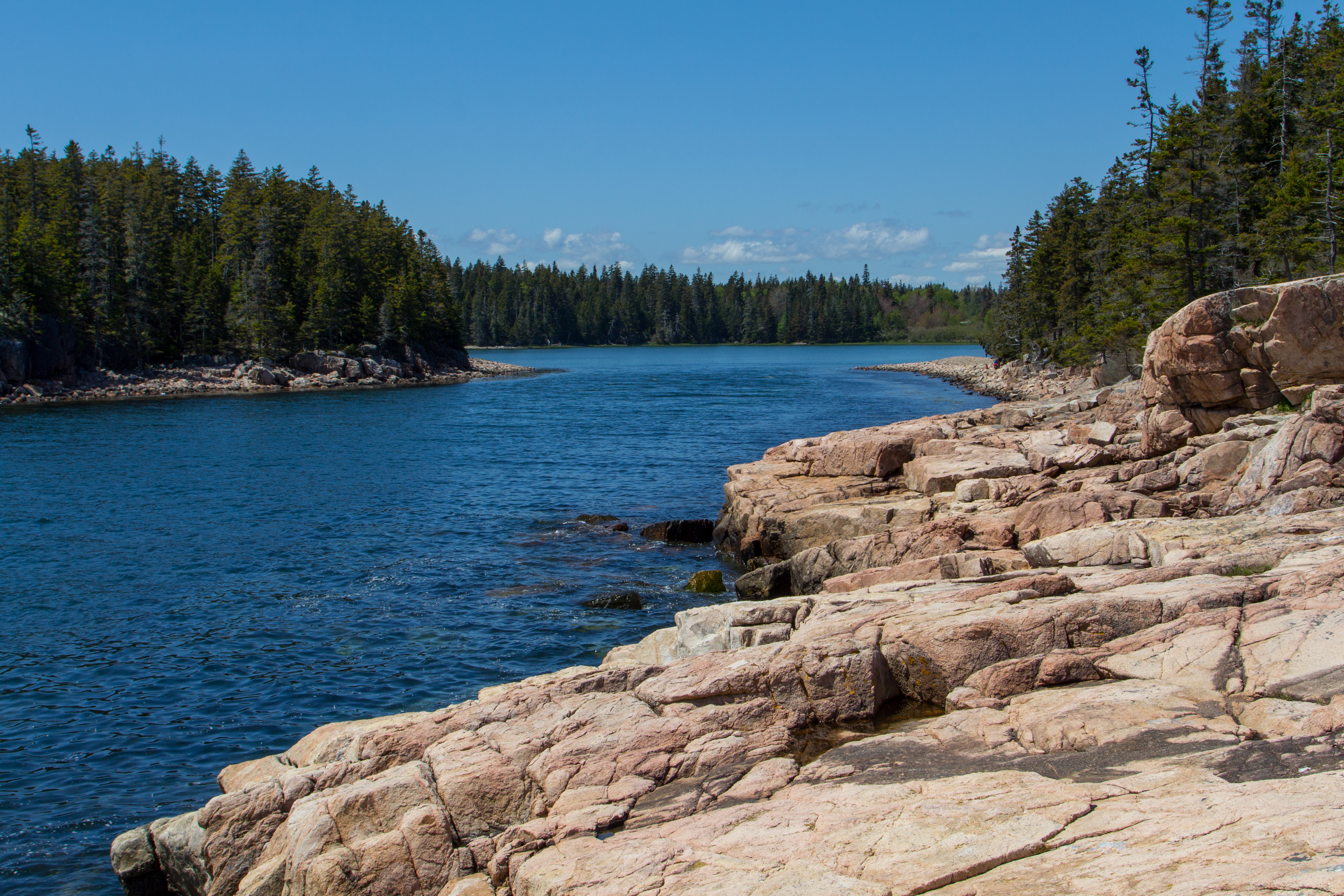
Located off Maine 102A down the road from Seawall Campground and Wonderland Trail, Ship Harbor Trail is a figure-8 trail covering 1.3 miles. It is a great trail for families and birders. Common loons, common eiders, great blue herons, black guillemots, ospreys and eagles have been seen here. A variety of habitats can be viewed along the shore, and there is access to a quiet cove and mudflats at low tide. Interpretive signs provide additional resource information.
Start by bearing right at the first junction. The trail will lead along the shore of a narrow cove. After passing the rocky headland, follow blue blazes on the rocks and turn right again. The trail continues through a spruce woods before opening up again and leading back to the parking lot.
Accessibility The first loop is ADA compliant. Second loop is mostly flat with occasional log framed steps and plank trail. Restrooms (vault toilets) at trailhead are not accessible. In front of the restroom, one accessible parking space is indicated by a sign and blue paint on the ground. Another space next to the trail entrance is indicated by blue striped paint on the ground. At the entrance of the trail there is a two-inch drop from the parking lot pavement. Wheelchair users may need assistance.
Sieur de Monts Developed Area
Sluiceway Trail
Spring Trail
Stanley Brook
Stanley Brook Carriage Road
Bridges
Along the way Clearance: 10 feet 4 inches
Stratheden Path
Thunder Hole Path
Triad Pass
Triad Trail
Bridges
Along the way Clearance: 12 feet 9 inches
Upper Mountain Carriage Road
Valley Cove Trail
Valley Peak Trail
Valley Trail
Boat launches
Along the way Long Pond - South End
Hike Jordan Pond Path the Park Service's write-up
1-3 Hours · dogs allowed
Start Jordan Pond
The Jordan Pond Path traverses the shore of Jordan Pond, one of Acadia’s most iconic landscapes. Located in a steep valley carved out by the retreat of glaciers, Jordan Pond is bordered by Penobscot, Pemetic, and two rounded peaks known as the Bubbles. Listen for the calls of common loons, search for signs of beaver activity, and watch the granite cliffs above for nesting peregrine falcons.
Distance: 3.3 mile loop
Terrain: Forested areas with uneven footing on wooden boardwalks, rocks, and footbridges
Jordan Pond is designated public water supply, so wading and swimming are prohibited at all times.
Hike Description
Note: The western half of the Jordan Pond Path is significantly more difficult than the eastern half, and may be challenging for families with small children, seniors, and people with mobility impairments.
The full loop consists of the eastern half, a short walk along the coast at the northern end of the pond, and a trek back to the trailhead along the western half (or said route in reverse). Visitors are encouraged to begin with the eastern half of the loop in case they choose to turn around, and the description below follows this order. See the photo gallery below the description for visual references.
At several points along the Jordan Pond Path, it intersects with other trails. Please check the difficulty and elevation profiles of these trails and make sure you are prepared before choosing to hike them.
Eastern Half
Start at the boat launch for Jordan Pond. Turn right and follow along the east shoreline.
The path is defined by even terrain and crushed stone underfoot. Use caution on stepping stones and bridges that allow water to flow from the slope above.
About two-thirds of the way along the eastern half of the loop, the Jordan Pond Path intersects with the Bubbles Trail and Jordan Pond Carry. This half of the Bubbles Trail leads to South Bubble and Bubble Rock.
Continue along the path to reach the northern end of the pond, which is marked by the Bubbles Divide Trailhead, as well as the Jordan Pond Buoy and two wooden log bridges slightly further along.
Western Half
Starting from the wooden bridges, continue along the path into the forest. Shortly after the bridge, the path intersects with the Deer Brook Trail, which crosses the Eagle Lake/Jordan Pond carriage road and eventually intersects with trails leading to Sargent Peak and Penobscot Peak.
The forest then gives way to an open, rocky area consisting of boulders that broke off from the sheer cliffs above. This area, while mostly level, involves stepping stones, uneven footing, and may require some scrambling. Use caution when climbing the rocks.
After the rocks is a raised wooden plank boardwalk through a forested area. Please stay on the path to protect vegetation.
At the end of the plank boardwalk, the path follows a short walk through the forest before coming to a small stone bridge. The gravel trail crossing the bridge is the Eagle Lake/Jordan Pond carriage road. Visitors may turn right after the bridge to continue along the carriage road, which intersects with the Jordan Stream Path further down.
To finish the Jordan Pond Path, turn left after the bridge into the small stone courtyard. Follow the shoreline to return to the Jordan Pond Path Trailhead.
Accessibility The Jordan Pond Path is not accessible. The trail has uneven footing, stepping stones, and a small bridge. The Jordan Pond restuarant area and boat launch are accessible.
Visitor Center Connector Carriage Road
West Ledge Trail
Western Head Road
Western Head Trail
Western Head Trail Sec. 1
Western Mountain Connector
Wild Gardens of Acadia
Hike Sieur de Monts to Jesup Path with Island Explorer Bus the Park Service's write-up
1-2 Hours · dogs allowed · Spring, Summer, Fall
Start Sieur de Monts to Jesup Path and Hemlock Road Loop
The Jesup Path and Hemlock Road Loop consists of two mostly level trail consisting of boardwalk and compressed crushed gravel creating a figure-8 for a 1.5-mile round trip hike made possible by the Island Explorer Bus. The loop runs through stands of white birch and hemlock and into the Great Meadow beyond Sieur de Monts. The hike offers benches and pullouts with views of Dorr Mountain interspersed in this walk. Great for families, kids, and wheel-chair accessible. Restrooms available.
This hike provides a tranquil stroll in a wooded area of the park accessible by almost anyone. Accessing the starting point of this trail by the Island Explorer is relatively easy since the Sieur de Monts drop off point is one of the first stops from the Hulls Cove Visitors Center. Additionally, the starting and ending point of this walk use the same bus location, making this hike easy to navigate. Before starting the walk, visitors can explore the heart of Acadia at Sieur de Monts, by checking out the exhibits and talking to a ranger at the Nature Center and viewing the Sieur de Monts Spring, the original Abbe Museum structure, the George B. Dorr Memorial, and the Wild Gardens of Acadia. This is also an excellent spot for birdwatching. Open, grassy fields beside the Nature Center are ideal for young children to run and play.
Sieur de Monts, often referred to as the "Heart of Acadia." Includes Sieur de Monts Spring and spring house, Nature Center, Wild Gardens of Acadia, Abbe Museum(closed), the tarn, Great Meadow Wetland, and access to multiple historic memorial paths. It is the first major stopping point along the Park Loop Road. At Sieur de Monts you can learn the natural and cultural history of Acadia through interpretive signs and hike trails of various lengths and difficulty and enjoy birdwatching. In the summer months you can speak with park staff at the Nature Center. This area serves as a memorial to George Dorr for his work toward the creation of the park and his direction from 1916–1944 as its first superintendent.
Accessibility The Jesup Path boardwalk is a 3-foot-wide wooden boardwalk with benches and pullouts running through a wetland area. The Jesup Path boardwalk is 3 foot wide and accessible. Great for familiesand kids.
Wild Gardens Path
Wildwood Connector
Bridges
Along the way Clearance: 12 feet 9 inches
Witch Hole Connector
Witch Hole Connector Carriage Road
Witch Hole Pond
Witch Hole Pond Carriage Road
Wonderland Trail
Hike Wonderland Trail the Park Service's write-up
30-60 Minutes · dogs allowed
Start Wonderland Trail
Located between Seawall Campground and the Ship Harbor Trail on Maine Route 102A, Wonderland Trail is an old gravel fire road which leads to the ocean. It is a family-friendly coastal trail, popular for birding and tidepooling at low tide. When exploring this area, never turn your back on the water. Explore as the tide is going out, and be gentle with any creatures in the tidepools.
Distance: 1.4 miles round trip
Terrain: gravel fire road, rocky sections, coastline
Hike Description
Start from the parking area and follow the trail along a old gravel fire road.
The road is mostly flat with minimal roots and rocks, leading through a spruce forest before opening up to Jack Pine.
The coastline access starts close to the end and opens up to a rocky shoreline. Use caution on the rocks, especially when wet. Views of the Duck Islands to the southeast and Great Cranberry Island to the northeast can be seen from the shore.
After seeing the coastline or tidepooling during low tide, return back the same way to reach the parking area.
Accessibility The Wonderland Trail is not accessible. The trail has uneven footing in areas. There is limited parking in a small lot. Street parking is also available. No accessible parking spaces are designated. There is no toilet at the trailhead. The closest accessible toilet is at the Ship Harbor Trailhead, a short drive south.
Wonsqueak Bike Path
Hike Schoodic Peninsula Trails the Park Service's write-up
dogs allowed
Start Schoodic Peninsula
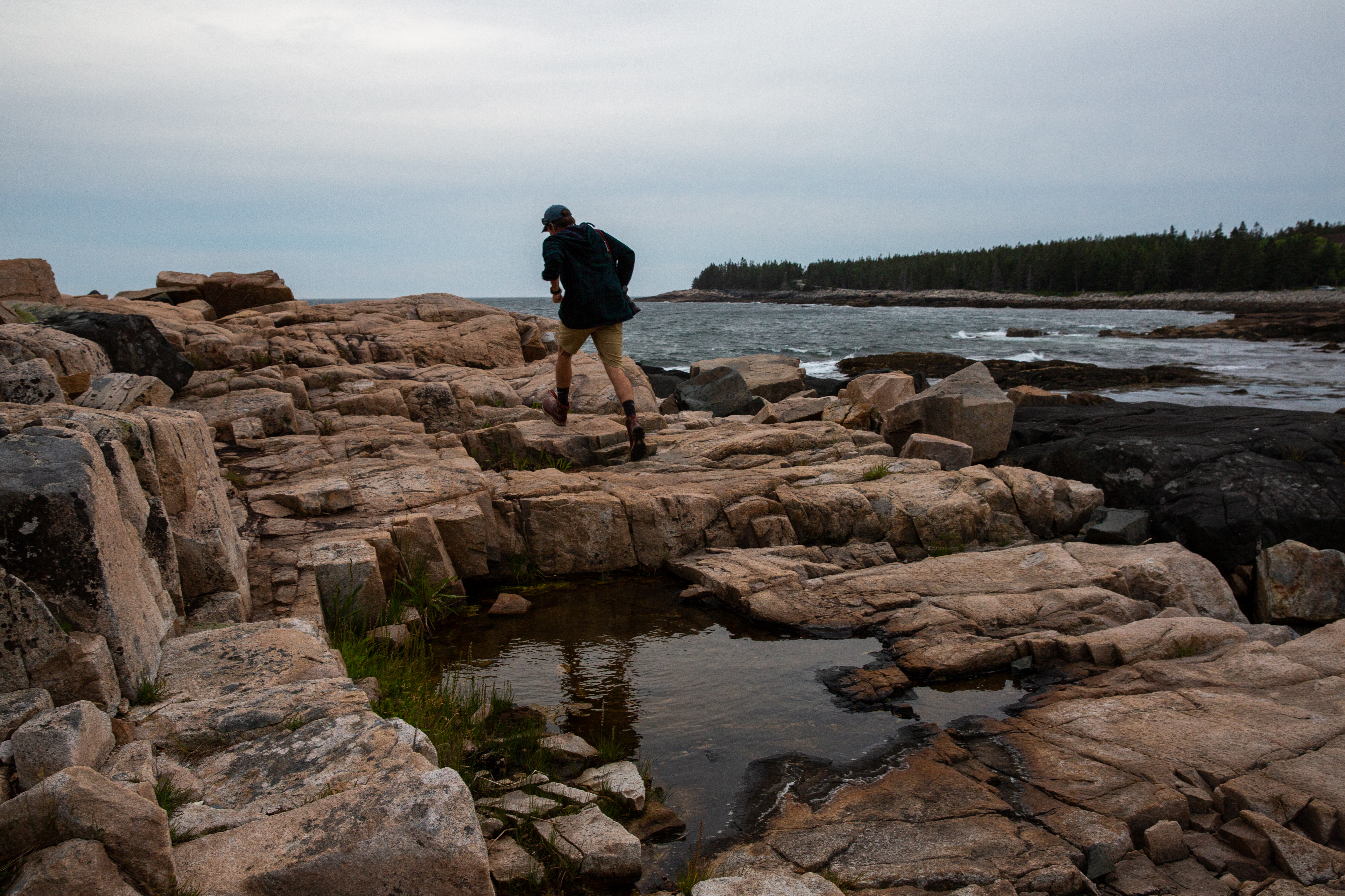
Schoodic Peninsula offers a network of hiking trails across the peninsula, from Winter Harbor in the north through spruce-fir forests, pine woodlands, and a shrubland, terminating on the southern end at Blueberry Hill. Enjoy views from the Anvil and Schoodic Head, as well as some challenging steep climbs from the East Trail.
Distance: 7.5 miles (for whole network)
Terrain: forested paths, coastal walks, rocky granite climbs
In addition to the trails described below, hikers may also walk on the Schoodic Bike Paths, to lengthen or shorten their trek as desired.
Hike Descriptions
Alder Trail: This short, easy walk traverses inland from the rocky shore along a grassy path among fruit trees and alder bushes. Butterflies are common here, as are pitch pine, cedar, birch, and ash trees. This pleasant trail highlights the contrast between ocean and old farmland.
Anvil Trail: This trail provides access to incredible views from both the rocky knob known as the Anvil and the 440-foot Schoodic Head. The trail starts by climbing through woods of ash, birch, and spruce and ends atop rocky summits.
Buck Cove Mountain Trail: This is the network's longest trail at just over 3 miles. The trail skirts the edge of Birch Harbor Mountain and leads to Schoodic Head summit. While it is longer and has more climbing than some of the network's other trails, the elevation gains allow for incredible views of the surrounding area and make this a very worth-while hike.
East Trail: This short but steep trail goes up the eastern side of Schoodic Head, with views along the way of Schoodic Point to the southwest and Spruce Point to the northeast. The trail begins with a steady ascent, then rises quickly via switchbacks. In the spring, Canada dogwood and tiny white starflowers bloom along the trail. Gnarled pitch pines, cedars, and sea-green lichen are plentiful here.
Lower Harbor Trail: This trail offers waterfront views for the majority of its 1.2 mile stretch. The flat terrain and coastal views make this a trail perfect for everyone to enjoy.
Schoodic Head: This trail provides a fresh perspective on Acadia National Park and expansive views of the area. The trail winds along Schoodic Head, the distinctive knob many visitor only see from atop Cadillac Mountain.
Accessibility Schoodic Peninsula Trails are not accessible. The trails have uneven footing throughout forested and coastal areas. Some biking paths are accessible but become steep in sections. There are accessible bathrooms at Schoodic Woods Campground only.
82 more mapped segments without a name are on the map, not in the list.
More hikes the Park Service describes
Write-ups that name no single mapped trail, in the Service's words.
- Hike Carriage Roads · dogs allowed
Many carriage roads intersect with hiking trails. They can be incorporated into a hike to create a loop, add distance, or provide opportunities for more even terrain to gain or lose elevation. - Hike Dorr Mountain South Ridge Loop · 1-2 Hours · no dogs · Spring, Summer, Fall
The Dorr Mountain South Ridge Loop is a 3.2 mile loop featuring views of Mount Desert Island from the top of Dorr Mountain after a steep ascent.
About these trails
The lines are the National Park Service's public trails layer, the trailheads and the waterfalls, views, peaks and historic places along them the Service's public points of interest, read 2026-10-14 and simplified for the map. The write-ups are the Service's own "things to do", unedited. Heights come from USGS 3DEP through Terrain Tiles on AWS (Mapzen/Tilezen), read along each line and rounded; a short trail on steep ground can be off by a few tens of feet. Closures change: check the park's own site before you go.