
Parkman Mountain Trail
Hike Bald Peak and Parkman Mountain Loop 2.7 mi round trip · the Park Service's write-up
1-2 Hours · dogs allowed
Start Bald Peak and Parkman Mountain
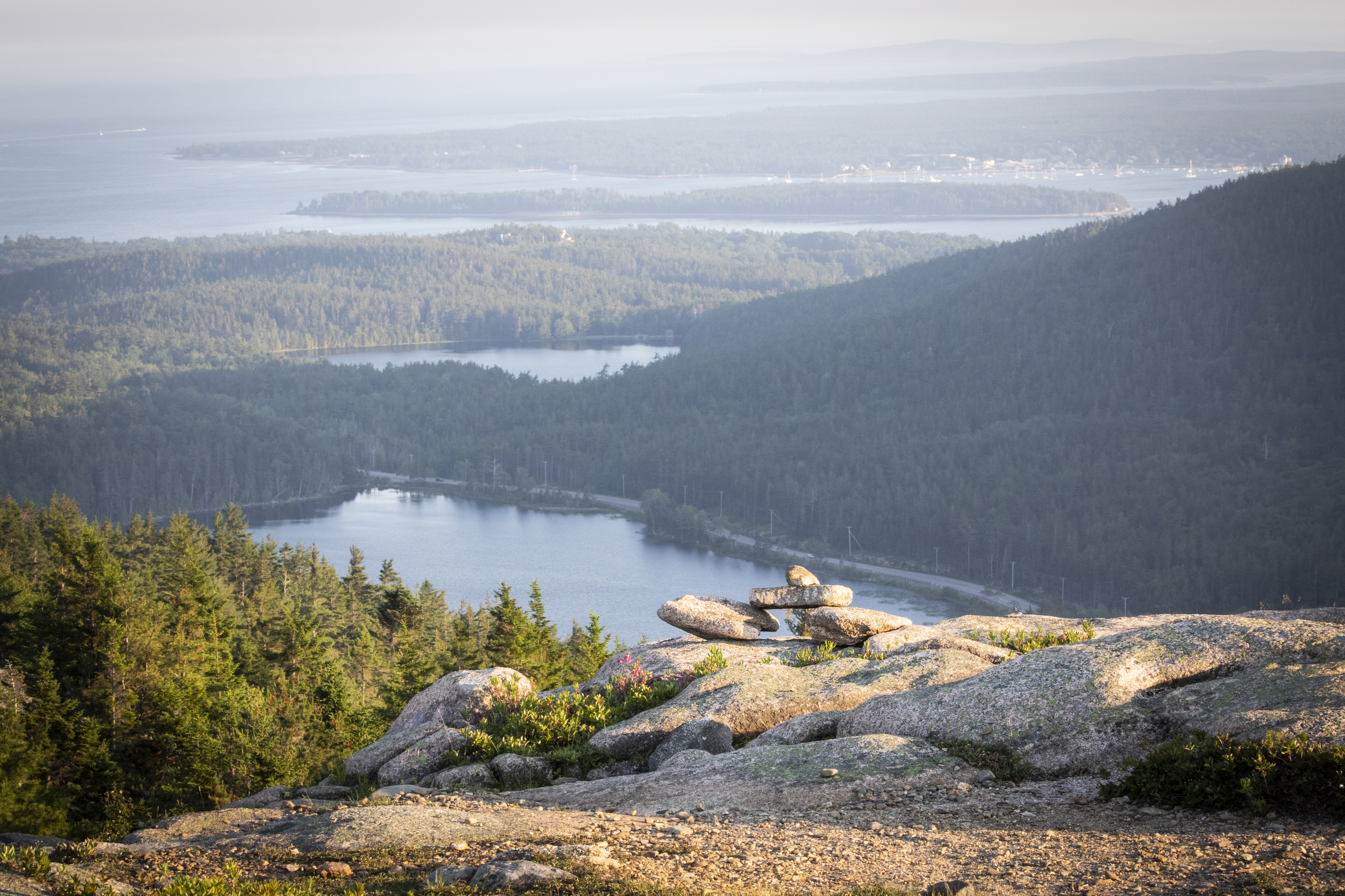
A short, challenging hike to the top of two mountains each over 900 feet. The hike crosses carriage roads before summiting for ocean views of the Somes Sound and Northeast Harbor. Start with Bald Peak Trail, as it offers steeper terrain than its western Parkman Mountain Trail counterpart. Choose dry weather to avoid hazards on slippery, exposed granite sections. This hike is also a good sunset option, but carry appropriate gear and headlamps when hiking at dusk and dark.
Distance: 2.7 miles round trip
Terrain: Forested path, steep granite and challenging rocky footing throughout with one iron rung.
Hike Description
The hike starts at Sargent Mountain Trailhead and descends slightly through the forest on the Hadlock Brook Trail.
Pass the Parkman Mountain Trail junction. After .2 miles, come to the junction for the Bald Peak Trail and turn left.
The Bald Peak Trail becomes more rugged as it follows a stream and begins to ascend Bald Peak. There are two carriage road crossings.
After crossing the second carriage road, the hike becomes significantly steeper and exposed. Blue blazes and stone Bates cairns on the open granite face mark the trail. This section is not recommended in wet weather.
At the top of Bald Peak, enjoy views of Upper Hadlock Pond and the outlying islands.
Continue down the north side of the mountain before ascending to the junction with Parkman Mountain Trail. Take a right for .1 mi to the summit.
Retrace the trail southward, pass the junction again, and continue the descent into the forest. There are two steep ledges and one iron rung. These sections are challenging when wet.
The trail crosses the carriage road three times before ending at the junction where the hike started. A right turn leads back the ME Route 198 and the parking lot.
Accessibility Bald Peak and Parkman Mountain Loop is not accessible. The trails have uneven footing and short, steep sections requiring some scrambling throughout. There are no accessible restrooms at the trailhead.