
Ocean Path
Hike Ocean Path Trail 2.2 mi out and back · the Park Service's write-up
2-4 Hours · dogs allowed
Start Ocean Path Trail

Explore vast slabs of pink granite, picturesque cliffs, and breathtaking oceans views as the Ocean Path takes you along the bold coast of Maine. The Ocean Path is a great way to access Thunder Hole and Otter Point from Sand Beach on a gradual hike. Find a plaque dedicated to John D. Rockefeller for all of the work he did in providing the experience that people continue to have today in Acadia National Park.
Distance: 2.2 mile traill one way, 4.4 miles round trip. The trail is 0.7 miles from Sand Beach to Thunder Hole.
Terrain/Safety: From Sand Beach to Thunder Hole the trail is a mix of concrete and packed gravel surfaces. The rest of the trail is gravelly and rocky with uneven surfaces. There are two staircases present 1.4 miles into the trail as the path climbs around a rocky cliff section. Steep drops into the ocean. Keep children away from the edge. Good footwear is recommended.
Visitors can ride the fare-free Island Explorer to visit Ocean Path. The bus drops off and picks up at regular intervals throughout the day at the Island Explorer sign located in the right lane of Park Loop Road at Thunder Hole, and on the right side of Sand Beach lower parking lot.
Hike Description
The trail begins from the upper parking lot of Sand Beach. It can also be accessed from the Thunder Hole and Otter Point parking areas.
Leaving from Sand Beach the trail consists of concrete and packed gravel sections that gradually rise over a hill providing a overarching view across the entire ocean path coastline.
Gradually descend on accessible trail to Thunder Hole, an underwater sea cave that with the right conditions (2 hours before high-tide and high winds) can produce thundering crashes heard up and down the trail.
Continuing past Thunder Hole the trail becomes uneven but remains gradual as it begins climbing up through a spruce/fir forest.
Arrive at Otter Cliffs, 110-ft cliffs that mark the highest point along the Ocean Path. Climb up a granite staircase to a walkway that parallels the road to cross over the cliffs and descend down another staircase on the other side.
The trail continues down to Otter Point where granite slabs are surrounded by ocean on both sides. Many people return to Sand Beach from here but a couple hundred more feet the trail ends at Otter Cove with a small staircase and a stunning view across the Otter Cove causeway with Cadillac and Dorr Mountain in the background.
Accessibility Ocean Path is accessible from the upper parking lot of Sand Beach to Thunder Hole. From Thunder Hole to Otter Point the trail becomes uneven and granite staircases help bring the trail past Otter Cliffs. There is accessible parking at the Sand Beach parking areas as well as accessible restrooms.
Hike Ocean Path Trail with Island Explorer Bus the Park Service's write-up
1-2 Hours · dogs allowed · Spring, Summer, Fall
Start The Ocean Path Trail
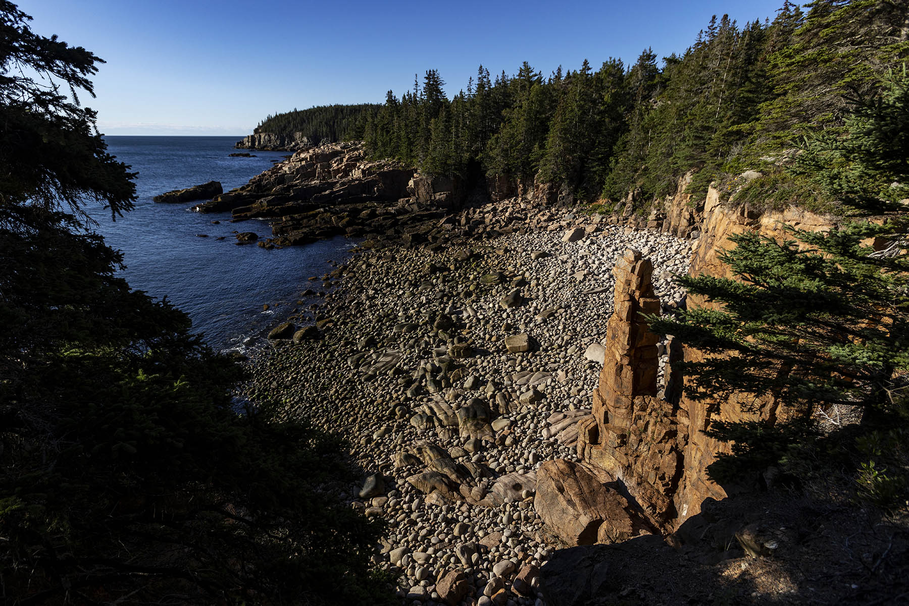
The Ocean Path stretches 2.2 miles along Acadia’s coastline. With a sand beach, rocky inlets and granite cliffs, this scenic trail is rightfully popular for those looking to get the most out of their trip to Acadia. This trail links together many of the Parks “must see” locations in one hike and has four official bus stops: one at its start and end and two along the way for maximum trail flexibility.
Hiking the Ocean Path is a relaxing and engaging way to explore many of Acadia’s iconic locations and vistas. By combining this hike with the bus, it cuts what would otherwise be an out-and-back hike in half while removing the stress of finding parking at any of the numerous popular destinations along this stretch. The trail is mostly flat and the section from Sand Beach to Thunder Hole is a 4-foot-wide path of mixed gravel and concrete with a few shallow steps. Beyond popular destinations and countless scenic vistas, other activities include swimming at Sand Beach, collecting a passport stamp from Thunder Hole and bird watching. Hikers can start at either end of the path, Sand Beach or Otter Point, and there are an additional two bus stops along the trail as well that can also act as the beginning/end of the hike. This flexibility is great for mixed groups or hikers unsure if they can make it 2.2 miles.
Swimming: Sand Beach is where the Ocean Path begins and is the easiest place to access the ocean for swimming in the whole park. The water is cold (around 55 degrees Fahrenheit in summer) so use caution and plan for a short swim.
Bird Watching: Ocean Path can be a great location to watch for sea birds like cormorants, guillemots and gulls
Passport Stamp Collecting: The Thunder Hole passport stamp can be found at the Thunder Hole gift shop at mile 0.7
Accessibility Ocean Path is an unpaved trail. The first .7 miles from Sand Beach to Thunder Hole is 3-4 feet wide, mixed gravel and concrete with a minimal grade and some small steps. Past Thunder Hole, the trail becomes uneven and narrows.