
Kurt Diederichs Climb
Hike Kurt Diederichs Climb 0.4 mi one way · the Park Service's write-up
20-30 Minutes · dogs allowed · Spring, Summer, Fall
Start Kurt Diederichs Climb
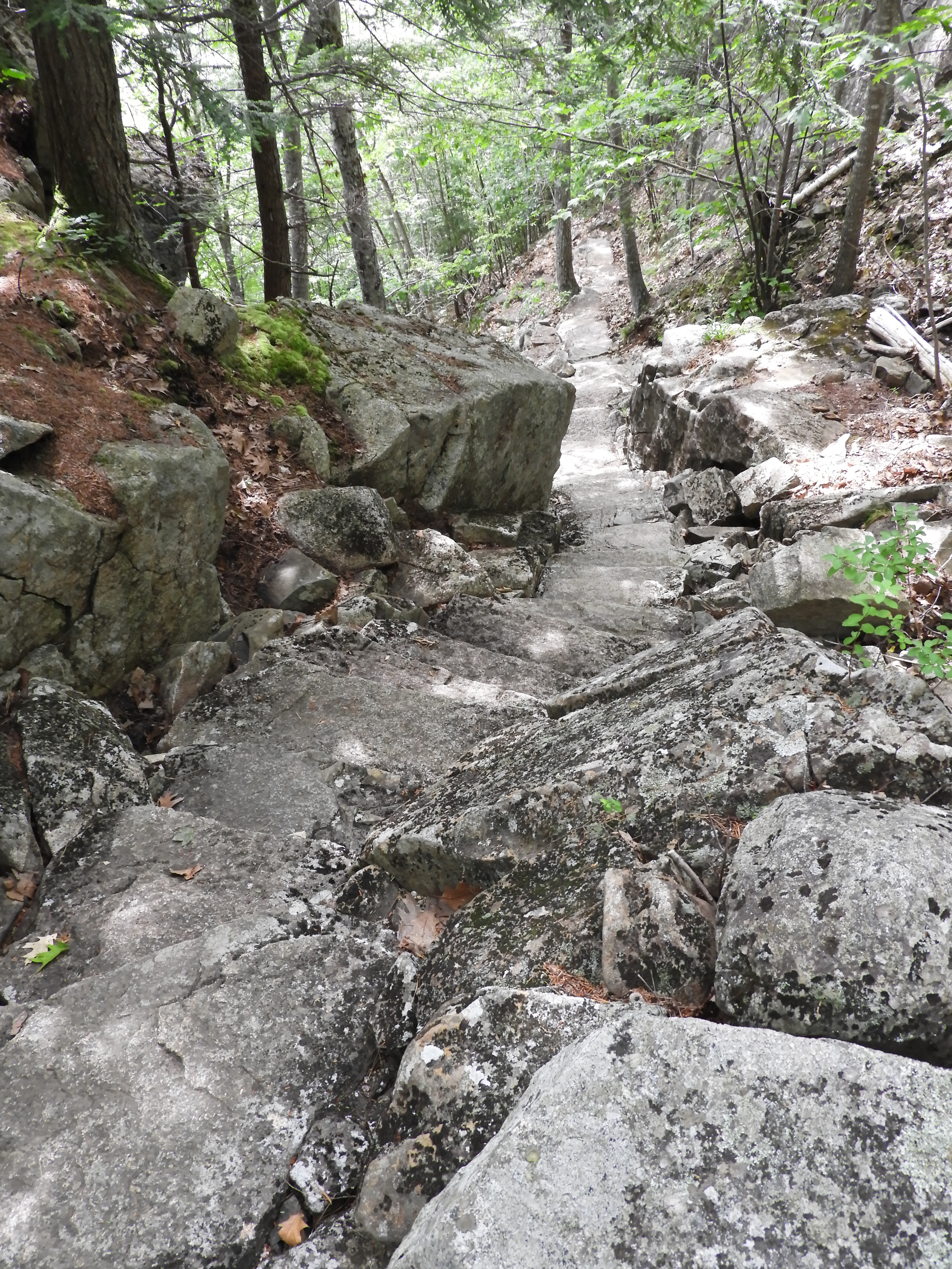
Kurt Diederichs Climb is a memorial trail at Sieur de Monts. It is a .4 mile steep ascent with many granite steps leading from the Tarn. It is one of the routes to reach Schiff Path, and eventually the summit of Dorr Mountain.
Kurt Diederich, and his daughter Elsa, lived in Washington D.C. after the death of his wife Sybil. They summered at his aunt’s cottage, Bowling Green, in Bar Harbor. Kurt died prematurely from anesthesia in 1913 at age 26. His aunt, Enid Hunt Slater, provided funds for a memorial path built in his honor. The sixth step up from the beginning of the trail at the Tarn is engraved with “Kurt Diederichs Climb.”
Distance: .4 miles one way
Terrain: Forested area with steep, rocky sections and many granite steps
Hike Description
Start at the Sieur de Monts Nature Center.
Walk towards the Abbe Museum and turn slightly left to follow the Jesup Path.
Continue for .2 miles before reaching the intersection of Kurt Diederichs Climb and Kane Path.
Turn right onto Kurt Diederichs Climb. Check the sixth step to see the engravement.
Begin the quick and steep ascent for less than .4 miles on mostly granite steps.
The trail ends at the intersection with Schiff Path.
To reach the summit of Dorr Mountain, follow Schiff Path for just over 1 mile.
To return to Sieur de Monts, retrace your steps back or take Emery Path or Homans Path. All three trails are quick, steep descent with granite steps. Use caution, especially when the rock is wet and slippery.
Accessibility Kurt Diederich's Climb is not accessible. The trail has uneven footing, granite stairs, and steep sections throughout. There is an accessible restroom at Sieur de Monts.