
Citadel Pueblo
Visit Citadel and Nalakihu Pueblos the Park Service's write-up
5-20 Minutes · no dogs · entrance fee applies
Start Citadel and Nalakihu Pueblo Trail
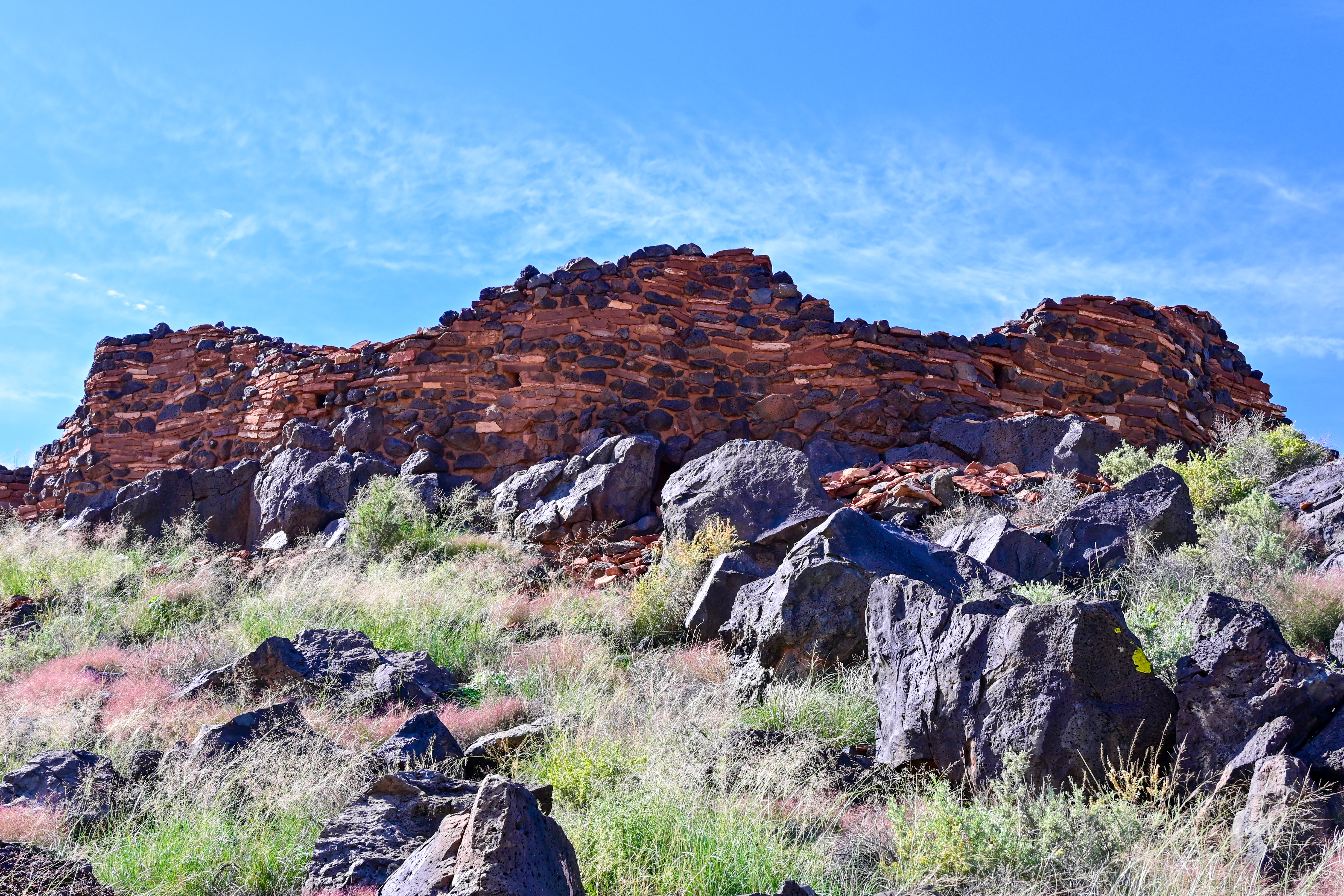
The Citadel and Nalakihu Pueblos were the central hub of a vibrant agricultural community between the early 1100s and mid 1200s CE. About half the size of Wupatki Pueblo, Citadel was around 50 rooms and is strategically located on the top of a small cinder hill overlooking a limestone sinkhole. The area provided good opportunities for farming and hunting game animals such as mule deer, elk, and pronghorn. Soil studies have revealed evidence that people here grew cotton which could have been an important trading commodity.
The Nalakihu Pueblo is a smaller structure built at the base of Citadel and was once used as the monument headquarters in the 1930s. The reconstructed portions of this pueblo have since been removed.
This trail is located a 4 mi. (6.4km) drive from the northern entrance off of HWY 89, or a 10 mi. (16km) drive from the Wupatki Visitor Center. It offers an intimate experience with an Ancestral Puebloan heritage site and grand views of the surrounding San Francisco peaks and volcanic field.
The first portion of the trail is accessible with a compacted decomposed granite surface. The parking lot is parallel to the road with an entrance/exit on both sides. There are 7 single car spaces, 2 accessible spaces, and 5 oversize vehicle spaces available. Pets are not allowed on this trail, leashed service animals are ok.
Although it is no longer physically occupied, descendent communities believe the people who lived and died here remain as spiritual guardians. These places are remembered and cared for, not abandoned. Thank you for visiting respectfully and leaving no trace. These sites and the lands they are on are culturally significant to the 13 Traditionally Associated Tribes of Wupatki National Monument, all of whom have ancestral ties to this area.
Pets Pets are allowed in the parking lot of this location but not on the trail. Leashed service animals are ok.
Accessibility accessible up to the base of the cinder hill with a compacted decomposed granite surface. The parking lot is parallel to the road with an entrance/exit on both sides. There are 7 single car spaces, 2 accessible spaces, and 5 oversize vehicle spaces available.