National Park · New Mexico

Trails in White Sands National Park

6 named trails · 9 miles · 6 trailheads · 4 with the Park Service's own write-up. The lines, trailheads and points are the Park Service's; the write-ups are the Service's own words; the climbing is read from USGS elevation along each line.

Open on the parks mapEvery park with trailsPark on nps.gov

6 trails, A to Z.

Alkali Flat Trail

4.7 mi one way · about 50 ft of climbing · 3,945 ft–3,995 ft · sand surface

3,995 ft 3,994 ft · 4.6 mi high 3,995 ft

Trailhead Alkali Flat Trail 3,995 ft Drive there

Hiking Alkali Flat Trail the Park Service's write-up

3-5 Hours · dogs allowed

Start Dunes Drive
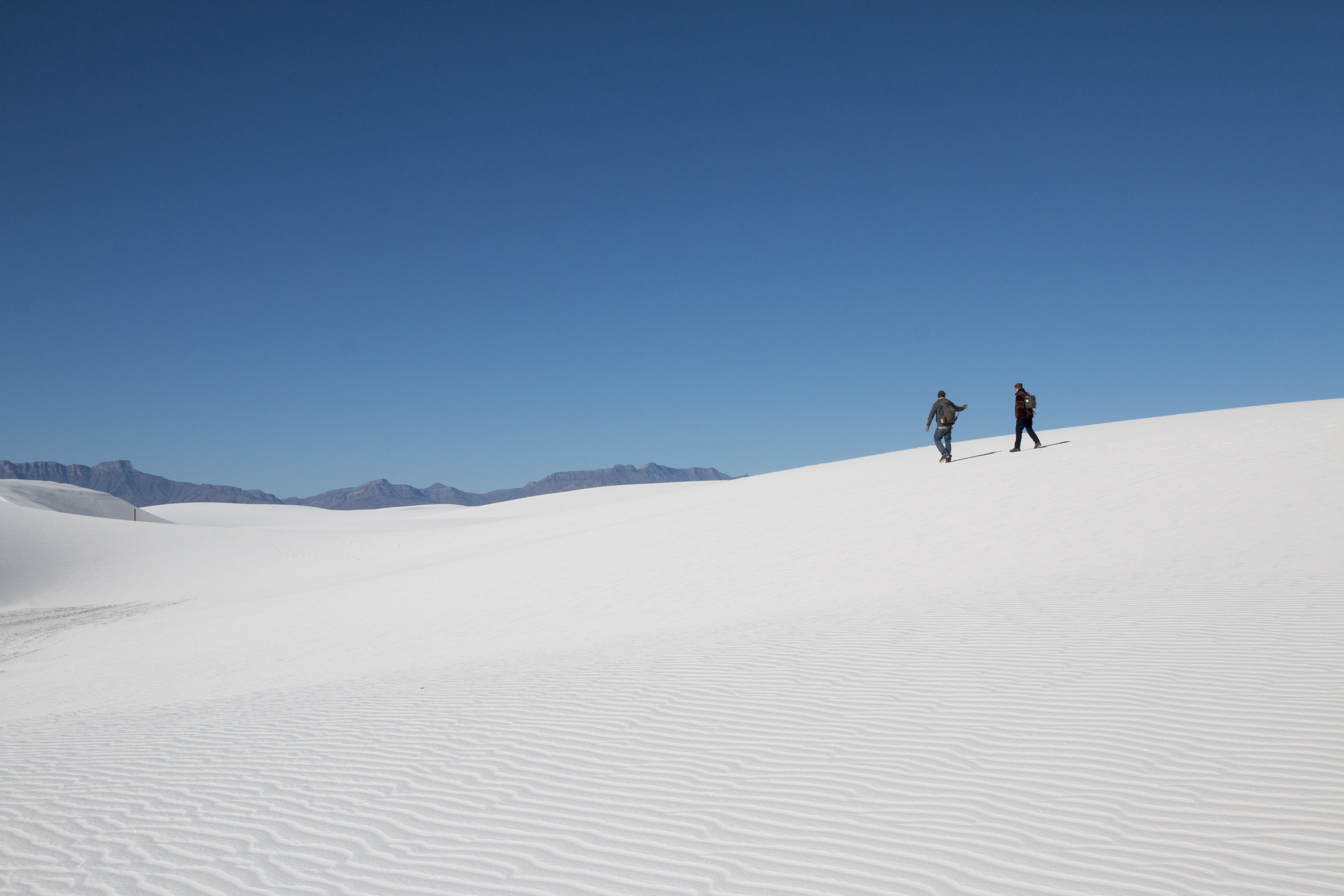
Two people silhouetted on top of a white dune with blue sky overhead
Alkali Flat Trail Photo: NPS

Surround yourself with a rolling white landscape that stretches endlessly in every direction. Embrace the solitude offered by this trail as it travels up and down the dunes and away from the road. Find yourself along the outer edge of Alakli Flat, the salty expanse where an ancient lake once flourished.

This is a strenuous five mile (8 km) out-and-back hike. You will hike 2.5 (4 km) miles to Alkali Flat and return the same way. This hike consistently has you climbing 60 ft (18.3 m) dunes.

This trail takes an average of four hours to complete.

Follow the red diamond trail markers to complete the trail. If you are unable to see the next marker, turn around and go back to the trailhead.

Although the name of the trail is "Alkali Flat," please note that this trail is not flat!

Ranger Recommendations

Bring plenty of water for your family and pets

This trail has very little shade. Use adequate sun protection.

Look carefully for the next trail marker before continuing. If you cannot see the next trail marker because of blowing sand or because the trail marker is knocked down, do not proceed—return to your car. Strong winds can reduce visibility to a few feet, making it easy to become lost.

Stay on the trail to avoid damaging delicate biocrust

Visit our Hiking Safety page for more recommendations about hiking in the unique conditions of White Sands National Park

Accessibility This trail is not ADA accessible. This hike includes walking up and down sand dunes of up to sixty feet in loose gypsum sand. The park's only accessible trail is the Interdune Boardwalk .
This hike on nps.gov

Backcountry Camping Loop Trail

1.7 mi one way · 3,996 ft–4,002 ft · sand surface

3,996 ft 3,996 ft · 1.7 mi high 4,002 ft

Trailhead Backcountry Camping Loop Trail 3,996 ft Drive there

Hiking Backcountry Camping Trail the Park Service's write-up

2-3 Hours · dogs allowed

Start Dunes Drive

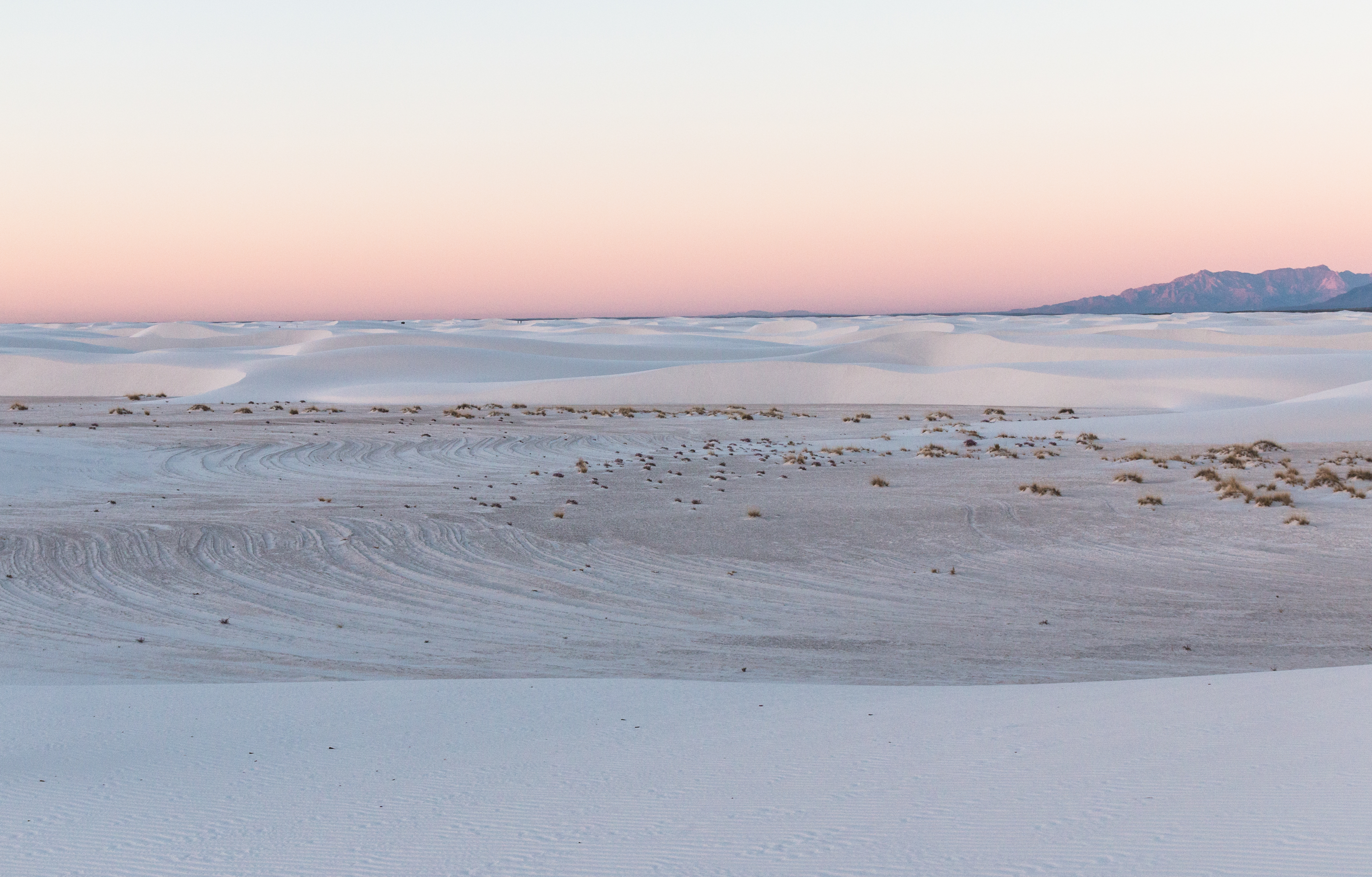
A pink sky at dusk over an interdune area
Dusk on Backcountry Camping Trail Photo: NPS

Explore the White Sands Backcountry to catch a view of gorgeous landscape with the stunning San Andres Mountains to the west. Along the Backcountry Camping Loop Trail, you're likely to see bleached earless lizards, towering soaptree yuccas, and the occasional white moth. This loop is also a good place to see a fiery White Sands sunset.

This is a 2 mile loop (3.2 kilometers) that is rated as moderate to strenous and climbs 40-50 foot (12-15 m) dunes throughout

This hike takes an average of 2-3 hours to complete

Follow the orange spade trail markers to complete the trail. If you're unable to see the next marker, turn around and go back to the trailhead.

Ranger Recommendations

Look carefully for the next trail marker before continuing. If you cannot see the next trail marker because of blowing sand or because the trail marker is knocked down, do not proceed—return to your car. Strong winds can reduce visibility to a few feet, making it easy to become lost.

Bring plenty of water for your family and pets. One gallon (4 Liters) of water per person per day is recommended, as well as high-energy snacks such as fruit, nuts, and energy bars. Fill up water containers at the visitor center. There is no water available in the dunefield.

This trail has very little shade. Use adequate sun protection.

Visit our Hiking Safety page for more recommendations about hiking in the unique conditions of White Sands National Park

Accessibility This trail is not ADA accessible. This hike includes walking up and down sand dunes of up to fifty feet on loose gypsum sand. The park's only accessible trail is the Interdune Boardwalk .
This hike on nps.gov

Dune Life Nature Trail

0.9 mi one way · 4,002 ft–4,002 ft · sand surface

4,002 ft 4,002 ft · 0.9 mi high 4,002 ft

Trailhead Dune Life Nature Trail 4,002 ft Drive there

Hiking Dune Life Nature Trail the Park Service's write-up

45-60 Minutes · dogs allowed

Start Dunes Drive

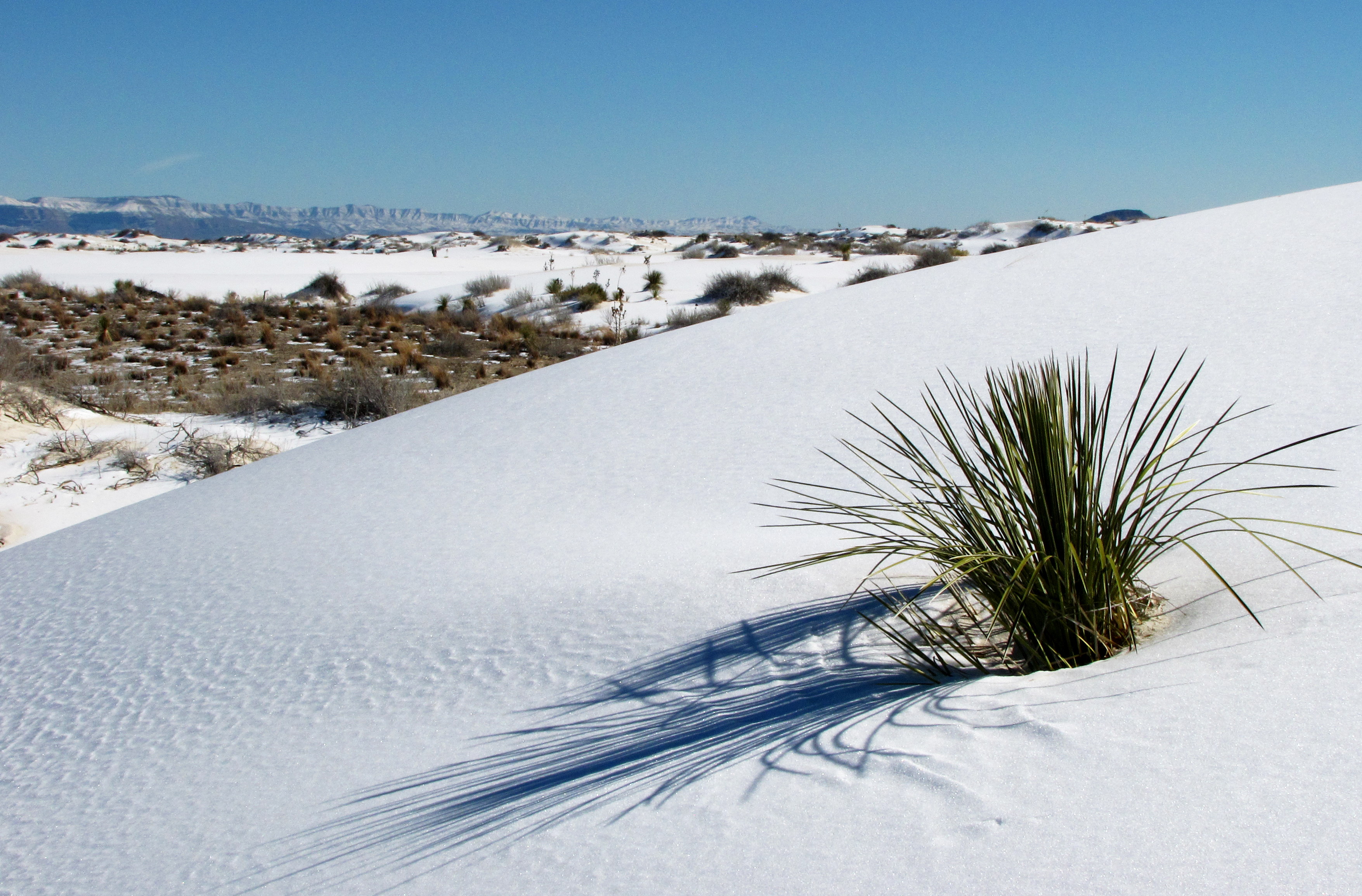
White sand dune in front of plant-spotted interdune with mountains on horizon
Yucca on the Dune Life Nature Trail Photo: NPS

Join Dune Life Nature Trail mascot Katie the Kit Fox along this trail to learn about the animals that live here in 14 interpretive signs.

The Dune Life Nature Trail is an ecotone: a place where two communities meet and integrate. In this area, the desert scrub community and the gypsum sand dunes meet and form one of the most diverse ecosystems in the park. Look for the tracks of the animals that call these dunes home: kit foxes, badgers, birds, coyotes, rodents, and reptiles all live in this area.

Dune Life Nature Trail is a moderate one mile (1.6 km) loop through dunes of up to 30 feet (9.1 m) tall as well as an interdune area.

This trail takes an average of one hour to complete.

You will follow blue trail markers with a club symbol to navigate the trail.

Ranger Recommendations

Bring plenty of water for your family and pets

This trail has very little shade. Use adequate sun protection.

Look carefully for the next trail marker before continuing. If you cannot see the next trail marker because of blowing sand or because the trail marker is knocked down, do not proceed—return to your car. Strong winds can reduce visibility to a few feet, making it easy to become lost.

Keep in mind that this trail is for observing plant and animal life. If you want to play in the sand, please drive farther down Dunes Drive where there are better dunes for sledding and picnic tables with shade.

Stay on the trail to avoid damaging delicate biocrust.

Visit our Hiking Safety page for more recommendations about hiking in the unique conditions of White Sands National Park

Accessibility This trail is not ADA accessible. This hike includes walking up and down sand dunes of up to thirty feet (9 meters) on loose gypsum sand. The park's only accessible trail is the Interdune Boardwalk .
This hike on nps.gov

Hiking the Ice Age Trail the Park Service's write-up

45-60 Minutes · dogs allowed

Start Dunes Drive

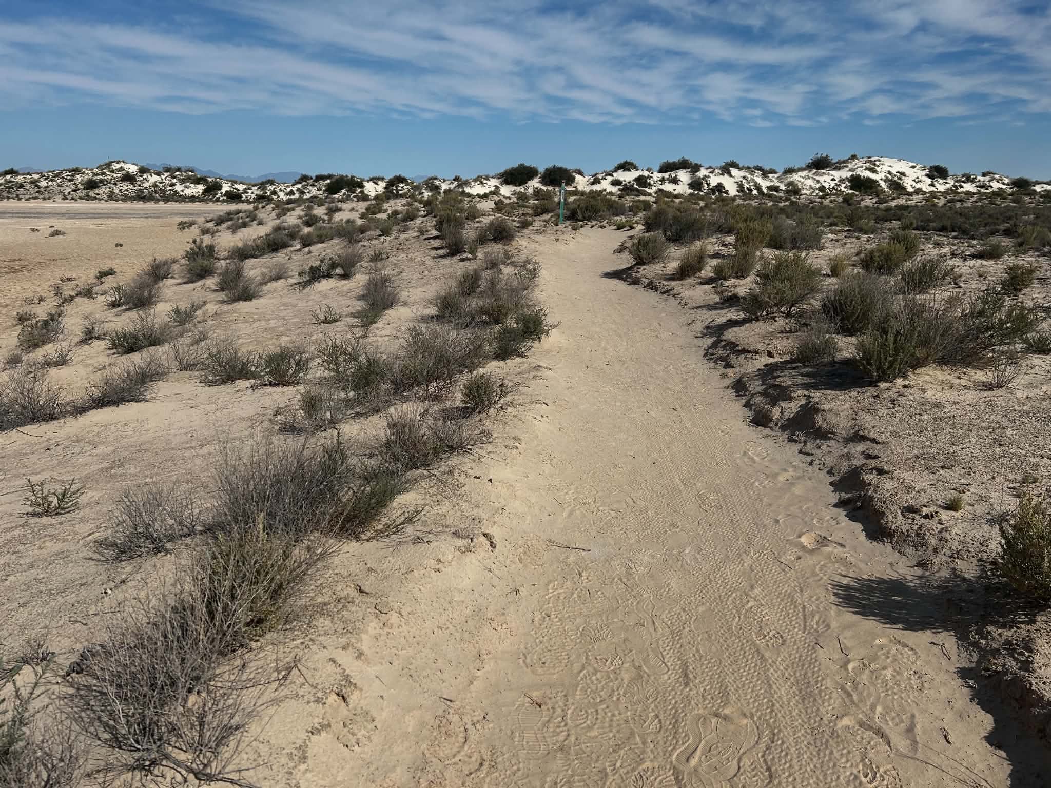
A dirt trail in the desert floor
The Ice Age Trail interprets ancient life in the Tularosa Basin Photo: NPS Photo/ Tharon S.

Between 21,000 and 23,000 years ago, the Tularosa Basin was a lush wetland dominated by ancient Lake Otero. Humans and ice age giants such as mammoths and American lions left footprints in the soft mud of the lake. When conditions were right, these footprints were preserved to the modern day. Learn about this ancient landscape

Ice Age Trail is a 0.8 mile (1.3 km) loop.

Green trail markers with a heart symbol mark the trail.

Nine interpretive panels are located along the trail

Ranger Recommendations

Bring plenty of water for your family and pets.

This trail has no shade--bring adequate sun protection.

Stay on the trail to avoid damaging delicate biocrust.

Visit our Hiking Safety page for more recommendations about hiking in the unique conditions of White Sands National Park.

Accessibility This trail is not ADA Accessible. The trail is mostly flat, compacted sediment. The park's only accessible trail is the Interdune Boardwalk .

This hike on nps.gov

Interdune Boardwalk

0.2 mi one way · 4,002 ft–4,002 ft · wood surface

4,002 ft 4,002 ft · 0.2 mi high 4,002 ft

Trailhead Interdune Boardwalk Trail 4,002 ft Drive there

Hiking Interdune Boardwalk the Park Service's write-up

15-30 Minutes · dogs allowed

Start Dunes Drive

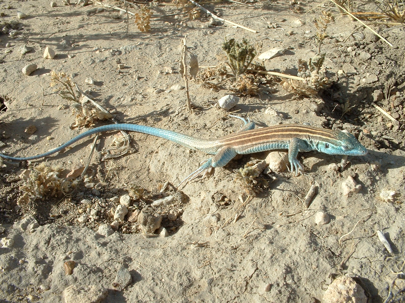
Close up of a large lizard with blue face and tail
Blue whiptail lizard on the Interdune Boardwalk Photo: NPS

The Interdune Boardwalk is currently closed because of the active safety corridor. Please refer to safety corridor page for more information on visiting White Sands National Park. Visit the visitor center to speak with rangers about alternatives to the boardwalk for your visit.

The Interdune Boardwalk is an elevated boardwalk that leads you through the fragile interdune area to a scenic view of the dunefield and the Sacramento mountains. Ten interpretive panels along the boardwalk explain the amazing science of White Sands National Park, including tenacious wildlife, fascinating geology, and other special features of the world's largest gypsum dunefield. This short walk has much to discover!

The Interdune Boardwalk is 0.4 miles (0.6 km) round trip.

A large shade structure is located halfway down the boardwalk.

An accessible restroom is located in the parking area.

Ranger Recommendations

Bring plenty of water for your family and pets.

Keep in mind that this trail is for observing plant and animal life. If you want to play in the sand, please drive farther down Dunes Drive where there are better dunes for sledding and picnic tables with shade.

Stay on the trail to avoid damaging delicate biocrust.

Visit our Hiking Safety page for more recommendations about hiking in the unique conditions of White Sands National Park.

Accessibility This trail is ADA accessible. The parking lot is well-compacted sand. A large shade structure is located halfway down the boardwalk. Sometimes wind blows sand onto small patches of the boardwalk, making travel accross the boardwalk more difficult. Please report sand on the boardwalk to a park employee.

This hike on nps.gov

About these trails

The lines are the National Park Service's public trails layer, the trailheads and the waterfalls, views, peaks and historic places along them the Service's public points of interest, read 2026-10-14 and simplified for the map. The write-ups are the Service's own "things to do", unedited. Heights come from USGS 3DEP through Terrain Tiles on AWS (Mapzen/Tilezen), read along each line and rounded; a short trail on steep ground can be off by a few tens of feet. Closures change: check the park's own site before you go.