42 named trails · 74 miles · 6 trailheads · 1 with the Park Service's own write-up. The lines, trailheads and points are the Park Service's; the write-ups are the Service's own words; the climbing is read from USGS elevation along each line.
42 trails, A to Z.
0.2 mi one way · about 30 ft of climbing · 2,729 ft–2,762 ft
2,729 ft
2,762 ft · 0.2 mi
high 2,762 ft
On the parks map · Drive to the trail's end
0.1 mi one way · about 80 ft of climbing · 2,226 ft–2,303 ft · native surface · bike, hiking, horse
2,226 ft
2,303 ft · 0.1 mi
high 2,303 ft
On the parks map · Drive to the trail's end
3.6 mi one way · about 200 ft of climbing · 1,100 ft of descent · 1,294 ft–2,260 ft · native surface · bike, hiking, horse
2,224 ft
1,555 ft · 1.6 mi
high 2,225 ft
Trailheads Boulder Creek Trailhead 1,294 ft Drive there · Mill Creek Trailhead 2,169 ft Drive there
On the parks map
1.4 mi one way · about 20 ft of climbing · 650 ft of descent · 2,020 ft–2,648 ft · native surface · bike, hiking, horse · temporarily closed
2,648 ft
2,020 ft · 1.4 mi
high 2,648 ft
On the parks map · Drive to the trail's end
2.0 mi one way · about 80 ft of climbing · 850 ft of descent · 1,283 ft–1,989 ft · native surface · bike, hiking, horse · temporarily closed
Picnic areas
1,792 ft
1,665 ft · 0.3 mi
high 1,792 ft
Along the way Brandy Creek Roadside Picnic Area
On the parks map · Drive to the trail's end
1.0 mi one way · 150 ft of descent · 1,041 ft–1,192 ft · native surface · bike, hiking, horse
1,192 ft
1,041 ft · 0.9 mi
high 1,192 ft
On the parks map · Drive to the trail's end
0.7 mi one way · about 100 ft of climbing · 1,269 ft–1,345 ft · native surface · bike, hiking, horse
1,295 ft
1,332 ft · 0.4 mi
high 1,345 ft
On the parks map · Drive to the trail's end
4.9 mi one way · about 300 ft of climbing · 1,043 ft–1,158 ft · native surface · hiking, horse
1,044 ft
1,052 ft · 0.6 mi
high 1,072 ft
On the parks map · Drive to the trail's end
2.7 mi one way · about 200 ft of climbing · 450 ft of descent · 1,247 ft–1,448 ft · native surface · hiking, horse
1,268 ft
1,357 ft · 1.7 mi
high 1,448 ft
On the parks map · Drive to the trail's end
0.7 mi one way · about 250 ft of climbing · 1,780 ft–2,007 ft
Campgrounds
1,780 ft
2,007 ft · 0.7 mi
high 2,007 ft
Along the way Crystal Creek Campground
Trailhead Crystal Creek Falls Trailhead 1,729 ft Drive there
On the parks map
0.3 mi one way · about 40 ft of climbing · 1,719 ft–1,773 ft · asphalt surface · hiking
1,729 ft
1,773 ft · 0.3 mi
high 1,773 ft
Trailhead Crystal Creek Falls Trailhead 1,729 ft Drive there
On the parks map
0.8 mi one way · about 90 ft of climbing · 1,379 ft–1,429 ft · native surface · hiking
1,391 ft
1,429 ft · 0.8 mi
high 1,429 ft
On the parks map · Drive to the trail's end
3.1 mi one way · about 400 ft of climbing · 1,212 ft–1,388 ft · native surface · hiking
1,254 ft
1,296 ft · 3.0 mi
high 1,382 ft
On the parks map · Drive to the trail's end
1.0 mi one way · about 200 ft of climbing · 943 ft–1,066 ft · bike, hiking
Campgrounds
947 ft
1,066 ft · 0.7 mi
high 1,066 ft
Along the way Horse Camp Primitive Campground
Trailhead Guardian Rock Trailhead 943 ft Drive there
On the parks map
1.0 mi one way · about 90 ft of climbing · 300 ft of descent · 935 ft–1,245 ft · native surface · bike, hiking, horse
1,183 ft
1,021 ft · 0.6 mi
high 1,245 ft
On the parks map · Drive to the trail's end
0.5 mi one way · about 20 ft of climbing · 150 ft of descent · 965 ft–1,054 ft · native surface · bike, hiking, horse
1,054 ft
965 ft · 0.4 mi
high 1,054 ft
On the parks map · Drive to the trail's end
1.4 mi one way · about 650 ft of climbing · 2,187 ft–2,800 ft · native surface · bike, hiking, horse
2,227 ft
2,800 ft · 1.0 mi
high 2,800 ft
Trailhead James K. Carr Trailhead 2,269 ft Drive there
On the parks map
1.0 mi one way · about 30 ft of climbing · 650 ft of descent · 1,341 ft–1,972 ft · native surface · bike, hiking, horse
1,972 ft
1,344 ft · 1.0 mi
high 1,972 ft
On the parks map · Drive to the trail's end
3.4 mi one way · about 1,000 ft of climbing · 1,170 ft–2,107 ft · native surface · bike, hiking, horse
1,550 ft
1,988 ft · 1.5 mi
high 2,107 ft
On the parks map · Drive to the trail's end
1.8 mi one way · about 650 ft of climbing · 1,982 ft–2,583 ft · native surface · bike, hiking, horse
1,982 ft
2,583 ft · 1.7 mi
high 2,583 ft
On the parks map · Drive to the trail's end
0.3 mi one way · about 100 ft of climbing · 976 ft–1,077 ft · native surface · bike, hiking, horse
976 ft
1,077 ft · 0.3 mi
high 1,077 ft
On the parks map · Drive to the trail's end
0.3 mi one way · about 10 ft of climbing · 150 ft of descent · 1,042 ft–1,176 ft · native surface · bike, hiking, horse
1,176 ft
1,053 ft · 0.3 mi
high 1,176 ft
On the parks map · Drive to the trail's end
1.1 mi one way · about 80 ft of climbing · 350 ft of descent · 1,001 ft–1,361 ft · native surface · bike, hiking, horse
1,361 ft
1,076 ft · 1.0 mi
high 1,361 ft
On the parks map · Drive to the trail's end
7.0 mi one way · about 1,200 ft of climbing · 1,229 ft–3,020 ft · native surface · hiking, horse · temporarily closed
2,162 ft
3,020 ft · 3.1 mi
high 3,020 ft
Trailhead Mill Creek Trailhead 2,169 ft Drive there
On the parks map
2.1 mi one way · about 450 ft of climbing · 950 ft of descent · 1,296 ft–2,432 ft · native surface · hiking
2,022 ft
1,296 ft · 0.9 mi
high 2,022 ft
On the parks map · Drive to the trail's end
3.1 mi one way · about 500 ft of climbing · 1,065 ft–1,474 ft · native surface · bike, hiking, horse
1,168 ft
1,102 ft · 1.6 mi
high 1,473 ft
Trailhead Mt. Shasta Mine Loop Trailhead 1,163 ft Drive there
On the parks map
2.9 mi one way · about 400 ft of climbing · 700 ft of descent · 985 ft–1,663 ft · native surface · bike, hiking, horse
1,365 ft
1,064 ft · 2.9 mi
high 1,658 ft
On the parks map · Drive to the trail's end
2.7 mi one way · about 150 ft of climbing · 1,212 ft–1,267 ft · native surface · bike, hiking, horse
1,235 ft
1,239 ft · 2.2 mi
high 1,267 ft
On the parks map · Drive to the trail's end
4.9 mi one way · about 1,000 ft of climbing · 1,844 ft–2,808 ft · native surface · bike, hiking
Campgrounds
2,761 ft
1,845 ft · 2.5 mi
high 2,804 ft
Along the way Sheep Camp
On the parks map · Drive to the trail's end
1.9 mi one way · about 200 ft of climbing · 750 ft of descent · 1,907 ft–2,313 ft · native surface · bike, hiking, horse
2,297 ft
1,907 ft · 1.1 mi
high 2,313 ft
On the parks map · Drive to the trail's end
2.5 mi one way · about 150 ft of climbing · 1,078 ft–1,192 ft · hiking
1,117 ft
1,078 ft · 2.4 mi
high 1,192 ft
On the parks map · Drive to the trail's end
0.4 mi one way · 30 ft of descent · 1,101 ft–1,141 ft · native surface · bike, hiking, horse
1,135 ft
1,101 ft · 0.4 mi
high 1,141 ft
On the parks map · Drive to the trail's end
2.3 mi one way · about 550 ft of climbing · 4,133 ft–4,698 ft
4,152 ft
4,573 ft · 2.2 mi
high 4,696 ft
On the parks map · Drive to the trail's end
0.1 mi one way · 30 ft of descent · 2,012 ft–2,045 ft
2,045 ft
2,012 ft · 0.1 mi
high 2,045 ft
On the parks map · Drive to the trail's end
2.4 mi one way · about 700 ft of climbing · 1,991 ft–2,612 ft · native surface · bike, hiking, horse
1,991 ft
2,434 ft · 2.3 mi
high 2,612 ft
On the parks map · Drive to the trail's end
0.8 mi one way · about 250 ft of climbing · 969 ft–1,435 ft · native surface · bike, hiking, horse
1,370 ft
1,186 ft · 0.5 mi
high 1,435 ft
On the parks map · Drive to the trail's end
0.3 mi one way · about 100 ft of climbing · 960 ft–1,071 ft · native surface · bike, hiking, horse
Campgrounds
960 ft
1,068 ft · 0.3 mi
high 1,071 ft
Along the way Horse Camp Primitive Campground
On the parks map · Drive to the trail's end
1.9 mi one way · about 300 ft of climbing · 1,041 ft–1,367 ft · native surface · bike, hiking, horse
1,352 ft
1,079 ft · 0.8 mi
high 1,367 ft
On the parks map · Drive to the trail's end
1.6 mi one way · about 500 ft of climbing · 1,989 ft–2,720 ft · native surface · bike, hiking, horse
2,223 ft
2,430 ft · 1.1 mi
high 2,717 ft
On the parks map · Drive to the trail's end
3.2 mi one way · about 500 ft of climbing · 1,500 ft of descent · 4,270 ft–5,586 ft · native surface · hiking
5,586 ft
4,573 ft · 3.1 mi
high 5,586 ft
Hike to Whiskeytown Falls the Park Service's write-up
2-3 Hours · dogs allowed
Start James K Carr Trailhead
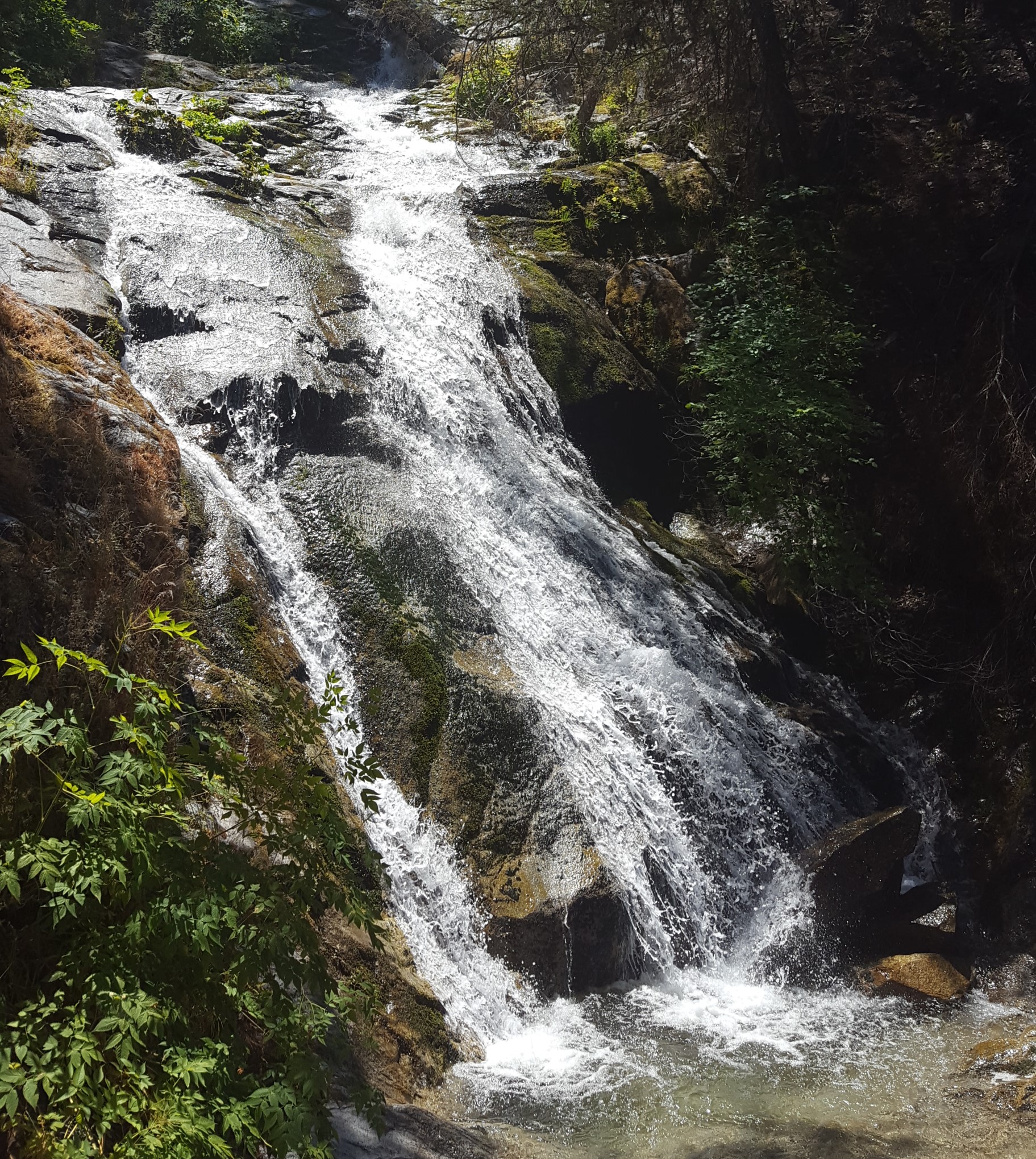
Upper Whiskeytown Falls Photo: NPS/Lisa Johnston Whiskeytown Falls is a series of cascades which drop 220 feet as the east fork of Crystal Creek winds down the slope of Shasta Bally. The falls are accessed by the James K. Carr trail, a moderately strenuous 3.4 mile round-trip path which follows old logging routes through shade and sun in a forested area that was only lightly affected by the Carr Fire of 2018. Beginning at an elevation of 2200 feet, the trail descends for about .25 miles before making a steady ascent up to the falls at 2900 feet. Be sure to stay to the right at the Mill Creek trail junction.
About .25 miles from the end of the trail, you will find a level picnic area. Steps and handrails along the cascades are provided for safety. Upper levels of the path have been damaged since the Carr fire and may not be accessible until repair work is completed. Please to not continue past any closures.
Parking for the James K. Carr trail is located 3.5 miles up Crystal Creek Road on the west side of the park. A gravel parking lot will be on your left, perched over the forested ravine of Crystal Creek near the end of the paved road. If you have arrived at a closed gate, you have gone a little too far. A vault-style restroom is provided at the trailhead on the east side of the gravel lot.
Accessibility Be aware that the James K. Carr trail is considered a moderately difficultly hike with a round trip distance of 3.4 miles and an elevation gain of 700. The trail is steep in places and is unpaved with loose rocks, sand and gravel. People with mobility issues are advised to use extra caution when considering participating in this activity.
This hike on nps.gov
On the parks map · Drive to the trail's end
0.4 mi one way · about 50 ft of climbing · 150 ft of descent · 1,221 ft–1,359 ft · native surface · hiking
Visitor centers
1,267 ft
1,272 ft · 0.2 mi
high 1,272 ft
Along the way Visitor Information Center/Overlook
On the parks map · Drive to the trail's end
0.2 mi one way · about 50 ft of climbing · 1,230 ft–1,280 ft · native surface · hiking
1,230 ft
1,280 ft · 0.2 mi
high 1,280 ft
On the parks map · Drive to the trail's end
2 more mapped segments without a name are on the map, not in the list.
The lines are the National Park Service's public trails layer, the trailheads and the waterfalls, views, peaks and historic places along them the Service's public points of interest, read 2026-10-14 and simplified for the map. The write-ups are the Service's own "things to do", unedited. Heights come from USGS 3DEP through Terrain Tiles on AWS (Mapzen/Tilezen), read along each line and rounded; a short trail on steep ground can be off by a few tens of feet. Closures change: check the park's own site before you go.