
National Monument · Arizona
Trails in Tuzigoot National Monument
8 named trails · 3 miles · 1 with the Park Service's own write-up. The lines, trailheads and points are the Park Service's; the write-ups are the Service's own words; the climbing is read from USGS elevation along each line.
8 trails, A to Z.
TUZI Connector Trail
TUZI Marsh Overlook Trail
ExhibitsVisitor centers
Along the way Information Sign Information Sign Information Sign Information Sign Information Sign Information Sign Information Sign Information Sign Information Sign Visitor Center
TUZI Old Dairy Trail Road
TUZI Tavasci Marsh Trail
TUZI VC Parking Lot ADA Accessible Ramp
ExhibitsVisitor centers
Along the way Information Sign Information Sign Visitor Center
Tuzigoot Pueblo Trail
ExhibitsVisitor centers
Along the way Information Sign Information Sign Information Sign Information Sign Information Sign Information Sign Information Sign Information Sign Information Sign Information Sign Information Sign Information Sign and 1 more
Visit Tuzigoot Pueblo the Park Service's write-up
30-45 Minutes · dogs allowed · entrance fee applies
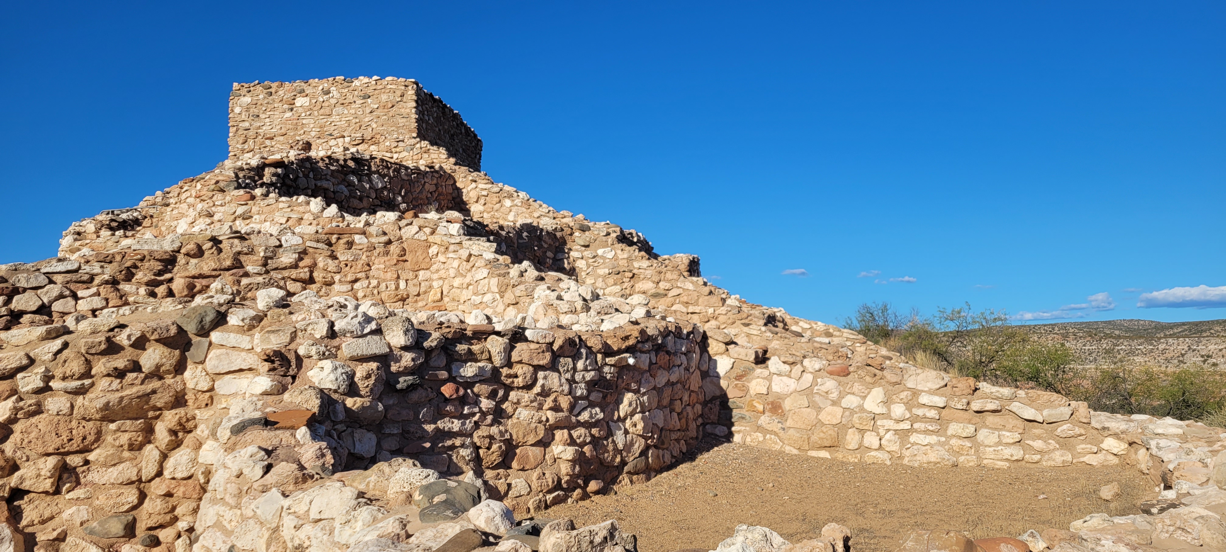
Have you ever wondered what life in the desert would have looked like thousands of years ago? Visitors to Tuzigoot National Monument can look into the lives of the Sinagua , the people who lived here and built the pueblo the park is named for by hiking the Pueblo Trail. The trail is a 0.3 mile (0.5 km) loop that encircles the dwelling and allows an up close look at this incredible testament to community and ancient engineering.
Visitors can also walk into and stand on the roof of one of the pueblo rooms. The tower or citadel provides the opportunity to view the inner structure of a pueblo room and some relief from the intense sun. A set of stairs leads to the roof of the citadel which offers 360-degree views of Tuzigoot.
The pueblo was constructed and expanded in four phases from approximately 1050 CE to 1380. By the end of construction, Tuzigoot held about 110 rooms, 23 of them built on the second story. It's estimated about 225 people could have lived in the pueblo at its peak. It's very likely that women in the community constructed most of the structure while men gathered materials. Tuzigoot was just one of many Sinagua villages in the Verde Valley at the time; there were at least three other villages that were built within sight of Tuzigoot.
This was home to a vibrant, thriving community until the Sinagua left the Verde Valley by about the early 1400s. It's not known exactly why the Sinagua left the area, but it may have been for multiple reasons such as climate change causing hotter, drier conditions in the southwest, competition for resources with other peoples, collapse of trade routes, or disease. Traditional knowledge from some descendants of the Sinagua say the pueblos in the Verde Valley like Tuzigoot were never meant to be permanent settlements and it was just time for their people to move on. However, Tuzigoot is not abandoned and forgotten; it remains a place where people come to connect with their culture and heritage. It is remembered and honored.
Although most of Tuzigoot was reconstructed between 1933 and 1935, the reconstruction was built on the original foundation of the pueblo. Park staff continue to maintain the structure using natural materials and building techniques very similar to what the Sinagua would have used. If you're lucky, you may see cultural resources staff hard at work on this important project.
Safety
Bring water on your walk. The Pueblo Trail does not have shade and summer high temperatures range from 95 ° to 115 ° F (35 ° to 46 ° C). The park does not sell bottled water, but water bottles can be purchased from the bookstore and a water bottle refill station and drinking fountain are available at the restrooms.
From spring through fall, rattlesnakes are seen in the park and may be present on the trails. If you encounter a rattlesnake during your visit, please let a staff member know immediately. Park rangers are specially trained to safely relocate rattlesnakes. Never attempt to handle or move a snake yourself and give all snakes at least six feet of space. Please remember that we are visitors in their home; rattlesnakes and all other park wildlife are protected from harm or harassment by law.
Check the forecast ahead of time. From July through mid-September, heavy rainstorms called monsoons are common in the afternoon. Park trails are closed for 30 minutes following any lightning strikes five miles or less from the park.
Regulations
Never climb or sit on the dwellings or structures. Please refrain from touching dwelling walls.
Please stay on the trail.
Drones and other unmanned aircraft are not permitted in the park.
Please leave all plants, animals, rocks, artifacts, bones, and other items where you find them for others to enjoy. If you find something interesting on the trail, take a photo to share with a ranger.
Pets are welcome on the trails but must be on a leash no more than six feet at all times. Always clean up after your pet. Never leave your pets in the car.
Accessibility The Pueblo Trail is entirely paved and generally easy in difficulty, but includes some steeper grades that are not suitable for wheelchairs and may be difficult for those with balance, mobility, or knee issues. Benches are located along the trail, but most of the trail is in the sun for the duration of the day. The citadel roof is accessed by two sets of stairs and hazards include dim lighting and steep, potentially slippery stairs. Accessing the citadel roof may be difficult for those with vision issues.
Verde River Greenway trail
More hikes the Park Service describes
Write-ups that name no single mapped trail, in the Service's words.
- Become a Montezuma Castle and Tuzigoot BARK Ranger · 30-120 Minutes · dogs allowed
Do you think your dog has what it takes to become an official Montezuma Castle and Tuzigoot Bark Ranger? Stop by the visitor center to get certified. Certification allows you to purchase an exclusive BARK Ranger badge from the bookstore.
About these trails
The lines are the National Park Service's public trails layer, the trailheads and the waterfalls, views, peaks and historic places along them the Service's public points of interest, read 2026-10-14 and simplified for the map. The write-ups are the Service's own "things to do", unedited. Heights come from USGS 3DEP through Terrain Tiles on AWS (Mapzen/Tilezen), read along each line and rounded; a short trail on steep ground can be off by a few tens of feet. Closures change: check the park's own site before you go.