
National Park · North Dakota
Trails in Theodore Roosevelt National Park
34 named trails · 94 miles · 24 trailheads · 9 with the Park Service's own write-up. The lines, trailheads and points are the Park Service's; the write-ups are the Service's own words; the climbing is read from USGS elevation along each line.
34 trails, A to Z.
Achenbach Trail
ViewsExhibits
Along the way Wayside Exhibit - "Roosevelt and the Boat Thieves" Achenbach View Oxbow Overlook Oxbow Overlook Sperati Point View
Trailhead Oxbow Overlook Trailhead 2,405 ft Drive there
Hiking in the North Unit the Park Service's write-up
no dogs
Start Theodore Roosevelt National Park - North Unit
Trail and Information Guide
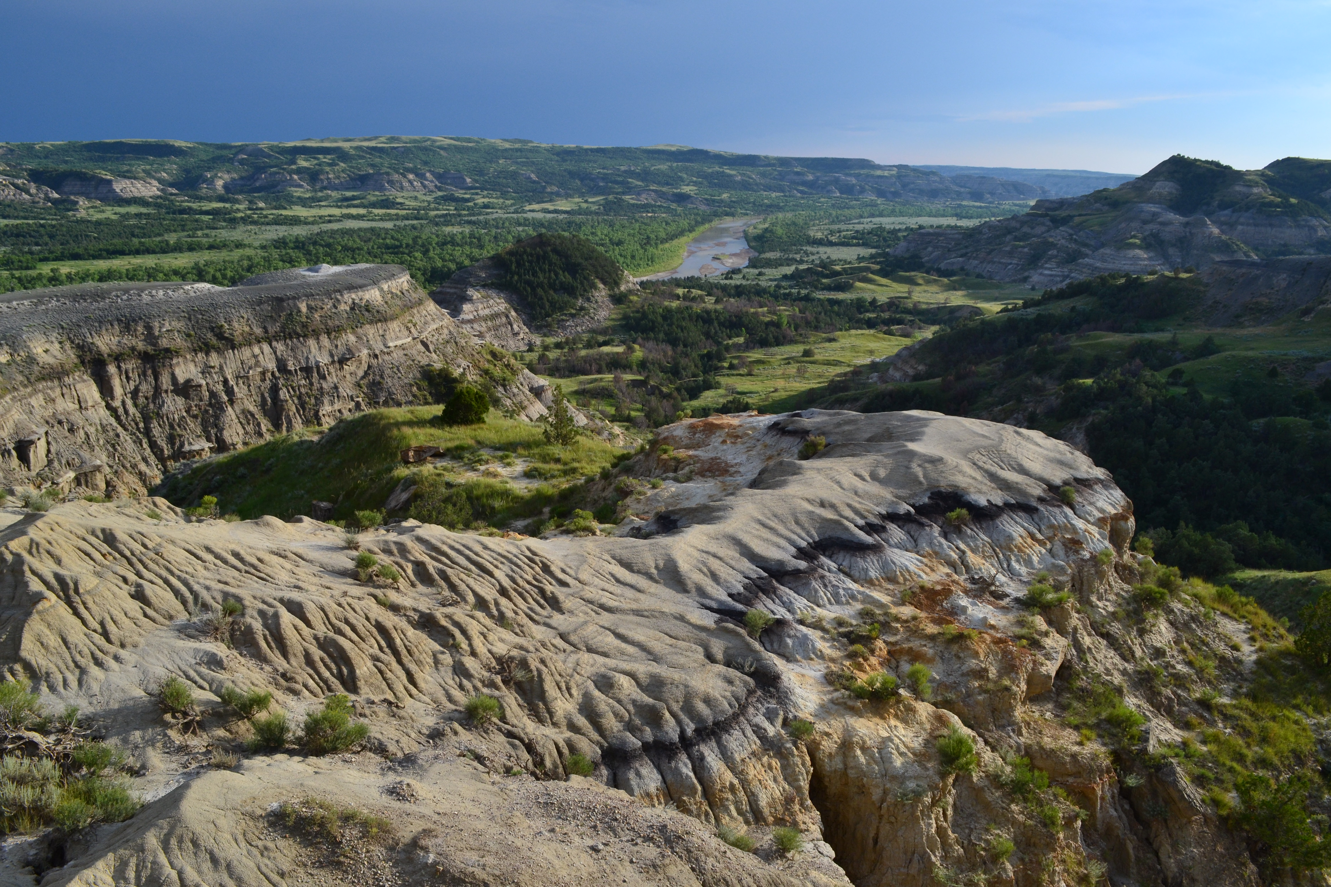
Known for its dramatic scenery and wilderness character, hiking trails in the North Unit offer opportunities for solitude and discovery.
From paved nature trails to rugged backcountry trails, there are many options to fit all levels of hikers.
Are you a nature enthusiast looking for a casual hike to learn more about the park’s resources? Try one of the park’s short nature trails!
Maybe you’re looking for an adventurous wilderness experience? Explore options for backcountry trails that traverse rugged badlands terrain.
Pets Pets are not allowed on trails. Pets can only be on 6 foot leashes where cars can go; roadway, scenic pulloffs, and picnic areas/campgrounds.
Accessibility The Little Mo Nature Trail under Nature Trails Tile below is an accessible trail.
Badlands Spur Trail
Trailhead Badlands Spur Trailhead 2,361 ft Drive there
Big Plateau Trail
Buckhorn Trail
Exhibits
Along the way Wayside Exhibit - "Cannon Ball Concretions" Wayside Exhibit - "Longhorns" Wayside Exhibit - "Trail Information"
Trailheads Buckhorn Trail Trailhead 1,975 ft Drive there · Cannonball Concretions Trailhead 1,972 ft Drive there
Explore the Cannonball Concretions the Park Service's write-up
5-15 Minutes · no dogs
Start Cannonball Concretion Pullout
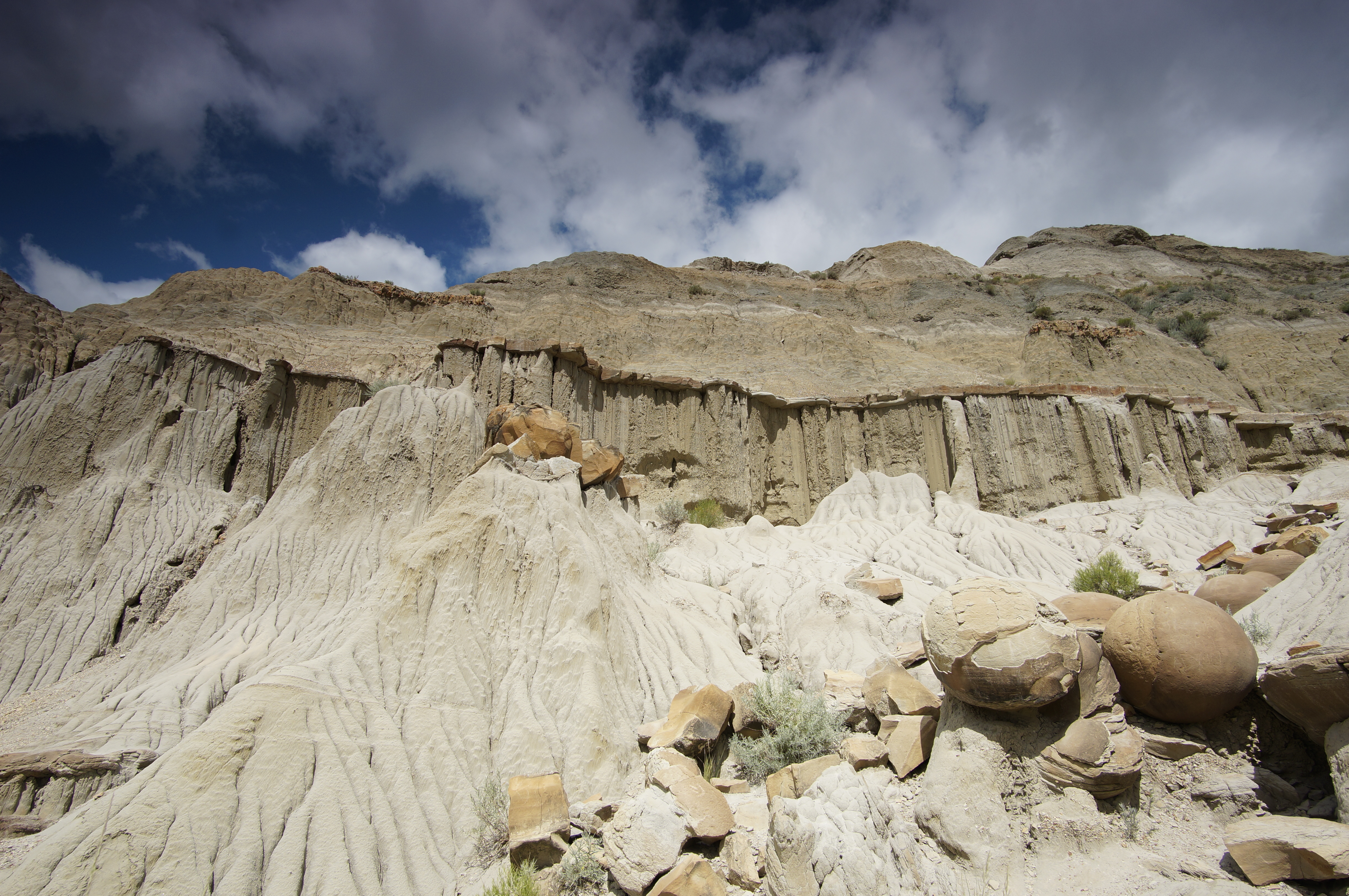
Driving the North Unit Scenic Drive, the cannonball concretions can be an arresting sight. These large, round rocks don't seem to fit with the rest of the landscape. Stop at this pullout and explore their mysteries!
Hikers can also access the 11.4 mile Buckhorn trail at this pullout. Proper hiking gear, water, and sun protection are recommended.
It is illegal to remove any resource from a national park. Leave any flower, stone, or other object where you find it so that other visitors can enjoy it as well.
It is illegal to carve, paint, or otherwise alter anything in a national park.
Accessibility A sidewalk provides accessible viewing of the cannonball concretions and of an interpretive exhibit. The cannonball concretions are located in an unpaved area which may include uneven ground and potential slip hazards. Proper footwear is recommended. Service animals are allowed, but must be on a leash no longer than 6 feet.
Hike The Little Mo Nature Trail the Park Service's write-up
30-45 Minutes · no dogs
Start Little Mo Nature Trail trailhead
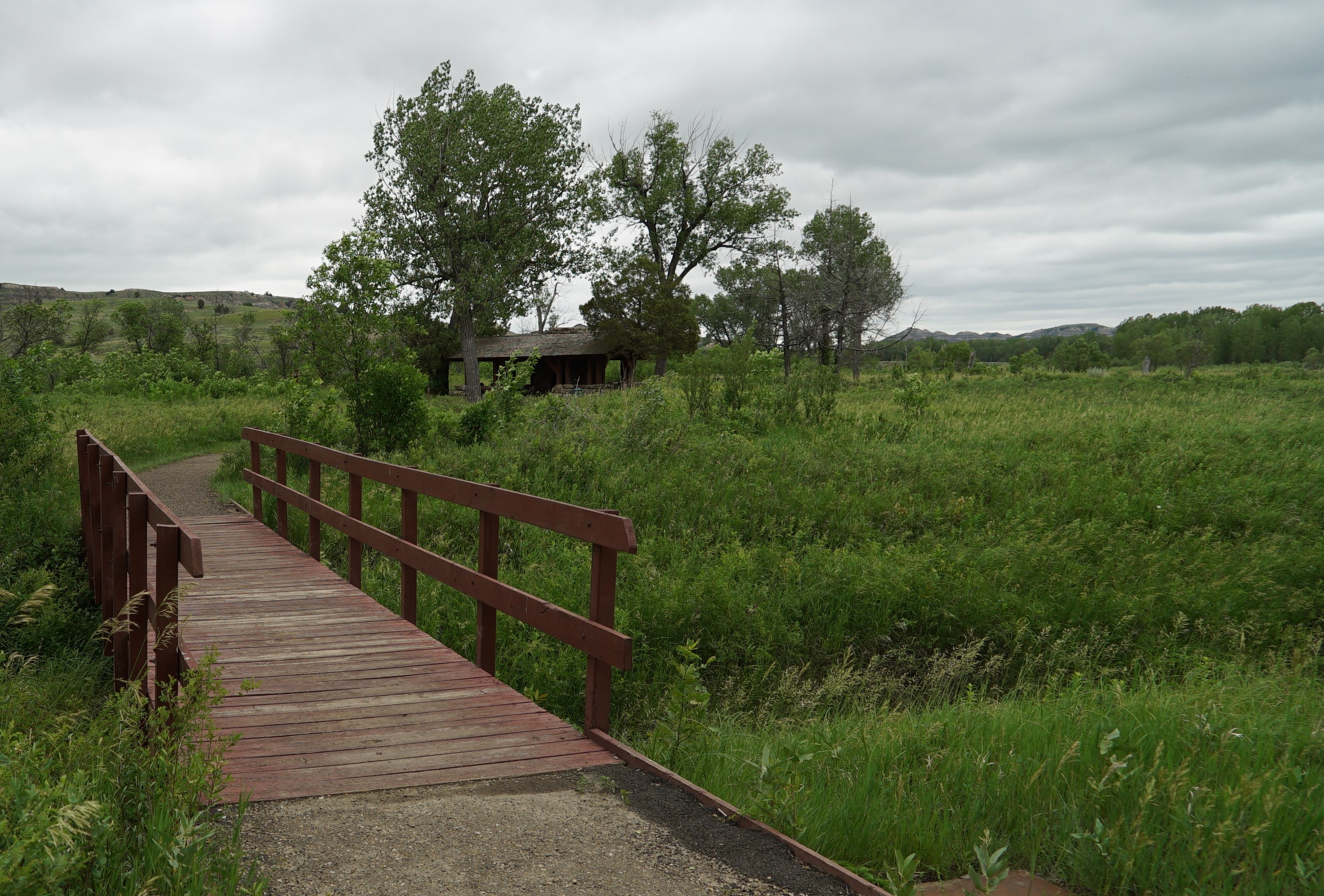
The Little Mo Nature Trail offers a different look at the North Unit of Theodore Roosevelt National Park. Winding along the river, where the harsh badlands transform into lush greenery, the trail includes stops where visitors can read from a free guide to learn more about the park. The trail is a 0.7 mile paved loop, with an additional 0.7 mile section of unpaved trail.
Proper footwear is recommended.
It is illegal to remove any resource from a national park. Leave any flower, stone, or other object where you find it so that other visitors can enjoy it as well.
It is illegal to carve, paint, or otherwise alter anything in a national park.
Accessibility The Little Mo Nature Trail is approximately five feet wide and has a 0.7 mile paved inner loop and an additional 0.7 mile outer loop that has unpaved sections and steep stairs. The trail may contain uneven footing and slip or trip hazards. Proper footwear is recommended. Service animals are allowed, but must be on a leash no longer than 6 feet.
Hiking in the North Unit the Park Service's write-up
no dogs
Start Theodore Roosevelt National Park - North Unit
Trail and Information Guide
Known for its dramatic scenery and wilderness character, hiking trails in the North Unit offer opportunities for solitude and discovery.
From paved nature trails to rugged backcountry trails, there are many options to fit all levels of hikers.
Are you a nature enthusiast looking for a casual hike to learn more about the park’s resources? Try one of the park’s short nature trails!
Maybe you’re looking for an adventurous wilderness experience? Explore options for backcountry trails that traverse rugged badlands terrain.
Pets Pets are not allowed on trails. Pets can only be on 6 foot leashes where cars can go; roadway, scenic pulloffs, and picnic areas/campgrounds.
Accessibility The Little Mo Nature Trail under Nature Trails Tile below is an accessible trail.
Caprock Coulee Trail
ViewsExhibits
Along the way Wayside Exhibit - "Trail Information" River Bend Overlook River Bend Overlook River Bend Overlook
Trailheads Caprock Coulee Trailhead 2,052 ft Drive there · Riverbend Overlook Trailhead 2,424 ft Drive there
Hiking in the North Unit the Park Service's write-up
no dogs
Start Theodore Roosevelt National Park - North Unit
Trail and Information Guide
Known for its dramatic scenery and wilderness character, hiking trails in the North Unit offer opportunities for solitude and discovery.
From paved nature trails to rugged backcountry trails, there are many options to fit all levels of hikers.
Are you a nature enthusiast looking for a casual hike to learn more about the park’s resources? Try one of the park’s short nature trails!
Maybe you’re looking for an adventurous wilderness experience? Explore options for backcountry trails that traverse rugged badlands terrain.
Pets Pets are not allowed on trails. Pets can only be on 6 foot leashes where cars can go; roadway, scenic pulloffs, and picnic areas/campgrounds.
Accessibility The Little Mo Nature Trail under Nature Trails Tile below is an accessible trail.
Coal Vein Nature Trail
Exhibits
Along the way Wayside Exhibit - "Hell with Fire Out"
Trailhead Coal Vein Trailhead 2,510 ft Drive there
Hike Coal Vein Trail the Park Service's write-up
30-45 Minutes · no dogs
Start Coal Vein Trailhead
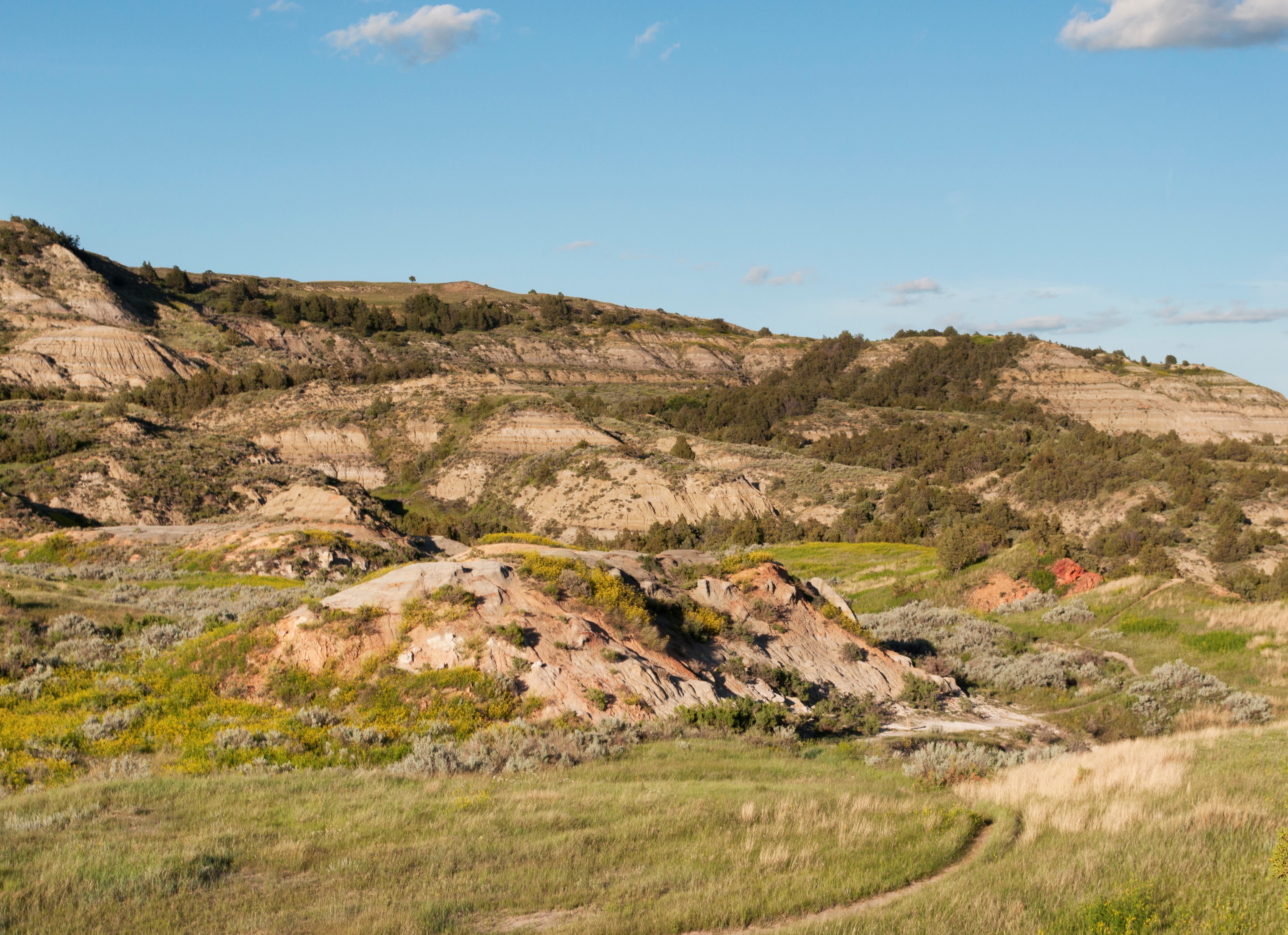
You've seen the beautiful red clinker capping the tops of buttes throughout the Little Missouri badlands. But where does it come from?
Coal Vein Trail answers this and many more of your geology questions along its 0.8-mile length. Pick up one of the trail guides from the trailhead and go on a self-guided tour of the small loop, learning about clinker, bentonite, and the coal seam that burned here for more than 25 years!
Hikers should wear proper footwear and keep away from steep cliff edges.
It is illegal to remove any resource from a national park. Leave any flower, stone, or other object where you find it so that other visitors can enjoy it as well.
It is illegal to carve, paint, or otherwise alter anything in a national park.
Pets Pets are welcome in Theodore Roosevelt National Park. However, they are only allowed in certain areas. Leashed pets may be walked along roads and road shoulders, sidewalks, parking areas, and in campgrounds and picnic areas. More information: Visiting with Pets .
Accessibility Coal Vein Trail is an unpaved trail which includes uneven footing, steep stairs, and potential slip hazards. Hikers should keep away from steep cliff edges. Proper footwear is recommended. Service animals are allowed, but must be on a leash no longer than 6 feet.
Ekblom Trail
Trailhead Peaceful Valley Trailhead 2,245 ft Drive there
Elkhorn Ranch South Trailhead
Elkhorn Ranch Unit Trail
Visit the Elkhorn Ranch Unit the Park Service's write-up
3-6 Hours · no dogs
Start Elkhorn Ranch Parking Area
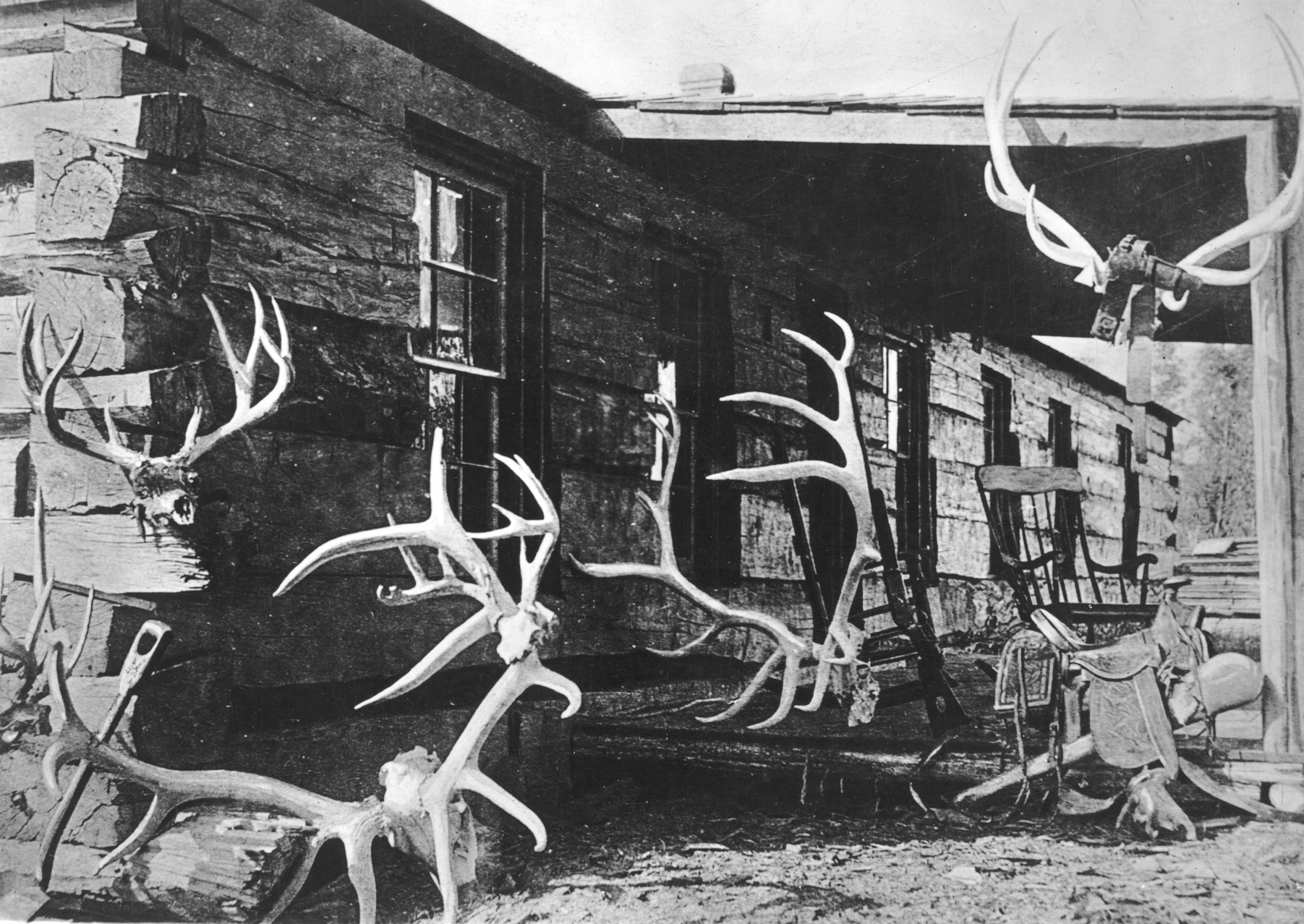
The Elkhorn Ranch may seem like a long drive for little reward; after all, the cabin no longer stands, with only foundation stones remaining. However, make the trip, and you'll find yourself in one of the most peaceful parts of Theodore Roosevelt National Park.
Roosevelt established the Elkhorn after the tragic loss of his wife and mother on the same day in 1884. Looking for somewhere more quiet and remote than the Maltese Cross Cabin, with its relative proximity to Medora, Roosevelt headed north, eventually choosing a spot that spanned the Little Missouri river. This location and the house he built there became a retreat for him. Take a moment and stand atop one of the foundation stones while visiting and imagine what Roosevelt's ranch life might have been like.
"My home ranch-house stands on the river brink. From the low, long veranda, shaded by leafy cotton-woods, one looks across sand bars and shallows to a strip of meadowland, behind which rises a line of sheer cliffs and grassy plateaus. This veranda is a pleasant place in the summer evenings when a cool breeze stirs along the river and blows in the faces of the tired men, who loll back in their rocking-chairs (what true American does not enjoy a rocking-chair?), book in hand--though they do not often read the books, but rock gently to and for, gazing sleepily out at the weird-looking buttes opposite, until their sharp outlines grow indistinct and purple in the after-glow of the sunset." - From Hunting Trips of a Ranchman by Theodore Roosevelt.
Accessibility The Elkhorn Ranch unit is a remote, 218-acre site with a flat 0.7 mile mowed trail leading to the former location of the Elkhorn Ranch cabin. The ground can be slippery in inclement weather. Service animals are allowed, but must be on a leash no longer than 6 feet.
Halliday Well Trailhead
Trailhead Halliday Well Trailhead 2,273 ft Drive there
Jones Creek Trail
Exhibits
Along the way Wayside Exhibit - "Building from Hard Times"
Trailheads Lower Jones Creek Trailhead 2,249 ft Drive there · Upper Jones Creek Trailhead 2,471 ft Drive there
Little Missouri Nature Trail
Trailhead Little Missouri Nature Trail Trailhead 1,954 ft Drive there
Lone Tree Trail
Trailhead Peaceful Valley Trailhead 2,245 ft Drive there
Lower Paddock Creek Trail
Trailhead Halliday Well Trailhead 2,273 ft Drive there
Lower Talkington Trail
Trailhead Lower Talkington Trailhead 2,443 ft Drive there
Maah Daah Hey Trail
Mike Auney Shortcut Trail
Campgrounds
Along the way Roundup Horse Group Campground
Mike Auney Trail
Trailhead Mike Auney Trailhead 2,386 ft Drive there
North Achenbach Trail
Exhibits
Along the way Wayside Exhibit - "Roosevelt and the Boat Thieves"
Trailhead Oxbow Overlook Trailhead 2,405 ft Drive there
Old East Entrance Station Trail
History
Along the way Historic South Unit Entrance Station
Trailhead Old East Entrance Trailhead 2,571 ft Drive there
Painted Canyon Loop Trail
Exhibits
Along the way Wayside Exhibit - "Dude on the Frontier" Wayside Exhibit - "Invador on the Badlands" Wayside Exhibit - "Invasion Confronted"
Trailhead Painted Canyon Nature Trail Trailhead 2,786 ft Drive there
Painted Canyon Trail
Trailhead Painted Canyon Trailhead 2,773 ft Drive there
Hike the Painted Canyon Nature Trail the Park Service's write-up
30-80 Minutes · no dogs
Start Painted Canyon Nature Trail Trailhead
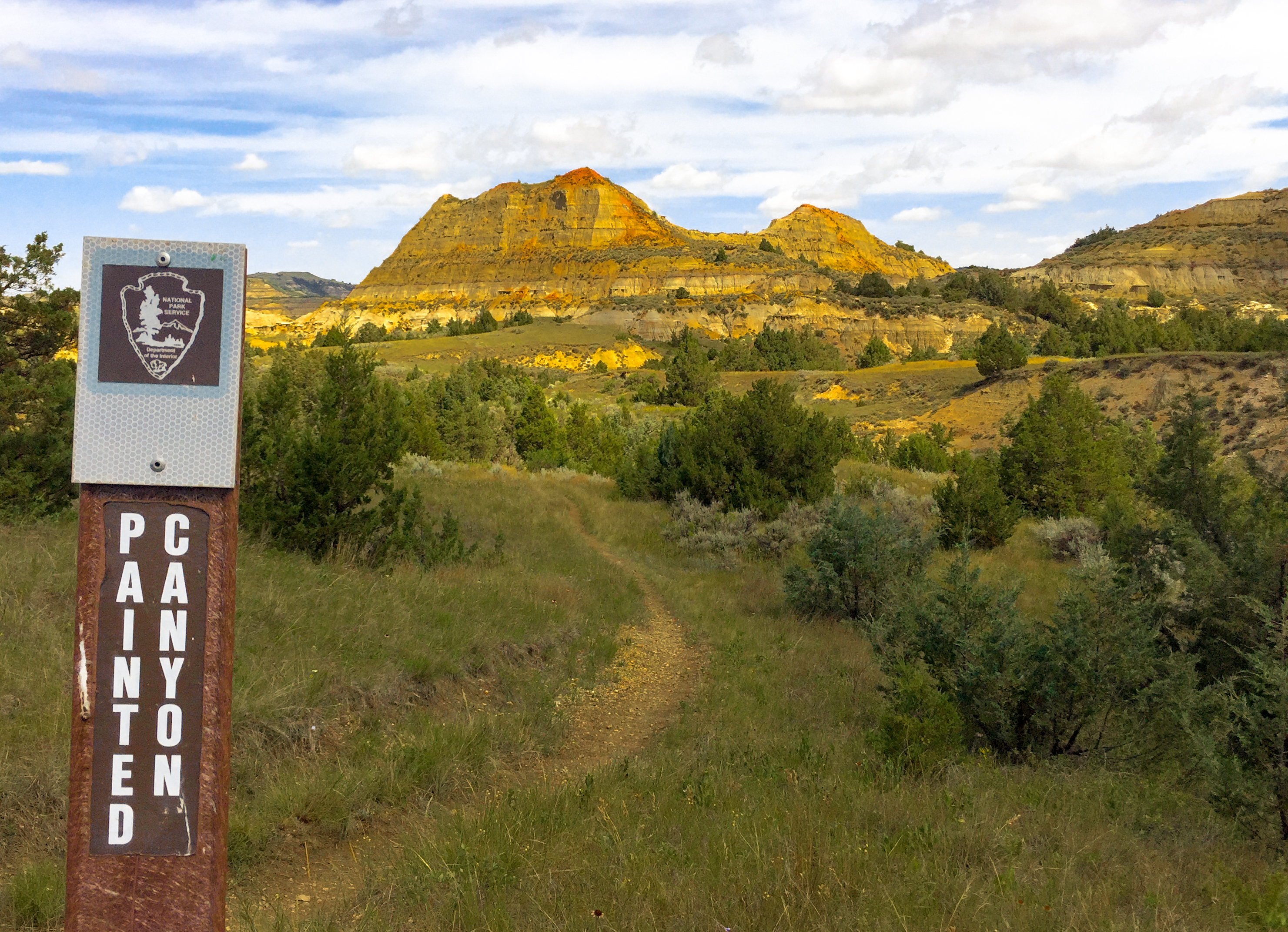
For visitors arriving from the east, Painted Canyon is a dramatic introduction to the badlands of North Dakota. Named for its vivid layers, it's also home to one of the most popular trails in the park, a 1-mile loop that drops down into the canyon. Winding through juniper and wildflowers, crossing cracked washes and showcasing ongoing erosion, the Painted Canyon Nature Trail offers a moderate challenge with massive rewards.
Proper footwear is recommended.
It is illegal to remove any resource from a national park. Leave any flower, stone, or other object where you find it so that other visitors can enjoy it as well.
It is illegal to carve, paint, or otherwise alter anything in a national park.
Accessibility Painted Canyon Nature Trail is an unpaved trail which includes uneven footing, steps, and potential slip hazards. Proper footwear is recommended. Service animals are allowed, but must be on a leash no longer than 6 feet.
Peacefull Valley Ranch
Trailhead Peaceful Valley Trailhead 2,245 ft Drive there
Petrified Forest Loop Trail
Trailhead Petrified Forest Trailhead 2,556 ft Drive there
Hike the Petrified Forest the Park Service's write-up
2-10 Hours · no dogs
Start Petrified Forest Trail
Petrified Forest Trailhead Access Update: Use Approved Route
Directions to the Petrified Forest trailhead have changed. Please use the approved legal route from I-94, Exit 10 toward Camels Hump Lake and follow the clearly marked posts. This update helps maintain good cooperation with neighbors and respect park boundaries.
Take Exit 10 towards Camels Hump Lake
Turn right and continue on CR -11
Take an immediate right and travel for 3.7 miles
Turn right onto 30th St SW and travel for 3.5 miles
Turn left onto Wannagan Creek Rd at Durham Ranch (Watch for Children sign present) and travel for 3.2 miles
Turn right onto 730 (no sign present) and travel for 4.4 miles
Turn left and travel 1 mile to the Petrified Forest trailhead
The trail starts at the lift gate behind the trailhead sign
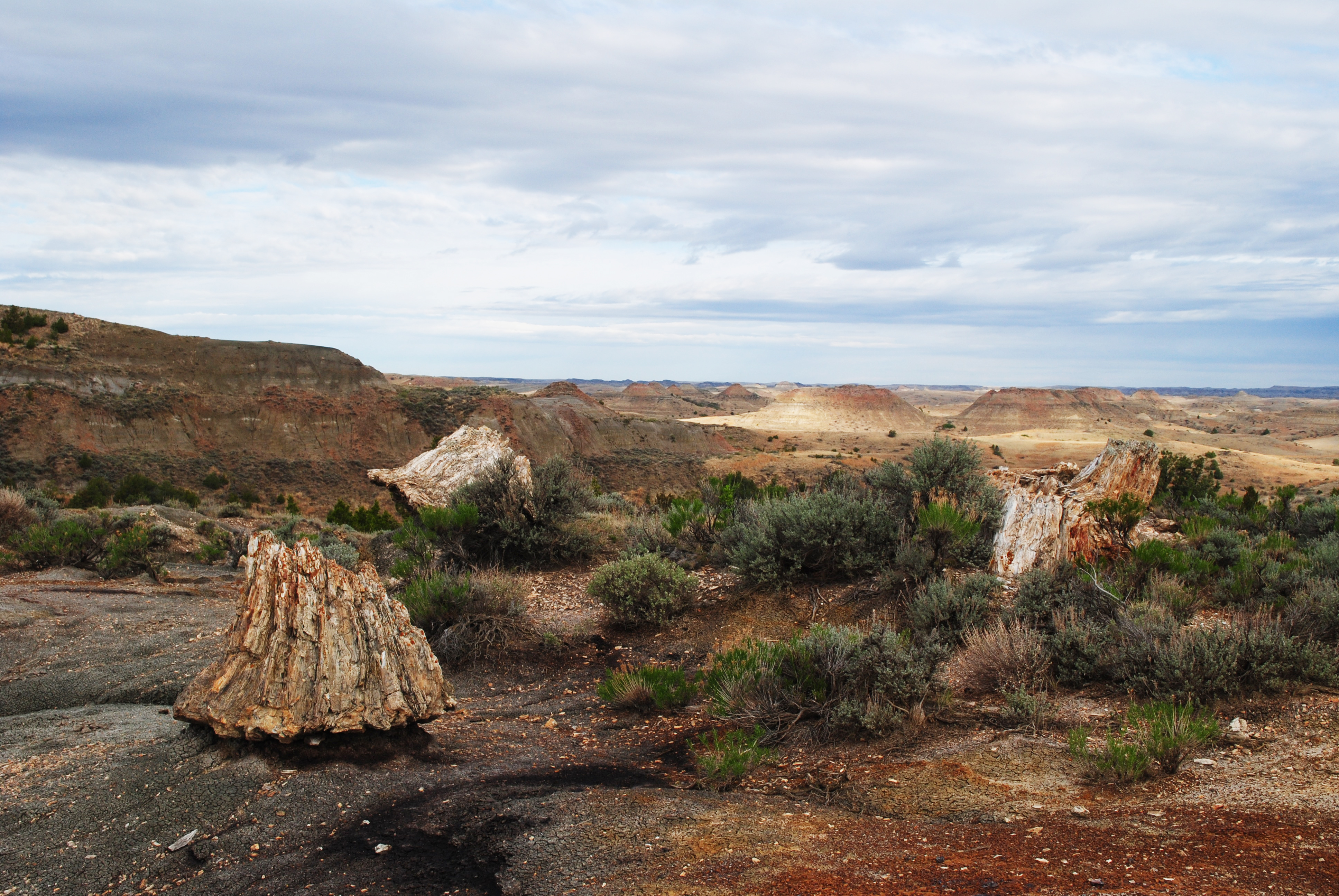
From Medora, the drive to the Petrified Forest is approximately 50 minutes on dirt and gravel roads. Theodore Roosevelt National Park is home to the third highest concentration of petrified wood in the United States. These geological wonders give context to the park's past, allowing hikers to travel back to a time when, instead of buttes and prairies, the landscape was dominated by massive trees and shallow swamps.
The trail travels up out of the badlands onto a wide prairie where it splits, each section then dropping down into a valley containing the petrified stumps. Both sections of petrified wood are approximately 1.5 miles from the parking area.
Hikers can continue past the petrified wood to complete the 10.4 mile loop or access other trails in the park. Additional water and supplies are recommended for this longer hike.
It is illegal to remove any resource from a national park. Leave any fossil, stone, or other object where you find it so that other visitors can enjoy it as well.
Accessibility The Petrified Forest Trail is a remote, unpaved backcountry trail which includes steep slopes, uneven footing, and potentially unstable ground. Proper footwear is recommended. Service animals are allowed, but must be on a leash no longer than 6 feet.
Riverbend Overlook Trail
ViewsExhibits
Along the way Wayside Exhibit - "Building from Hard Times" River Bend Overlook River Bend Overlook River Bend Overlook
Trailhead Riverbend Overlook Trailhead 2,424 ft Drive there
Roundup Camp Trail
Skyline Vista Trail
Trailhead Skyline Vista Trailhead 2,542 ft Drive there
Hike Skyline Vista Trail the Park Service's write-up
5-15 Minutes · no dogs
Start Skyline Vista Trailhead
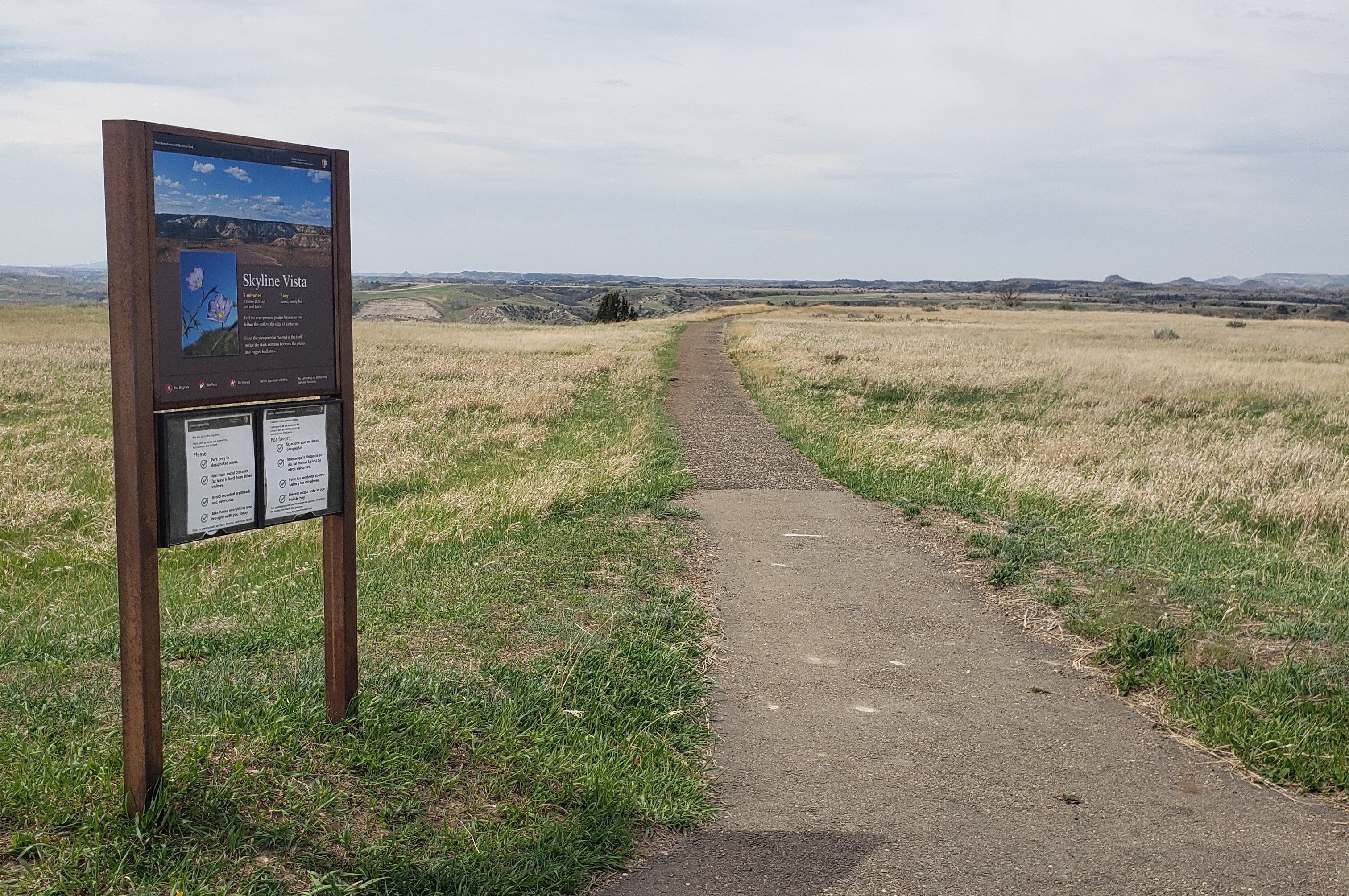
Skyline Vista Trail is a great way to start your visit to Theodore Roosevelt National Park's South Unit. This accessible 0.1 mile round-trip trail is located just a little more than four miles into the park and gives wonderful views of the western horizon.
It is illegal to remove any resource from a national park. Leave any flower, stone, or other object where you find it so that other visitors can enjoy it as well.
It is illegal to carve, paint, or otherwise alter anything in a national park.
Pets Pets are welcome in Theodore Roosevelt National Park. However, they are only allowed in certain areas. Leashed pets may be walked along roads and road shoulders, parking areas, and in campgrounds and picnic areas. More information: Visiting with Pets .
Accessibility Skyline Vista Trail is a fully paved and accessible trail. Accessible parking is located right at the trailhead. Service animals are allowed, but must be on a leash no longer than 6 feet.
South Petrified Forest Trail
Sperati Point Overlook
Views
Along the way Sperati Point View
Talkington Trail
Upper Paddock Creek Trail
Upper Talkington Trail
Trailheads Lower Talkington Trailhead 2,443 ft Drive there · Upper Talkington Trailhead 2,433 ft Drive there
Wind Canyon Trail
Exhibits
Along the way Wayside Exhibit - "Carved by Wind and Water"
Trailhead Wind Canyon Trailhead 2,348 ft Drive there
Hike Wind Canyon Trail the Park Service's write-up
5-30 Minutes · no dogs
Start Wind Canyon Trailhead
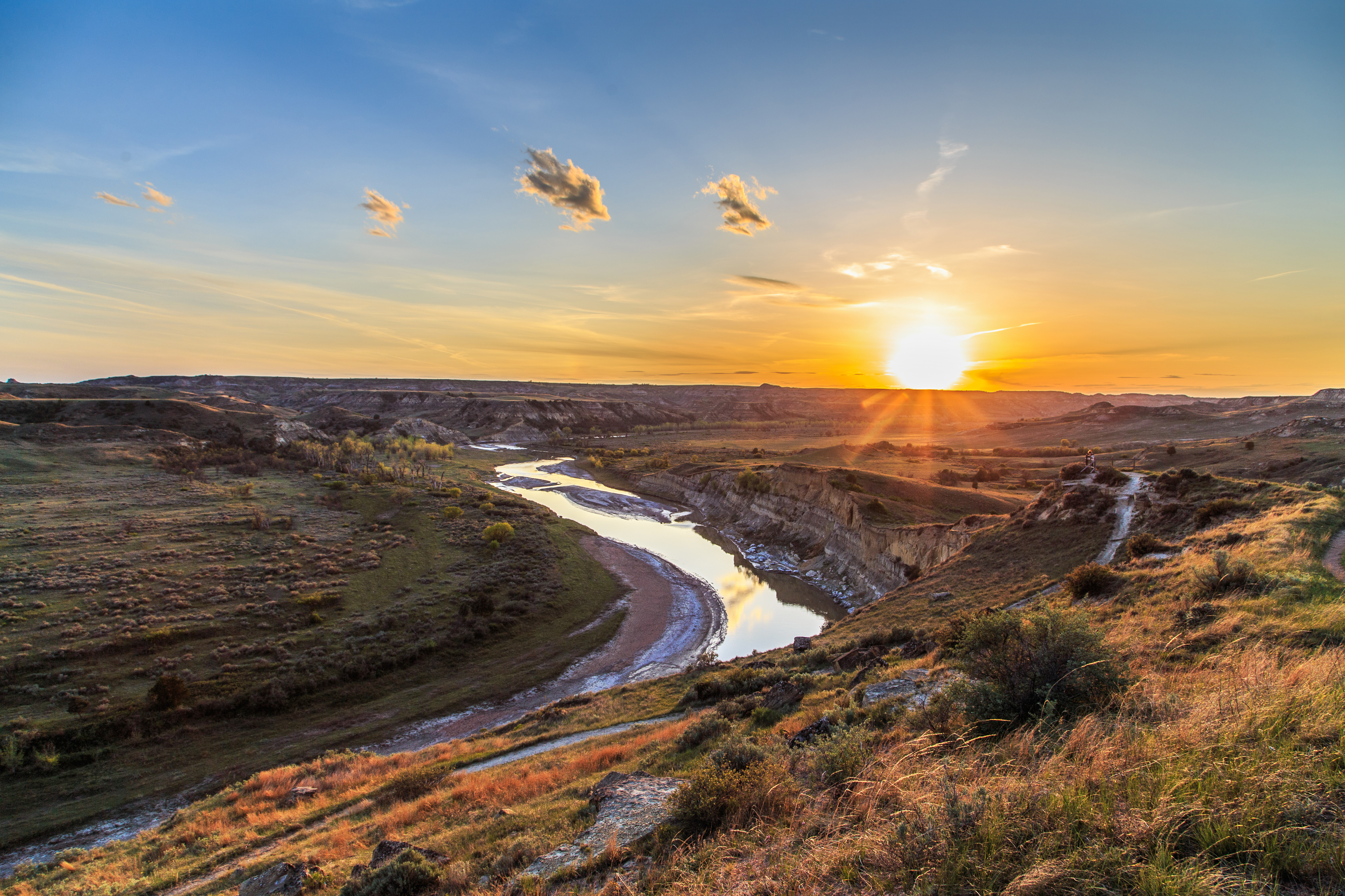
There are many beautiful vistas in the South Unit of Theodore Roosevelt National Park, but perhaps none are more dramatic than the view from Wind Canyon trail. This short loop trail travels along wind eroded cliffs above the Little Missouri river, before climbing up to a dramatic lookout point.
A perfect place for a short hike or to watch the sunset over the badlands, no trip to Theodore Roosevelt National Park is complete without stopping here.
Hikers should wear proper footwear and keep away from steep cliff edges.
It is illegal to remove any resource from a national park. Leave any flower, stone, or other object where you find it so that other visitors can enjoy it as well.
It is illegal to carve, paint, or otherwise alter anything in a national park.
Pets Pets are welcome in Theodore Roosevelt National Park. However, they are only allowed in certain areas. Leashed pets may be walked along roads and road shoulders, sidewalks, parking areas, and in campgrounds and picnic areas. More information: Visiting with Pets .
Accessibility Wind Canyon Trail is an unpaved trail which includes uneven footing, steps, and potential slip hazards. There is a very small seating area approximately halfway along the trail. Proper footwear is recommended. Service animals are allowed, but must be on a leash no longer than 6 feet.
3 more mapped segments without a name are on the map, not in the list.
More hikes the Park Service describes
Write-ups that name no single mapped trail, in the Service's words.
- Hike Boicourt Trail · 15-30 Minutes · no dogs
This short hike, with its elevated perspective and accessible trail, offers a unique view of the Little Missouri Badlands that the whole family can enjoy. - Hike up Buck Hill · 5-30 Minutes · no dogs
Hike to the top of Buck Hill, one of the highest points in the park, and get an amazing 360° view of the surrounding badlands! - Hiking in the South Unit · no dogs
From paved paths to strenuous backcountry trails – the hiking trails in the South Unit have a little something for everyone. Explore a sampling of park terrain with trail options to fit all levels of hikers.
About these trails
The lines are the National Park Service's public trails layer, the trailheads and the waterfalls, views, peaks and historic places along them the Service's public points of interest, read 2026-10-14 and simplified for the map. The write-ups are the Service's own "things to do", unedited. Heights come from USGS 3DEP through Terrain Tiles on AWS (Mapzen/Tilezen), read along each line and rounded; a short trail on steep ground can be off by a few tens of feet. Closures change: check the park's own site before you go.