
White Horse Trail
Picnic areas
Along the way Picnic Area = 16 Picnic Area = 17 Picnic Area = 18 Picnic Area = 22 Picnic Area = 28
Boulder Bridge Hike 4 mi loop · the Park Service's write-up
90-200 Minutes · dogs allowed
Start White Horse Trailhead

Overview:
This 4-mile loop hike travels through the forest and along the creek. President Theodore Roosevelt frequented this area of the park 100 years ago.
Directions from Rock Creek Park Nature Center and Planetarium
Begin by Parking at the Rock Creek Park Nature Center and Planetarium, located at 5200 Glover Road Northwest Washington, DC. If the parking there is full you can park at either Picnic Grove #13 (located at the split for Ridge and Glover roads near Military Rd) or in the parking area for the Maintenance Yard located at 5000 Glover Road NW.
Exit the Nature Center and turn left out the door. Walk back through the parking lot toward the Rock Creek Park Horse Center.
Take a sharp left into the Horse Center complex and keep left.
Walk past the small parking lot and gray barn towards the outdoor corrals. Look for the dirt trail to the left of the corral fence. This is the trail head for the White Horse Trail.
Stay straight on the path (do not take the split to the right). Walk down the hill towards the creek (roughly half a mile). You will come to a roadway, this is Ross Drive at Picnic Grove #22 .
Cross Ross Drive and follow the dirt path as it parallels the roadway towards Beach Drive (to the right)
Take a right just before the automobile bridge that crosses Rock Creek.
Heading downstream, listen to the fast-flowing water—i.e., rapids. This is the fall zone, a geologic transition zone where the Piedmont Plateau (harder rock) meets the Atlantic Coastal Plain (softer, sedimentary rock).
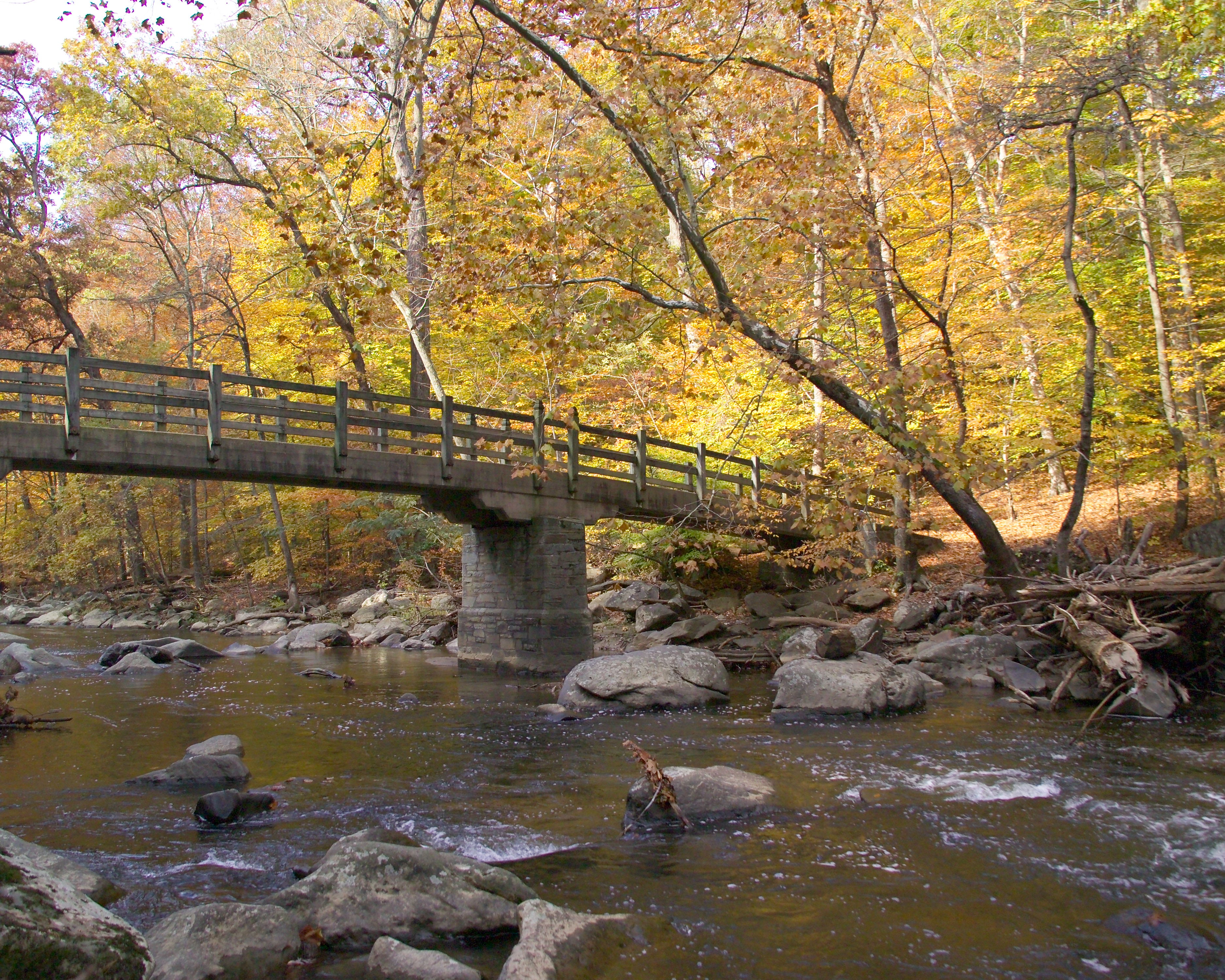
After hiking along the creek for a half mile, enjoy the view from the center of Rapids Bridge
Cross Rapids Bridge.
Turn right on Beach Drive and follow Rock Crek downstream. This will provide you with a beautiful panorama of Boulder Bridge .
Cross Boulder Bridge and stay on Beach Drive until you come to the gates at the intersection with Broad Branch Road. The trails returning to the Nature Center will be in the trees behind you and to the right. You will see a small white four way sign in the grass. The trailhead to come north is just beyond it.
Follow the signs for the Western Ridge Trail and take it north back towards the Rock Creek Park Nature Center. You will follow the light green blazes.
Walk by the horse turn-out at equitation field. Follow the “foot traffic only” signs when the trail veers off the wider horse trail.
After ¾ of a mile, the trail seems to end at Picnic Grove 13 and a grassy field. Cross the field and the two roads. Hike up the hill to the Nature Center.
Accessibility Trail starts at the Rock Creek Horse Center where it is roughly six feet across and relatively smooth, though there are occasional roots and rocks. The decent is sustained over half a mile. The bridle trail along the creek rises and falls with the natural terrain along the bank of the creek. The trail crosses Rapids Bridge which is a narrow concrete and metal bridge roughly four feet in width and forty feet across. The most accessible portion of this route is the segment that is on Beach Drive NW between Rapids Bridge and Boulder Bridge. The trail continues up a steep two foot wide foot trail. The ascent is steady and covers several hundred feet in elevation over half a mile. Visitors must once again cross a road stepping up and over curbs. The trail continues along the bridle trails though there are foot traffic only options. The foot traffic only option will be much more rugged and narrow while the bridle trails are wider and slightly smoother. A steep ascent up to another roadway and crossing curbs will bring visitors back to Picnic Grove #13 where additional roads and curbs will need to be crossed to return to the Nature Center.
Rapids Bridge Hike 2 mi loop · the Park Service's write-up
dogs allowed · season Visibility is increased in the late autumn and winter months when leaves have fallen, opening the landscape to deeper view sheds and better viewing of the creek. Trails are not cleared of snow and can have ice and compacted snow on them. Use caution.<br /> <br /> Spring and summer rains can flood the creek quickly. Seek higher ground if the water comes up to the trail level.<br /> <br />
Start Rapids Bridge
For your convenience this hike is blazed in bright orange tape wrapped around sign posts.
Exit left or walk south/back through the parking lot toward the Horse Center.
Take a sharp left into the Horse Center and keep left.
Walk past the small parking lot. Look for the dirt trail to the left of the corral fence. This is the beginning of the White Horse Trail .
Hike to the creek. Take a right just before the bridge that crosses Rock Creek.
Heading downstream, listen to the fast-flowing water—i.e., rapids. This is the fall zone, a geologic transition zone where the Piedmont Plateau (harder rock) meets the Atlantic Coastal Plain (softer, sedimentary rock).
After 3/5-mile, you will see Rapids Bridge. Be sure and enjoy the view from the footbridge.
Do not cross Rapids Bridge. Continue hiking 165-feet south. Take the unmarked trail to the right uphill.
In ¼ mile, at the trail fork, keep right and go under the bridge.
In ¼ mile, the dirt trail comes to a fork at the horse center. Take the trail to the right to rejoin the bridle trail you started on.
Turn left and return through the Horse Center parking area to the Nature Center.
The horse center barn, stables and paddocks are off limits. Please do not enter the facilities or try to pet the horses.
Accessibility Rapids Bridge Hike uses the wide bridle trail known as the White Horse Trail for it's initial descent. This trail is 6-8 feet wide and is relatively smooth and free of obstructions. The trail continues along the edge of the creek to Rapids Bridge, which is roughly four feet wide and sixty feet across. The trail that returns to the nature center can narrow in width to four feet and is steep and can have hazards, such as exposed roots and rocks. For an accessible alternative, visitors can exit the Nature Center and make use of the paved multi-use trail that parallels Military Road to go to the creek. From there, Beach Drive is a paved alternative to get to Rapids Bridge. The ascent back to the Nature Center via the paved multi-use path is steep. Take your time and use caution. If you prefer not to make the descent and have to come back up the hill you can park your vehicle at Picnic Grove #6 to access Beach Drive. Beach Drive is closed to motor vehicle traffic on Saturdays, Sundays and holidays.