
Rhododendron Trail
Bridges
Along the way Newton B. Drury Scenic Drive Bridge
Trailheads Moorman Pond Trailhead 400 ft Drive there · Rhododendron Trailhead 402 ft Drive there
Hike Zig Zag Loop 3.9 mi loop · the Park Service's write-up
no dogs
Start Moorman Pond Trailhead
Walk along flowing Prairie Creek before ascending to ridgetop views.
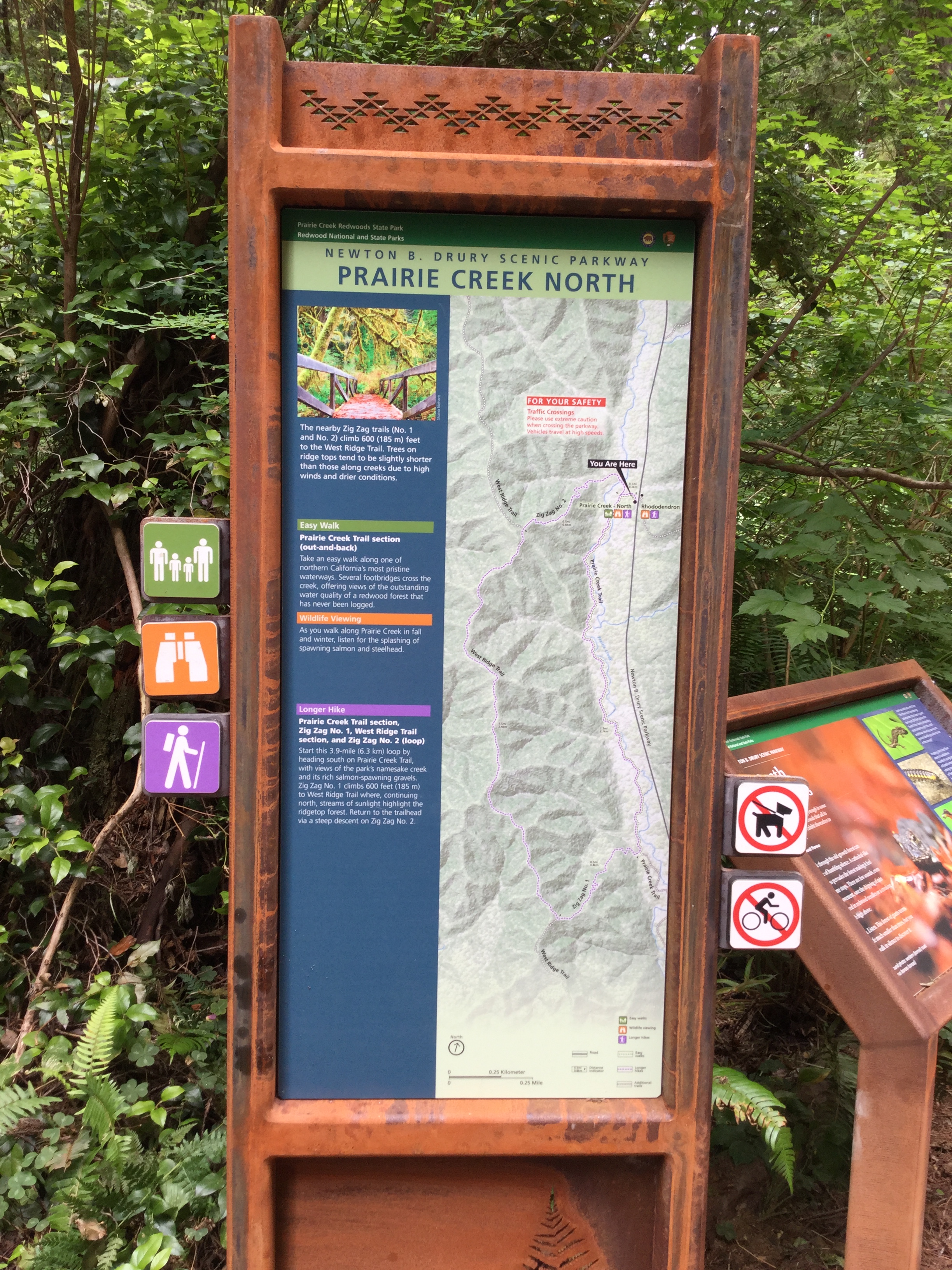
Start this 3.9-mile (6.3 km) loop by heading south on Prairie Creek Trail, with views of the park's namesake creek and its rich salmon-spawning gravels. Zig Zag No. 1 climbs 600 feet (185 m) to West Ridge Trail where, continuing north, streams of sunlight highlight the ridgetop forest. Return to the trailhead via a steep descent on Zig Zag No. 2.
Parking: Limited dirt parking at Moorman Pond Trailhead 3 1/2 miles north of the Prairie Creek Visitor Center on Newton B. Drury Parkway. May not be suitable for larger RVs and trailers.
Difficulty: This loop includes two very steep sections, each progressing 600 feet over 1/2 mile. The terrain is compact dirt and may be wet and muddy. You may need to go over large roots and possible debris.
Safety Tips
Use a good map and trail guide for your adventures in Redwood National and State Parks. Don’t rely on online maps.
To protect the habitats, leave no trace also means staying on the developed trail. Please don’t go off trail or make any new trails. These forests grow by the inch, and will die by your foot.
To protect the wildlife (and you and other visitors), pets are not allowed on park trails.
Cell coverage is very limited and cannot be relied on in an emergency. Have a plan for checking in and checking out with a friend when you are here.
Accessibility This narrow trail is not wheelchair-accessible. The terrain (compact dirt) is rough and uneven, and often has protruding roots. The first section is fairly level, but the trail is very steep past the intersection with Zig Zag No. 1.