
Fern Canyon Trail
Bridges
Along the way Foothill Trail Bridge
Hike the James Irvine Trail to Fern Canyon Loop 12 mi loop · the Park Service's write-up
4-8 Hours · no dogs · season Winter will be very rainy and windy with the possibilty of falling trees along the trail. Winter rains may flood Hope Creek and make crossing through Fern Canyon dangerous. Hikers' bridges in Fern Canyon are only installed in summer.
Start James Irvine Trailhead
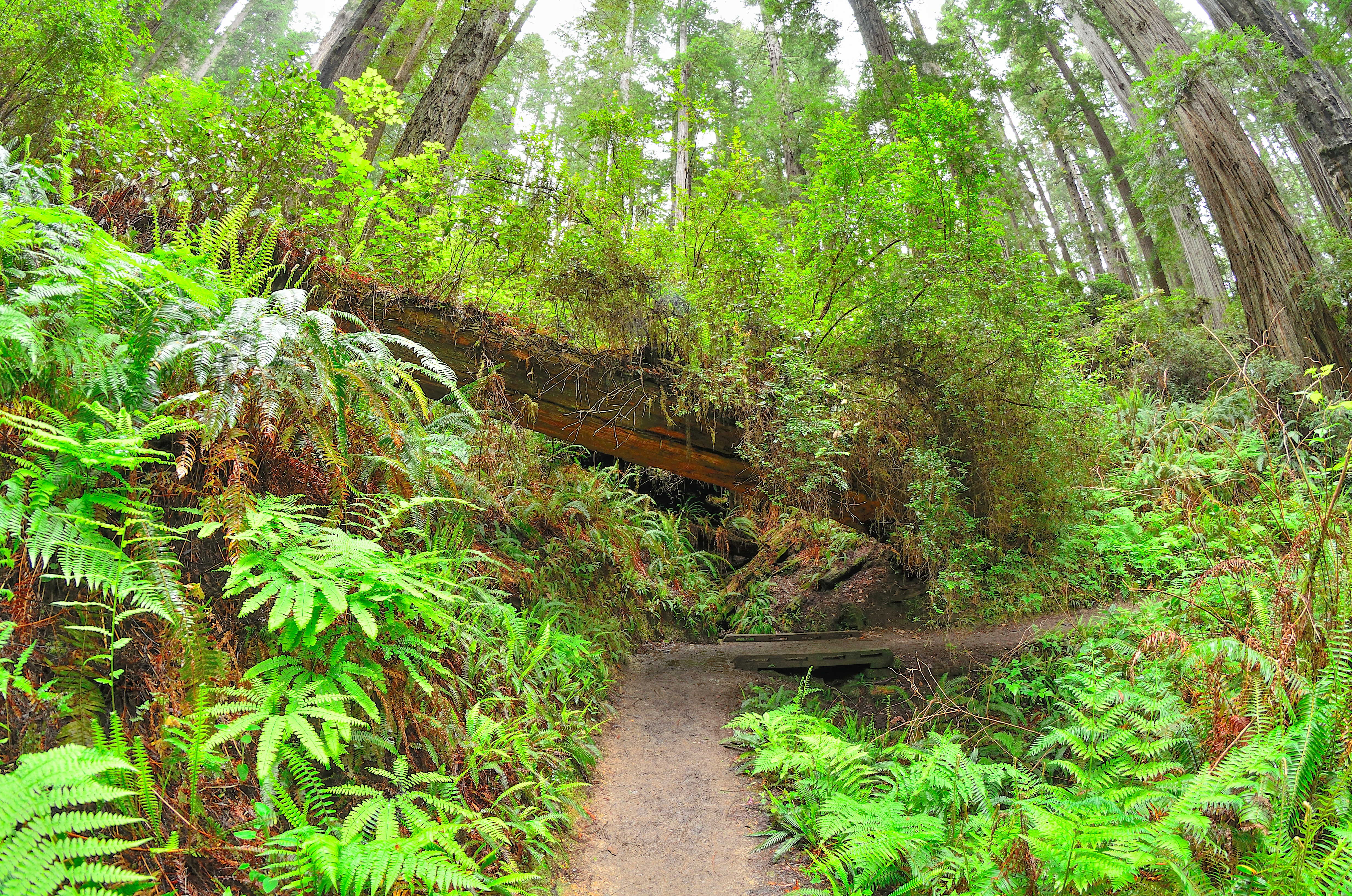
All Day Hike Through Redwoods to the Ocean and Back
A favorite and convenient series of trails for those ready and able to spend the whole day hiking. Hikers will follow creeks, see different kinds of forests and be rewarded by finding the Pacific Ocean. This 12-mile (19 km) loop starts and ends adjacent to the Prairie Creek Visitor Center - all hikers should pick up a hiking map for these trails from any park visitor center .
The first section of the 4.5 mile (7.2 km) James Irvine Trail will be in old-growth redwood forests before entering the spruce forests of the coast. On the western (coastal) end of the James Irvine trail it connects briefly with the Friendship Ridge Trail, and then onto the Fern Canyon Loop Trail. This will lead hikers through the dripping walls and stream cobbles of Fern Canyon and finally onto Gold Bluffs Beach - this is the ultimate turn around point. You can return back to the Prairie Creek Visitor Center on the same series of trails, or make a longer loop by heading 1.5 miles (2.4 km) south on Davison Road and taking the 4.1 mile (6.5 km) Miners Ridge trail back to the Praire Creek Visitor Center area.
There is limited full-day parking near the Prairie Creek Visitor Center, but there is parking for any sized vehicle along Newton B. Drury Scenic Parkway .
Accessibility This series of trails is not ADA accessible. Switchbacks with aggregate / wood surface. Elevation changes exceed 200 feet. Stream and steambed crossings with flowing water. Service animals are welcome.
Walk the Fern Canyon Loop Trail 10 mi round trip · the Park Service's write-up
45-90 Minutes · no dogs · entrance fee applies · reservation required
Start Fern Canyon
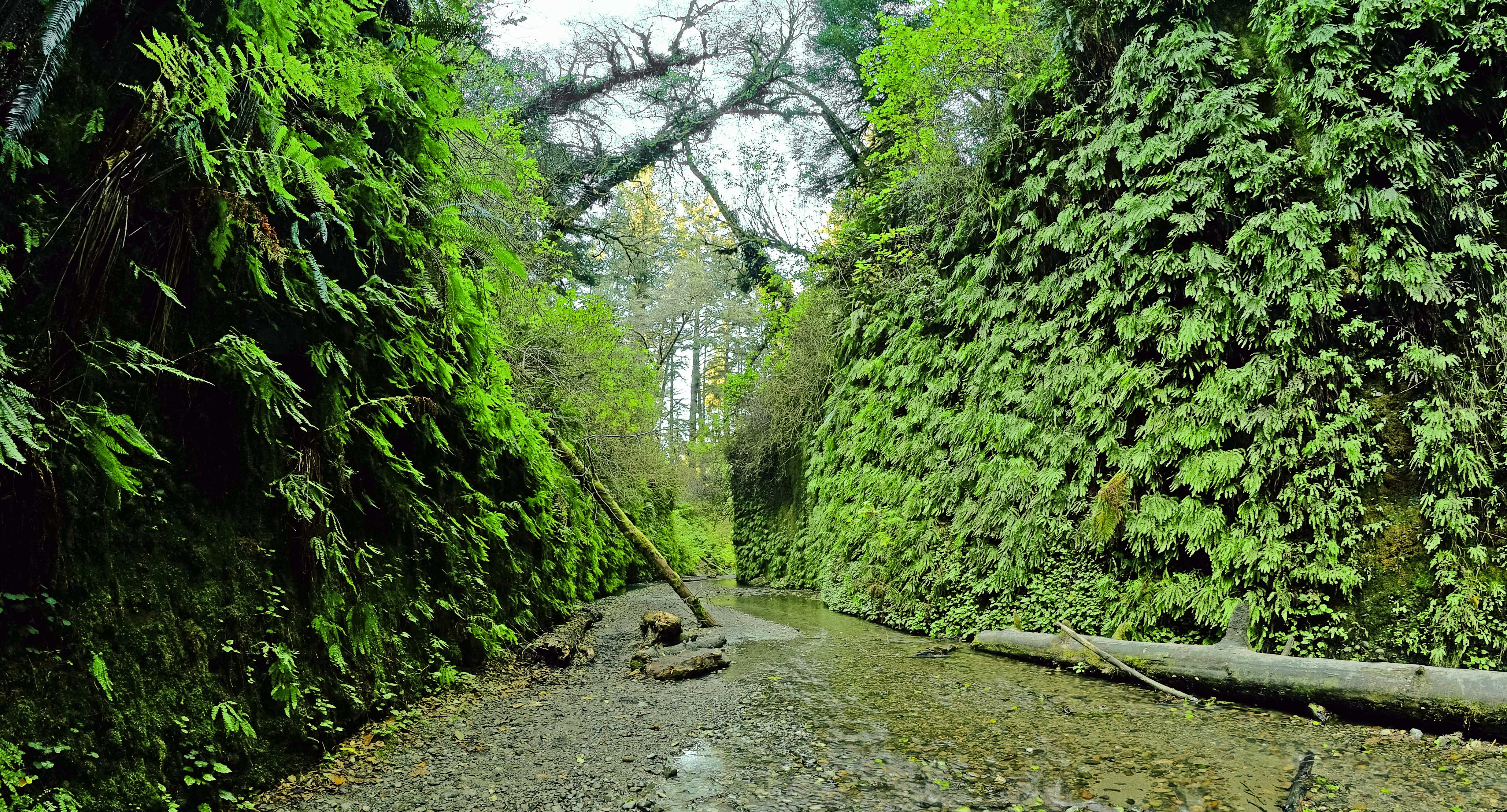
A Popular Destination That Comes With Challenges: Wild Elk and Stream Crossings
If you plan to drive to Fern Canyon from May 15th - Sept 15th, you will need a free Gold Bluffs Beach / Fern Canyon parking reservation (available online only).
Note : Hikers can still access Fern Canyon by doing the 10-mile round-trip hike on the James Irvine Trail from the Prairie Creek Visitor Center without a reservation.
Prepare to get your feet wet when exploring this short hike into a stunning mini-canyon covered with ferns. This very popular walk up a cobbled creek, Home Creek, takes you from Gold Bluffs Beach into the forest. Hikers must wade through the creek and climb over fallen trees, even when the boardwalk path is installed (summer only). Many travel writers and bloggers are correct when they talk about the natural beauty of this area while you won't find huge redwoods right here it is surrounded by sitka spruce and other conifers.
Hiking Fern Canyon:
Want to experience the entire canyon? Hike the 1-mile ‘lolly-pop’ loop to see in and above the canyon. The full loop takes about 45 minutes and has an elevation gain of 150 feet.
Interested in a shorter experience? Hike a quarter of a mile along Home Creek (the creek running through the canyon) to see the steep, leafy walls. This in-and-out option has a 30-foot elevation change.
Note : Both options require climbing through log jams and walking through an active creek.There is no defined trail along Home Creek, and you must cross the stream to experience the canyon.
From June to September, there are wooden footbridges installed in Fern Canyon to help walkers get partially up Home Creek without getting their feet too wet. Visitors should still plan to get wet!
Ranger tip: wear waterproof footwear with good traction and bring a pair of dry shoes to wear after the hike.
Be aware that the winding Davison Road (a gravel road) is not suitable for large recreational vehicles or anything towing a trailer . Also, people driving low-clearance vehicles often get stuck when trying to drive through the two streams on the way to the Fern Canyon parking area.
There is a California State Park entrance station on the way out Davison Road where you need to stop and pay the $12.00 entrance fee (per vehicle). Cash or check only for payment, credit cards are not accepted. California State Parks or the America the Beautiful (federal) passes are honored at this kiosk.
A herd of Roosevelt Elk are often spotted around the Fern Canyon area. It is important to keep your distance - don't approach them for any reason. Calving season is from late May to early June, which is when the female (cow) elk are very protective of their babies. Female elk might not have big antlers but they will kick and stomp anyone who gets too close. August through October is the rut season which means the male (bull) elk are especially irritable. Not only will the males use their antlers to protect their group of females, but they can also kick, stomp, and charge at anyone who gets too close (including vehicles). Year-round you should give the elk as much space as possible, at least a school bus length between you and the elk. Learn how to be safe around elk .
Before you set off to visit Fern Canyon, be sure to check current conditions and make sure that the roads are open - or to see if the seasonal footbridges have been installed.
Vault toilets and picnic tables are availble in the Fern Canyon parking area. There is also beach access from this parking area.
Accessibility Handicapped parking spaces. This is not an ADA trail. Much of the trail is through a cobbled stream bed. Seasonal footbridges are made of wood and about two feet wide. Service pets are welcome.