
National Lakeshore · Michigan
Trails in Pictured Rocks National Lakeshore
12 named trails · 73 miles · 7 trailheads · 1 with the Park Service's own write-up. The lines, trailheads and points are the Park Service's; the write-ups are the Service's own words; the climbing is read from USGS elevation along each line.
12 trails, A to Z.
Chapel Rock Trail
Trailhead Trailhead 746 ft Drive there
Fox River Pathway
Lake Superior Trail
Walks and Hikes of One Mile or Less the Park Service's write-up
30-60 Minutes · dogs allowed
Start Pictured Rocks National Lakeshore
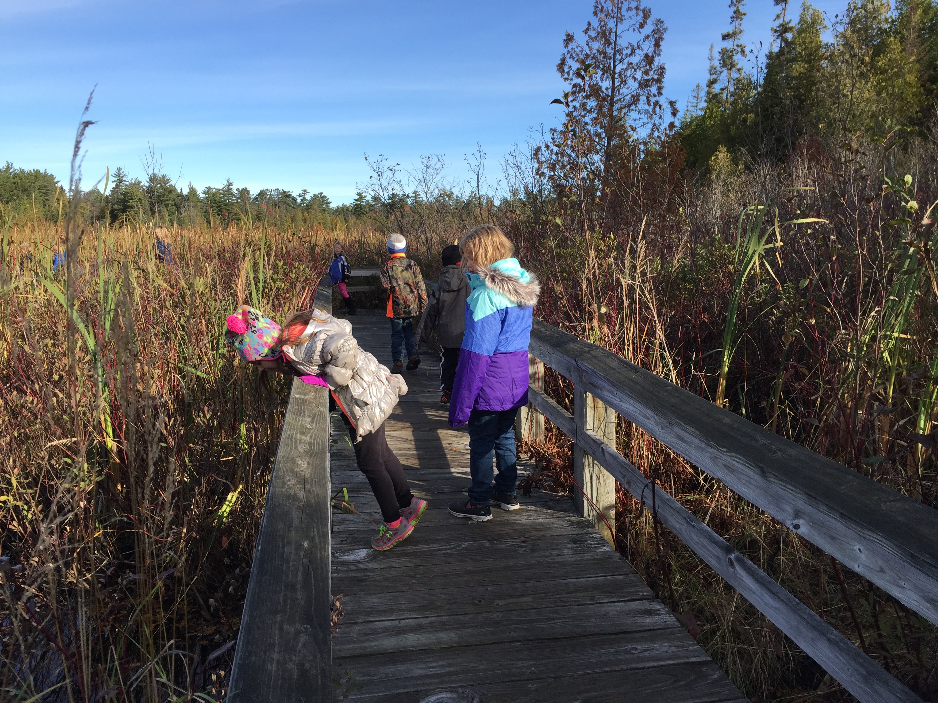
Sand Point Marsh Trail - Length: 0.5 mile loop. Located across from Sand Point Beach, this boardwalk trail takes you through one of the park's most beautiful wetlands. Old beach ridges, a cattail marsh, small ponds, and white cedar and black spruce swamp communities dominate the scene.
The best times for wildlife activity are early or late in the day. The entire trail loop is wheelchair-accessible when ice and snow are absent. This trail is easy to access year-round since Sand Point Road and the beach/trail parking area is plowed all winter. Pets not allowed on the marsh trail.
Munising Falls - Length: 800 feet one way. Walk this paved trail up the cool, shaded sandstone canyon along Munising Creek to the main viewing platform to see the 50-foot drop waterfall. Two sets of stairs lead to elevated platforms that offer different views of the water as it drops over a sandstone cliff. Please stay on the paved trail. Going into or behind the falls is dangerous and is prohibited.
The central viewing platform is wheelchair-accessible. Waterfalls are beautiful in winter, and Munising Falls is easy to access as the road and parking lot is plowed all winter. Leashed pets allowed on trail and at platforms.
Miners Castle Overlook - Length varies: 200 to 1300 feet one way. This is the most popular spot in the park. Miners Castle can be viewed from three different viewing platforms. The two upper viewing areas are wheelchair-accessible and are a short distance from the parking lot. The walk to the lower platform includes stairs and steep inclines. Leashed pets are allowed on paved (not dirt) trails, at viewing platforms, and in picnic area.
Superior Overlook Beach - Offers a beautiful view of Lake Superior and short stairway access to a beach. A brief walk on the beach leads to Sullivan's Creek emptying into Lake Superior. The overlook platform is wheelchair-accessible from the parking lot. Leashed pets allowed .
Twelvemile Beach - Access via stairs from the tall bluff at the day-use picnic and parking area near the campground down to a sandy beach that has great sunset views. Leashed pets allowed on beach in front of and to the east of the campground. Pets not allowed on beach west of the campground.
Log Slide Overlook Trail - Length: 0.3 mile roundtrip. This short trail leads through mature hardwoods to the western edge of the Grand Sable Dunes where logs once slid down to the lake in a wooden chute.
The overlook platform was destroyed in a winter storm but the path to the platform location is still there. You'll be rewarded with breathtaking views of Lake Superior, the Grand Sable Dunes, and Au Sable Lighthouse in the distance. Pets not allowed.
Grand Sable Dunes Trail - Length: 0.6 mile roundtrip. This is the main access point into the Grand Sable Dunes. The trail starts at the Sable Falls parking area near the top of the falls, continues past an old orchard and field, and crosses a bridge over Sable Creek. It then winds through a jack pine forest gradually uphill into an open dune environment. Requires some uphill climbing in sand. Pets not allowed.
Sable Falls Trail – Length: 0.4 mile roundtrip. Part of the North Country Scenic Trail. From the Sable Falls parking lot, this trail starts with 168 steps down to the base of the falls and and continues past the falls along Sable Creek to a rock and sand beach on Lake Superior. The first landing on the stairs provides a view of Sable Falls, although the best view is from the bottom. Leashed pets allowed on trail and stairs.
Visit the park's Day Hikes webpage for more "Things to Know" about hiking at Pictured Rocks.
Accessibility Sand Point Marsh Trail - Entire loop is wheelchair-accessible. Munising Falls - The paved trail and central viewing platform is wheelchair-accessible. Munising Castle Overlook - The two upper platforms are wheelchair-accessible. Superior Overlook - The overlook is wheelchair-accessible.
Mosquito Falls Trail
Trailhead Trailhead 746 ft Drive there
Mosquito River Trail
North Country Trail
CampgroundsPicnic areasVisitor centers
Along the way Chapel Beach Twelve Mile Beach Grand Sable Lake Ove Log Slide Sable Falls Grand Sable
Northwest Beaver Lake Trail
Sable Falls Access
Sand Point Marsh Trail
Trailheads Sand Point Marsh 603 ft Drive there · Trailhead 603 ft Drive there
Sand Point NCT Connector Trail
Trailheads Sand Point Marsh 603 ft Drive there · Trailhead 603 ft Drive there
Wwhite Pine Trail
CampgroundsBoat launches
Along the way Little Beaver Lake Little Beaver Lake Little Beaver Lake
Trailheads Trailhead 618 ft Drive there · White Pine Trail 641 ft Drive there
38 more mapped segments without a name are on the map, not in the list.
More hikes the Park Service describes
Write-ups that name no single mapped trail, in the Service's words.
- Walks and Hikes Over a Mile · 1-5 Hours · dogs allowed
Longer hikes and walks lead to stunning cliff views, remote beaches, the Beaver Basin Wilderness, Au Sable Lighthouse, and many other scenic areas.
About these trails
The lines are the National Park Service's public trails layer, the trailheads and the waterfalls, views, peaks and historic places along them the Service's public points of interest, read 2026-10-14 and simplified for the map. The write-ups are the Service's own "things to do", unedited. Heights come from USGS 3DEP through Terrain Tiles on AWS (Mapzen/Tilezen), read along each line and rounded; a short trail on steep ground can be off by a few tens of feet. Closures change: check the park's own site before you go.