
National Park · California
Trails in Pinnacles National Park
22 named trails · 28 miles · 1 trailhead · 15 with the Park Service's own write-up. The lines, trailheads and points are the Park Service's; the write-ups are the Service's own words; the climbing is read from USGS elevation along each line.
22 trails, A to Z.
Balconies Trail
Picnic areas
Along the way Chaparral Picnic Area
Hike Balconies Cliffs Trail to Balconies Cave Trail Loop the Park Service's write-up
1-2 Hours · no dogs
Start Balconies Trailhead
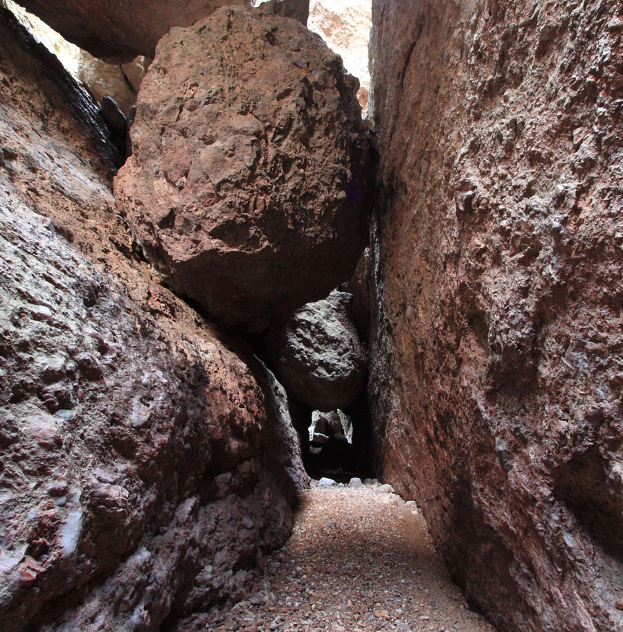
Scramble through the talus passages of the Balconies Cave . Explore rock cliffs and narrow canyons toppled by huge boulders.
This trail crosses up and over the Balconies Cave, then descends back down to the Old Pinnacles Trail and Balconies Cave Trail junction, which leads back through the cave.
*Accessing from the east side, see "Hike Old Pinnacles Trail to Balconies Cave".
Recreate Responsibly. Check park webpage alerts and weather forecast . Hiking, caving, and climbing can be fun but remember-if you get injured, you are a long way from medical help. Cell phones may not work in this remote park. Don't let your guard down when it comes to safety. Be prepared. Let someone know your plan before you go. Most of the trails are exposed. Bring a map and use the best judgement of your abilities. Drinking water is only available in developed areas-there is no water along any of the trails. Carry at least a liter of water for every hour of hiking. In winter, wear warm clothes and waterproof clothing. In summer, do not hike during the hottest parts of the day (10AM-4PM) especially on strenuous trails. Heat and dehydration can be fatal. Hiking steep trails requires more energy and results in greater water loss through sweating. Wear lightweight, light-colored, loose-fitting clothing. Wear sunscreen, a hat, and sunglasses. Wear sturdy, non-slip shoes or boots with ankle support due to rocky, uneven terrain and slick and sometimes slippery rocks. In all seasons, carry plenty of water and salty snacks (ex. pretzels, crackers, chips). Stay hydrated with plain water and an electrolyte drink replacement. Stay cool in summer and warm in winter and take rest breaks. Know your limits and turn back if needed. Stay on established trails to help prevent erosion. Wildflowers, pine cones, rocks, and other natural and cultural features are beautiful, but please do not remove or destroy them;leave them for the enjoyment of other visitors. All plants, animals, rocks, and structures in the park are protected by federal law. Be careful where you sit, step, and place your hands: poison oak, stinging nettle, and rattlesnakes are found here. Feeding, approaching, or hunting wildlife is prohibited. Using remotely piloted aircrafts like drones is prohibited.
Plan ahead and prepare. Take only pictures and leave only footprints, leaving objects as you find them. Observe wildlife from a distance and avoid loud voices or noises to be considerate of others.
Accessibility Difficulty: Moderate Distance: Approx. 2.4 mile loop Trail width: Approx. 2 - 4 feet Maximum grade: 200 feet Surface Composition: dirt, rock Exposure: Limited shade, no shade on Balconies Cliffs Trail Flashlight required in the cave; Watch for low ceilings, slippery rocks, and uneven footing. Wading may be necessary in the winter when precipitation creates; Cave may be closed for short periods in winter due to flooding. *Service animals permitted
Hike Bench Trail to Balconies Cave Trail the Park Service's write-up
4-6 Hours · no dogs
Start Bench Trailhead
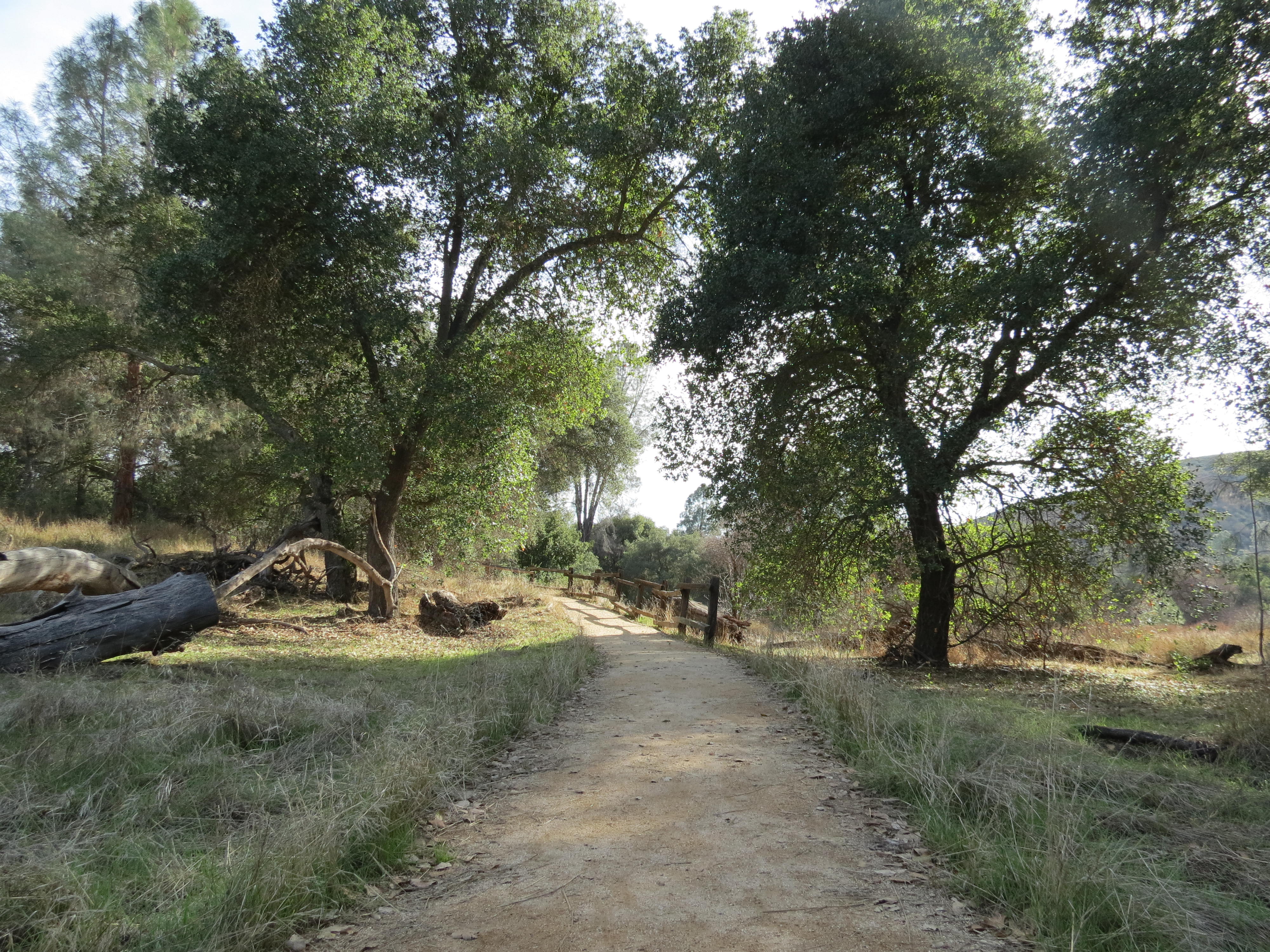
Hike along sunny Chalone Creek on the Bench and Old Pinnacles trails to Balconies Cave . On the return trip, cross over the cave via the Balconies Cliffs for views of formations.
A section of the Bench Trail between Peaks View and South Wilderness Trail may be accessible to visitors in wheelchairs.
Recreate Responsibly. Check park webpage alerts and weather forecast . Hiking, caving, and climbing can be fun but remember-if you get injured, you are a long way from medical help. Cell phones may not work in this remote park. Don't let your guard down when it comes to safety. Be prepared. Let someone know your plan before you go. Most of the trails are exposed. Bring a map and use the best judgement of your abilities. Drinking water is only available in developed areas-there is no water along any of the trails. Carry at least a liter of water for every hour of hiking. In winter, wear warm clothes and waterproof clothing. In summer, do not hike during the hottest parts of the day (10AM-4PM) especially on strenuous trails. Heat and dehydration can be fatal. Hiking steep trails requires more energy and results in greater water loss through sweating. Wear lightweight, light-colored, loose-fitting clothing. Wear sunscreen, a hat, and sunglasses. Wear sturdy, non-slip shoes or boots with ankle support due to rocky, uneven terrain and slick and sometimes slippery rocks. In all seasons, carry plenty of water and salty snacks (ex. pretzels, crackers, chips). Stay hydrated with plain water and an electrolyte drink replacement. Stay cool in summer and warm in winter and take rest breaks. Know your limits and turn back if needed. Stay on established trails to help prevent erosion. Wildflowers, pine cones, rocks, and other natural and cultural features are beautiful, but please do not remove or destroy them;leave them for the enjoyment of other visitors. All plants, animals, rocks, and structures in the park are protected by federal law. Be careful where you sit, step, and place your hands: poison oak, stinging nettle, and rattlesnakes are found here. Feeding, approaching, or hunting wildlife is prohibited. Using remotely piloted aircrafts like drones is prohibited.
Plan ahead and prepare. Take only pictures and leave only footprints, leaving objects as you find them. Observe wildlife from a distance and avoid loud voices or noises to be considerate of others.
Accessibility Difficulty: Moderate Distance: Approx. 9.4 mile roundtrip Trail width: Approx. 2 - 4 feet Maximum grade: 450 feet Surface Composition: dirt, rock Exposure: Limited shade, no shade on Balconies Cliffs Trail Flashlight required in the cave; Watch for low ceilings, slippery rocks, and uneven footing. Wading may be necessary in the winter when precipitation creates; Cave may be closed for short periods in winter due to flooding. *A section of the Bench Trail between Peaks View and South Wilderness Trail may be accessible to visitors in wheelchairs *Service animals permitted
Hike High Peaks to Balconies Cave Loop the Park Service's write-up
4-5 Hours · no dogs
Start Chaparral Parking Area
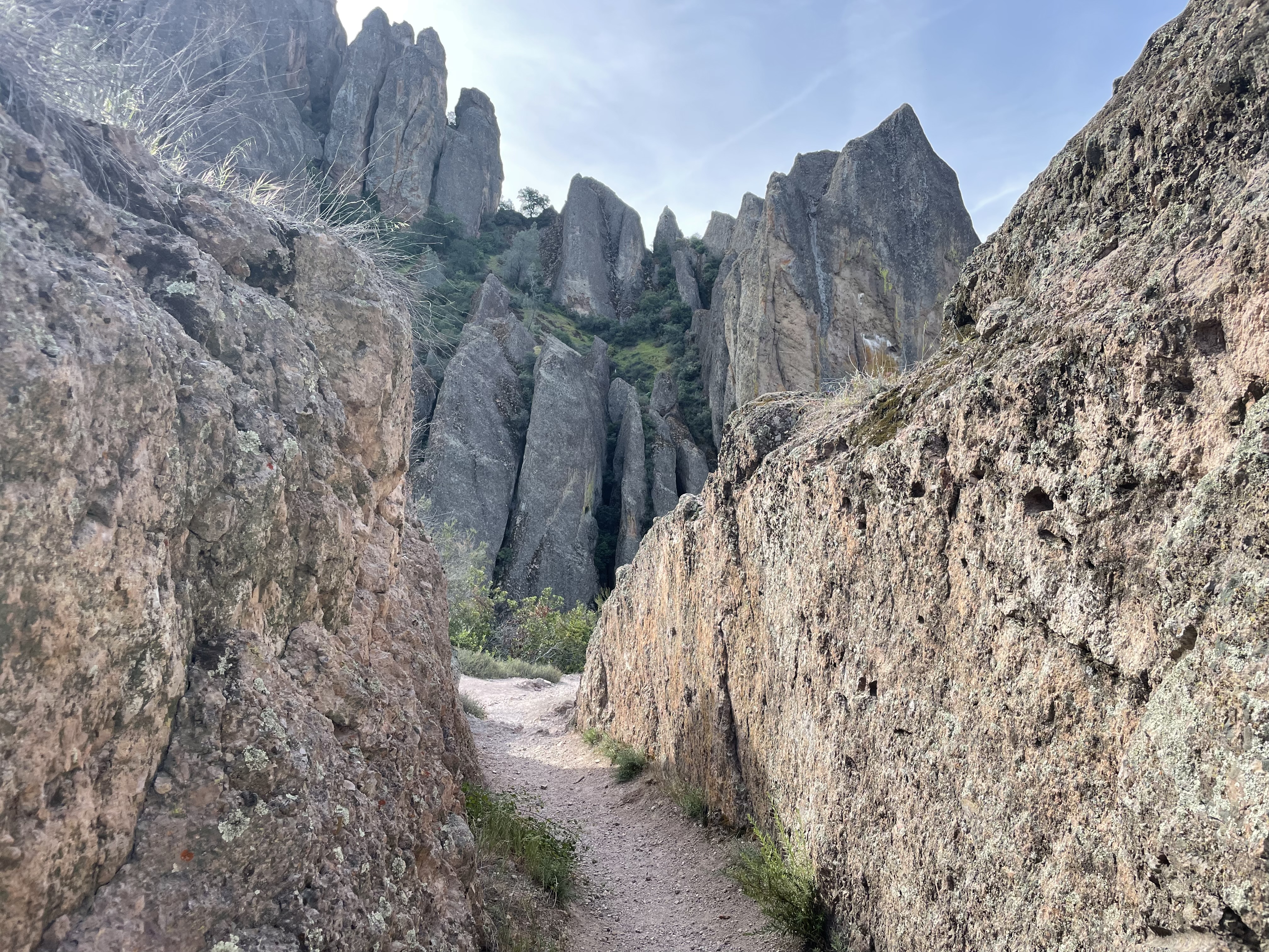
Strenuous hike to and through High Peaks. Begin west up towards High Peaks for excellent views, return on Old Pinnacles and the Balconies trails, in or around the cave.
*Access from the East Side, take Blue Oak to High Peaks retuning in or around cave to Old Pinnacles Trail.
Recreate Responsibly. Check park webpage alerts and weather forecast . Hiking, caving, and climbing can be fun but remember-if you get injured, you are a long way from medical help. Cell phones may not work in this remote park. Don't let your guard down when it comes to safety. Be prepared. Let someone know your plan before you go. Most of the trails are exposed. Bring a map and use the best judgement of your abilities. Drinking water is only available in developed areas-there is no water along any of the trails. Carry at least a liter of water for every hour of hiking. In winter, wear warm clothes and waterproof clothing. In summer, do not hike during the hottest parts of the day (10AM-4PM) especially on strenuous trails. Heat and dehydration can be fatal. Hiking steep trails requires more energy and results in greater water loss through sweating. Wear lightweight, light-colored, loose-fitting clothing. Wear sunscreen, a hat, and sunglasses. Wear sturdy, non-slip shoes or boots with ankle support due to rocky, uneven terrain and slick and sometimes slippery rocks. In all seasons, carry plenty of water and salty snacks (ex. pretzels, crackers, chips). Stay hydrated with plain water and an electrolyte drink replacement. Stay cool in summer and warm in winter and take rest breaks. Know your limits and turn back if needed. Stay on established trails to help prevent erosion. Wildflowers, pine cones, rocks, and other natural and cultural features are beautiful, but please do not remove or destroy them;leave them for the enjoyment of other visitors. All plants, animals, rocks, and structures in the park are protected by federal law. Be careful where you sit, step, and place your hands: poison oak, stinging nettle, and rattlesnakes are found here. Feeding, approaching, or hunting wildlife is prohibited. Using remotely piloted aircrafts like drones is prohibited.
Plan ahead and prepare. Take only pictures and leave only footprints, leaving objects as you find them. Observe wildlife from a distance and avoid loud voices or noises to be considerate of others.
Accessibility Difficulty: Strenuous Distance: Approx. 8.4 mile loop Trail width: Approx. 2 - 4 feet Maximum grade: 1,540 feet Surface Composition: dirt, rock, sand Exposure: Mostly no shade, limited shade on Old Pinnacles Trail In summer, expect temperatures in the High Peaks and Chalone Peaks to be 10 degrees hotter than parking areas. Avoid hiking during the hottest parts of the day. Flashlight required in the cave; Watch for low ceilings, slippery rocks, and uneven footing. Wading may be necessary in the winter when precipitation creates; Cave may be closed for short periods in winter due to flooding. *Service animals permitted
Hike Old Pinnacles Trail to Balconies Cave the Park Service's write-up
3-4 Hours · no dogs
Start Old Pinnacles Parking Area
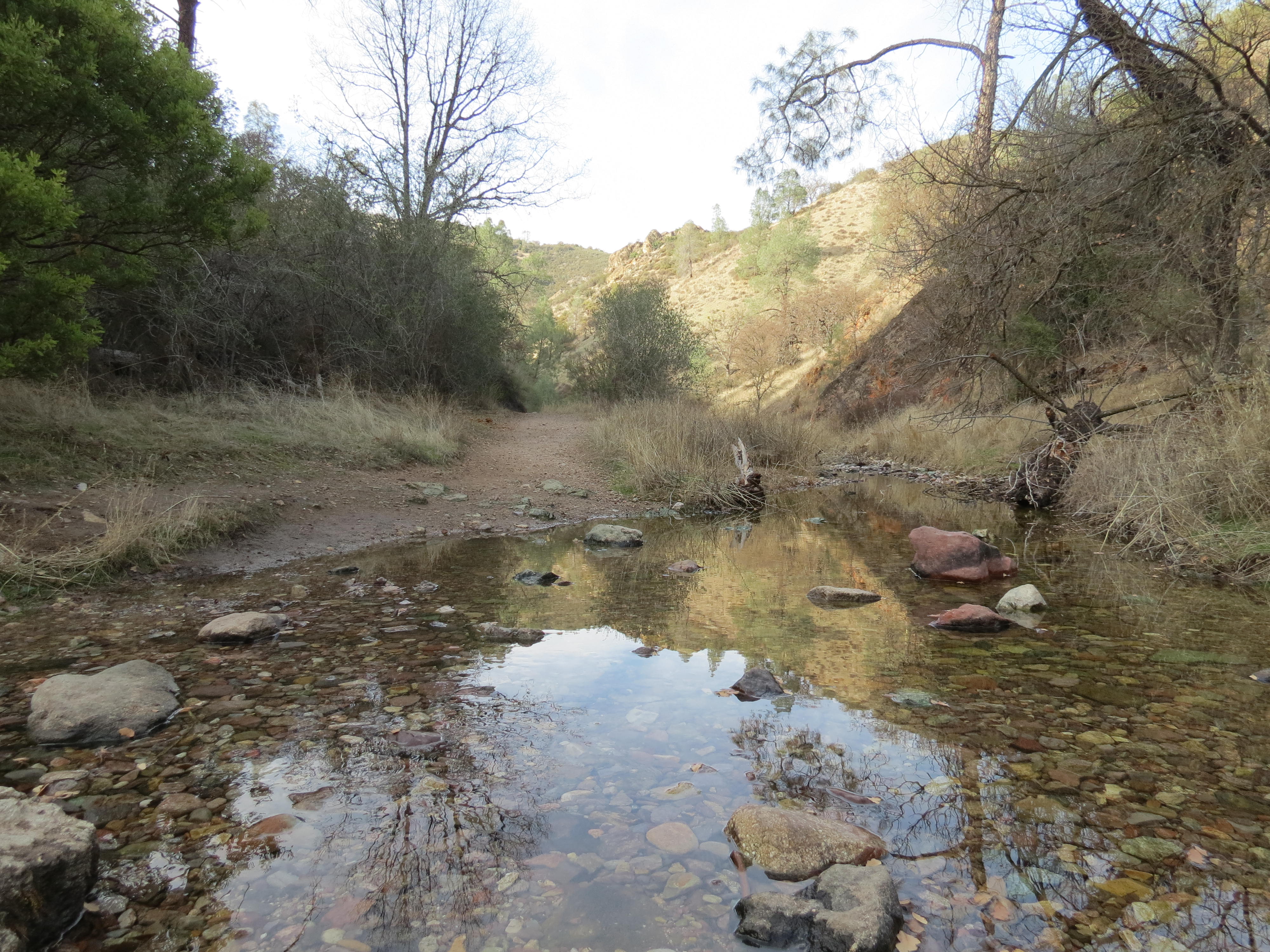
This sunny hike to Balconies Cave leads to towering rock formations: Machete Ridge and the Balconies Cliffs. Traverse through six creek crossings which flow seasonally. Begin at the Old Pinnacles Trailhead. Enter through the Balconies Cave and back around along the Balconies Cliffs.
Recreate Responsibly. Check park webpage alerts and weather forecast . Hiking, caving, and climbing can be fun but remember-if you get injured, you are a long way from medical help. Cell phones may not work in this remote park. Don't let your guard down when it comes to safety. Be prepared. Let someone know your plan before you go. Most of the trails are exposed. Bring a map and use the best judgement of your abilities. Drinking water is only available in developed areas-there is no water along any of the trails. Carry at least a liter of water for every hour of hiking. In winter, wear warm clothes and waterproof clothing. In summer, do not hike during the hottest parts of the day (10AM-4PM) especially on strenuous trails. Heat and dehydration can be fatal. Hiking steep trails requires more energy and results in greater water loss through sweating. Wear lightweight, light-colored, loose-fitting clothing. Wear sunscreen, a hat, and sunglasses. Wear sturdy, non-slip shoes or boots with ankle support due to rocky, uneven terrain and slick and sometimes slippery rocks. In all seasons, carry plenty of water and salty snacks (ex. pretzels, crackers, chips). Stay hydrated with plain water and an electrolyte drink replacement. Stay cool in summer and warm in winter and take rest breaks. Know your limits and turn back if needed. Stay on established trails to help prevent erosion. Wildflowers, pine cones, rocks, and other natural and cultural features are beautiful, but please do not remove or destroy them;leave them for the enjoyment of other visitors. All plants, animals, rocks, and structures in the park are protected by federal law. Be careful where you sit, step, and place your hands: poison oak, stinging nettle, and rattlesnakes are found here. Feeding, approaching, or hunting wildlife is prohibited. Using remotely piloted aircrafts like drones is prohibited.
Plan ahead and prepare. Take only pictures and leave only footprints, leaving objects as you find them. Observe wildlife from a distance and avoid loud voices or noises to be considerate of others.
Accessibility Difficulty: Moderate Distance: Approx. 5.4 miles roundtrip Trail width: Approx. 2 - 4 feet Maximum grade: 350 feet Surface Composition: sand, dirt, rock Exposure: Limited shade, no shade on Balconies Cliffs Trail Flashlight required in the cave; Watch for low ceilings, slippery rocks, and uneven footing. Wading may be necessary in the winter when precipitation creates; Cave may be closed for short periods in winter due to flooding. *Service animals permitted
Bear Gulch Caves Trail
Bench Trail
Picnic areas
Along the way Peaks View Picnic Area
Trailhead Bench Trailhead 1,011 ft Drive there
Hike Bench Trail to Balconies Cave Trail the Park Service's write-up
4-6 Hours · no dogs
Start Bench Trailhead
Hike along sunny Chalone Creek on the Bench and Old Pinnacles trails to Balconies Cave . On the return trip, cross over the cave via the Balconies Cliffs for views of formations.
A section of the Bench Trail between Peaks View and South Wilderness Trail may be accessible to visitors in wheelchairs.
Recreate Responsibly. Check park webpage alerts and weather forecast . Hiking, caving, and climbing can be fun but remember-if you get injured, you are a long way from medical help. Cell phones may not work in this remote park. Don't let your guard down when it comes to safety. Be prepared. Let someone know your plan before you go. Most of the trails are exposed. Bring a map and use the best judgement of your abilities. Drinking water is only available in developed areas-there is no water along any of the trails. Carry at least a liter of water for every hour of hiking. In winter, wear warm clothes and waterproof clothing. In summer, do not hike during the hottest parts of the day (10AM-4PM) especially on strenuous trails. Heat and dehydration can be fatal. Hiking steep trails requires more energy and results in greater water loss through sweating. Wear lightweight, light-colored, loose-fitting clothing. Wear sunscreen, a hat, and sunglasses. Wear sturdy, non-slip shoes or boots with ankle support due to rocky, uneven terrain and slick and sometimes slippery rocks. In all seasons, carry plenty of water and salty snacks (ex. pretzels, crackers, chips). Stay hydrated with plain water and an electrolyte drink replacement. Stay cool in summer and warm in winter and take rest breaks. Know your limits and turn back if needed. Stay on established trails to help prevent erosion. Wildflowers, pine cones, rocks, and other natural and cultural features are beautiful, but please do not remove or destroy them;leave them for the enjoyment of other visitors. All plants, animals, rocks, and structures in the park are protected by federal law. Be careful where you sit, step, and place your hands: poison oak, stinging nettle, and rattlesnakes are found here. Feeding, approaching, or hunting wildlife is prohibited. Using remotely piloted aircrafts like drones is prohibited.
Plan ahead and prepare. Take only pictures and leave only footprints, leaving objects as you find them. Observe wildlife from a distance and avoid loud voices or noises to be considerate of others.
Accessibility Difficulty: Moderate Distance: Approx. 9.4 mile roundtrip Trail width: Approx. 2 - 4 feet Maximum grade: 450 feet Surface Composition: dirt, rock Exposure: Limited shade, no shade on Balconies Cliffs Trail Flashlight required in the cave; Watch for low ceilings, slippery rocks, and uneven footing. Wading may be necessary in the winter when precipitation creates; Cave may be closed for short periods in winter due to flooding. *A section of the Bench Trail between Peaks View and South Wilderness Trail may be accessible to visitors in wheelchairs *Service animals permitted
Hike Bench Trail to South Wilderness Trail the Park Service's write-up
3-4 Hours · no dogs
Start Bench Trailhead
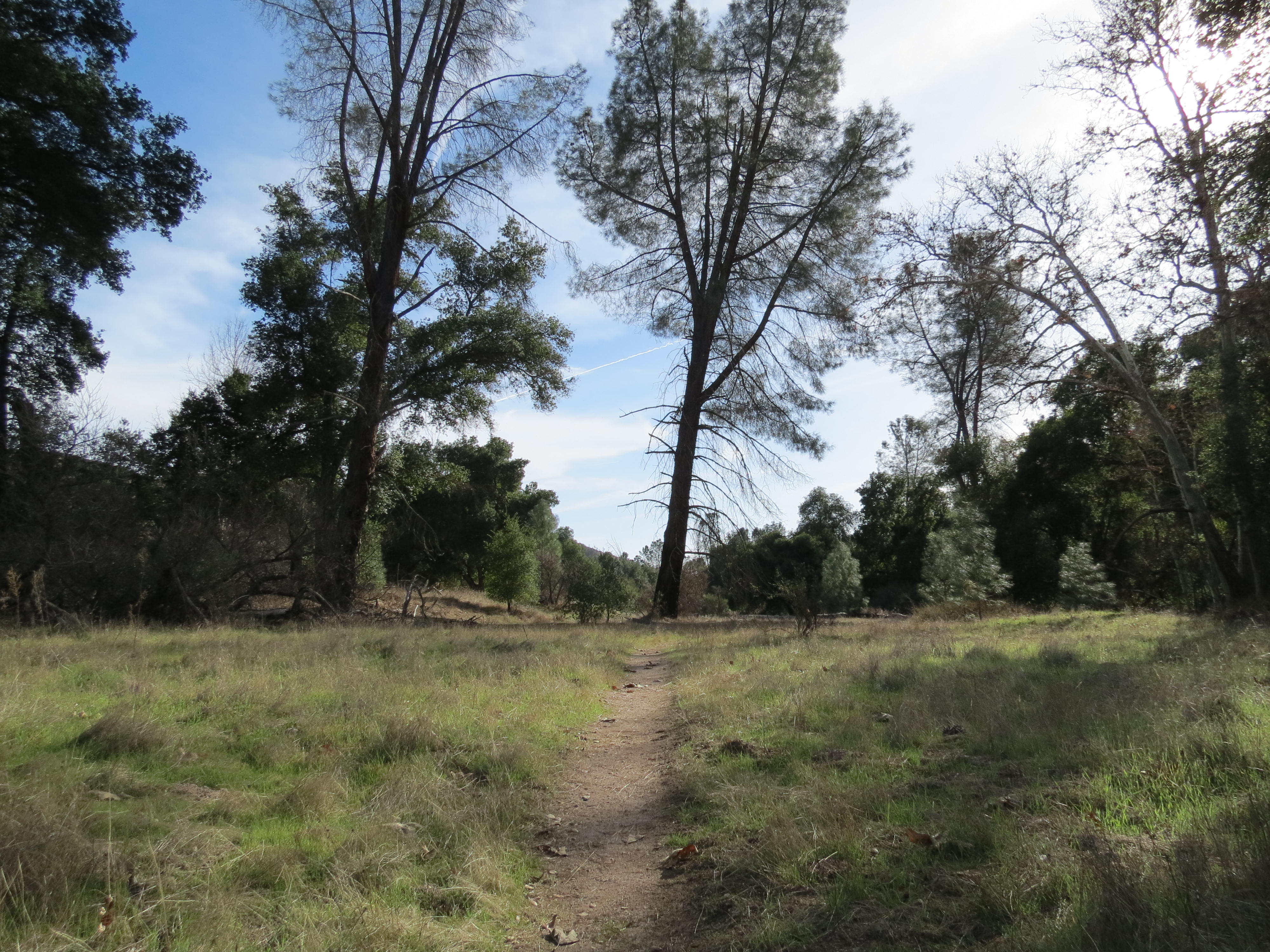
Travel to the south park boundary, or simply meander through the magnificient grove of valley oaks. Begin on the Bench Trail and follow the fire road for about half a mile to the South Wilderness marker. Follow the trail and/or creek to boundary for an oppurtunity for more solitude and a good choice for bird and other wildlife viewing. Learn about wilderness areas on the park webpage or main nps site.
A section of the Bench Trail between Peaks View and South Wilderness Trail may be accessible to visitors in wheelchairs.
Recreate Responsibly. Check park webpage alerts and weather forecast . Hiking, caving, and climbing can be fun but remember-if you get injured, you are a long way from medical help. Cell phones may not work in this remote park. Don't let your guard down when it comes to safety. Be prepared. Let someone know your plan before you go. Most of the trails are exposed. Bring a map and use the best judgement of your abilities. Drinking water is only available in developed areas-there is no water along any of the trails. Carry at least a liter of water for every hour of hiking. In winter, wear warm clothes and waterproof clothing. In summer, do not hike during the hottest parts of the day (10AM-4PM) especially on strenuous trails. Heat and dehydration can be fatal. Hiking steep trails requires more energy and results in greater water loss through sweating. Wear lightweight, light-colored, loose-fitting clothing. Wear sunscreen, a hat, and sunglasses. Wear sturdy, non-slip shoes or boots with ankle support due to rocky, uneven terrain and slick and sometimes slippery rocks. In all seasons, carry plenty of water and salty snacks (ex. pretzels, crackers, chips). Stay hydrated with plain water and an electrolyte drink replacement. Stay cool in summer and warm in winter and take rest breaks. Know your limits and turn back if needed. Stay on established trails to help prevent erosion. Wildflowers, pine cones, rocks, and other natural and cultural features are beautiful, but please do not remove or destroy them;leave them for the enjoyment of other visitors. All plants, animals, rocks, and structures in the park are protected by federal law. Be careful where you sit, step, and place your hands: poison oak, stinging nettle, and rattlesnakes are found here. Feeding, approaching, or hunting wildlife is prohibited. Using remotely piloted aircrafts like drones is prohibited.
Plan ahead and prepare. Take only pictures and leave only footprints, leaving objects as you find them. Observe wildlife from a distance and avoid loud voices or noises to be considerate of others.
Accessibility Difficulty: Moderate Distance: Approx. 6.5 mile roundtrip Trail width: Approx. 2 - 4 feet Maximum grade: 300 feet Surface Composition: dirt Exposure: Limited shade *South Wilderness is an unmaintained trail. *A section of the Bench Trail between Peaks View and South Wilderness Trail may be accessible to visitors in wheelchairs *Service animals permitted
Hike Bench Trail to Sycamore Trail the Park Service's write-up
1-2 Hours · no dogs
Start Bench Trailhead
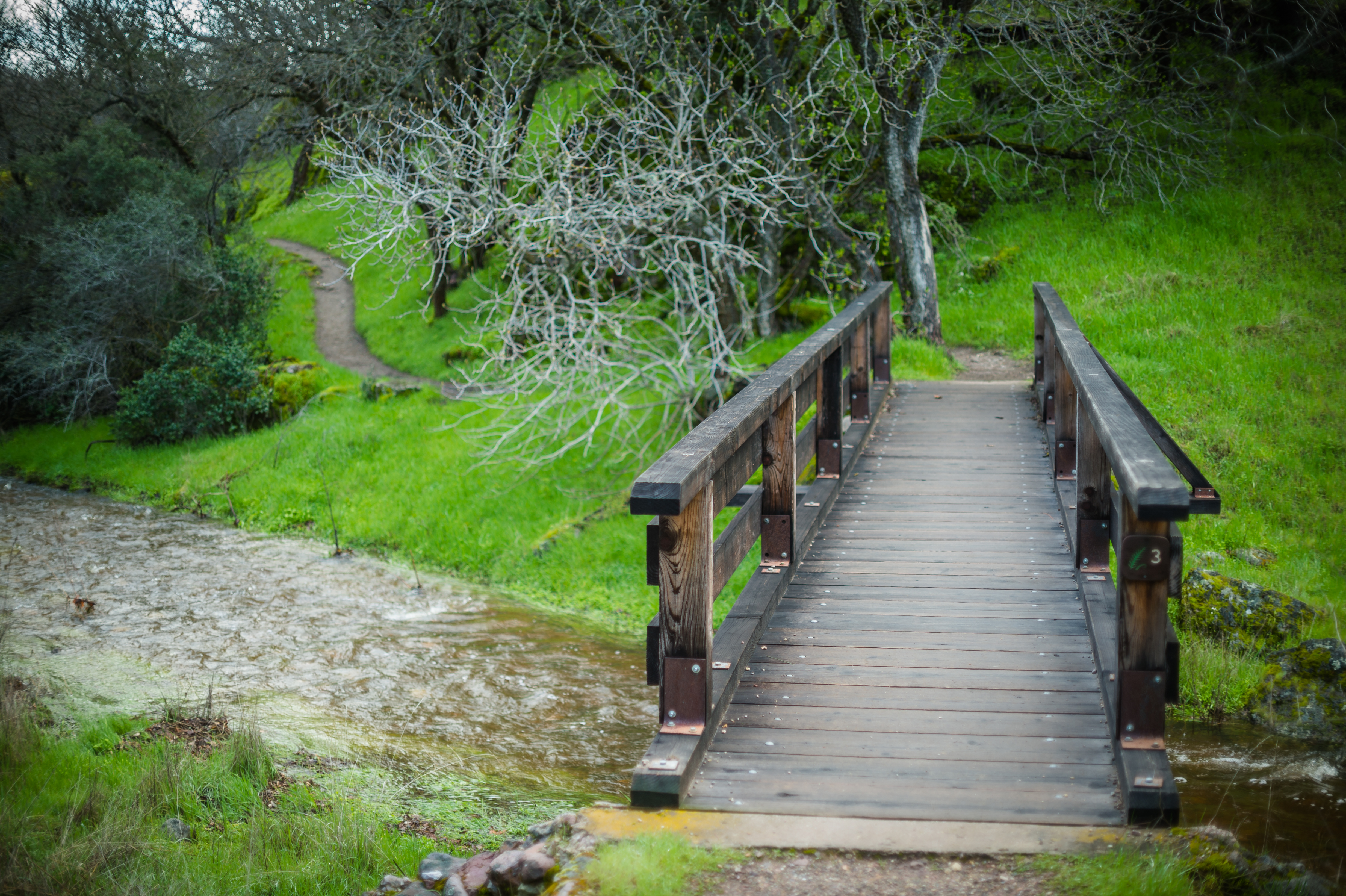
Walk along Chalone and Bear creeks from the Campground to the Bear Gulch Day Use Area . Creeks run seasonally, small waterfalls may occur during periods of heavy rains along the Sycamore Trail.
A section of the Bench Trail between Peaks View and South Wilderness Trail may be accessible to visitors in wheelchairs; Trail also connects to South Wilderness Trail.
Recreate Responsibly. Check park webpage alerts and weather forecast . Hiking, caving, and climbing can be fun but remember-if you get injured, you are a long way from medical help. Cell phones may not work in this remote park. Don't let your guard down when it comes to safety. Be prepared. Let someone know your plan before you go. Most of the trails are exposed. Bring a map and use the best judgement of your abilities. Drinking water is only available in developed areas-there is no water along any of the trails. Carry at least a liter of water for every hour of hiking. In winter, wear warm clothes and waterproof clothing. In summer, do not hike during the hottest parts of the day (10AM-4PM) especially on strenuous trails. Heat and dehydration can be fatal. Hiking steep trails requires more energy and results in greater water loss through sweating. Wear lightweight, light-colored, loose-fitting clothing. Wear sunscreen, a hat, and sunglasses. Wear sturdy, non-slip shoes or boots with ankle support due to rocky, uneven terrain and slick and sometimes slippery rocks. In all seasons, carry plenty of water and salty snacks (ex. pretzels, crackers, chips). Stay hydrated with plain water and an electrolyte drink replacement. Stay cool in summer and warm in winter and take rest breaks. Know your limits and turn back if needed. Stay on established trails to help prevent erosion. Wildflowers, pine cones, rocks, and other natural and cultural features are beautiful, but please do not remove or destroy them;leave them for the enjoyment of other visitors. All plants, animals, rocks, and structures in the park are protected by federal law. Be careful where you sit, step, and place your hands: poison oak, stinging nettle, and rattlesnakes are found here. Feeding, approaching, or hunting wildlife is prohibited. Using remotely piloted aircrafts like drones is prohibited.
Plan ahead and prepare. Take only pictures and leave only footprints, leaving objects as you find them. Observe wildlife from a distance and avoid loud voices or noises to be considerate of others.
Accessibility Difficulty: Moderate Distance: Approx. 2.3 miles one way Trail width: Approx. 2 - 4 feet Maximum grade: 350 feet Surface Composition: dirt Exposure: limited shade *A section of the Bench Trail between Peaks View and South Wilderness Trail may be accessible to visitors in wheelchairs *Service animals permitted
BUTTERFIELD RANCH ROAD
CONDOR GULCH ROAD
Visitor centers
Along the way East Side Visitor Center
Condor Gulch Trail
Visitor centers
Along the way East Side Visitor Center
Hike Condor Gulch Trail the Park Service's write-up
60-90 Minutes · no dogs
Start Condor Gulch Trailhead
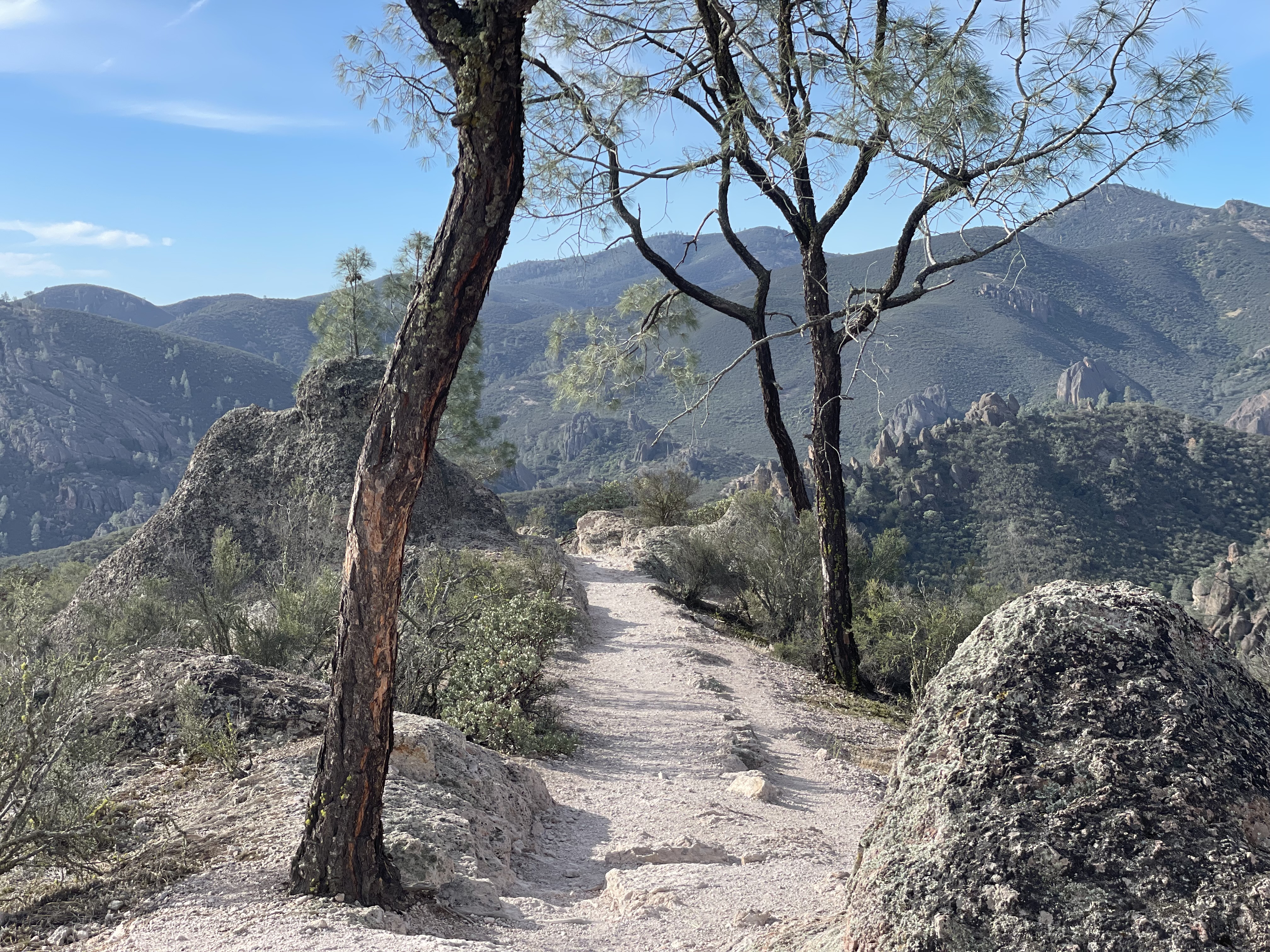
This trail offers spectacular views of the High Peaks and is a popular area for birdwatching, whether you hike just a few minutes or the entire trail. Condor Gulch Viewpoint is only one mile up the trail where they tower overhead.
Recreate Responsibly. Check park webpage alerts and weather forecast . Hiking, caving, and climbing can be fun but remember-if you get injured, you are a long way from medical help. Cell phones may not work in this remote park. Don't let your guard down when it comes to safety. Be prepared. Let someone know your plan before you go. Most of the trails are exposed. Bring a map and use the best judgement of your abilities. Drinking water is only available in developed areas-there is no water along any of the trails. Carry at least a liter of water for every hour of hiking. In winter, wear warm clothes and waterproof clothing. In summer, do not hike during the hottest parts of the day (10AM-4PM) especially on strenuous trails. Heat and dehydration can be fatal. Hiking steep trails requires more energy and results in greater water loss through sweating. Wear lightweight, light-colored, loose-fitting clothing. Wear sunscreen, a hat, and sunglasses. Wear sturdy, non-slip shoes or boots with ankle support due to rocky, uneven terrain and slick and sometimes slippery rocks. In all seasons, carry plenty of water and salty snacks (ex. pretzels, crackers, chips). Stay hydrated with plain water and an electrolyte drink replacement. Stay cool in summer and warm in winter and take rest breaks. Know your limits and turn back if needed. Stay on established trails to help prevent erosion. Wildflowers, pine cones, rocks, and other natural and cultural features are beautiful, but please do not remove or destroy them;leave them for the enjoyment of other visitors. All plants, animals, rocks, and structures in the park are protected by federal law. Be careful where you sit, step, and place your hands: poison oak, stinging nettle, and rattlesnakes are found here. Feeding, approaching, or hunting wildlife is prohibited. Using remotely piloted aircrafts like drones is prohibited.
Plan ahead and prepare. Take only pictures and leave only footprints, leaving objects as you find them. Observe wildlife from a distance and avoid loud voices or noises to be considerate of others.
Accessibility Difficulty: Strenuous, Moderate to the viewpoint Distance: Approx. 1.7 miles one-way, 1 mile to the viewpoint Trail width: Approx. 2 - 4 feet Maximum grade: 1,100 feet Surface Composition: dirt, rock Exposure: No shade In summer, expect temperatures in the High Peaks and Chalone Peaks to be 10 degrees hotter than parking areas. Avoid hiking during the hottest parts of the day. *service animals permitted
Hike Condor Gulch Trail to High Peaks Trail Loop the Park Service's write-up
3-5 Hours · no dogs
Start Bear Gulch Day Use Area
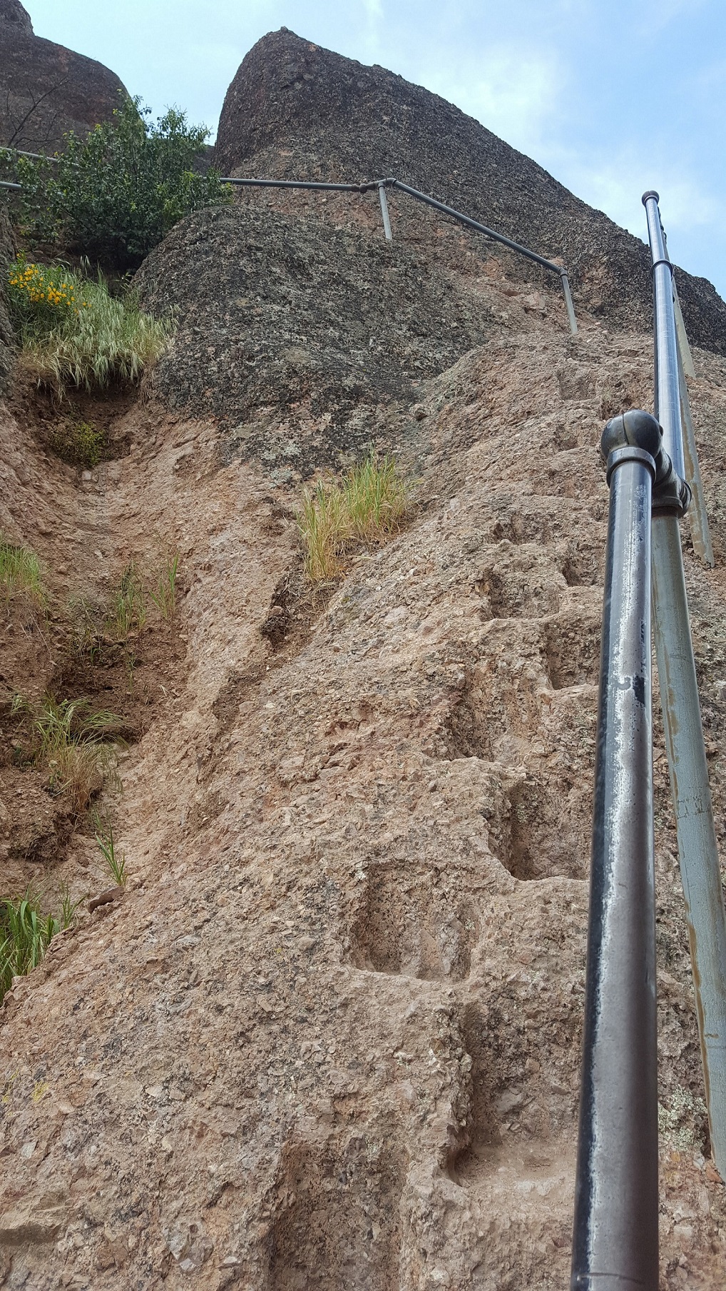
Walk through the heart of the Pinnacles rock formations , particularly along the Steep and Narrow section of the High Peaks Trail. Endangered California Condors frequent these rocks. Make sure to maintain a safe distance and keep wildlife wild.
Strenuous hike with excellent views; Loop hike of about 5.3 miles; Add Rim and Moses Spring trails to extend the loop to 6.2 miles; For a shorter option hike 1 mile to the Condor Gulch viewpoint and back for an elevation gain of about 600 feet.
Recreate Responsibly. Check park webpage alerts and weather forecast . Hiking, caving, and climbing can be fun but remember-if you get injured, you are a long way from medical help. Cell phones may not work in this remote park. Don't let your guard down when it comes to safety. Be prepared. Let someone know your plan before you go. Most of the trails are exposed. Bring a map and use the best judgement of your abilities. Drinking water is only available in developed areas-there is no water along any of the trails. Carry at least a liter of water for every hour of hiking. In winter, wear warm clothes and waterproof clothing. In summer, do not hike during the hottest parts of the day (10AM-4PM) especially on strenuous trails. Heat and dehydration can be fatal. Hiking steep trails requires more energy and results in greater water loss through sweating. Wear lightweight, light-colored, loose-fitting clothing. Wear sunscreen, a hat, and sunglasses. Wear sturdy, non-slip shoes or boots with ankle support due to rocky, uneven terrain and slick and sometimes slippery rocks. In all seasons, carry plenty of water and salty snacks (ex. pretzels, crackers, chips). Stay hydrated with plain water and an electrolyte drink replacement. Stay cool in summer and warm in winter and take rest breaks. Know your limits and turn back if needed. Stay on established trails to help prevent erosion. Wildflowers, pine cones, rocks, and other natural and cultural features are beautiful, but please do not remove or destroy them;leave them for the enjoyment of other visitors. All plants, animals, rocks, and structures in the park are protected by federal law. Be careful where you sit, step, and place your hands: poison oak, stinging nettle, and rattlesnakes are found here. Feeding, approaching, or hunting wildlife is prohibited. Using remotely piloted aircrafts like drones is prohibited.
Plan ahead and prepare. Take only pictures and leave only footprints, leaving objects as you find them. Observe wildlife from a distance and avoid loud voices or noises to be considerate of others.
Accessibility Difficulty: Strenuous Distance: Approx. 5.3 mile loop Trail width: Approx. 2 - 4 feet Maximum grade: 1500 feet Surface Composition: dirt, rock Exposure: No shade In summer, expect temperatures in the High Peaks and Chalone Peaks to be 10 degrees hotter than parking areas. Avoid hiking during the hottest parts of the day. *Service animals permitted
High Peaks Trail
Hike Condor Gulch Trail to High Peaks Trail Loop the Park Service's write-up
3-5 Hours · no dogs
Start Bear Gulch Day Use Area
Walk through the heart of the Pinnacles rock formations , particularly along the Steep and Narrow section of the High Peaks Trail. Endangered California Condors frequent these rocks. Make sure to maintain a safe distance and keep wildlife wild.
Strenuous hike with excellent views; Loop hike of about 5.3 miles; Add Rim and Moses Spring trails to extend the loop to 6.2 miles; For a shorter option hike 1 mile to the Condor Gulch viewpoint and back for an elevation gain of about 600 feet.
Recreate Responsibly. Check park webpage alerts and weather forecast . Hiking, caving, and climbing can be fun but remember-if you get injured, you are a long way from medical help. Cell phones may not work in this remote park. Don't let your guard down when it comes to safety. Be prepared. Let someone know your plan before you go. Most of the trails are exposed. Bring a map and use the best judgement of your abilities. Drinking water is only available in developed areas-there is no water along any of the trails. Carry at least a liter of water for every hour of hiking. In winter, wear warm clothes and waterproof clothing. In summer, do not hike during the hottest parts of the day (10AM-4PM) especially on strenuous trails. Heat and dehydration can be fatal. Hiking steep trails requires more energy and results in greater water loss through sweating. Wear lightweight, light-colored, loose-fitting clothing. Wear sunscreen, a hat, and sunglasses. Wear sturdy, non-slip shoes or boots with ankle support due to rocky, uneven terrain and slick and sometimes slippery rocks. In all seasons, carry plenty of water and salty snacks (ex. pretzels, crackers, chips). Stay hydrated with plain water and an electrolyte drink replacement. Stay cool in summer and warm in winter and take rest breaks. Know your limits and turn back if needed. Stay on established trails to help prevent erosion. Wildflowers, pine cones, rocks, and other natural and cultural features are beautiful, but please do not remove or destroy them;leave them for the enjoyment of other visitors. All plants, animals, rocks, and structures in the park are protected by federal law. Be careful where you sit, step, and place your hands: poison oak, stinging nettle, and rattlesnakes are found here. Feeding, approaching, or hunting wildlife is prohibited. Using remotely piloted aircrafts like drones is prohibited.
Plan ahead and prepare. Take only pictures and leave only footprints, leaving objects as you find them. Observe wildlife from a distance and avoid loud voices or noises to be considerate of others.
Accessibility Difficulty: Strenuous Distance: Approx. 5.3 mile loop Trail width: Approx. 2 - 4 feet Maximum grade: 1500 feet Surface Composition: dirt, rock Exposure: No shade In summer, expect temperatures in the High Peaks and Chalone Peaks to be 10 degrees hotter than parking areas. Avoid hiking during the hottest parts of the day. *Service animals permitted
Hike High Peaks to Balconies Cave Loop the Park Service's write-up
4-5 Hours · no dogs
Start Chaparral Parking Area
Strenuous hike to and through High Peaks. Begin west up towards High Peaks for excellent views, return on Old Pinnacles and the Balconies trails, in or around the cave.
*Access from the East Side, take Blue Oak to High Peaks retuning in or around cave to Old Pinnacles Trail.
Recreate Responsibly. Check park webpage alerts and weather forecast . Hiking, caving, and climbing can be fun but remember-if you get injured, you are a long way from medical help. Cell phones may not work in this remote park. Don't let your guard down when it comes to safety. Be prepared. Let someone know your plan before you go. Most of the trails are exposed. Bring a map and use the best judgement of your abilities. Drinking water is only available in developed areas-there is no water along any of the trails. Carry at least a liter of water for every hour of hiking. In winter, wear warm clothes and waterproof clothing. In summer, do not hike during the hottest parts of the day (10AM-4PM) especially on strenuous trails. Heat and dehydration can be fatal. Hiking steep trails requires more energy and results in greater water loss through sweating. Wear lightweight, light-colored, loose-fitting clothing. Wear sunscreen, a hat, and sunglasses. Wear sturdy, non-slip shoes or boots with ankle support due to rocky, uneven terrain and slick and sometimes slippery rocks. In all seasons, carry plenty of water and salty snacks (ex. pretzels, crackers, chips). Stay hydrated with plain water and an electrolyte drink replacement. Stay cool in summer and warm in winter and take rest breaks. Know your limits and turn back if needed. Stay on established trails to help prevent erosion. Wildflowers, pine cones, rocks, and other natural and cultural features are beautiful, but please do not remove or destroy them;leave them for the enjoyment of other visitors. All plants, animals, rocks, and structures in the park are protected by federal law. Be careful where you sit, step, and place your hands: poison oak, stinging nettle, and rattlesnakes are found here. Feeding, approaching, or hunting wildlife is prohibited. Using remotely piloted aircrafts like drones is prohibited.
Plan ahead and prepare. Take only pictures and leave only footprints, leaving objects as you find them. Observe wildlife from a distance and avoid loud voices or noises to be considerate of others.
Accessibility Difficulty: Strenuous Distance: Approx. 8.4 mile loop Trail width: Approx. 2 - 4 feet Maximum grade: 1,540 feet Surface Composition: dirt, rock, sand Exposure: Mostly no shade, limited shade on Old Pinnacles Trail In summer, expect temperatures in the High Peaks and Chalone Peaks to be 10 degrees hotter than parking areas. Avoid hiking during the hottest parts of the day. Flashlight required in the cave; Watch for low ceilings, slippery rocks, and uneven footing. Wading may be necessary in the winter when precipitation creates; Cave may be closed for short periods in winter due to flooding. *Service animals permitted
Hike High Peaks to Bear Gulch Loop the Park Service's write-up
4-5 Hours · no dogs
Start Moses Spring Trailhead
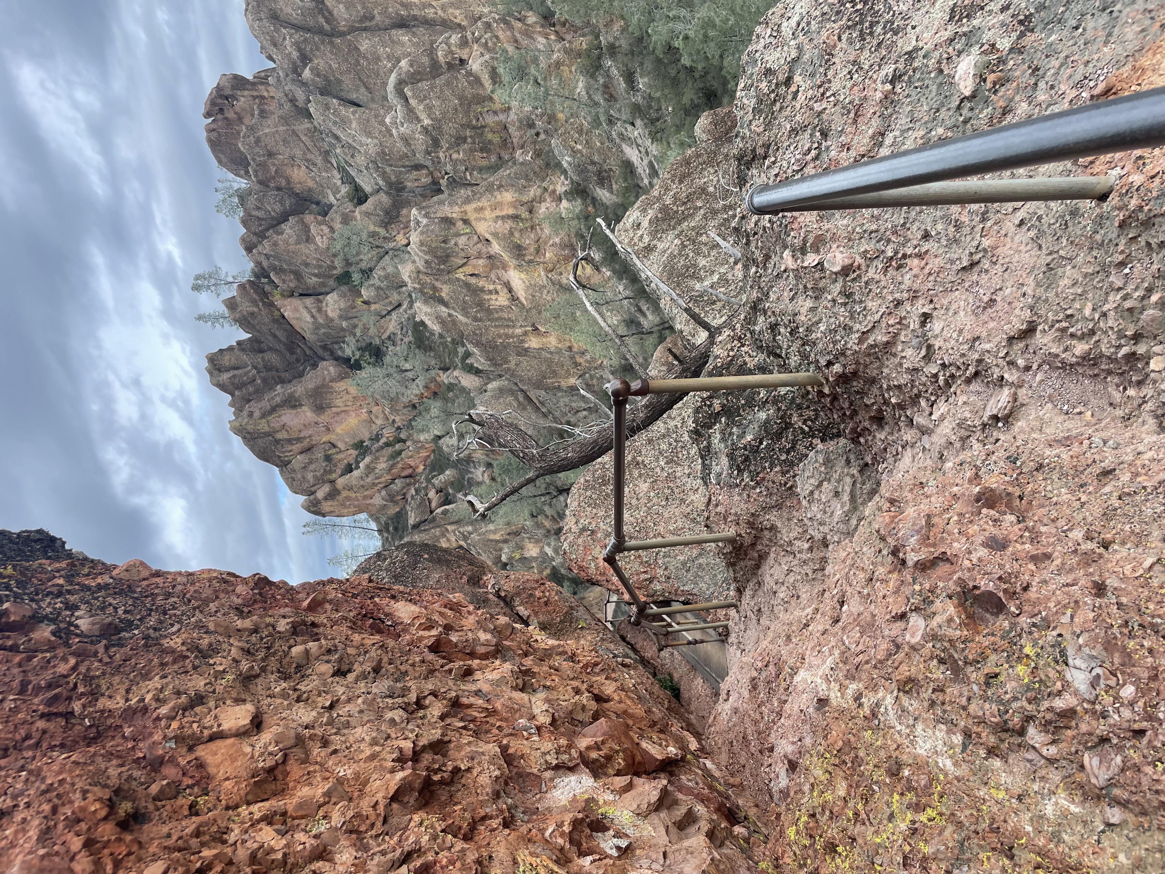
Climb into the High Peaks and descend along the ridge through meadows of grasses, and in the spring, wildflowers. Return to the Bear Gulch Day Use Area under the shade of sycamore, buckeye, and oak trees along the Bench and Sycamore Trail.
For a shorter loop, use the Condor Gulch Trail instead of following Blue Oak Trail.
Alternatively, this hike may be best started counter-clockwise with Blue Oak Trail ending with Sycamore Trail if parking is limited at Bear Gulch Day Use Area.
Recreate Responsibly. Check park webpage alerts and weather forecast . Hiking, caving, and climbing can be fun but remember-if you get injured, you are a long way from medical help. Cell phones may not work in this remote park. Don't let your guard down when it comes to safety. Be prepared. Let someone know your plan before you go. Most of the trails are exposed. Bring a map and use the best judgement of your abilities. Drinking water is only available in developed areas-there is no water along any of the trails. Carry at least a liter of water for every hour of hiking. In winter, wear warm clothes and waterproof clothing. In summer, do not hike during the hottest parts of the day (10AM-4PM) especially on strenuous trails. Heat and dehydration can be fatal. Hiking steep trails requires more energy and results in greater water loss through sweating. Wear lightweight, light-colored, loose-fitting clothing. Wear sunscreen, a hat, and sunglasses. Wear sturdy, non-slip shoes or boots with ankle support due to rocky, uneven terrain and slick and sometimes slippery rocks. In all seasons, carry plenty of water and salty snacks (ex. pretzels, crackers, chips). Stay hydrated with plain water and an electrolyte drink replacement. Stay cool in summer and warm in winter and take rest breaks. Know your limits and turn back if needed. Stay on established trails to help prevent erosion. Wildflowers, pine cones, rocks, and other natural and cultural features are beautiful, but please do not remove or destroy them;leave them for the enjoyment of other visitors. All plants, animals, rocks, and structures in the park are protected by federal law. Be careful where you sit, step, and place your hands: poison oak, stinging nettle, and rattlesnakes are found here. Feeding, approaching, or hunting wildlife is prohibited. Using remotely piloted aircrafts like drones is prohibited.
Plan ahead and prepare. Take only pictures and leave only footprints, leaving objects as you find them. Observe wildlife from a distance and avoid loud voices or noises to be considerate of others.
Accessibility Difficulty: Strenuous Distance: Approx. 6.7 mile loop Trail width: Approx. 2 - 4 feet Maximum grade: 1,425 feet Surface Composition: dirt, rock Exposure: Mostly no shade, shade along Sycamore Trail In summer, expect temperatures in the High Peaks and Chalone Peaks to be 10 degrees hotter than parking areas. Avoid hiking during the hottest parts of the day. Flashlight required in cave; Watch for low ceilings, slippery rocks, and uneven footing. Cave is open seasonally; Cave may be closed for short periods in winter due to flooding. *Service animals permitted
Jawbone Canyon Trail
Hike Jawbone Trail the Park Service's write-up
30-60 Minutes · no dogs
Start Jawbone Trailhead
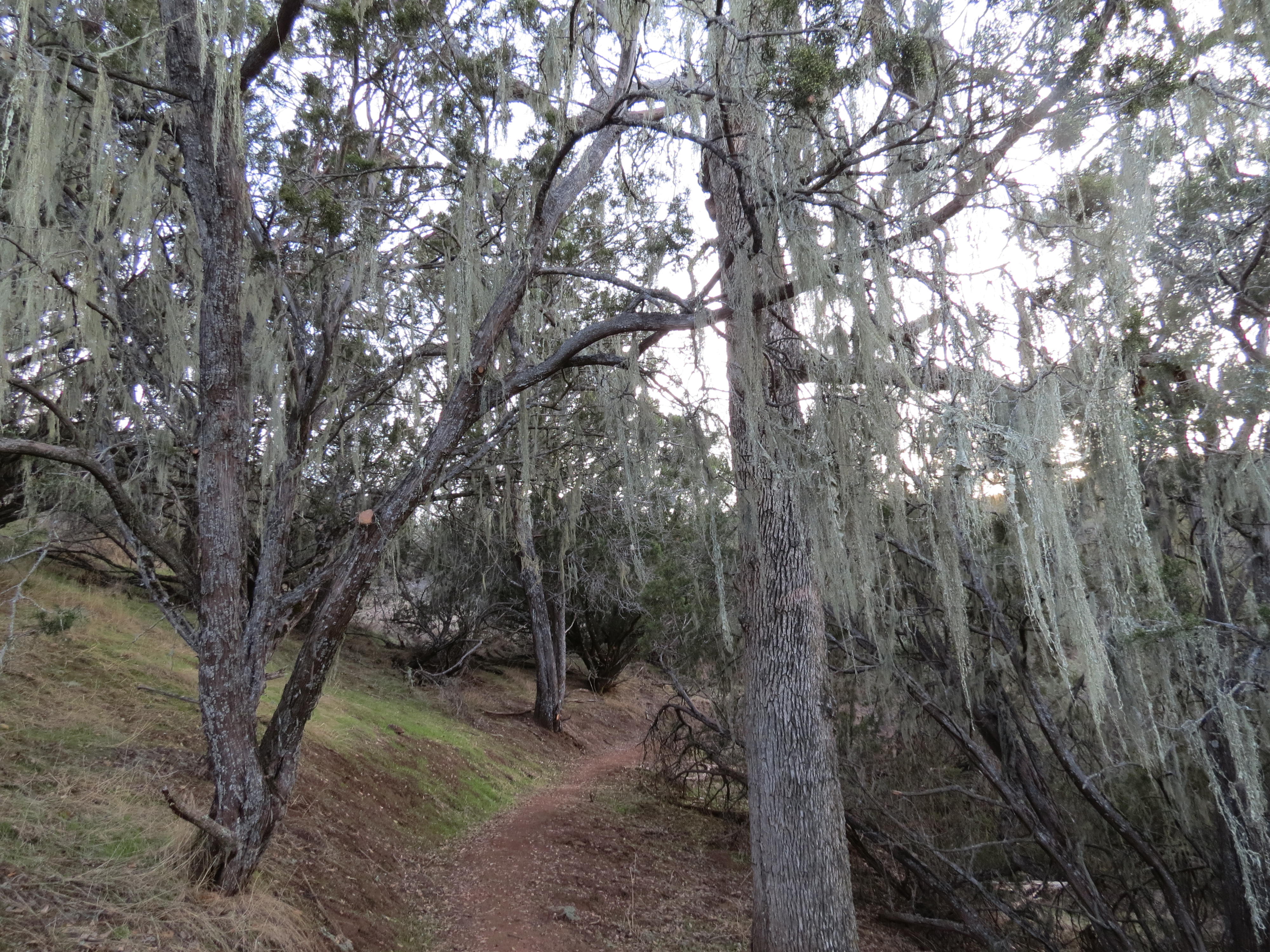
Head northwest from the Prewett Point Trail and descend into the Jawbone Parking Area, where the trail connects to the Chaparral Parking Area (0.3 miles), trailhead for Balconies Cliffs - Balconies Cave Loop, Juniper Canyon Loop, and High Peaks - Balconies Cave Loop.
Recreate Responsibly. Check park webpage alerts and weather forecast . Hiking, caving, and climbing can be fun but remember-if you get injured, you are a long way from medical help. Cell phones may not work in this remote park. Don't let your guard down when it comes to safety. Be prepared. Let someone know your plan before you go. Most of the trails are exposed. Bring a map and use the best judgement of your abilities. Drinking water is only available in developed areas-there is no water along any of the trails. Carry at least a liter of water for every hour of hiking. In winter, wear warm clothes and waterproof clothing. In summer, do not hike during the hottest parts of the day (10AM-4PM) especially on strenuous trails. Heat and dehydration can be fatal. Hiking steep trails requires more energy and results in greater water loss through sweating. Wear lightweight, light-colored, loose-fitting clothing. Wear sunscreen, a hat, and sunglasses. Wear sturdy, non-slip shoes or boots with ankle support due to rocky, uneven terrain and slick and sometimes slippery rocks. In all seasons, carry plenty of water and salty snacks (ex. pretzels, crackers, chips). Stay hydrated with plain water and an electrolyte drink replacement. Stay cool in summer and warm in winter and take rest breaks. Know your limits and turn back if needed. Stay on established trails to help prevent erosion. Wildflowers, pine cones, rocks, and other natural and cultural features are beautiful, but please do not remove or destroy them;leave them for the enjoyment of other visitors. All plants, animals, rocks, and structures in the park are protected by federal law. Be careful where you sit, step, and place your hands: poison oak, stinging nettle, and rattlesnakes are found here. Feeding, approaching, or hunting wildlife is prohibited. Using remotely piloted aircrafts like drones is prohibited.
Plan ahead and prepare. Take only pictures and leave only footprints, leaving objects as you find them. Observe wildlife from a distance and avoid loud voices or noises to be considerate of others.
Accessibility Difficulty: Easy to Moderate Distance: Approx. 1.2 miles one-way Trail width: Approx. 2.5 - 4 feet Maximum grade: 560 feet Surface Composition: dirt Exposure: Limited shade *Service animals permitted
Jawbone Connector Trail
Picnic areas
Along the way Chaparral Picnic Area
Juniper Canyon Trail
Picnic areas
Along the way Chaparral Picnic Area
Hike Juniper Canyon Trail Loop the Park Service's write-up
2-3 Hours · no dogs · reservation required
Start Chaparral Parking Area

This steep trail climbs along switchbacks to the heart of the High Peaks. At the top, circle through the rock formations along the Steep and Narrow section of the High Peaks Trail and begin the descent down on the Tunnel Trail.
Recreate Responsibly. Check park webpage alerts and weather forecast . Hiking, caving, and climbing can be fun but remember-if you get injured, you are a long way from medical help. Cell phones may not work in this remote park. Don't let your guard down when it comes to safety. Be prepared. Let someone know your plan before you go. Most of the trails are exposed. Bring a map and use the best judgement of your abilities. Drinking water is only available in developed areas-there is no water along any of the trails. Carry at least a liter of water for every hour of hiking. In winter, wear warm clothes and waterproof clothing. In summer, do not hike during the hottest parts of the day (10AM-4PM) especially on strenuous trails. Heat and dehydration can be fatal. Hiking steep trails requires more energy and results in greater water loss through sweating. Wear lightweight, light-colored, loose-fitting clothing. Wear sunscreen, a hat, and sunglasses. Wear sturdy, non-slip shoes or boots with ankle support due to rocky, uneven terrain and slick and sometimes slippery rocks. In all seasons, carry plenty of water and salty snacks (ex. pretzels, crackers, chips). Stay hydrated with plain water and an electrolyte drink replacement. Stay cool in summer and warm in winter and take rest breaks. Know your limits and turn back if needed. Stay on established trails to help prevent erosion. Wildflowers, pine cones, rocks, and other natural and cultural features are beautiful, but please do not remove or destroy them;leave them for the enjoyment of other visitors. All plants, animals, rocks, and structures in the park are protected by federal law. Be careful where you sit, step, and place your hands: poison oak, stinging nettle, and rattlesnakes are found here. Feeding, approaching, or hunting wildlife is prohibited. Using remotely piloted aircrafts like drones is prohibited.
Plan ahead and prepare. Take only pictures and leave only footprints, leaving objects as you find them. Observe wildlife from a distance and avoid loud voices or noises to be considerate of others.
Accessibility Difficulty: Strenuous Distance: Approx. 4.3 miles roundtrip Trail width: Approx. 2.5 - 4 feet Maximum grade: 1,215 feet Surface Composition: dirt, rock Exposure: No shade, little provided in rock tunnel on Tunnel Trail In summer, expect temperatures in the High Peaks and Chalone Peaks to be 10 degrees hotter than parking areas. Avoid hiking during the hottest parts of the day. *Service animals permitted
Moses Spring Trail
Hike Moses Spring Trail to Rim Trail Loop the Park Service's write-up
1-2 Hours · no dogs
Start Moses Spring Trailhead
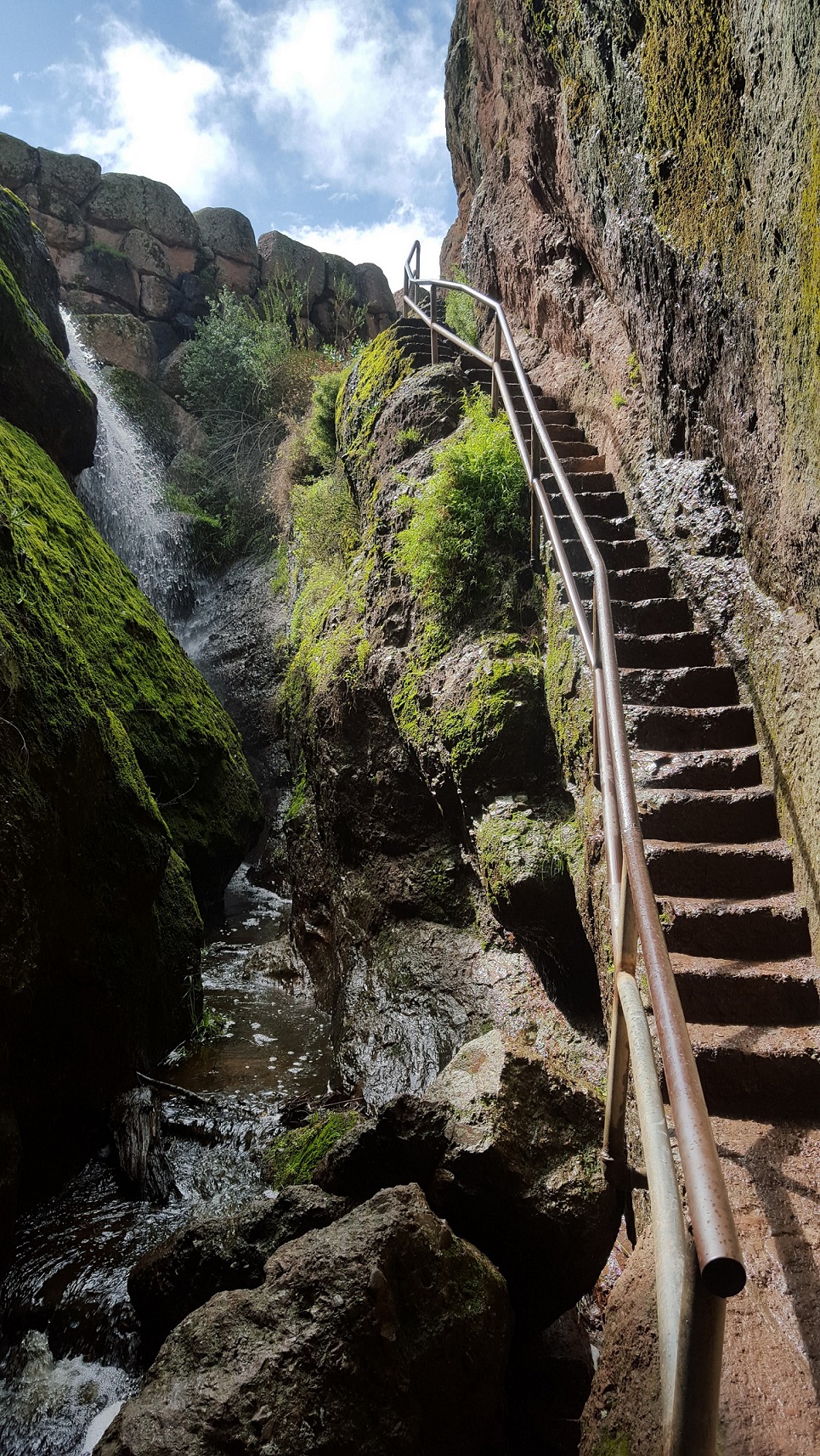
This loop is a good choice for rock formations, talus caves, and the reservoir. Hike through Bear Gulch to the Reservoir, passing over caves, then along the rim of the gulch with panoramic views. This loop is the way to access Bear Gulch Cave . Bear Gulch Cave is open seasonally check the status of the cave before visiting.
Trailhead starts near Bear Gulch Nature Center; also connects with High Peaks Trail and North Chalone Peak Trail; trail guide available for purchase at the Park Store.
Recreate Responsibly. Check park webpage alerts and weather forecast . Hiking, caving, and climbing can be fun but remember-if you get injured, you are a long way from medical help. Cell phones may not work in this remote park. Don't let your guard down when it comes to safety. Be prepared. Let someone know your plan before you go. Most of the trails are exposed. Bring a map and use the best judgement of your abilities. Drinking water is only available in developed areas-there is no water along any of the trails. Carry at least a liter of water for every hour of hiking. In winter, wear warm clothes and waterproof clothing. In summer, do not hike during the hottest parts of the day (10AM-4PM) especially on strenuous trails. Heat and dehydration can be fatal. Hiking steep trails requires more energy and results in greater water loss through sweating. Wear lightweight, light-colored, loose-fitting clothing. Wear sunscreen, a hat, and sunglasses. Wear sturdy, non-slip shoes or boots with ankle support due to rocky, uneven terrain and slick and sometimes slippery rocks. In all seasons, carry plenty of water and salty snacks (ex. pretzels, crackers, chips). Stay hydrated with plain water and an electrolyte drink replacement. Stay cool in summer and warm in winter and take rest breaks. Know your limits and turn back if needed. Stay on established trails to help prevent erosion. Wildflowers, pine cones, rocks, and other natural and cultural features are beautiful, but please do not remove or destroy them;leave them for the enjoyment of other visitors. All plants, animals, rocks, and structures in the park are protected by federal law. Be careful where you sit, step, and place your hands: poison oak, stinging nettle, and rattlesnakes are found here. Feeding, approaching, or hunting wildlife is prohibited. Using remotely piloted aircrafts like drones is prohibited.
Plan ahead and prepare. Take only pictures and leave only footprints, leaving objects as you find them. Observe wildlife from a distance and avoid loud voices or noises to be considerate of others.
Accessibility Difficulty: Moderate Distance: Approx. 2.2 mile loop Trail width: Approx. 2.5 - 4 feet Maximum grade: 500 feet Surface Composition: dirt, rock Exposure: Limited shade, no shade on Rim Trail Flashlight required in cave; Watch for low ceilings, slippery rocks, and uneven footing. Cave is open seasonally; Cave may be closed for short periods in winter due to flooding. *Service animals permitted
North Chalone Peak Trail
Hike Chalone Peak Trail the Park Service's write-up
3-5 Hours · no dogs
Start North Chalone Trail
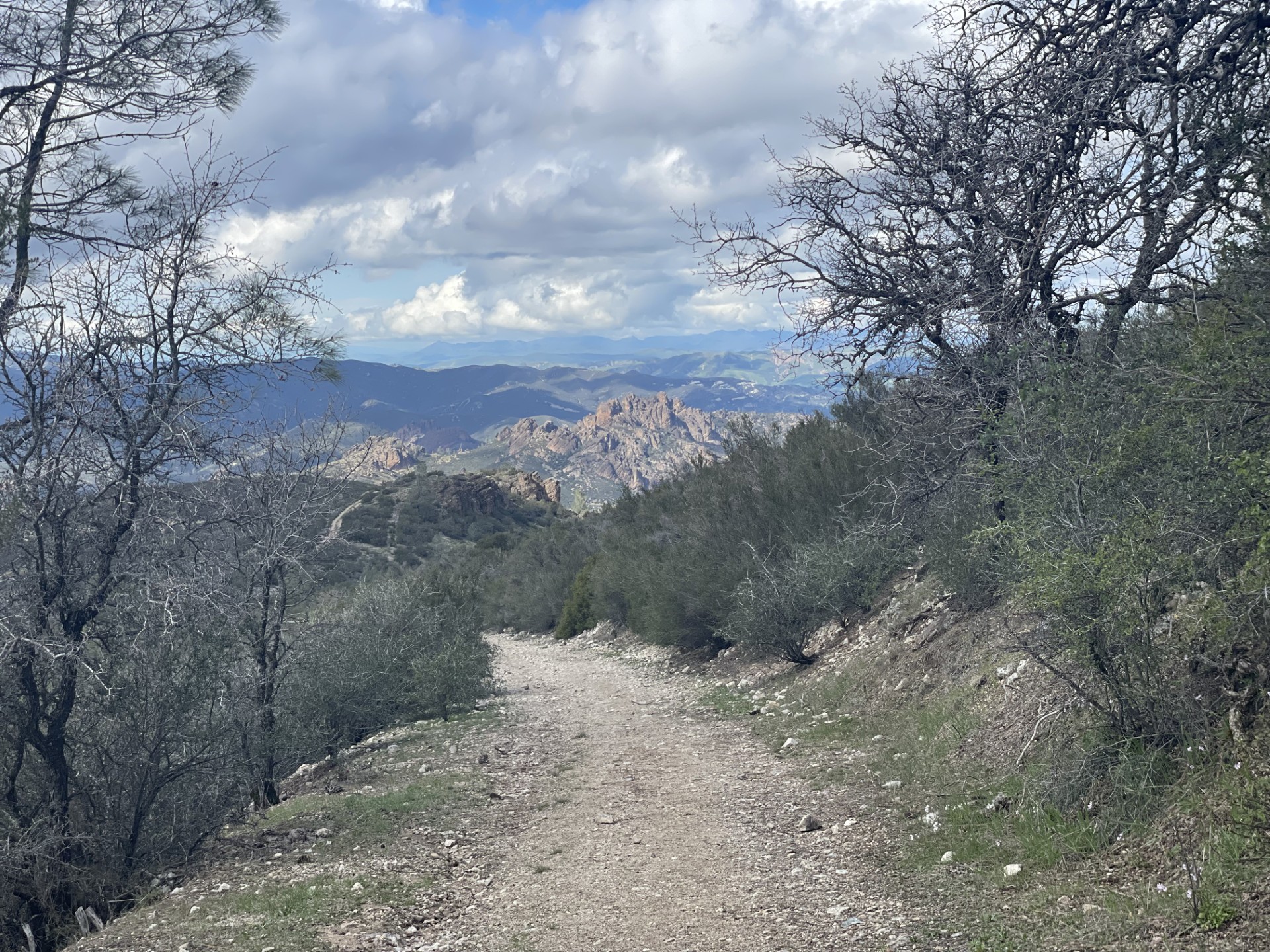
Climb to the highest point in the park, North Chalone Peak, and be rewarded with views of the surrounding valleys. This trail begins at the reservoir and climbs gradually to the peak. The last mile is on a dirt road. For a longer hike continue 1.6 miles further on an unmaintained trail to South Chalone Peak, with a unique vista from the southern end of the Gabilan Range.
Recreate Responsibly. Check park webpage alerts and weather forecast . Hiking, caving, and climbing can be fun but remember-if you get injured, you are a long way from medical help. Cell phones may not work in this remote park. Don't let your guard down when it comes to safety. Be prepared. Let someone know your plan before you go. Most of the trails are exposed. Bring a map and use the best judgement of your abilities. Drinking water is only available in developed areas-there is no water along any of the trails. Carry at least a liter of water for every hour of hiking. In winter, wear warm clothes and waterproof clothing. In summer, do not hike during the hottest parts of the day (10AM-4PM) especially on strenuous trails. Heat and dehydration can be fatal. Hiking steep trails requires more energy and results in greater water loss through sweating. Wear lightweight, light-colored, loose-fitting clothing. Wear sunscreen, a hat, and sunglasses. Wear sturdy, non-slip shoes or boots with ankle support due to rocky, uneven terrain and slick and sometimes slippery rocks. In all seasons, carry plenty of water and salty snacks (ex. pretzels, crackers, chips). Stay hydrated with plain water and an electrolyte drink replacement. Stay cool in summer and warm in winter and take rest breaks. Know your limits and turn back if needed. Stay on established trails to help prevent erosion. Wildflowers, pine cones, rocks, and other natural and cultural features are beautiful, but please do not remove or destroy them;leave them for the enjoyment of other visitors. All plants, animals, rocks, and structures in the park are protected by federal law. Be careful where you sit, step, and place your hands: poison oak, stinging nettle, and rattlesnakes are found here. Feeding, approaching, or hunting wildlife is prohibited. Using remotely piloted aircrafts like drones is prohibited.
Plan ahead and prepare. Take only pictures and leave only footprints, leaving objects as you find them. Observe wildlife from a distance and avoid loud voices or noises to be considerate of others.
Accessibility Difficulty: Strenuous Distance: Approx. 9 miles roundtrip Trail width: Approx. 2 - 4 feet Maximum grade: 2,040 feet Surface Composition: dirt, rock Exposure: No shade In summer, expect temperatures in the High Peaks and Chalone Peaks to be 10 degrees hotter than parking areas. Avoid hiking during the hottest parts of the day. Expect to step over a stile where the dirt road begins and ends along Chalone Peak Trail leading up to the North Chalone fire tower. *South Chalone Peak is unmaintained Flashlight required in the cave; Watch for low ceilings, slippery rocks, and uneven footing. Wading may be necessary in the winter when precipitation creates; Cave may be closed for short periods in winter due to flooding. *Service animals permitted
North Wilderness Trail
Hike North Wilderness Trail Loop the Park Service's write-up
5-8 Hours · no dogs
Start North Wilderness Trailhead
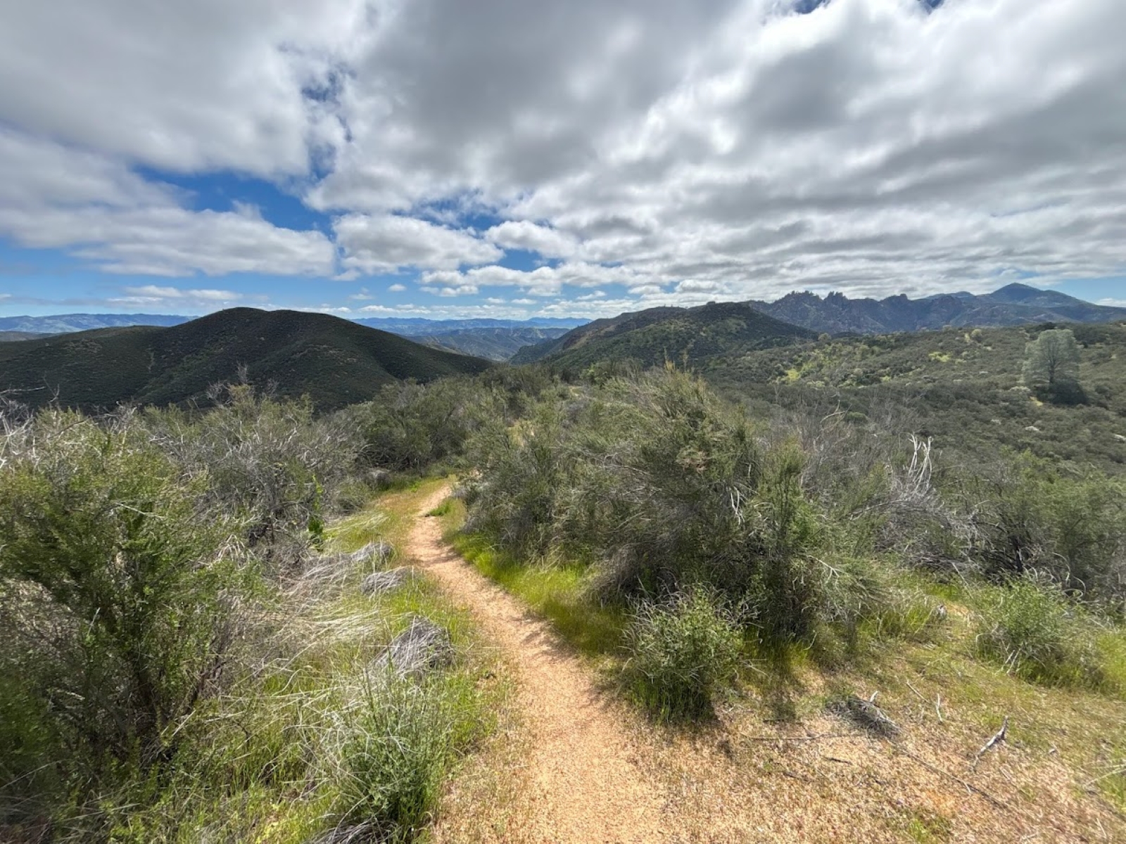
This unmaintained trail climbs along the ridge tops and then descends into Chalone Creek bed, where it is marked by rock cairns. Return along the Old Pinnacles and Balconies Trail.
This loop is strenuous and begins from Chaparral Parking on the west side but may be accessed from Old Pinnacles Parking on the east side.
Recreate Responsibly. Check park webpage alerts and weather forecast . Hiking, caving, and climbing can be fun but remember-if you get injured, you are a long way from medical help. Cell phones may not work in this remote park. Don't let your guard down when it comes to safety. Be prepared. Let someone know your plan before you go. Most of the trails are exposed. Bring a map and use the best judgement of your abilities. Drinking water is only available in developed areas-there is no water along any of the trails. Carry at least a liter of water for every hour of hiking. In winter, wear warm clothes and waterproof clothing. In summer, do not hike during the hottest parts of the day (10AM-4PM) especially on strenuous trails. Heat and dehydration can be fatal. Hiking steep trails requires more energy and results in greater water loss through sweating. Wear lightweight, light-colored, loose-fitting clothing. Wear sunscreen, a hat, and sunglasses. Wear sturdy, non-slip shoes or boots with ankle support due to rocky, uneven terrain and slick and sometimes slippery rocks. In all seasons, carry plenty of water and salty snacks (ex. pretzels, crackers, chips). Stay hydrated with plain water and an electrolyte drink replacement. Stay cool in summer and warm in winter and take rest breaks. Know your limits and turn back if needed. Stay on established trails to help prevent erosion. Wildflowers, pine cones, rocks, and other natural and cultural features are beautiful, but please do not remove or destroy them;leave them for the enjoyment of other visitors. All plants, animals, rocks, and structures in the park are protected by federal law. Be careful where you sit, step, and place your hands: poison oak, stinging nettle, and rattlesnakes are found here. Feeding, approaching, or hunting wildlife is prohibited. Using remotely piloted aircrafts like drones is prohibited.
Plan ahead and prepare. Take only pictures and leave only footprints, leaving objects as you find them. Observe wildlife from a distance and avoid loud voices or noises to be considerate of others.
Accessibility Difficulty: Strenuous Distance: Approx. 9.3 miles roundtrip Trail width: Approx. 2 - 4 feet Maximum grade: 1,020 feet Surface Composition: dirt, rock Exposure: Limited shade Flashlight required in the cave; Watch for low ceilings, slippery rocks, and uneven footing. Wading may be necessary in the winter when precipitation creates; Cave may be closed for short periods in winter due to flooding. *Unmaintained trail *Service animals permitted
Old Pinnacles Trail
Hike Old Pinnacles Trail to Balconies Cave the Park Service's write-up
3-4 Hours · no dogs
Start Old Pinnacles Parking Area
This sunny hike to Balconies Cave leads to towering rock formations: Machete Ridge and the Balconies Cliffs. Traverse through six creek crossings which flow seasonally. Begin at the Old Pinnacles Trailhead. Enter through the Balconies Cave and back around along the Balconies Cliffs.
Recreate Responsibly. Check park webpage alerts and weather forecast . Hiking, caving, and climbing can be fun but remember-if you get injured, you are a long way from medical help. Cell phones may not work in this remote park. Don't let your guard down when it comes to safety. Be prepared. Let someone know your plan before you go. Most of the trails are exposed. Bring a map and use the best judgement of your abilities. Drinking water is only available in developed areas-there is no water along any of the trails. Carry at least a liter of water for every hour of hiking. In winter, wear warm clothes and waterproof clothing. In summer, do not hike during the hottest parts of the day (10AM-4PM) especially on strenuous trails. Heat and dehydration can be fatal. Hiking steep trails requires more energy and results in greater water loss through sweating. Wear lightweight, light-colored, loose-fitting clothing. Wear sunscreen, a hat, and sunglasses. Wear sturdy, non-slip shoes or boots with ankle support due to rocky, uneven terrain and slick and sometimes slippery rocks. In all seasons, carry plenty of water and salty snacks (ex. pretzels, crackers, chips). Stay hydrated with plain water and an electrolyte drink replacement. Stay cool in summer and warm in winter and take rest breaks. Know your limits and turn back if needed. Stay on established trails to help prevent erosion. Wildflowers, pine cones, rocks, and other natural and cultural features are beautiful, but please do not remove or destroy them;leave them for the enjoyment of other visitors. All plants, animals, rocks, and structures in the park are protected by federal law. Be careful where you sit, step, and place your hands: poison oak, stinging nettle, and rattlesnakes are found here. Feeding, approaching, or hunting wildlife is prohibited. Using remotely piloted aircrafts like drones is prohibited.
Plan ahead and prepare. Take only pictures and leave only footprints, leaving objects as you find them. Observe wildlife from a distance and avoid loud voices or noises to be considerate of others.
Accessibility Difficulty: Moderate Distance: Approx. 5.4 miles roundtrip Trail width: Approx. 2 - 4 feet Maximum grade: 350 feet Surface Composition: sand, dirt, rock Exposure: Limited shade, no shade on Balconies Cliffs Trail Flashlight required in the cave; Watch for low ceilings, slippery rocks, and uneven footing. Wading may be necessary in the winter when precipitation creates; Cave may be closed for short periods in winter due to flooding. *Service animals permitted
Prewett Point Trail
Visitor centers
Along the way West Pinnacles Visitor Contact Station
Hike Prewett Point Trail the Park Service's write-up
30-60 Minutes · no dogs
Start West Visitor Contact Station Parking Area
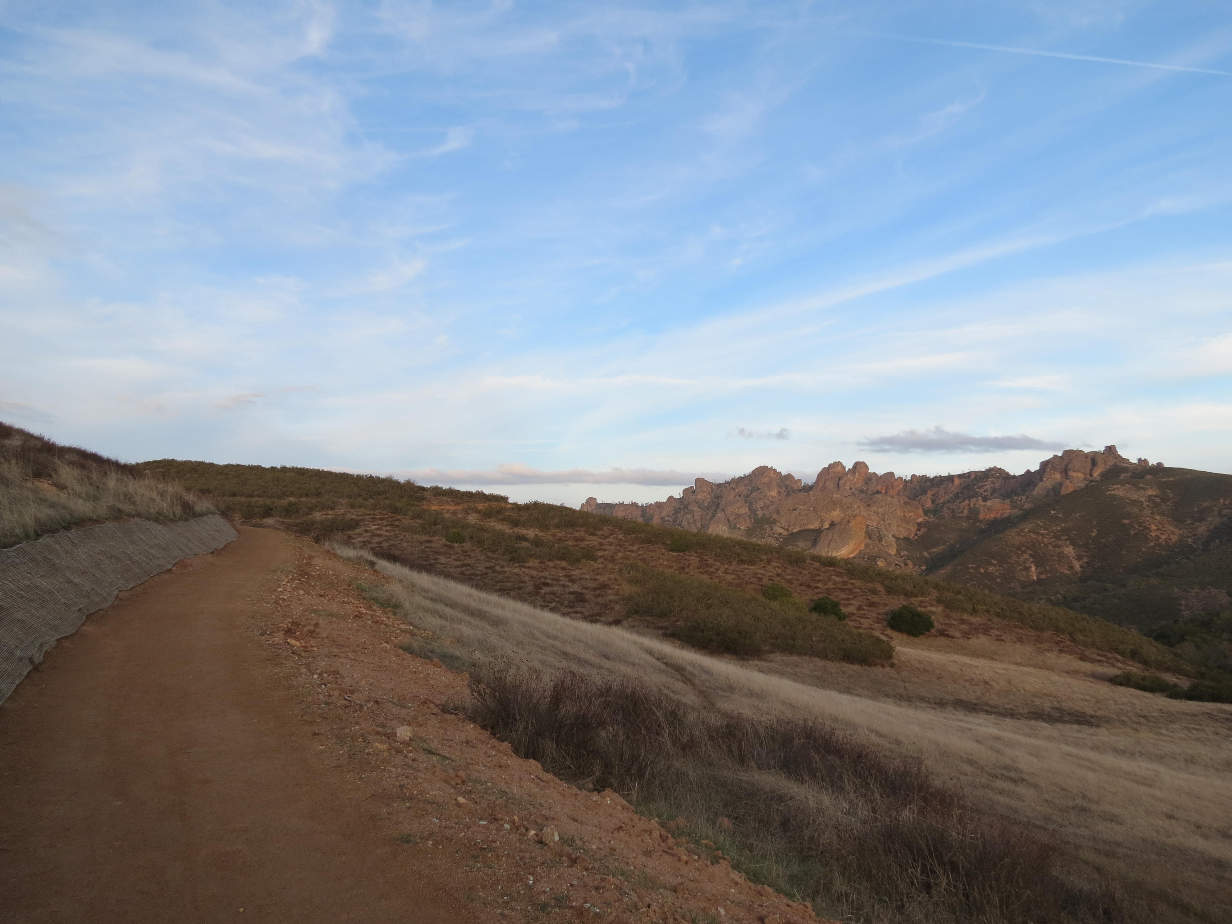
A gentle hike with great views of the Pinnacles rock formations and the Hain Wilderness to the largest overlook. Some pullouts have benches. There is little shade, and the sun can be intense in the late morning and afternoon.
Recreate Responsibly. Check park webpage alerts and weather forecast . Hiking, caving, and climbing can be fun but remember-if you get injured, you are a long way from medical help. Cell phones may not work in this remote park. Don't let your guard down when it comes to safety. Be prepared. Let someone know your plan before you go. Most of the trails are exposed. Bring a map and use the best judgement of your abilities. Drinking water is only available in developed areas-there is no water along any of the trails. Carry at least a liter of water for every hour of hiking. In winter, wear warm clothes and waterproof clothing. In summer, do not hike during the hottest parts of the day (10AM-4PM) especially on strenuous trails. Heat and dehydration can be fatal. Hiking steep trails requires more energy and results in greater water loss through sweating. Wear lightweight, light-colored, loose-fitting clothing. Wear sunscreen, a hat, and sunglasses. Wear sturdy, non-slip shoes or boots with ankle support due to rocky, uneven terrain and slick and sometimes slippery rocks. In all seasons, carry plenty of water and salty snacks (ex. pretzels, crackers, chips). Stay hydrated with plain water and an electrolyte drink replacement. Stay cool in summer and warm in winter and take rest breaks. Know your limits and turn back if needed. Stay on established trails to help prevent erosion. Wildflowers, pine cones, rocks, and other natural and cultural features are beautiful, but please do not remove or destroy them;leave them for the enjoyment of other visitors. All plants, animals, rocks, and structures in the park are protected by federal law. Be careful where you sit, step, and place your hands: poison oak, stinging nettle, and rattlesnakes are found here. Feeding, approaching, or hunting wildlife is prohibited. Using remotely piloted aircrafts like drones is prohibited.
Plan ahead and prepare. Take only pictures and leave only footprints, leaving objects as you find them. Observe wildlife from a distance and avoid loud voices or noises to be considerate of others.
Accessibility Difficulty: Easy Distance: Approx. 0.9 miles round trip Trail width: Approx. 3 - 5 feet Maximum grade: 70 feet Surface Composition: dirt Exposure: No shade *Accessible for wheelchairs and mobility devices *Service animals permitted
Rim Trail
Hike Moses Spring Trail to Rim Trail Loop the Park Service's write-up
1-2 Hours · no dogs
Start Moses Spring Trailhead
This loop is a good choice for rock formations, talus caves, and the reservoir. Hike through Bear Gulch to the Reservoir, passing over caves, then along the rim of the gulch with panoramic views. This loop is the way to access Bear Gulch Cave . Bear Gulch Cave is open seasonally check the status of the cave before visiting.
Trailhead starts near Bear Gulch Nature Center; also connects with High Peaks Trail and North Chalone Peak Trail; trail guide available for purchase at the Park Store.
Recreate Responsibly. Check park webpage alerts and weather forecast . Hiking, caving, and climbing can be fun but remember-if you get injured, you are a long way from medical help. Cell phones may not work in this remote park. Don't let your guard down when it comes to safety. Be prepared. Let someone know your plan before you go. Most of the trails are exposed. Bring a map and use the best judgement of your abilities. Drinking water is only available in developed areas-there is no water along any of the trails. Carry at least a liter of water for every hour of hiking. In winter, wear warm clothes and waterproof clothing. In summer, do not hike during the hottest parts of the day (10AM-4PM) especially on strenuous trails. Heat and dehydration can be fatal. Hiking steep trails requires more energy and results in greater water loss through sweating. Wear lightweight, light-colored, loose-fitting clothing. Wear sunscreen, a hat, and sunglasses. Wear sturdy, non-slip shoes or boots with ankle support due to rocky, uneven terrain and slick and sometimes slippery rocks. In all seasons, carry plenty of water and salty snacks (ex. pretzels, crackers, chips). Stay hydrated with plain water and an electrolyte drink replacement. Stay cool in summer and warm in winter and take rest breaks. Know your limits and turn back if needed. Stay on established trails to help prevent erosion. Wildflowers, pine cones, rocks, and other natural and cultural features are beautiful, but please do not remove or destroy them;leave them for the enjoyment of other visitors. All plants, animals, rocks, and structures in the park are protected by federal law. Be careful where you sit, step, and place your hands: poison oak, stinging nettle, and rattlesnakes are found here. Feeding, approaching, or hunting wildlife is prohibited. Using remotely piloted aircrafts like drones is prohibited.
Plan ahead and prepare. Take only pictures and leave only footprints, leaving objects as you find them. Observe wildlife from a distance and avoid loud voices or noises to be considerate of others.
Accessibility Difficulty: Moderate Distance: Approx. 2.2 mile loop Trail width: Approx. 2.5 - 4 feet Maximum grade: 500 feet Surface Composition: dirt, rock Exposure: Limited shade, no shade on Rim Trail Flashlight required in cave; Watch for low ceilings, slippery rocks, and uneven footing. Cave is open seasonally; Cave may be closed for short periods in winter due to flooding. *Service animals permitted
SERVICE ROAD
Hike Bacon-Butterfield Ranch Trail the Park Service's write-up
30-60 Minutes · dogs allowed
Start Bacon-Butterfield Ranch Trailhead
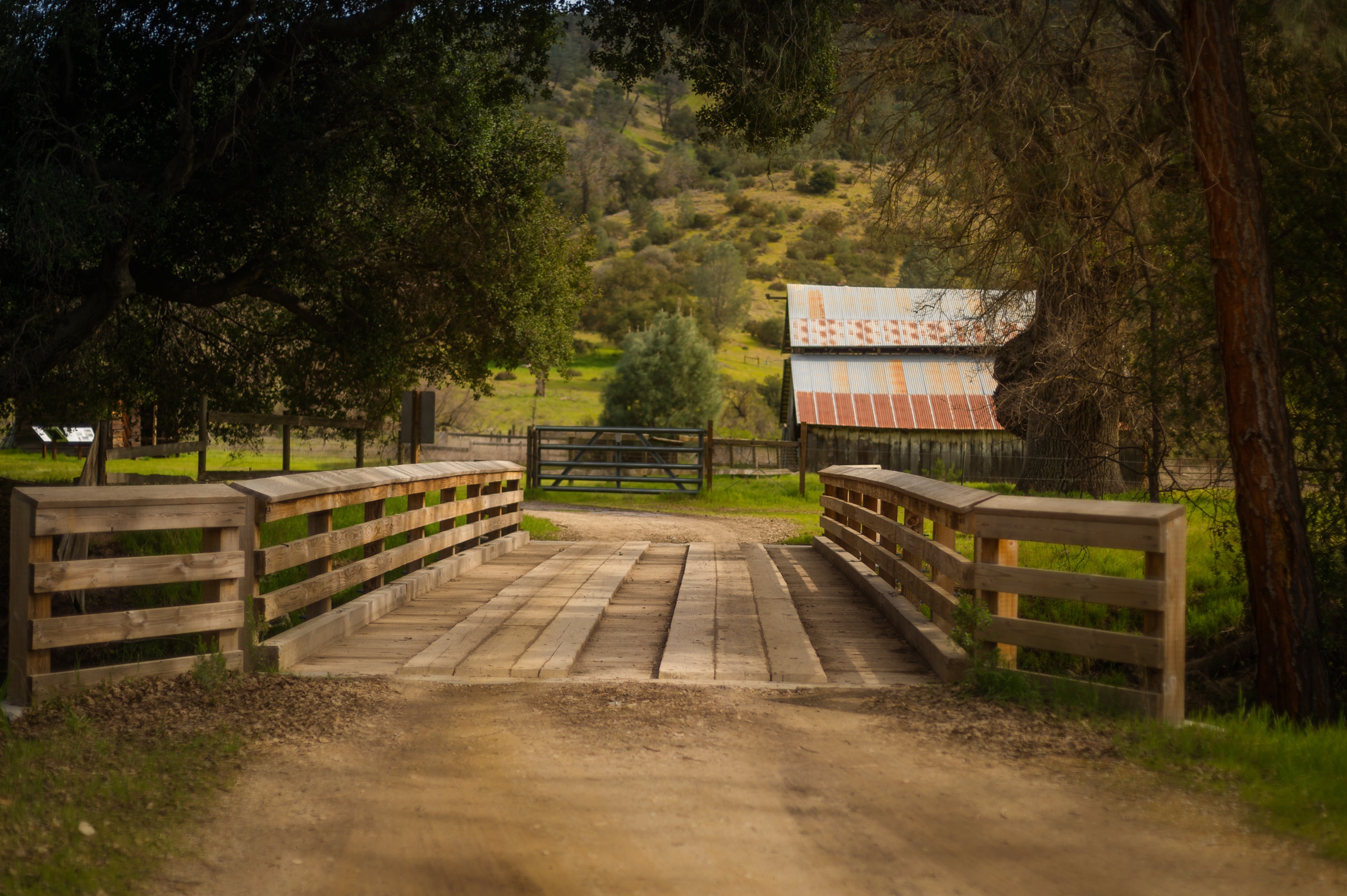
Explore the Bacon Ranch and imagine what it was like to grow up on a 19th century homestead, one of the first settlers in Bear Valley. Night sky and wildlife viewing is also a popular activity here.
The Bacon Ranch is a short walk from the Campground. Take the road to the right of the Campground and Park Store north 1/4 mile (0.4km).
Recreate Responsibly. Check park webpage alerts and weather forecast . Hiking, caving, and climbing can be fun but remember-if you get injured, you are a long way from medical help. Cell phones may not work in this remote park. Don't let your guard down when it comes to safety. Be prepared. Let someone know your plan before you go. Most of the trails are exposed. Bring a map and use the best judgement of your abilities. Drinking water is only available in developed areas-there is no water along any of the trails. Carry at least a liter of water for every hour of hiking. In winter, wear warm clothes and waterproof clothing. In summer, do not hike during the hottest parts of the day (10AM-4PM) especially on strenuous trails. Heat and dehydration can be fatal. Hiking steep trails requires more energy and results in greater water loss through sweating. Wear lightweight, light-colored, loose-fitting clothing. Wear sunscreen, a hat, and sunglasses. Wear sturdy, non-slip shoes or boots with ankle support due to rocky, uneven terrain and slick and sometimes slippery rocks. In all seasons, carry plenty of water and salty snacks (ex. pretzels, crackers, chips). Stay hydrated with plain water and an electrolyte drink replacement. Stay cool in summer and warm in winter and take rest breaks. Know your limits and turn back if needed. Stay on established trails to help prevent erosion. Wildflowers, pine cones, rocks, and other natural and cultural features are beautiful, but please do not remove or destroy them;leave them for the enjoyment of other visitors. All plants, animals, rocks, and structures in the park are protected by federal law. Be careful where you sit, step, and place your hands: poison oak, stinging nettle, and rattlesnakes are found here. Feeding, approaching, or hunting wildlife is prohibited. Using remotely piloted aircrafts like drones is prohibited.
Plan ahead and prepare. Take only pictures and leave only footprints, leaving objects as you find them. Observe wildlife from a distance and avoid loud voices or noises to be considerate of others.
Accessibility Difficulty: Easy Distance: Approx. 0.7 mile one-way Trail width: Approx. 4 feet Maximum grade: no gain Surface Composition: dirt Exposure: Limited shade *service animals permitted It is mostly flat, but not easily wheelchair accessible. Pets and bicycles are permitted There are no restrooms or drinking water at the site. Part of the walk is in the sun, so bring a hat and water.
South Chalone Peak Trail
South Wilderness Trail
Hike Bench Trail to South Wilderness Trail the Park Service's write-up
3-4 Hours · no dogs
Start Bench Trailhead
Travel to the south park boundary, or simply meander through the magnificient grove of valley oaks. Begin on the Bench Trail and follow the fire road for about half a mile to the South Wilderness marker. Follow the trail and/or creek to boundary for an oppurtunity for more solitude and a good choice for bird and other wildlife viewing. Learn about wilderness areas on the park webpage or main nps site.
A section of the Bench Trail between Peaks View and South Wilderness Trail may be accessible to visitors in wheelchairs.
Recreate Responsibly. Check park webpage alerts and weather forecast . Hiking, caving, and climbing can be fun but remember-if you get injured, you are a long way from medical help. Cell phones may not work in this remote park. Don't let your guard down when it comes to safety. Be prepared. Let someone know your plan before you go. Most of the trails are exposed. Bring a map and use the best judgement of your abilities. Drinking water is only available in developed areas-there is no water along any of the trails. Carry at least a liter of water for every hour of hiking. In winter, wear warm clothes and waterproof clothing. In summer, do not hike during the hottest parts of the day (10AM-4PM) especially on strenuous trails. Heat and dehydration can be fatal. Hiking steep trails requires more energy and results in greater water loss through sweating. Wear lightweight, light-colored, loose-fitting clothing. Wear sunscreen, a hat, and sunglasses. Wear sturdy, non-slip shoes or boots with ankle support due to rocky, uneven terrain and slick and sometimes slippery rocks. In all seasons, carry plenty of water and salty snacks (ex. pretzels, crackers, chips). Stay hydrated with plain water and an electrolyte drink replacement. Stay cool in summer and warm in winter and take rest breaks. Know your limits and turn back if needed. Stay on established trails to help prevent erosion. Wildflowers, pine cones, rocks, and other natural and cultural features are beautiful, but please do not remove or destroy them;leave them for the enjoyment of other visitors. All plants, animals, rocks, and structures in the park are protected by federal law. Be careful where you sit, step, and place your hands: poison oak, stinging nettle, and rattlesnakes are found here. Feeding, approaching, or hunting wildlife is prohibited. Using remotely piloted aircrafts like drones is prohibited.
Plan ahead and prepare. Take only pictures and leave only footprints, leaving objects as you find them. Observe wildlife from a distance and avoid loud voices or noises to be considerate of others.
Accessibility Difficulty: Moderate Distance: Approx. 6.5 mile roundtrip Trail width: Approx. 2 - 4 feet Maximum grade: 300 feet Surface Composition: dirt Exposure: Limited shade *South Wilderness is an unmaintained trail. *A section of the Bench Trail between Peaks View and South Wilderness Trail may be accessible to visitors in wheelchairs *Service animals permitted
Sycamore Trail
Picnic areasVisitor centers
Along the way Bear Gulch Picnic Area East Side Visitor Center
Hike Bench Trail to Sycamore Trail the Park Service's write-up
1-2 Hours · no dogs
Start Bench Trailhead
Walk along Chalone and Bear creeks from the Campground to the Bear Gulch Day Use Area . Creeks run seasonally, small waterfalls may occur during periods of heavy rains along the Sycamore Trail.
A section of the Bench Trail between Peaks View and South Wilderness Trail may be accessible to visitors in wheelchairs; Trail also connects to South Wilderness Trail.
Recreate Responsibly. Check park webpage alerts and weather forecast . Hiking, caving, and climbing can be fun but remember-if you get injured, you are a long way from medical help. Cell phones may not work in this remote park. Don't let your guard down when it comes to safety. Be prepared. Let someone know your plan before you go. Most of the trails are exposed. Bring a map and use the best judgement of your abilities. Drinking water is only available in developed areas-there is no water along any of the trails. Carry at least a liter of water for every hour of hiking. In winter, wear warm clothes and waterproof clothing. In summer, do not hike during the hottest parts of the day (10AM-4PM) especially on strenuous trails. Heat and dehydration can be fatal. Hiking steep trails requires more energy and results in greater water loss through sweating. Wear lightweight, light-colored, loose-fitting clothing. Wear sunscreen, a hat, and sunglasses. Wear sturdy, non-slip shoes or boots with ankle support due to rocky, uneven terrain and slick and sometimes slippery rocks. In all seasons, carry plenty of water and salty snacks (ex. pretzels, crackers, chips). Stay hydrated with plain water and an electrolyte drink replacement. Stay cool in summer and warm in winter and take rest breaks. Know your limits and turn back if needed. Stay on established trails to help prevent erosion. Wildflowers, pine cones, rocks, and other natural and cultural features are beautiful, but please do not remove or destroy them;leave them for the enjoyment of other visitors. All plants, animals, rocks, and structures in the park are protected by federal law. Be careful where you sit, step, and place your hands: poison oak, stinging nettle, and rattlesnakes are found here. Feeding, approaching, or hunting wildlife is prohibited. Using remotely piloted aircrafts like drones is prohibited.
Plan ahead and prepare. Take only pictures and leave only footprints, leaving objects as you find them. Observe wildlife from a distance and avoid loud voices or noises to be considerate of others.
Accessibility Difficulty: Moderate Distance: Approx. 2.3 miles one way Trail width: Approx. 2 - 4 feet Maximum grade: 350 feet Surface Composition: dirt Exposure: limited shade *A section of the Bench Trail between Peaks View and South Wilderness Trail may be accessible to visitors in wheelchairs *Service animals permitted
Tunnel Trail
About these trails
The lines are the National Park Service's public trails layer, the trailheads and the waterfalls, views, peaks and historic places along them the Service's public points of interest, read 2026-10-14 and simplified for the map. The write-ups are the Service's own "things to do", unedited. Heights come from USGS 3DEP through Terrain Tiles on AWS (Mapzen/Tilezen), read along each line and rounded; a short trail on steep ground can be off by a few tens of feet. Closures change: check the park's own site before you go.