National Historical Park · New Mexico

Trails in Pecos National Historical Park

3 named trails · 7 miles · 1 trailhead · 3 with the Park Service's own write-up. The lines, trailheads and points are the Park Service's; the write-ups are the Service's own words; the climbing is read from USGS elevation along each line.

Open on the parks mapEvery park with trailsPark on nps.gov

3 trails, A to Z.

Ancestral Sites Trail

1.2 mi one way · about 80 ft of climbing · 6,883 ft–6,963 ft

ViewsPicnic areasVisitor centers

6,934 ft 6,884 ft · 0.4 mi high 6,934 ft

Along the way Picnic Area Picnic Area Pecos Mission Church The Pecos Pueblo Visitor Center

Hiking the Ancestral Sites Trail the Park Service's write-up

40-90 Minutes · dogs allowed
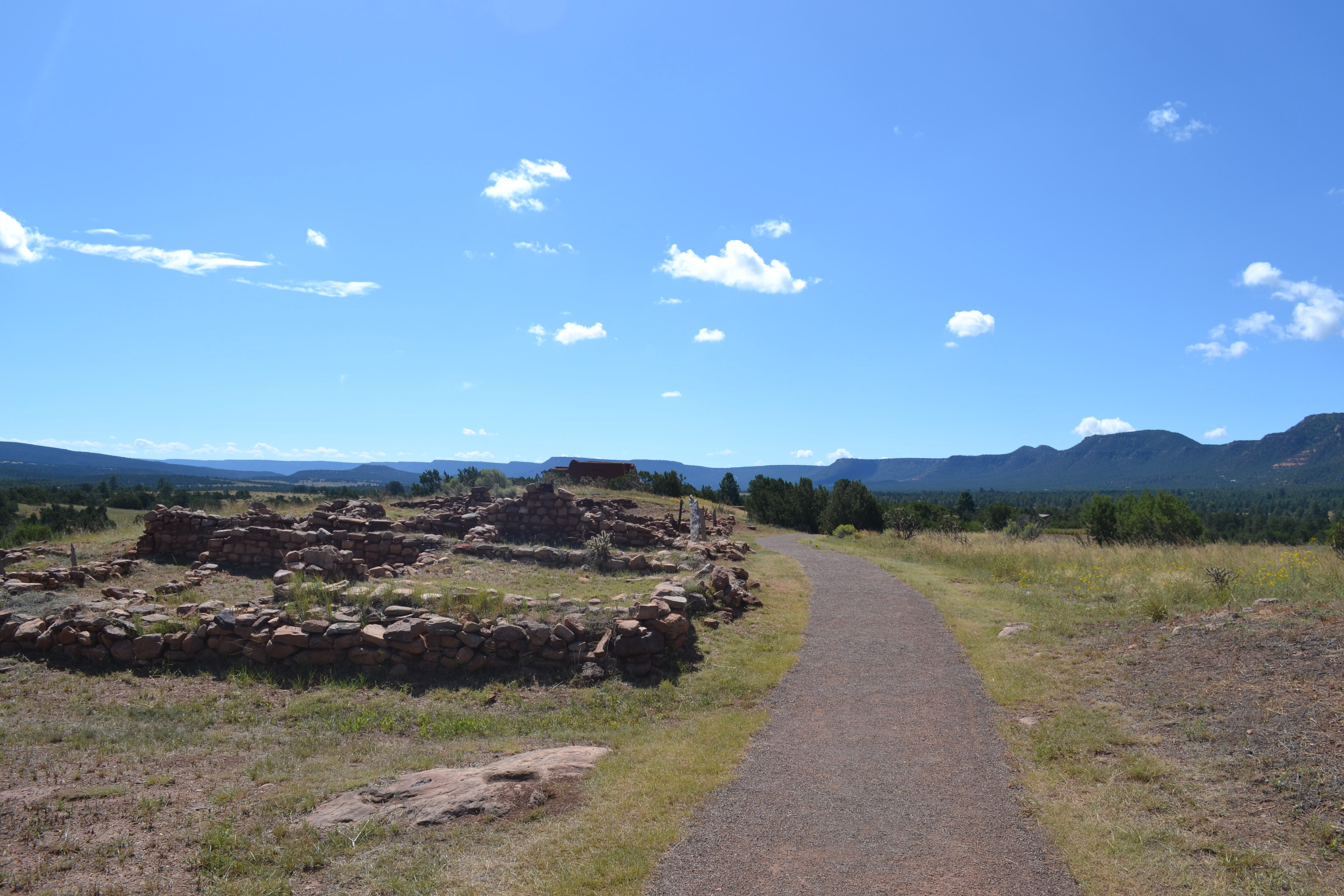
A trail passes by stone walls of the pueblo toward the adobe church.
South Pueblo walls show room sizes on the way to the church. Photo: NPS Photo/Stan Ford

The Ancestral Sites Trail leads visitors to the ancestral sites of Pecos Pueblo and the Spanish Mission Church. Pecos Pueblo contributed to a trade network that stretched the continent and beyond, boasting approximately 2,000 thriving inhabitants on this landscape for over 400 years. The Spanish worked to convert Pecos Pueblo by establishing a massive church, which was burnt down in the Pueblo Revolt and eventually replaced by a smaller mission. This trail allows you to see those locations, look across the Pecos River Valley, go into two restored kivas, and learn more about the archeology of the site and connections to communities today.

The trail is a 1.25 mile (2 km) roundtrip loop and begins right behind the visitor center. The trail is easy, with approximately 80 feet (23 m) of elevation change. The trail surface is gravel/dirt. Trail guides are available for purchase inside the the visitor center.

Accessibility The Ancestral Sites Trail is mostly accessible; the surface is hard-packed dirt/gravel with a width exceeding four feet. The grade is typically under 3%; however, an area of the trail near the North Pueblo has a grade closer to 7% for a span of 40 feet. The church has two small steps of four inches in height that may be bypassed by following the trail through the side of the church. The reconstructed kivas require use of 10-foot ladders and are largely inaccessible for visitors in wheelchairs or with significant mobility constraints. Audio Description devices are available at the visitor center for checkout. Accessible parking for the trail is also available at the visitor center and church parking lots. The visitor center and attendant restrooms are accessible.
This hike on nps.gov

Glorieta Battlefield Trail

2.5 mi one way · about 300 ft of climbing · 7,264 ft–7,361 ft

Bridges

7,307 ft 7,308 ft · 2.2 mi high 7,359 ft

Along the way Bridge Bridge Bridge Bridge Bridge Bridge Bridge

Hiking Glorieta Pass Battlefield the Park Service's write-up

90-150 Minutes · dogs allowed

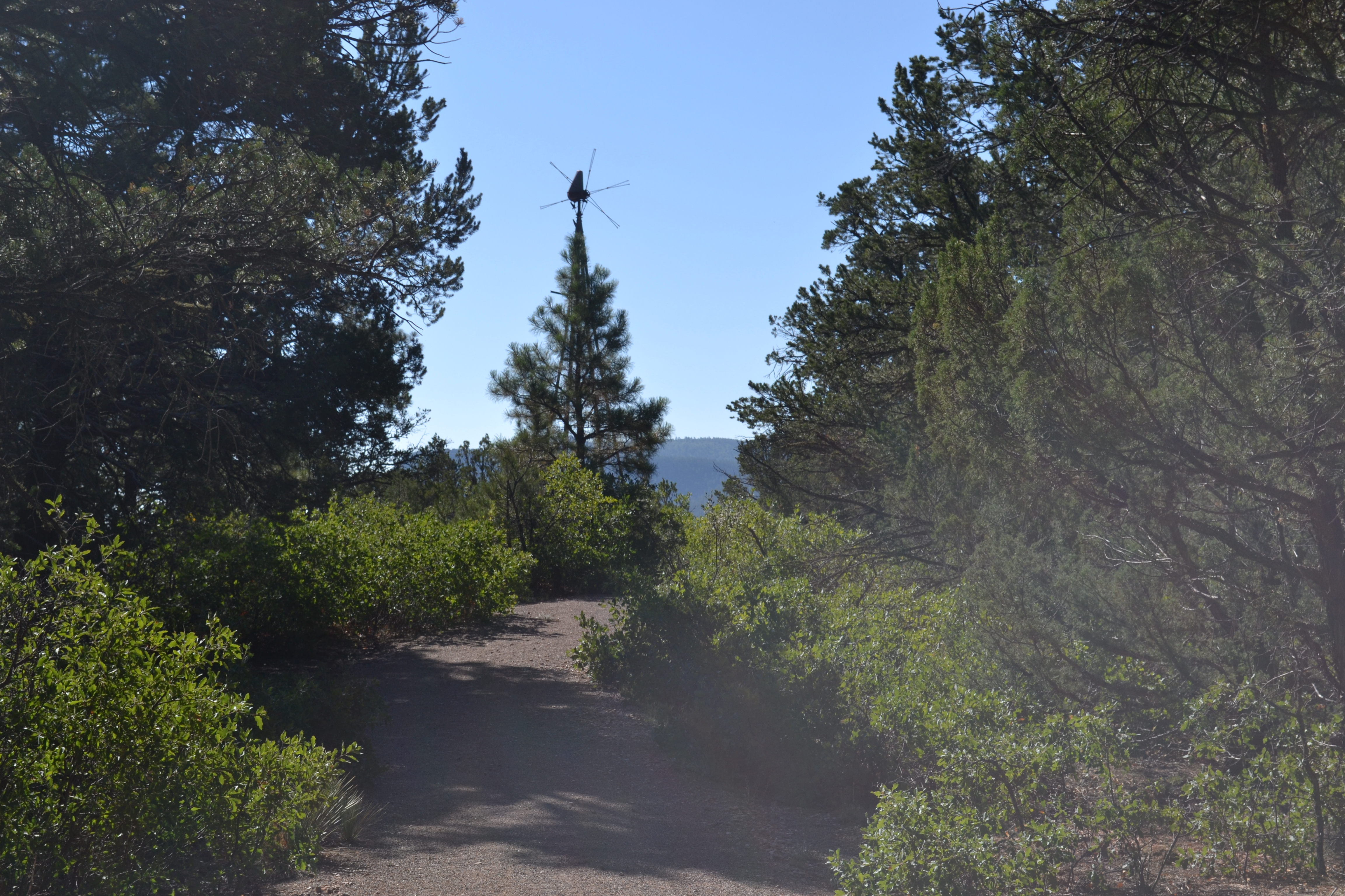
A trail winds through shrubs and low trees, leading to a silhouetted windmill.
The shaded trail winds through sites associated with the 1862 Battle of Glorieta Pass. Photo: NPS Photo

When Union and Confederate forces met in battle at Glorieta Pass, they fought for gold and for control of the Southwest. The Glorieta Pass Battlefield Trail allows visitors to hike to several places where fighting took place. Though presently covered by a Piñon-Juniper woodland, locals and travelers had largely cleared Glorieta Pass of wood by 1862. Standing on Windmill Hill gives visitors the opportunity to see the terrain of the battlefield. Continuing the hike to Artillery Ridge allows visitors to stand near the position where the Union positioned mountain howitzers.

The trail is considered moderately strenuous; it is 2.25 miles long with approximately 500 feet of elevation change, and is composed of a dirt and gravel composite. There is a picnic table and a vault toilet; no other amenities are available at the trailhead. Please bring water and wear sunscreen. Pets are allowed on the trail provided they are leashed and under control.

Accessibility The Glorieta Pass Battlefield Trail is a moderately strenuous trail with steep grades. The 0.3-mile paved trail is more accessible and does not offer steep grades, but is not wheelchair-friendly due to trail width.

This hike on nps.gov

South Pasture Loop Trail

2.9 mi one way · about 100 ft of climbing · 200 ft of descent · 6,733 ft–6,846 ft · hiking

6,846 ft 6,759 ft · 1.5 mi high 6,846 ft

Trailhead South Pasture Loop Trailhead 6,847 ft Drive there

Walking the South Pasture Loop the Park Service's write-up

90-150 Minutes · no dogs

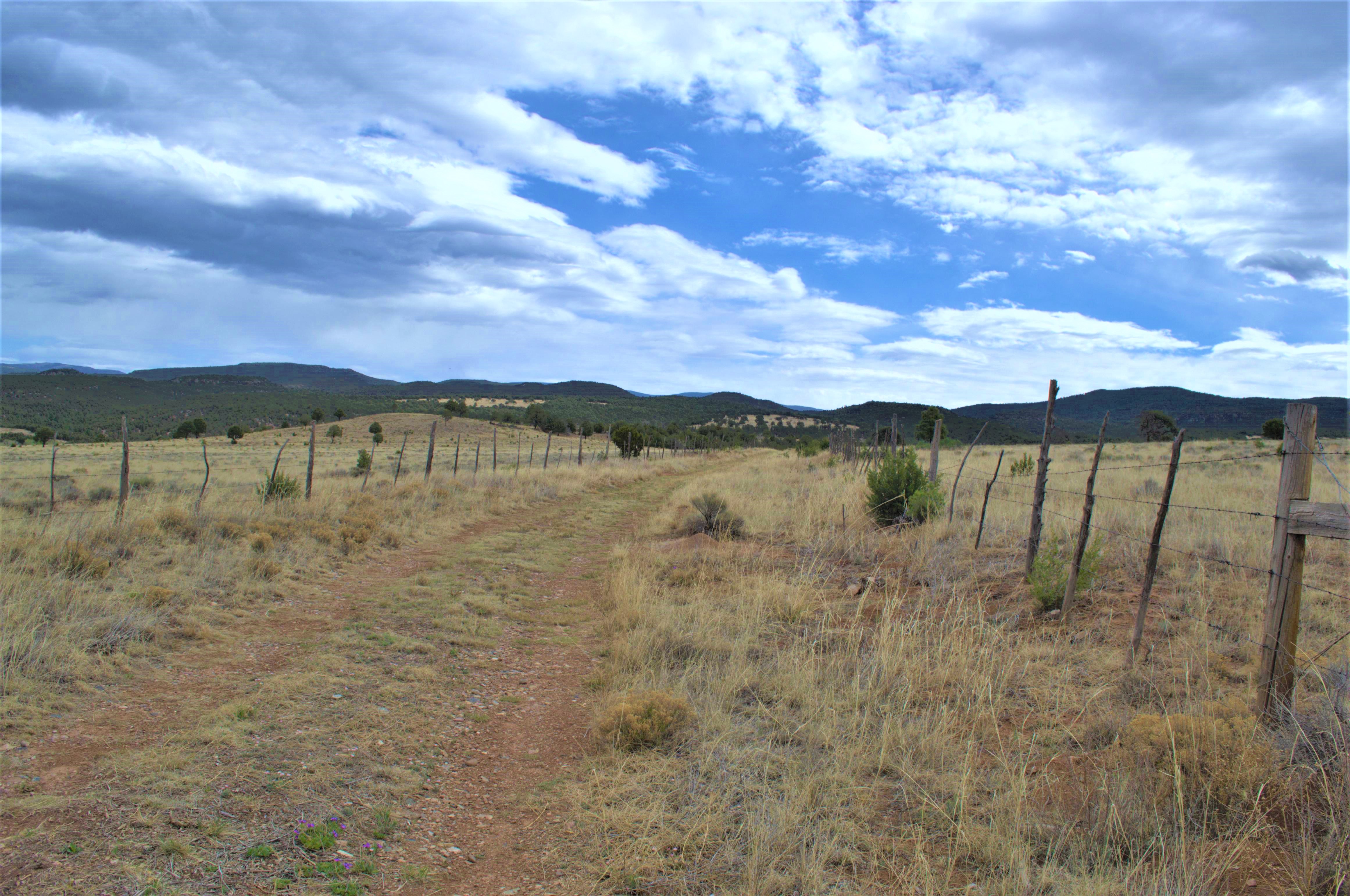
Dirt Road, Blue Sky, Mountains, Grass, Fence Posts
The South Pasture Loop, an old ranch road, can be a beautiful walk. Photo: NPS

Are you looking for a nice walk through a beautiful field? Follow an old ranch road through the South Pasture of the Forked Lightning Ranch. This 3.8-mile hike showcases some of the natural beauty of the Pecos Valley, presenting visitors with sweeping views of the surrounding mesas and mountains. Pets are not allowed on the South Pasture Loop.

Note that this trail closes at 3pm; therefore, hikers are encouraged to begin their walk no later than 1pm. There are no amenities at the trailhead; hikers should bring water. Please inquire at the E.E. Fogelson Visitor Center for information and directions.

Accessibility As an old ranch road, the South Pasture Loop was not designed as a hiking trail. The trail is dirt, there is almost no shade, and occassional patches of river stones may present tripping hazards. There is one hill with a steeper grade which may cause hazards. As with all hikes in the park, the trail is at an elevation of nearly 7000 feet. Although pets are not allowed on the trail, service animals that are trained to perform a specific task are welcome.

This hike on nps.gov

About these trails

The lines are the National Park Service's public trails layer, the trailheads and the waterfalls, views, peaks and historic places along them the Service's public points of interest, read 2026-10-14 and simplified for the map. The write-ups are the Service's own "things to do", unedited. Heights come from USGS 3DEP through Terrain Tiles on AWS (Mapzen/Tilezen), read along each line and rounded; a short trail on steep ground can be off by a few tens of feet. Closures change: check the park's own site before you go.