
Arch Canyon Trail
Picnic areas
Along the way Picnic Area
Hike Arch Canyon 1.2 mi round trip · the Park Service's write-up
60-90 Minutes · no dogs · entrance fee applies
Start Arch Canyon Trailhead
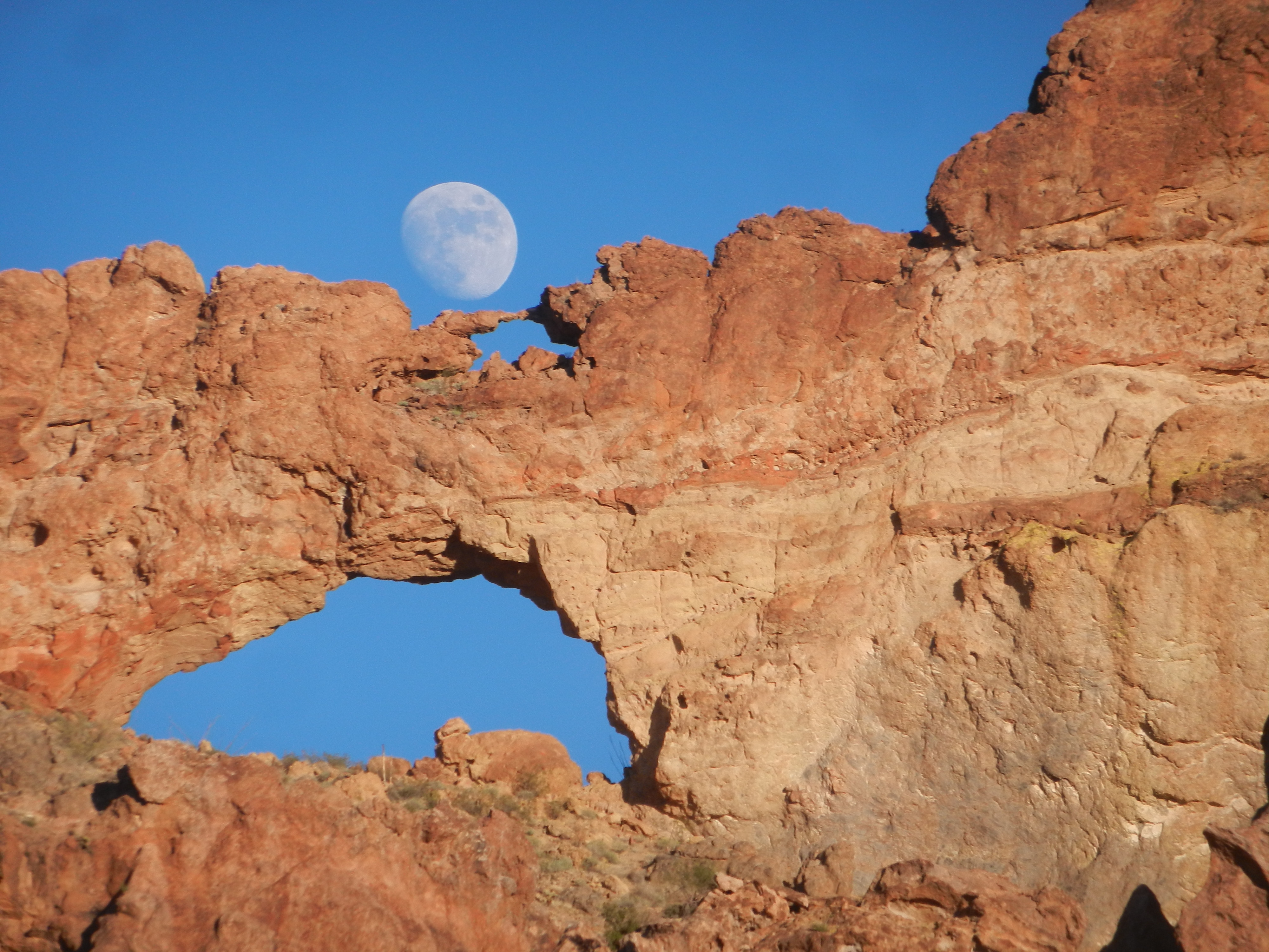
One of the most photographed sites along the Ajo Mountain Drive are the double arches carved into the mountains. Walking the easy, relatively flat Arch Canyon trail provides wonderful opportunities to see wildflowers and gaze upon the rhyolite arches.
Note that this trail does not lead up to the arches and the official trail ends part way into the canyon. There are unofficial social trails that lead up to the arch, but these trails are strenuous and not maintained.
Distance : 1.2 miles (1.9 km) Round-trip;
Difficulty : Easy
The Makings of an Arch
The present landscape of the Ajo Mountain Range began to take shape 30 to 14 million years ago (the middle and late Tertiary time) as the crust of the western part of North America stretched in an east-west direction. This stretching created fractures in the crust, and the resulting volcanic eruptions and lava flows created most of the modern landscape you see today. Most of the reddish-brown rock you see forming the Ajo Range and the double arches is a volcanic rock called rhyolite. When it was molten, rhyolite was thick and gooey like maple syrup. It could not flow far before becoming too cool to move, creating relatively short mountain ranges like the Ajos.
Over time, the freezing and expanding of water ate away at the rhyolite to form the arch in Arch Canyon, opening a hole larger and larger over time. Rushing water from storms carved the canyons like Arch Canyon and Estes Canyon. The winter and monsoon rains continue to mold and carve this landscape. As you’re walking through the canyons, look for dark vertical stains on the rock where waterfalls form during heavy storms.
Accessibility Trail terrain is uneven, rocky, and steep in some sections. Hikers of many different abilities have hiked this route in the past. If you are curious about accessibility for your needs, please contact the park. While pets are not allowed on this trail, service animals are allowed.