
Grandview Rim Trail
ViewsPicnic areas
Along the way Grandview Picnic Shelter 1 Grandview North Overlook
Trailheads Grandview Shelter 1 Trailhead 2,458 ft Drive there · Main Overlook Trailhead 2,504 ft Drive there · Turkey Spur Trailhead 2,337 ft Drive there
Hike the Grandview Rim Trail 1.6 mi one way · the Park Service's write-up
0-2 Hours · dogs allowed
Start Grandview Rim Trail
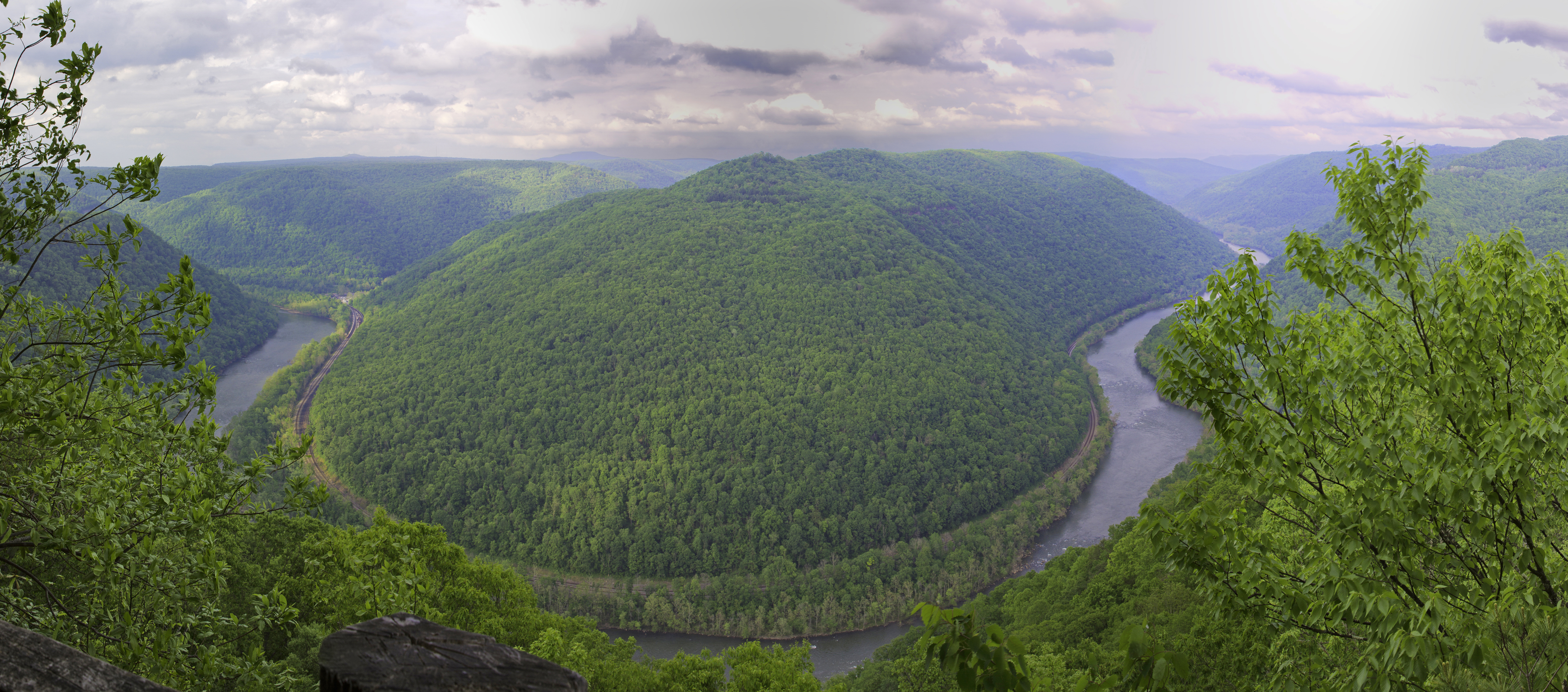
Visit the highest point in New River Gorge National Park and Preserve!
The main overlook at Grandview give spectacular views of a horseshoe bend of the New River.
The Grandview Rim Trail connects the Main Overlook to two other overlooks, North Overlook and Turkey Spur Overlook. This moderate 1.6 mile (one-way) trail takes you along the ridge at Grandview, through the forest overlooking the gorge. Look for wildlife along the trail and enjoy the blooming rhododendren in the spring time (typically around May).
Accessibility The Grandview Rim Trail is a moderate trail along the ridge at Grandview. The Turkey Spur and Main Overlooks are accessible by car. To reach the Turkey Spur Overlook, you must climb a series of wooden steps. The steps can become slippery in wet or snowy weather, please take caution. The Main Overlook has a paved sidewalk and is generally accessible from the parking lot. The main overlook viewing area is a large, mostly flat rock overlooking the gorge. It can be slippery in wet or snowy conditions.
Trail Run Grandview Rim Trail 3.1 mi out and back · the Park Service's write-up
dogs allowed · season This trail is open year round. During the summer there is a heavy canopy of Rhododendrons to keep the air cool. Druing the Fall, there can be a large amount of leaf litter that can make running this route a bit hazardous due to divets and dips not being apparent due to the leaves obscuring the view. The winter is great, but can be prone to snow.
Start Grandview Rim Trail Starting Point
Trail Run: Grandview Rim Trail: 3.1 miles out and back.
Are you looking for a great place to run and have great views down into the Gorge of the New River? The Grandview Rim Trail at the Grandview location is super easy to find and to follow. Park in the area near the Grandview Visitor Center and start your warm-up by walking the short distance to the Main Overlook. This is about a football field distance from the car parking area. As you walk to the Main Overlook from the parking area, notice the benches to your left that are bordering a wide trail. This is your starting point. The Grandview Rim Trail follows along the perimeter of the Gorge so keep the Gorge to your right shoulder and you will come to a sign for the North Overlook. This is where you will split away from the Gorge and start in a more forested area. When you reach the road , stay on the trail to the right and it is a windy trail that will have a change in elevation of about 460 feet. The trail will end in a parking lot for Turkey Spur. If you want to stop running for a few minutes and go up the 150 steps in this rock outcropping next to the parking lot you can. There are three additional vantage points to see down into the Gorge from the top of Turkey Spur. Most runners simply turn around in the parking lot and retrace their steps back to the main parking area next to the Main Overlook.
Accessibility This trail is a mixture of hard packed soil, rocks, and smaller dirt compositions. It is not entirely accessible. There are segments that are accessible at the start of the trail, but there are divots and dips within .2 of a mile from the starting point. .