
National Preserve · California
Trails in Mojave National Preserve
14 named trails · 23 miles · 4 with the Park Service's own write-up. The lines, trailheads and points are the Park Service's; the write-ups are the Service's own words; the climbing is read from USGS elevation along each line.
14 trails, A to Z.
Barber Peak Loop Trail
Hole-in-the-Wall Nature Trail
Picnic areasVisitor centers
Along the way Hole-in-the-Wall Picnic Area Hole-in-the-Wall Visitor Information Center Mojave National Preserve Hole-In-The-Wall Visitor Center
Kelso Dunes Trail
Hike Desert Sand Dunes the Park Service's write-up
1-4 Hours · dogs allowed · Winter, Spring, Fall
Start Kelso Dunes
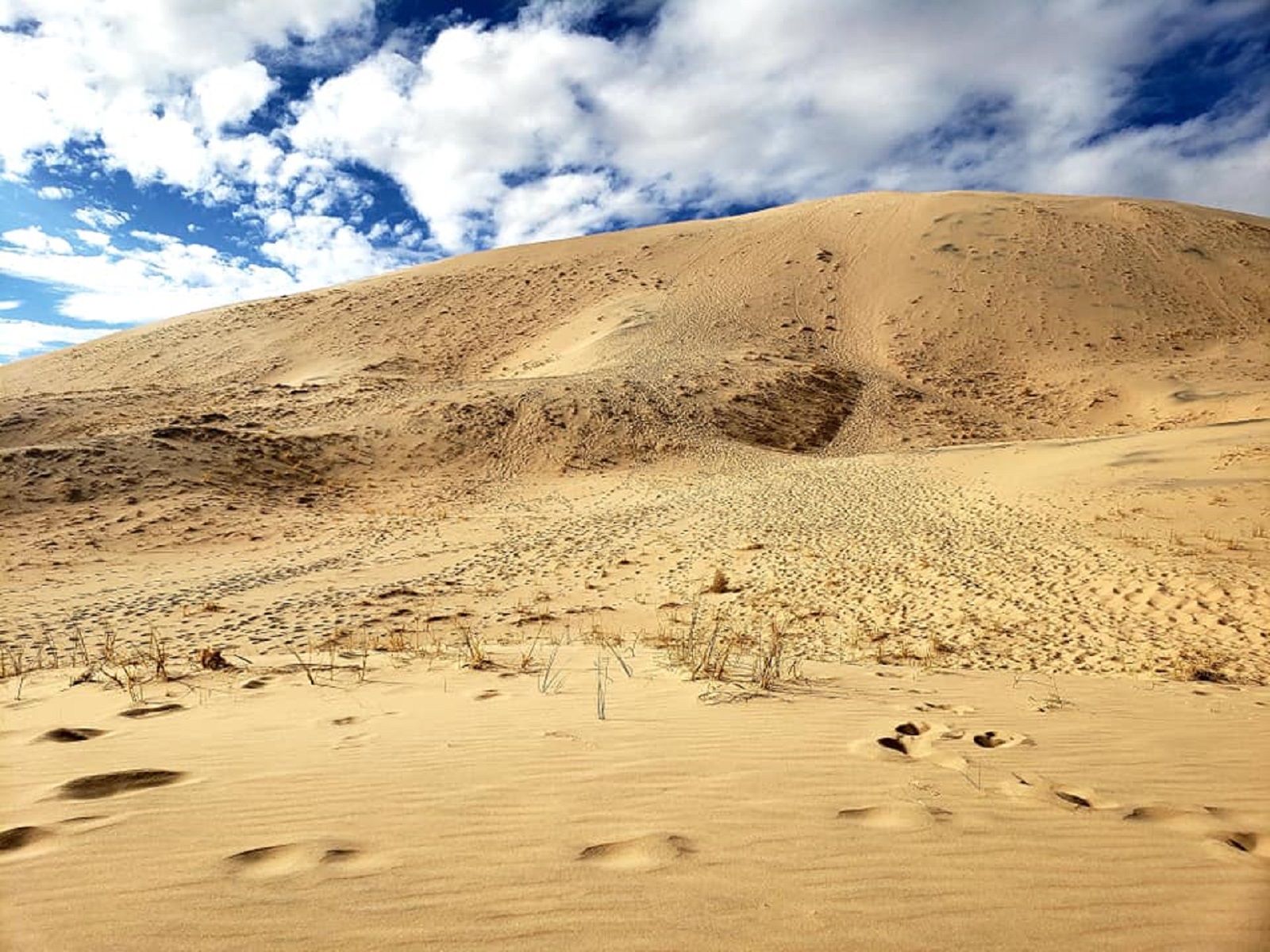
The trail up the Kelso Sand Dunes is the most popular in the Preserve for good reason: beautiful views from some of the largest dunes in America! The hike is approximately three miles round-trip with an elevation gain of 650 feet. This is a strenuous trail, as the last part is steeply uphill in sand. Fall and spring are the ideal seasons to hike, and morning and evening bring comfortable, spectacular light shows and temperatures. This trail is completely exposed and very hot in summer. Remember to bring plenty of water and snacks, and keep your pets on a six-foot leash at all times.
Accessibility The trail starts off level, but gets more and more difficult as hikers get closer to the summit. The views get better and better as visitors climb the dunes. Most hikers choose the top of the tallest dune as their destination, but hikers can go anywhere in the volcano field that they'd like to. No matter what path visitors choose, there is deep, soft sand at a steep uphill grade that needs to be navigated. It is not an easy trail.
Hike the Kelso Dunes the Park Service's write-up
30-180 Minutes · dogs allowed · Winter, Spring, Fall
Start Kelso Dunes Trail Trailhead
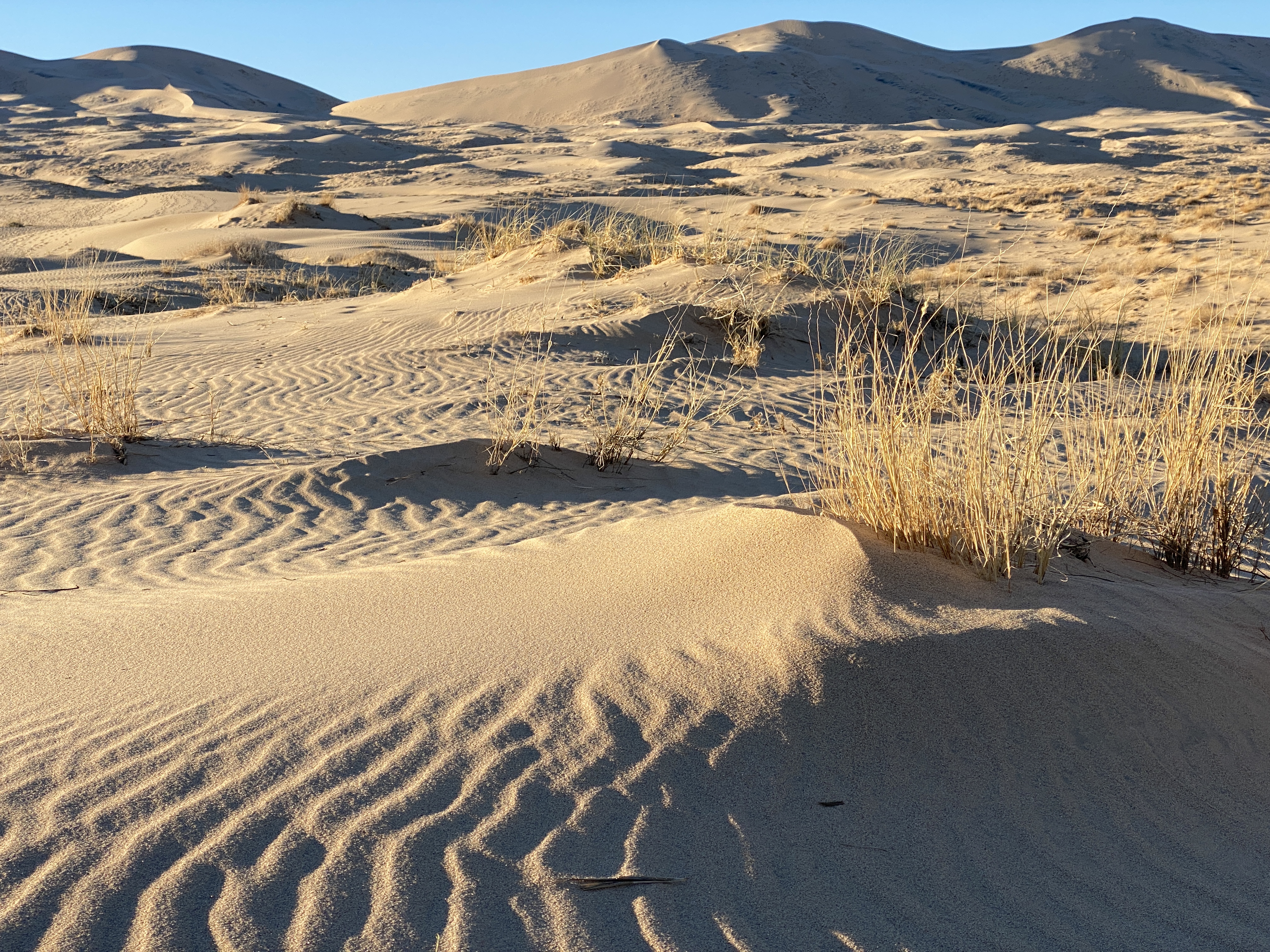
The spectacular and majestic Kelso Dunes are our most popular hike for good reason. When hikers reach the summit, they are rewarded with a surreal backdrop of sand that seems to extend forever. Although this is the most popular trail at the Mojave Preserve, potential hikers can still expect solitude.
Accessibility The parking area next to the trailhead has accessible restrooms and wayside exhibits. The first part of the trail has loose gravel and is flat. After 0.5 miles, sandy conditions prevail, and the route is not considered accessible to wheelchair.
Lava Tube Trail
Visit a Lava Tube the Park Service's write-up
0-30 Minutes · dogs allowed
Start Lava Tube
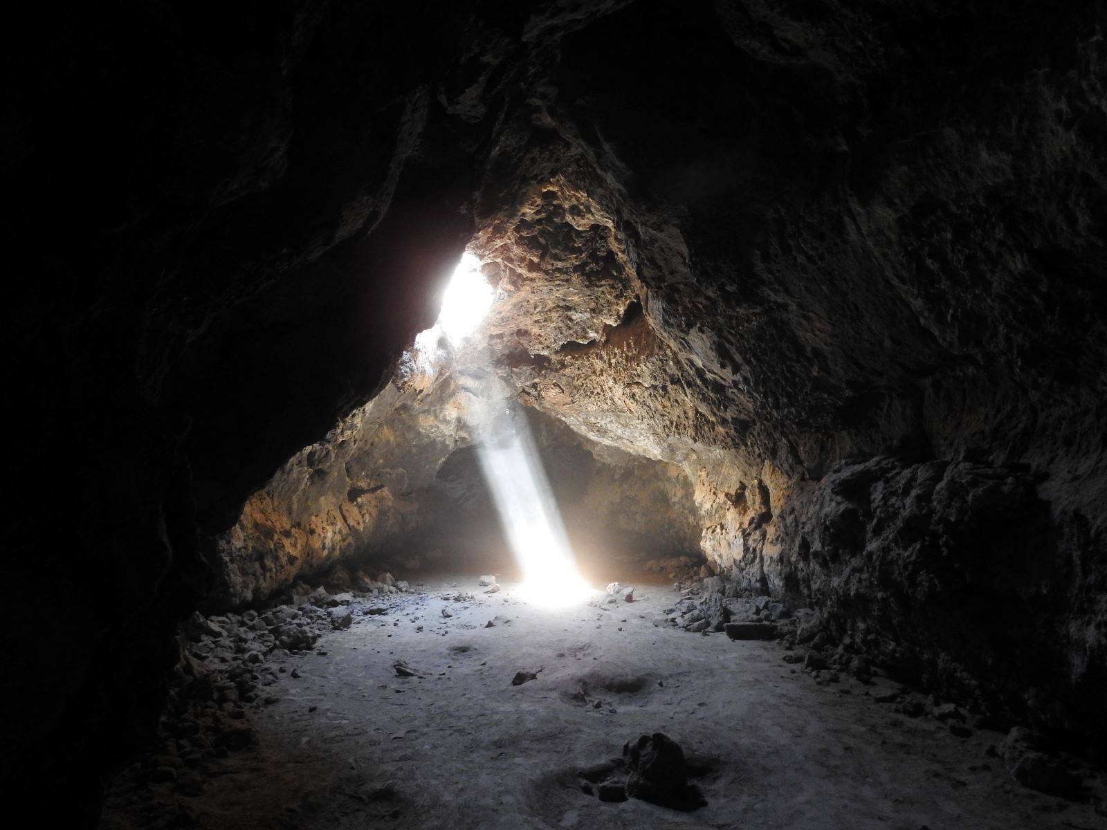
Take an underground adventure into the lava tube! Just a short walk from the road brings you to this natural cave made of lava that cooled thousands of years ago. Enjoy some fascinating geologic formations and the beautiful contrast between light and dark inside. Sometimes during daylight hours you can see a bright sunbeam streaming through the multiple ceiling holes. The lava tube is often enjoyed by photographers, hikers, and adventurers of all ages. Please note that the road approaching it is rough, and a high-clearance vehicle is recommended.
Accessibility The trail from the parking area to the lava tube is approximately 1/4 mile long and moderately difficult, since it progresses uphill and there are many large, loose boulders along the trail. To enter into the lava tube, visitors descend a wide, sturdy ladder with handrails, then progress further into the tube by walking on and between boulders. Visitors must stoop or crawl for a distance of about 6 feet to pass under a low section of the ceiling before entering the main room of the lava tube cave.
Mid Hills to Hole-in-the-Wall Trail
Morning
Piute Canyon
Piute Canyon Loop
Springs
Along the way Piute Spring
Quail Spring
Ring Loop Trail
Picnic areas
Along the way Hole-in-the-Wall Picnic Area
Hike the Rings Loop the Park Service's write-up
1-2 Hours · dogs allowed
Start Rings Loop Trailhead

The Rings Loop Trail is very popular with all ages. You'll walk through beautiful open valley views, where Native Americans, miners, and ranchers lived for centuries. Colorful cacti, rock art, and fascinating geologic shapes are abundant. Banshee Canyon provides exciting opportunities to explore the effects of ancient volcanic eruptions. To exit the canyon, climb up two sets of metal rings bolted into the rock walls.
Accessibility The trail is mostly narrow and passes through either soft sand or along mostly flat rock. When the trail enters Banshee Canyon, some mild climbing is required to get to the top of small piles of boulders, and it is also necessary to use rings embedded into the rocks to pull yourself up through sections of canyon. The rings can be climbed like a ladder. One rings section is about 10 feet tall and one is about 6 feet.
Rock Springs Trail
Spur Trail to Wild Horse Canyon Road
Teutonia Peak Trail
Teutonia Peak trail the Park Service's write-up
0-3 Hours · dogs allowed
Start Teutonia Peak trailhead
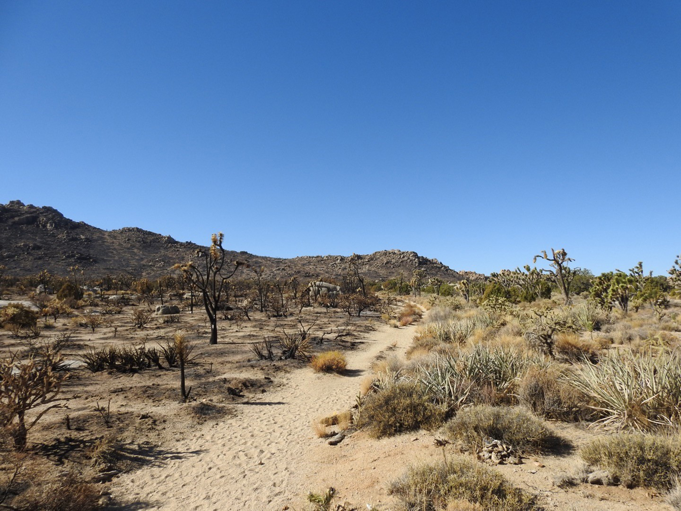
In August of 2020, a lightning strike ignited dried grasses on Cima Dome. Though an on-site fire crew responded immediately, the fire spread. By the time it was fully contained a few days later, the Dome Fire had scorched 43,273 acres of Joshua tree woodland.
The fire burned through most of the Teutonia Peak trail. Now, hikers can see the impacts of the Dome Fire up close with a three-mile round-trip walk on this trail.
The area will probably see great change in the next few years. Since Joshua tree root systems are so shallow, the tall spindly plants will probably blow over within a few seasons. Grasses will recolonize the bare burned ground. We are hopeful that native grass seeds will be able to out-compete non-native invaders. Slow-growing cactus and yuccas will also return, though it will take many years for them to reach the size of their predecessors.
The parking area for the Teutonia Peak trail has room for 4-5 vehicles. There are no bathrooms facilities, drinking water, or waste bins anywhere along the trail. Please pack out all waste.
Accessibility The trail is sandy and between 3 and 5 feet across. For the first 80% of the trail, it slopes gently upward at a 2% grade. At the end of the trail, it becomes much steeper as visitors climb rock steps to ascend to the top of Teutonia Peak. The views get better the higher you go, but there is no official "end" to the trail.
About these trails
The lines are the National Park Service's public trails layer, the trailheads and the waterfalls, views, peaks and historic places along them the Service's public points of interest, read 2026-10-14 and simplified for the map. The write-ups are the Service's own "things to do", unedited. Heights come from USGS 3DEP through Terrain Tiles on AWS (Mapzen/Tilezen), read along each line and rounded; a short trail on steep ground can be off by a few tens of feet. Closures change: check the park's own site before you go.