
FTRL-Cedar Sink Front Country Trail
Explore Wildflowers at Cedar Sink 1 mi round trip · the Park Service's write-up
45-60 Minutes · dogs allowed · Spring, Summer, Fall · season <p paraeid="{ca28bdc5-8d21-4e1b-8aed-ca8e23cd9395}{173}" paraid="550379709">There are many striking wildflowers to see throughout the warmer parts of spring, summer, and fall. </p> <p paraeid="{ca28bdc5-8d21-4e1b-8aed-ca8e23cd9395}{183}" paraid="1261641426">As wildflowers bloom and give way to other wildflower species, visitors are consistently rewarded by frequent visits to cedar sink throughout the year and even throughout single seasons. </p>
Start Cedar Sink Trailhead
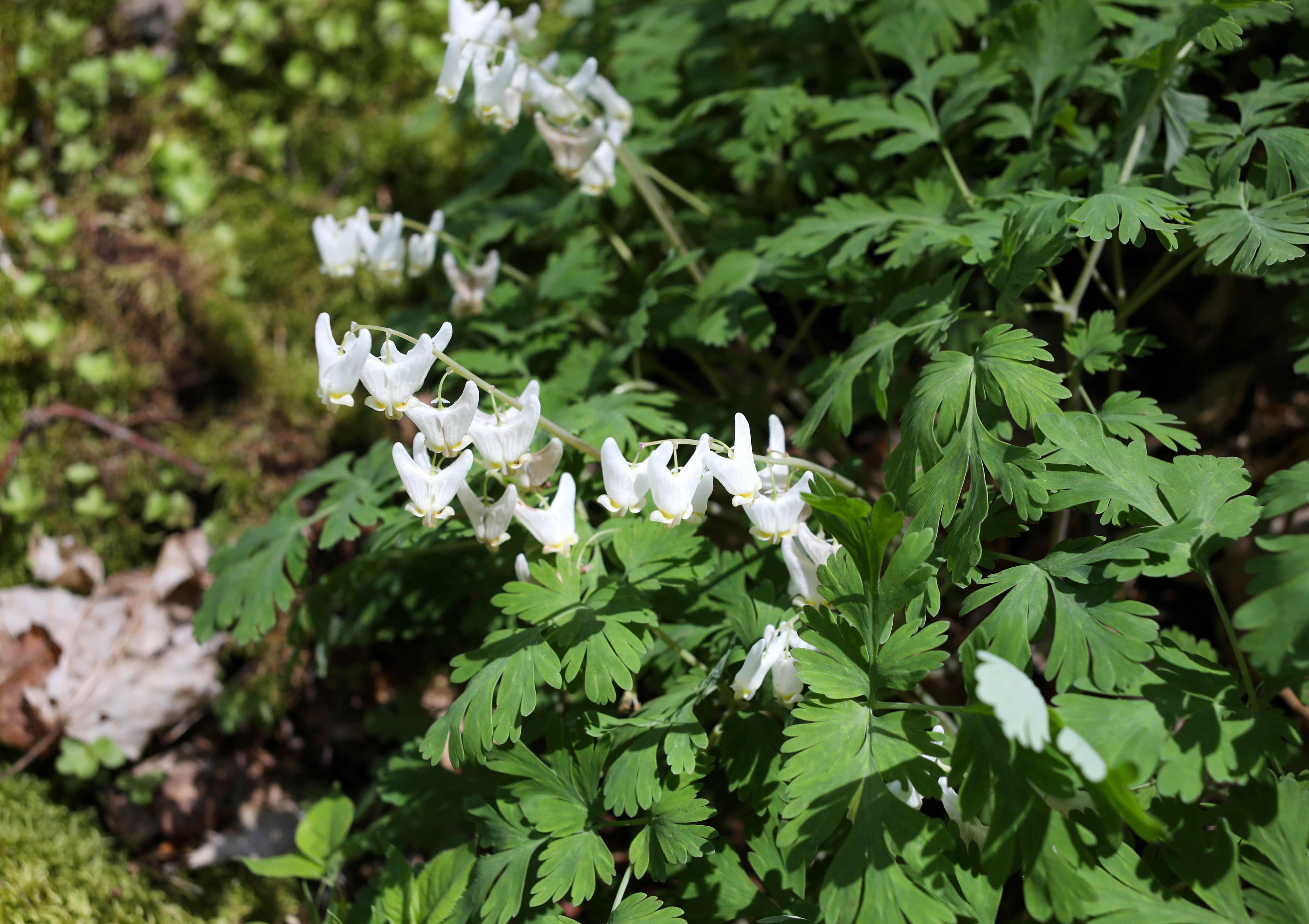
Mammoth Cave National Park is home to an incredible variety of seasonal wildflowers due to the abundance of forest habitats. One such place an enormous sinkhole called Cedar Sink. It hosts a stunning variety of spring and summer wildflowers, making it a favorite spot for hikers and floral enthusiasts.
The hike is 1-mile roundtrip, with several sets of stairs that will lead you down into the sink hole and back out. A total of 295 stairs will be traveled during the hike.
Accessibility Cedar Sink trail is not accessible for all visitors. The trail to Cedar Sink is a rolling dirt path, roughly 6 feet wide. This section extends for approximately 0.75 miles before arriving at the sink. To enter the Cedar, visitors must descend 150 feet of stairs and return up another 150 feet of stairs at the other end of the sinkhole. Once inside the sinkhole, footing is fairly flat and stable. Parking is at located at the trailhead, and may fill up quickly depending on visitation. Service animals are welcome on this trail.