National Recreation Area · Washington

Trails in Lake Roosevelt National Recreation Area

7 named trails · 15 miles · 4 with the Park Service's own write-up. The lines, trailheads and points are the Park Service's; the write-ups are the Service's own words; the climbing is read from USGS elevation along each line.

Open on the parks mapEvery park with trailsPark on nps.gov

7 trails, A to Z.

Bluff Trail

0.5 mi one way · about 250 ft of climbing · 1,413 ft–1,653 ft · hiking

1,413 ft 1,653 ft · 0.5 mi high 1,653 ft

Hike the Mission Point Trail the Park Service's write-up

0-1 Hours · dogs allowed

Start St. Paul's Mission, Kettle Falls

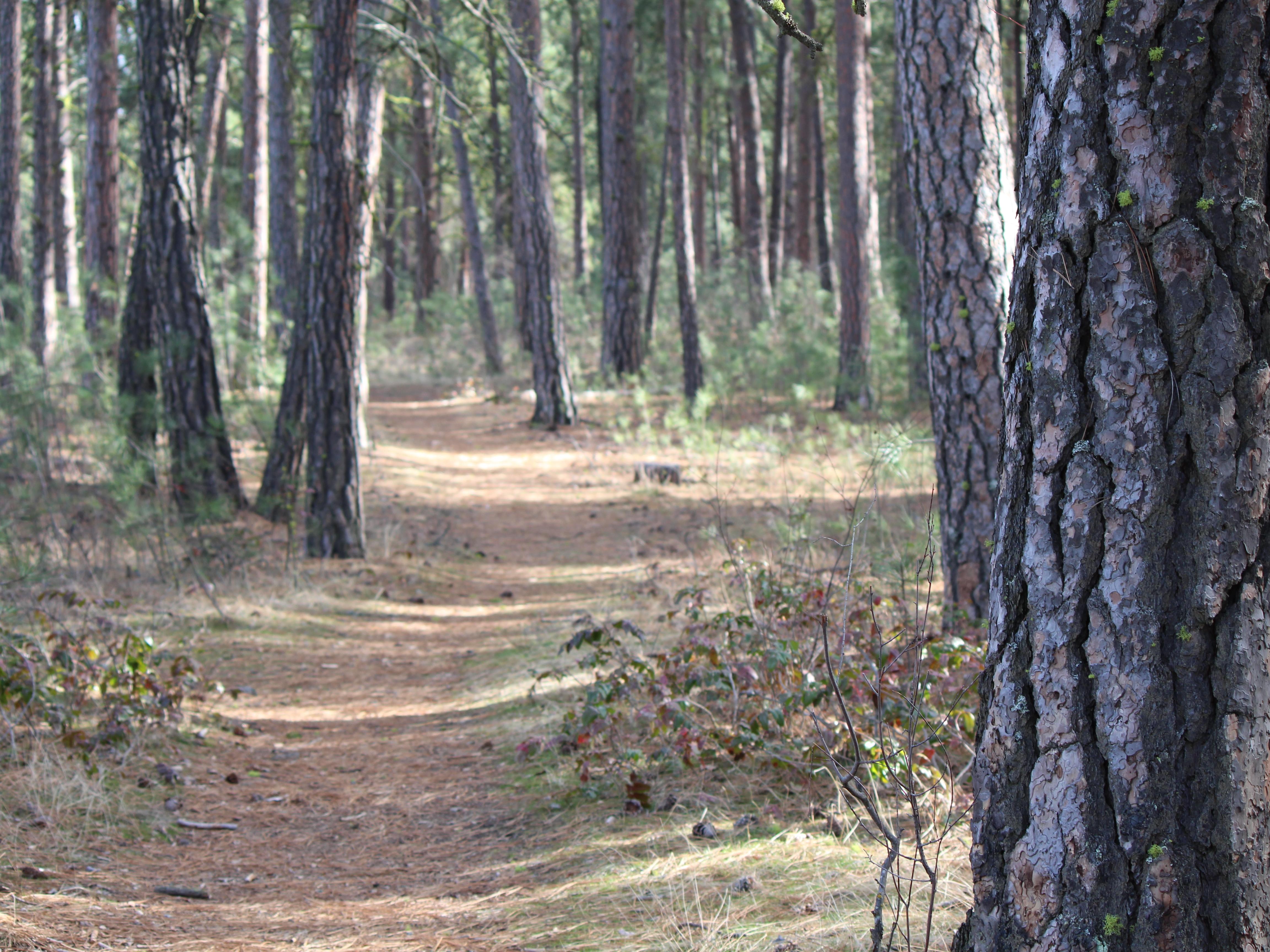
A dirt path winds through pine trees.
The trail is relatively flat and winds through groves of pine trees. Photo: NPS

This short, half-mile (0.8 kilometer) walking loop takes you on a relatively flat, unpaved hike to the bluff overlooking the site of the former Kettle Falls. Signs explain the history of the falls, the mission, and the Hudson’s Bay Company’s influence on the area. The view of the river is rivaled only by the abundance of plants along the way. Take your time and enjoy the ponderosa pine forest and immerse yourself in both nature and history.

This area was used for millenia by the local tribes as a seasonal encampment for salmon fishing. On the point, there is a massive black stone with polishing facets used to hone tools.

The Mission Point Trail is open year-round, though snowfall can make access tricky. Afterwards, explore St. Paul’s Mission , originally built in 1847 and reconstructed in 1939.

Accessibility This is a relatively flat dirt trail. Pine needles or leaves may be on the ground, but otherwise is clear.

This hike on nps.gov

Bunchgrass Trail

0.3 mi one way · about 90 ft of climbing · 1,397 ft–1,511 ft · hiking

Campgrounds

1,416 ft 1,397 ft · 0.3 mi high 1,511 ft

Along the way Spring Canyon Campground

Hike the Bunchgrass Prairie Nature Trail the Park Service's write-up

0-1 Hours · dogs allowed

Start Spring Canyon Campground

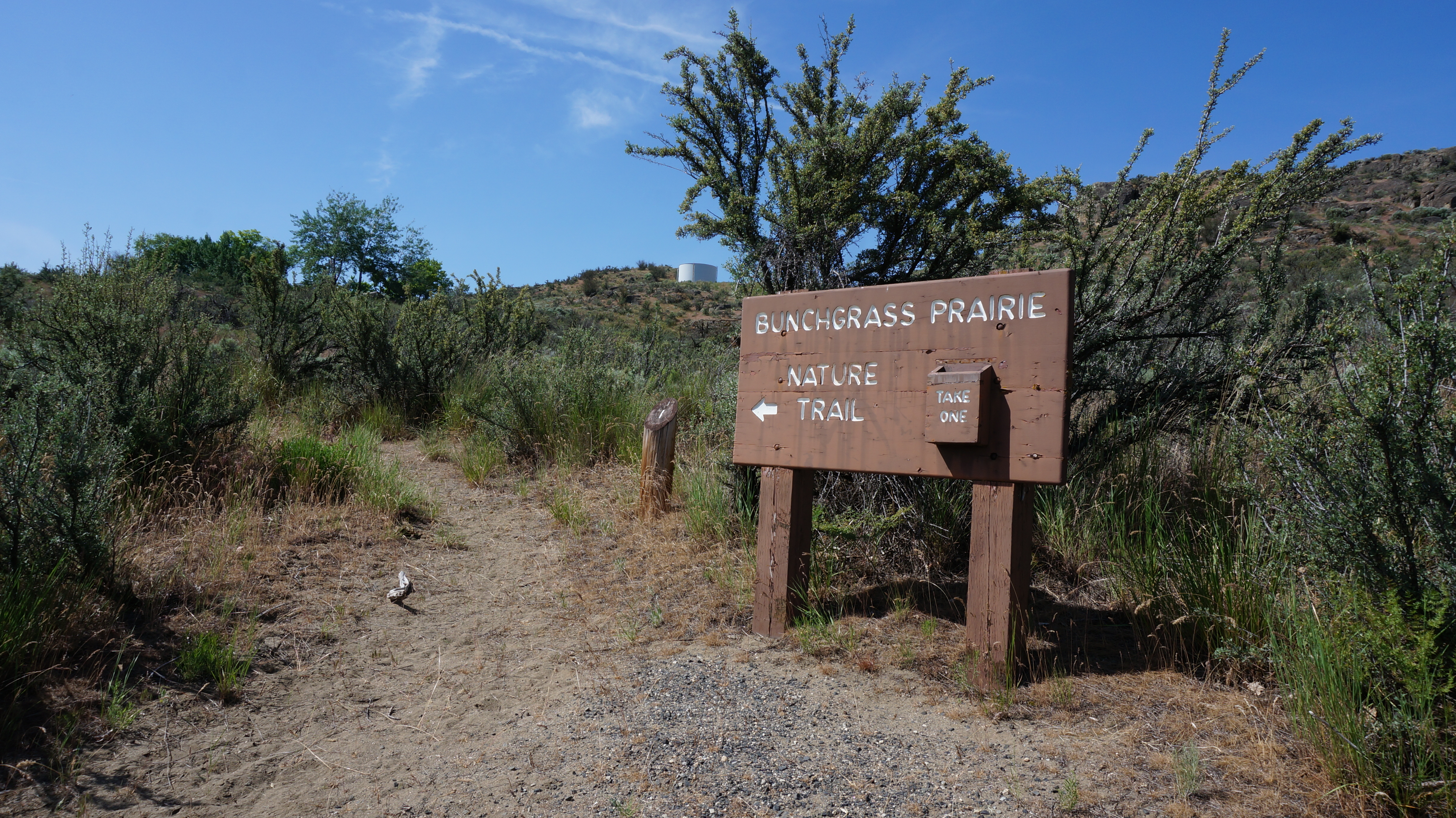
Large wood sign reads Bunchgrass Prairie Nature Trail at the start of a trailhead.
Start this loop trail from the Bunchgrass Prairie sign Photo: NPS

This half-mile trail starts on the west side of the lower campground loop in the Spring Canyon Campground. Several parking spaces are available nearby. Discover wildflowers, lichen, cactus, and watch for signs of the animals that call the grasslands home. A free trail guide is available at the start of the trail.

Accessibility This trail is dirt in the summertime and snow-packed in the wintertime. The trail begins at a slight upward angle, and then has a steep incline up to a peak, followed by a steep decline. Benches are available at various points along the trail, often with washed out dirt below, making them higher than a standard bench. There are no railings along this trail.

This hike on nps.gov

Sentinal Trail

1.2 mi one way · about 20 ft of climbing · 1,407 ft–1,424 ft · hiking

Visitor centers

1,413 ft 1,424 ft · 0.2 mi high 1,424 ft

Along the way Fort Spokane Visitor Center and Museum

Hike the Sentinel Trail the Park Service's write-up

1-2 Hours · dogs allowed

Start Fort Spokane Guardhouse

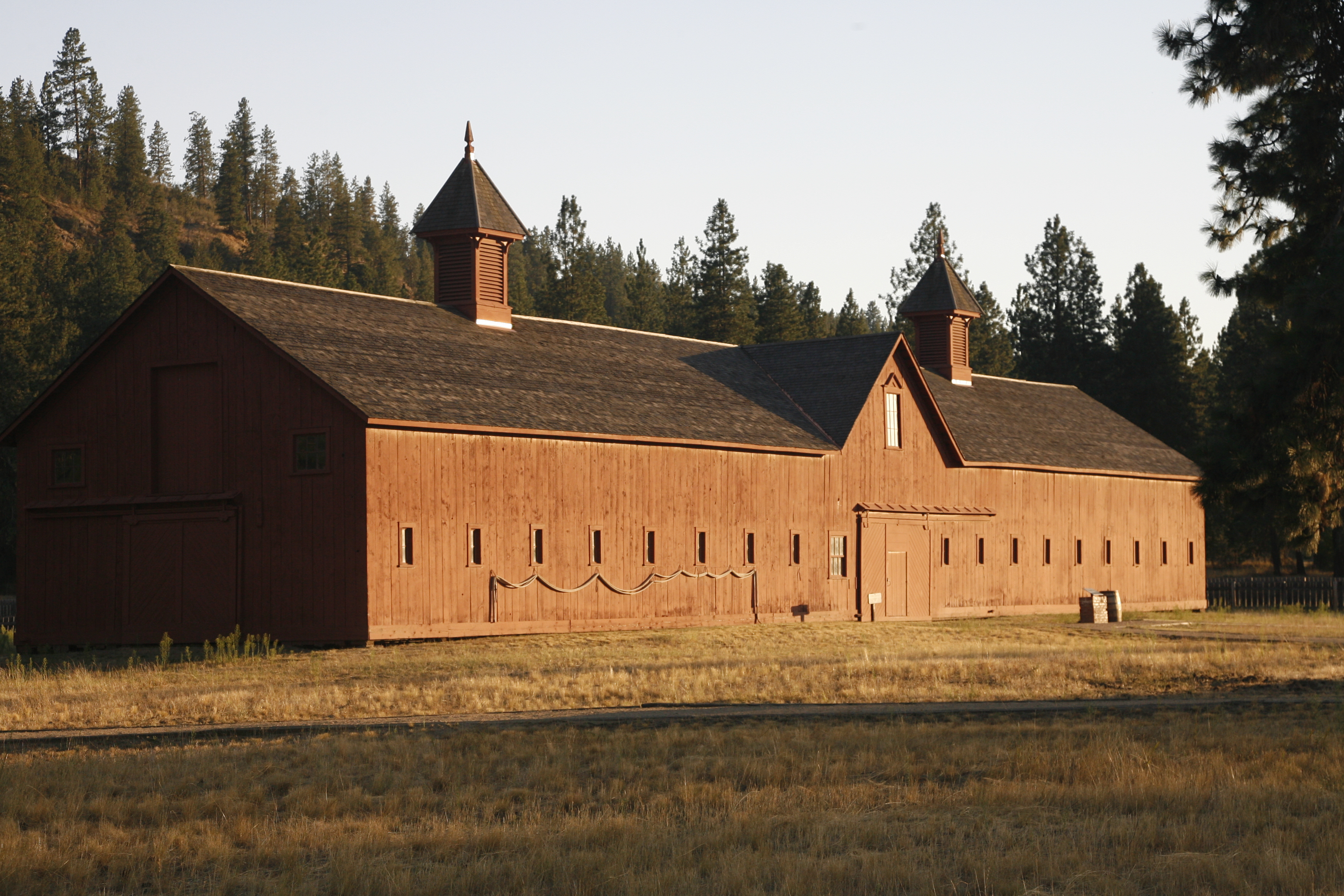
Long wood building with brown shingles and two small towers sits in a dry grassy field.
The quartermaster's barn at Fort Spokane. Photo: NPS

Explore the history of Fort Spokane via the Sentinel Trail. This trail takes the visitor to various stops and trailside markers to learn more about the people who lived and worked here in the late 1800s. Watch for remnants of buildings and other clues that tell the story of what a thriving settlement may have looked like.

The Fort Spokane area marks a transition zone between two environments at Lake Roosevelt: the shrub-steppe desert and the more dense ponderosa pine forests.

Branching off of the Sentinel Trail is the Bluff Trail. This section of trail climbs about 300 feet in elevation to the top of a bluff, which provides spectacular aerial views of the fort grounds and the confluence of the rivers.

Remember to bring water along the trail and watch out for Northern Pacific Rattlesnakes that may be out and about in the warmer months. Stay on trail and be careful where you step.

Accessibility The parade grounds portion is composed of compacted decomposed granite suitable for wheelchairs. The grade is relatively flat and is edged with wooden rails on the ground. The section that climbs to the bluff is very steep and strenuous as is the portions that leads up the hill from the campground and the day use area. After rain or snow melt, the parade ground route can be muddy, but should be passable. In the winter, trail can be hard-packed with ice and snow. Visitors are welcome to snowshoe or cross country ski the grounds during the winter.

This hike on nps.gov

Sherman Creek Trail

6.6 mi one way · about 450 ft of climbing · 850 ft of descent · 1,300 ft–1,534 ft · hiking

1,476 ft 1,479 ft · 0.5 mi high 1,500 ft

Hike the Sherman Creek Wildlife Area the Park Service's write-up

dogs allowed

Start Haag Cove Campground

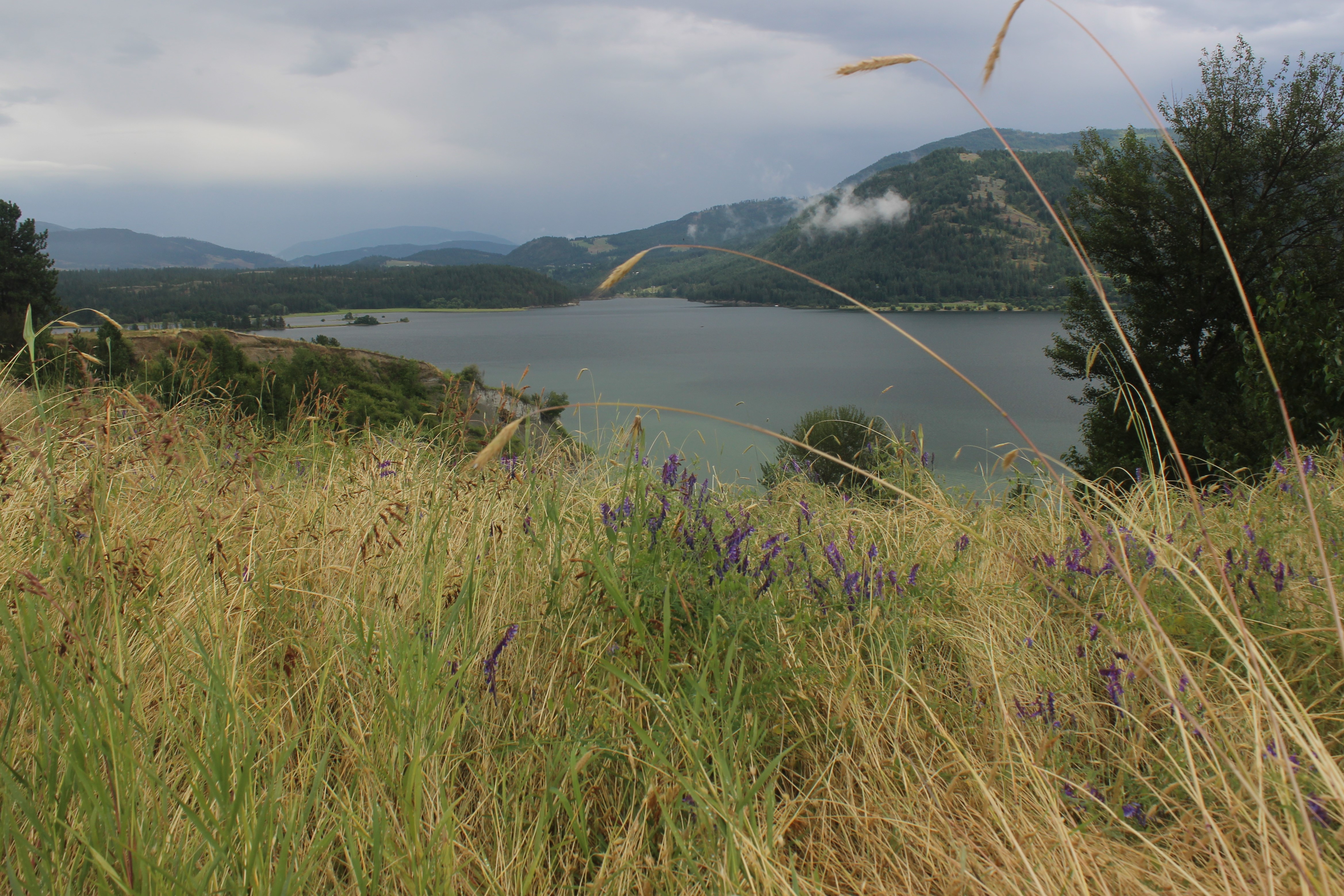
Long tall light tan grasses sway to the side in front of a large body of water with mountains behind
Photo: NPS

The Sherman Creek Wildlife Area is a cooperative trail system between the Washington Department of Fish and Wildlife and the National Park Service. There are multiple access points to this trail network and the length of the trail depends on which pathway is taken. The trail network features a gentle grade and is great for wildlife viewing.

The National Park Service managed trailhead begins at Haag Cove Campground, 10 yards/30 feet from the left of campsite 17. All other trailheads and parking areas are managed by the Washing Department of Fish and Wildlife. For these sites, a Discover Pass is required. These locations include the Sherman Creek Wildlife Area Agriculture Field Parking Area, the Mellenberger Bridge Trailhead off of Mellenberger Road, and the Sherman Creek Wildlife Area Headquarters Trailhead off of Hwy 20. Note: a Discover Pass is not required to park at Haag Cove Campground.

One Way Distances starting from Haag Cove

From Haag Cove to Mellenberger Bridge Trailhead (northbound): 2.10 miles.

Along this route is the Reed Farm to Ferry Landing trail (eastbound): 0.61 miles.

Just north of the Reed Farm to Ferry Landing cut off is the Sherman Point Loop (eastbound): 0.83 miles. This ultimately curves southbound and connects back to the Reed Farm to Ferry Landing trail.

From Mellenberger Bridge Trailhead to Sherman Homes (northbound): 1 mile

Along this route is an alternative path. Heading east, then north, then west to connect back to the Mellenberger Bridge Trailhead to Sherman Homes is the Hatchery Loop : 0.86 miles.

From Sherman Holmes, head east to take the Sherman Homes Road Connection : 0.25 miles.

This connects to the Wilkie Access Bypass (northbound) for 0.29 miles and connects back to the Wilkie Access Road (see below).

From Sherman Holmes, head north to take the Wilkie Access Road : 0.42 miles. This connects to the middle of the Sherman Homes Road to HQ trail.

Turn left (northbound) to follow the trail towards the Sherman Creek Wildlife Area Headquarters Trailhead. About half way along this trail, you'll come to a junction. Take the right hand junction for the Spur Below HQ trail (northbound): 0.22 miles.

Turn right (southbound) on the HQ to Sherman Homes Trail. This ultimately connects back to the Sherman Homes Road Connection. Sherman Creek Wildlife Area Headquarters Trailhead to Sherman Homes Road is 1.11 miles.

At the junction between the Sherman Homes Road Connection and the HQ to Sherman Homes Road is one more connection: the Sherman Homes Spur (northbound) is 0.15 miles and connects back to the Wilkie Access Bypass.

Accessibility This trail is mostly flat, with a gentle grade. It is mostly dirt with scattered grass. It is not paved.

This hike on nps.gov

38 more mapped segments without a name are on the map, not in the list.

About these trails

The lines are the National Park Service's public trails layer, the trailheads and the waterfalls, views, peaks and historic places along them the Service's public points of interest, read 2026-10-14 and simplified for the map. The write-ups are the Service's own "things to do", unedited. Heights come from USGS 3DEP through Terrain Tiles on AWS (Mapzen/Tilezen), read along each line and rounded; a short trail on steep ground can be off by a few tens of feet. Closures change: check the park's own site before you go.