
National Historical Park · Alaska
Trails in Klondike Gold Rush National Historical Park
69 named trails · 43 miles · 9 trailheads · 1 with the Park Service's own write-up. The lines, trailheads and points are the Park Service's; the write-ups are the Service's own words; the climbing is read from USGS elevation along each line.
69 trails, A to Z.
6.5 Mile Bridge
AB Mountain Trail
Trailhead AB Mountain Trailhead 316 ft Drive there
Avalanche Bridge
Views
Along the way Taiya River/Mt. Cleveland
Beaver Pond Boardwalk
Blueberry Bridge
Boardwalk
Bridge
Bridge of Dankness
Broadway Trail
Campground Trail
Canyon City Campground Trail
Canyon City Suspension Bridge
Chilkoot Trail
ViewsBackcountry campsCampgroundsPicnic areasRanger stations
Along the way Sheep Camp Tent Pad Sheep Camp Tent Pad Sheep Camp Tent Pad Sheep Camp Tent Pad Sheep Camp Tent Pad Sheep Camp Tent Pad Sheep Camp Tent Pad Sheep Camp Tent Pad Sheep Camp Tent Pad Sheep Camp Tent Pad Sheep Camp Tent Pad Sheep Camp Tent Pad and 44 more
Trailhead Chilkoot Trailhead 56 ft Drive there
Hike The Chilkoot Trail With Your Dog the Park Service's write-up
1-7 Days · dogs allowed · entrance fee applies · reservation required · Summer
Start Chilkoot Trail trailhead
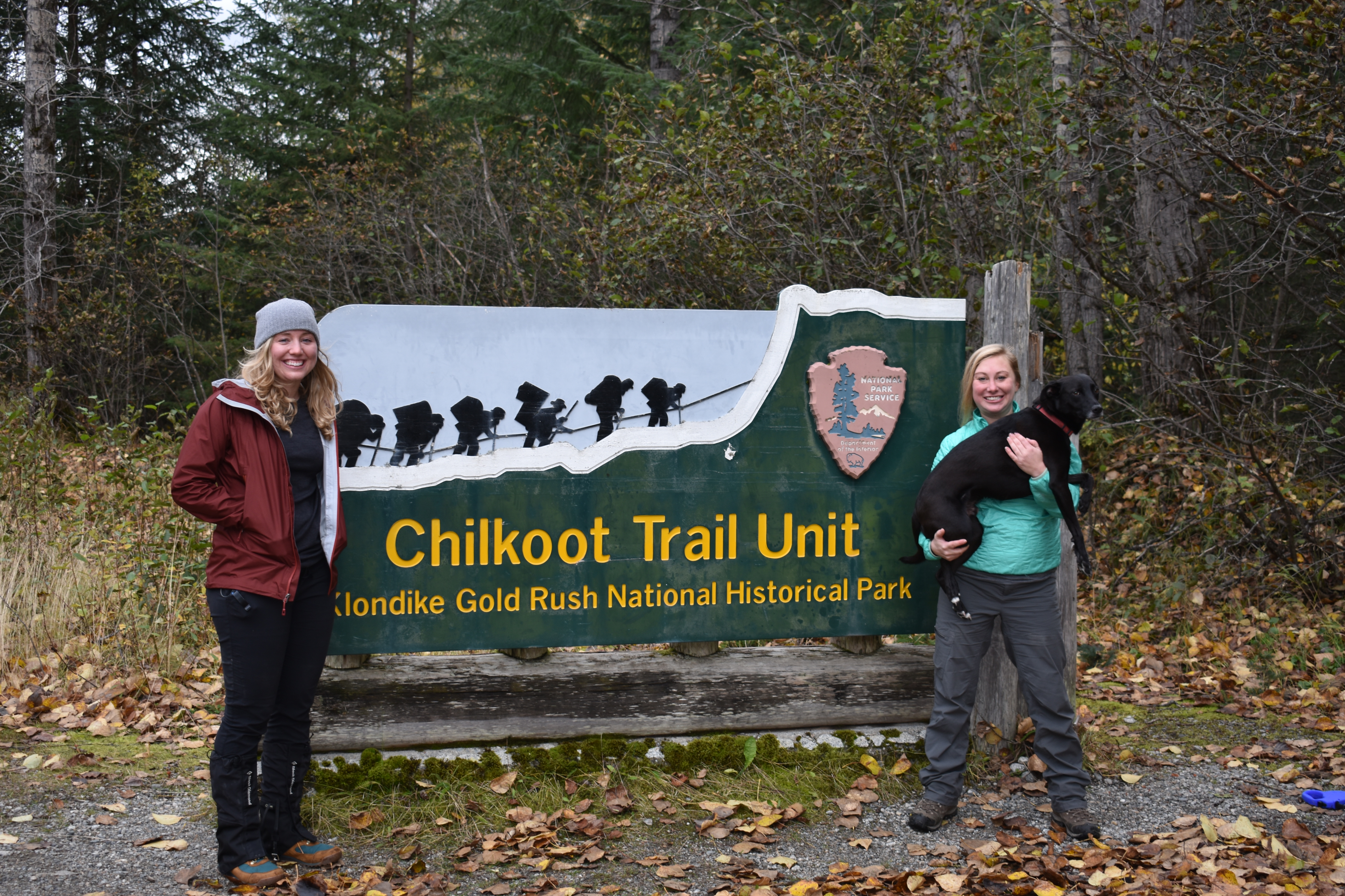
Bringing your four-legged friend as a hiking companion on the Chilkoot Trail is nothing new, but rules about dogs on the trail have changed since the days of the Klondike Gold Rush . Before embarking on a single day or multi-day hiking trip, dog owners should be aware of some of the following issues that their dogs may face while on the trail:
This is a very rough trail with lots of rocks that can be rough on dog paws, so bring a dog first aid kit.
Some water sources are difficult to get to with a dog on leash, so bring a water dish.
Conditions can be very wet on the trail, so bring a towel for your dog.
Sleeping directly on the ground can be very cold, so bring warm gear and a sleeping pad for your dog.
Hikers must cross one suspension bridge that not all dogs are comfortable with (must cross two if hikers go to the Canyon City Ruins ). Suspension bridges are built to be flexible and they can sway and yield to hiker body weights, but some dogs struggle with this lack of stability under foot
The Golden Stairs is a ½ mile steep ascent up a scree and boulder field, so dogs will have to rock hop.
Dogs are not allowed on emergency medical helicopter flights, so solo hikes with dogs are not advised.
Accessibility The Chilkoot Trail is a 33 miles challenging trek. Most hikers spend 3-5 days backpacking the route. Terrain is uneven and extremely steep in some sections. Hikers of all abilities have hiked this route in the past. If you are curious about accessibility for your needs please contact the park .
Denver Glacier Trail
Trailhead Denver Glacier Trailhead 461 ft Drive there
Devil's Punchbowl Trail
Dry Fork Bridge
Dyea Multi-Use Trail
Trailheads Dyea Multi-Use Trailhead 128 ft Drive there · Lost Lake Trailhead 124 ft Drive there
Dyea OHV Trail
Backcountry campsCampgrounds
Along the way Dyea Campground Tent Site 14 Dyea Campground Tent Site 16 Dyea Campground Tent Site 17 Dyea Campground Tent Site 22 Dyea Campground Tent Site 5 Dyea Campground Tent Site 6 Dyea Campground Tent Site 7 Dyea Campground Tent Site 8 Dyea Campground Tent Site 9 Dyea Campground, National Park Service
Eagle Rock Bridge
Eagle's Nest Bridge
Views
Along the way Mt. Yeatman West Creek / California Glacier
False Front Alley Trail
Exhibits
Along the way False Front
Fifth Street Trail
First Street Bridge
First Street Trail
Frenchy's Bridge
Glacier View Loop Trail
Exhibits
Along the way Canyon City Boiler
Historic Trail Spur
Icy Lake Junction Trail
Trailhead Dewey Lakes Trail System Trailhead 83 ft Drive there
Icy Lake/Upper Reid Falls Trail
Laughton Glacier Trail
Trailhead Laughton Glacier Trailhead 1,898 ft Drive there
Lost Lake Trail
Trailhead Lost Lake Trailhead 124 ft Drive there
Lower Dewey Lake Loop Trail
Trailhead Dewey Lakes Trail System Trailhead 83 ft Drive there
Lower Reid Falls Trail
History
Along the way Gold Rush Cemetery (Historic)
Trailhead Lower Reid Falls Trailhead 158 ft Drive there
Main Street Trail
Exhibits
Along the way False Front
Nelson Slough Foot Bridge
Exhibits
Along the way Historic Townsite Entrance Pullen Barn Interpretive Exhibit
Nine Mile Bridge
North Ditch Bridge
Pat Moore Suspension Bridge
Pet Cemetery Trail
Trailhead Yakutania Point/Smuggler's Cove Trailhead 65 ft Drive there
Pullen Barn Trail
Exhibits
Along the way Historic Townsite Entrance Pullen Barn Interpretive Exhibit
River Access Trail
Backcountry campsCampgroundsPicnic areas
Along the way Sheep Camp Tent Pad Sheep Camp Tent Pad Sheep Camp Tent Pad Sheep Camp Tent Pad Pleasant Camp Campground Sheep Camp Campground Sheep Camp Picnic Shelter
Rock Garden Bridge
Scow Street Trail
Exhibits
Along the way Historic Townsite Entrance Pullen Barn Interpretive Exhibit
Second Street Trail
Sheep Camp Tent Sites Trail
Backcountry campsCampgroundsPicnic areas
Along the way Sheep Camp Tent Pad Sheep Camp Tent Pad Sheep Camp Tent Pad Sheep Camp Tent Pad Sheep Camp Tent Pad Sheep Camp Tent Pad Sheep Camp Tent Pad Sheep Camp Tent Pad Sheep Camp Tent Pad Sheep Camp Tent Pad Sheep Camp Tent Pad Sheep Camp Tent Pad and 17 more
Shovel and Broom Bridge
Slide Cemetery Trail
Exhibits
Along the way Slide Cemetery
South Canyon City Bridge
Campgrounds
Along the way Canyon City Campground
Spruce Tree Log Bridge
Stariway to Heaven Bridge
Sturgill's Landing Trail
Third Street Trail
Trail Crew Cabin Spur
Views
Along the way Lower Valley/False Nourse
Trail Crew Camp Spur
Views
Along the way Lower Valley/False Nourse
Upper Canyon Lookout Trail
Views
Along the way International Falls Upper Canyon/Sheep Camp Glacier
Upper Dewey Lake Trail
View Trail Spur 2
Views
Along the way Taiya River Canyon/Upper Valley
Walk-in Site 10 Trail
Backcountry campsCampgrounds
Along the way Dyea Campground Tent Site 10 (Walk-In) Dyea Campground Tent Site 11 (Walk-In) Dyea Campground Tent Site 21 Dyea Campground Tent Site 22 Dyea Campground Tent Site 7 Dyea Campground Tent Site 8 Dyea Campground Tent Site 9 Dyea Campground, National Park Service
Walk-in Site 11 Trail
Backcountry campsCampgrounds
Along the way Dyea Campground Tent Site 10 (Walk-In) Dyea Campground Tent Site 11 (Walk-In) Dyea Campground Tent Site 21 Dyea Campground Tent Site 22 Dyea Campground Tent Site 8 Dyea Campground Tent Site 9 Dyea Campground, National Park Service
Walk-in Site 21 Trail
Backcountry campsCampgrounds
Along the way Dyea Campground Tent Site 10 (Walk-In) Dyea Campground Tent Site 11 (Walk-In) Dyea Campground Tent Site 20 Dyea Campground Tent Site 20 (Walk-In) Dyea Campground Tent Site 21 Dyea Campground Tent Site 9 Dyea Campground, National Park Service
Walk-in Site Trail
Backcountry camps
Along the way Dyea Campground Tent Site 14 Dyea Campground Tent Site 17 Dyea Campground Tent Site 19 Dyea Campground Tent Site 20 Dyea Campground Tent Site 20 (Walk-In) Dyea Campground Tent Site 21
Water Access Spur Trail
Waterfall Bridge
West Creek View (River Access) Trail
Views
Along the way Mt. Yeatman West Creek / California Glacier
West Street Trail
Yakutania Point/Smuggler's Cove to AB Mountain Access Trail
Trailhead AB Mountain Trailhead 316 ft Drive there
Yakutania Point/Smuggler's Cove Trail
Shelters
Along the way Picnic Shelter Picnic Shelter
Trailhead Yakutania Point/Smuggler's Cove Trailhead 65 ft Drive there
Zig Zag Bridge
About these trails
The lines are the National Park Service's public trails layer, the trailheads and the waterfalls, views, peaks and historic places along them the Service's public points of interest, read 2026-10-14 and simplified for the map. The write-ups are the Service's own "things to do", unedited. Heights come from USGS 3DEP through Terrain Tiles on AWS (Mapzen/Tilezen), read along each line and rounded; a short trail on steep ground can be off by a few tens of feet. Closures change: check the park's own site before you go.