
National Park · Alaska
Trails in Kenai Fjords National Park
13 named trails · 17 miles · 2 trailheads · 2 with the Park Service's own write-up. The lines, trailheads and points are the Park Service's; the write-ups are the Service's own words; the climbing is read from USGS elevation along each line.
13 trails, A to Z.
Campground Access Trail
Shelters
Along the way Campground Picnic Shelter/Food Storage
Easement Route
Backcountry camps
Along the way 24 Hour Public Camping Easement 24 Hour Public Camping Easement 24 Hour Public Camping Easement 24 Hour Public Camping Easement 24 Hour Public Camping Easement 24 Hour Public Camping Easement 24 Hour Public Camping Easement 24 Hour Public Camping Easement DESI01
Edge of Glacier Trail
Trailhead Harding Icefield Trailhead 492 ft Drive there
Exit Glacier Main Trail
Shelters
Along the way EG Interp Pavilion
Trailhead Harding Icefield Trailhead 492 ft Drive there
Exit Glacier Paved Trail
SheltersPicnic areasVisitor centers
Along the way Exit Glacier Picnic Area Education Pavilion EG Interp Pavilion Picnic Shelter/Warming Hut Nature Center
Trailhead Exit Glacier Trailhead 451 ft Drive there
Glacier Spur Trail
Views
Along the way Glacier Overlook
Glacier View Trail
SheltersVisitor centers
Along the way Education Pavilion EG Interp Pavilion Picnic Shelter/Warming Hut Nature Center
Trailhead Exit Glacier Trailhead 451 ft Drive there
Explore the Exit Glacier area in a couple of hours the Park Service's write-up
no dogs · Spring, Summer, Fall
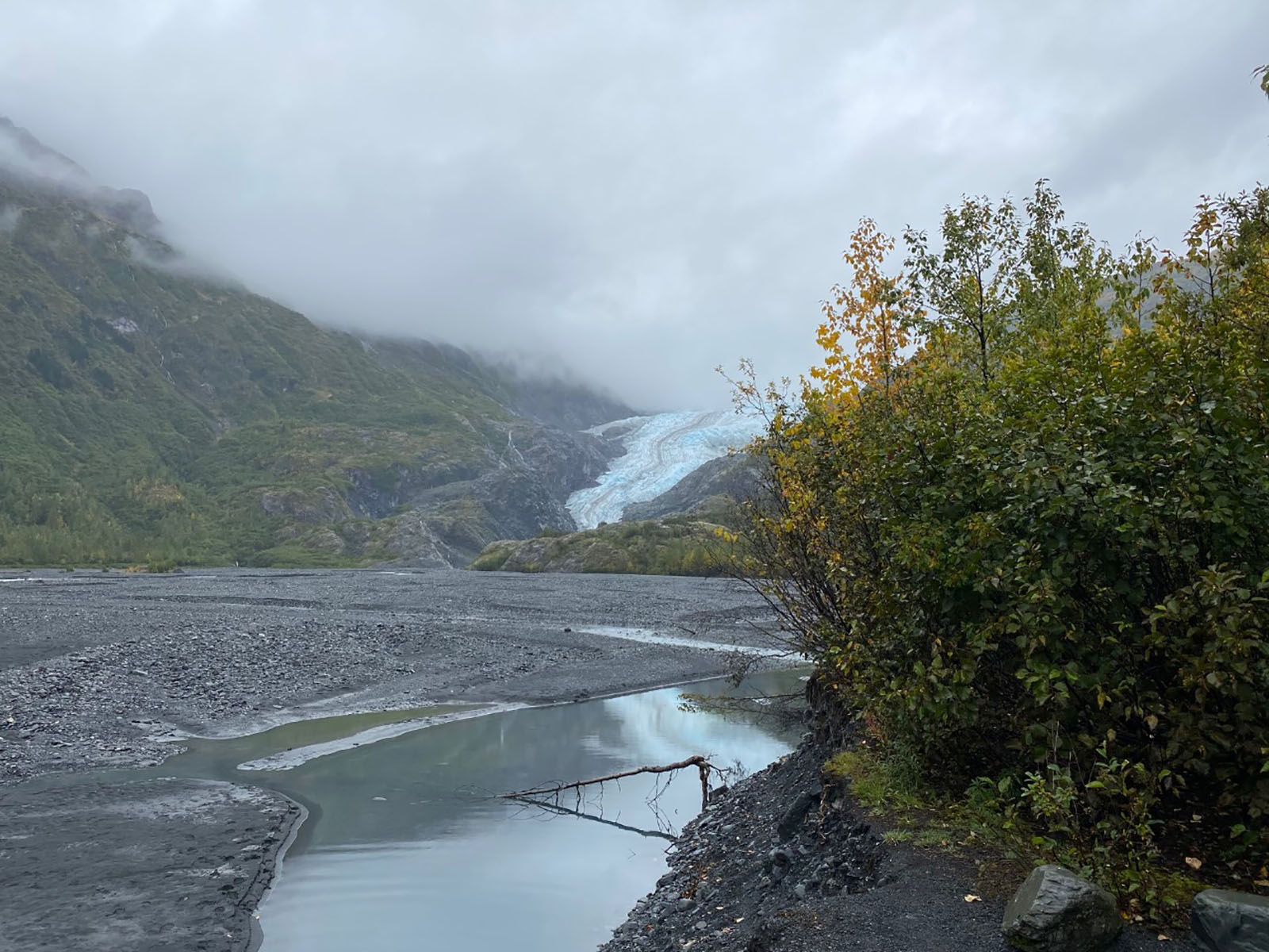
Would you like to explore the Exit Glacier area, and only have a couple of hours? Here are a few things you might consider doing.
Visit the Exit Glacier Nature Center: The Exit Glacier Nature Center is open from Memorial Day though Labor day. Inside are displays about the Exit Glacier Area, wildlife, and glaciers! Rangers are available if you have any questions. 30 minutes - 1 hour
Hike the Lower Trails: The lower trails offer some excellent views of Exit Glacier, as they follow the years of it's retreat. The first section of the lower trails is an accessible trail. It is packed gravel and dirt, and 3 feet wide. The second section goes up a slightly steeper elevation, with more narrow trail areas. The trail ends at a glacier overlook where Exit Glacier was in 2010. 1-2 hours
Pets Pets are not allowed on the trails in the Exit Glacier Area unless they are service animals.
Accessibility The first half of the lower trail section is 3 feet wide. It is packed dirt and gravel. The second half of the lower trail increases 300 feet in elevation, and the trail is narrow and unpacked. There is an accessible bathroom located near the Exit Glacier Nature Center.
Harding Icefield Trail
Views
Along the way Harding Icefield Overlook Top of the Cliffs Overlook
Trailhead Harding Icefield Trailhead 492 ft Drive there
Hike the Harding Icefield Trail the Park Service's write-up
6-8 Hours · no dogs · Summer, Fall
Start Exit Glacier Area
Ranger Recommendation
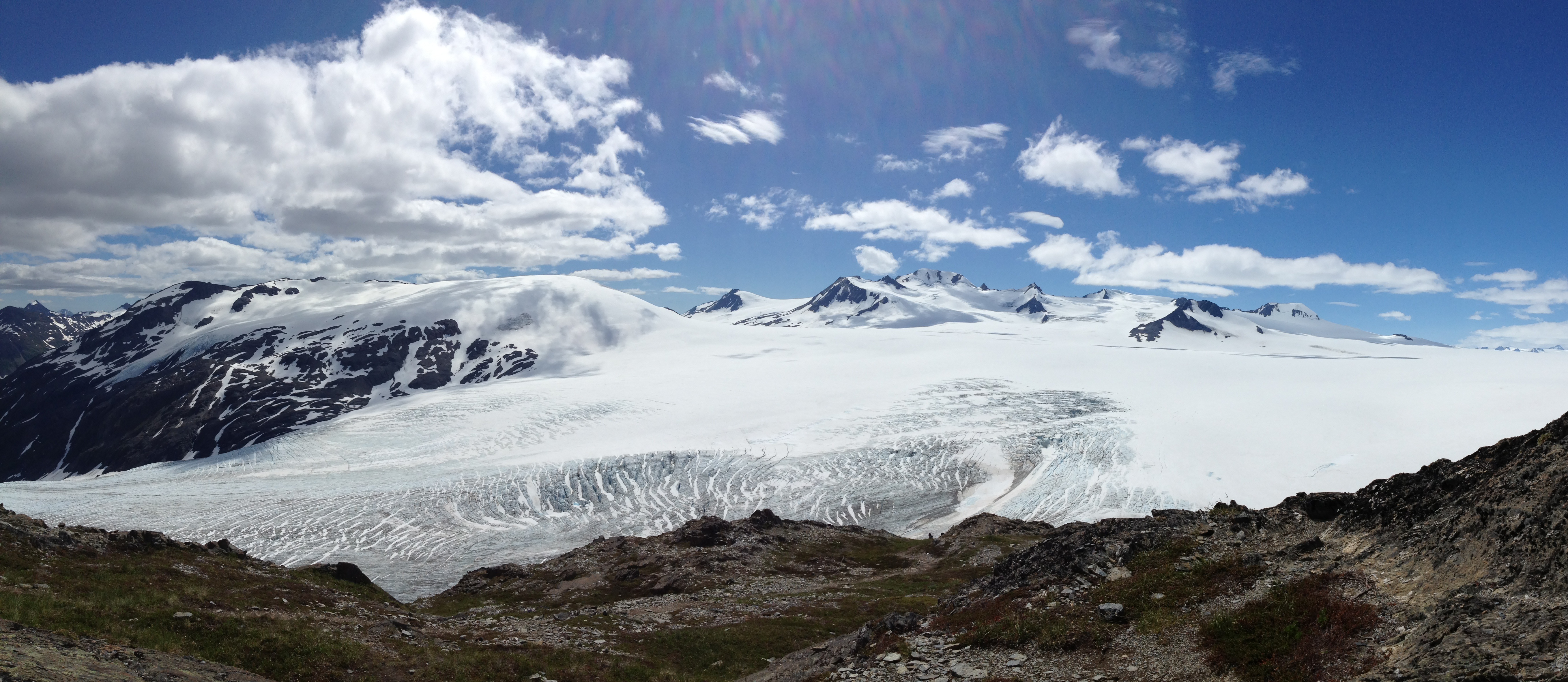
Keep your eyes open! Stops along the way at Marmot Meadows (1.4 miles) and Top of the Cliff (2.4 miles) provide scenic vistas to take a break during your journey or turn around for a shorter hike. Watch for wildlife throughout your hike, as bears, mountain goats, hoary marmots, and others, have all been seen from the trail.
Be prepared! Check on trail conditions before starting out - the upper portion of the trail is often covered with snow through early July, and there may be avalanche danger. Be prepared for storms, high winds, intense sunlight, and sudden temperature changes. Bring warm clothes, rain gear, sturdy footwear, sunglasses, and sunscreen. Carry plenty of water (at least 2 liters per person).
Stay on the trail. Alpine vegetation is extremely fragile. Careless hikers who cut switchbacks, along with frequent summer rains, cause tremendous erosion. Volunteers help restore and maintain this trail every year. Please respect their hard work by sticking to the trail.
Accessibility The trail ascends steeply over the 4.1 miles, gaining around 3500' of elevation. The surface can be muddy, slippery, rocky and include snow and ice depending on the time of year. Though pets are prohibited on this trail, service animals are able to accompany visitors.
Holgate Public Use Cabin Trail
Lower Loop Trail
Trailhead Harding Icefield Trailhead 492 ft Drive there
Side of Glacier Trail
Upper Loop Trail
About these trails
The lines are the National Park Service's public trails layer, the trailheads and the waterfalls, views, peaks and historic places along them the Service's public points of interest, read 2026-10-14 and simplified for the map. The write-ups are the Service's own "things to do", unedited. Heights come from USGS 3DEP through Terrain Tiles on AWS (Mapzen/Tilezen), read along each line and rounded; a short trail on steep ground can be off by a few tens of feet. Closures change: check the park's own site before you go.