
Orin Falls Trail
Trailhead Orin Falls Trailhead 638 ft Drive there
Hike To Orin Falls 6 mi round trip · the Park Service's write-up
3-6 Hours · dogs allowed
Start Wassataquoik Gate Parking Lot
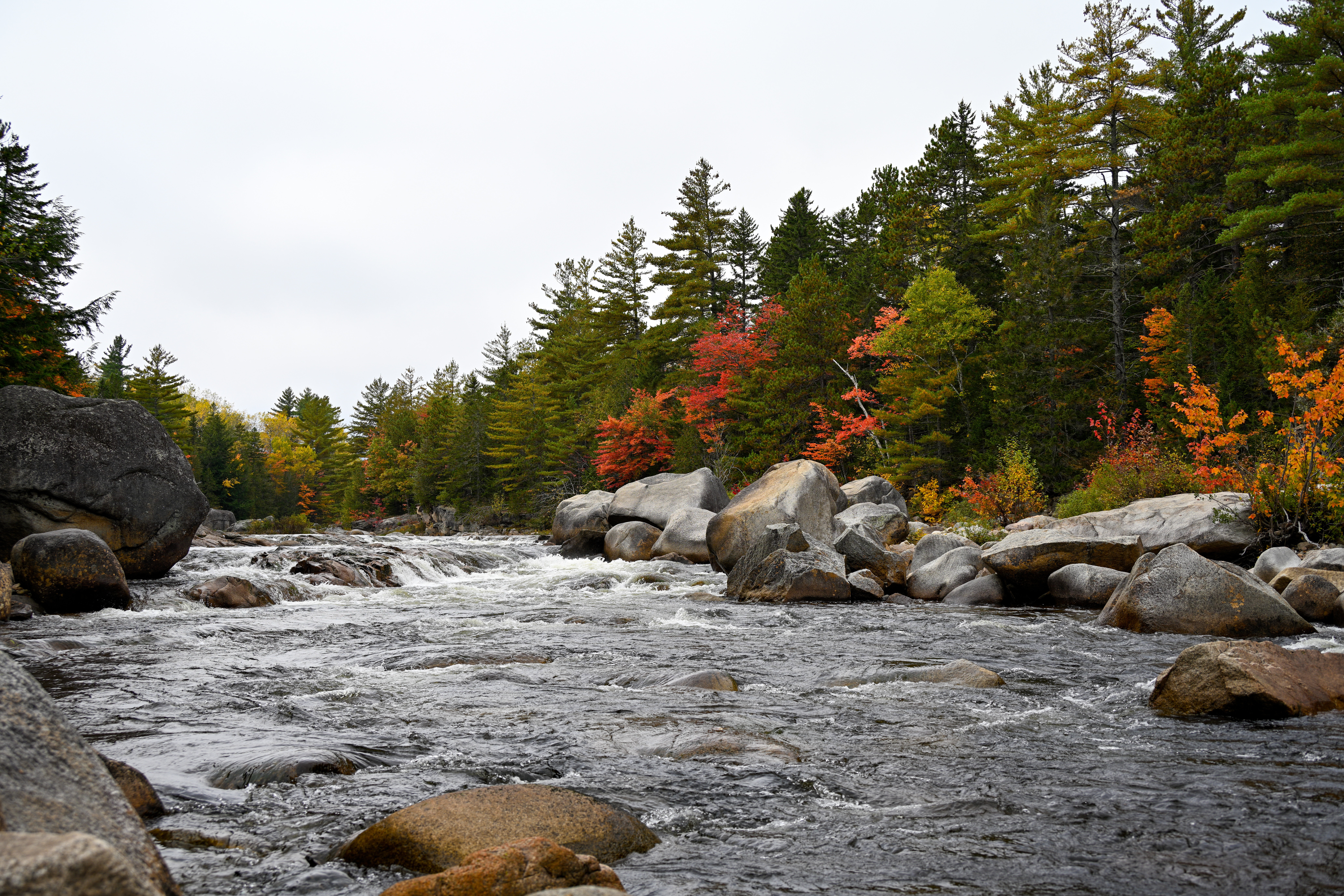
Hike to Orin Falls, where a magnificent view of a cascading waterfall made of tiered glacial boulders and rocks greets you. The water that tumbles and churns the rocks at Orin Falls comes from Wassataquoik Stream. This 6-mile (round-trip) hike will take you through dense forests, meadows, and waterways of Katahdin Woods and Waters NM. Be aware of bikers as well as wildlife on the trail. Remember to pack in enough water to stay hydrated. There is no potable water.
Trail Details
Start by parking your vehicle at Wassataquoik Gate. There is a vault toilet available for use here.
Hike northwest to the trailhead. The trail starts on a former gravel logging road.
In approximately 0.4 miles, you will cross over Katahdin Brook on a footbridge and reach Wassataquoik Campsite on your left. Continue to hike past the campsite and Wassataquoik Lean-to.
Continue hiking for approximately 0.6 miles. Continue onward in a northwest direction when you arrive at a junction. Do not turn left unless you would like to follow the International Appalachian Trail to the Barnard Mountain Trailhead.
After the junction, continue for another 1.5 miles before turning right onto a narrow trail through dense forest. There will be a sign with Orin Falls on it to remind you.
This final narrow section of the trail has wooden boards and a small wooden footbridge to keep you on trail and hopefully out of the mud and water. Be aware it may be slippery. Notice the sound of water as you approach Orin Falls.
Retrace your steps to return to your vehicle. This is an out and back hike.
Reminder: Carry out all trash and food waste (fruit peels, shells, etc.). Do not feed the wildlife . Dress appropriately and be prepared for a high concentration of biting and stinging bugs during late spring, summer months.
Accessibility The surface is made of gravel, dirt, and organic matter. Be careful of larger rocks on the trail and uneven terrain. There are areas where you will have to cross small and narrow wooden footbridges. Wooden surfaces and rocks may be slippery. The trail is narrow near Wassataquoik Stream. Orin Falls viewing area has many rocks, boulders, and areas of sand.