
Mount Franklin Trail
Hike the Mount Franklin Trail the Park Service's write-up
1-4 Hours · no dogs · Spring, Summer, Fall
Start Mount Franklin Trail at Isle Royale National Park
About this Trail
Mileage: About 2.5 miles (including spur trails to overlook and campground)
Rocks and roots on trail
Overgrown vegetation near trail
Changing trail conditions require a map, compass, and navigation skills
Trailheads
Rock Harbor
Windigo via the Greenstone Ridge Trail
Hidden Lake
Via water taxi from Rock Harbor Lodge . Reservations needed in advance.
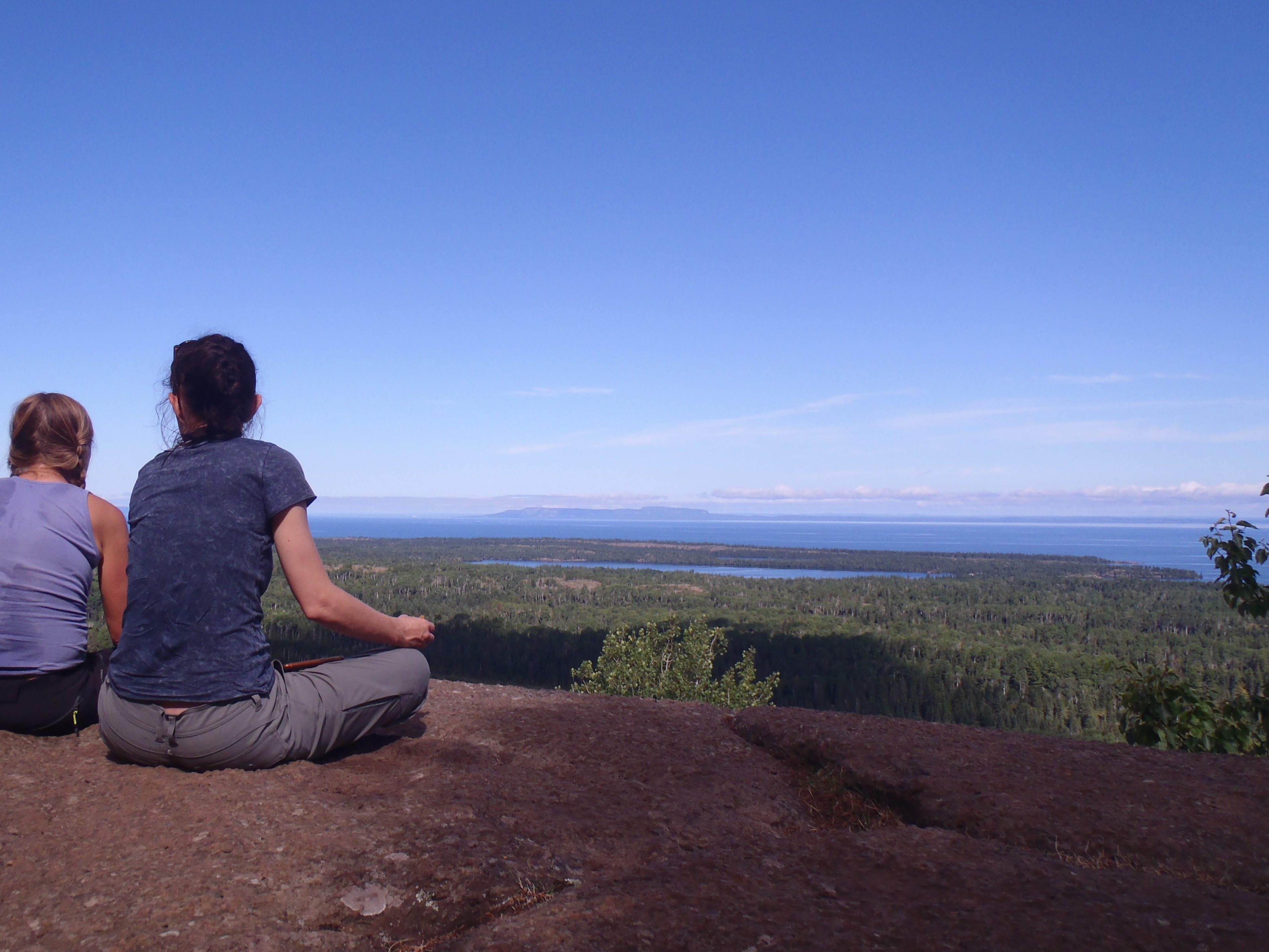
The Mount Franklin Trail connects the scenic overlook at Mount Franklin to the Tobin Harbor Trail junction and eventually Three Mile Campground to the south. This trail has a steep gradient. At the northern point of this trail is the junction with the Greenstone Ridge Trail and the Lane Cove Trail. Backpackers often use this trail to climb off the Greenstone Ridge and hike into Rock Harbor via the Tobin Harbor Trail or Rock Harbor Trails.
Found Nearby
Rock Harbor
Three Mile Campground
Lane Cove Campground
Rock Harbor Campground
Daisy Farm Campground
Accessibility The trail is 18 inches wide and covered in rocks and roots.
Hike the Tobin Harbor Trail the Park Service's write-up
2-4 Hours · no dogs · Spring, Summer, Fall
Start Tobin Harbor Trail at Isle Royale National Park
About this Trail
Mileage: About 3 miles
Rocks and roots on trail
Trailheads
Rock Harbor
Windigo via Greenstone Ridge Trail
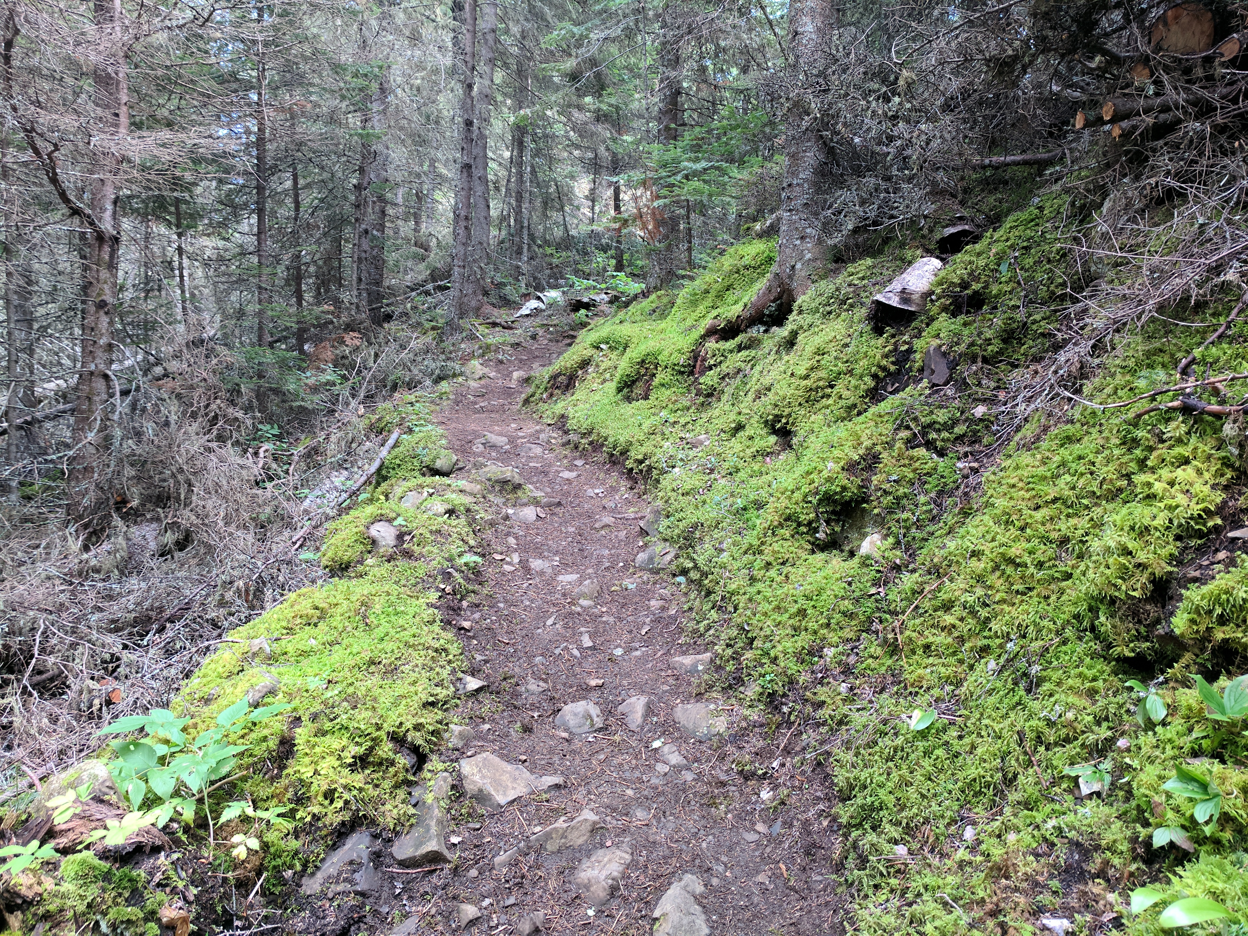
The Tobin Harbor Trail connects the Rock Harbor area with the Mount Franklin Trail. The Mount Franklin Trail gives access to Mount Franklin, Suzy's Cave, Three Mile Campground, Lane Cove Campground, and the Greenstone Ridge Trail. Some backpackers and day hikers prefer the Tobin Harbor Trail over the Rock Harbor Trail because of the Tobin Harbor Trail's smoothness and gentle grade.
At the junction with the Mount Franklin Trail the Tobin Harbor Trail winds gently downhill through boreal forest until it meets Tobin Harbor. The remainder of the trail continues on a general downward slope hugging Tobin Harbor. This trail ends near the Rock Harbor Lodge in the Rock Harbor area.
Found Nearby
Rock Harbor
Rock Harbor Campground
Three Mile Campground
Suzy's Cave
Mount Franklin
Lane Cove Campground
Accessibility The trail is about 18 inches wide and is not paved. The trail is covered in rocks and roots.