Campground Connector
Backcountry campsCampgrounds
Along the way campsite 2 campsite 29 campsite 31--host campsite 4 HVCP - Campground
Trailhead Ruins Loop Trailhead 5,221 ft Drive there

National Monument · Colorado, Utah
14 named trails · 7 miles · 8 trailheads · 3 with the Park Service's own write-up. The lines, trailheads and points are the Park Service's; the write-ups are the Service's own words; the climbing is read from USGS elevation along each line.
14 trails, A to Z.
Backcountry campsCampgrounds
Along the way campsite 2 campsite 29 campsite 31--host campsite 4 HVCP - Campground
Trailhead Ruins Loop Trailhead 5,221 ft Drive there
Trailhead Cutthroat Trailhead 5,886 ft Drive there
Trailheads Holly Trailhead 5,356 ft Drive there · Holly Trailhead 5,211 ft Drive there
4 Hours · dogs allowed · Spring, Summer, Fall
Start Hovenweep Campground to Holly Site
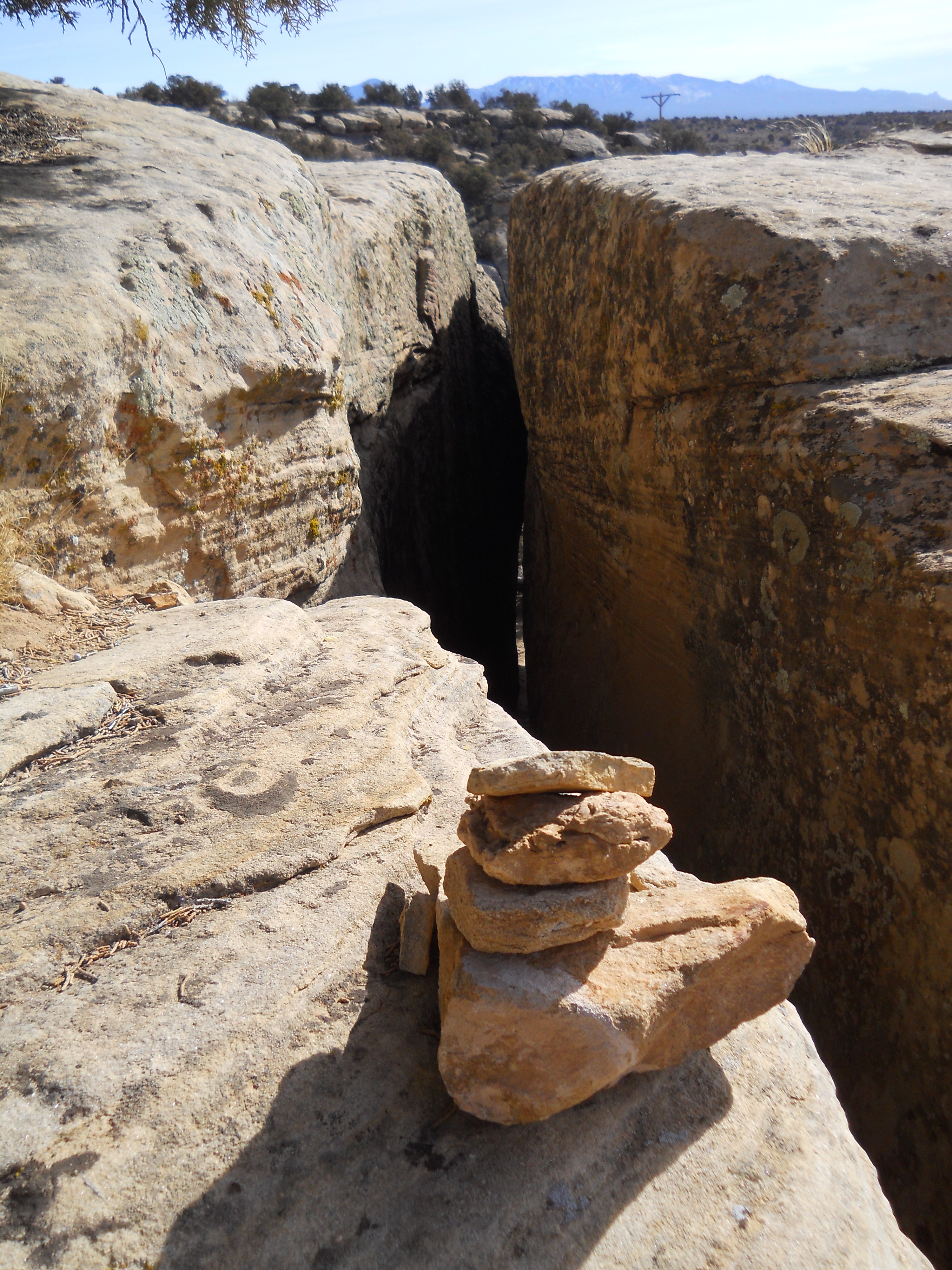
The Holly Trail is Hovenweep’s longest and most rugged hike. Start at the campground follow the trail 3.5 miles along a canyon wash to the Holly Group. After exploring Holly’s standing structures and lasting petroglyphs, return along the same route for a total distance of 7 miles. The trail leads into and out of the canyon by way of slot canyon (one on each end) and winds across the wash.
We recommend the Holly trail for those wanting a longer hike, canyon hiking, or a different point of view. After all, the trail must be very similar to those taken by people who lived at Square Tower Group visiting their neighbors at Holly. There aren’t any standing structures until you reach the Holly Group, but about two miles in are rubble piles from an older, fallen structure.
The Holly Group is also home to the Holly Sun Panel, a petroglyph panel that archeologists believe marks the summer solstice. Visible any time of year, the panel is seen from an overlook at the far end of the Holly Group.
The Holly Group is also accessible from a dirt road off Road 10.
Visiting Respectfully
These structures may seem long-abandoned, but they are ancestral homes for the modern Pueblo peoples, many of whom believe their ancestors inhabit them still. Hovenweep National Monument was established to protect these places. Help us protect these dwellings by remaining on trail, not touching or entering any structure, and leaving any artifact in place. Thank you for doing your part and visiting respectfully!
Accessibility The Holly trail is 7 miles, roundtrip, over rough and uneven terrain. The trail starts with a descent through a slot canyon to the canyon floor. From there, the trail is relatively level, but crosses washes several times. The trail leads up through a second slot canyon to reach the Holly site. Total elevation change is 646 feet. Trail terrain is exposed sandstone, loose rock and gravel, sand, and packed dirt.
Trailhead Horseshoe-Hackberry Trailhead 5,497 ft Drive there
Trailhead Cajon Trailhead 5,166 ft Drive there
Trailhead Cutthroat Trailhead 5,886 ft Drive there
Backcountry campsCampgrounds
Along the way campsite 14 campsite 8 HVCP - Campground
Trailhead Holly Trailhead 5,211 ft Drive there
Visitor centers
Along the way HVVC - Visitor Center
Trailhead Ruins Loop Trailhead 5,244 ft Drive there
dogs allowed
Start Square Tower Group
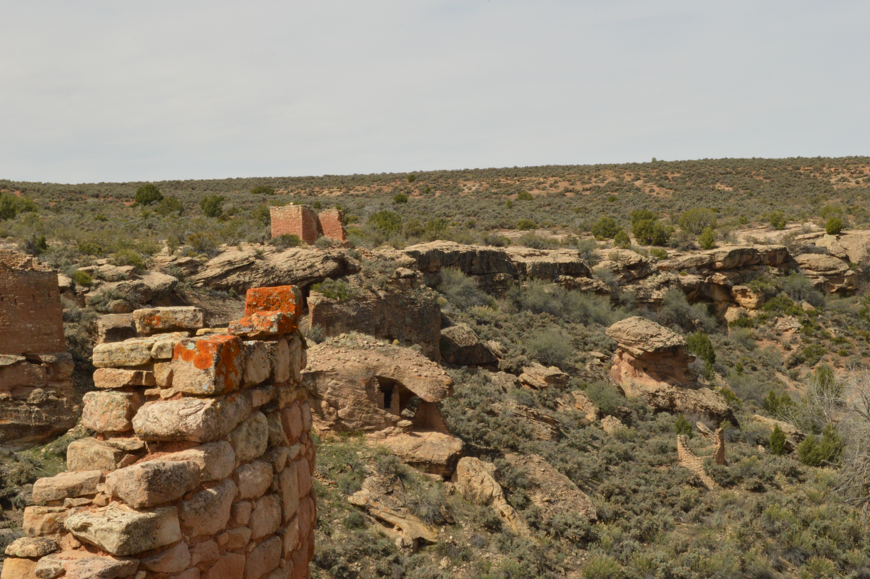
This two mile loop trail starts at the visitor center and circles around the Square Tower Group structures / Little Ruin Canyon. The trail starts as sidewalk down to the overlook, then veers off in either direction (and loops back around) to circle the canyon. A portion of this trail crosses the canyon, with 80 feet of elevation gain and loss on stairs. The primitive trail is lined with rocks and passes within 5-10 feet of most of the structures, allowing visitors an uninterrupted and natural view of these architectural wonders. A trail guide gives historical information and insight into the towers, but we encourage you to ponder the day-to-day life of the ancestral Pueblo people who lived here.
The Square Tower Group is Hovenweep’s largest and most convenient collection of standing structures. Ten buildings perch on the rim of Little Ruin Canyon; the remains of several more are crumbled down the canyon walls. Some of the most popular and unique structures in the Four Corners region are in this canyon: Hovenweep Castle, Twin Towers, and Square Tower, for which the group is named.
You don’t have to walk the entire loop to see and enjoy the Square Tower Group. Several out-and-back hikes give plenty of options to do as little or as much as you can or want.
Visiting Respectfully
These structures may seem long-abandoned, but they are ancestral homes for the modern Pueblo peoples, many of whom believe their ancestors inhabit them still. Hovenweep National Monument was established to protect these places. Help us protect these dwellings by remaining on trail, not touching or entering any structure, and leaving any artifact in place. Thank you for doing your part and visiting respectfully!
Accessibility The first 300 yards from the visitor center to the canyon overlook are paved. At the overlook, the trail turns to primitive slickrock, dirt, and gravel. Most of the trail is on top of the canyon with very little elevation change and a few steps up or down onto rock. However, part of the trail crosses the canyon, descending 80 feet into the canyon and ascending 80 feet to reach the other side. There are also 4 benches placed along the trail in the shade. This trail is not wheelchair accessible.
10-30 Minutes · dogs allowed
Start Hovenweep Visitor Center
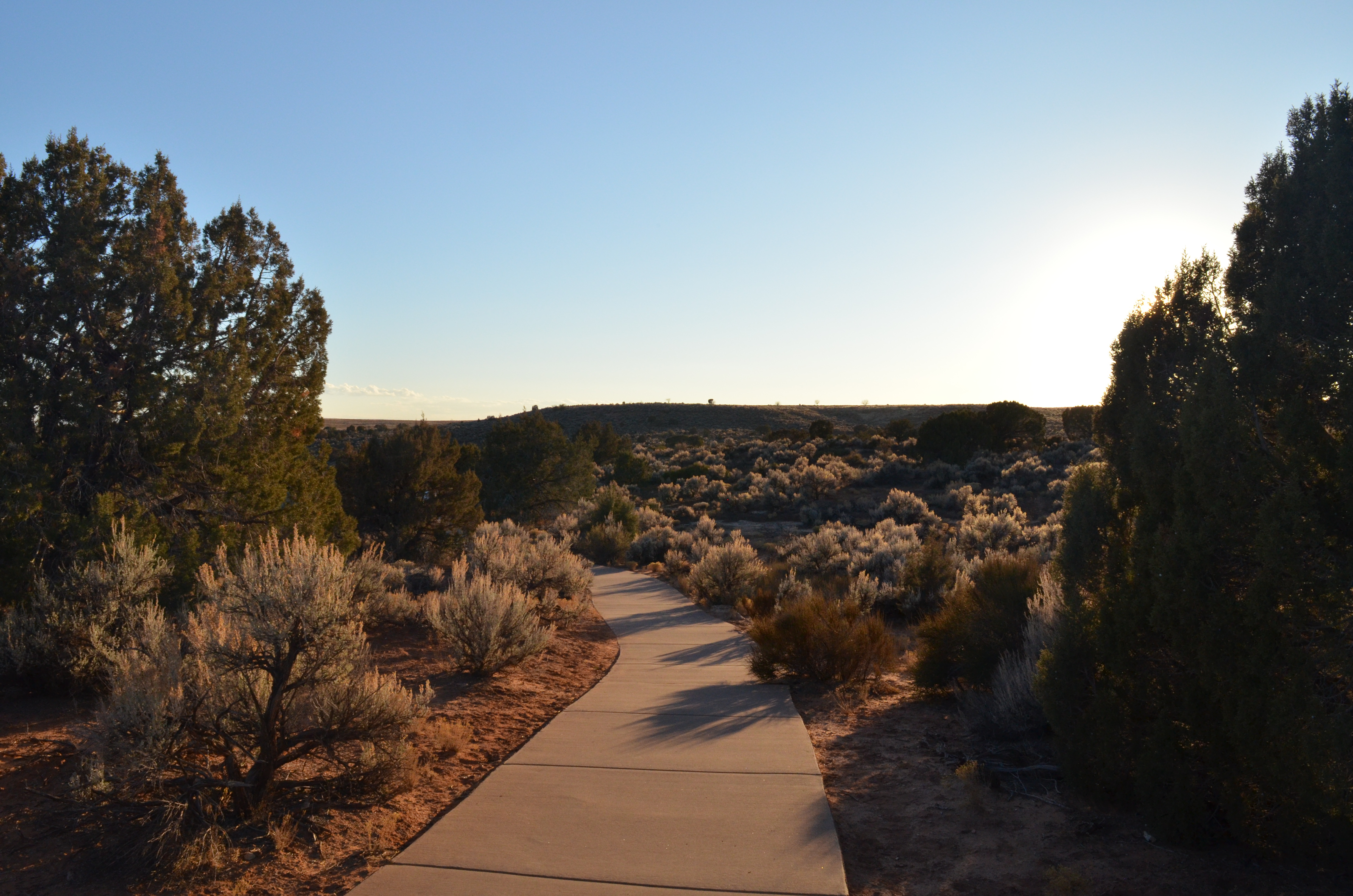
This overlook is your gateway to the Square Tower Group and often your first glimpse of Hovenweep’s ancestral Puebloan structures. Just a 10-minute walk from the visitor center, the overlook provides scenic views of the surrounding landscape, Little Ruin Canyon, and several of the Square Tower Group structures. It is also the beginning of the Square Tower Group rim trail.
The paved overlook trail beings at the visitor center; round-trip length is 0.32 miles (0.5 kilometers). Along the way, placards identify native plants.
The Square Tower Group is Hovenweep’s largest collection of standing structures. From the overlook, you can see Stronghold House, Twin Towers, Eroded Boulder House, and Tower Point. Waysides at the overlook identify and interpret these structures.
Visiting Respectfully
These structures may seem long-abandoned, but they are ancestral homes for the modern Pueblo peoples, many of whom believe their ancestors inhabit them still. Hovenweep National Monument was established to protect these places. Help us protect these dwellings by remaining on trail, not touching or entering any structure, and leaving any artifact in place. Thank you for doing your part and visiting respectfully!
Accessibility The overlook trail is paved sidewalk. The trail curves a few times and declines 33 feet down to the overlook. There is a total ascent of 33 feet when returning to the visitor center. There are benches at the trailhead/ visitor center, a bench halfway down the trail, and a bench at the overlook. Total trail length (round trip) is 0.32 miles, or about 600 yards (0.5 kilometers).
dogs allowed
Start Square Tower Group
This two mile loop trail starts at the visitor center and circles around the Square Tower Group structures / Little Ruin Canyon. The trail starts as sidewalk down to the overlook, then veers off in either direction (and loops back around) to circle the canyon. A portion of this trail crosses the canyon, with 80 feet of elevation gain and loss on stairs. The primitive trail is lined with rocks and passes within 5-10 feet of most of the structures, allowing visitors an uninterrupted and natural view of these architectural wonders. A trail guide gives historical information and insight into the towers, but we encourage you to ponder the day-to-day life of the ancestral Pueblo people who lived here.
The Square Tower Group is Hovenweep’s largest and most convenient collection of standing structures. Ten buildings perch on the rim of Little Ruin Canyon; the remains of several more are crumbled down the canyon walls. Some of the most popular and unique structures in the Four Corners region are in this canyon: Hovenweep Castle, Twin Towers, and Square Tower, for which the group is named.
You don’t have to walk the entire loop to see and enjoy the Square Tower Group. Several out-and-back hikes give plenty of options to do as little or as much as you can or want.
Visiting Respectfully
These structures may seem long-abandoned, but they are ancestral homes for the modern Pueblo peoples, many of whom believe their ancestors inhabit them still. Hovenweep National Monument was established to protect these places. Help us protect these dwellings by remaining on trail, not touching or entering any structure, and leaving any artifact in place. Thank you for doing your part and visiting respectfully!
Accessibility The first 300 yards from the visitor center to the canyon overlook are paved. At the overlook, the trail turns to primitive slickrock, dirt, and gravel. Most of the trail is on top of the canyon with very little elevation change and a few steps up or down onto rock. However, part of the trail crosses the canyon, descending 80 feet into the canyon and ascending 80 feet to reach the other side. There are also 4 benches placed along the trail in the shade. This trail is not wheelchair accessible.
Backcountry camps
Along the way campsite 8
Trailhead Holly Trailhead 5,211 ft Drive there
Trailheads Cutthroat Trailhead 5,886 ft Drive there · Trailhead 6,021 ft Drive there
The lines are the National Park Service's public trails layer, the trailheads and the waterfalls, views, peaks and historic places along them the Service's public points of interest, read 2026-10-14 and simplified for the map. The write-ups are the Service's own "things to do", unedited. Heights come from USGS 3DEP through Terrain Tiles on AWS (Mapzen/Tilezen), read along each line and rounded; a short trail on steep ground can be off by a few tens of feet. Closures change: check the park's own site before you go.