National Park · Arkansas

Trails in Hot Springs National Park

28 named trails · 27 miles · 23 with the Park Service's own write-up. The lines, trailheads and points are the Park Service's; the write-ups are the Service's own words; the climbing is read from USGS elevation along each line.

Open on the parks mapEvery park with trailsPark on nps.gov

28 trails, A to Z.

Arlington Trail

0.1 mi one way · about 100 ft of climbing · 696 ft–808 ft

696 ft 808 ft · 0.1 mi high 808 ft

Arlington Trail the Park Service's write-up

5-10 Minutes · dogs allowed

Start Trail head

A lush, green lawn lays before a tall, wide, tan hotel building.
Arlington Lawn Photo: NPS Photo/Mitch Smith

Ask for directions to the trailhead from staff at the Arlington Hotel lobby. Arlington Trail will connect with Lower Dogwood Trail.

Distance (one way): 0.1mi (0.2km)

Elevation: 718 - 731ft (219 - 223m)

Typical grade: 2.5%

Accessibility This is a packed dirt trail with a few concrete steps to reach the trail itself. It is not ADA compliant.

This hike on nps.gov

Tufa Terrace Trail the Park Service's write-up

15-30 Minutes · dogs allowed

Start Lower Tufa Terrace Trailhead

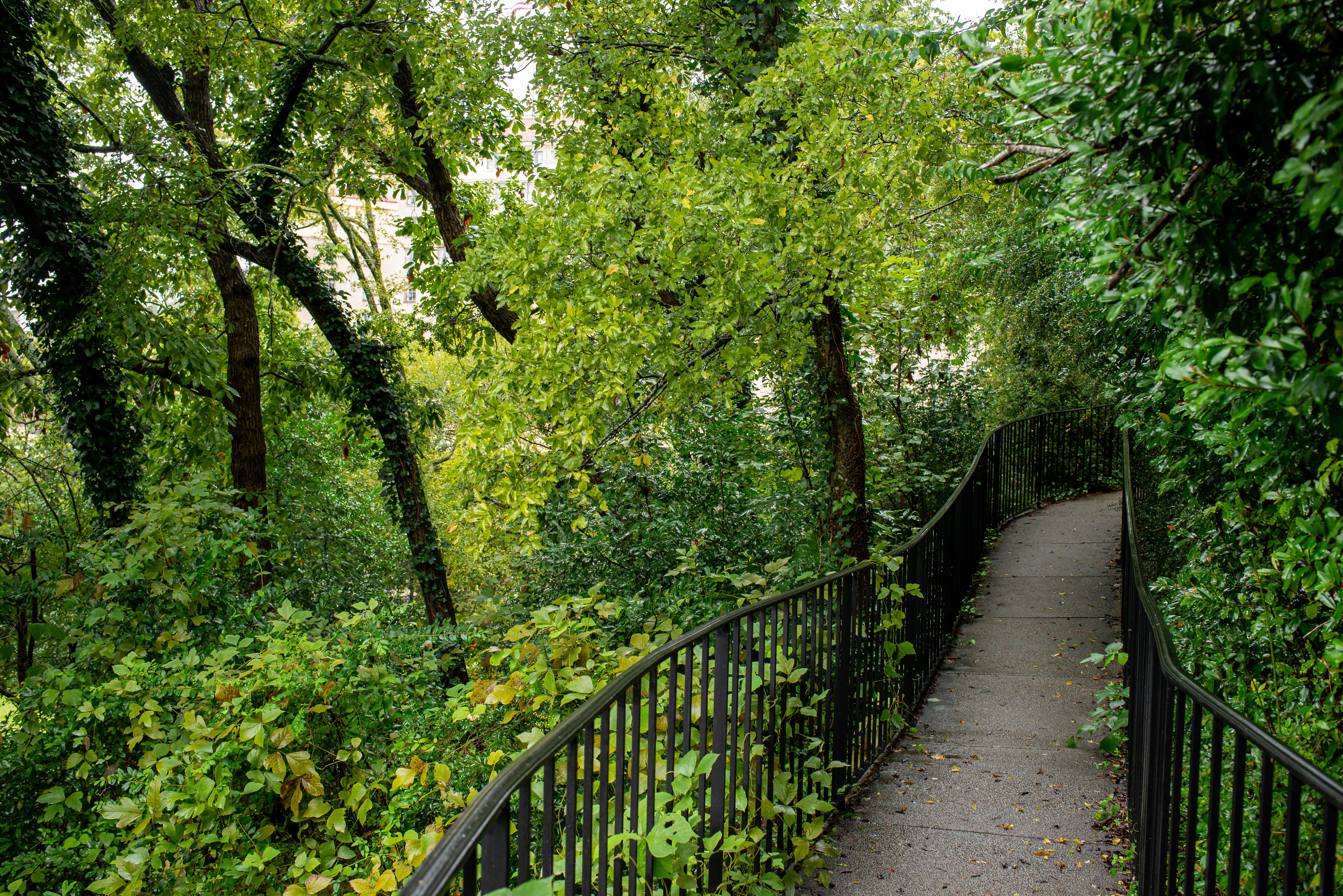
A railed, thin pathway leads through bright green trees and brush.
Lower Tufa Terrace Trail Photo: NPS Photo/Mitch Smith

This paved trail can be reached from the Grand Promenade or Arlington Lawn. The lower portion of the Tufa Terrace Trail is near the Hot Water Cascade.

Distance (one way): 0.3 mi (0.5km)

Elevation: 650ft - 745ft (198 - 227m)

Typical Grade: 6%

Accessibility The Tufa Terrace is not consdiered to be ADA compliant, as there are stairs at various places throughout the trail.

This hike on nps.gov

Canyon Trail

0.6 mi one way · 350 ft of descent · 642 ft–988 ft

988 ft 642 ft · 0.6 mi high 988 ft

Canyon Trail the Park Service's write-up

25-45 Minutes · dogs allowed

Start Trail head

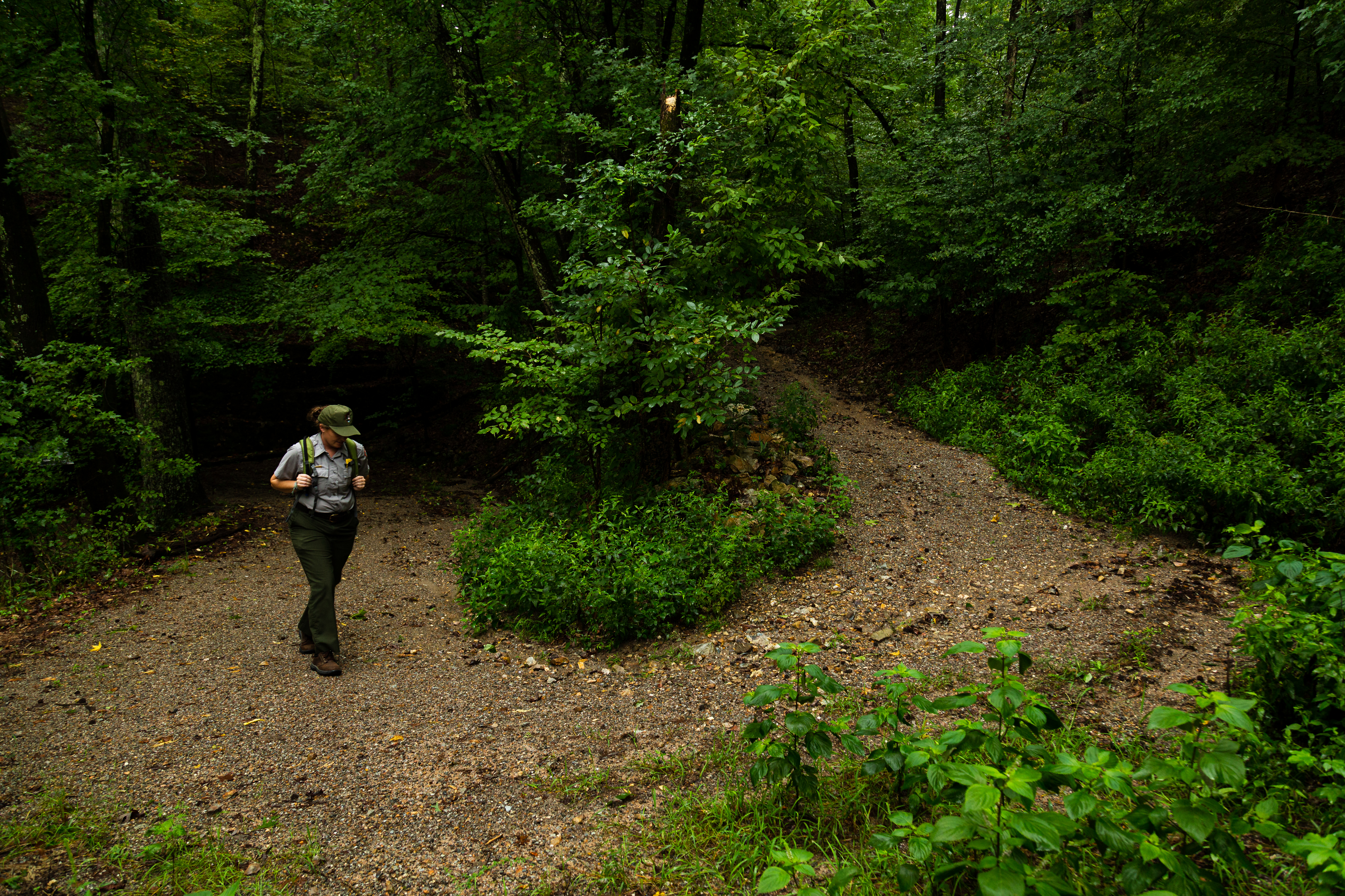
A ranger in uniform walks up the curved trail through the forest.
A ranger walks up the Canyon Trail. Photo: NPS Photo/Mitch Smith

The West Mountain trails can be reached from downtown via Canyon Trail. The trailhead is behind the Mountain Valley Water building. The section between West Mountain Drive and West Mountain Trail is very steep.

Distance (one way): 0.7mi (1.1km)

Elevation: 626 - 933ft (191 - 303m)

Typical grade: 10%

Accessibility This is a steep, packed gravel trail. It is not ADA compliant.

This hike on nps.gov

Mountain Top Trail the Park Service's write-up

45-75 Minutes · dogs allowed

Start Trail head

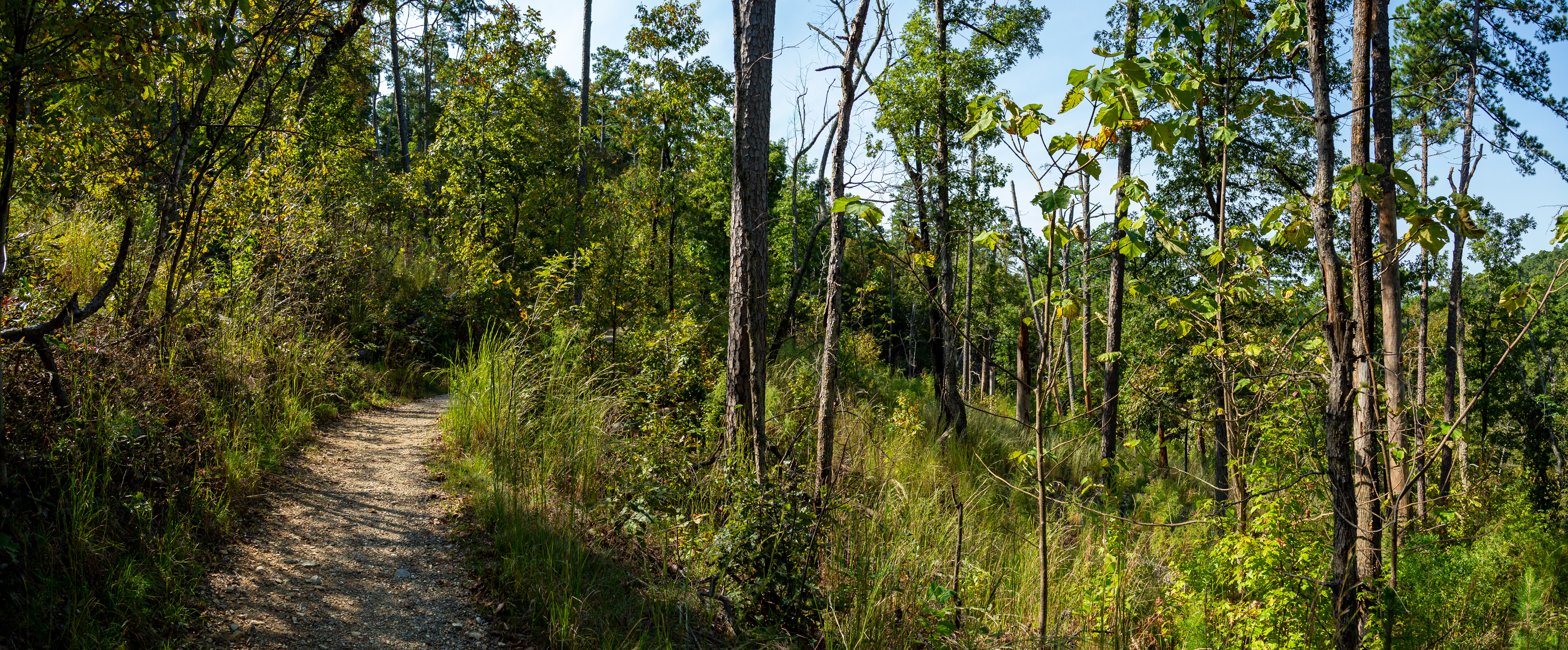
A rocky trail curves through the trees on a hillside.
A view of a trail on West Mountain. Photo: NPS Photo/Mitch Smith

Mountaintop trail can be linked with Canyon Trail and West Mountain trail to complete a loop around West Mountain. If hiking southward, the trail is strenuous, as it gains elevation quickly. If hiking northward, there is a steady rise in elevation until you cross Sunset Trail; the trail descends steeply to the trailhead at Whittington Park.

Distance (one way): 1.5mi (2.4km)

Elevation: 675 - 1100ft (206 - 335m)

Typical grade: 5.4%

Accessibility This is a rocky, packed gravel, steep trail. It is not ADA compliant.

This hike on nps.gov

Floral Trail

0.4 mi one way · about 100 ft of climbing · 701 ft–806 ft

753 ft 806 ft · 0.3 mi high 806 ft

Floral Trail the Park Service's write-up

20-40 Minutes · dogs allowed

Start Trail head

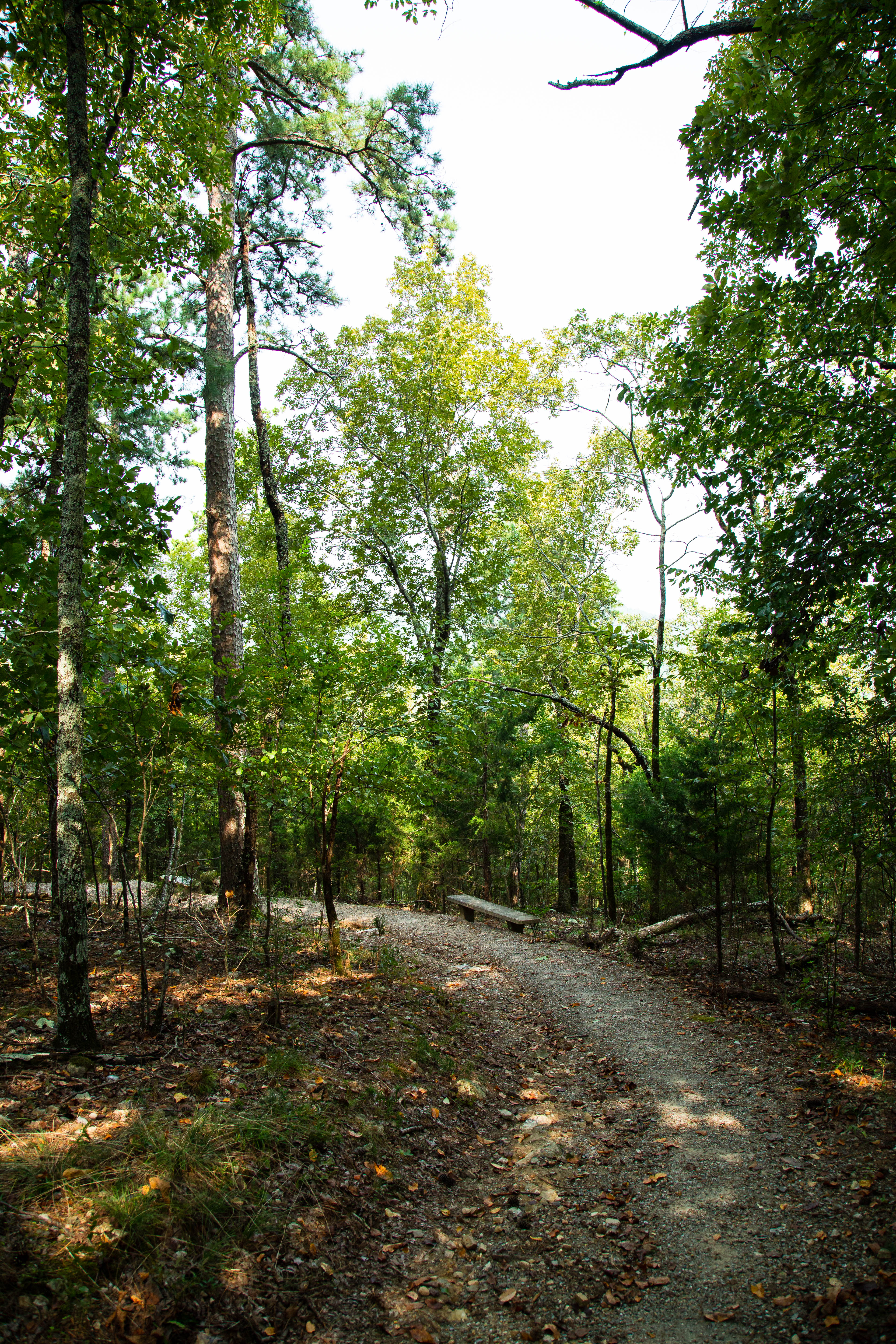
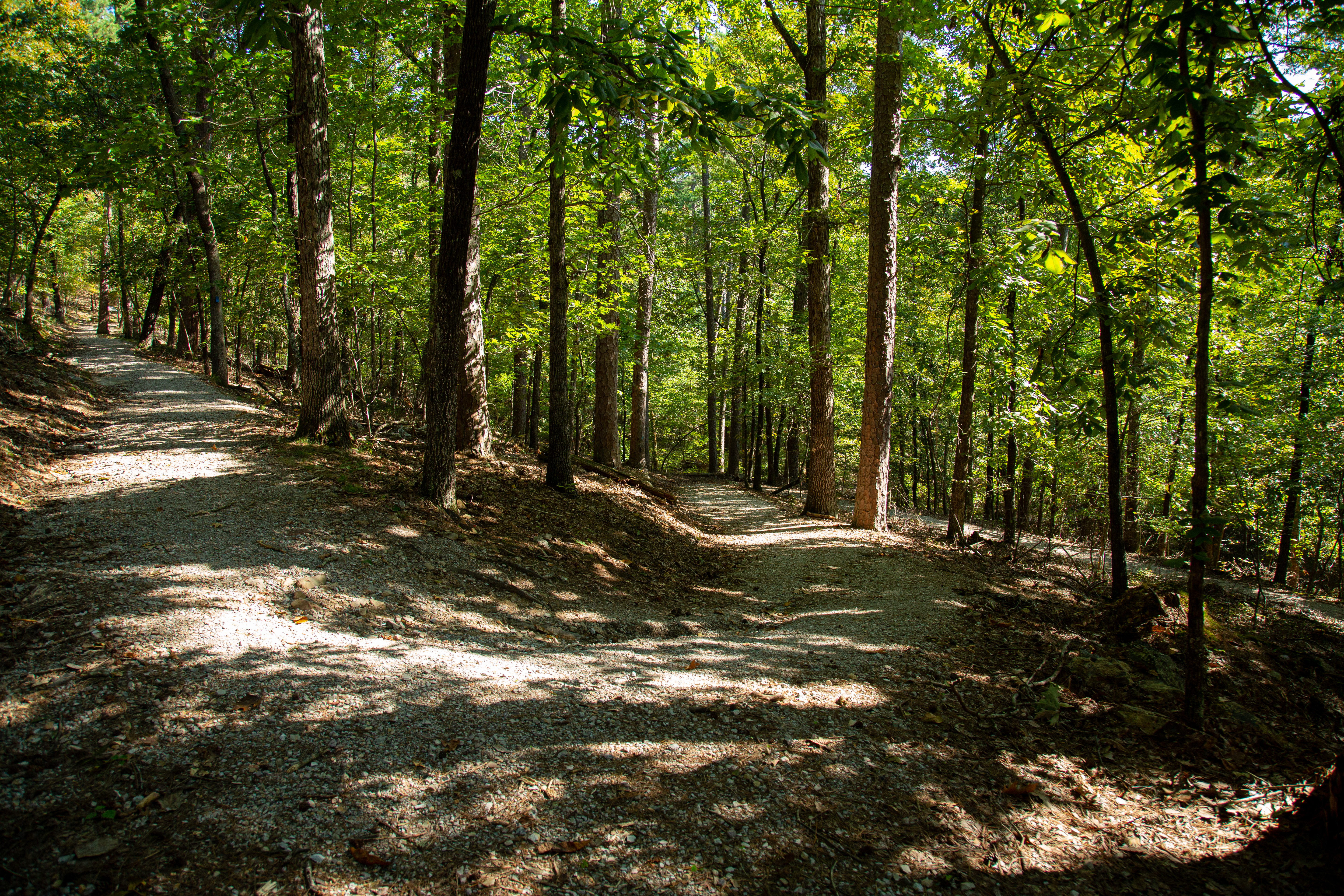
A packed gravel path leads through a forested hillside.
A view of a trail on Hot Springs Mountain. Photo: NPS Photo/Mitch Smith

Floral Trail connects Lower Dogwood Trail and Honeysuckle Trail. From either trailhead you will descend into a valley and climb the other side.

Distance (one way): 0.7mi (1.1km)

Elevation: 690 - 840ft (210 - 256km)

Typical grade: 4.1%

Accessibility This is a rocky, packed gravel trail. It is not ADA complaint.

This hike on nps.gov

Fountain Trail

0.1 mi one way · 50 ft of descent · 654 ft–702 ft

702 ft 654 ft · 0.1 mi high 702 ft

Fountain Trail the Park Service's write-up

10-25 Minutes · dogs allowed

Start Trail head

A gravel path leads through an a hillside forest.
A view from Hot Springs Mountain. Photo: NPS Photo/Mitch Smith

This short trail begins on Fountain Street below the entrance to Hot Springs Mountain Drive. Use it to reach Honeysuckle Trail by crossing the road.

Distance (one way): 0.2mi (0.3km)

Elevation: 657 - 760ft (200 - 232km)

Typical grade: 9.8%

Accessibility This is a packed gravel, steep trail. It is not ADA compliant.

This hike on nps.gov

Goat Rock Trail

1.0 mi one way · about 300 ft of climbing · 784 ft–1,072 ft

784 ft 1,072 ft · 0.9 mi high 1,072 ft

Goat Rock Trail the Park Service's write-up

30-75 Minutes · dogs allowed

Start Trail head

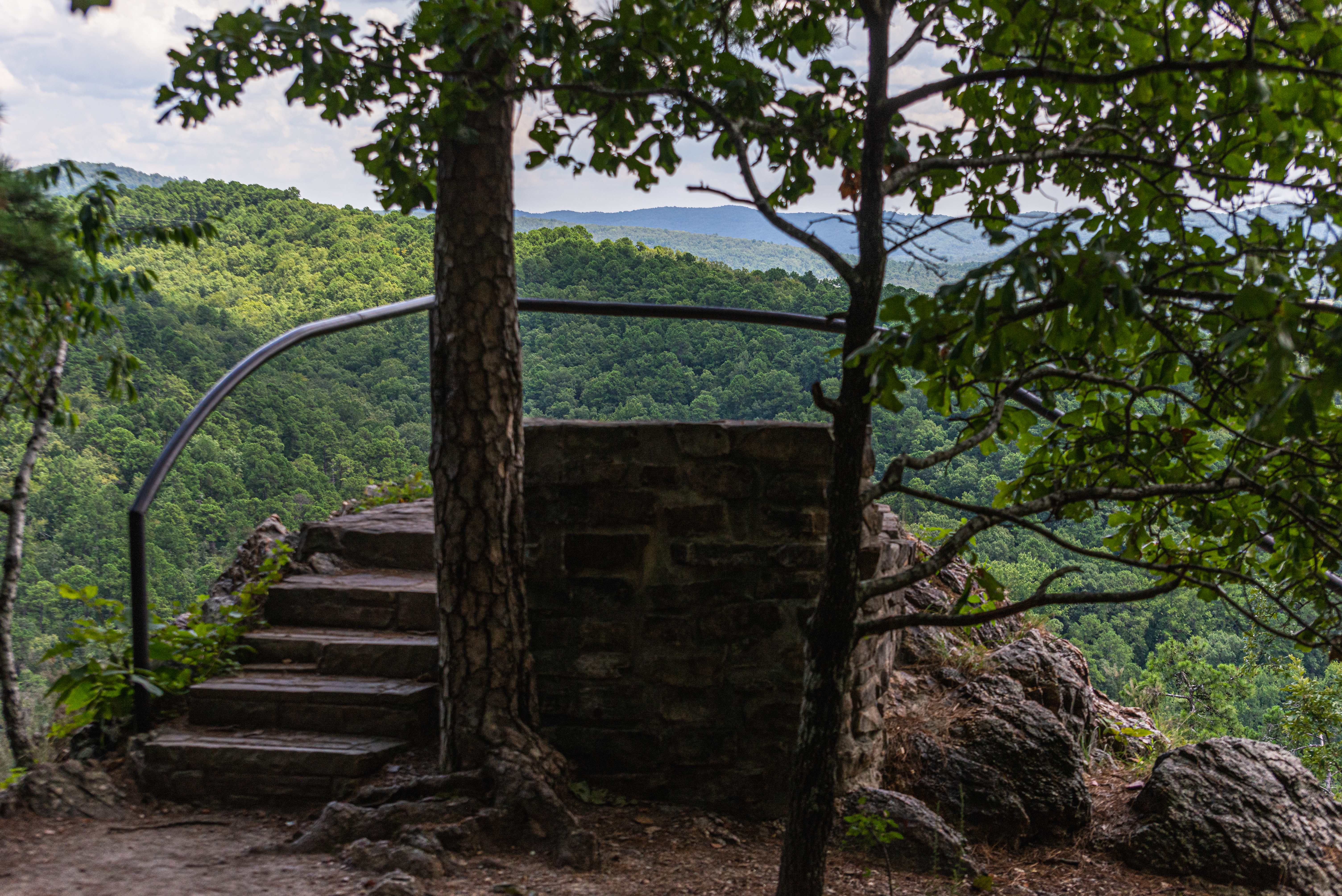
A black metal rail surrounds an outcropping overlooking rolling, forested hills.
The Goat Rock viewpoint Photo: NPS Photo/Mitch Smith

The Goat Rock trail offers stunning views of the Ouachita Mountains and the recharge zone for the thermal springs. Limited parking is available at the overlook on North Mountain. The trailhead starts south of the parking area.

Distance (one way): 1.1mi (1.8km)

Elevation: 886 - 1067ft (270 - 325m)

Typical grade: 3.2%

Accessibility This is a rocky, packed gravel and packed dirt trail. It is not ADA compliant.

This hike on nps.gov

Grand Avenue Trail

0.1 mi one way · 40 ft of descent · 574 ft–613 ft

613 ft 574 ft · 0.1 mi high 613 ft

Grand Avenue Trail the Park Service's write-up

10-20 Minutes · dogs allowed

Start Trail head

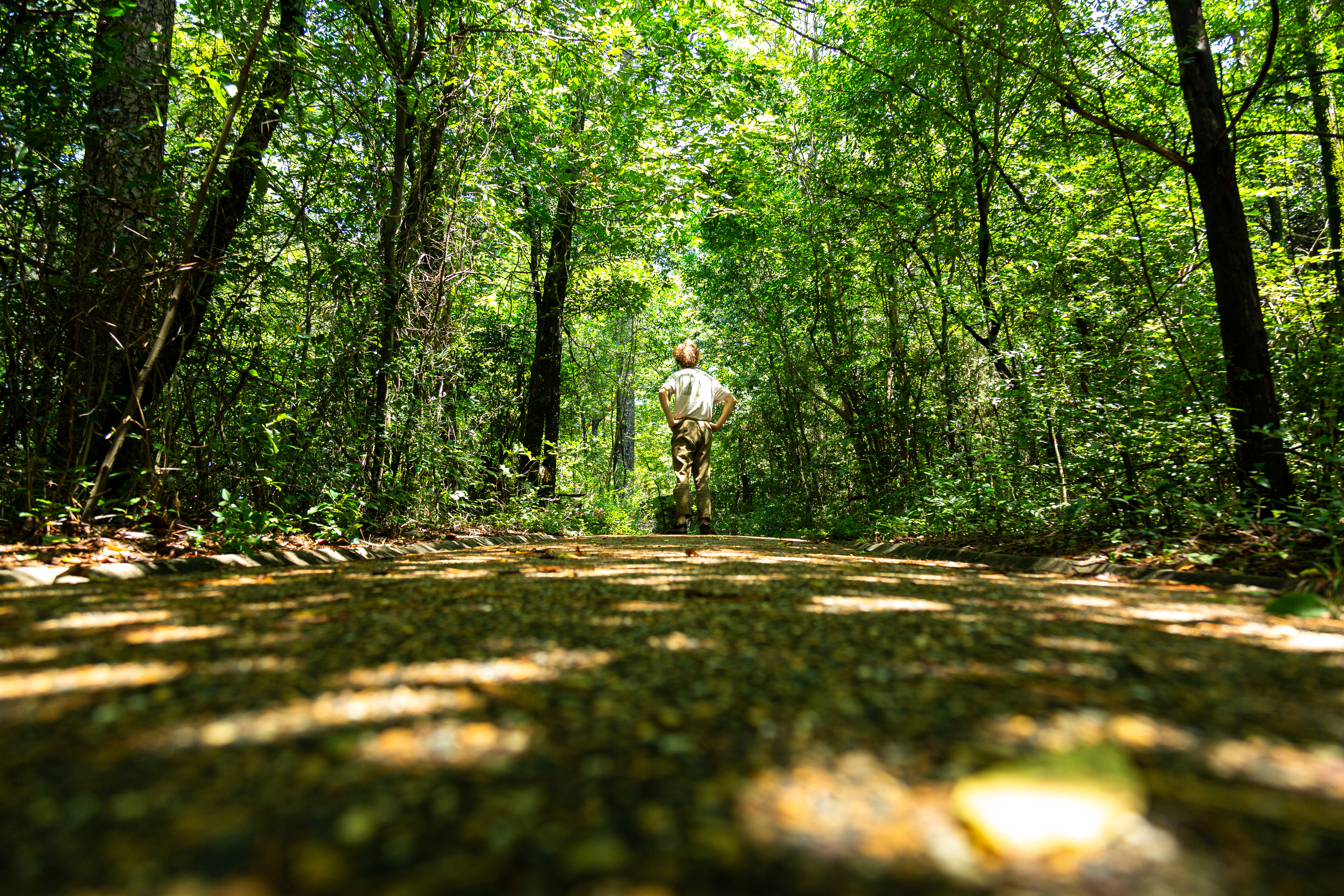
A young man stands in the middle of a packed gravel trail looking up to the lush green trees.
Looking up on the trail Photo: NPS Photo/Mitch Smith

Grand Avenue Trail connects Oertel Trail with Grand Avenue. A local motel lies just south of the trailhead.

Distance (one way): 0.2mi (0.3km)

Elevation: 581 - 631ft (177 - 192m)

Typical grade: 4.7%

Accessibility This is a packed gravel trail. It is not ADA compliant.

This hike on nps.gov

Grand Promenade

0.4 mi one way · about 30 ft of climbing · 50 ft of descent · 618 ft–671 ft

645 ft 618 ft · 0.4 mi high 671 ft

Grand Promenade National Recreation Trail the Park Service's write-up

30-60 Minutes · dogs allowed

Start South Entrance

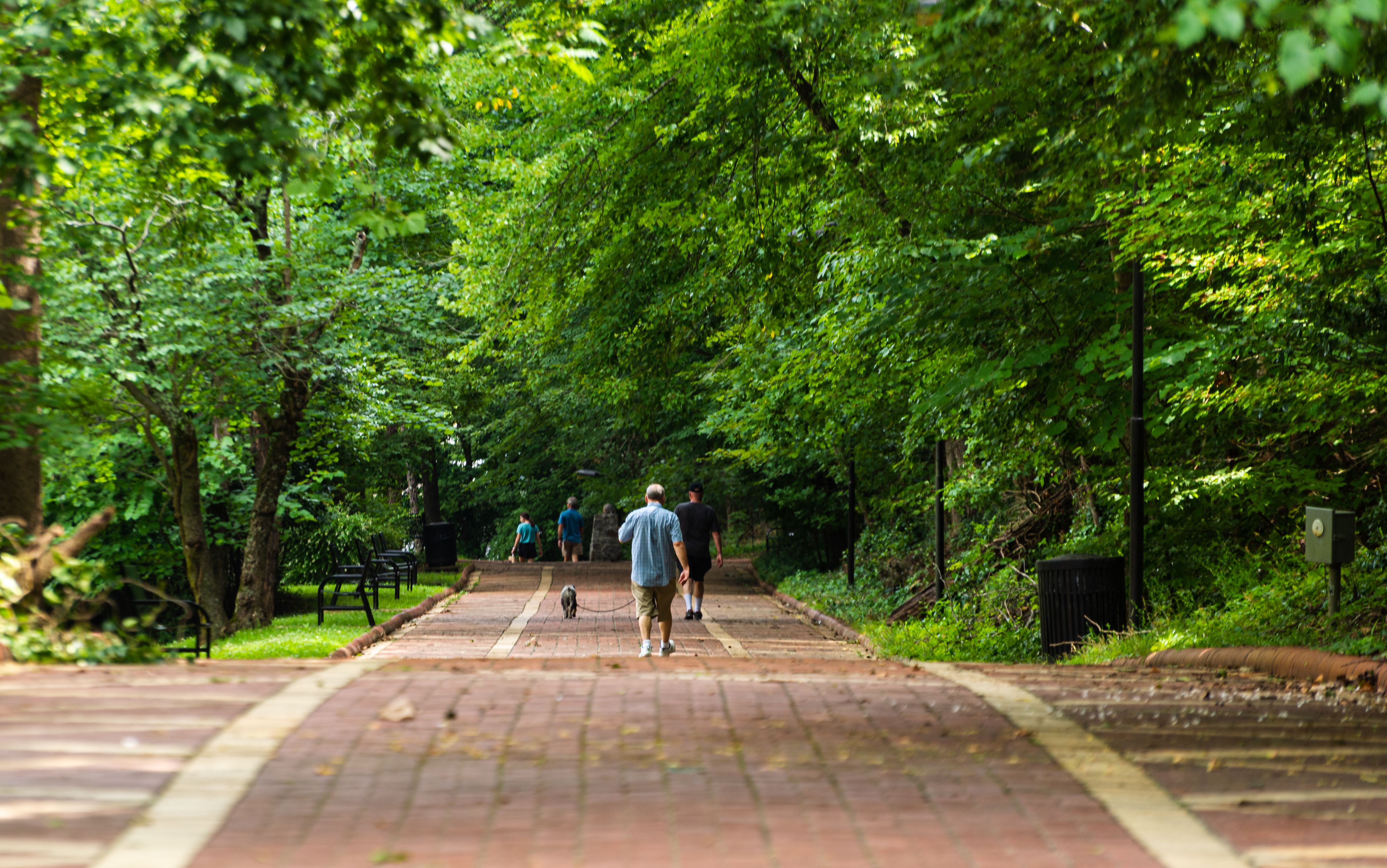
A man walks with his dog down a red brick path surrounded by bright green trees.
The Grand Promenade Photo: NPS Photo/Mitch Smith

This National Recreation Trail is the entry point for many of the Hot Springs and North Mountain trails from downtown. Oertel, Peak, and Tufa Terrace trails all branch off from the Grand Promenade and lead to other trails. The Grand Promenade has four entry points: Reserve Street (stairs), Fountain Street (ramp), Stephen’s Balustrade (grand staircase), and an access ramp behind the Fordyce Bathhouse.

Distance (one way): 0.5 mi (0.8km)

Elevation: 619 - 717 ft. (188 - 218m)

Typical grade: 3.7%

Accessibility The Grand Promenade is an 8 foot wide paved, brick pathway with a grade of 3.7%.

This hike on nps.gov

Oertel Trail the Park Service's write-up

30-60 Minutes · dogs allowed

Start Trailhead

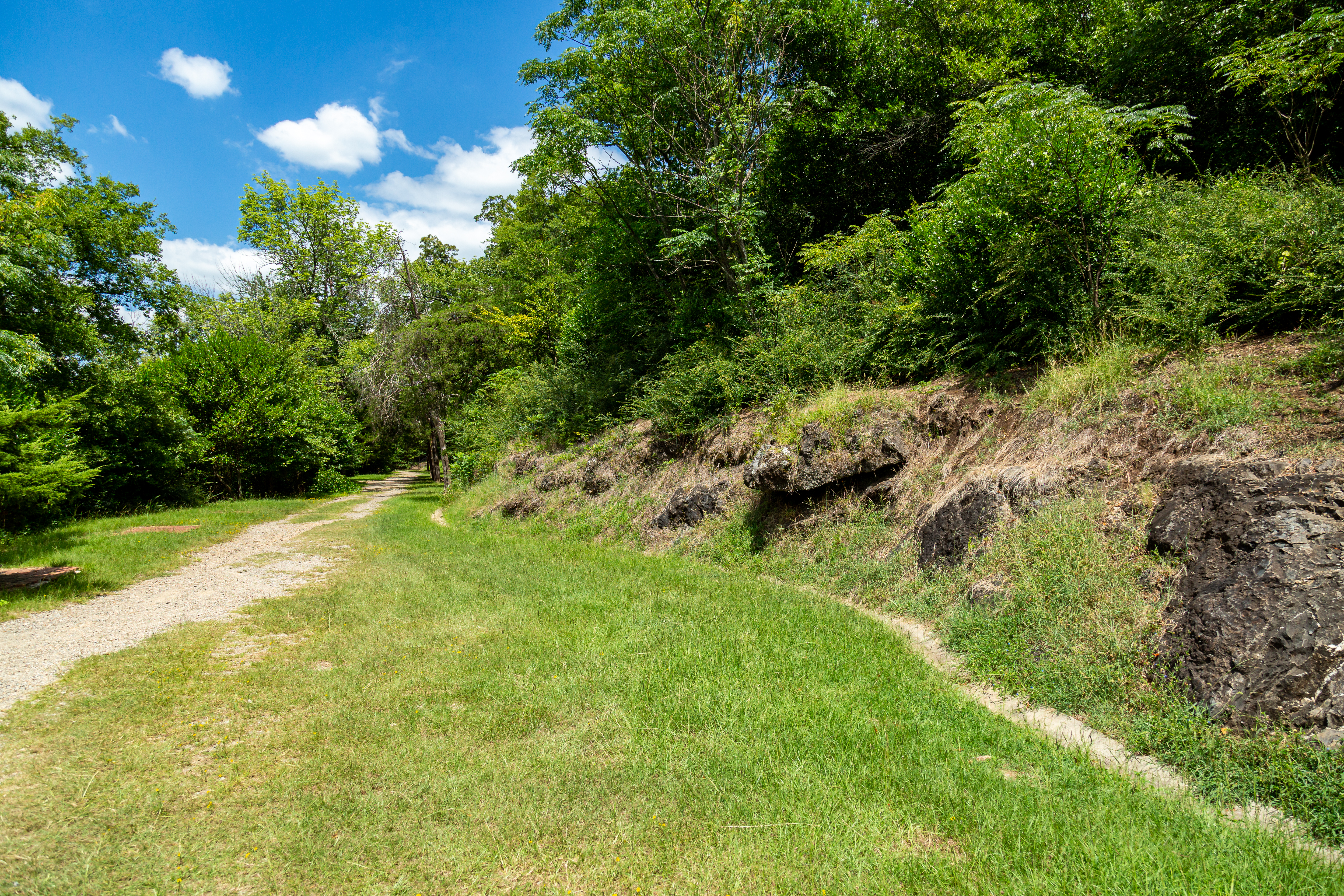
Gravel paths converge on the grass.
The path to the Oertel Trail Photo: NPS Photo/Mitch Smith

The Oertel Trail is formerly known as the Dead Chief Trail.

From downtown, ascend the Stephen's Balustrade (grand staircase) behind the Fordyce Visitor Center to the Grand Promenade and climb the next two sets of steps until you reach the gravel road. Take the road right until you reach an iron gate; the trailhead begins here. Oertel Trail ranges from moderate to very steep grade.

Distance (one way): 1.4mi (2.3km)

Elevation: 670 - 863ft. (204 - 263m)

Typical grade: 2.6%

Accessibility The Oertel Trail is a steep, bumpy gravel trail and is not ADA accessible.

This hike on nps.gov

Tufa Terrace Trail the Park Service's write-up

15-30 Minutes · dogs allowed

Start Lower Tufa Terrace Trailhead

A railed, thin pathway leads through bright green trees and brush.
Lower Tufa Terrace Trail Photo: NPS Photo/Mitch Smith

This paved trail can be reached from the Grand Promenade or Arlington Lawn. The lower portion of the Tufa Terrace Trail is near the Hot Water Cascade.

Distance (one way): 0.3 mi (0.5km)

Elevation: 650ft - 745ft (198 - 227m)

Typical Grade: 6%

Accessibility The Tufa Terrace is not consdiered to be ADA compliant, as there are stairs at various places throughout the trail.

This hike on nps.gov

Gulpha Gorge Trail

0.7 mi one way · 400 ft of descent · 538 ft–931 ft

931 ft 539 ft · 0.7 mi high 931 ft

Gulpha Gorge Trail the Park Service's write-up

30-60 Minutes · dogs allowed

Start Trail head

A stone pathway crossed a flowing river with tall trees in the background.
Gulpha Gorge trail crosses Gulpha Creek before heading up the mountain. Photo: NPS Photo/Mitch Smith

Gulpha Gorge Trail connects the Gulpha Gorge Campground to many of the park's trails. The trail going west from the campground is steep.

Distance (one way): 0.6mi (1.0km)

Elevation: 530 - 968ft (162 - 295m)

Typical grade: 13.8%

Accessibility This is a steep, packed dirt trail. It is not ADA compliant.

This hike on nps.gov

Honeysuckle Trail

1.0 mi one way · about 300 ft of climbing · 727 ft–855 ft

781 ft 855 ft · 0.5 mi high 855 ft

Floral Trail the Park Service's write-up

20-40 Minutes · dogs allowed

Start Trail head

A packed gravel path leads through a forested hillside.
A view of a trail on Hot Springs Mountain. Photo: NPS Photo/Mitch Smith

Floral Trail connects Lower Dogwood Trail and Honeysuckle Trail. From either trailhead you will descend into a valley and climb the other side.

Distance (one way): 0.7mi (1.1km)

Elevation: 690 - 840ft (210 - 256km)

Typical grade: 4.1%

Accessibility This is a rocky, packed gravel trail. It is not ADA complaint.

This hike on nps.gov

Honeysuckle Trail the Park Service's write-up

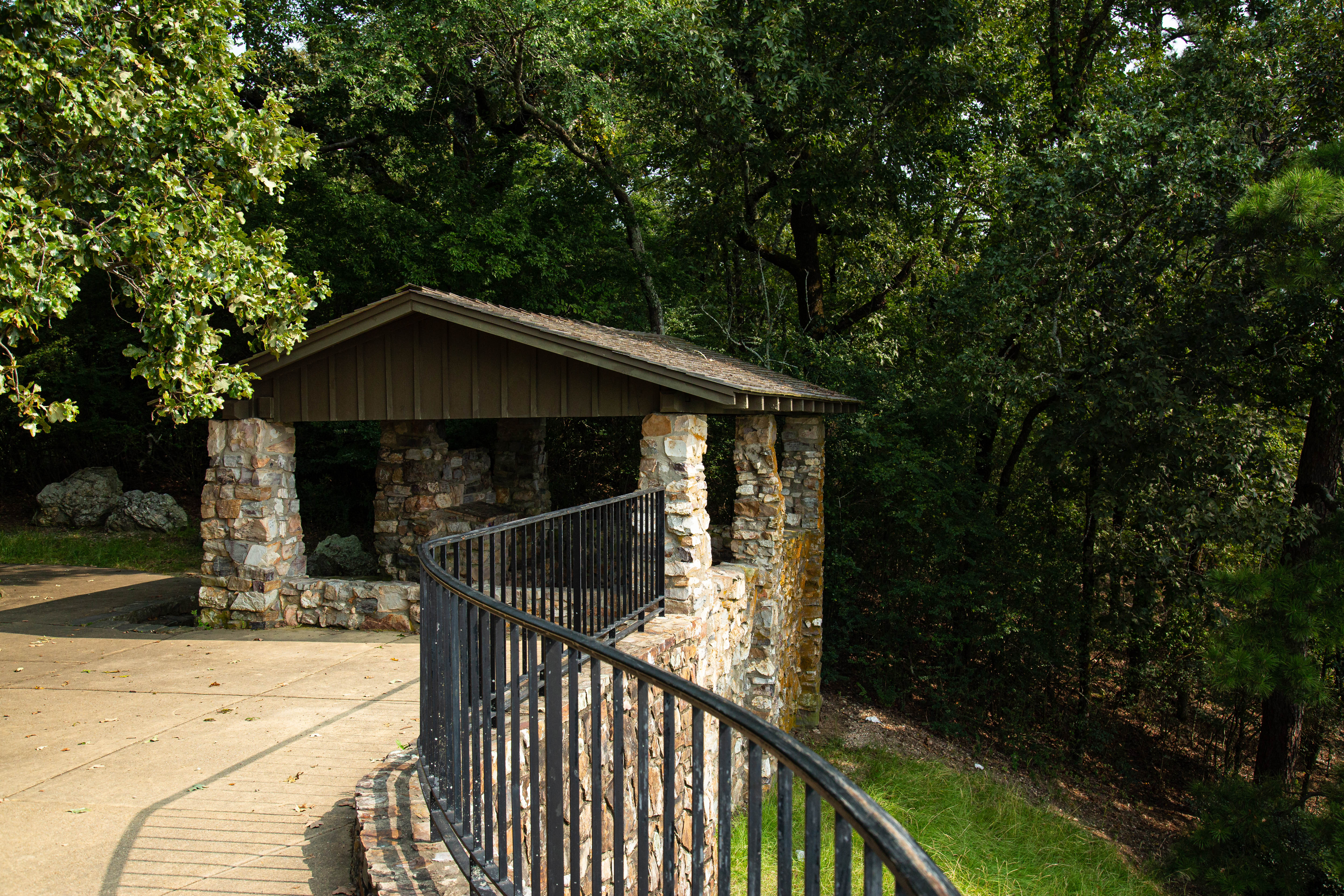
20-45 Minutes · dogs allowed

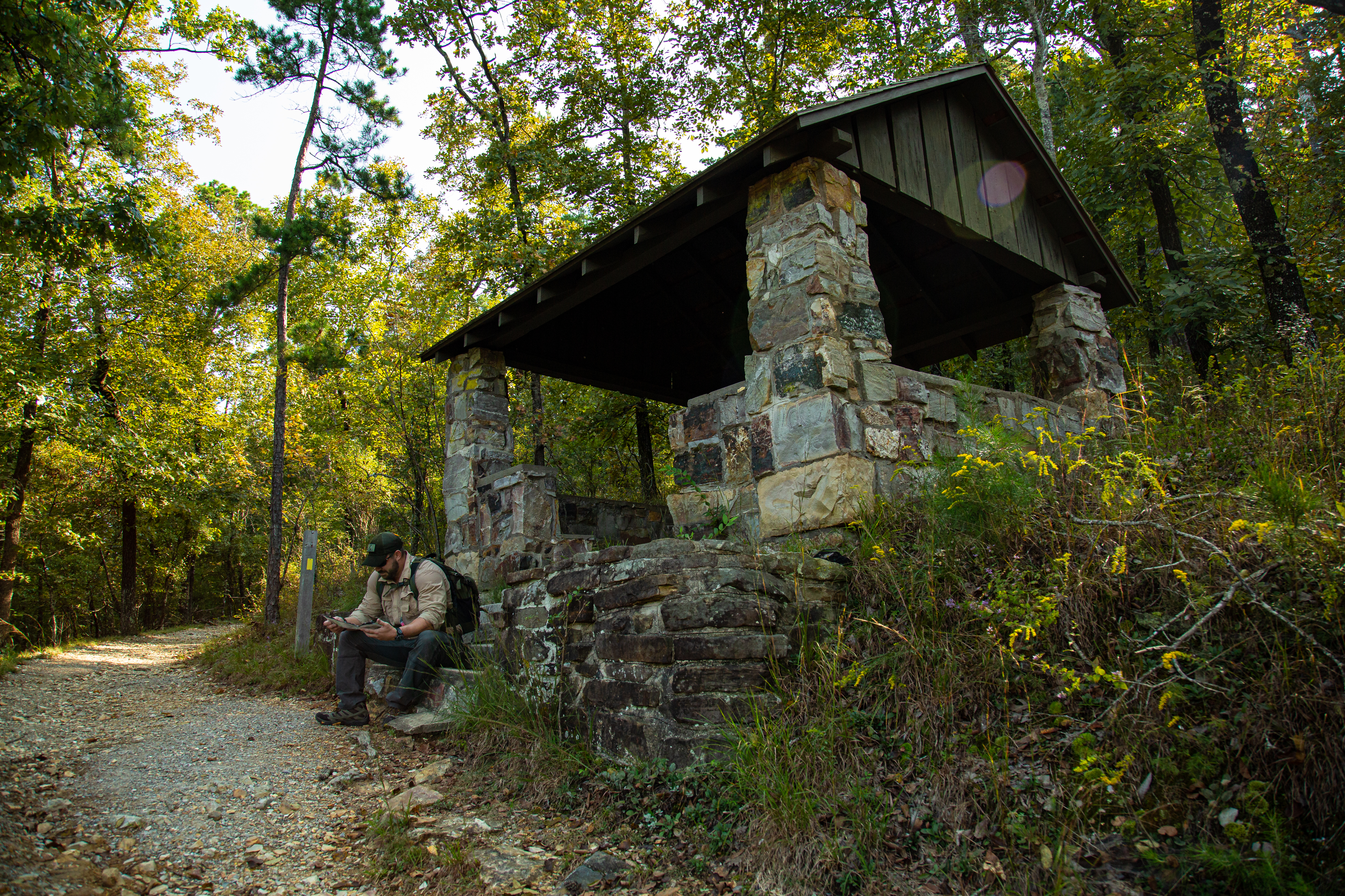
A stone shelter built in a 1930s style sits alongside a gravel trail.
Shelter at the intersection of the Honeysuckle and Floral Trail. Photo: NPS Photo/Mitch Smith

Honeysuckle Trail connects Peak Trail with Hot Springs Mountain Trail.

Distance (one way): 0.5mi (0.8km)

Elevation: 727 - 870ft. (222 - 265m)

Typical grade: 5.4%

Accessibility This trail is narrow, steep, rocky, and made primarily of packed gravel. It is not an ADA compliant trail.

This hike on nps.gov

Hot Springs Mountain Trail

1.6 mi loop · about 250 ft of climbing · 820 ft–969 ft

963 ft 939 ft · 1.6 mi high 969 ft

An Overview: Hot Springs and North Mountain Trails the Park Service's write-up

30-300 Minutes · dogs allowed

Start Hot Springs Mountain

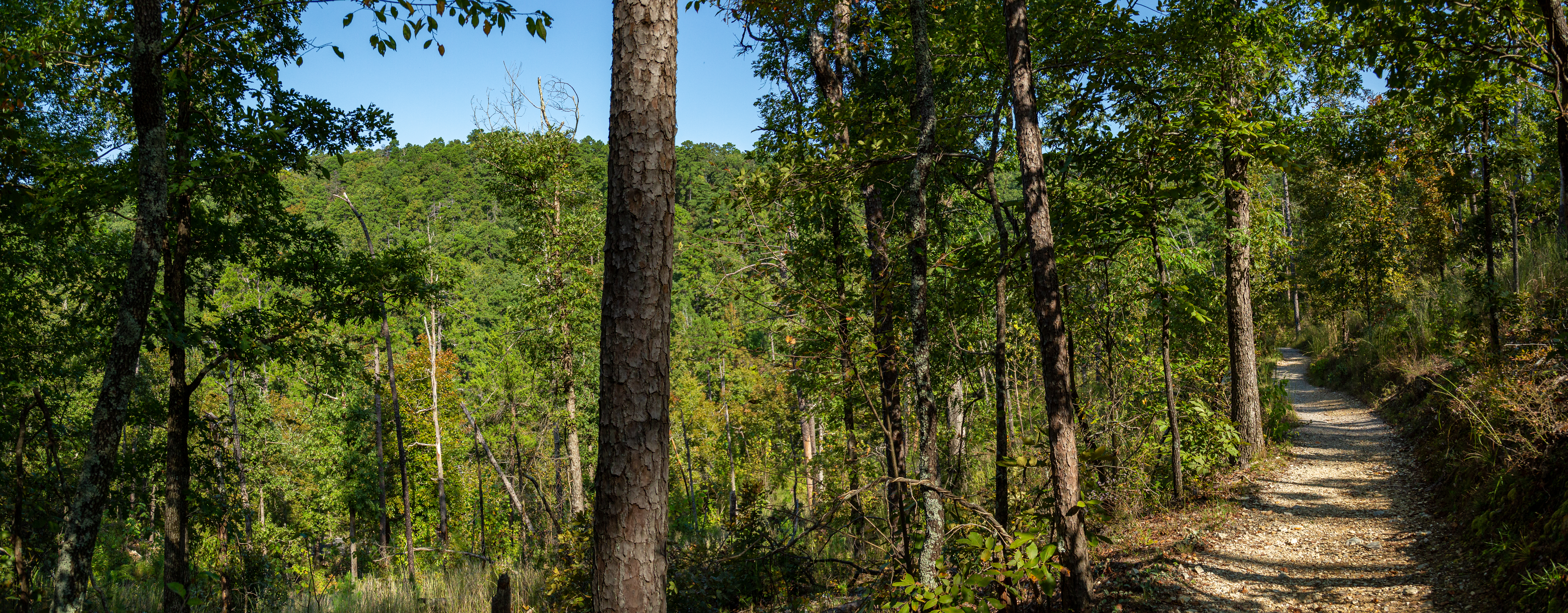
Gravel hiking trail surrounded by a dense forrest.
Hot Springs Mountain Trail Photo: NPS Photo/Mitch Smith

The Hot Springs and North Mountain trails are popular since they are easy to reach and provide scenic views. You can get to these trails via Stephen’s Balustrade (grand staircase) behind the Fordyce Bathhouse, Hot Springs Mountain Drive, and the Gulpha Gorge Campground. See the Hot Springs and North Mountain trail map for more information.

Easy:

Grand Promenade - This National Recreation Trail is the entry point for many of the Hot Springs and North Mountain trails from downtown. Oertel, Peak, and Tufa Terrace trails all branch off from the Grand Promenade and lead to other trails. The Grand Promenade has four entry points: Reserve Street (stairs), Fountain Street (ramp), Stephen’s Balustrade (grand staircase), and an access ramp behind the Fordyce Bathhouse.

Distance (one way): 0.5mi (0.8km)

Elevation gain: 619-717ft (188-218m)

Grade: 3.7%

Tufa Terrace Trail - This paved trail can be reached from the Grand Promenade or Arlington Lawn. The lower portion of the Tufa Terrace Trail is near the Hot Water Cascade.

Distance (one way): 0.3mi (0.5km)

Elevation gain: 650-745ft (198-227m)

Grade: 6%

Reserve Trail - Reserve Trail connects Oertel Trail with Spring Street and Reserve Street at a "Y" intersection.

Distance (one way): 0.3mi (0.5km)

Elevation gain: 622-713ft (190-217m)

Grade: 5.7%

Grand Avenue Trail - Grand Avenue Trail connects Oertel Trail with Grand Avenue. A local motel lies just south of the trailhead.

Distance (one way): 0.2mi (0.3km)

Elevation gain: 581-631ft (177-192m)

Grade: 4.7%

Arlington Trail - Ask for directions to the trailhead from staff at the Arlington Hotel lobby. Arlington Trail will connect with Lower Dogwood Trail.

Distance (one way): 0.1mi (0.2km)

Elevation gain: 718-731ft (219-223m)

Grade: 2.5%

Moderate:

Peak Trail - The beginning of Peak Trail is paved then turns to gravel. Peak Trail leads to the Hot Springs Mountain Tower.

Distance (one way): 0.6mi (1.0km)

Elevation gain: 644-1044ft (196-318m)

Grade: 12.6%

Hot Springs Mountain Trail - Hot Springs Mountain Trail is a moderate stroll around the top of the mountain with several scenic overlooks.

Distance (one way): 1.7mi (2.7km)

Elevation gain: 952-994ft (290-303m)

Grade: 0.5%

Honeysuckle Trail - Honeysuckle Trail connects Peak Trail with Hot Springs Mountain Trail.

Distance (one way): 0.5mi (0.8km)

Elevation gain: 727-870ft (222-265m)

Grade: 5.4%

Fountain Trail - This short trail begins on Fountain Street below the entrance to Hot Springs Mountain Drive. Use it to reach Honeysuckle Trail by crossing the road.

Distance (one way): 0.2mi (0.3km)

Elevation gain: 657-760ft (200-232m)

Grade: 9.8%

Goat Rock Trail - Limited parking is available at the overlook on North Mountain. The trailhead starts south of the parking area.

Distance (one way): 1.1mi (1.8km)

Elevation gain: 886-1067ft (270-325m)

Grade: 3.2%

Floral Trail - Floral Trail connects Lower Dogwood Trail and Honeysuckle Trail. From either trailhead you will descend into a valley and climb the other side.

Distance (one way): 0.7mi (1.1km)

Elevation gain: 690-840ft (210-256m)

Grade: 4.1%

Lower Dogwood Trail - Lower Dogwood Trail climbs North Mountain. Near the top, boulders mark the westernmost tip of the trail. From there, the trail drops downhill.

Distance (one way): 0.7mi (1.1km)

Elevation gain: 784-953ft (239-290m)

Grade: 4.6%

Upper Dogwood Trail - Upper Dogwood trail has short rises and long stretches of flat trail.

Distance (one way): 1.0mi (1.6km)

Elevation gain: 880-1131ft (268-345m)

Grade: 4.8%

Strenuous:

Oertel Trail (formerly Dead Chief Trail) - From downtown, ascend the Stephen's Balustrade (grand staircase) behind the Fordyce Visitor Center to the Grand Promenade and climb the next two sets of steps until you reach the gravel road. Take the road right until you reach an iron gate; the trailhead begins here. Oertel Trail ranges from moderate to very steep grade.

Distance (one way): 1.4mi (2.3km)

Elevation gain: 670-863ft (204-263m)

Grade: 2.6%

Shortcut Trail - Short Cut Trail connects Oertel Trail with Hot Springs Mountain Trail near a picnic area.

Distance: 0.2mi (0.3km)

Elevation gain: 813-1036ft (247-316m)

Grade: 21.1%

Gulpha Gorge Trail - Gulpha Gorge Trail connects the Gulpha Gorge Campground to many of the park's trails. The trail going west from the campground is steep.

Distance (one way): 0.6mi (1.0km)

Elevation gain: 530-968ft (162-295m)

Grade: 13.8%

Accessibility Accessibility information will vary by trail location. Please check with the individual trail for more specific information. Service animals are allowed at all locations.

This hike on nps.gov

Fountain Trail the Park Service's write-up

10-25 Minutes · dogs allowed

Start Trail head

A gravel path leads through an a hillside forest.
A view from Hot Springs Mountain. Photo: NPS Photo/Mitch Smith

This short trail begins on Fountain Street below the entrance to Hot Springs Mountain Drive. Use it to reach Honeysuckle Trail by crossing the road.

Distance (one way): 0.2mi (0.3km)

Elevation: 657 - 760ft (200 - 232km)

Typical grade: 9.8%

Accessibility This is a packed gravel, steep trail. It is not ADA compliant.

This hike on nps.gov

Honeysuckle Trail the Park Service's write-up

20-45 Minutes · dogs allowed

A stone shelter built in a 1930s style sits alongside a gravel trail.
Shelter at the intersection of the Honeysuckle and Floral Trail. Photo: NPS Photo/Mitch Smith

Honeysuckle Trail connects Peak Trail with Hot Springs Mountain Trail.

Distance (one way): 0.5mi (0.8km)

Elevation: 727 - 870ft. (222 - 265m)

Typical grade: 5.4%

Accessibility This trail is narrow, steep, rocky, and made primarily of packed gravel. It is not an ADA compliant trail.

This hike on nps.gov

Hot Springs Mountain Trail the Park Service's write-up

45-75 Minutes · dogs allowed

Start Trail head

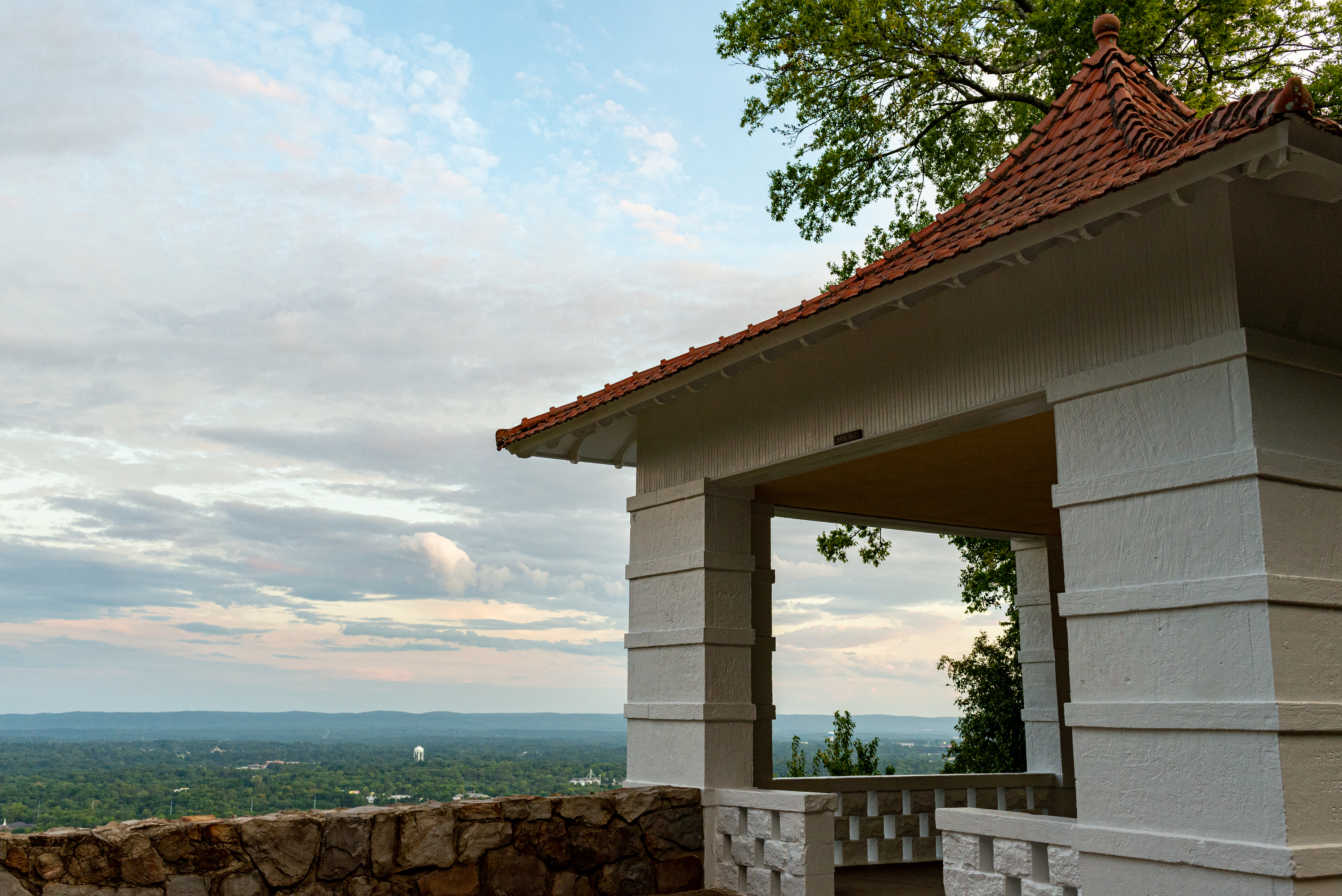
A white pagoda with a red roof sits on the edge of a hillside.
Hot Springs Mountain pagoda Photo: NPS Photo/Mitch Smith

Hot Springs Mountain Trail is an easy stroll around the top of the mountain with several scenic overlooks.

Distance (one way): 1.7mi (2.7km)

Elevation: 952 - 994ft (290 - 303m)

Typical grade: 0.5%

Accessibility This is not an ADA compliant trail.

This hike on nps.gov

Peak Trail the Park Service's write-up

40 Minutes · dogs allowed

Start Peak Trail

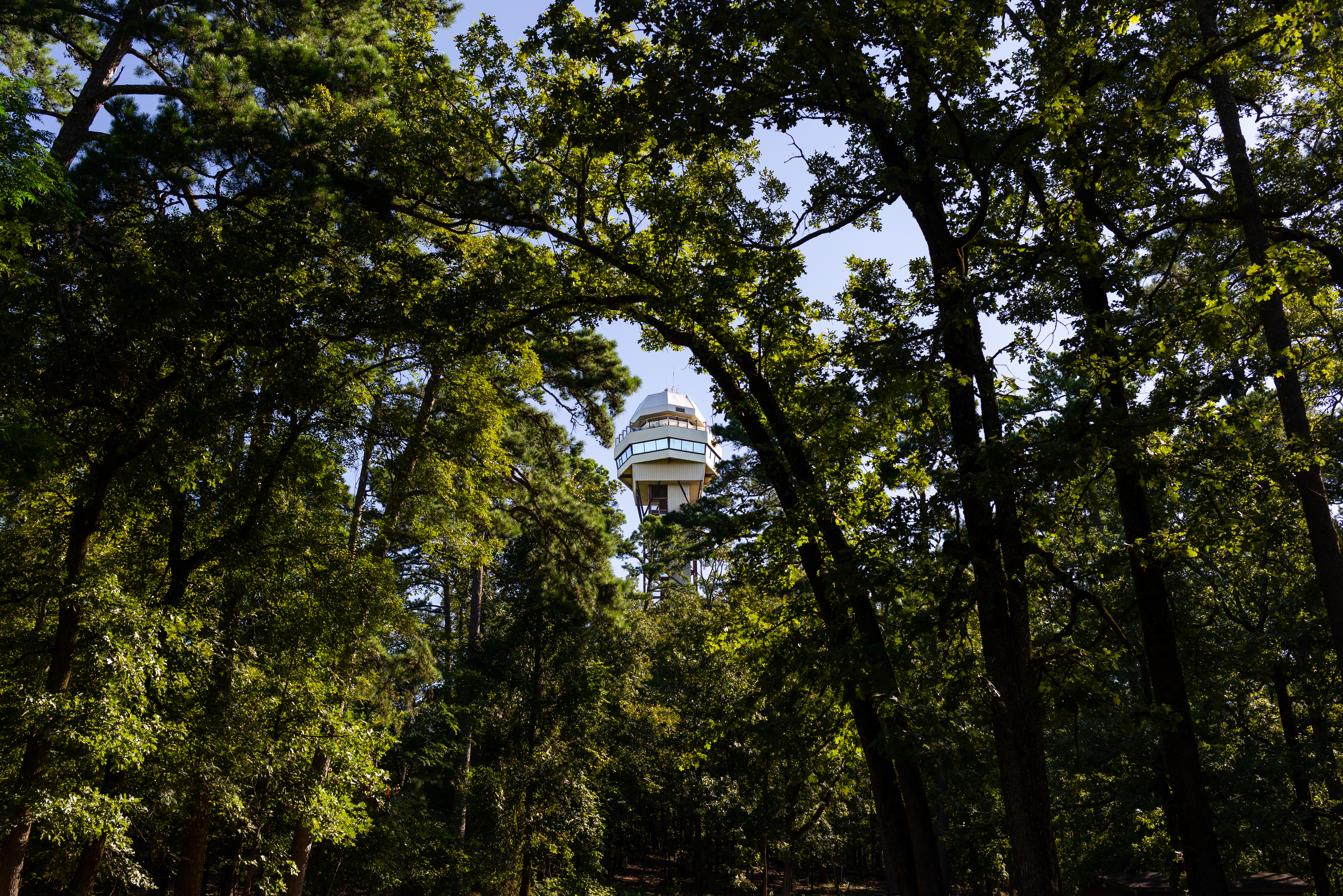
Dense wooded area with a tall mountain observation tower at the peak of the mountain.
Peak Trail to Mountain Tower Photo: NPS Photo/Mitch Smith

The Peak Trail leads directly to the Hot Springs Mountain Tower and the top of Hot Springs Mountain. Visitors can choose to explore the Mountain Tower, take in views from the overlooks, or enjoy a picnic from the top of Hot Springs Mountain. The Peak Trail is a great connector to a lot of the other hiking trails around Hot Springs Mountain for those looking to explore a bit further.

The trailhead is located near the center of the Grand Promenade. From the Fordyce Bathhouse, follow the stairs up behind the Shell Fountain, follow the Grand Promenade to the left, and you'll see the trailhead on the right-hand side. The trail is 0.6 mi (1.0 km) long with an elevation gain of roughly 400 feet (644 - 1044 ft/196-318 m). It has a 12.6% grade and is initially paved before turning to gravel.

See the Hot Springs and North Mountain trail map for more information.

Accessibility The beginning of Peak Trail is paved then turns to gravel. It is a moderate trail: 0.6 mi (1.0 km), 644-1044 ft (196-318 m) elevation, and typical grade of 12.6%.

This hike on nps.gov

Short Cut Trail the Park Service's write-up

10-25 Minutes · dogs allowed

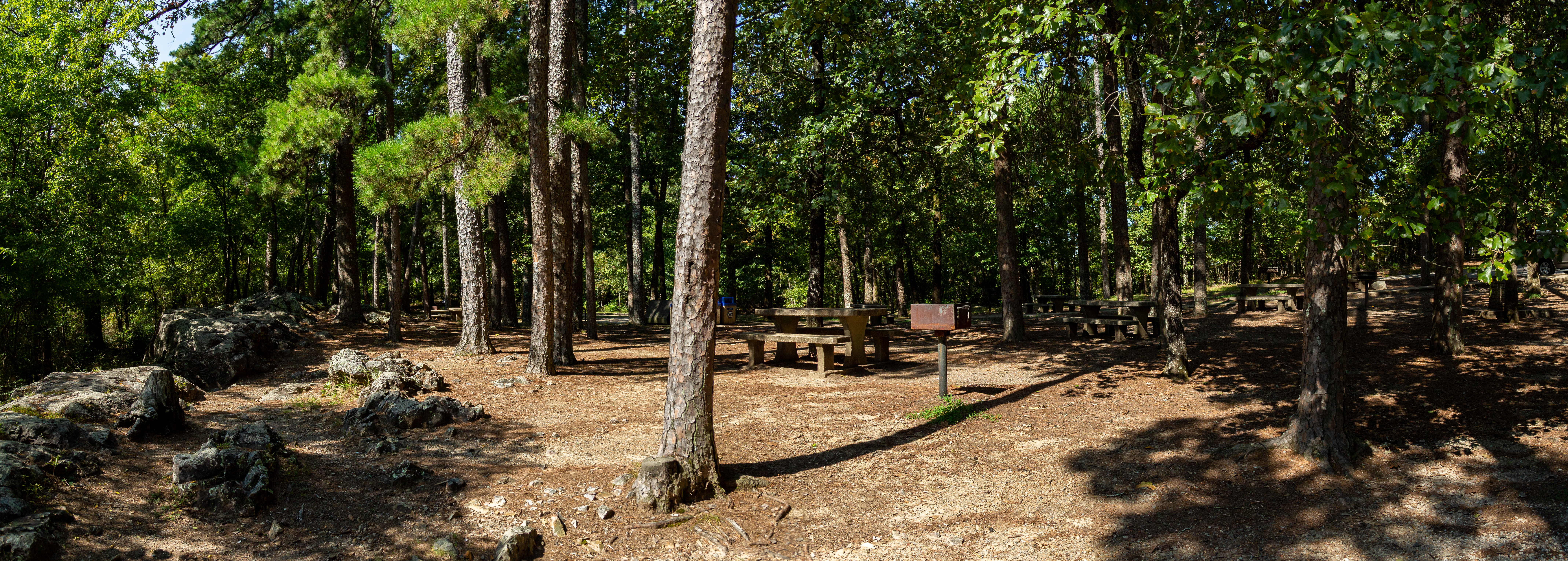
A picnic area with many tables sit beneath the shade of the trees.
View from the Short Cut trailhead Photo: NPS Photo/Mitch Smith

Short Cut Trail connects Oertel Trail with Hot Springs Mountain Trail near the picnic area atop Hot Springs Mountain.

Distance (one way): 0.2 mi (0.3km)

Elevation: 813 - 1036ft. (247 - 316m)

Typical grade: 21.1%

Accessibility This trail is made of loose rocky, gravel. This trail is not ADA compliant.

This hike on nps.gov

Lower Dogwood Trail

0.7 mi loop · about 150 ft of climbing · 746 ft–943 ft

940 ft 882 ft · 0.7 mi high 943 ft

Floral Trail the Park Service's write-up

20-40 Minutes · dogs allowed

Start Trail head

A packed gravel path leads through a forested hillside.
A view of a trail on Hot Springs Mountain. Photo: NPS Photo/Mitch Smith

Floral Trail connects Lower Dogwood Trail and Honeysuckle Trail. From either trailhead you will descend into a valley and climb the other side.

Distance (one way): 0.7mi (1.1km)

Elevation: 690 - 840ft (210 - 256km)

Typical grade: 4.1%

Accessibility This is a rocky, packed gravel trail. It is not ADA complaint.

This hike on nps.gov

Lower Dogwood Trail the Park Service's write-up

15-40 Minutes · dogs allowed

Start Trail head

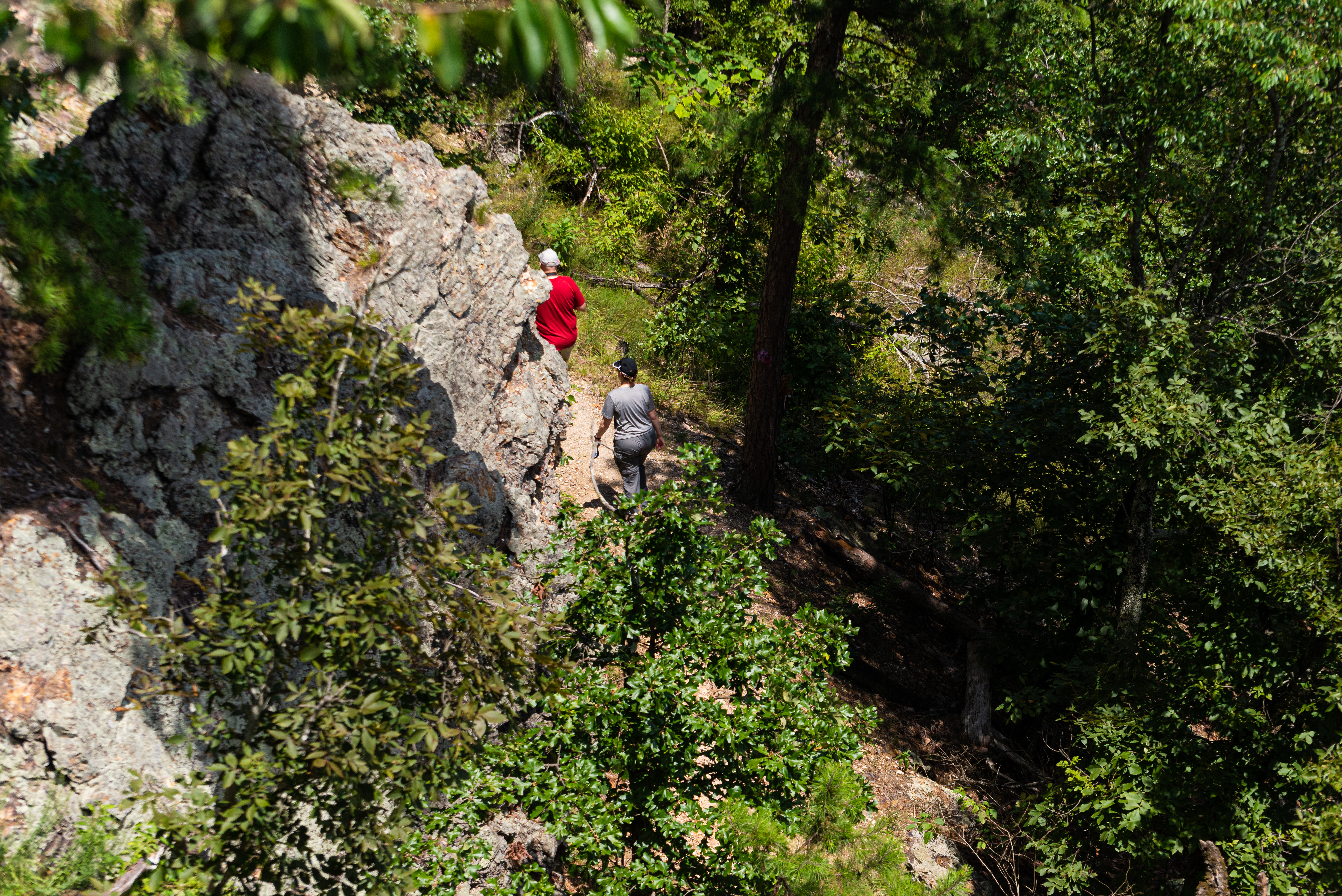
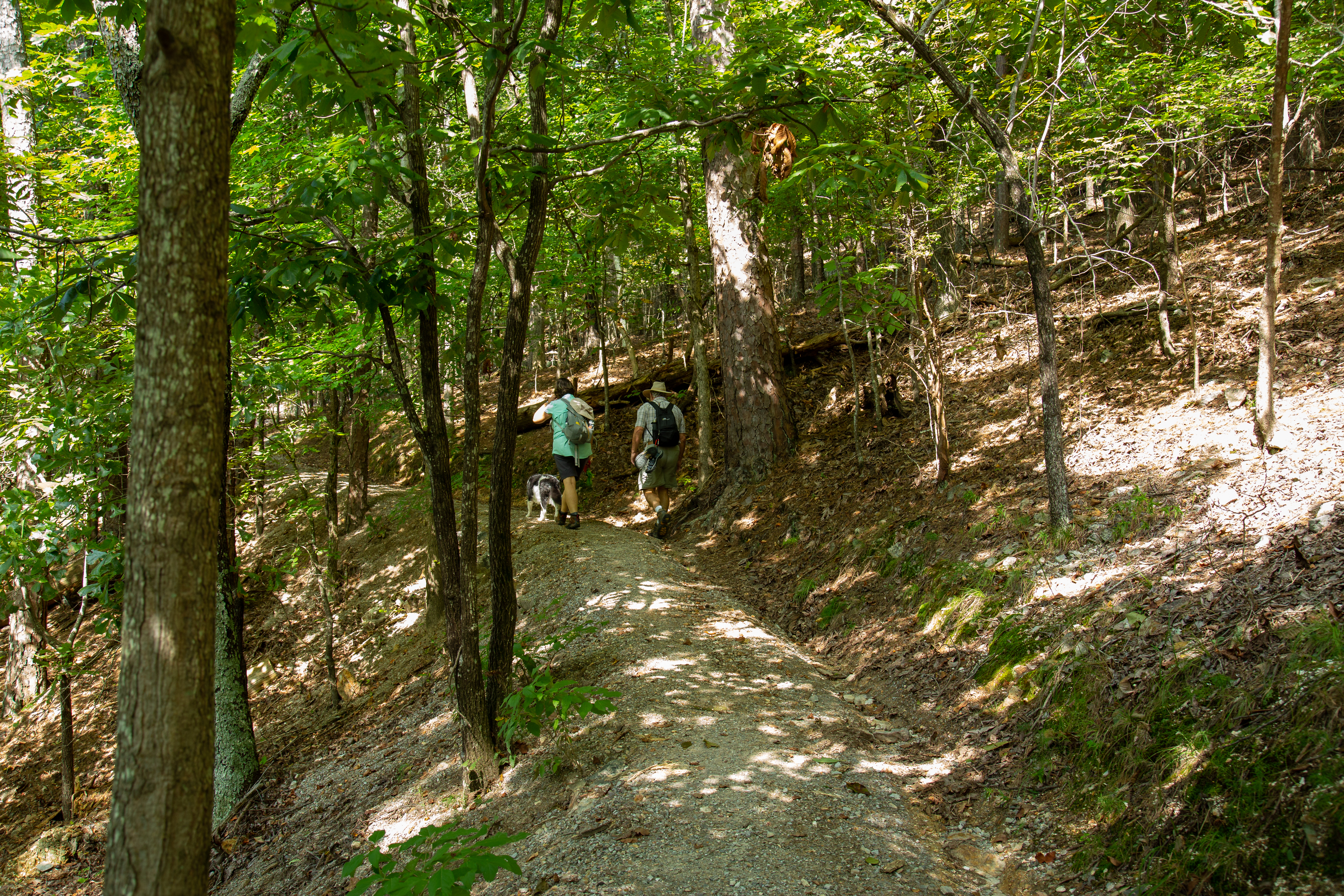
Two people hike along a rocky trail.
Hiking around North Mountain Photo: NPS Photo/Mitch Smith

Lower Dogwood Trail climbs North Mountain. Near the top, boulders mark the westernmost tip of the trail. From there, the trail drops downhill.

Distance (one way): 0.7mi (1.1km)

Elevation: 784 - 953ft (239 - 290m)

Typical grade: 4.6%

Accessibility This is a packed dirt trail. It is not ADA compliant.

This hike on nps.gov

Mountain Top Trail

1.4 mi one way · about 400 ft of climbing · 674 ft–1,082 ft

674 ft 712 ft · 1.4 mi high 1,081 ft

Mountain Top Trail the Park Service's write-up

45-75 Minutes · dogs allowed

Start Trail head

A rocky trail curves through the trees on a hillside.
A view of a trail on West Mountain. Photo: NPS Photo/Mitch Smith

Mountaintop trail can be linked with Canyon Trail and West Mountain trail to complete a loop around West Mountain. If hiking southward, the trail is strenuous, as it gains elevation quickly. If hiking northward, there is a steady rise in elevation until you cross Sunset Trail; the trail descends steeply to the trailhead at Whittington Park.

Distance (one way): 1.5mi (2.4km)

Elevation: 675 - 1100ft (206 - 335m)

Typical grade: 5.4%

Accessibility This is a rocky, packed gravel, steep trail. It is not ADA compliant.

This hike on nps.gov

Oak Trail

0.9 mi one way · about 30 ft of climbing · 200 ft of descent · 692 ft–894 ft

894 ft 716 ft · 0.9 mi high 894 ft

Oak Trail the Park Service's write-up

25-45 Minutes · dogs allowed

Start Trail head

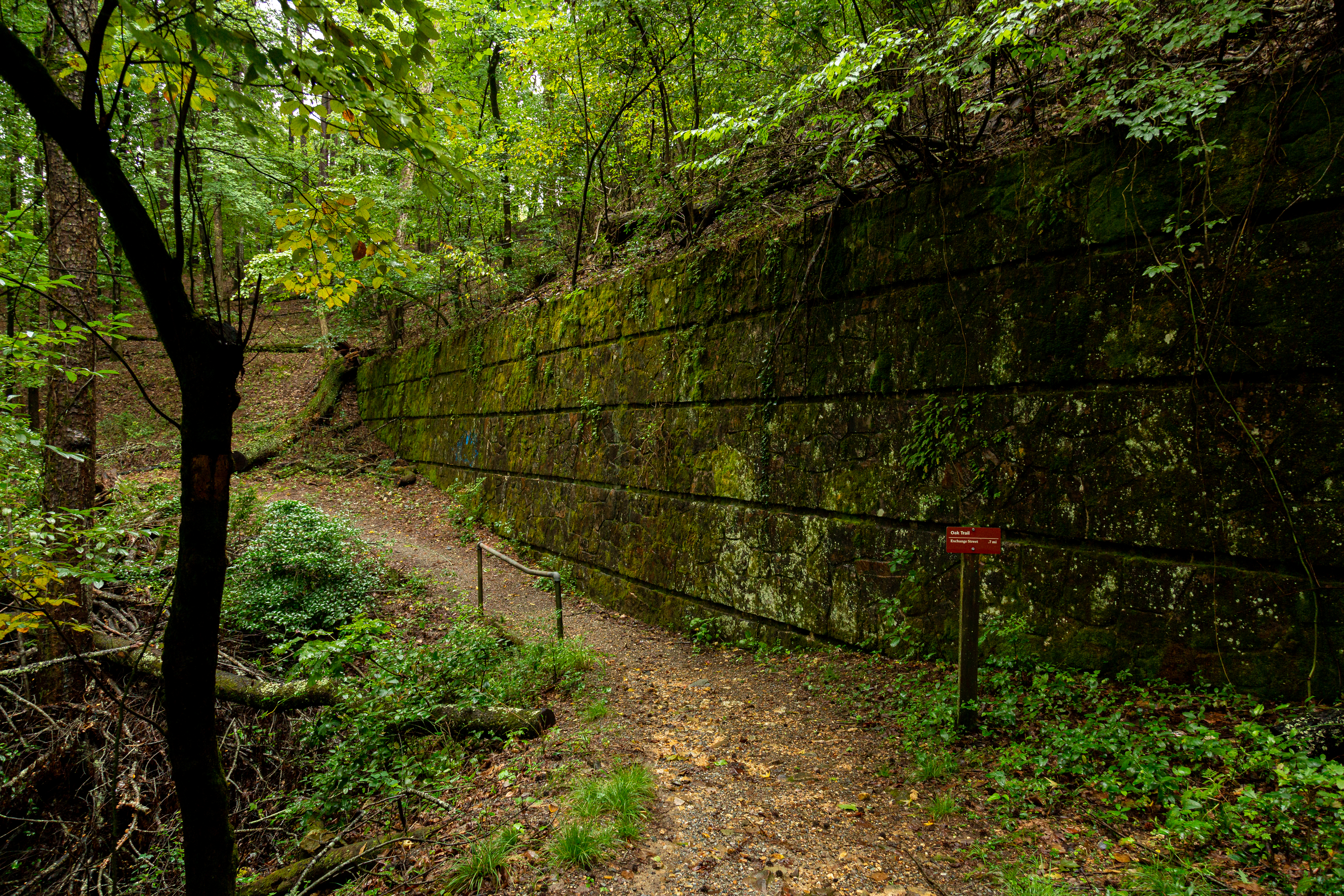
A mossy stone wall lines a paved dirt pathway through the woods.
The Oak Trail where it meets the Canyon Trail. Photo: NPS Photo/Mitch Smith

The northeastern end of Oak Trail is mostly flat. The trail is fairly steep for a short distance between West Mountain Trail and West Mountain Drive.

Distance (one way): 1.0mi (1.6km)

Elevation: 698 - 922ft (213 - 281m)

Typical grade: 4.2%

Accessibility This is a packed dirt, often steep trail. It is not ADA compliant.

This hike on nps.gov

Oertel Trail

1.4 mi one way · about 250 ft of climbing · 599 ft–783 ft

625 ft 650 ft · 1.4 mi high 783 ft

Grand Avenue Trail the Park Service's write-up

10-20 Minutes · dogs allowed

Start Trail head

A young man stands in the middle of a packed gravel trail looking up to the lush green trees.
Looking up on the trail Photo: NPS Photo/Mitch Smith

Grand Avenue Trail connects Oertel Trail with Grand Avenue. A local motel lies just south of the trailhead.

Distance (one way): 0.2mi (0.3km)

Elevation: 581 - 631ft (177 - 192m)

Typical grade: 4.7%

Accessibility This is a packed gravel trail. It is not ADA compliant.

This hike on nps.gov

Oertel Trail the Park Service's write-up

30-60 Minutes · dogs allowed

Start Trailhead

Gravel paths converge on the grass.
The path to the Oertel Trail Photo: NPS Photo/Mitch Smith

The Oertel Trail is formerly known as the Dead Chief Trail.

From downtown, ascend the Stephen's Balustrade (grand staircase) behind the Fordyce Visitor Center to the Grand Promenade and climb the next two sets of steps until you reach the gravel road. Take the road right until you reach an iron gate; the trailhead begins here. Oertel Trail ranges from moderate to very steep grade.

Distance (one way): 1.4mi (2.3km)

Elevation: 670 - 863ft. (204 - 263m)

Typical grade: 2.6%

Accessibility The Oertel Trail is a steep, bumpy gravel trail and is not ADA accessible.

This hike on nps.gov

Reserve Trail the Park Service's write-up

10-25 Minutes · dogs allowed

Start Trail head

A shaded, highly vegetated piece of the forest with knobby, thin trees.
A glimpse of the forests in Hot Springs. Photo: NPS Photo/Mitch Smith

Reserve Trail connects Oertel Trail with Spring Street and Reserve Street at a "Y" intersection.

Distance (one way): 0.3mi (0.5km)

Elevation: 622 - 713ft (190 - 217m)

Typical grade: 5.7%

Accessibility This trail is not ADA compliant.

This hike on nps.gov

Short Cut Trail the Park Service's write-up

10-25 Minutes · dogs allowed

A picnic area with many tables sit beneath the shade of the trees.
View from the Short Cut trailhead Photo: NPS Photo/Mitch Smith

Short Cut Trail connects Oertel Trail with Hot Springs Mountain Trail near the picnic area atop Hot Springs Mountain.

Distance (one way): 0.2 mi (0.3km)

Elevation: 813 - 1036ft. (247 - 316m)

Typical grade: 21.1%

Accessibility This trail is made of loose rocky, gravel. This trail is not ADA compliant.

This hike on nps.gov

Peak Trail

0.6 mi one way · about 400 ft of climbing · 644 ft–1,027 ft

644 ft 1,027 ft · 0.5 mi high 1,027 ft

Honeysuckle Trail the Park Service's write-up

20-45 Minutes · dogs allowed

A stone shelter built in a 1930s style sits alongside a gravel trail.
Shelter at the intersection of the Honeysuckle and Floral Trail. Photo: NPS Photo/Mitch Smith

Honeysuckle Trail connects Peak Trail with Hot Springs Mountain Trail.

Distance (one way): 0.5mi (0.8km)

Elevation: 727 - 870ft. (222 - 265m)

Typical grade: 5.4%

Accessibility This trail is narrow, steep, rocky, and made primarily of packed gravel. It is not an ADA compliant trail.

This hike on nps.gov

Peak Trail the Park Service's write-up

40 Minutes · dogs allowed

Start Peak Trail

Dense wooded area with a tall mountain observation tower at the peak of the mountain.
Peak Trail to Mountain Tower Photo: NPS Photo/Mitch Smith

The Peak Trail leads directly to the Hot Springs Mountain Tower and the top of Hot Springs Mountain. Visitors can choose to explore the Mountain Tower, take in views from the overlooks, or enjoy a picnic from the top of Hot Springs Mountain. The Peak Trail is a great connector to a lot of the other hiking trails around Hot Springs Mountain for those looking to explore a bit further.

The trailhead is located near the center of the Grand Promenade. From the Fordyce Bathhouse, follow the stairs up behind the Shell Fountain, follow the Grand Promenade to the left, and you'll see the trailhead on the right-hand side. The trail is 0.6 mi (1.0 km) long with an elevation gain of roughly 400 feet (644 - 1044 ft/196-318 m). It has a 12.6% grade and is initially paved before turning to gravel.

See the Hot Springs and North Mountain trail map for more information.

Accessibility The beginning of Peak Trail is paved then turns to gravel. It is a moderate trail: 0.6 mi (1.0 km), 644-1044 ft (196-318 m) elevation, and typical grade of 12.6%.

This hike on nps.gov

Pullman Trail

0.7 mi one way · about 70 ft of climbing · 150 ft of descent · 698 ft–842 ft

773 ft 698 ft · 0.7 mi high 842 ft

Pullman Trail the Park Service's write-up

25-45 Minutes · dogs allowed

Start Trail head

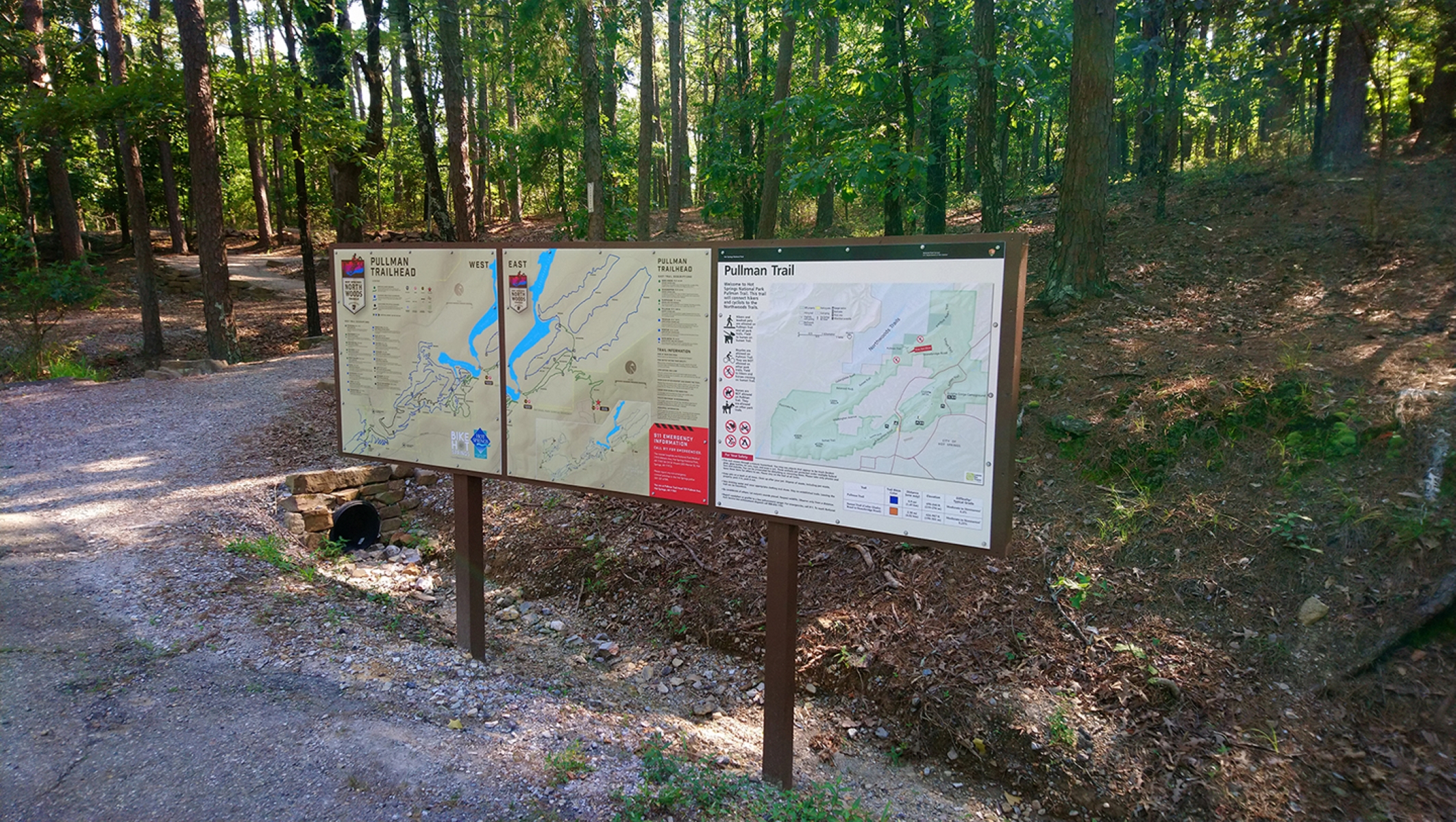
Three trail head signs line the front of a trailhead that leads into the forest.
Pullman trailhead signage Photo: NPS Photo/Tom Hill

The Pullman Trail is the only trail in the park that allows bicycles. This moderate trail passes an archeological site and connects with the city's Northwoods Trails.

Distance (one way): 0.8mi (1.2km)

Elevation: 717 - 850ft (218 - 259m)

Typical grade: 24.4%

Accessibility This is a packed gravel and rocky trail. There are frequently mountain bikes on this trail. It is not ADA compliant.

This hike on nps.gov

Reserve Trail

0.3 mi one way · about 60 ft of climbing · 619 ft–679 ft

619 ft 679 ft · 0.3 mi high 679 ft

Reserve Trail the Park Service's write-up

10-25 Minutes · dogs allowed

Start Trail head

A shaded, highly vegetated piece of the forest with knobby, thin trees.
A glimpse of the forests in Hot Springs. Photo: NPS Photo/Mitch Smith

Reserve Trail connects Oertel Trail with Spring Street and Reserve Street at a "Y" intersection.

Distance (one way): 0.3mi (0.5km)

Elevation: 622 - 713ft (190 - 217m)

Typical grade: 5.7%

Accessibility This trail is not ADA compliant.

This hike on nps.gov

Short Cut Trail

0.2 mi one way · about 150 ft of climbing · 799 ft–941 ft

799 ft 941 ft · 0.2 mi high 941 ft

Short Cut Trail the Park Service's write-up

10-25 Minutes · dogs allowed

A picnic area with many tables sit beneath the shade of the trees.
View from the Short Cut trailhead Photo: NPS Photo/Mitch Smith

Short Cut Trail connects Oertel Trail with Hot Springs Mountain Trail near the picnic area atop Hot Springs Mountain.

Distance (one way): 0.2 mi (0.3km)

Elevation: 813 - 1036ft. (247 - 316m)

Typical grade: 21.1%

Accessibility This trail is made of loose rocky, gravel. This trail is not ADA compliant.

This hike on nps.gov

Sunset Trail

9.3 mi one way · about 2,000 ft of climbing · 541 ft–1,368 ft

541 ft 1,087 ft · 9.2 mi high 1,347 ft

Sunset Trail the Park Service's write-up

6-9 Hours · dogs allowed

Start Sunset Trail

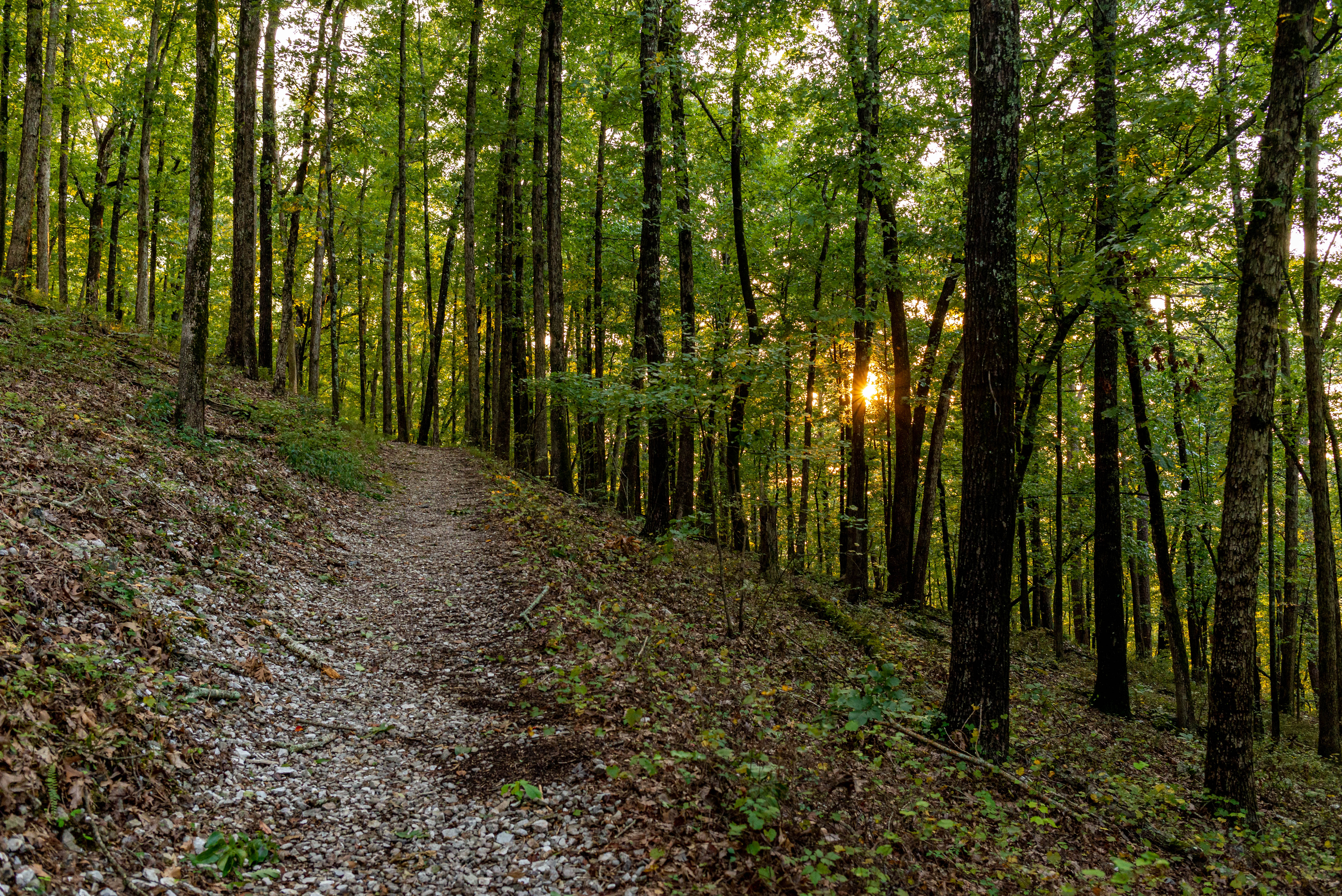
Hiking trail through a dense forest with the sun setting through the trees.
Sunset Trail Photo: NPS Photo/Mitch Smith

The Sunset Trail is the longest trail in Hot Springs National Park, covering approximately 10 miles one way or complete the full 13-17 mile loop. This trail offers the most dynamic views of the park, as it crosses a variety of terrain and makes it way through more remote areas of the park following the inner edge of the park's boundary.

The trail crosses three major roads, making it possible to break the entire trail up into smaller sections: West Mountain (2.8 miles), Sugarloaf Mountain (2.6 miles), and Stonebridge Road (3.8 miles).

The Sunset Trail can be combined with Hot Springs Mountain trails (like the Gulpha Gorge Trail (.3 miles) and the Oertel Trail (1.4 miles) and West Mountain trails (like the Oak Trail (.7 miles), West Mountain Trail (1.6 miles), and Mountain Top Trail (.7 miles) to complete the strenuous 13 -17-mile loop hike.

See the Sunset Trail map for more information.

Accessibility The trail is dirt and gravel with uneven footing. It is not ADA accessible.

This hike on nps.gov

Tufa Terrace Trail

0.2 mi one way · about 20 ft of climbing · 30 ft of descent · 626 ft–657 ft

643 ft 656 ft · 0.1 mi high 657 ft

Tufa Terrace Trail the Park Service's write-up

15-30 Minutes · dogs allowed

Start Lower Tufa Terrace Trailhead

A railed, thin pathway leads through bright green trees and brush.
Lower Tufa Terrace Trail Photo: NPS Photo/Mitch Smith

This paved trail can be reached from the Grand Promenade or Arlington Lawn. The lower portion of the Tufa Terrace Trail is near the Hot Water Cascade.

Distance (one way): 0.3 mi (0.5km)

Elevation: 650ft - 745ft (198 - 227m)

Typical Grade: 6%

Accessibility The Tufa Terrace is not consdiered to be ADA compliant, as there are stairs at various places throughout the trail.

This hike on nps.gov

Upper Dogwood Trail

1.0 mi one way · about 50 ft of climbing · 200 ft of descent · 848 ft–1,026 ft

1,026 ft 874 ft · 1.0 mi high 1,026 ft

Upper Dogwood Trail the Park Service's write-up

25-45 Minutes · dogs allowed

Start Trail head

Rolling hills and forested hillsides extend towards the horizon.
View from the North Mountain overlook. Photo: NPS Photo/Mitch Smith

Upper Dogwood trail has short rises and long stretches of flat trail. It can be combined with the Lower Dogwood Trail or the Goat Rock Trail to create a longer hike.

Distance (one way): 1.0mi (1.6km)

Elevation: 880 - 1131ft (268 - 345m)

Typical grade: 4.8%

Accessibility The trail is compacted dirt and uneven in certain locations. It is not ADA compliant.

This hike on nps.gov

West Mountain Trail

1.2 mi one way · about 150 ft of climbing · 849 ft–985 ft

860 ft 849 ft · 1.2 mi high 985 ft

An Overview: West Mountain Trails the Park Service's write-up

40-240 Minutes · dogs allowed

Start Hot Springs National Park

Dirt hiking trail surrounded by dense forrest.
People hiking on West Mountain. Photo: NPS Photo/Mitch Smith

The West Mountain trails are typically less traveled, providing greater opportunities for wildlife sightings. You can get to these trails via Whittington Park and the Canyon Trailhead. See the West Mountain trail map for more information.

Easy:

Whittington Trail - The flat, gravel trail is popular with joggers and walkers. Whittington Trail loops around Whittington Park.

Distance (one way): 1.2 mi (1.9 km)

Elevation gain: 647-685ft (197-209m)

Grade: 0.6%

Moderate:

Oak Trail - The northeastern end of Oak Trail is mostly flat. The trail is fairly steep for a short distance between West Mountain Trail and West Mountain Drive.

Distance (one way): 1.0mi (1.6km)

Elevattion gain: 698-922ft (213-281m)

Grade: 4.2%

West Mountain Trail - Both sections of West Mountain Trail have gradual change in elevation. Note: West Mountain Trail can be made into a loop by using Mountian Top Trail (elevation change: 400 feet in this section).

Distance (one way): 1.2mi (1.9km)

Elevation gain: 926-992ft (282-302m)

Grade: 1.1 %

Strenuous:

Canyon Trail - The West Mountain trails can be reached from downtown via Canyon Trail. The trailhead is behind the Mountain Valley Water building. The section between West Mountain Drive and West Mountain Trail is very steep.

Distance (one way): 0.7mi (1.1km)

Elevation gain: 626-933ft (191-303m)

Grade: 10%

Mountain Top Trail - If hiking southward, the trail is strenous, as it gains elevation quickly. If hiking northward, there is a steady rise in elevation until you cross Sunset Trail; the trail descends steeply to the trailhead at Whittington Park.

Distance (one way): 1.5mi (2.4km)

Elevation gain: 675-1100ft (206-335m)

Grade: 5.4%

Accessibility Whittington Trail is accessible by most mobility devices. The other trails on West Mountain are not ADA compliant.

This hike on nps.gov

Canyon Trail the Park Service's write-up

25-45 Minutes · dogs allowed

Start Trail head

A ranger in uniform walks up the curved trail through the forest.
A ranger walks up the Canyon Trail. Photo: NPS Photo/Mitch Smith

The West Mountain trails can be reached from downtown via Canyon Trail. The trailhead is behind the Mountain Valley Water building. The section between West Mountain Drive and West Mountain Trail is very steep.

Distance (one way): 0.7mi (1.1km)

Elevation: 626 - 933ft (191 - 303m)

Typical grade: 10%

Accessibility This is a steep, packed gravel trail. It is not ADA compliant.

This hike on nps.gov

Mountain Top Trail the Park Service's write-up

45-75 Minutes · dogs allowed

Start Trail head

A rocky trail curves through the trees on a hillside.
A view of a trail on West Mountain. Photo: NPS Photo/Mitch Smith

Mountaintop trail can be linked with Canyon Trail and West Mountain trail to complete a loop around West Mountain. If hiking southward, the trail is strenuous, as it gains elevation quickly. If hiking northward, there is a steady rise in elevation until you cross Sunset Trail; the trail descends steeply to the trailhead at Whittington Park.

Distance (one way): 1.5mi (2.4km)

Elevation: 675 - 1100ft (206 - 335m)

Typical grade: 5.4%

Accessibility This is a rocky, packed gravel, steep trail. It is not ADA compliant.

This hike on nps.gov

West Mountain Trail the Park Service's write-up

30-60 Minutes · dogs allowed

Start Trail head

A stone shelter sits on a hillside overlooking a rolling landscape.
Shelter near the West Mountain Trail. Photo: NPS Photo/Mitch Smith

Both sections of West Mountain Trail have gradual change in elevation. Note: West Mountain Trail can be made into a loop by using Mountain Top Trail (elevation change: 400 feet in this section).

Distance (one way): 1.2mi (1.9km)

Elevation: 926 - 992ft (282 - 302m)

Typical grade: 1.1%

Accessibility This is packed gravel trail. It is not ADA compliant.

This hike on nps.gov

Whittington Trail

1.2 mi loop · about 40 ft of climbing · 641 ft–683 ft

643 ft 644 ft · 1.1 mi high 683 ft

Whittington Trail the Park Service's write-up

20-45 Minutes · dogs allowed

Start Trail head

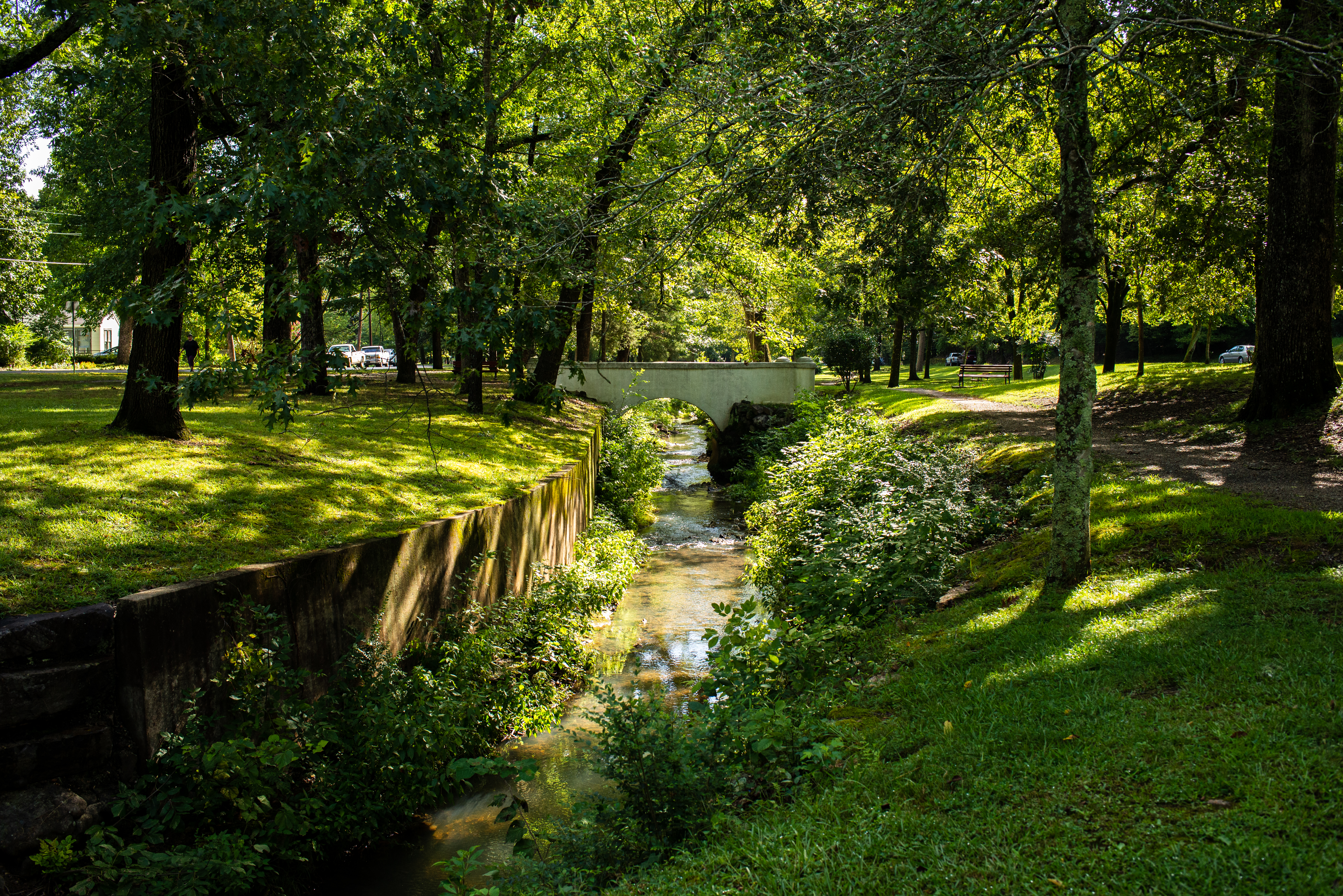
A white foot bridge crosses over a small creek amidst a vibrant open park with tall trees.
Whittington Park Photo: NPS Photo/Mitch Smith

The flat, gravel trail is popular with joggers and walkers. Whittington Trail loops around Whittington Park.

Distance (one way): 1.2mi (1.9km)

Elevation: 647 - 685ft (197 - 209m)

Typical grade: 0.6%

Accessibility This is a mostly flat, packed gravel trail. It is ADA compliant.

This hike on nps.gov

2 more mapped segments without a name are on the map, not in the list.

About these trails

The lines are the National Park Service's public trails layer, the trailheads and the waterfalls, views, peaks and historic places along them the Service's public points of interest, read 2026-10-14 and simplified for the map. The write-ups are the Service's own "things to do", unedited. Heights come from USGS 3DEP through Terrain Tiles on AWS (Mapzen/Tilezen), read along each line and rounded; a short trail on steep ground can be off by a few tens of feet. Closures change: check the park's own site before you go.