
National Historic Site · New York
Trails in Home Of Franklin D Roosevelt National Historic Site
13 named trails · 9 miles · 2 with the Park Service's own write-up. The lines, trailheads and points are the Park Service's; the write-ups are the Service's own words; the climbing is read from USGS elevation along each line.
13 trails, A to Z.
Bracken Pond Trail
Cove Trail
Visitor centersLakes
Along the way Ice Pond Garage
Farm Lane Parking Connector
Farm Lane Trail
Farm Lane Trail the Park Service's write-up
1-2 Hours · dogs allowed
Start Farm Lane Trail
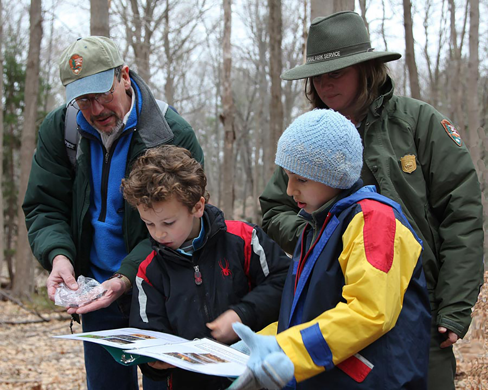
Length: 1.8 miles (3.6 miles round-trip)
Difficulty: Easy
Blaze: Green and white Hyde Park Trail Marker
Trailhead Location: Trailheads are located at Route 9 opposite the main entrance to the Home of FDR, and at Route 9G opposite the main entrance to Val-Kill. Limited parking available.
Terrain : The surface is gravel and the route is smooth but with some steep hills and curves.
Summary : The trail passes through a variety of upland and wetland habitats, including a bridge over the Maritje Kill. The lane is blazed with the green-and-white Hyde Park Trail markers. Permitted uses included hiking, bicycling (March through November only), cross-county skiing and snowshoeing.
History : Roosevelt Farm Lane is part of the historic road network that connected the Roosevelt Home, Val-Kill, Top Cottage, the Home Farm, and FDR’s tree plantations. From the 19th century through 1945, the flat, fertile lands along the Albany Post Road (Route 9) and Violet Avenue (Route 9G) were used for growing crops, while the rugged, rocky and wet interior was only suitable for growing trees. The Roosevelt family farm, known as the “Home Farm,” stretched along the east side of Route 9 from the current site of the Hyde Park Drive-In Theater south for nearly a mile. To the east along Route 9G, FDR leased land to a series of farmers, most notable Moses Smith. The interior of the land was heavily planted with trees by FDR—Norway spruce, tulip-poplar, white pine and red pine to name a few. FDR planted over 21 acres of trees between 1912 and 1944. After FDR’s death in 1945, the property was subdivided, with some of the land along Route 9 developed for commercial use. But the core of the land has mostly remained in its natural state to the present day. After being acquired by the Scenic Hudson Land Trust Inc. in 2001, the land was transferred to the National Park Service in 2007.
Trail Intersections: There are three additional trails, marked with paint blazes. These are more traditional trails and the footing can be uneven; please use caution and wear appropriate footwear for the season. Stay on the marked trails.
The White Trail starts about 0.2 miles from the Route 9 trailhead and is 0.7 miles long. It passes three historic tree plantations, parallels the Maritje Kill and ends at the Yellow Trail.
The 0.8 mile-long Yellow Trail begins about a half mile from the Route 9 trailhead. It travels east along a road historically called Newbold Road for 0.4 miles before turning south and plunging into native forest for another 0.4 mile. It connects back to the Roosevelt Farm Lane about 0.3 miles west of the Route 9G trailhead.
The short Blue Trail leads for 0.2 miles between Roosevelt Farm Lane and the Yellow Trail.
Trail map available here .
Rules & Regulations
Safety first!
Trail is open daily sunrise to sunset.
Bikes permitted March through November only.
Bikes must yield to pedestrians. Keep right except to pass. Sound a warning before passing.
Garbage cans are not available. This is a Carry In,Carry Out trail.
Stay on marked trails only.
Hunting, trapping, or possession of firearms prohibited.
No Fires, camping, or swimming.
Pets must be leashed; You must clean up after your pet.
Removal or disturbance of flora, fauna, or cultural resources is strictly prohibited.
Motorized vehicles prohibited.
In Case of Emergency Call 911
Report Safety & Security Issues to (845) 229-9380
Report Trail Maintenance Issues to (845) 229-1521
Forest Trail
Hyde Park Trail
Visitor centers
Along the way Wallace Center
Top Cottage Trail the Park Service's write-up
1-2 Hours · dogs allowed
Length: 2 miles, round-trip
Difficulty: Moderate
Blaze: Green and white Hyde Park Trail Marker
Trailhead Location: Trailhead is located south of the historic core, beyond the access road to the parking lot.
Terrain : Moderate walking on woodland paths with some steep hills and rough surface in spots.
Summary : The trail follows a road built by FDR in 1940. Follow the Hyde Park Trail blazes (green leaf).
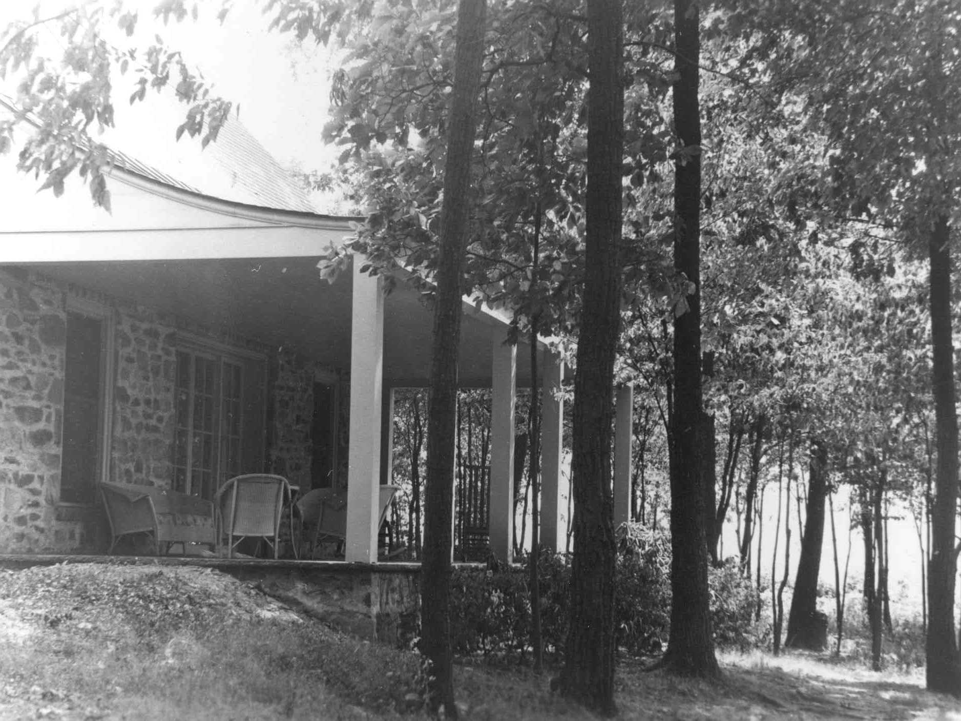
History : This trail takes you to the highest point on the Hyde Park Trails. When you reach the summit, you will have made the same climb that kings and queens and a host of foreign leaders made during some of the most critical days of the 20 th century. Top Cottage, FDR’s humble hilltop getaway hosted pivotal meetings that shaped world history. It also provided guests with a dramatic vantage point from which to view the natural beauty of the Hudson River Valley, FDR’s cherished home.
Trail map available here .
Rules & Regulations
Safety first!
Trail is open daily sunrise to sunset.
Bikes are not permitted on any trails at this site.
Garbage cans are not available. This is a Carry In,Carry Out trail.
Stay on marked trails only.
Hunting, trapping, or possession of firearms prohibited.
No Fires, camping, or swimming.
Pets must be leashed; You must clean up after your pet.
Removal or disturbance of flora, fauna, or cultural resources is strictly prohibited.
Motorized vehicles prohibited.
In Case of Emergency Call 911
Report Safety & Security Issues to (845) 229-9380
Report Trail Maintenance Issues to (845) 972-2268
Accessibility Moderate walking on woodland paths with some steep hills and rough surface in spots.
Hyde Park Trail, Top Cottage Trail-ELRO Section
IMBA Trail
Meadow Trail
Newbold Trail
Spur Trail
Unmaintained Trail
About these trails
The lines are the National Park Service's public trails layer, the trailheads and the waterfalls, views, peaks and historic places along them the Service's public points of interest, read 2026-10-14 and simplified for the map. The write-ups are the Service's own "things to do", unedited. Heights come from USGS 3DEP through Terrain Tiles on AWS (Mapzen/Tilezen), read along each line and rounded; a short trail on steep ground can be off by a few tens of feet. Closures change: check the park's own site before you go.