1810 Stone Steps
Exhibits
Along the way A. Burton Fine Watch Repair Black Voices Dry Goods Store Frankel's Clothing Store Harpers Ferry Wetlands Provost Marshal Office Roeder’s Confectionery

National Historical Park · West Virginia, Virginia, Maryland
45 named trails · 26 miles · 1 with the Park Service's own write-up. The lines, trailheads and points are the Park Service's; the write-ups are the Service's own words; the climbing is read from USGS elevation along each line.
45 trails, A to Z.
Exhibits
Along the way A. Burton Fine Watch Repair Black Voices Dry Goods Store Frankel's Clothing Store Harpers Ferry Wetlands Provost Marshal Office Roeder’s Confectionery
Views
Along the way Schoolhouse Ridge South Viewpoint
ViewsHistoryExhibits
Along the way A. Burton Fine Watch Repair Arsenal Square Black Voices Dry Goods Store Frankel's Clothing Store Harpers Ferry Wetlands John Brown's Fort John Brown's Fort (Original Site) Provost Marshal Office Roeder’s Confectionery Gravesite of Robert Harper Jefferson Rock
1-8 Hours · dogs allowed · entrance fee applies
Start Harpers Ferry National Historical Park
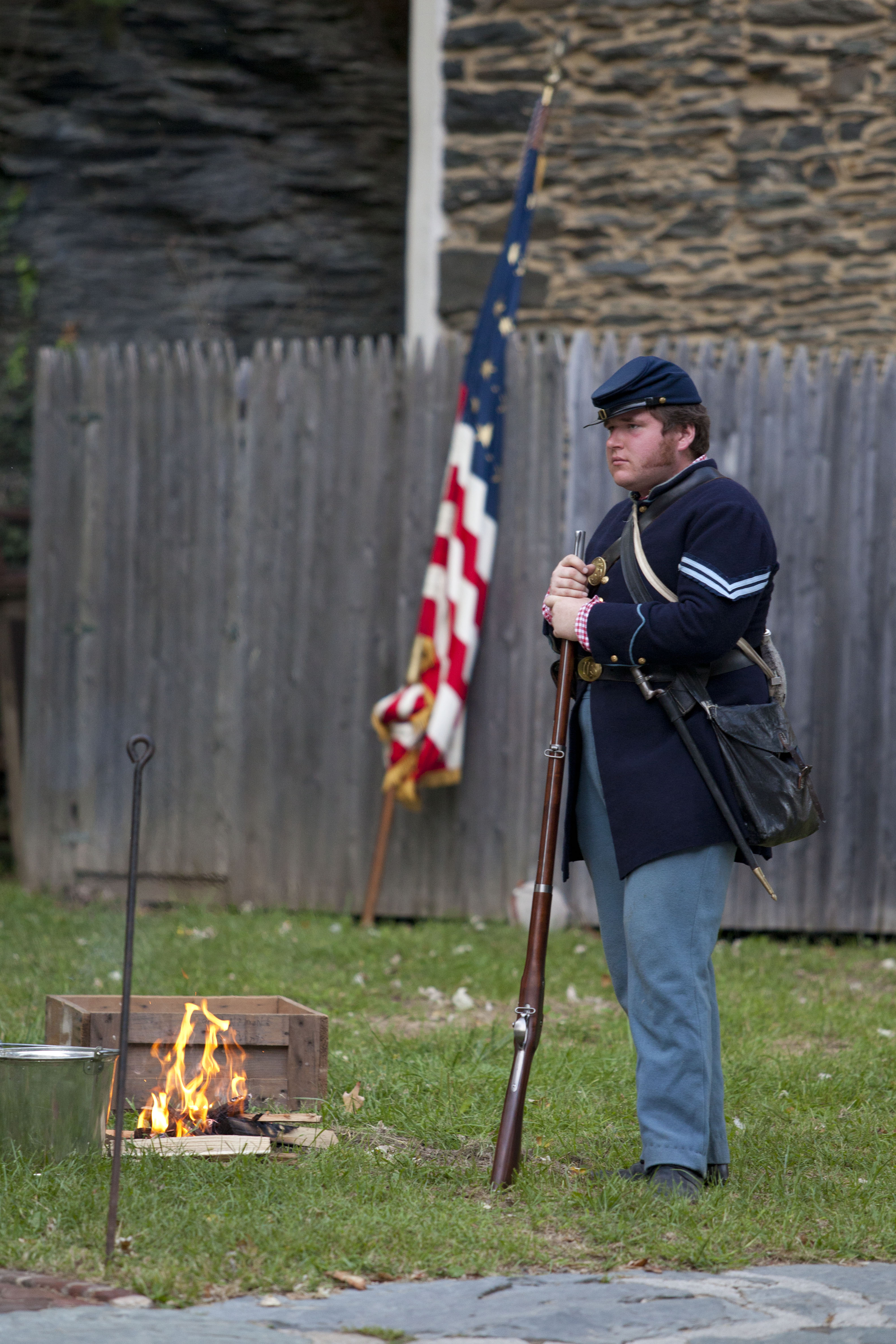
Surrounding the Shenandoah Valley
Did you know the park has over 20 miles of hiking trails? The trails vary from easy, riverside strolls to four-mile hikes across Civil War battlefields to eight-mile adventures on the tops of mountains.
During the Confederacy's first invasion of the North, on September 15, 1862, Maj. Gen. Thomas J. "Stonewall" Jackson surrounded and captured the 12,700-man Union garrison stationed here. When the Federals returned to Harpers Ferry after the Battle of Antietam, they began transforming the surrounding heights into fortified encampments to protect both the town and the railroad. In 1864, Union Gen. Philip H. Sheridan used Harpers Ferry as his base of operations against Confederate troops in the Shenandoah Valley. Learn more about the 1862 Battle of Harpers Ferry or the park's various trails .
Accessibility General Information Harpers Ferry is a park consisting of historic buildings, Civil War battlefields, hiking trails, and much more. Within this complex park there is something for everyone to connect with and enjoy. Please be aware that due to the uniqueness of the park - its historic setting - some locations may be more difficult to access than others. This page offers you a glance at the park's amenities and features so that you may better prepare for your visit to Harpers Ferry. Physical Mobility Accessibility Visitor Center (located at 171 Shoreline Drive) Parking: There are accessible parking spaces at the Visitor Center complex. Entrance: The Visitor Center doors only open manually. Restrooms: The restroom building's exterior doors open manually. Wheelchairs: The park has two wheelchairs available that may be borrowed by visitors upon request. Shuttle Bus: The park's shuttle buses are equipped for those with physical limitations. The buses kneel and have lifts to accommodate those who are unable to utilize the stairs. Lower Town Restrooms: An accessible restroom is located in the Bookshop building on Shenandoah Street. Restrooms are also located on the second flood of the John Brown Museum. Exhibits and Museums: Most exhibits and museums in Lower Town have accessible entrances. These entrances are not always visible from the sidewalk. An accessible entrance map of Lower Town is available at the park's Visitor Center or Information Center. Sidewalks and Trails: The sidewalks in Lower Town are made of various materials including brick, slate, and cobblestone. Trails in Lower Town are mostly compacted dirt. The walkway between the John Brown Fort and The Point is gravel. Shuttle Bus: The park's shuttle buses are equipped for those with physical limitations. The buses kneel and have lifts to accommodate those who are unable to utilize the stairs. Programs and Tours Ranger-guided programs vary in topic and tour stops. Please feel free to contact the park ahead of time to ask about program routes and accessibility. Deaf / Hearing Loss Accessibility Exhibits and Museums: Video presentations within the park's museums are open captioned. Printed copies of video transcripts are available upon request. Programs and Tours: The park has assisted listening devices available, which may be borrowed by visitors upon request. Online audio / video presentations: All videos on the park's website are closed captioned. All audio presentations on the park website are accompanied by downloadable text transcript files. Blind / Low Vision Accessibility Braille: The park's brochure is available in braille. It is available at the park's Visitor Center. Exhibits and Museums: Some exhibits, museums, and outdoor waysides have tactile components and audio descriptions. Service Animals Service animals are allowed in National Parks. For a definition of a service animal, please go to www.ada.gov/service_animals_2010.htm . For more information regarding visiting Harpers Ferry with an animal, please see our Pets page.
1-2 Hours · dogs allowed · entrance fee applies
Start Jefferson Rock
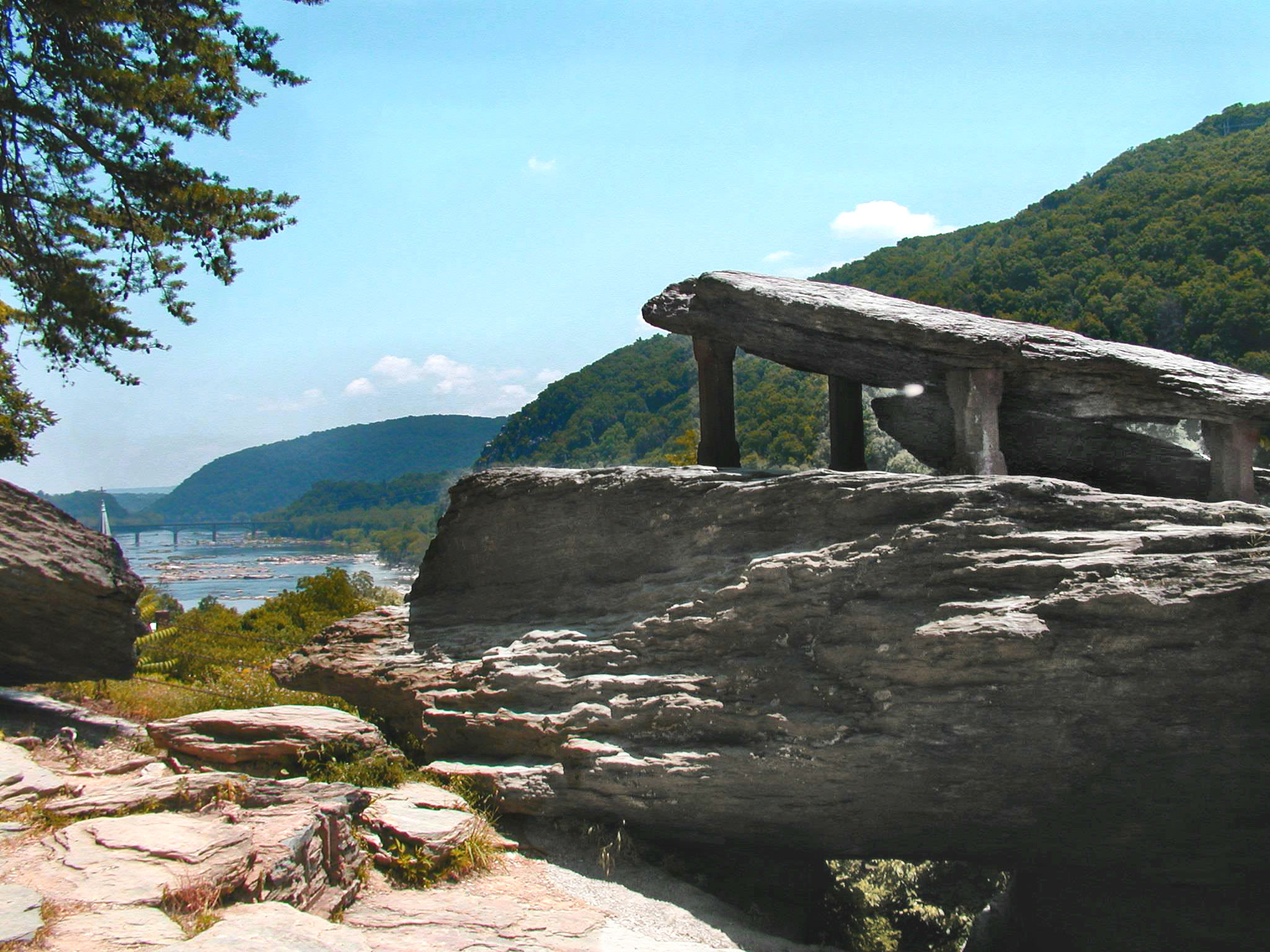
Several large masses of Harpers shale, piled one upon the other, comprise Jefferson Rock. The name of this landmark derives from Thomas Jefferson, who stood here on October 25, 1783.
The uppermost slab of Jefferson Rock originally rested on a natural stone foundation so narrow that one was able to sway the rock back and forth with a gentle push. Because this natural foundation had "dwindled to very unsafe dimensions by the action of the weather, and still more, by the devastations of tourists and curiosity-hunters," four stone pillars were placed under each corner of the uppermost slab sometime between 1855 and 1860.
Accessibility The National Park Service welcomes people with disabilities. The links below provide information about specific facilities, programs, and services that may help you better plan your visit. If a particular service is not mentioned below, such as alternate formats for print materials, audio description, assistive listening, captions, or physical access to particular facilities, programs or services, please contact the park at 304-535-6029 or via email . You may wish to learn about the America the Beautiful National Parks and Federal Recreational Lands Access Pass -- or simply, the Access Pass -- which provides a wide range of discounts on activities and services when you visit federal lands. General Information Harpers Ferry is a park consisting of historic buildings, Civil War battlefields, hiking trails, and much more. Within this complex park there is something for everyone to connect with and enjoy. Please be aware that due to the uniqueness of the park - its historic setting - some locations may be more difficult to access than others. This page offers you a glance at the park's amenities and features so that you may better prepare for your visit to Harpers Ferry. Physical / Mobility Accessibility Visitor Center (located at 171 Shoreline Drive) Parking: There are accessible parking spaces at the Visitor Center complex. Entrance: The Visitor Center doors only open manually. Restrooms: The restroom building's exterior doors open manually. Wheelchairs: The park has two wheelchairs available that may be borrowed by visitors upon request. Shuttle Bus: The park's shuttle buses are equipped for those with physical limitations. The buses kneel and have lifts to accommodate those who are unable to utilize the stairs. Lower Town Restrooms: An accessible restroom is located in the Bookshop building on Shenandoah Street. Restrooms are also located on the second flood of the John Brown Museum. Exhibits and Museums: Most exhibits and museums in Lower Town have accessible entrances. These entrances are not always visible from the sidewalk. An accessible entrance map of Lower Town is available at the park's Visitor Center or Information Center. Sidewalks and Trails: The sidewalks in Lower Town are made of various materials including brick, slate, and cobblestone. Trails in Lower Town are mostly compacted dirt. The walkway between the John Brown Fort and The Point is gravel. Shuttle Bus: The park's shuttle buses are equipped for those with physical limitations. The buses kneel and have lifts to accommodate those who are unable to utilize the stairs. Programs and Tours Ranger-guided programs vary in topic and tour stops. Please feel free to contact the park ahead of time to ask about program routes and accessibility. Deaf / Hearing Loss Accessibility Exhibits and Museums: Video presentations within the park's museums are open captioned. Printed copies of video transcripts are available upon request. Programs and Tours: The park has assisted listening devices available, which may be borrowed by visitors upon request. Online audio / video presentations: All videos on the park's website are closed captioned. All audio presentations on the park website are accompanied by downloadable text transcript files. Blind / Low Vision Accessibility Braille: The park's brochure is available in braille. It is available at the park's Visitor Center. Exhibits and Museums: Some exhibits, museums, and outdoor waysides have tactile components and audio descriptions. Service Animals Service animals are allowed in National Parks. For a definition of a service animal, please go to www.ada.gov/service_animals_2010.htm . For more information regarding visiting Harpers Ferry with an animal, please see our Pets page.
Visitor centers
Along the way Appalachian National Scenic Trail Headquarters and Visitor Center
Views
Along the way The Point
Picnic areas
Along the way Cavalier Heights Picnic Area
ViewsExhibits
Along the way Arsenal Square Dry Goods Store Frankel's Clothing Store Hamiliton Street Provost Marshal Office The Point
ViewsHistory
Along the way Gravesite of Robert Harper Jefferson Rock
ViewsHistory
Along the way Gravesite of Robert Harper Jefferson Rock
ViewsHistory
Along the way Gravesite of Robert Harper Jefferson Rock
Views
Along the way Split Rock Viewpoint
Exhibits
Along the way A. Burton Fine Watch Repair Arsenal Square Harpers Ferry Wetlands John Brown's Fort John Brown's Fort (Original Site) Roeder’s Confectionery
Exhibits
Along the way John Brown's Fort (Original Site)
Exhibits
Along the way A. Burton Fine Watch Repair Arsenal Square Black Voices Dry Goods Store Frankel's Clothing Store Harpers Ferry Wetlands John Brown's Fort John Brown's Fort (Original Site) Roeder’s Confectionery
ViewsHistoryExhibits
Along the way A. Burton Fine Watch Repair Arsenal Square Black Voices Dry Goods Store Frankel's Clothing Store Harpers Ferry Wetlands John Brown's Fort John Brown's Fort (Original Site) Provost Marshal Office Roeder’s Confectionery Gravesite of Robert Harper Jefferson Rock and 1 more
Exhibits
Along the way A. Burton Fine Watch Repair Arsenal Square Black Voices Dry Goods Store Frankel's Clothing Store Hamiliton Street Harpers Ferry Wetlands John Brown's Fort John Brown's Fort (Original Site) Provost Marshal Office Roeder’s Confectionery
Exhibits
Along the way A. Burton Fine Watch Repair Arsenal Square Black Voices Dry Goods Store Frankel's Clothing Store Hamiliton Street Harpers Ferry Wetlands John Brown's Fort John Brown's Fort (Original Site) Provost Marshal Office
ViewsExhibits
Along the way A. Burton Fine Watch Repair Arsenal Square Black Voices Dry Goods Store Frankel's Clothing Store Hamiliton Street Harpers Ferry Wetlands John Brown's Fort John Brown's Fort (Original Site) Provost Marshal Office The Point
ViewsVisitor centers
Along the way Murphy-Chambers Farm Viewpoint River Vista Harpers Ferry NHP Visitor Center
Views
Along the way Overlook Cliff
Exhibits
Along the way Blacksmith Shop
Exhibits
Along the way John Brown's Fort (Original Site)
Exhibits
Along the way Blacksmith Shop
7 more mapped segments without a name are on the map, not in the list.
The lines are the National Park Service's public trails layer, the trailheads and the waterfalls, views, peaks and historic places along them the Service's public points of interest, read 2026-10-14 and simplified for the map. The write-ups are the Service's own "things to do", unedited. Heights come from USGS 3DEP through Terrain Tiles on AWS (Mapzen/Tilezen), read along each line and rounded; a short trail on steep ground can be off by a few tens of feet. Closures change: check the park's own site before you go.