
Abrams Falls Trail
Waterfalls
Along the way Abrams Falls
Trailhead Abrams Falls Trail Trailhead 1,708 ft Drive there
Hike to Abrams Falls 5 mi round trip · the Park Service's write-up
no dogs · entrance fee applies
Start Trailhead located on 11-mile, one-way Cades Cove Loop Road
Overview
Abrams Falls trail will be closed Mondays through Thursdays from August 24 to September 30 so that the park can replace aging footlog bridges and improve visitor safety. During construction the trail will remain open to hikers Fridays through Sundays , and on Labor Day.
Swimming is strongly discouraged due to slippery rocks and a deadly undertow
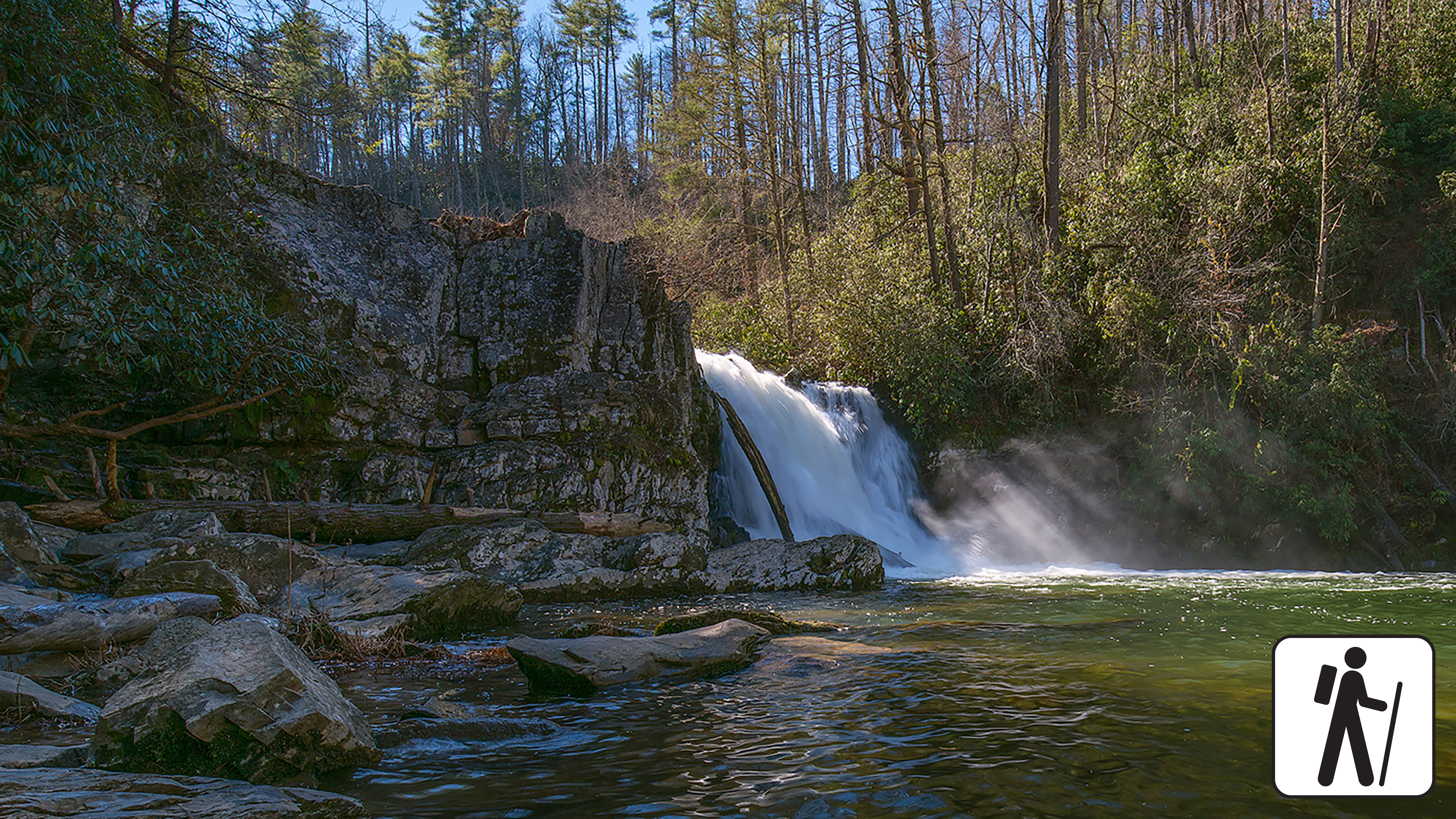
Walk 5 miles (8 km) roundtrip through rhododendron, hemlock, and pine-oak forest in Great Smoky Mountains National Park to a 25-foot (7.6-m) waterfall that flows over a ledge of sandstone into a deep, picturesque pool. This trail is also known for its spring wildflowers.
Length
5 miles (8 km) roundtrip
Parking & Trailhead
After driving roughly halfway around the one-way Cades Cove Loop Road , park at the Abrams Falls Trailhead at the end of Abrams Falls Road (between loop road sign posts 10 and 11). Don't forget your parking tag .
Nearest Restroom
Pit toilet at the trailhead (available year-round)
Alternate Hikes
Deep Creek Waterfall Loop : 2.4 miles (3.9 km) roundtrip
Lynn Camp Prong Cascades : 1.4 miles (2.3 km) roundtrip
West Prong: 5.4 miles (8.7 km) roundtrip
Pets The Gatlinburg Trail and Oconaluftee River Trail are the two park trails where pets are permitted. Pets are also allowed in picnic areas, in campgrounds, and on roads.
Accessibility Trail has occasional obstacles of roots and rocks.