
Rainbow Bridge
Docks
Along the way Rainbow Bridge Dock Rainbow Bridge Dock Rainbow Bridge Dock
From Your Boat To The Bridge 0.5–1.5 mi each way · the Park Service's write-up
2-8 Hours · no dogs · season <p>While Rainbow Bridge National Monument is open all year, it is most heavily visited in the summer months. Despite the lack of shade and 100+ degree temps, visiting Rainbow Bridge in the summer is easiest because boat travel is easiest then.</p>
Start The hike from the docks
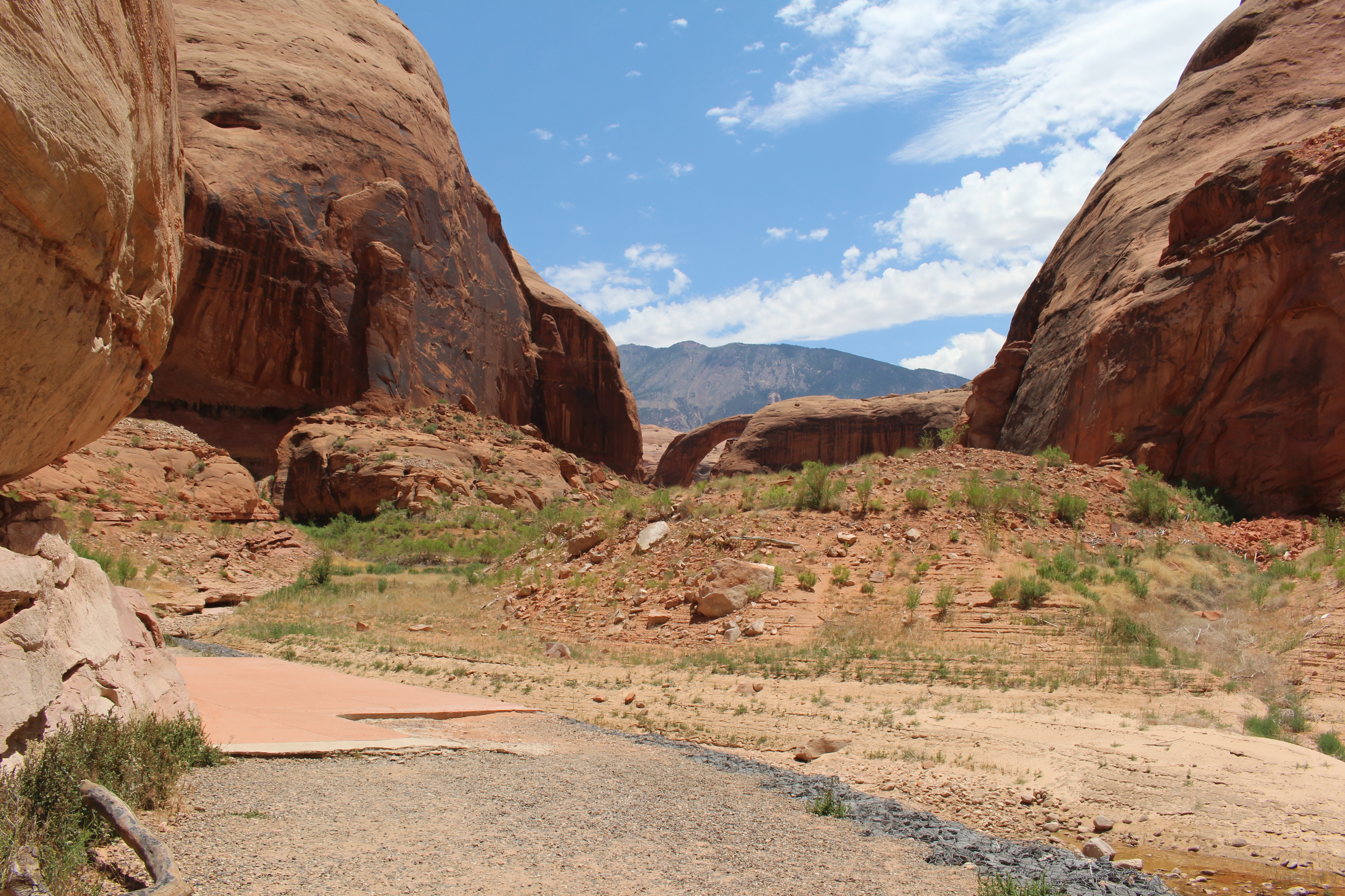
Take a hike - from your boat up the trail to the observation area at Rainbow Bridge.
If you have the time, continue on the trail around to the commemorative plaques and beyond!
The trail’s length, difficulty and time it takes to complete varies depending on lake levels. At current lake levels, the dock at Rainbow Bridge does not reach land. Beach your boat and walk through muck to the trail at your own risk. The docks can be reattached to the Rainbow Bridge trail when the lake level is about 3550'
Expect to walk anywhere from 0.5 to 1.5 miles (0.8 to 2.4km) each way. Proceed carefully and at your own risk. There is considerable elevation gain from the courtesy dock to the bridge itself. Follow the dock to the trailhead. Walk the rough trail along the wall next to Bridge Creek. After the second viewing area, a section of trail completed in 2017, extending the existing path entirely around the bridge. Visitors who decide to take this newer part of the trail can now see the bridge from multiple angles while honoring the sacred nature of the bridge by not walking directly under it. The new section of trail also gives visitors the opportunity to see the two large metal plaques located on the other side of the bridge commemorating Nasja Begay and Jim Mike for their help in the official discovery of Rainbow Bridge in 1909. Take extra water and plan to hike another 20-30 minutes round trip.The section of trail from the upper viewing area onward narrows considerably and transverses a steep section of slick rock sandstone.
Extreme Heat Warning: You must bring WATER! There is very little to no shade along the trail and summer temperatures can be above 100°F/37°C
Things to Know Before You Go
Use caution in the extreme heat.
Leave your pets and drones at home.
No swimming at the Rainbow Bridge courtesy dock, or within the boundaries of Rainbow Bridge National Monument.
Let the wild animals eat animal food, not people food.
There is no restroom after you start up the trail. Take care of your needs before you leave the docks.
Respect the vegetation and biotic soil crusts by staying on the trail.
Rainbow Bridge is a sacred site to several Native American tribes. Please respect these long-standing traditions by not approaching or walking under the bridge.
Things to ponder as you hike the trail (hopefully you'll know when you reach each of these spots).
1. Hanging Garden: How does it feel to see so much green in the desert?
Hanging gardens are spring-fed colonies of plants that cling to the vertical wall of a cliff in an alcove or “glen”, protected from the direct force of the desert sun. Hanging gardens support an incredible amount of diverse water loving plant species, including the Ryberg’s thistle (Cirsium rydbergii) and the Maidenhair fern (rydbergii Adiantum-capillus). As you continue up the trail and around corner, notice how the plant and animal life quickly changes as you leave the shade and moisture of the hanging garden.
2. Lower Viewing area: What gives you hope?
As you continue to ascend, you will begin to see a massive mountain in the distance. This is Navajo Mountain. At 10,388 feet, Navajo Mountain lies entirely inside the Navajo Nation. The harsh and hidden landscape around Navajo Mt and Rainbow Bridge once served as a safe haven for the Navajo people. Protecting a small group of people from the Long Walk of 1864; the forced removal of the Navajo from their homeland in Arizona and New Mexico to Fort Sumner, some 300 miles away at Boseque Redondo. The juxtaposition of Rainbow Bridge and Navajo Mountain, serves as symbol of resilience and hope for the future for the Navajo people.
3. Upper Viewing Area: Does it look like a rainbow to you?
Standing 290 feet from its base to the top of its arch - nearly as tall as the Statute of Liberty – and spanning 275 feet across the stream below, Rainbow Bridge is one of the largest natural bridges in the world. The top of the arch measures 42 feet thick and 33 feet wide. Throughout time the span has undoubtedly inspired people from the neighboring Native American tribes who consider Rainbow Bridge sacred, to the thousands of people from around the world who visit it each year. As an active sacred site please visit with respect by voluntarily not approaching or walking under the bridge. Interested in learning more? Ask a Park Ranger to tell you more about the cultural significance of the rainbow turned to stone.
4. A Sidelong View: How does water shape your life?
A natural bridge is created by flowing water. The stream flows around the site where the bridge will be, and slowly eats away at the stone until a hole forms. The hole gets bigger, and a natural bridge is born.
A natural arch is created by wind, ice, and water forces which never flowed under the span; rather they chipped away at the rock itself to create an opening.
5. Nasja Begay and Jim Mike: What will you be remembered for?
Late in the afternoon on August the 14th, 1909, two groups of Anglo explorers led by Paiute guides Nasja Begay and Jim Mike, saw Rainbow Bridge for the first time. In May of 1910, President William Howard Taft created Rainbow Bridge National Monument. Commemorated here in the plaques mounted high in the sandstone are Nasja Begay and Jim Mike for their help in sharing Rainbow Bridge with the world. Today thousands of people from all over the world come to experience the scenic beauty, cultural significance, and history preserved in Rainbow Bridge National Monument.
This concludes the trail. We hope this guide helped you slow down, enjoy a closer look at the landscape, and learn about the bridge’s history and what Rainbow Bridge means to you.
Pets Pets are not allowed at Rainbow Bridge National Monument. If you choose to take the walk to Rainbow Bridge, your pet must remain on your boat. Do not leave your pet in your boat unattended.
Accessibility The trail is a combination of boat dock, mud, concrete, packed dirt, loose dirt, rocks, and some uphill/downhill walking. It is not recommended for people with low mobility. Service animals are permitted on the trail only. The trail length changes throughout the year, all dependent on water levels. It is always at least 1 mile one-way. If water levels are low, traversing up and down the bank and crossing a shallow creek may be required to reach the main trail. Soft sandy soil and muddy creek beds may be present. If water levels are high, the main trail is hard pack dirt/sand with sections of varying elevation gain and slick rock sandstone.