
Poverty Creek
Begins at the forest's mile 0, 37.2853, -80.4614 - no trailhead mapped Drive to where the trail begins
Pandapas Pond Day Use Area the Forest Service's write-up
No Fee. Donations accepted. · season Open year round to
Pandapas Pond is a pastoral, 8 acre pond located just outside the town of Blacksburg. It sits on the Eastern Continental Divide and is surrounded by a forest of hardwoods and rhododendron. Visitors will enjoy strolling the one-mile wheelchair accessible trail that encircles the pond. A wooden boardwalk separates the pond from a small wetland area that is abundant with dragonflies, turtles, songbirds, and waterfowl. Horses and bicycles are not permitted on the trail around the pond; however they may use the 17-mile Poverty Creek Trail system that can be accessed from the upper parking lot.
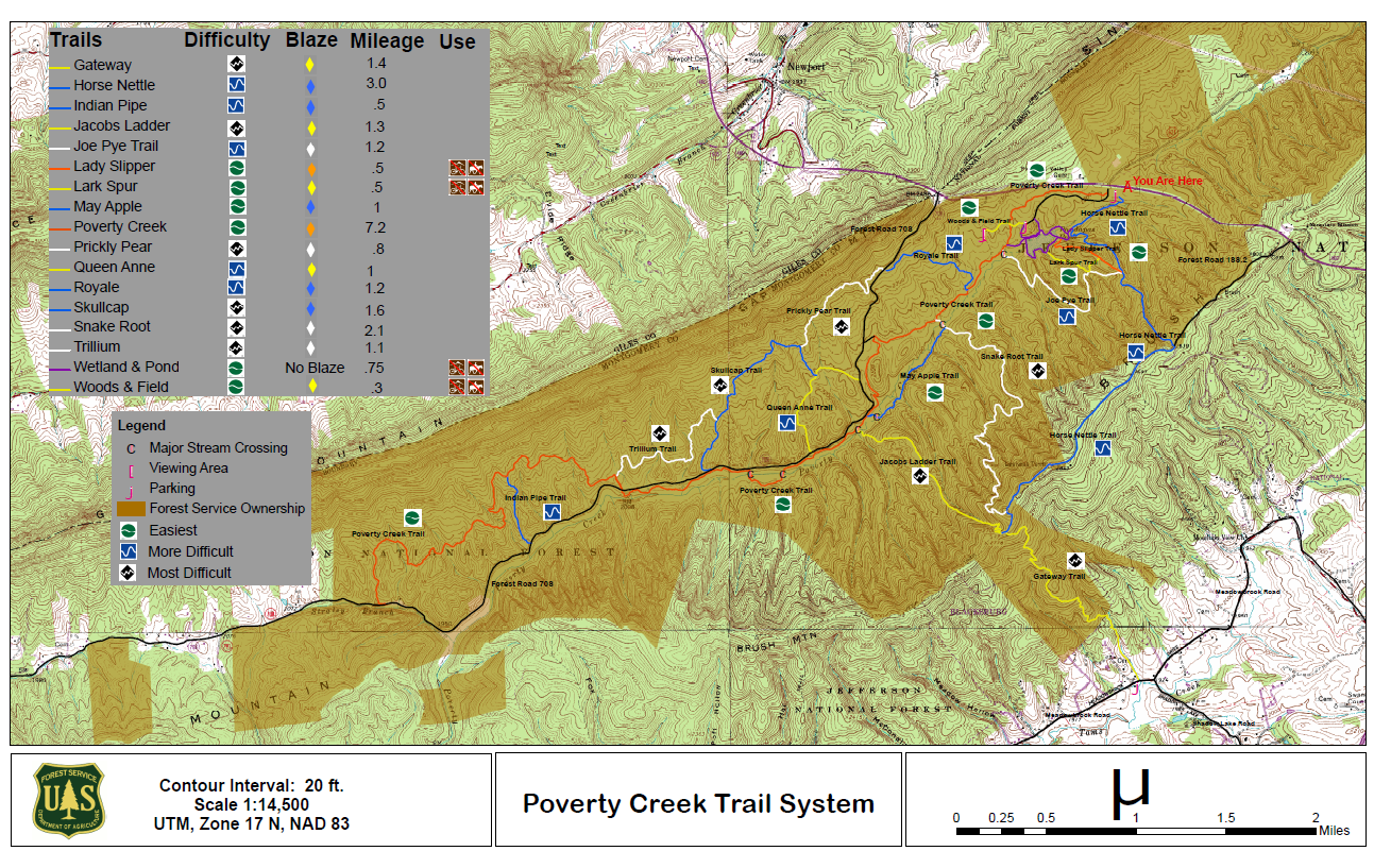
Poverty Creek Trail System Map
Restrictions Dogs must be leashed. <table border="0" cellpadding="1" cellspacing="1" style="width:500px"><tbody><tr><td><a href="http://www.fs.usda.gov/Internet/FSE_MEDIA/fseprd485549.jpg"><img alt="Map delineates the boundary of the no hunting zone which surrounds the Pandapas pond day use area" src="http://www.fs.usda.gov/Internet/FSE_MEDIA/fseprd485549.jpg" style="height:50px; width:68px" /></a></td><td>Hunting is not permitted in the area around Pandapas pond. </td></tr></tbody></table>
Every trail in George Washington and Jefferson National Forest