
National Monument · New Mexico
Trails in El Malpais National Monument
10 named trails · 104 miles · 6 trailheads · 3 with the Park Service's own write-up. The lines, trailheads and points are the Park Service's; the write-ups are the Service's own words; the climbing is read from USGS elevation along each line.
10 trails, A to Z.
Continental Divide National Scenic Trail
Picnic areasVisitor centers
Along the way Visitor Center Area El Malpais National Monument Information Center (NPS)
Trailheads Acoma-Zuni Trailhead 6,877 ft Drive there · El Calderon Loop Trailhead 7,268 ft Drive there
Continental Divide National Scenic Trail/Zuni-Acoma Trail
Trailhead Acoma-Zuni Trailhead 6,877 ft Drive there
El Calderon Loop
Trailhead El Calderon Loop Trailhead 7,268 ft Drive there
Hole-In-The-Wall
Lava Falls
Trailhead Lava Falls Trailhead 7,124 ft Drive there
Traverse the Lava Falls Trail the Park Service's write-up
1-2 Hours · dogs allowed
Start Lava Falls Trailhead
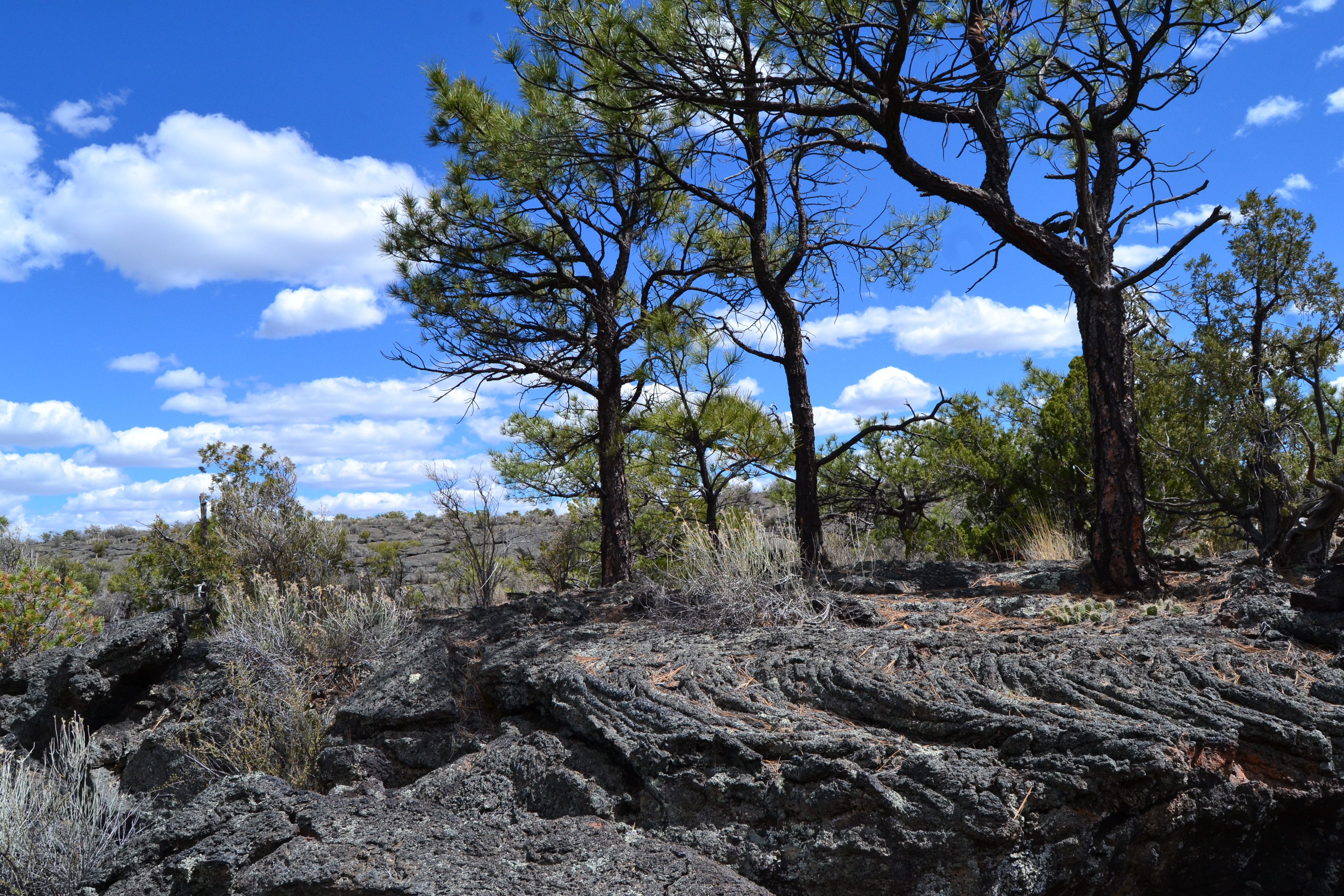
Hike on a lava flow! The Lava Falls Trail offers a unique way to experience the youngest lava flow at El Malpais National Monument. This rugged, one-mile cairned route across the lava passes by numerous volcanic features. Among the features you may encounter is the McCartys Crater-- the source of the lava you are hiking on--visible as a jagged ridge in the middle of the lava field and the Lava Falls Amphitheater. Pressure ridges, squeeze ups and lava toes can also be encountered. Good examples of pāhoehoe lava, which is smooth and ropy, abound on this trail.
This trail is a cairn- marked route, following the rock stacks around the loop. Always make sure you have a cairn in sight when hiking this route. Due to the very rugged nature of hiking on lava, good shoes, appropriate clothing and plenty of water are essential. This hike is best done early or late in the day when it is cooler and is not recommended for pets due to its rugged nature. The lava flow has little shade and is very exposed, so be mindful of weather conditions before you set out.
Accessibility Trailhead signs, brochure box, picnic tables, and vault toilets are easily accessed from the gravel parking lot. The hiking route across the lava is very strenuous, with numerous deep cracks, uneven ground and sharp lava.
Pack Trail
Spatter Cones
The Narrows
Hike the Narrows Rim Trail the Park Service's write-up
1-6 Hours · dogs allowed
Start Narrows Rim Trail
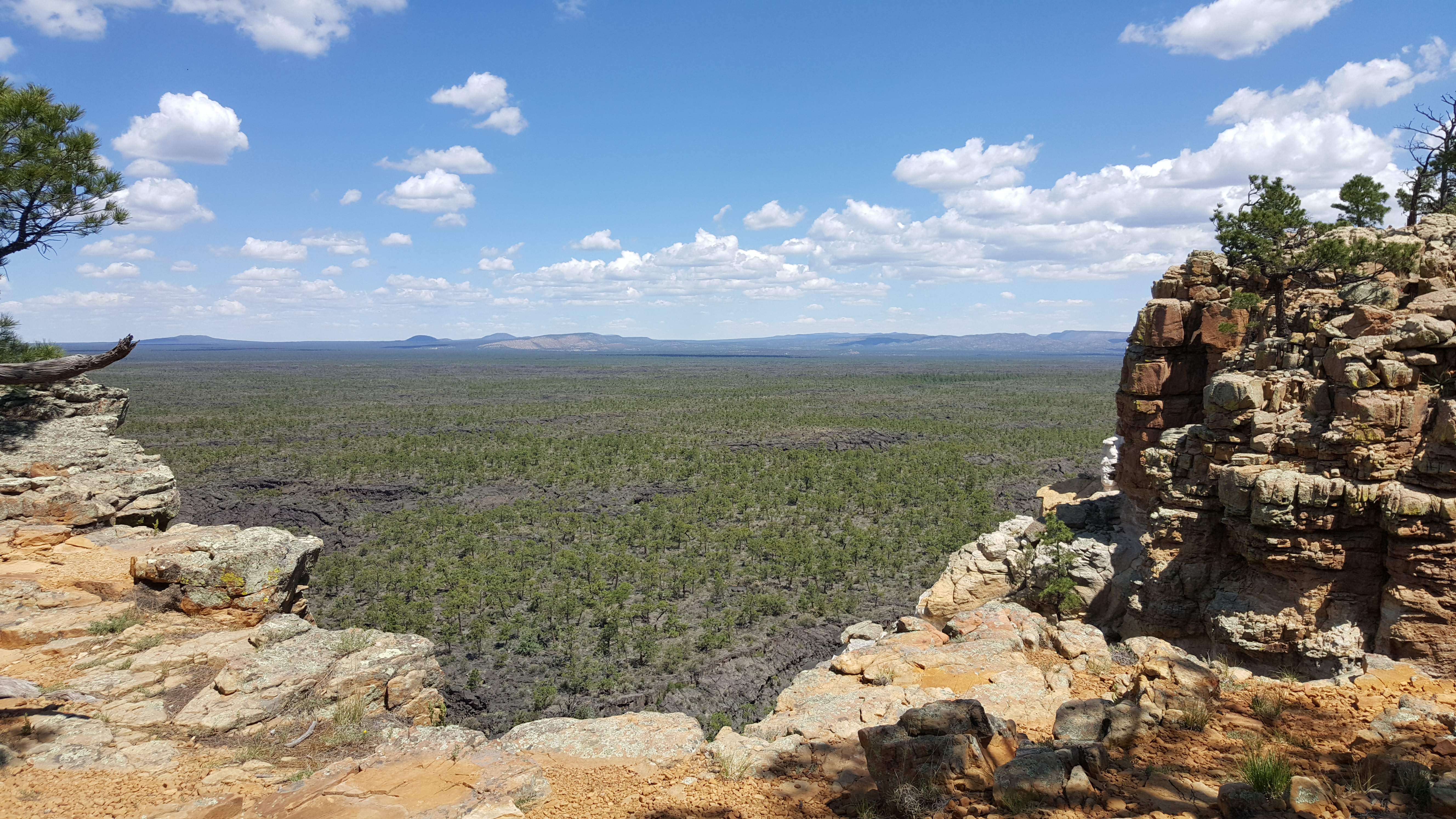
Enjoy spectacular views from this hike along Cretaceous-aged sandstone ramparts high above the young lava landscape of El Malpais National Monument. The expansive scenery of the lava flows and surrounding countryside ends with a distant view of the La Ventana Natural Arch. This moderate hike is 8 miles round trip and is dog friendly. Sweeping panoramic views over the McCartys Lava Flow can be had just a short distance (about 30 minutes or so) up this trail for those not wishing to do the entire hike.
Accessibility This trail is rocky and uneven. The beginning of the trail requires large steps up onto the sandstone bluff. The trail is sometimes difficult to find. Once at the top of the bluff, the trail is mostly flat.
Zuni-Acoma Trail
Trailhead Zuni-Acoma Trailhead 6,934 ft Drive there
Follow Ancient Footpaths on the Zuni-Acoma Trail the Park Service's write-up
2-8 Hours · dogs allowed
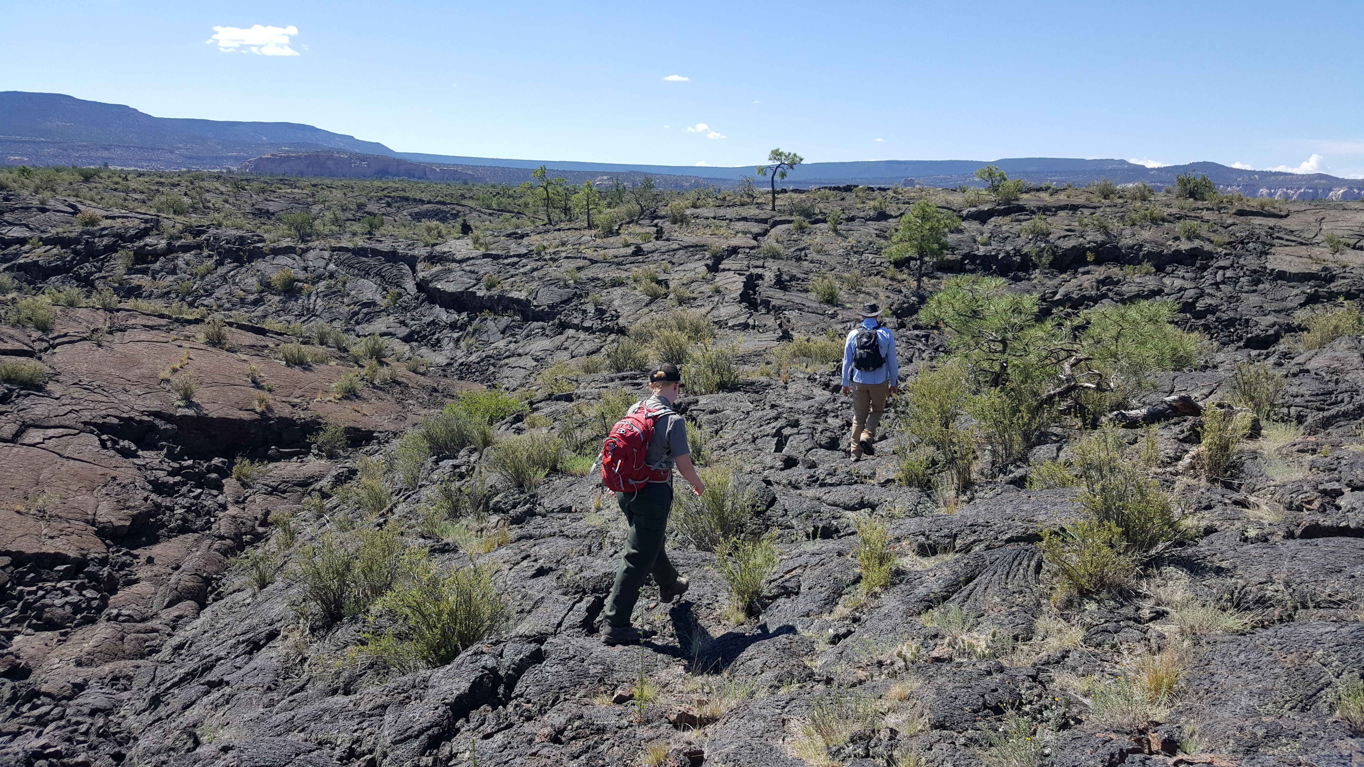
Hike a historic trail across the lava flows of El Malpais. The Zuni-Acoma trail is an ancient trail used by Puebloans, Navajo, Spanish and American explorers, and other travelers to journey between the pueblos of Zuni and Acoma. It is a very strenuous 7.5 mile one-way hike (a car shuttle is recommended) and follows a cairned route most of the way. This classic El Malpais hike is part of the 3,100 mile long Continental Divide National Scenic Trail. You can sample short parts of the Zuni-Acoma trail from either trailhead if you aren’t up for the entire hike. Due to its strenuous nature, this hike best done in the cooler months and is not recommended for pets due to the jagged rock of the lava flow.
The Zuni-Acoma trail is accessible from either Highway 117 or Highway 53 . The Highway 53 Trailhead has vault toilets and picnic tables.
Accessibility This Zuni-Acoma trail crosses several major lava flows. The trail is a route across the lava marked by cairns. The lava surface is very sharp and uneven. In many places, the route crosses deep crevasses that must be stepped across.
More hikes the Park Service describes
Write-ups that name no single mapped trail, in the Service's words.
- Explore Sandstone Bluffs Overlook · 15-60 Minutes · dogs allowed
Gaze across one of the youngest lava flows in the continental U.S. from the vantage of a high sandstone bluff created during the time of the dinosaurs. Explore the cliffs for different views, including a glimpse of New Mexico's second highest mountain! - Hike the El Calderon Trail · 1-3 Hours · dogs allowed
El Calderon Area at El Malpais National Monument offers easy to moderate difficulty hiking past lava tube caves, over ancient lava flows, and around the top of an extinct cinder cone. This trail can be hiked as a 3 mile or 5 mile route. - Visit La Ventana Natural Arch · 20-30 Minutes · dogs allowed
La Ventana Natural Arch is a beautiful natural arch formation located just off Highway 117 in El Malpais National Conservation Area.
About these trails
The lines are the National Park Service's public trails layer, the trailheads and the waterfalls, views, peaks and historic places along them the Service's public points of interest, read 2026-10-14 and simplified for the map. The write-ups are the Service's own "things to do", unedited. Heights come from USGS 3DEP through Terrain Tiles on AWS (Mapzen/Tilezen), read along each line and rounded; a short trail on steep ground can be off by a few tens of feet. Closures change: check the park's own site before you go.