Amphitheater
Backcountry campsExhibitsPicnic areas
Along the way Campsite Campsite Campsite Campsite Campsite Campsite Campsite Host Campsite 004 005 South Side Trail Picnic Area

National Monument · Wyoming
7 named trails · 8 miles · 1 trailhead · 3 with the Park Service's own write-up. The lines, trailheads and points are the Park Service's; the write-ups are the Service's own words; the climbing is read from USGS elevation along each line.
7 trails, A to Z.
Backcountry campsExhibitsPicnic areas
Along the way Campsite Campsite Campsite Campsite Campsite Campsite Campsite Host Campsite 004 005 South Side Trail Picnic Area
Exhibits
Along the way viewing tube viewing tube
Exhibits
Along the way Canyon Floor Forest Joyner Ridge Trail Prairie
Trailhead Trailhead 4,201 ft Drive there
1-2 Hours · no dogs
Start Joyner Ridge parking area
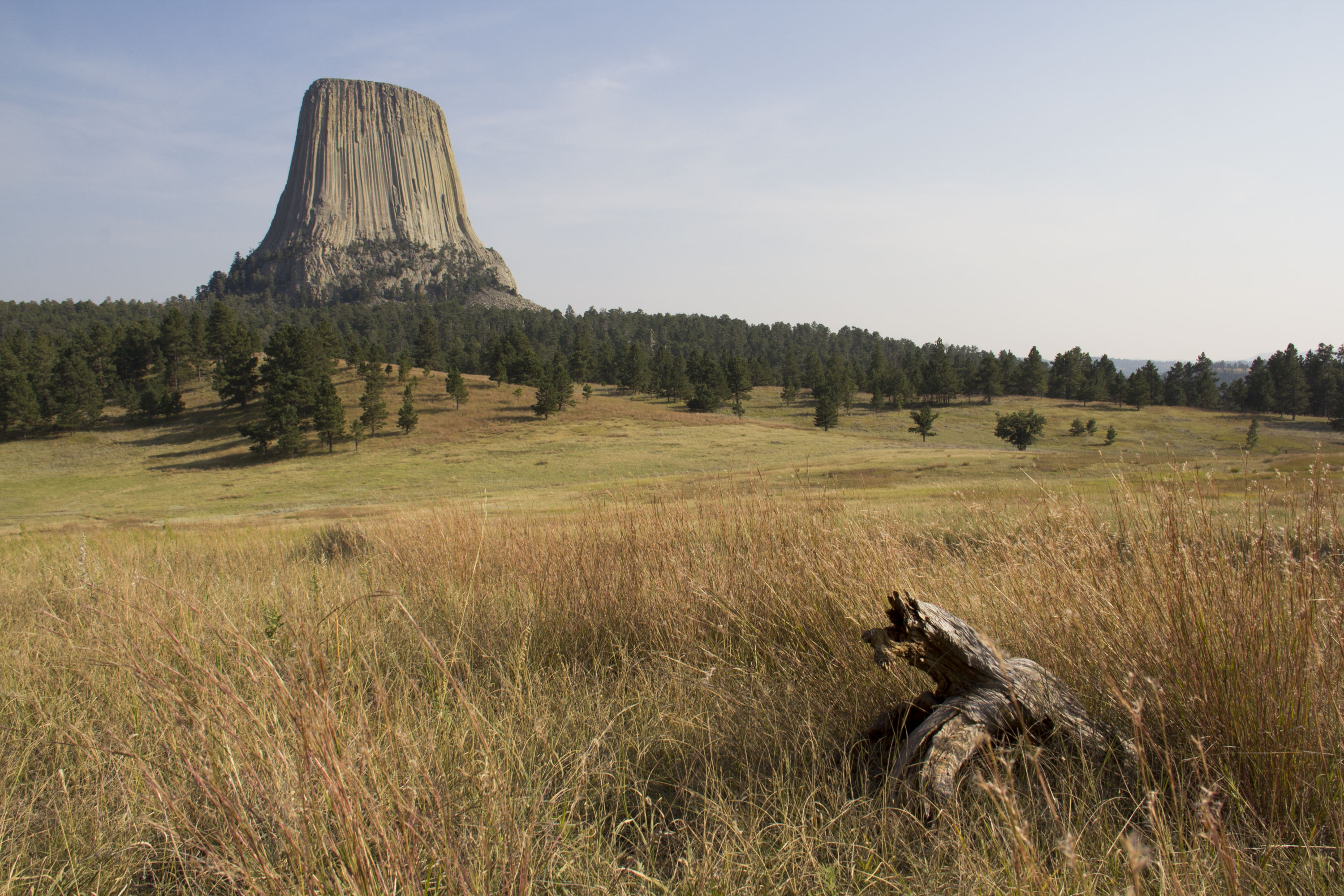
Joyner Ridge Trail is one of the most scenic trails at Devils Tower. Located along the north boundary, this 1.5-mile (2.4 km) loop follows Joyner Ridge and dips down into the draw below. Named after Devils Tower park custodian Newell Joyner , this trail offers dramatic views of the Tower and winds its way through tall grass prairies and dense forests. You may even spot a deer or two on your hike.
Along the way learn more about the wide variety of ecosystems at the park via wayside exhibits. During the late spring and summer months at the Tower, bring your wildflower guide book to spot pasqueflowers, sego lilies, Oregon grape and more!
Enjoy the full loop of Joyner Ridge Trail or use the 0.6-mile (1 km) connector trail (located about half-way) to Red Beds Trail to explore the rest of the park.
Be aware that there is significant elevation change along the eastern portion, dropping from or climbing the ridge. The trail is not maintained in the winter, and commonly has packed snow and ice from December through April.
Pets You may walk leashed pets on the unpaved road leading to the Joyner Ridge parking area.
Accessibility The Joyner Ridge Trail is not accessible by ADA standards; it is not wheelchair or assistive device accessible. This primitive trail has rocky, uneven terrain with steep sections throughout. Many parts consist of loose rocks and dirt and is only wide enough for one person. Along the ridge line there are steep drop offs with no railings.
ExhibitsVisitor centers
Along the way 001 002 alt 1-5, Climbing Plant Succession Red Beds Trail Red Beds Trail Tower Trail vista overlook vista overlook Visitor Center
2-3 Hours · no dogs
Start Devils Tower National Monument
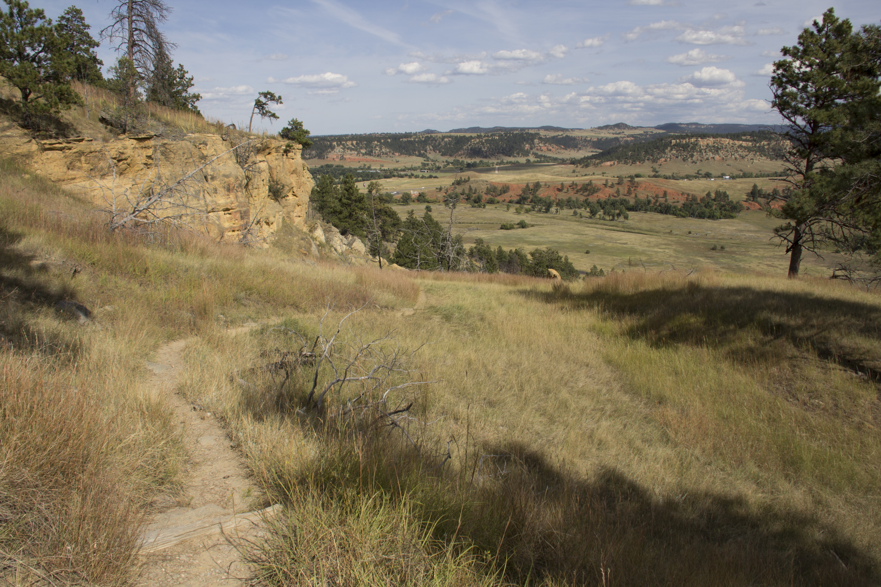
For those craving a traditional hiking experience at Devils Tower, the Red Beds Trail is a 2.8 mile (4.5 km) moderately strenuous path that loops around the Tower. This trail climbs up and down between the river valley and the visitor center, offering stunning views of the Tower and surrounding landscape. Get up-close views of the underlying geologic formations , including the red beds of the Spearfish Formation- the oldest visible rocks in the park! Learn about this region’s past from clues in these rocks.
Be aware that this trail contains steep, rocky sections. For a shorter, less-strenuous loop around the Tower, check out the Tower Trail . Wear comfortable walking shoes and bring plenty of water. The trail is open year-round; it is very sunny in the summer and is not maintained in the winter.
Pets Pets are not allowed on any hiking trail in the park.
Accessibility The Red Beds Trail is not accessible by ADA standards. Most of the trail is only wide enough for one person; it is not wheelchair or assistive device accessible. There are many steep sections on this primitive trail, including rock stairs without railings and portions of the trail with loose rocks and dirt. Be aware that there are sections of the Red Beds Trail that have steep drop offs along the side. During the summer, most of this trail is directly exposed to sunlight.
Exhibits
Along the way Canyon Floor
ExhibitsVisitor centers
Along the way 002 002 alt 003 1-5, Climbing Climbing Routes Different Faces of the To Fallen Column Plant Succession Red Beds Trail Red Beds Trail The Buried Tower Tower Fragments and 8 more
2-3 Hours · no dogs
Start Devils Tower National Monument
For those craving a traditional hiking experience at Devils Tower, the Red Beds Trail is a 2.8 mile (4.5 km) moderately strenuous path that loops around the Tower. This trail climbs up and down between the river valley and the visitor center, offering stunning views of the Tower and surrounding landscape. Get up-close views of the underlying geologic formations , including the red beds of the Spearfish Formation- the oldest visible rocks in the park! Learn about this region’s past from clues in these rocks.
Be aware that this trail contains steep, rocky sections. For a shorter, less-strenuous loop around the Tower, check out the Tower Trail . Wear comfortable walking shoes and bring plenty of water. The trail is open year-round; it is very sunny in the summer and is not maintained in the winter.
Pets Pets are not allowed on any hiking trail in the park.
Accessibility The Red Beds Trail is not accessible by ADA standards. Most of the trail is only wide enough for one person; it is not wheelchair or assistive device accessible. There are many steep sections on this primitive trail, including rock stairs without railings and portions of the trail with loose rocks and dirt. Be aware that there are sections of the Red Beds Trail that have steep drop offs along the side. During the summer, most of this trail is directly exposed to sunlight.
0-30 Minutes · no dogs
Start Belle Fourche River hub
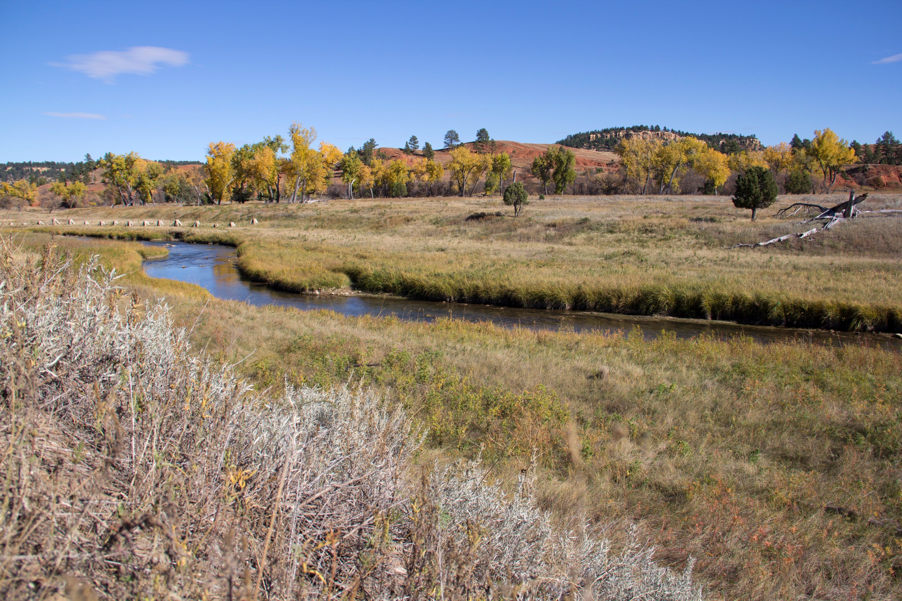
Valley View Trail is perfect for young hikers or a quick leg stretch. This 0.6 mile (1 km), one-way, trail starts at the park amphitheater (Belle Fourche River hub) and swerves right to wind through prairie dog town and past the Belle Fourche River. The trail crosses the park road near the Belle Fourche River bridge and ascends to junction with Red Beds Trail . Red Beds Trail also connects with South Side Trail , Joyner Ridge Trail , and the visitor center and Tower Trail .
Hikers young and old will enjoy exploring the bustling town of prairie dogs. Scenic views of cottonwoods, the Belle Fourche River, and Devils Tower are a bonus. Some prairie dog burrows are close to the trail, so watch your step! Do not approach, touch, or feed prairie dogs or their burrows.
Common Trail Combinations:
Amphitheater Circuit (Valley View to Red Beds to South Side trails): 1.5-mile loop
Valley View to Red Beds Loop: 4 mile hike using Valley View Trail to access Red Beds loop and return to amphitheater
Pets Pets are not allowed on any hiking trail in the park.
Accessibility Valley View trail is not accessible by ADA standards. The trail is wide enough for one person and is not wheelchair or assistive device accessible. The trail ascends after the road crossing to reach Red Beds Trail. During summer, most of this trail is in direct sunlight. The trail is mostly packed dirt, with sections of loose rock and dirt.
40 Minutes · no dogs
Start Devils Tower National Monument
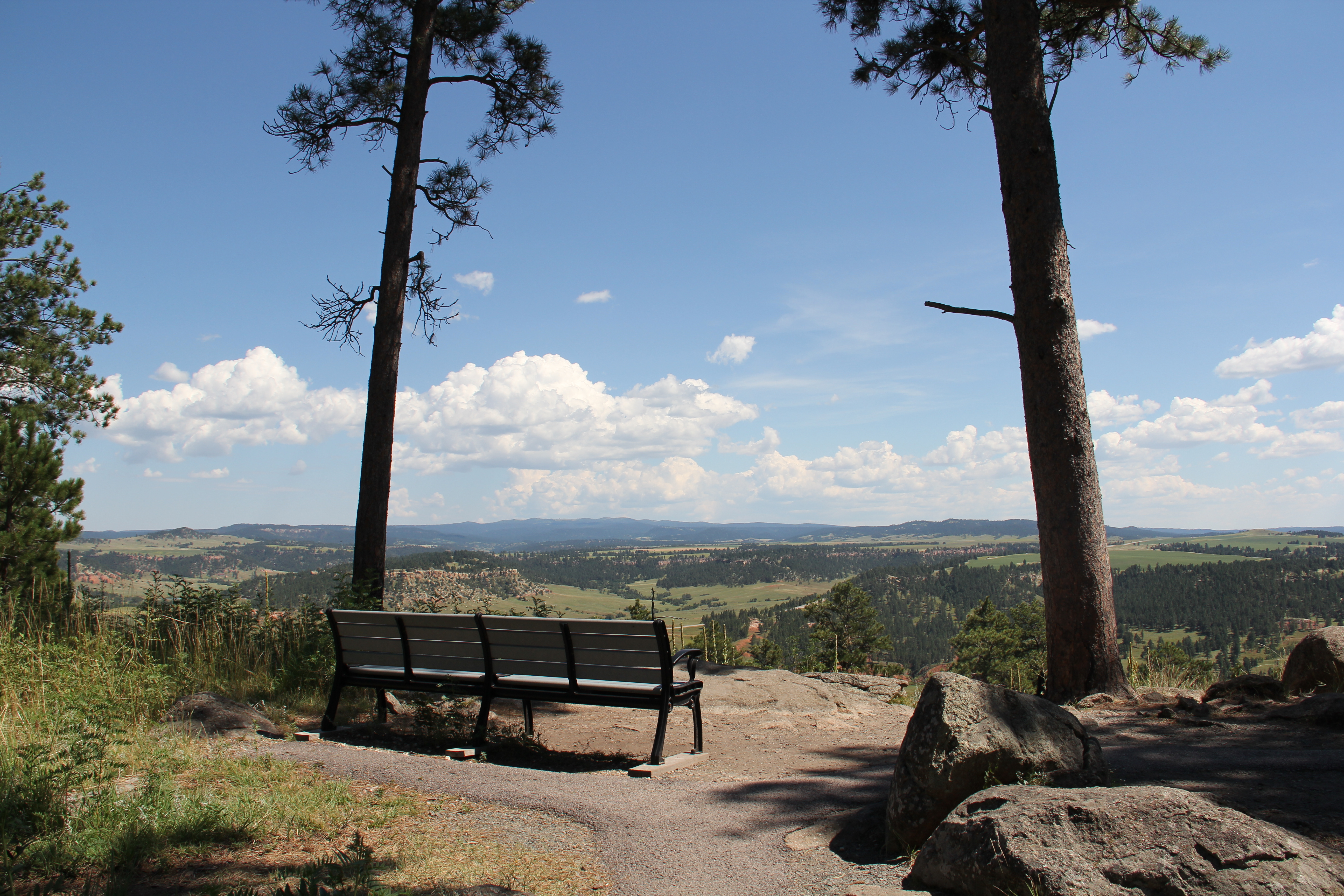
The Tower Trail is a 1.3-mile (2-km) paved walking path around the base of Devils Tower. Although it has a very steep start, and some uphill-downhill sections, the trail is generally easy to walk. Benches, waysides and beautiful views offer plenty of chances for relaxation.
Waysides throughout the trail help visitors learn about the natural and cultural history of the park. Access to rock scrambling is available from the trail, and many visitors enjoy watching the rock climbers as they make their way up and down the Tower.
This trail takes about 45-60 minutes to walk, and is a great way to experience the park for those visitors only staying a short time. Wear comfortable walking shoes and bring water. The trail is open year round, but is not maintained in the winter. It commonly has packed snow and ice from December through April.
Pets Pets are not allowed on any hiking trail in the park.
Accessibility The Tower Trail is not accessible by ADA standards. The first section of the trail includes a +20% grade. Other sections have a +10% grade. However, it is a paved path; some parts are narrower than others, but it is a minimum of 30 inches wide. Visitors should use their own judgment if they would like to access this trail with a wheelchair, walker, or other mobility assistance device.
Exhibits
Along the way 004 005 Prairie Dog Town South Side Trail
Write-ups that name no single mapped trail, in the Service's words.
The lines are the National Park Service's public trails layer, the trailheads and the waterfalls, views, peaks and historic places along them the Service's public points of interest, read 2026-10-14 and simplified for the map. The write-ups are the Service's own "things to do", unedited. Heights come from USGS 3DEP through Terrain Tiles on AWS (Mapzen/Tilezen), read along each line and rounded; a short trail on steep ground can be off by a few tens of feet. Closures change: check the park's own site before you go.