Blueberry Hill Trail
Trailhead Blueberry Hill Trailhead 2,064 ft Drive there

National Park & Preserve · Alaska
57 named trails · 68 miles · 32 trailheads · 2 with the Park Service's own write-up. The lines, trailheads and points are the Park Service's; the write-ups are the Service's own words; the climbing is read from USGS elevation along each line.
57 trails, A to Z.
Trailhead Blueberry Hill Trailhead 2,064 ft Drive there
Trailhead Murie Center Trailhead 1,805 ft Drive there
Visitor centers
Along the way Eielson Visitor Center
Trailheads Eielson Alpine Trailhead 3,790 ft Drive there · Tundra Loop Trailhead 3,768 ft Drive there
Visitor centers
Along the way Eielson Visitor Center
Trailheads Eielson Alpine Trailhead 3,790 ft Drive there · Gorge Creek Trailhead 3,700 ft Drive there · Tundra Loop Trailhead 3,768 ft Drive there · Tundra Spur Trailhead 3,730 ft Drive there
Trailhead Tundra Spur Trailhead 3,730 ft Drive there
Visitor centers
Along the way Eielson Visitor Center
Trailheads Eielson Alpine Trailhead 3,790 ft Drive there · Tundra Loop Trailhead 3,768 ft Drive there
Trailhead Gorge Creek Trailhead 3,700 ft Drive there
Trailhead Horseshoe Lake Trailhead 1,771 ft Drive there
2-3 Hours · no dogs · Spring, Summer, Fall
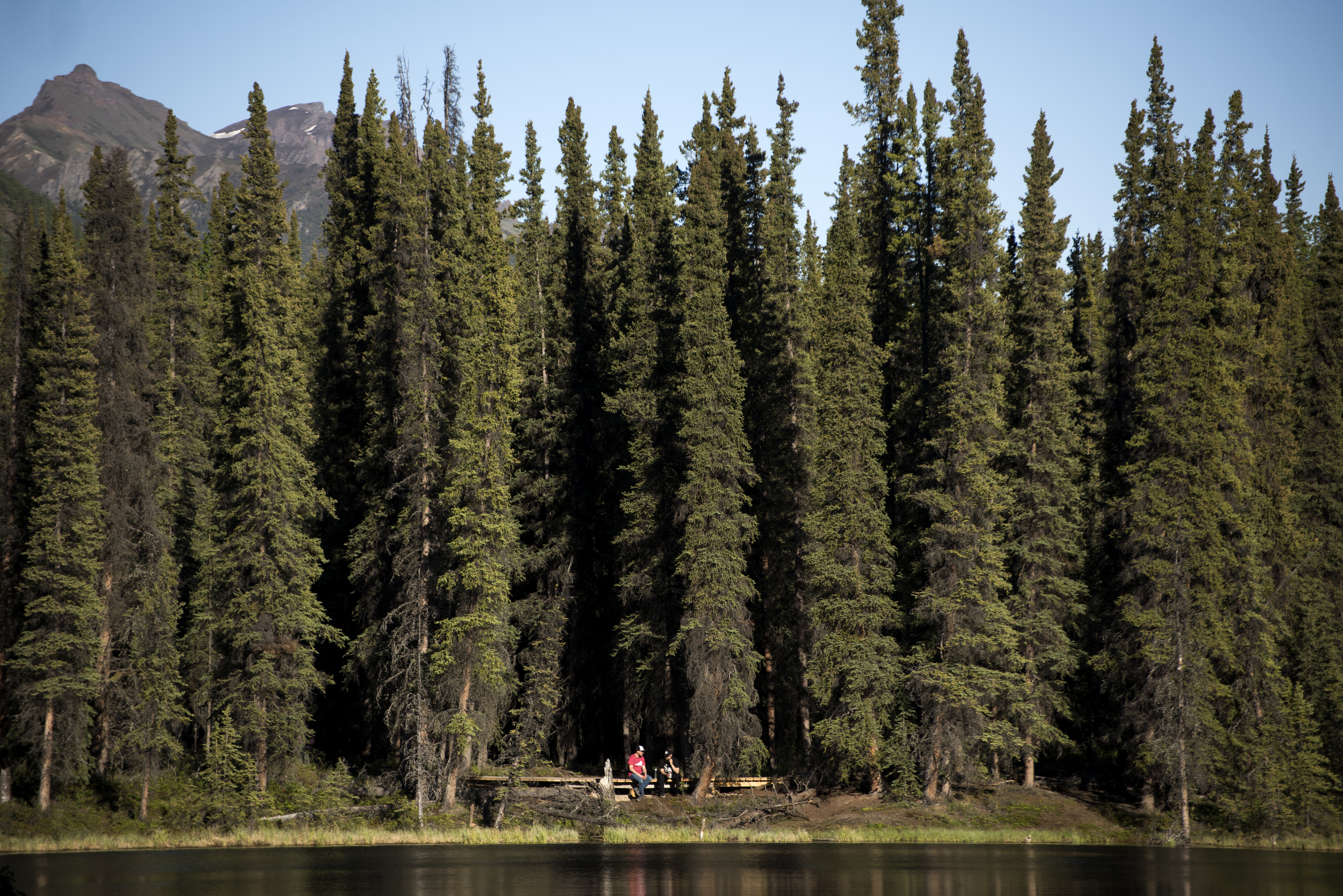
Horseshoe Lake Trail starts high above its namesake lake. A bench offers a nice overlook of the lake, and affords a resting spot for hikers who do not wish to descend (and then ascend!) a steep hill.
Description
This is one of the most popular trails in Denali, but it is not usually busy early in the morning. If you start hiking by 7 am, you are likely to encounter few fellow-hikers. This also ensures you will be back at the visitor center well before noon, which is a common departure time for people leaving Denali by train or bus.
Horseshoe Lake is one of the best places to look for wildlife in the entrance area of Denali. Though wildlife sightings are never guaranteed, an early morning hike to Horseshoe Lake is one of your best bets for seeing a variety of animals, such as beavers, waterfowl and moose.
Benches overlook the lake from high above, after which the trail descends steeply to the lake. Hikers who travel downhill will find the trail winding its way around the lake, making a large loop. Several observation platforms sit along the lake, letting you keep an eye out for wildlife. The trail also gets very close to a beaver dam (please be sure not to walk off trail and onto the dam!).
Hiking the entire trail without any stops will take around 2 hours, but you may find it rewarding to spend more time in the area, enjoying the tranquility of the lake and hoping to spot some wildlife.
Access
There are several ways to reach this trail.
From the Denali Visitor Center
The most direct route is to hike the Bike Path in the direction of the Denali Bus Depot. At the railroad tracks, cross the park road and continue along the Horseshoe Lake Trail.
A longer route is to hike the Taiga Trail until it meets the Horseshoe Lake Trail. This route adds roughly 1 mile round-trip (or just half a mile if you plan to only hike the Taiga trail on the way to or from the lake, instead of in both directions).
From the Denali Bus Depot
Hike the Bike Path in the direction of the Denali Visitor Center. At the railroad tracks, cross the park road and continue along the Horseshoe Lake Trail.
From the park road / Alaska Railroad junction
A small parking lot is at the junction of the park road and the train tracks. You can park there or be dropped off by your hotel.
Wildlife Safety
Any time you're in Denali, you might encounter bears, wolves, or moose. Know how to behave around wildlife to keep yourself and wild animals safe!
Pets Pets are prohibited on most park trails.
Accessibility Quick Details Distance (round-trip from the Denali Visitor Center): 2.2 miles Duration (round-trip): Around 2 hours Elevation change: 250 feet gain, mainly in one long hill. Max grade: 20% Trail width: 5' Surface: A mix of well-compacted gravel, loose gravel and areas of exposed roots and other impediments. Though pets are prohibited on this trail, service animals are able to accompany visitors.
Trailhead Mount Healy Trailhead 1,896 ft Drive there
Trailhead McKinley Bar Trailhead 2,143 ft Drive there
Visitor centers
Along the way Denali Visitor Center
Trailheads McKinley Station Trailhead 1,816 ft Drive there · McKinley Station Trailhead 1,686 ft Drive there · Morino Trailhead 1,814 ft Drive there · Spruce Forest Trailhead 1,815 ft Drive there · Taiga Trailhead 1,815 ft Drive there · Triple Lakes Trailhead 1,799 ft Drive there
Trailhead Meadow View Trailhead 1,965 ft Drive there
Trailhead Morino Trailhead 1,814 ft Drive there
Shelters
Along the way Mountain Vista Bus Shelter Viewing Shelter
Trailhead Mountain Vista Trailhead 2,801 ft Drive there
Shelters
Along the way Mountain Vista Bus Shelter Viewing Shelter
Trailheads Mountain Vista Trailhead 2,801 ft Drive there · Mountain Vista Trailhead 2,754 ft Drive there
2-6 Hours · no dogs · Spring, Summer, Fall
Start Savage River
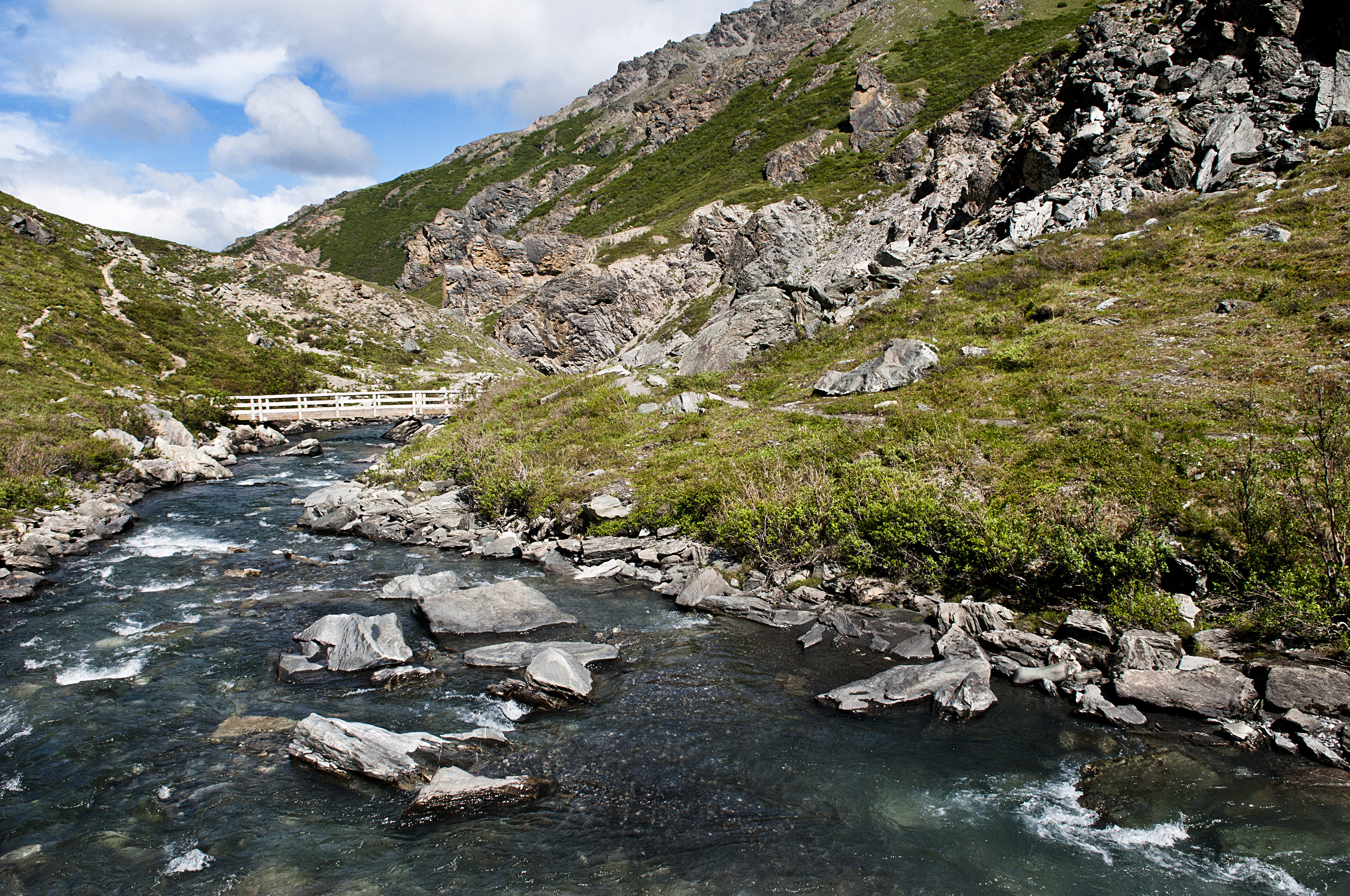
Alaska Native Place Name : Savage River is known as Tr'at'egheth No' in the Lower Tanana dialect, meaning " From Cottonwood Creek ."
Edge of the Wilderness
While most of Denali’s sole road is restricted just to bus traffic, any non-commercial vehicle can drive out to Mountain vista and Savage River in summer, as well as part of the spring and fall.
Located about 15 miles inside the park, the area is scenic, featuring several trails (some short, one long) and a picnic area.
Know Before You Go
You can park at, or ride the free bus to, either the Mountain Vista Rest Stop (Mile 13) or to the Savage Rest Area (Mile 15). Savage River Campground is situated between the two day-use areas. Trails connect the two areas, or you can walk the road.
The Savage River Shuttle can accommodate up to two bikes at a time.
The parking area can get full each day in summer. We recommend using the bus when possible, which you can catch at the Denali Visitor Center (or several other buildings near the park entrance).
This area can be very windy, so bring layers. It is also several hundred feet higher in elevation than the park entrance, so it can be a bit chillier than conditions at the visitor center.
Why Explore Mountain Vista and Savage River?
Scenery
The Denali Park Road is near the tree-line in this area. This means most of the vegetation is short and brushy, which lets you see for long distances. The Alaska Range, to the south, is very prominent and Mount McKinley can be seen on the way to, and from many points around, Savage River.
Wildlife
On occasion, large animals like bears, moose, Dall sheep and caribou can be seen in the area.
Access
You can get here in your own car when the park road is open (roughly May-September, sometimes in April and October). In summer, you can also use a free bus called the Savage River Shuttle to get here.
Things to Do at Savage River
Long hike
The Savage Alpine Trail is a strenuous trail. Start at either the Savage River parking lot or the Mountain Vista parking lot and hike one-way on the trail; in summer, you can then use a free bus called the Savage River Shuttle to travel back to your car (or back to the park entrance, if you came to the area originally via shuttle). You may also hike off-trail in this area, as long as you do not see any temporary signs indicating a wildlife closure has been instituted for any reason. Learn more about hiking in Denali .
Short hike
The Savage River Loop Trail is about 2 miles round-trip. It meanders alongside Savage River for about a mile, crosses the river on a small bridge, and winds back to the parking area.
Picnic
Picnic tables are available. Please be cautious about your food; mew gulls and squirrels in this area can be very persistent at trying to steal food. Do not allow wildlife to obtain food from you!
Leaf-peeping
In August, this landscape typically erupts into a vivid sea of red foliage, as dwarf birch is prevalent. The exact peak of fall colors is variable, but typically the second or third week of August is the high point.
Cross-country ski
The road is impassable to this point for most of the early and mid-winter, but we begin plowing the park road in March. Once vehicle access is possible, in late winter and spring, this is a popular area for skiing.
Accessibility The free Savage River Shuttle is wheelchair-accessible. Restrooms at Mountain Vista Rest Area and the Savage River Rest Area are wheelchair accessible. Savage River Loop Trail For the first quarter-mile, the Savage River Loop Trail is surfaced with compacted gravel and is 48” wide, with negligible elevation change; after that, the trail grows very narrow ( Savage Alpine Trail This long trail is fairly narrow (
Trailhead Mount Healy Trailhead 1,896 ft Drive there
Visitor centers
Along the way Murie Science and Learning Center
Trailheads Oxbow Trailhead 1,902 ft Drive there · Triple Lakes Southern Trailhead 1,903 ft Drive there
Trailhead Parks Highway Trailhead 1,635 ft Drive there
Trailhead Parks Highway Multi-Use Trailhead 1,603 ft Drive there
Trailhead McKinley Station Trailhead 1,686 ft Drive there
Trailhead Horseshoe Lake Trailhead 1,771 ft Drive there
Visitor centers
Along the way Murie Science and Learning Center
Trailhead Horseshoe Lake Trailhead 1,771 ft Drive there
Trailheads Roadside Trailhead 2,141 ft Drive there · Roadside Trailhead 1,822 ft Drive there · Rock Creek Trailhead 2,109 ft Drive there · Sled Dog Kennels Trailhead 2,141 ft Drive there · Trailhead 2,119 ft Drive there
Trailheads Roadside Trailhead 2,141 ft Drive there · Roadside Trailhead 1,822 ft Drive there
Trailheads Meadow View Trailhead 1,965 ft Drive there · Rock Creek Trailhead 2,109 ft Drive there
Trailheads Savage Alpine Trailhead 2,635 ft Drive there · Savage Alpine Trailhead 2,837 ft Drive there · Savage Canyon Trailhead 2,634 ft Drive there
Trailhead Savage Cabin Interpretive Trailhead 2,825 ft Drive there
Shelters
Along the way Savage River West Bus Shelter
Trailheads Savage Alpine Trailhead 2,635 ft Drive there · Savage Canyon Trailhead 2,634 ft Drive there
Trailhead Mountain Vista Trailhead 2,754 ft Drive there
Shelters
Along the way Bus Shelter
Trailhead Savage Alpine Trailhead 2,837 ft Drive there
Trailheads Roadside Trailhead 2,141 ft Drive there · Sled Dog Kennels Trailhead 2,141 ft Drive there
Visitor centers
Along the way Denali Visitor Center
Trailheads McKinley Station Trailhead 1,816 ft Drive there · Morino Trailhead 1,814 ft Drive there · Spruce Forest Trailhead 1,815 ft Drive there · Taiga Trailhead 1,815 ft Drive there
Visitor centers
Along the way Denali Visitor Center
Trailheads McKinley Station Trailhead 1,816 ft Drive there · Mount Healy Trailhead 1,896 ft Drive there · Roadside Trailhead 1,822 ft Drive there · Spruce Forest Trailhead 1,815 ft Drive there · Taiga Trailhead 1,815 ft Drive there
Trailheads Oxbow Trailhead 1,902 ft Drive there · Triple Lakes Southern Trailhead 1,903 ft Drive there · Triple Lakes Trailhead 1,799 ft Drive there
Visitor centers
Along the way Murie Science and Learning Center
Trailhead Murie Center Trailhead 1,805 ft Drive there
SheltersCampgrounds
Along the way Wonder Lake Campground Bus Shelter Campground Shelter #1
1 more mapped segment without a name is on the map, not in the list.
Write-ups that name no single mapped trail, in the Service's words.
The lines are the National Park Service's public trails layer, the trailheads and the waterfalls, views, peaks and historic places along them the Service's public points of interest, read 2026-10-14 and simplified for the map. The write-ups are the Service's own "things to do", unedited. Heights come from USGS 3DEP through Terrain Tiles on AWS (Mapzen/Tilezen), read along each line and rounded; a short trail on steep ground can be off by a few tens of feet. Closures change: check the park's own site before you go.