
Blue Hen Falls
Hike to Blue Hen Falls from Boston 3 mi round trip · the Park Service's write-up
1-2 Hours · dogs allowed · season <p>The Buckeye Trail includes steep inclines, switchbacks, and stairs. Mud and ice can greatly impact trail quality during wet or wintry conditions.</p>
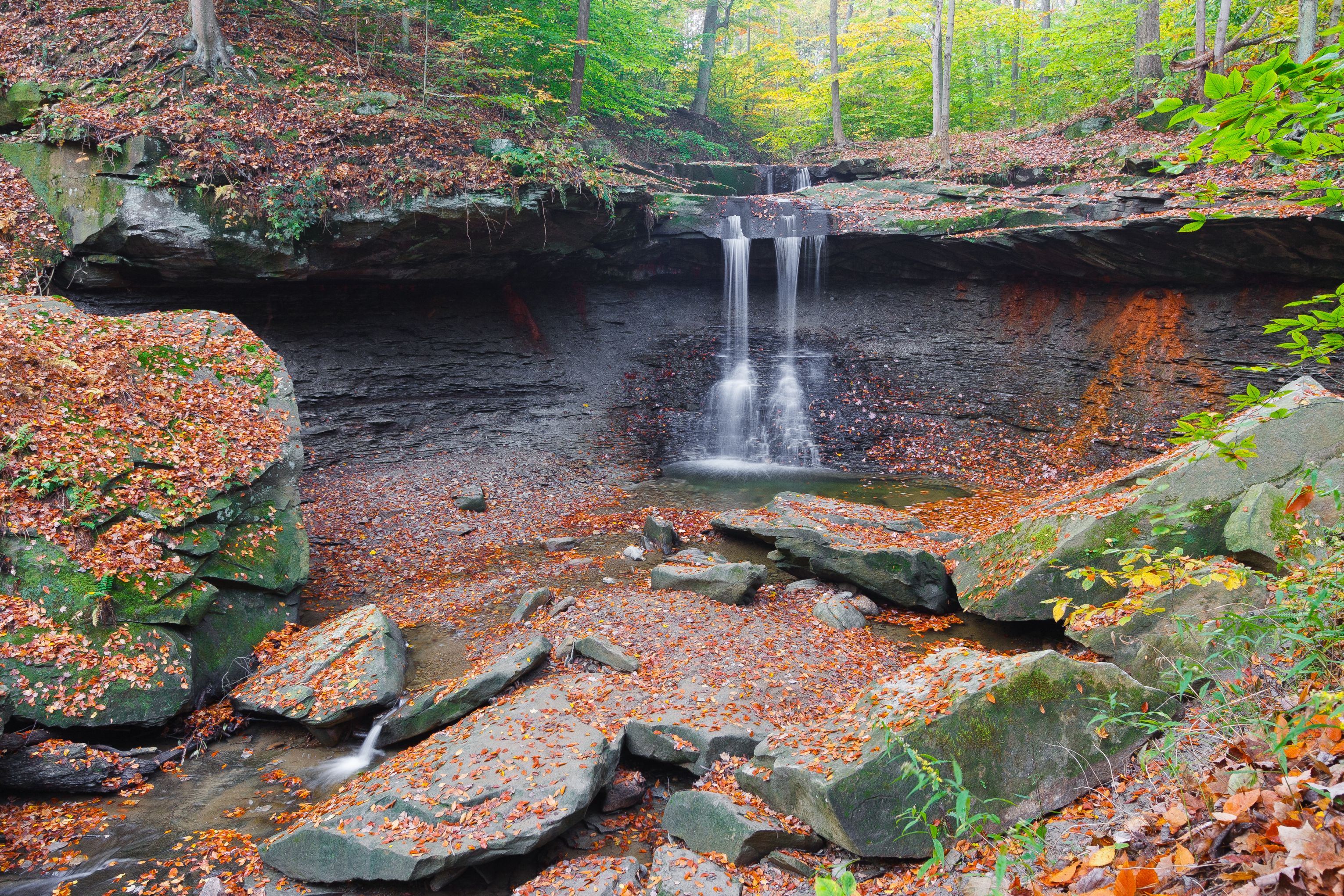
The scenic overlook at Blue Hen Falls is a popular hiking destination in the Boston area. The 15-foot waterfall is lovely throughout the year. The hike is 3 miles roundtrip from the Boston Mill Visitor Center on the rugged Buckeye Trail. There is a 580-foot change in elevation. For most people, that's steep! We recommend wearing sturdy walking shoes. If the ground is wet or icy, save this hike for a drier day.
Park at Boston Mill Visitor Center or Boston Trailhead . Limited spaces are also available at the oversize vehicle lot, across from the main visitor center parking lot. Parking areas tend to fill up on weekends and days with warm weather. Consider doing this hike early or late in the day to avoid the midday crowds.
During operating hours, stop at the visitor center for maps and information. Public restrooms are in the gray building next to the visitor center. Fill up a water bottle here to bring on your hike. There is no drinking water at Blue Hen Falls.
The hike at a glance
Distance: 3 miles roundtrip (or more if parking farther away)
Elevation change: 580 feet
Nearest restrooms & water: Boston Mill Visitor Center
A hilly hike
From the big park sign outside the visitor center, follow the curved path to the intersection of Riverview and Boston Mills roads. Carefully cross Riverview Road and find the stone staircase that marks the entrance to the Buckeye Trail. This statewide trail is marked by blue “blazes” painted on trees and posts. To protect the forest habitat, please follow these blazes and stay on the marked trail.
The trail climbs and descends two steep ridges along its route to the falls. The hike begins with an immediate 200-foot climb. This is followed by a 100-foot staircase down to the ravine floor to cross a footbridge. After crossing the creek, the trail climbs a second hill and skirts around a maintenance yard at the top. Carefully cross Boston Mills Road at the top of the hill and stay alert for oncoming traffic. Follow the trail as it zigzags through the forest and down to the waterfall. Return to Boston along the same route.
Alternate routes
For a longer hike that avoids the busy Boston parking areas, consider starting your hike from elsewhere along the Buckeye Trail. The nearest alternative is the Jaite Trailhead, located near the intersection of Riverview and Vaughn roads. Be sure to consult a map and plan ahead for your hike. Distances and hike times will vary by location. Bring extra water as needed.
Hiking tips and reminders
Pack water and wear sturdy walking shoes.
Do not walk on roads.
The Buckeye Trail can be very muddy and is hilly.
Use caution when crossing roads.
Stay on the main trail to help preserve plants and reduce erosion.
Park only in designated areas. Parking along roadways is prohibited. Vehicles parked illegally may be ticketed and towed.
Accessibility This section of the Buckeye Trail is not wheelchair accessible. It is hilly with an unpaved surface that is rocky and muddy in places. There are multiple staircases along this hike. Service animals and leashed comfort pets are welcome. Audio description is available for exhibit panels in the visitor center.