Amphitheater to North Crater Flow Trail
Trailheads Amphitheater to North Crater Flow Trail Trailhead 5,895 ft Drive there · North Crater Flow Trailhead 5,903 ft Drive there

National Monument & Preserve · Idaho
17 named trails · 12 miles · 12 trailheads · 6 with the Park Service's own write-up. The lines, trailheads and points are the Park Service's; the write-ups are the Service's own words; the climbing is read from USGS elevation along each line.
17 trails, A to Z.
Trailheads Amphitheater to North Crater Flow Trail Trailhead 5,895 ft Drive there · North Crater Flow Trailhead 5,903 ft Drive there
Campgrounds
Along the way Lava Flow Campground
60-90 Minutes · no dogs · Spring, Summer, Fall
Start Tree Molds Parking Area
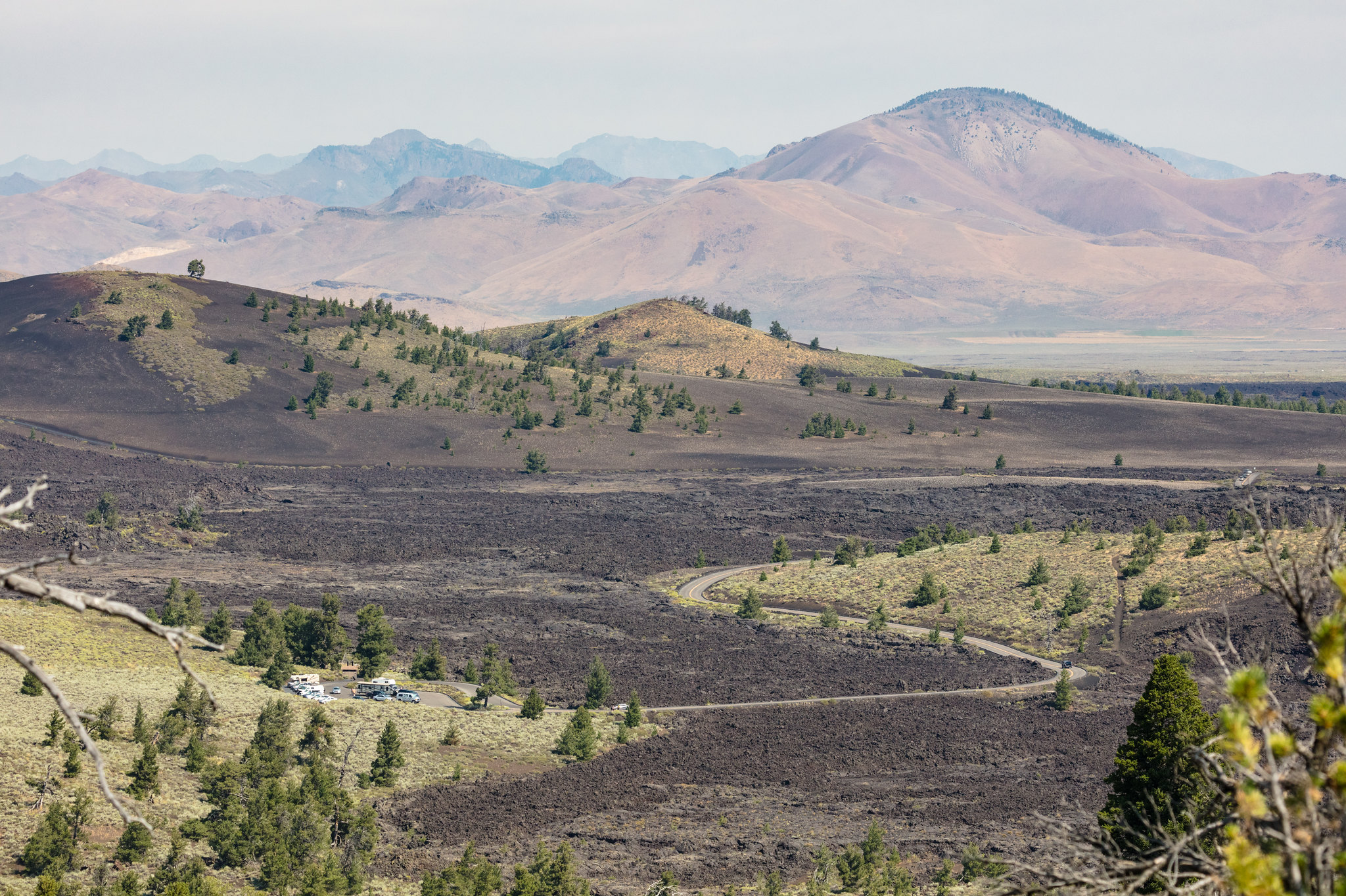
Trail Length: 1.8 mi (3 km) Loop
Elevation gain: 242 ft (74 m)
The Broken Top Loop Trail is one of the most outstanding trails within Craters of the Moon. You can observe nearly every type of volcanic feature characteristic of the basaltic eruptions that created this unearthly landscape. This trail also provides access to the Wilderness Trail.
The Broken Top Loop Hiking Guide lets you learn about this amazing area on your hike and is available at the trailhead or from the visitor center bookstore managed by the Craters of the Moon Natural History Association.
Pets Pets are not allowed on any trails or in caves. Lava rocks are rough and jagged. The surface of the dark rocks can reach 150°F (65°C) or more in the summer and quickly burns paws. Pets should never be left unattended in vehicles or the campground. Parking areas do not have shade and air temperatures can exceed 90°F (32°C) in the middle of summer.
Accessibility TRAIL LENGTH: 1.8 miles (3 km) loop CUMULATIVE ELEVATION CHANGE: Gain 242 ft (74 m), loss 197 ft (60 m) TYPICAL GRADE: 3° (4.8%) 23% of trail is from 4.5° to 32° (8% to 62%) Standard wheelchair ramp is 4.5° (8%) TYPICAL CROSS SLOPE: 1° (2.3%) 12% of trail is from 4.5° to 16° (8% to 29%) TYPICAL TREAD WIDTH: 49 in (124 cm) MINIMUM TREAD WIDTH: 18 in (46 cm) TRAIL SURFACE: Gravel-like cinders and lava 74% of trail is FIRM, 26% of trail is HARD or PAVED OBSTRUCTIONS: ROCKS to 12 inches, RUTS to 10 inches, STEPS to 20 inches WARNING: Trail conditions may have changed since this trail was assessed. Temporary obstructions may include downed trees and rock fall. Maximum grades and cross slopes may vary by 10% or more.
Picnic areas
Along the way Caves Picnic Area
Trailhead Caves Trailhead 5,744 ft Drive there
Picnic areas
Along the way Devil's Orchard Picnic Area
Trailheads Devil's Orchard Trailhead 5,742 ft Drive there · Devil's Orchard Trailhead 5,742 ft Drive there
30-45 Minutes · no dogs · Spring, Summer, Fall
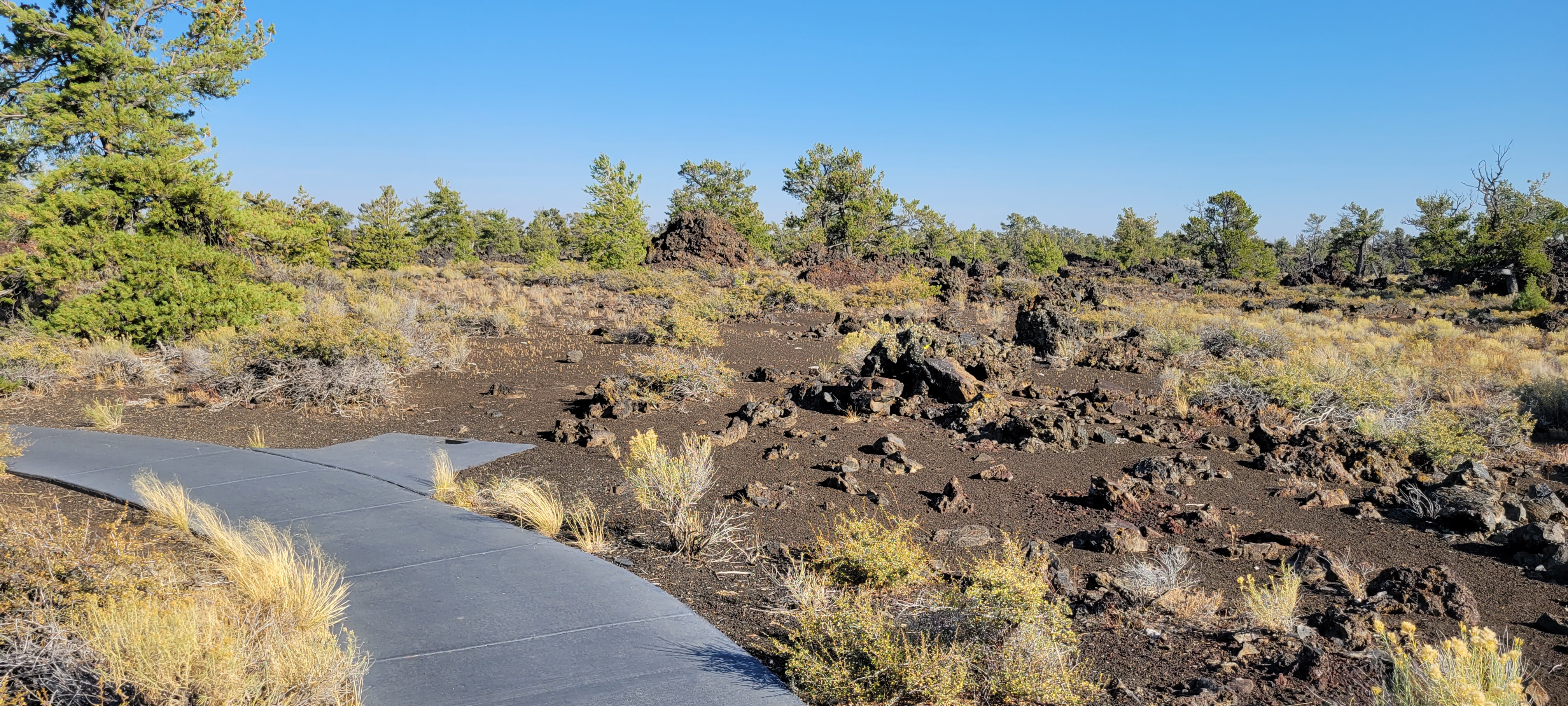
Trail Length: 0.5 mi (0.8 km) loop
Elevation gain: 39 ft (12 m)
This fully accessible loop trail meanders through an open limber pine woodland and around blocky lava flows. Large, broken-off pieces of North Crater volcano can be seen along the trail. Interpretive signs discuss the indigenous relationship with the land and the unique adaptations plants and animals have evolved to survive here.
Pets Pets are not allowed on any trails or in caves. Lava rocks are rough and jagged. The surface of the dark rocks and asphalt can reach 150°F (65°C) or more in the summer and quickly burns paws. Pets should never be left unattended in vehicles or the campground. Parking areas do not have shade and air temperatures can exceed 90°F (32°C) in the middle of summer.
Accessibility Fully Accessible Trail TRAIL LENGTH: 0.5 miles (0.8 km) loop CUMULATIVE ELEVATION CHANGE: Gain 39 ft (12 m), loss 28 ft (9 m) TYPICAL GRADE: 1.5° (2.5%) 12% of trail is from 4.5° to 9° (8% to 15%) Standard wheelchair ramp is 4.5° (8%) TYPICAL CROSS SLOPE: 2° (3.8%) TYPICAL TREAD WIDTH: 60 in (152 cm) MINIMUM TREAD WIDTH: 60 in (152 cm) TRAIL SURFACE: Concrete 100% of trail is PAVED
Trailheads North Crater Flow Trailhead 5,864 ft Drive there · North Crater Flow Trailhead 5,903 ft Drive there
Trailheads North Crater Trailhead 5,859 ft Drive there · North Crater Trailhead 6,054 ft Drive there · Snow Cone Trailhead 6,037 ft Drive there · Spatter Cones Trailhead 6,031 ft Drive there
90-120 Minutes · no dogs · Spring, Summer, Fall
Start North Crater Trailhead or Spatter Cones Parking Area
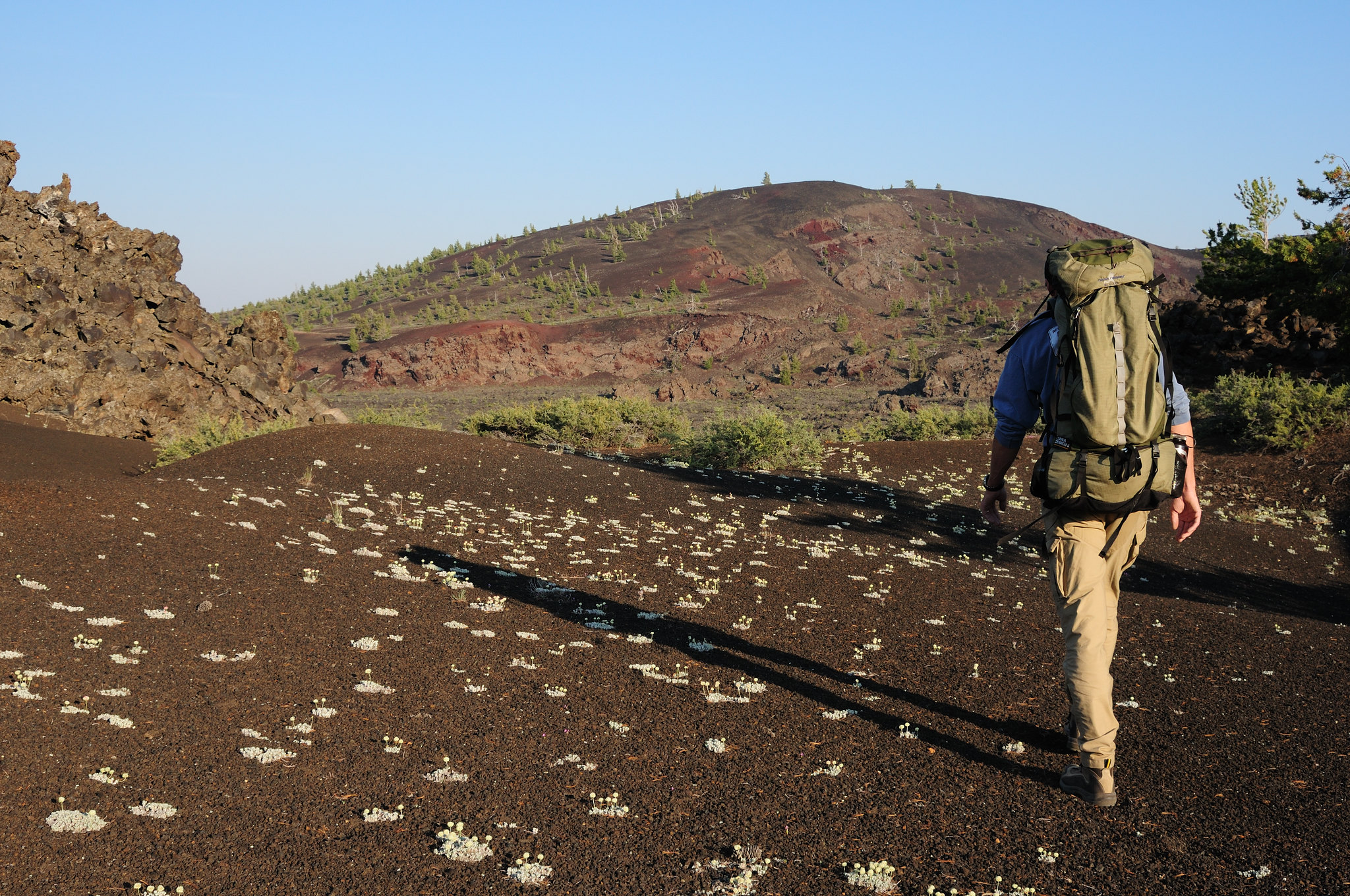
Trail length: 3.5 miles (5.6 km) round-trip
Elevation gain: 758 ft (231 m)
This strenuous trail traverses North Crater and drops into the crater mouth, the vent for the North Crater flow. The trail continues to the rim of Big Craters before descending to the Spatter Cones. For your safety and to protect fragile lava formations, off-trail travel is not permitted at the Spatter Cones or Big Craters areas.
Start your hike at either end of the trail. The northern trailhead is located just a few hundred feet up the park road from the adjacent North Crater Flow Trailhead, and the southern trailhead is located at the Spatter Cones parking area, branching off from the Snow Cone walkway. Hike out and back, or arrange to be picked up or dropped off at one end for a shorter trip.
Pets Pets are not allowed on any trails or in caves. Lava rocks are rough and jagged. The surface of the dark rocks and asphalt can reach 150°F (65°C) or more in the summer and quickly burns paws. Pets should never be left unattended in vehicles or the campground. Parking areas do not have shade and air temperatures can exceed 90°F (32°C) in the middle of summer.
Accessibility TRAIL LENGTH: 3.5 miles (5.6 km) round-trip CUMULATIVE ELEVATION CHANGE: gain 758 ft (231 m), loss 510 ft (155 m) TYPICAL GRADE: 7.5° (13.4%) 64% of trail is from 4.5° to 43° (8% to 94%) Standard wheelchair ramp is 4.5° (8%) TYPICAL CROSS SLOPE: 2.5° (4.2%) 28% of trail is from 4.5° to 48.5° (8% to 113%) TYPICAL TREAD WIDTH: 44 in (111 cm) MINIMUM TREAD WIDTH: 18 in (46 cm) TRAIL SURFACE: Gravel-like cinders and lava rock 90% of trail is FIRM or HARD, 10% of trail is PAVED OBSTRUCTIONS: ROCKS to 10 inches, RUTS to 16 inches, STEPS to 19 inches WARNING: There is one uprooted tree along the trail that restricts vertical clearance to 54 inches. Trail conditions may have changed since this trail was assessed. Temporary obstructions may include downed trees and rock fall. Maximum grades and cross slopes may vary by 10% or more.
Trailheads North Crater Trailhead 6,054 ft Drive there · Snow Cone Trailhead 6,037 ft Drive there · Spatter Cones Trailhead 6,031 ft Drive there
Trailheads North Crater Trailhead 6,054 ft Drive there · Snow Cone Trailhead 6,037 ft Drive there · Spatter Cones Trailhead 6,031 ft Drive there
10-15 Minutes · no dogs · Spring, Summer, Fall
Start Spatter Cones Parking Area
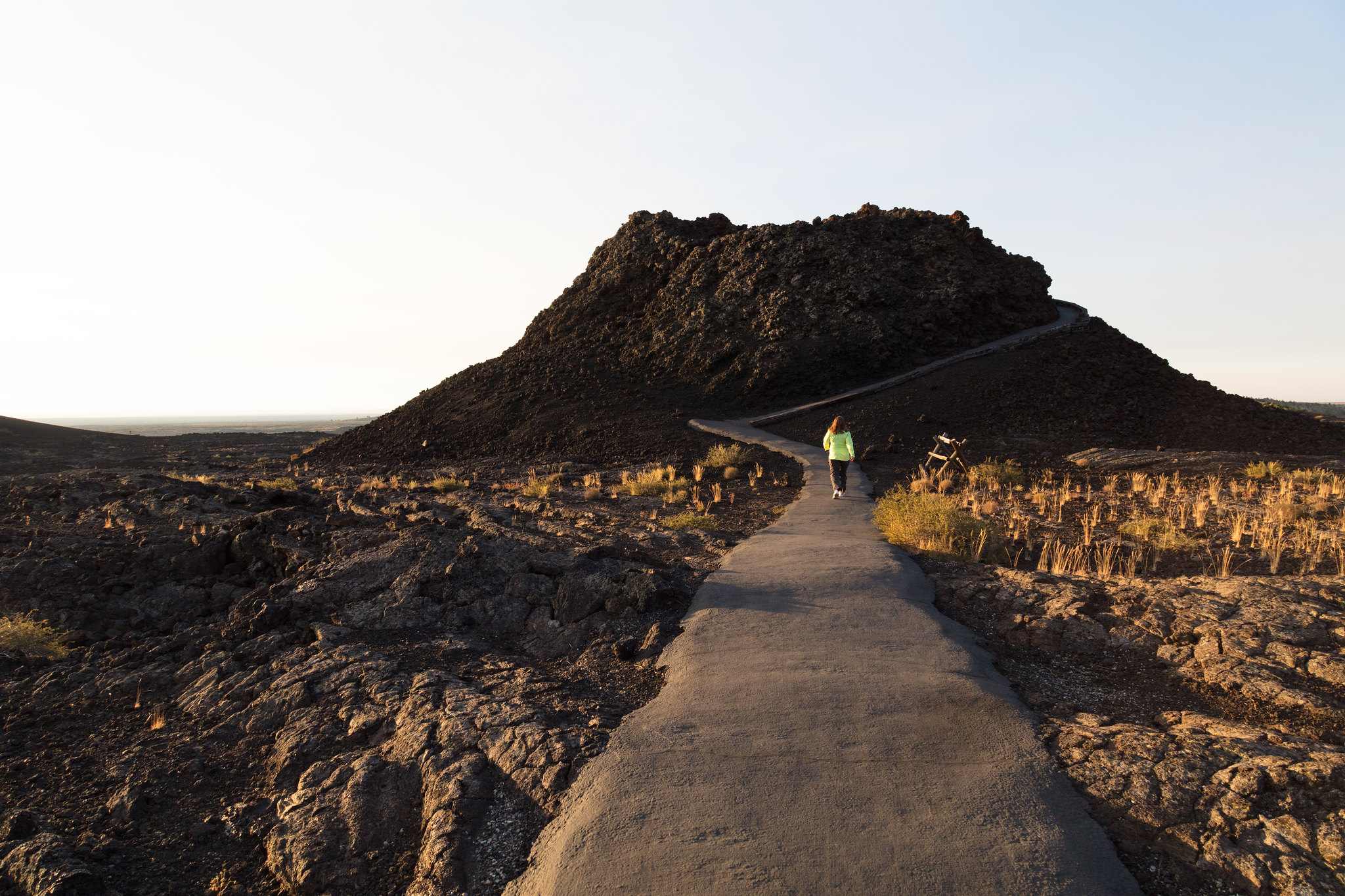
Trail length: 0.1 mile (0.16 km) round-trip
For those short on time, the Spatter Cones provide an intimate look into some of the park's smallest volcanoes. From the parking area, two short trails can be accessed to view these formations; Spatter Cone and Snow Cone. Only the trail to Snow Cone is wheelchair accessible.
For your safety and to protect fragile lava formations, off-trail travel is not permitted at the Spatter Cones or Big Craters areas.
Pets Pets are not allowed on any trails or in caves. Lava rocks are rough and jagged. The surface of the dark rocks and asphalt can reach 150°F (65°C) or more in the summer and quickly burns paws. Pets should never be left unattended in vehicles or the campground. Parking areas do not have shade and air temperatures can exceed 90°F (32°C) in the middle of summer.
Accessibility Only Snow Cone Trail is fully accessible. The trail to the larger Spatter Cone is a 0.1 mile (0.16 km) round-trip walk and not wheelchair accessible. The trail is paved but uneven, narrow, and features short, steep inclines, steep drop-offs, no railing, and sharp rocks that may present a tripping hazard. Water or ice may present an additional slipping hazard. SNOW CONE TRAIL INFORMATION: TRAIL LENGTH: 0.1 mile (0.16 km) round-trip CUMULATIVE ELEVATION CHANGE: Negligible TYPICAL GRADE: 6.9° (4%) 13% of trail has a grade above 8% Standard wheelchair ramp is 8% TYPICAL CROSS SLOPE: 1° (2.1%) TYPICAL TREAD WIDTH: 74 in (188 cm) MINIMUM TREAD WIDTH: 71 in (180 cm) TRAIL SURFACE: Concrete 100% of trail is paved OBSTRUCTIONS: None
Trailhead Tree Molds Trailhead 5,862 ft Drive there
60-90 Minutes · no dogs · Spring, Summer, Fall
Start Tree Molds Trailhead
Length: 2 mi (3.2 km) round-trip
Elevation gain: 108 ft (33 m)
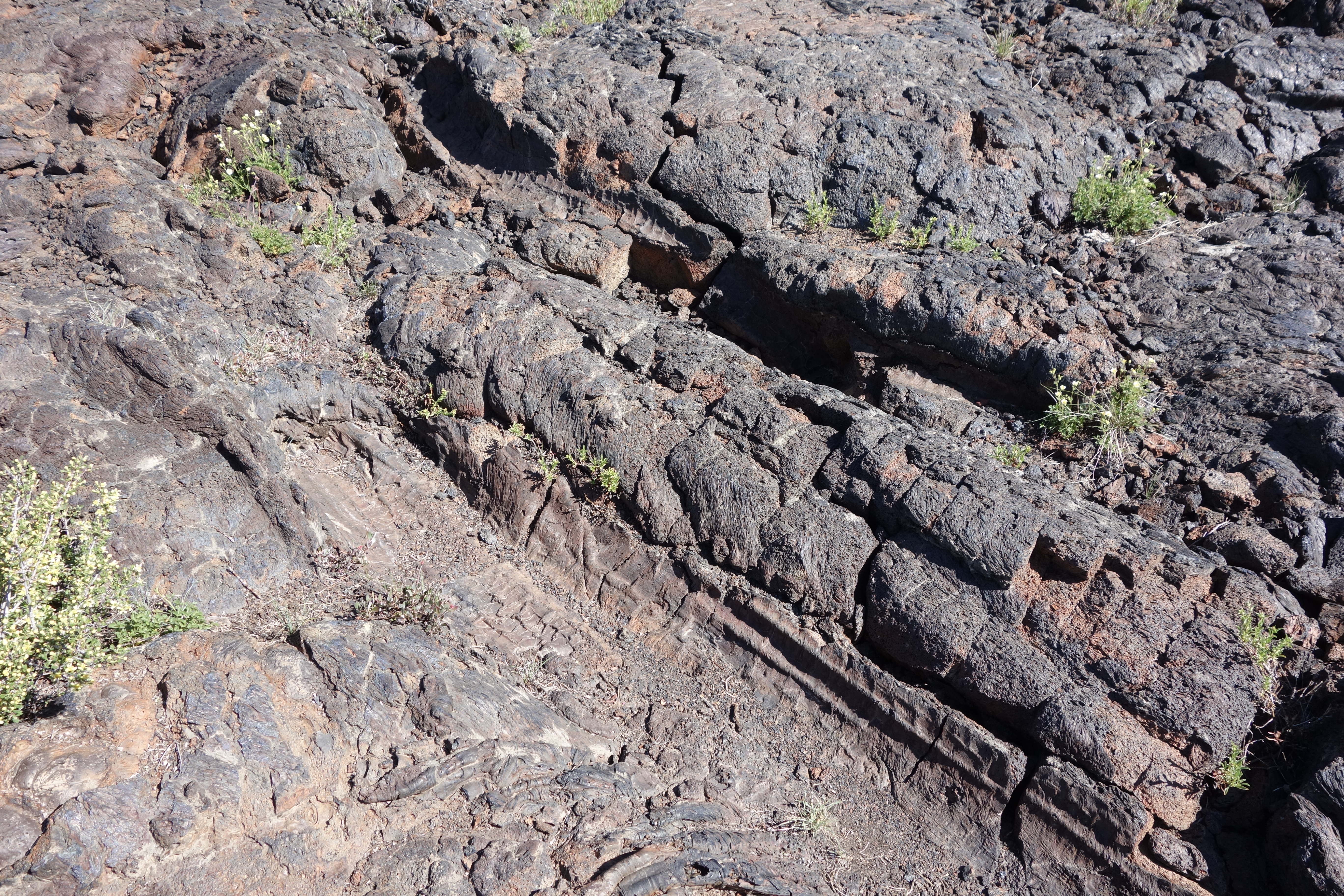
This trail winds through shrubs and stands of limber pine within the Craters of the Moon Wilderness before reaching the edge of the Blue Dragon Flow. While still molten, this lava flow knocked down and ignited trees. The charred tree trunks left impressions in the lava rock. In other places, the trees remained standing as the lava encased them, leaving vertical molds in the cooling lava.
The tree molds can be seen at the end of the trail, one mile from the trailhead.
Pets Pets are not allowed on any trails or in caves. Lava rocks are rough and jagged. The surface of the dark rocks can reach 150°F (65°C) or more in the summer and quickly burns paws. Pets should never be left unattended in vehicles or the campground. Parking areas do not have shade and air temperatures can exceed 90°F (32°C) in the middle of summer.
Accessibility TRAIL LENGTH: 2 miles (3.2 km) round-trip to 1st group of tree molds CUMULATIVE ELEVATION CHANGE: gain 108 ft (33 m), loss 147 ft (45 m) TYPICAL GRADE: 3° (5.1%) 20% of trail is from 4.5° to 14° (8% to 25%) Standard wheelchair ramp is 4.5° (8%) TYPICAL CROSS SLOPE: 2.5° (4%) 36% of trail is from 4.5° to 10° (8% to 18%) TYPICAL TREAD WIDTH: 44 in (113 cm) MINIMUM TREAD WIDTH: 17 in (43 cm) TRAIL SURFACE: Asphalt and gravel-like cinders 10% of trail is PAVED, 90% of trail is cinder OBSTRUCTIONS: ROCKS to 5 inches WARNING: Trail measurements end after one mile at the marked tree molds. After that point, expect rocks, ruts, and steps of varying sizes. Trail conditions may have changed since this trail was assessed. Temporary obstructions may include downed trees and rock fall. Maximum grades and cross slopes may vary by 10% or more.
60-90 Minutes · no dogs · Spring, Summer, Fall
Start Tree Molds Trailhead
Length: 2 mi (3.2 km) round-trip
Elevation gain: 108 ft (33 m)
This trail winds through shrubs and stands of limber pine within the Craters of the Moon Wilderness before reaching the edge of the Blue Dragon Flow. While still molten, this lava flow knocked down and ignited trees. The charred tree trunks left impressions in the lava rock. In other places, the trees remained standing as the lava encased them, leaving vertical molds in the cooling lava.
The tree molds can be seen at the end of the trail, one mile from the trailhead.
Pets Pets are not allowed on any trails or in caves. Lava rocks are rough and jagged. The surface of the dark rocks can reach 150°F (65°C) or more in the summer and quickly burns paws. Pets should never be left unattended in vehicles or the campground. Parking areas do not have shade and air temperatures can exceed 90°F (32°C) in the middle of summer.
Accessibility TRAIL LENGTH: 2 miles (3.2 km) round-trip to 1st group of tree molds CUMULATIVE ELEVATION CHANGE: gain 108 ft (33 m), loss 147 ft (45 m) TYPICAL GRADE: 3° (5.1%) 20% of trail is from 4.5° to 14° (8% to 25%) Standard wheelchair ramp is 4.5° (8%) TYPICAL CROSS SLOPE: 2.5° (4%) 36% of trail is from 4.5° to 10° (8% to 18%) TYPICAL TREAD WIDTH: 44 in (113 cm) MINIMUM TREAD WIDTH: 17 in (43 cm) TRAIL SURFACE: Asphalt and gravel-like cinders 10% of trail is PAVED, 90% of trail is cinder OBSTRUCTIONS: ROCKS to 5 inches WARNING: Trail measurements end after one mile at the marked tree molds. After that point, expect rocks, ruts, and steps of varying sizes. Trail conditions may have changed since this trail was assessed. Temporary obstructions may include downed trees and rock fall. Maximum grades and cross slopes may vary by 10% or more.
Write-ups that name no single mapped trail, in the Service's words.
The lines are the National Park Service's public trails layer, the trailheads and the waterfalls, views, peaks and historic places along them the Service's public points of interest, read 2026-10-14 and simplified for the map. The write-ups are the Service's own "things to do", unedited. Heights come from USGS 3DEP through Terrain Tiles on AWS (Mapzen/Tilezen), read along each line and rounded; a short trail on steep ground can be off by a few tens of feet. Closures change: check the park's own site before you go.