20 named trails · 18 miles · 14 with the Park Service's own write-up. The lines, trailheads and points are the Park Service's; the write-ups are the Service's own words; the climbing is read from USGS elevation along each line.
0.9 mi one way · about 90 ft of climbing · 200 ft of descent · 6,843 ft–7,049 ft · hiking
Heart of Rocks Loop the Park Service's write-up
4-6 Hours · no dogs
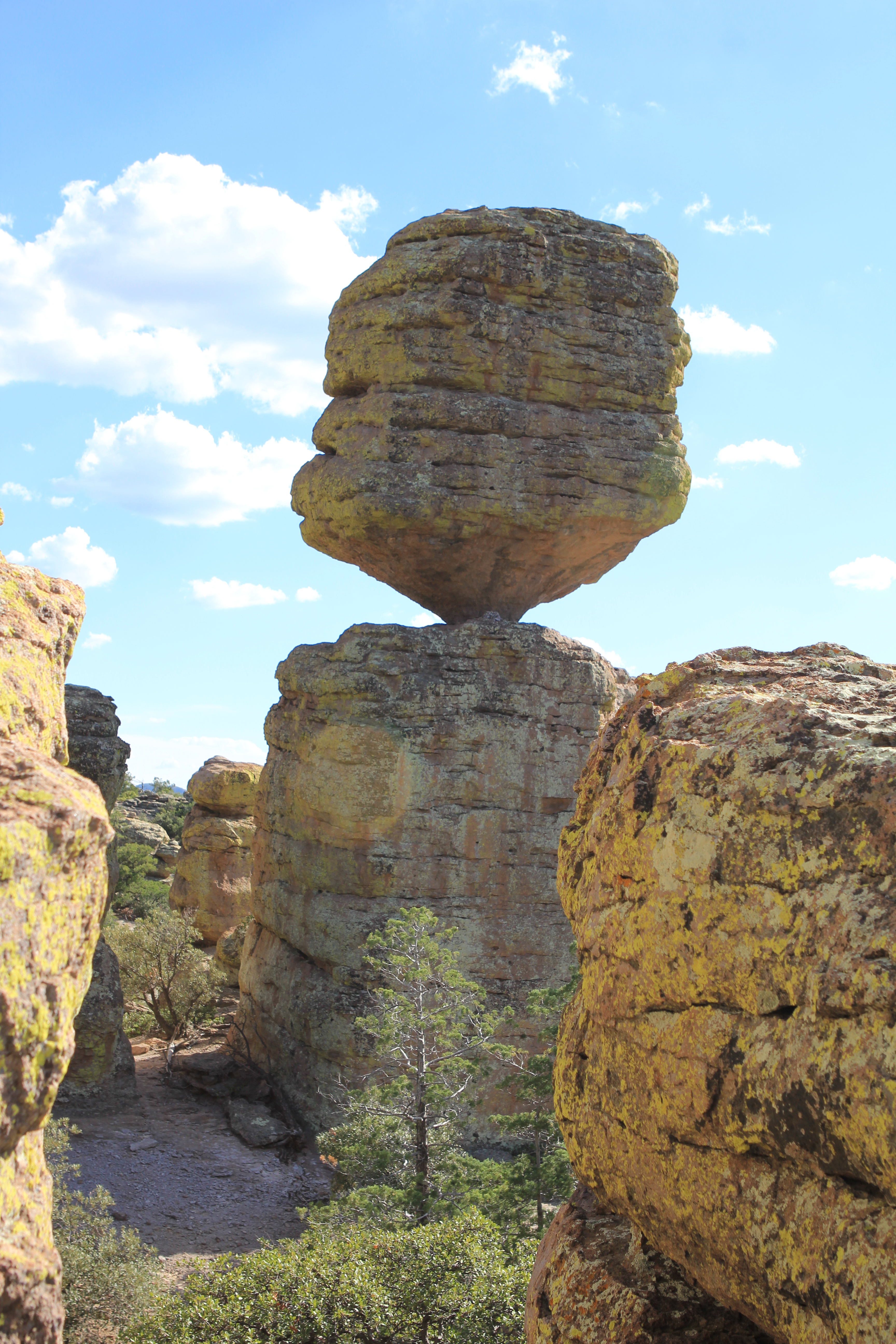
Big Balanced Rock Photo: NPS Photo
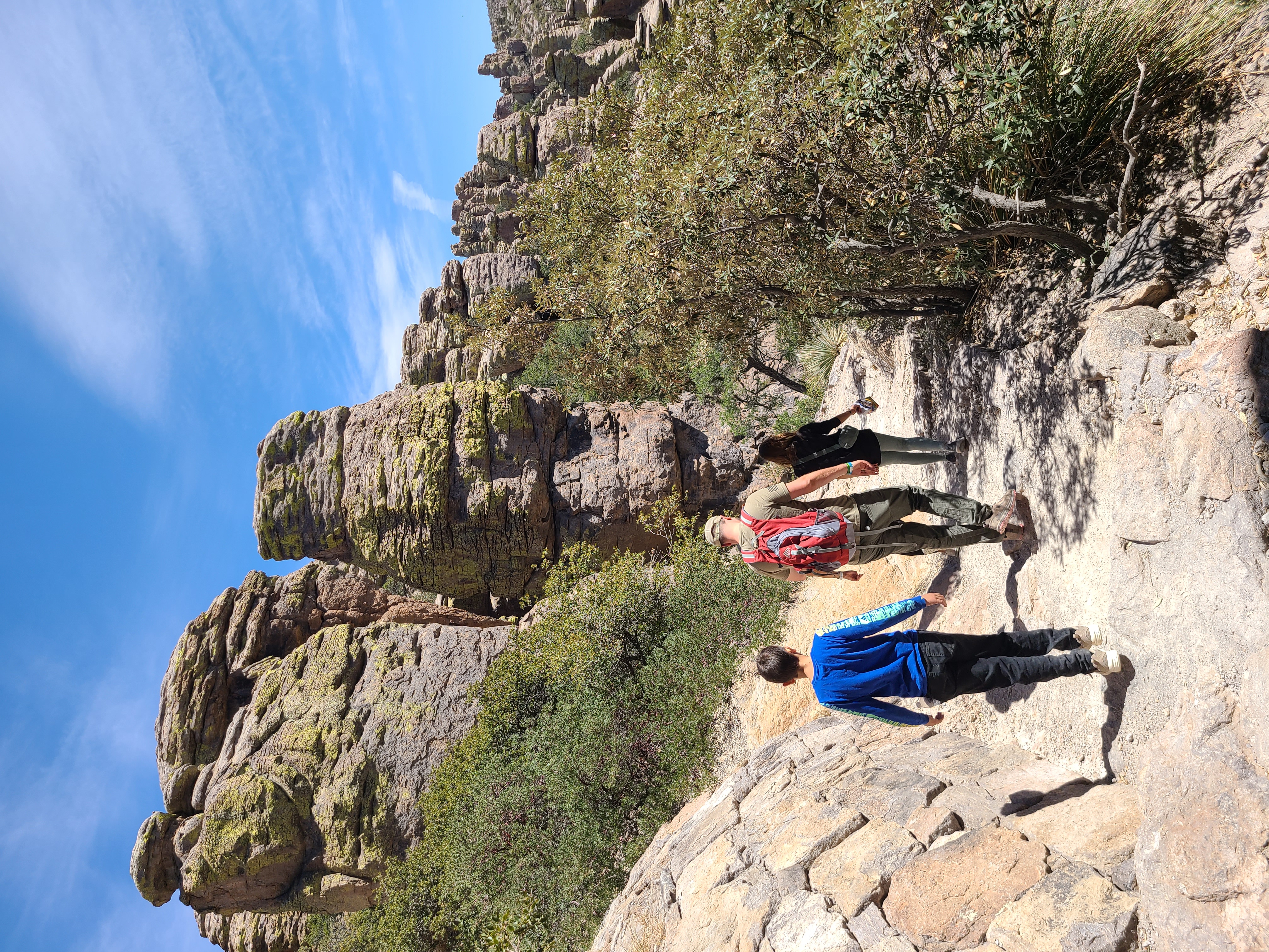
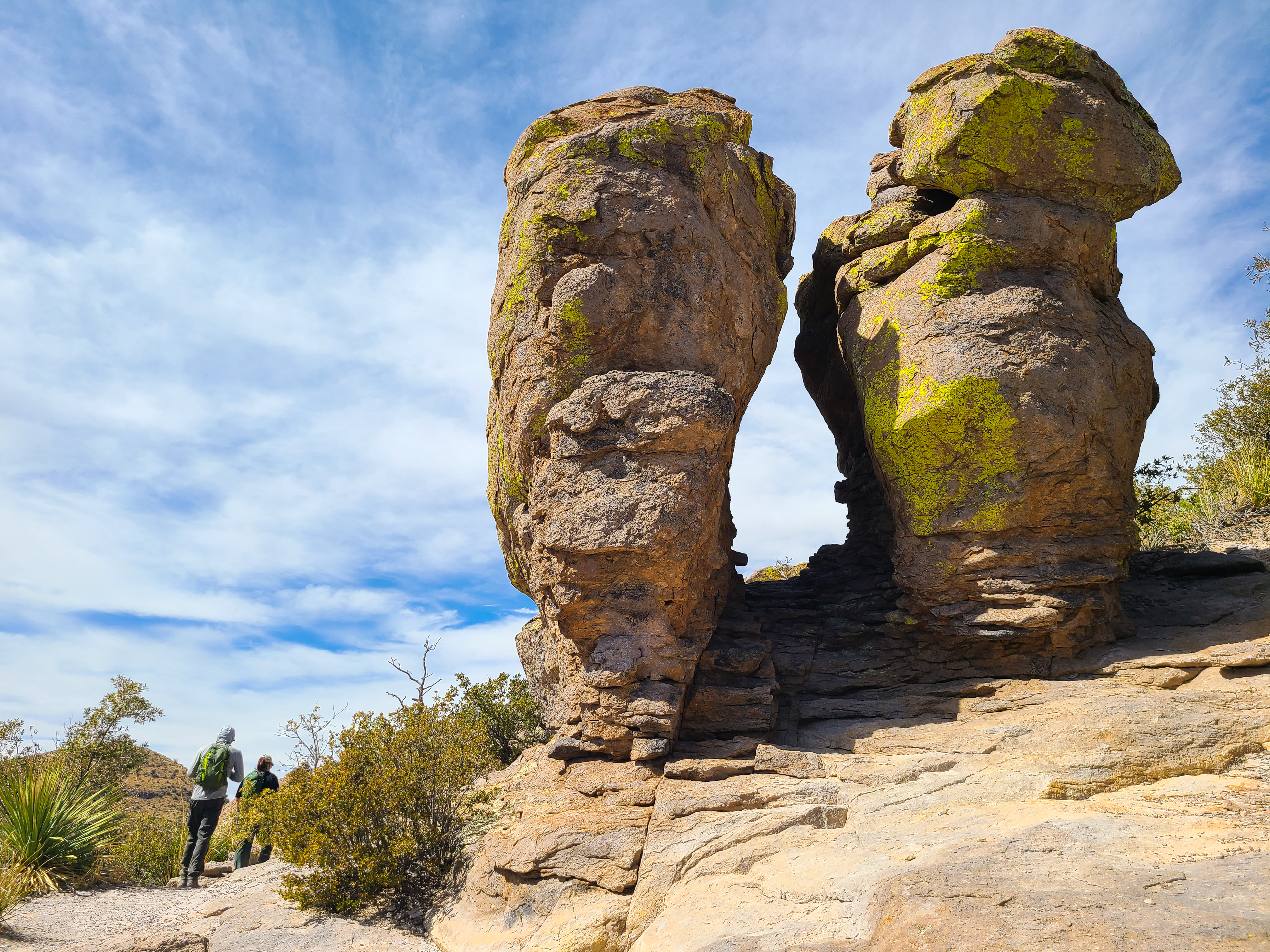
The Heart of Rocks Loop is a 7.3 mile / 11.8 kilometer roundtrip hike to many of the most unusual rock formations in the monument, including Pinnacle Balanced Rock and Big Balanced Rock. Start the loop to the left and hike clockwise for the best views and easiest walking. Lots of rock steps make this a challenging loop, but it's worth the effort. There are three different ways to get to the loop, all of them being the same distance.
Option #1 - Heart of Rocks Loop from Echo Canyon Trailhead
This route consists of the Ed Riggs, Mushroom Rock, Big Balanced Rock, and Heart of Rocks Loop trails. This is an easier route to Heart of Rocks than starting from the visitor center with more views of the rock formations. Ed Riggs trail drops you into the canyon while Mushroom Rock trail climbs 610ft/186m up the other side. Big Balanced Rock trail is along the top of the ridge. Complete the Heart of Rocks Loop and return.
Option #2 - Heart of Rocks Loop from Visitor Center
This route consists of Lower Rhyolite Canyon, Sarah Deming, and Heart of Rocks Loop trails. Lower Rhyolite Canyon trail begins as an easy level walk in the lower canyon forest, but soon starts climbing up Rhyolite Canyon. Sarah Deming trail gains 880ft / 268m to reach the top of the ridge. Complete the Heart of Rocks Loop and return.
Option #3 - Echo Canyon Trailhead to Visitor Center
This route consists of Ed Riggs, Mushroom Rock, Big Balanced Rock, Heart of Rocks Loop, Sarah Deming, and Lower Rhyolite Canyon trails. Make sure you have transportation back to your vehicle or ride the hikers' shuttle at 9:00 am. Watch for changes in vegetation from the upper canyon areas to the lower canyon riparian areas.
NOTE: Additional 0.5 mi / 0.8 to campground OR 1.5 mi / 2.4 km to Faraway Ranch parking lot when riding the shuttle.
Accessibility This is a strenuous trail with rock steps and rocky areas. Pets are not permitted.
For folks wanting to do everything, this strenuous, 9.5 mile route consists of the Echo Canyon, Upper Rhyolite Canyon, Sarah Deming, Heart of Rocks, Big Balanced Rock, Inspiration Point, Mushroom Rock, and Ed Riggs trails. It features our balanced rocks. The trail begins from the Echo Canyon trailhead.
Accessibility This trail is 9.5 miles/15.4 kilometers long and is rated as strenuous. Stretches of the trail are rocky and steep.
0.9 mi one way · about 60 ft of climbing · 5,147 ft–5,204 ft · concrete surface · hiking
Exhibits
Along the wayBirds of ChiricahuaBonita CreekChiricahua Life ZonesFaraway Ranch Historic District
Bonita Creek Loop the Park Service's write-up
15-30 Minutes · dogs allowed
Start Trailhead for Bonita Creek Trail Loop
Walk the paved trail between towering cliffs.
This Bonita Creek loops around the picnic area and takes you along the intermittent Bonita Creek. Watch for Apache plume and prickly poppy flowers in spring and early summer. Arizona whitetail deer are frequently seen in the lower portion of Bonita Canyon. This is a good trail to view grassland birds. This is an easy 0.2 mile loop.
Accessibility This is an easy 0.2 mile trail that is wheelchair accessible. There is no elevation change and pets are allowed on the trail.
Winding along Bonita Creek, usually dry, this trail connects the Bonita Creek and Faraway Ranch Picnic Areas. Look for wild animals, including migrating birds, deer, coatimundi, and javelina. This is an easy 0.5 mile trail.
Accessibility This easy 0.5 mile hike is suitable for all ages. Pets are allowed on this trail.
1.3 mi one way · about 70 ft of climbing · 550 ft of descent · 6,285 ft–6,779 ft · hiking
Exhibits
Along the wayEcho CanyonEcho Canyon Loop Trail
Echo Canyon Grottoes the Park Service's write-up
30-60 Minutes · no dogs
Start Echo Canyon Parking Lot
Be sure to pause and look into the grottoes Photo: NPS
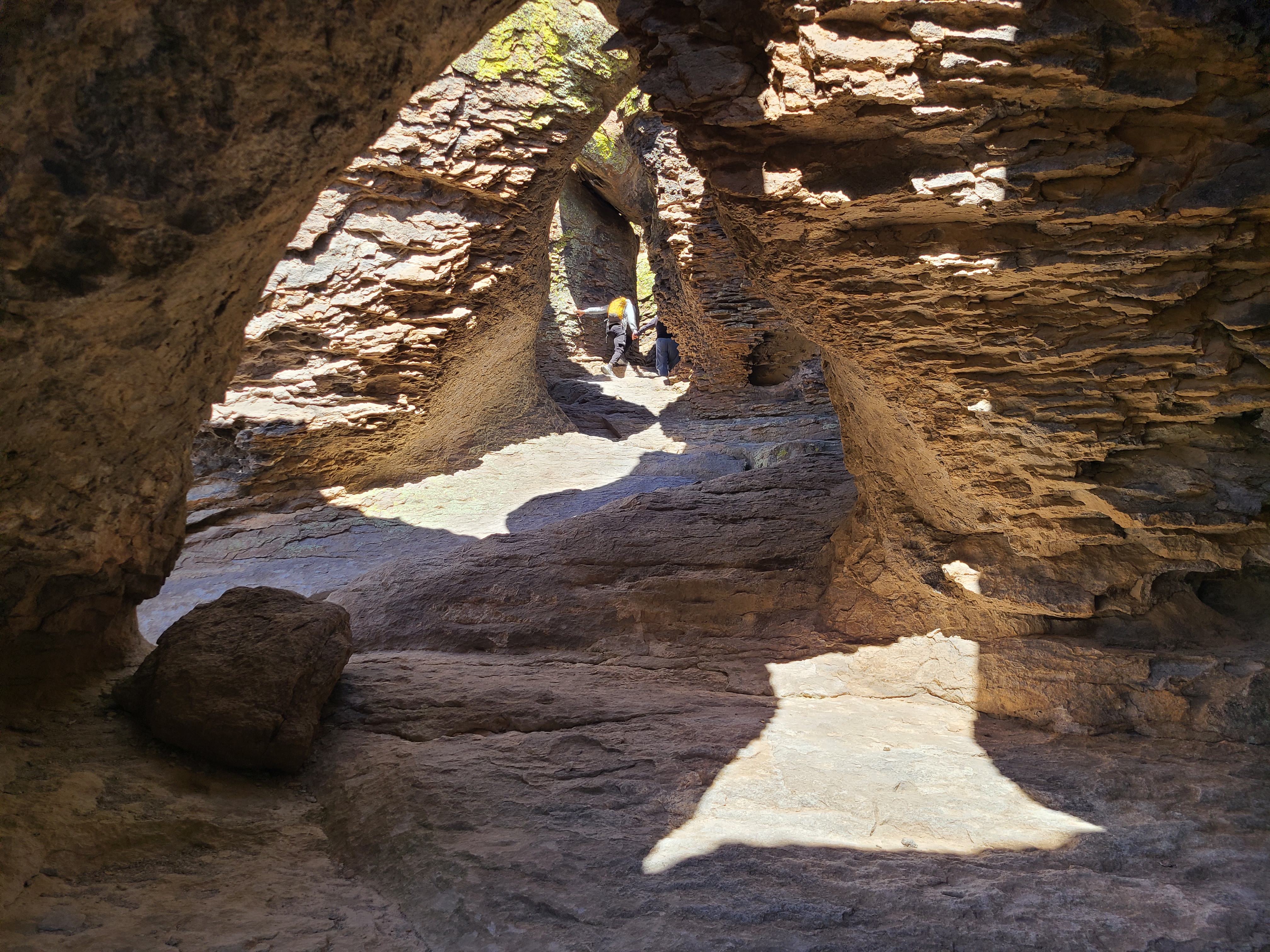
Start from the Echo Canyon Parking area. Take the Echo Canyon Trail down toward the right. When it branches, follow signs for the Echo Canyon Trail to the right. You'll pass a variety of interesting balanced rocks and pinnacle. About 1/2 mile down, on your righthand side, are the Grottoes. These tunnel-like formations are fun to explore. Look for a small sign, because you could walk right past!
If you feel energetic you can continue to the switchbacks just another 1/4 mile, around the entire loop (3.3 miles) or turn around. Notice how different the rocks look on your way back!
This trail has loose rock and includes about 200 feet of elevation decline. The trail is generally suitable for children as well as adults. A hiking stick may be helpful for those with uneven footing and during the winter.
Pets Pets are not allowed on any of the upper trails through the rocks. Narrow paths and cliffs can scare animals and humans. Sensitive flora and fauna live in this wilderness area.
Accessibility Not suitable for wheelchairs or strollers. This trail is steep and rocky. Some areas may be unpleasant for those with acrophobia (intense fear of heights).
Echo Canyon Loop Trail the Park Service's write-up
2-4 Hours · no dogs
Start Trailhead for Echo Canyon Loop
Echo Canyon Trail at Chiricahua National Monument Photo: NPS
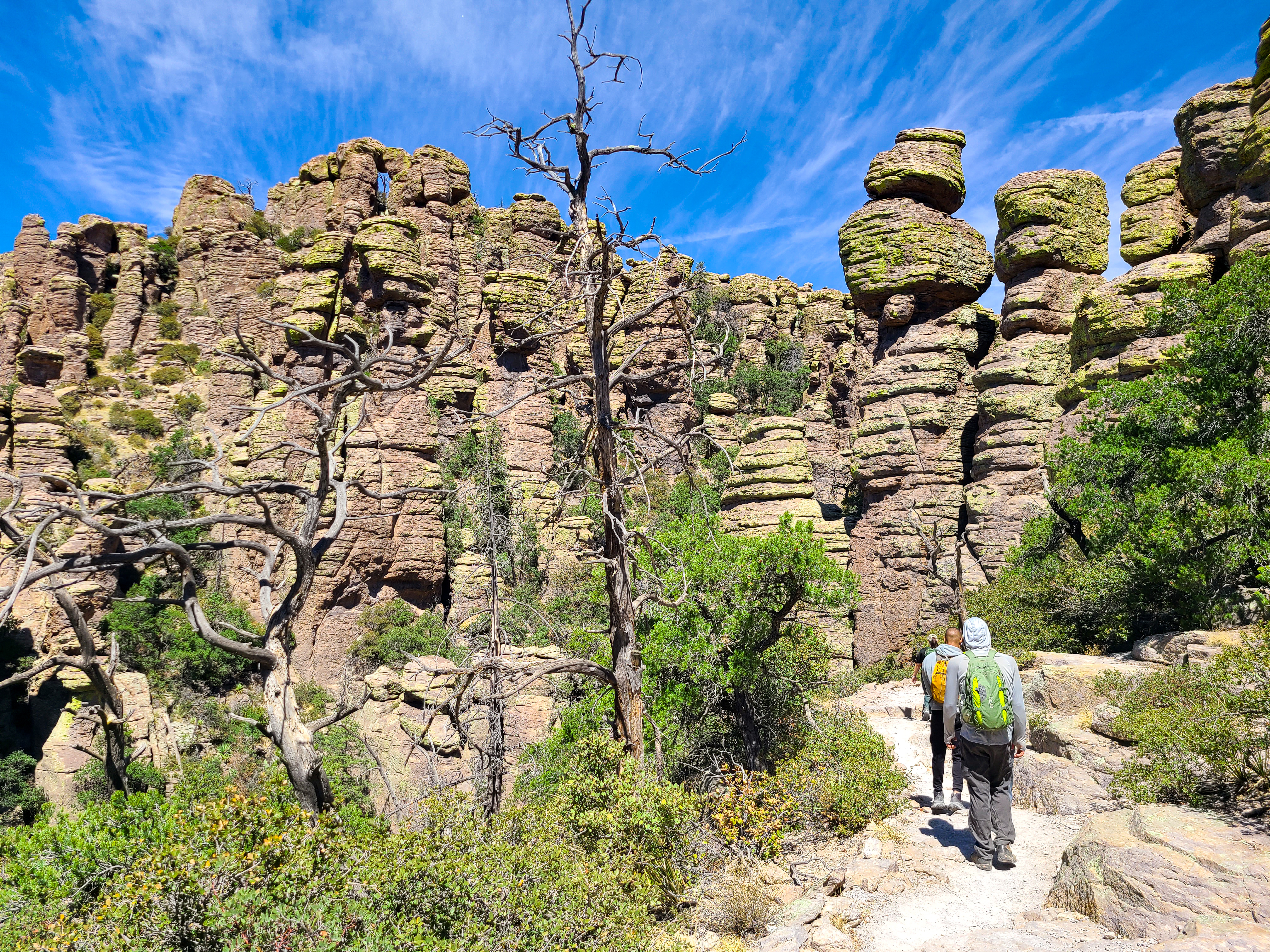
Echo Canyon, Hailstone, and Ed Riggs Trails form a triangular loop through some of the best rocks in the park. We recommend hiking counterclockwise (go right) for great views and because of elevation. The hike is a moderate 3.4 miles with some steep drop offs and loose, rocky, and uneven surfaces.
Echo Canyon trail descends 400 feet through spectacular rock formations. It is a wonder of engineering constructed by the Civilian Conservation Corps.
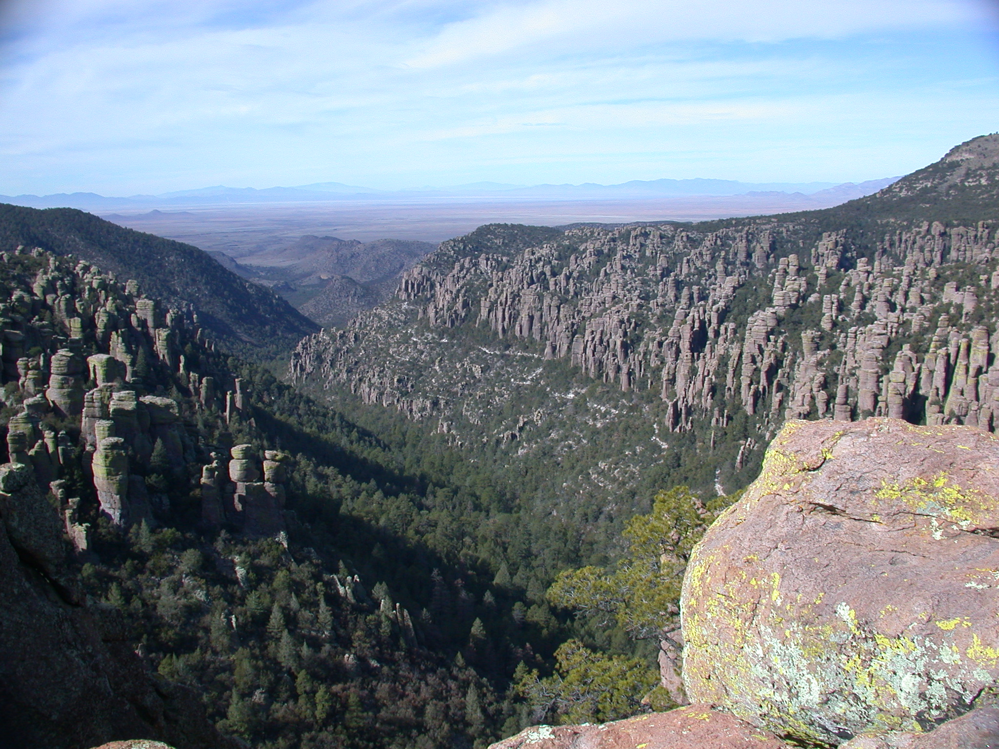
Hailstone Trail is almost level with sweeping views of the Wonderland of Rocks. Look for unusual stones that resemble hail. Desert yucca, agave, and cactus are abundant on Hailstone's sunny southern exposure.
Ed Riggs Trail climbs back up 400 feet to Echo Canyon parking or a bit further if you started from Massai Point.
Moderately difficult. Uneven terrain throughout. 1-25% grade with cross-slope up to 50%. Tripping hazards include rocks, boulders, roots, and run off channels. Total elevation: 560 feet.
This hike can be done in 2 hours, but most people prefer to give it 3 or 4 hours.
Pets Pets are not allowed on any of the upper trails through the rocks. Narrow paths and cliffs can scare animals and humans. Sensitive flora and fauna live in this wilderness area.
Accessibility Not suitable for wheelchairs or strollers. This trail is steep and rocky with over 500 feet in elevation change. Some areas may be unpleasant for those with acrophobia (intense fear of heights). No pets.
Echo Canyon to Visitor Center the Park Service's write-up
2-4 Hours · no dogs
Start Echo Canyon Trailhead
Rhyolite Canyon Photo: NPS Photo
This moderate, 4.2 mile / 6.8 kilometer trail begins at Echo Canyon trailhead and consists of Echo Canyon, Upper Rhyolite Canyon, and Lower Rhyolite Canyon trails ending at the Visitor Center. It goes downhill through spectacular rock formations in Echo Canyon. One stream crossing on the Upper Rhyolite segment can be hazardous if runoff is significant. The last half of the hike is in shaded oak woodlands. Make sure you have transportation back to your vehicle or ride the seasonal hikers' shuttle at 9:00 am.
NOTE: Additional 0.5 mi / 0.8 to campground OR 1.5 mi / 2.4 km to Faraway Ranch parking lot when riding the shuttle.
Accessibility This downhill trail contains rock steps and occasional steep terrain. No pets are allowed.
For folks wanting to do everything, this strenuous, 9.5 mile route consists of the Echo Canyon, Upper Rhyolite Canyon, Sarah Deming, Heart of Rocks, Big Balanced Rock, Inspiration Point, Mushroom Rock, and Ed Riggs trails. It features our balanced rocks. The trail begins from the Echo Canyon trailhead.
Accessibility This trail is 9.5 miles/15.4 kilometers long and is rated as strenuous. Stretches of the trail are rocky and steep.
0.5 mi one way · about 200 ft of climbing · 6,474 ft–6,685 ft · hiking
The Big Loop the Park Service's write-up
4-7 Hours · no dogs
View from The Big Loop trail Photo: NPS Photo
For folks wanting to do everything, this strenuous, 9.5 mile route consists of the Echo Canyon, Upper Rhyolite Canyon, Sarah Deming, Heart of Rocks, Big Balanced Rock, Inspiration Point, Mushroom Rock, and Ed Riggs trails. It features our balanced rocks. The trail begins from the Echo Canyon trailhead.
Accessibility This trail is 9.5 miles/15.4 kilometers long and is rated as strenuous. Stretches of the trail are rocky and steep.
0.7 mi loop · about 150 ft of climbing · 6,766 ft–6,903 ft · earth surface · hiking
Heart of Rocks Loop the Park Service's write-up
4-6 Hours · no dogs
Big Balanced Rock Photo: NPS Photo
The Heart of Rocks Loop is a 7.3 mile / 11.8 kilometer roundtrip hike to many of the most unusual rock formations in the monument, including Pinnacle Balanced Rock and Big Balanced Rock. Start the loop to the left and hike clockwise for the best views and easiest walking. Lots of rock steps make this a challenging loop, but it's worth the effort. There are three different ways to get to the loop, all of them being the same distance.
Option #1 - Heart of Rocks Loop from Echo Canyon Trailhead
This route consists of the Ed Riggs, Mushroom Rock, Big Balanced Rock, and Heart of Rocks Loop trails. This is an easier route to Heart of Rocks than starting from the visitor center with more views of the rock formations. Ed Riggs trail drops you into the canyon while Mushroom Rock trail climbs 610ft/186m up the other side. Big Balanced Rock trail is along the top of the ridge. Complete the Heart of Rocks Loop and return.
Option #2 - Heart of Rocks Loop from Visitor Center
This route consists of Lower Rhyolite Canyon, Sarah Deming, and Heart of Rocks Loop trails. Lower Rhyolite Canyon trail begins as an easy level walk in the lower canyon forest, but soon starts climbing up Rhyolite Canyon. Sarah Deming trail gains 880ft / 268m to reach the top of the ridge. Complete the Heart of Rocks Loop and return.
Option #3 - Echo Canyon Trailhead to Visitor Center
This route consists of Ed Riggs, Mushroom Rock, Big Balanced Rock, Heart of Rocks Loop, Sarah Deming, and Lower Rhyolite Canyon trails. Make sure you have transportation back to your vehicle or ride the hikers' shuttle at 9:00 am. Watch for changes in vegetation from the upper canyon areas to the lower canyon riparian areas.
NOTE: Additional 0.5 mi / 0.8 to campground OR 1.5 mi / 2.4 km to Faraway Ranch parking lot when riding the shuttle.
Accessibility This is a strenuous trail with rock steps and rocky areas. Pets are not permitted.
0.5 mi one way · about 20 ft of climbing · 50 ft of descent · 6,922 ft–6,978 ft · hiking
Views
Along the wayInspiration Point
Inspiration Point Trail the Park Service's write-up
3-4 Hours · no dogs
Start Echo Canyon or Massai Point Trailheads
Inspiration Point Photo: NPS Photo
This 5.4 mile / 8.6 kilometer strenuous trail takes you to the Inspiration Point overlook. The route consists of Ed Riggs, Mushroom Rock, and Inspiration Point trails. Excellent views of Cochise Head and Rhyolite Canyon make this a great rest stop!
Accessibility This trail is rated as strenuous and contains rock steps. No pets are allowed.
For folks wanting to do everything, this strenuous, 9.5 mile route consists of the Echo Canyon, Upper Rhyolite Canyon, Sarah Deming, Heart of Rocks, Big Balanced Rock, Inspiration Point, Mushroom Rock, and Ed Riggs trails. It features our balanced rocks. The trail begins from the Echo Canyon trailhead.
Accessibility This trail is 9.5 miles/15.4 kilometers long and is rated as strenuous. Stretches of the trail are rocky and steep.
1.5 mi one way · 550 ft of descent · 5,378 ft–5,932 ft · hiking
Visitor centers
Along the wayVisitor Center
Echo Canyon to Visitor Center the Park Service's write-up
2-4 Hours · no dogs
Start Echo Canyon Trailhead
Rhyolite Canyon Photo: NPS Photo
This moderate, 4.2 mile / 6.8 kilometer trail begins at Echo Canyon trailhead and consists of Echo Canyon, Upper Rhyolite Canyon, and Lower Rhyolite Canyon trails ending at the Visitor Center. It goes downhill through spectacular rock formations in Echo Canyon. One stream crossing on the Upper Rhyolite segment can be hazardous if runoff is significant. The last half of the hike is in shaded oak woodlands. Make sure you have transportation back to your vehicle or ride the seasonal hikers' shuttle at 9:00 am.
NOTE: Additional 0.5 mi / 0.8 to campground OR 1.5 mi / 2.4 km to Faraway Ranch parking lot when riding the shuttle.
Accessibility This downhill trail contains rock steps and occasional steep terrain. No pets are allowed.
Hike the Trails at Chiricahua the Park Service's write-up
1-9 Hours · no dogs
Start Chiricahua National Monument
Hiking trails travel right next to rock pinnacles. Photo: NPS
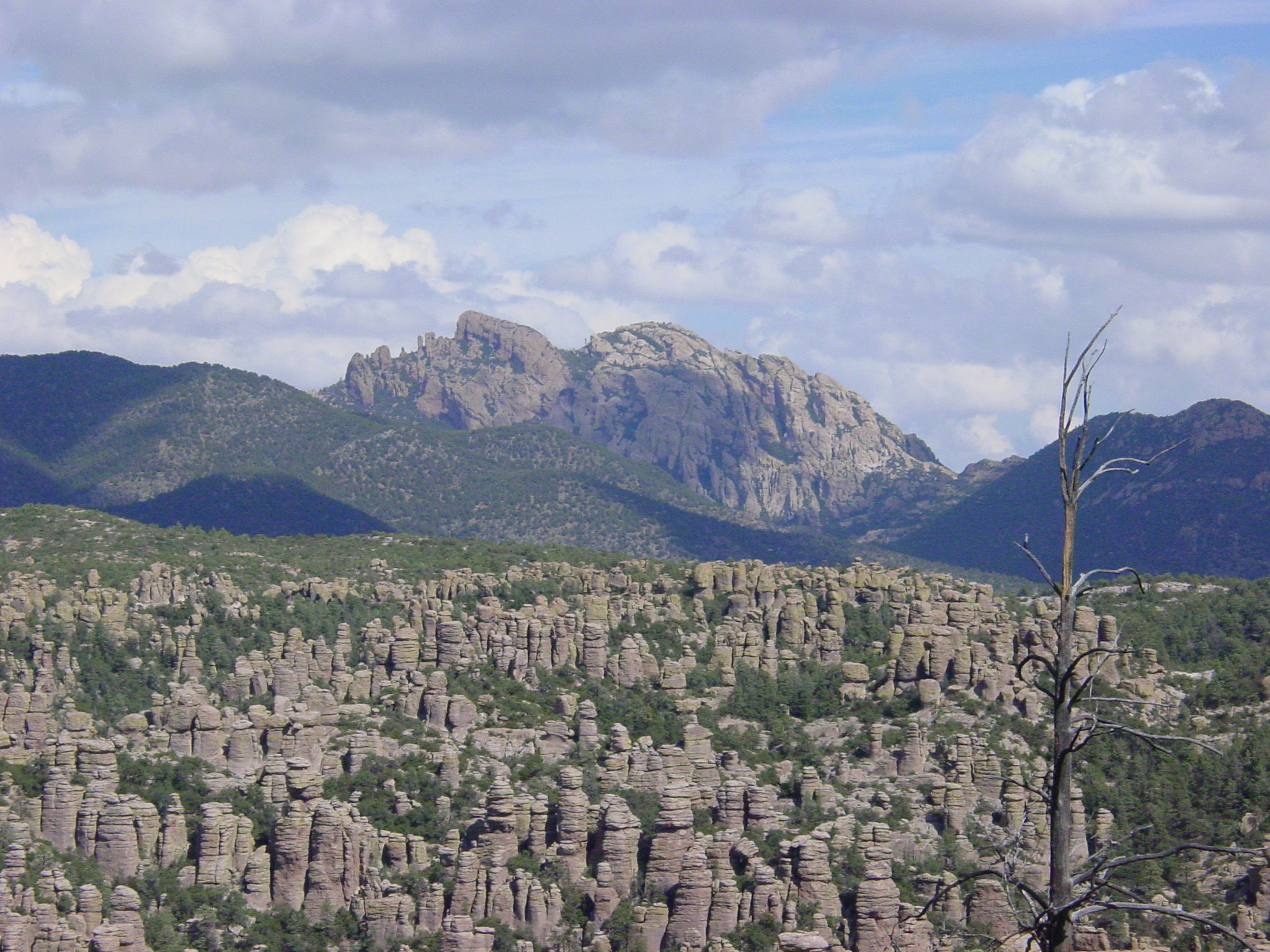
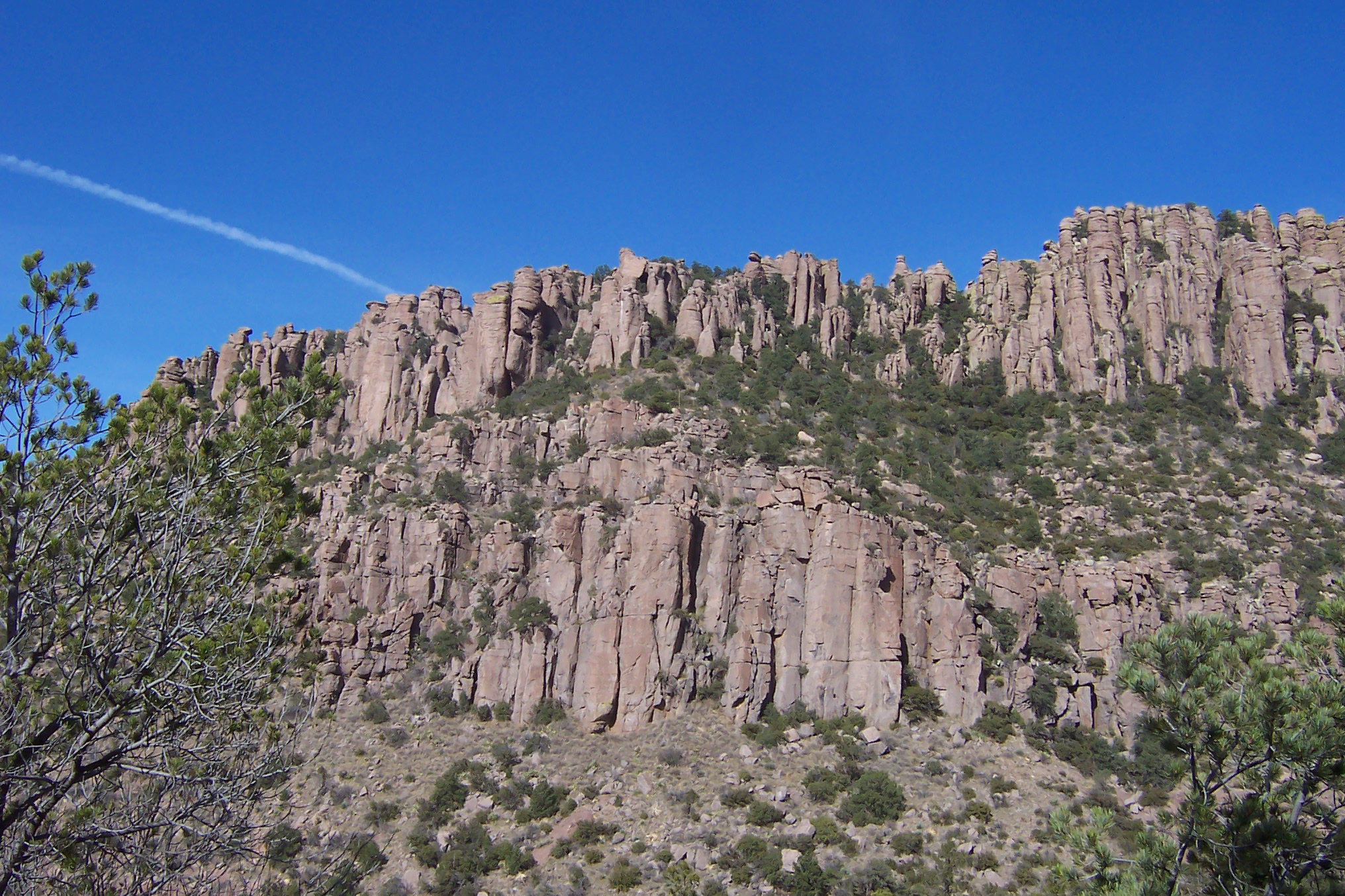
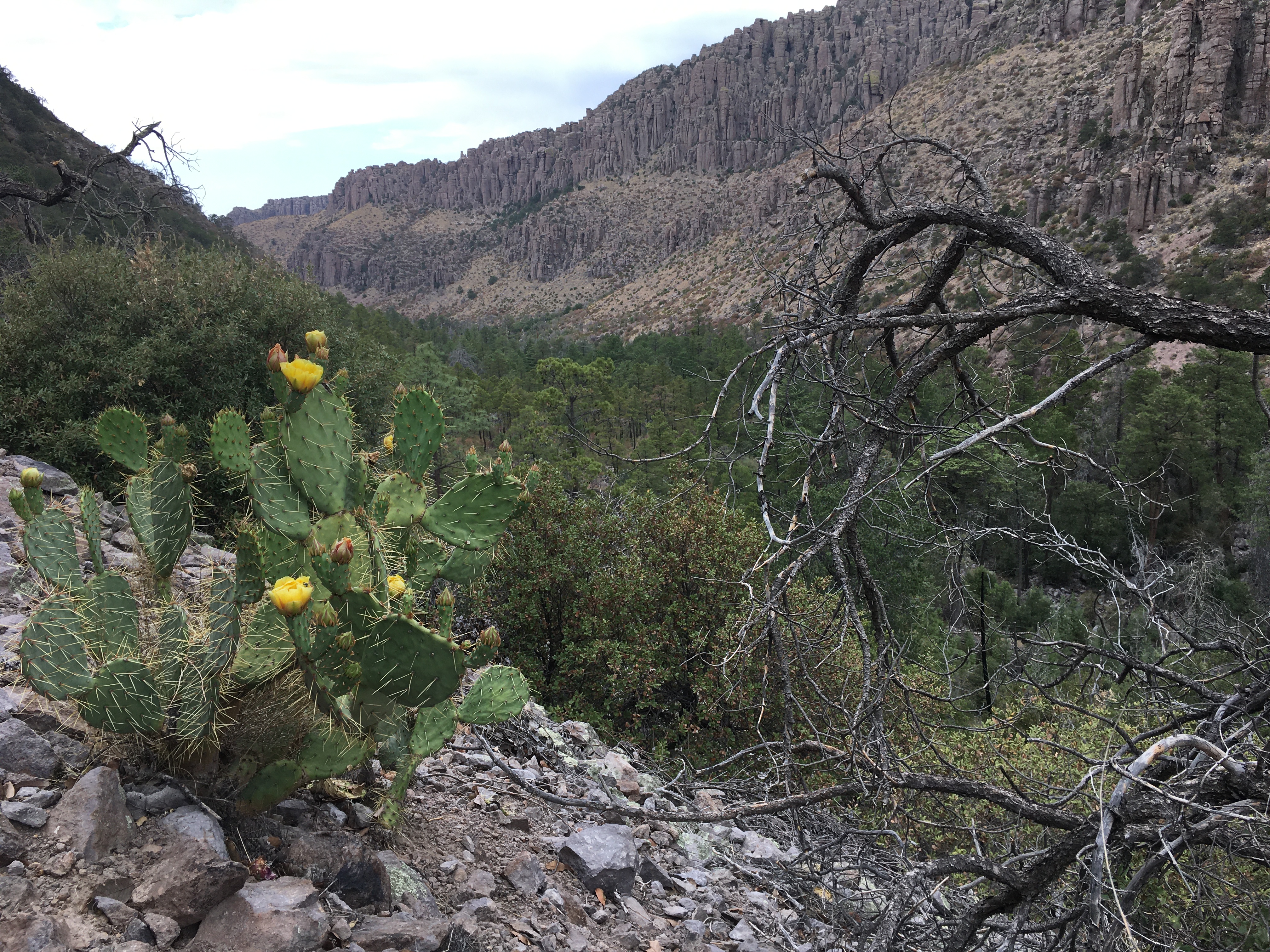
Hiking at Chiricahua National Monument is an experience like no other. Many of the trails immediately bring visitors into an epic landscape of rocks of all shapes and sizes. Visitors don't just gaze at the formations from above, but stand under and beside the towering giants.
Pets Most trails in the rock formations do not allow pets. Lower trails near Faraway Ranch and the Campground allow pets on a leash.
Accessibility Bonita Creek Trail is accessible. A portion of the Massai Point Trail is paved, but may not be accessible due to steep grade.
Lower Rhyolite Canyon Trail the Park Service's write-up
no dogs
Start Visitor Center
Lower Rhyolite Canyon Photo: NPS Photo / T. Ferraro
A good way to view the rocks without driving up the road, this mostly-level trail takes you to Rhyolite Canyon, a canyon lined with rock pinnacles. Walk 1.5 miles / 2.4 km until you reach the junction between Upper Rhyolite Canyon and Sarah Deming trails. Return the same way.
Accessibility This trail has a mostly-level, gravel surface.
0.4 mi one way · about 30 ft of climbing · 6,835 ft–6,888 ft · hiking
Exhibits
Along the wayBasins and RangesBigfoot MassaiChiricahua Mountains WildernessCochise HeadCochise StrongholdColumns, Pinnacles, and Balanced RocksExhibit BuildingHarris MountainMassai Point Trailhead
0.3 mi one way · 150 ft of descent · 6,694 ft–6,831 ft · hiking
Exhibits
Along the wayColumns, Pinnacles, and Balanced RocksMassai Point Trailhead
Massai Point Nature Trail the Park Service's write-up
30 Minutes · no dogs
Rock pinnacles at Massai Point tower above the trail. Photo: NPS
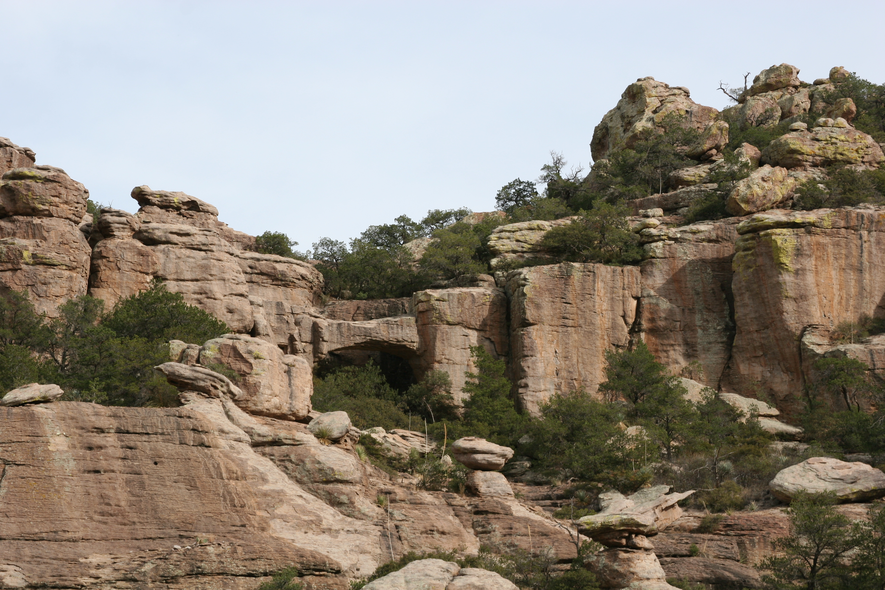
Take in sweeping views, balanced rock formations, and the park’s geologic story from this short trail beginning at the Massai Point parking area. The half‑mile route starts on the north side, climbs to the exhibit building, and then follows the west rim south around the point. Interpretive signs describe how these unique formations developed over time.
Those looking to explore deeper into the rock formations can connect to the Ed Riggs Trail and the larger trail system.
Uneven footing, stairs, and the 6,870‑foot (2,094 m) elevation can make this short hike feel more challenging.
Accessibility The northern section of this trail (0.1 mile, 500 feet) is paved with a steep grade. Visitors using wheelchairs or other mobility devices may find a powered or assisted device helpful due to curved, exposed edges, and steep grade. The rest of the trail is generally not passable for most wheeled mobility devices due to stairs and uneven terrain.
1.0 mi one way · about 40 ft of climbing · 550 ft of descent · 6,405 ft–6,956 ft · hiking
The Big Loop the Park Service's write-up
4-7 Hours · no dogs
View from The Big Loop trail Photo: NPS Photo
For folks wanting to do everything, this strenuous, 9.5 mile route consists of the Echo Canyon, Upper Rhyolite Canyon, Sarah Deming, Heart of Rocks, Big Balanced Rock, Inspiration Point, Mushroom Rock, and Ed Riggs trails. It features our balanced rocks. The trail begins from the Echo Canyon trailhead.
Accessibility This trail is 9.5 miles/15.4 kilometers long and is rated as strenuous. Stretches of the trail are rocky and steep.
2.4 mi one way · about 650 ft of climbing · 5,553 ft–6,070 ft · hiking
ViewsExhibits
Along the wayNatural Bridge TrailheadNatural Bridge Trailhead Interpretive SignNatural Bridge Viewing Area
Trail to Natural Bridge the Park Service's write-up
3-4 Hours · no dogs
Start Trailhead for Natural Bridge Trail
Natural Bridge Trail at Chiricahua NM Photo: NPS
The least used trail in the monument climbs through oak and juniper woodlands to a ridge then drops into the Apache pine forest of Picket Park. It ends at an overlook for the small water-carved bridge located across the canyon. Return the same way. This is a moderate 4.8 mile hike round trip.
Accessibility This is a moderate trail with sections that are steep and rocky. Dogs are not allowed on this trail.
0.2 mi one way · about 50 ft of climbing · 5,315 ft–5,360 ft · hiking
Silver Spur Meadow Trail the Park Service's write-up
45-90 Minutes · dogs allowed
Start Faraway Ranch, Visitor Center, or Campground
Silver Spur Meadow Photo: NPS Photo
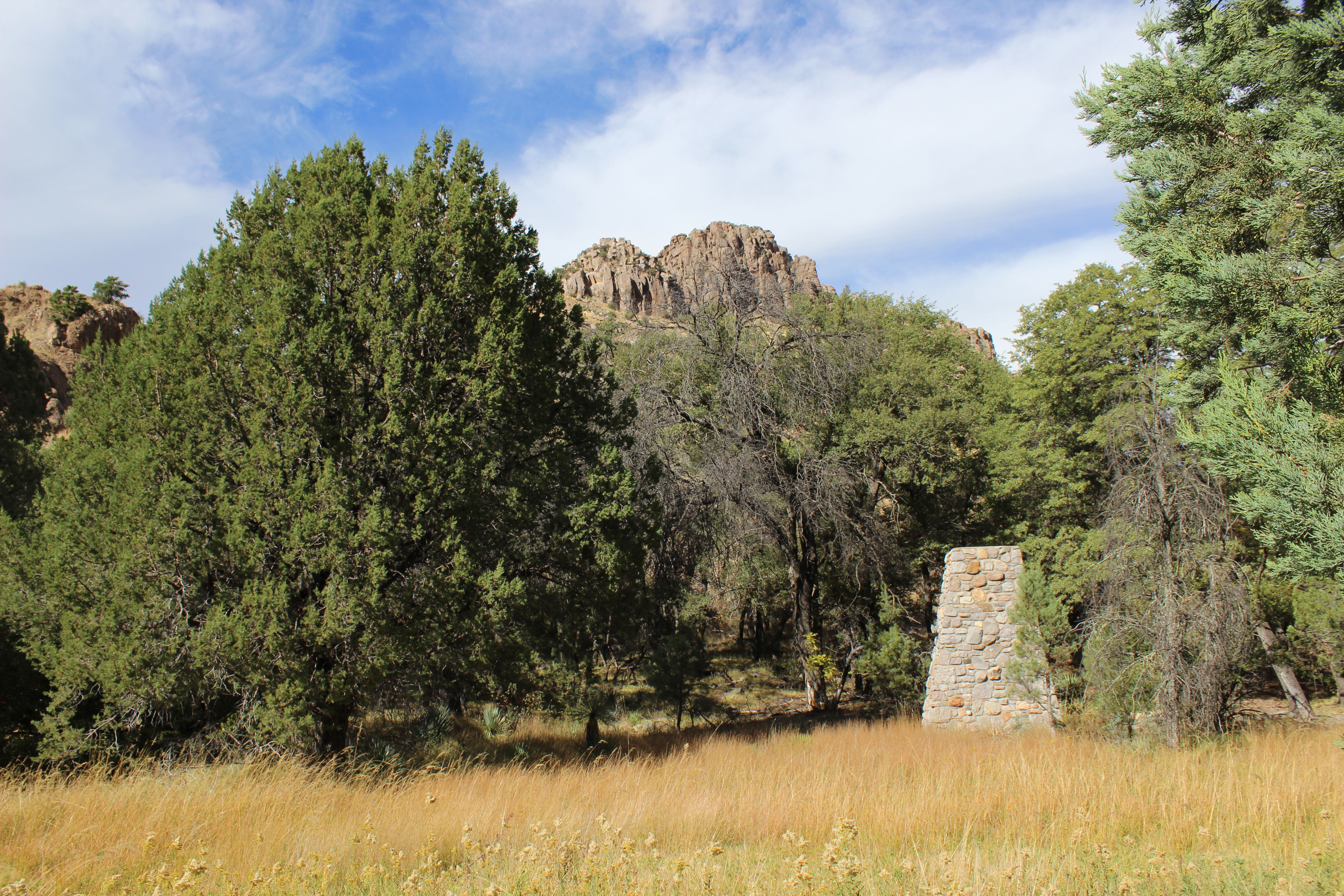
Beginning from the Visitor Center, Campground, or Faraway Ranch picnic area, this 1.2 mile/1.9 kilometer leisurely walk leads you through the Faraway Ranch Historic District to Stafford Cabin, built in the 1880s. You'll see Silver Spur Meadow, home for Civilian Conservation Corps Camp NM-2-A, Company 828 during the 1930s. The fireplaces are remnants from the lodge of the Silver Spur Guest Ranch in business from 1948 to 1968. Stream crossings can be hazardous during winter snowmelt or summer monsoons. This is a dog-friendly trail.
Accessibility This is an easy, relatively level, dirt trail. The trail occassionally dips into washes making it unsuitable for standard wheelchairs.
1.1 mi one way · about 150 ft of climbing · 5,219 ft–5,335 ft · hiking
Backcountry campsExhibits
Along the wayCampsite 15Campsite 16Campsite 17Campsite 18Ed RiggsErickson HomesteadFaraway RanchNational Register of Historic Places SignNeil and Emma EricksonSilver Spur Faraway TrailStafford Cabin Sign ja hu
Silver Spur Meadow Trail the Park Service's write-up
45-90 Minutes · dogs allowed
Start Faraway Ranch, Visitor Center, or Campground
Silver Spur Meadow Photo: NPS Photo
Beginning from the Visitor Center, Campground, or Faraway Ranch picnic area, this 1.2 mile/1.9 kilometer leisurely walk leads you through the Faraway Ranch Historic District to Stafford Cabin, built in the 1880s. You'll see Silver Spur Meadow, home for Civilian Conservation Corps Camp NM-2-A, Company 828 during the 1930s. The fireplaces are remnants from the lodge of the Silver Spur Guest Ranch in business from 1948 to 1968. Stream crossings can be hazardous during winter snowmelt or summer monsoons. This is a dog-friendly trail.
Accessibility This is an easy, relatively level, dirt trail. The trail occassionally dips into washes making it unsuitable for standard wheelchairs.
0.9 mi one way · about 450 ft of climbing · 6,828 ft–7,289 ft · hiking
Exhibits
Along the waySugarloaf Mountain TrailTurkey Creek CalderaTurkey Creek Caldera
Sugarloaf Mountain Trail the Park Service's write-up
1-2 Hours · no dogs
Start Sugarloaf Mountain Trailhead
View from Sugarloaf Mountain Photo: NPS Photo
This moderate trail to the top of Sugarloaf Mountain is 1.8 miles/2.8 kilometers roundtrip. Rising above the surrounding canyons, the summit of Sugarloaf Mountain at 7,310ft/2,228m is one of the highest points in the monument. The dark rock is dacite, evidence of a lava flow. Lightning activity is monitored from the Civilian Conservation Corps constructed fire lookout during the summer. Return the same way. Access is from the Sugarloaf parking lot.
Accessibility This uphill trail is well-established with little rough terrain. No pets are allowed.
1.0 mi one way · about 400 ft of climbing · 5,873 ft–6,275 ft · hiking
Echo Canyon to Visitor Center the Park Service's write-up
2-4 Hours · no dogs
Start Echo Canyon Trailhead
Rhyolite Canyon Photo: NPS Photo
This moderate, 4.2 mile / 6.8 kilometer trail begins at Echo Canyon trailhead and consists of Echo Canyon, Upper Rhyolite Canyon, and Lower Rhyolite Canyon trails ending at the Visitor Center. It goes downhill through spectacular rock formations in Echo Canyon. One stream crossing on the Upper Rhyolite segment can be hazardous if runoff is significant. The last half of the hike is in shaded oak woodlands. Make sure you have transportation back to your vehicle or ride the seasonal hikers' shuttle at 9:00 am.
NOTE: Additional 0.5 mi / 0.8 to campground OR 1.5 mi / 2.4 km to Faraway Ranch parking lot when riding the shuttle.
Accessibility This downhill trail contains rock steps and occasional steep terrain. No pets are allowed.
For folks wanting to do everything, this strenuous, 9.5 mile route consists of the Echo Canyon, Upper Rhyolite Canyon, Sarah Deming, Heart of Rocks, Big Balanced Rock, Inspiration Point, Mushroom Rock, and Ed Riggs trails. It features our balanced rocks. The trail begins from the Echo Canyon trailhead.
Accessibility This trail is 9.5 miles/15.4 kilometers long and is rated as strenuous. Stretches of the trail are rocky and steep.
The lines are the National Park Service's public trails layer, the trailheads and the waterfalls, views, peaks and historic places along them the Service's public points of interest, read 2026-10-14 and simplified for the map. The write-ups are the Service's own "things to do", unedited. Heights come from USGS 3DEP through Terrain Tiles on AWS (Mapzen/Tilezen), read along each line and rounded; a short trail on steep ground can be off by a few tens of feet. Closures change: check the park's own site before you go.