
Kirby Nature Trail
Picnic areas
Along the way Day Use Area
Trailhead Kirby Nature Trailhead (Staley Cabin) Day Use Area 100 ft Drive there
Hike the Kirby Nature Trail 3 mi round trip · the Park Service's write-up
1-2 Hours · dogs allowed
Start Turkey Creek Unit | Kountze, TX
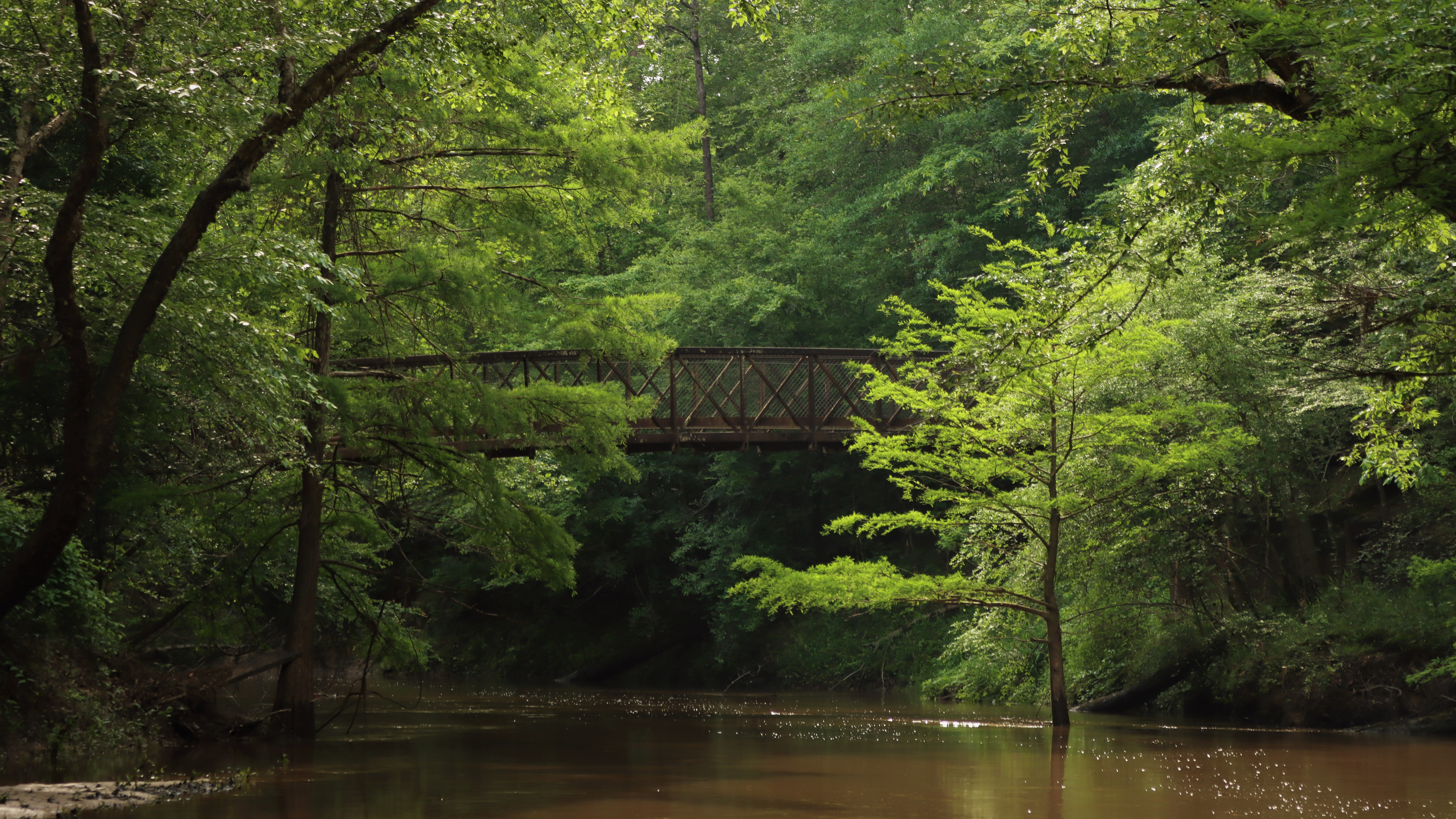
This is a great loop hike to see dense thicket, a bald cypress slough, and Village Creek. Connect with the Turkey Creek and Sandhill Loop trails for a longer hike.
Distance: 1½ to 2½ miles roundtrip
Type: Loop
Location: Turkey Creek Unit
Trailhead: Parking lot on FM 420
Lat/Long: 30.462122, -94.350825
Overview
The Kirby Nature Trail has 3 loops: 1½-mile inner loop, 0.3-mile cypress loop, and 0.9-mile outer loop. Combine them all into one big loop for a 2½-mile loop hike.
The trail begins on Farm to Market Road (FM) 420 next to historic Staley Cabin . Go past the kiosk and down the wooden ramp to reach the first junction at the start of the inner loop. Turn left to go clockwise and descend a gentle slope with a canopy of beech, magnolia, and loblolly pine overhead.
After crossing a few wooden bridges, head left on the cypress loop to see a slough of large bald cypress trees and knees. If the water is high, take the high water bypass to skip the cypress loop.
Continuing clockwise from the cypress loop, the inner loop follows Village Creek. At the next junction, the right fork takes the inner loop back south toward the trailhead. The left fork begins the outer loop and immediately enters a picnic area next to an iron bridge over Village Creek*. Continue past the bridge on the outer loop as it meanders clockwise and eventually meets up with the inner loop and trailhead.
*Extend Your Hike!
Add an extra 3 miles roundtrip: Combine the Turkey Creek and Sandhill Loop trails with Kirby to make a 4½- or 5½-mile loop and out-and-back combination. The Sandhill Loop features a forest of tall longleaf pines, scattered cacti, and solitude.
Cross the iron bridge over Village Creek to begin the Turkey Creek Trail. After 0.8 miles, cross a second iron bridge, over Turkey Creek. The Sandhill Loop Trail begins on the opposite (east) side of the bridge.
Go right or left to begin the 1.4-mile Sandhill Loop. On the north end of the loop, there is another junction with the northbound Turkey Creek Trail, marked with a bench—go past it to continue on the Sandhill Loop. When you return to the iron bridge over Turkey Creek, cross it and follow the Turkey Creek Trail south to return to the Kirby Nature Trail and the trailhead.
More Information
Download a trail map
Get a Kirby Nature Trail Guide at the visitor center for a small fee.
Explore the Turkey Creek Unit
Accessibility The 1.5-mile inner loop is accessible and wide enough for a wheelchair. It's mostly flat with a gentle downhill grade at the start. Surfaces include wooden boardwalks and dirt; both can be slippery following heavy rain.
Hike to the Sandhill Loop Trail 9.4 mi round trip · the Park Service's write-up
2-8 Hours · dogs allowed
Start Turkey Creek Unit | Kountze, TX

The Sandhill Loop Trail offers solitude in an unusual arid sandyland ecosystem that is home to longleaf pine and prickly pear cactus.
Distance: 4½ to 9.4 miles roundtrip
Type: Out-and-back and loop combination
Location: Turkey Creek Unit
Trailhead: 2 options— see below
Overview
The Sandhill Loop Trail is a 1.4-mile loop but to reach it you will need to hike 4½ to 9.4 miles roundtrip via one of two options:
Option A: From the South
4½ miles roundtrip via Kirby Nature Trail and Turkey Creek Trail
Trailhead: Kirby Nature Trail on FM 420
Lat/Long: 30.462122, -94.350825
This route begins on FM 420 and follows the Kirby Nature Trail and Turkey Creek Trail north to the Sandhill Loop Trail. Depending on which Kirby loop you choose, you can make this a 4½- or 5½-mile hike.
Begin the Kirby Nature Trail next to Staley Cabin. Go left on the loop to head north on the inner loop. On the north side of the loop, there is a picnic area next to an iron bridge that crosses Village Creek. Cross the bridge to begin the Turkey Creek Trail. After 0.8 miles on the Turkey Creek Trail, cross another iron bridge and begin the Sandhill Loop Trail.
Go right or left to begin the 1.4-mile Sandhill Loop. On the north end of the loop, there is another junction with the northbound Turkey Creek Trail, marked with a bench—go past it to continue on the Sandhill Loop. When you return to the iron bridge, cross it and follow the Turkey Creek Trail south to return to the Kirby Nature Trail and the trailhead.
Option B: From the North
9.4 miles roundtrip via Turkey Creek Trail
Trailhead: Turkey Creek Trail (southbound) on Gore Store Road
Lat/Long: 30.521094, -94.343759
This route begins on Gore Store Road and follows the Turkey Creek Trail southbound to the Sandhill Loop Trail.
After 4 miles on the Turkey Creek Trail, you reach the beginning of the Sandhill Loop Trail, marked with a couple of benches. Head left to go clockwise and explore a forest of longleaf pine with a few scattered patches of prickly pear cactus.
After completing the loop, return the way you came.
More Information
Download a trail map
Explore the Turkey Creek Unit
Accessibility The trail surface is hard-packed dirt, covered in leaves, with several wooden bridges. The trail is generally flat with some hilly sections. Hikers may encounter mud and/or flooding if it has rained significantly recently.