2 named trails · 1 miles · 2 with the Park Service's own write-up. The lines, trailheads and points are the Park Service's; the write-ups are the Service's own words; the climbing is read from USGS elevation along each line.
0.8 mi one way · 20 ft of descent · 6,164 ft–6,184 ft · earth surface · hiking
Explore the Walking Trails the Park Service's write-up
no dogs · Summer, Fall
Start Lower Parking Lot Trailheads
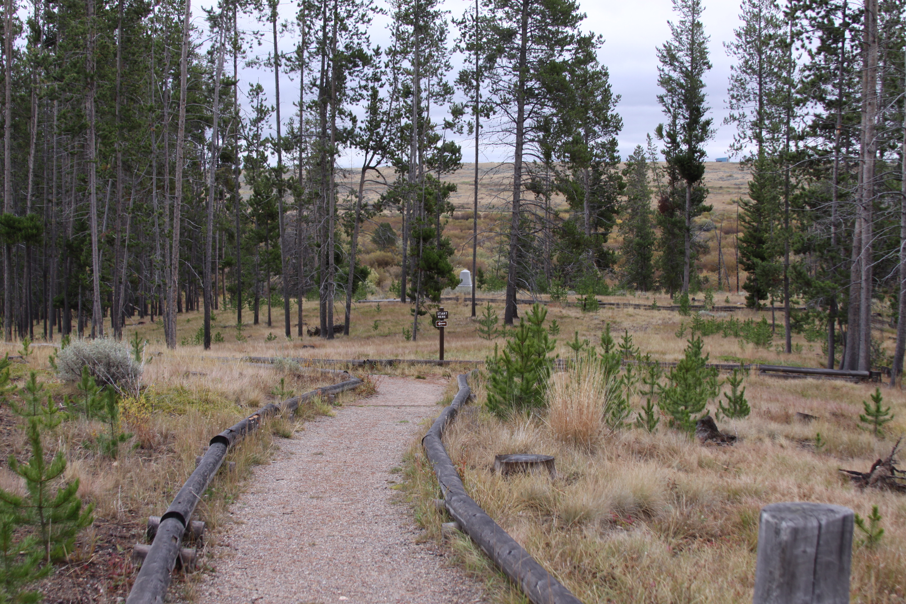
Trail leading into the siege area. Photo: NPS photo
Experience the sacred nature of this battleground by hiking a trail out to the camp where the Nez Perce lay sleeping when the battle began, over to the stand of trees where the Nez Perce warriors held the soldiers and Bitterroot volunteers under siege, or up to the site where the Nez Perce warriors capture the army's mountain howitzer cannon. Trail guides are available at the trailheads.
Camp Trail: 1.6 miles round-trip walking trail with no elevation gain. 1 hour.
Siege Area Trail: 1.2 miles round-trip and climbs about fifty feet in elevation. 45 minutes.
Howitzer Trail: 0.8 mile spur trail off of the Siege Area trail that climbs 320 feet in elevation. 40 minutes.
Accessibility The existing services that support exploring the trails include trailhead parking that provides standard car, oversize vehicle and accessible parking, outdoor recreation access routes to picnic areas, trailheads and viewing areas, trailheads, trails, picnicking facilities, interpretive waysides, a trail guide, benches and restrooms. Restrooms are accessed via a concrete curb cut and pad. Both picnic areas are covered by shade sails and include moveable tables on a flat, crushed stone surface. The picnic area closest to accessible parking has a curb cut entry. The trailhead to the Siege Trail and to the Howitzer Capture site and Battlefield Overlook includes a wayside and information panel and bench at the entrance. A wide, flat concrete pathway meets up to a wooden bridge river crossing and continues onto a firm and stable, natural earth trail with a mown grass strip down the centerline. A sign with trail lengths and a trail guide box are posted along the edge of the trail. Both trails are steep and uneven, and both the Capture Site and Overlook have impressive views of the battlefield and valley.One of the most sacred of locations within this site is the Nez Perce Camp. A wide trail composed of crushed stone begins with gentle to moderate slopes, then the trail continues within flat conditions. All cross slopes are less than 2%. Large print trail guides are provided just off the improved trail. The trail changes from compacted crushed stone to a flat but rough dirt road bed with grassy outcrops throughout the trail centerline. These trail conditions continue up to the Nez Perce Campsite, where the trail grass is mowed. Numbered guide rocks are located just off the trail within the grassy meadow edge. Benches and waysides are provided off the trail and within the camp.
0.5 mi one way · about 80 ft of climbing · 6,184 ft–6,263 ft · hiking
Explore the Walking Trails the Park Service's write-up
no dogs · Summer, Fall
Start Lower Parking Lot Trailheads
Trail leading into the siege area. Photo: NPS photo
Experience the sacred nature of this battleground by hiking a trail out to the camp where the Nez Perce lay sleeping when the battle began, over to the stand of trees where the Nez Perce warriors held the soldiers and Bitterroot volunteers under siege, or up to the site where the Nez Perce warriors capture the army's mountain howitzer cannon. Trail guides are available at the trailheads.
Camp Trail: 1.6 miles round-trip walking trail with no elevation gain. 1 hour.
Siege Area Trail: 1.2 miles round-trip and climbs about fifty feet in elevation. 45 minutes.
Howitzer Trail: 0.8 mile spur trail off of the Siege Area trail that climbs 320 feet in elevation. 40 minutes.
Accessibility The existing services that support exploring the trails include trailhead parking that provides standard car, oversize vehicle and accessible parking, outdoor recreation access routes to picnic areas, trailheads and viewing areas, trailheads, trails, picnicking facilities, interpretive waysides, a trail guide, benches and restrooms. Restrooms are accessed via a concrete curb cut and pad. Both picnic areas are covered by shade sails and include moveable tables on a flat, crushed stone surface. The picnic area closest to accessible parking has a curb cut entry. The trailhead to the Siege Trail and to the Howitzer Capture site and Battlefield Overlook includes a wayside and information panel and bench at the entrance. A wide, flat concrete pathway meets up to a wooden bridge river crossing and continues onto a firm and stable, natural earth trail with a mown grass strip down the centerline. A sign with trail lengths and a trail guide box are posted along the edge of the trail. Both trails are steep and uneven, and both the Capture Site and Overlook have impressive views of the battlefield and valley.One of the most sacred of locations within this site is the Nez Perce Camp. A wide trail composed of crushed stone begins with gentle to moderate slopes, then the trail continues within flat conditions. All cross slopes are less than 2%. Large print trail guides are provided just off the improved trail. The trail changes from compacted crushed stone to a flat but rough dirt road bed with grassy outcrops throughout the trail centerline. These trail conditions continue up to the Nez Perce Campsite, where the trail grass is mowed. Numbered guide rocks are located just off the trail within the grassy meadow edge. Benches and waysides are provided off the trail and within the camp.
The lines are the National Park Service's public trails layer, the trailheads and the waterfalls, views, peaks and historic places along them the Service's public points of interest, read 2026-10-14 and simplified for the map. The write-ups are the Service's own "things to do", unedited. Heights come from USGS 3DEP through Terrain Tiles on AWS (Mapzen/Tilezen), read along each line and rounded; a short trail on steep ground can be off by a few tens of feet. Closures change: check the park's own site before you go.